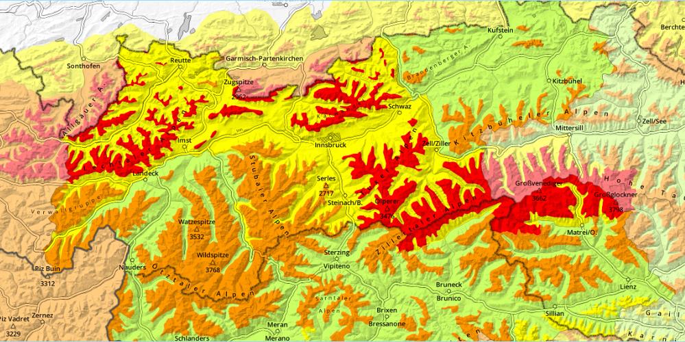
Gefahrenstufenkarte vom 27.03.2026

High avalanche danger regionally / Treacherous situation for winter sports enthusiasts, also over weekend

Heavy snowfall and strong-to-storm velocity winds have increased avalanche danger throughout the land. Regionally, high avalanche danger (Level 4) prevails. Activity of naturally triggered avalanches will gradually recede on Friday, 27.03. But the snowpack will be prone to triggering in many places over the weekend. Saturday, due to fine weather forecasts, an accident-prone situation is promised. We advise as much restraint as possible, advancing only carefully in outlying terrain and taking danger signs seriously.

Heavy precipitation and wind causing heightened avalanche danger

Cold front / northern powerful barrier cloud situation

A marked cold front made temperatures plummet to wintery levels on Thursday evening, 25.03. Until Friday we are caught in an extremely windy, moist-cold northern barrier cloud situation which will bring overall 40-60cm of fresh snow, significantly more in some places along the Northern Alps. The northerly winds will be blowing at strong velocity in the mountains, East Tirol will have gale-strength Tauern winds in gusts.

During the course of the day on Friday, weather conditions will calm. The precipitation will taper off by midday, also the Tauern wind will slacken off. On Friday night skies will clear, Saturday promises sunny winter weather with only light winds.
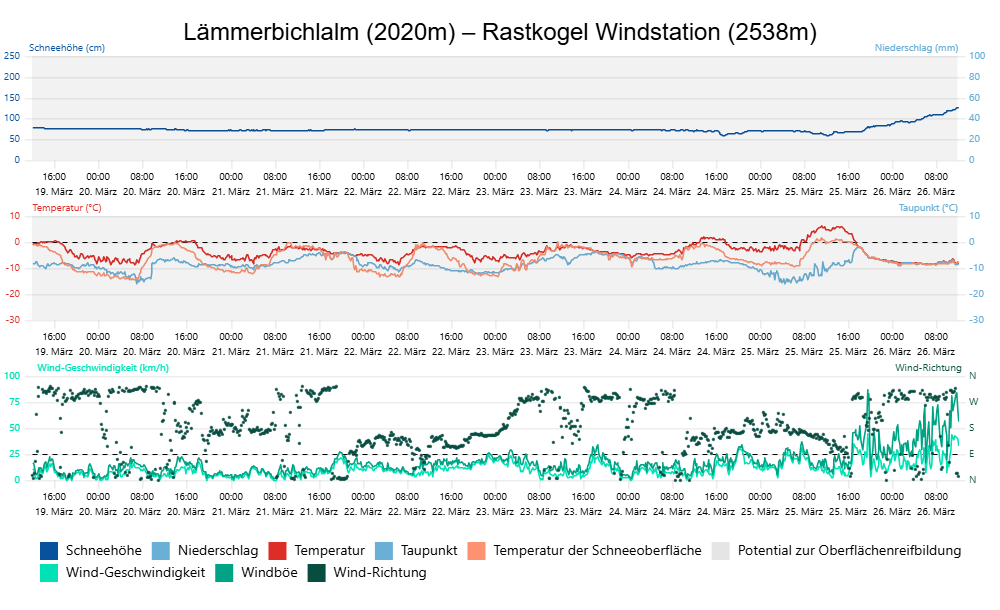
An den Wetterstationsdaten Lämmerbichlalm/ Rastkogel in den östlichen Tuxer Alpen ist der markante Wetterumschwung am Mittwochnachmittag, 25.03. deutlich ersichtlich: die Temperaturen fallen ab, der Wind legt deutlich zu und die Schneehöhe steigt mit dem Niederschlag an.
At the Lämmerbichlalm / Rastkogel weather station in the eastern Tux Alps, the marked weather reversal on Wednesday afternoon, 25.03, is clearly visible: temperatures drop, winds intensify measurably and snow depths rise in accord with precipitation.
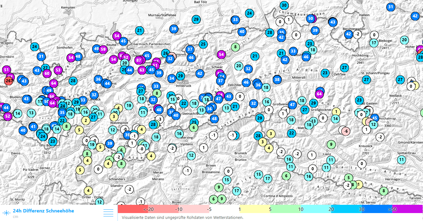
24h- Differenz der Schneehöhe bis Donnerstag, 17:00 Uhr. In den Hohen Tauern sowie in Nordtirol schneite es bereits verbreitet zwischen 30 und 50cm, in den Nordstaulagen teils deutlich mehr.
24-hr difference in snow depths until Thursday, 5:00 pm. In the Hohe Tauern and North Tirol there was already 30-50cm of fresh snow registered, in the northern barrier cloud regions often much more.
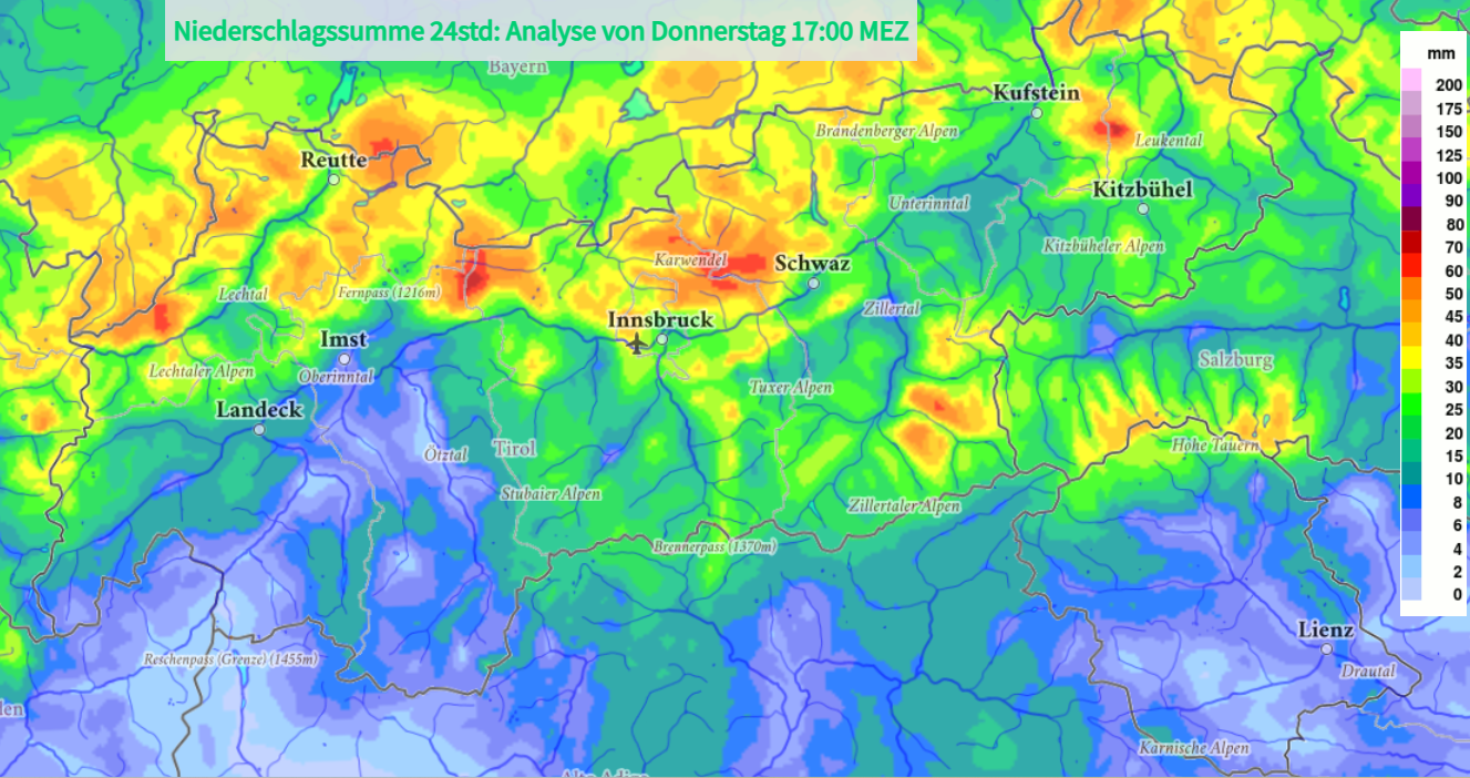
Modellierte 24h- Niederschlagssumme in Millimeter bis Donnerstag, 26.03. 17:00 Uhr. Bis Niederschlagsende am Freitag sollen nochmals rund 10 bis 20mm hinzukommen (©GeoSphere Austria).
Model of 24-hr sum of precipitation in millimetres until Thursday, 26.03, 5:00 pm. By the end of the period of precipitation on Friday, an additional 10-20mm of precipitation is expected in the barrier cloud regions (©GeoSphere Austria).
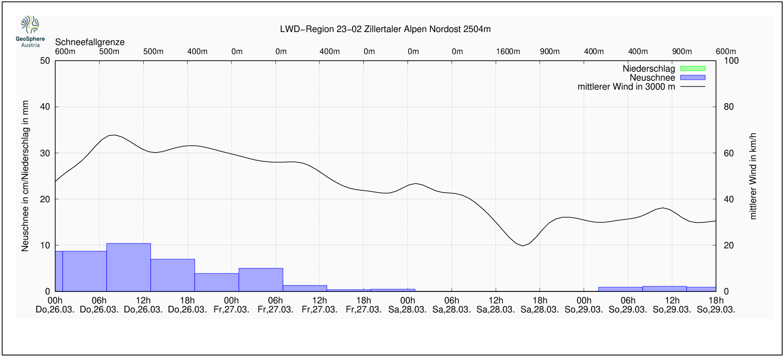
Entwicklung von Niederschlag und Mittelwind in der Region Zillertaler Alpen Nordost (©GeoSphere Austria).
Development of precipitation and middle wind values in the Zillertal Alps Northeast region (©GeoSphere Austria).
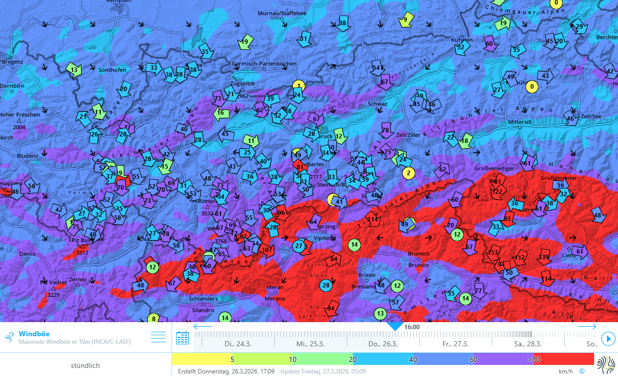
Stürmischer Wind mit orkanartigen Böen von über 120 km/h in Osttirol. Ab Freitagnachmittag, 27.03. schwächt sich der Tauernwind ab.
Stormy winds plus gale-strength gusts over 120 km/hr in East Tirol. Starting Friday afternoon, 27.03, Tauern winds will slacken off.

Trigger-sensitive snowpack / Dangerous avalanche situation

Avalanche danger has increased strikingly over the last 24 hours. In some regions the avalanche danger level is high: Danger Level 4. We are currently in the lower zone of this danger level. The situation is very dangerous, in particular for winter sports enthusiasts.

Until the precipitation tapers off and the strong northerly winds slacken on Friday, 27.03, numerous small and medium-sized naturally triggered avalanches on very steep, wind-protected slopes are anticipated. The weak layers in this case are primarily soft layers inside the fresh snow and freshly generated drifts.

In some places, also fractures in the old snowpack are possible which in isolated cases could trigger large avalanche releases (Magnitude 3). The relevant weak layers for these releases occur in the uppermost part of the old snowpack, particularly on north-facing slopes above about 2200m, on west and east-facing slopes above about 2500m, and on south-facing slopes above about 3000m. The weak layers are initially generated by layers of small faceted crystals which, as fine weather sets in bringing metamorphosis at the surface, is then blanketed by fresh snowfall. On especially steep slopes there is often a thin melt-freeze crust above the weak layer.
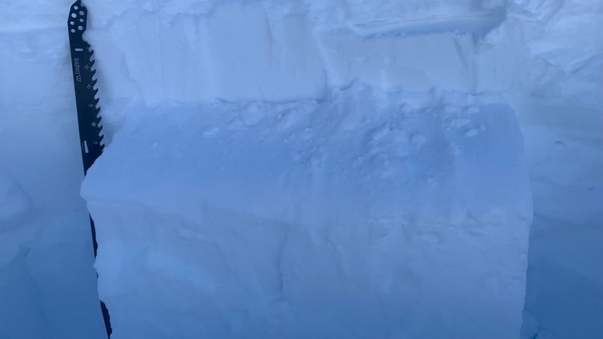
Im oberen Teil der Altschneedecke finden sich stellenweise Schwachschichten in Form von kleinen kantigen Kristallen. An diesem Standort in den westlichen Tuxer Alpen, an einem Nordosthang auf etwa 2300m konnte im Stabilitätstest ein Bruch initiiert werden, welcher sich durch den ganzen Block fortpflanzte (©Klaus Zweiker, 20.03.2026).
In many places in the upper part of the old snowpack: weak layers in the form of small faceted crystals. At the above location in the western Tux Alps on a NE-facing slope at about 2300m, a fracture could be generated in stability tests which then propagated through the entire block (©Klaus Zweiker, 20.03.2026).
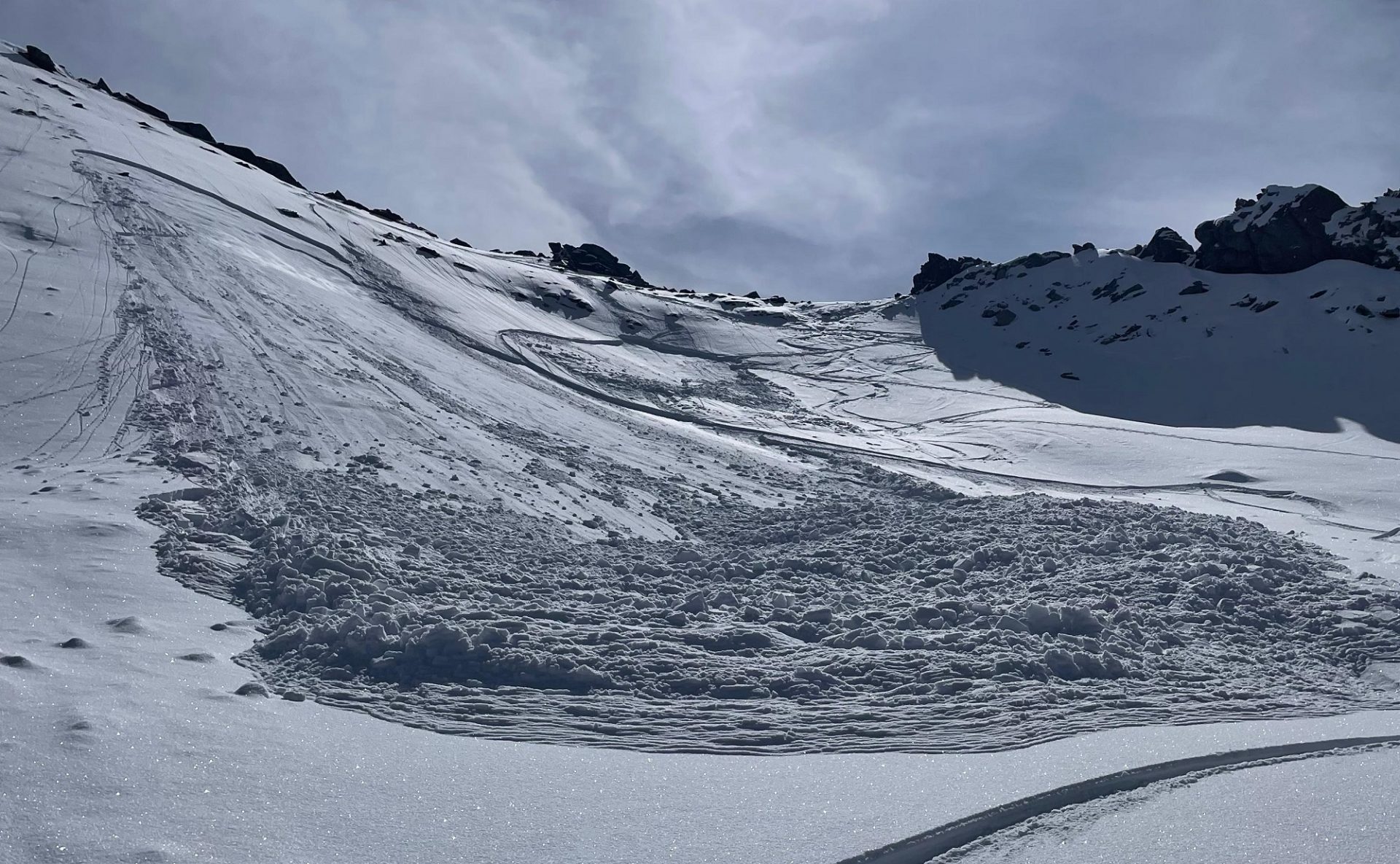
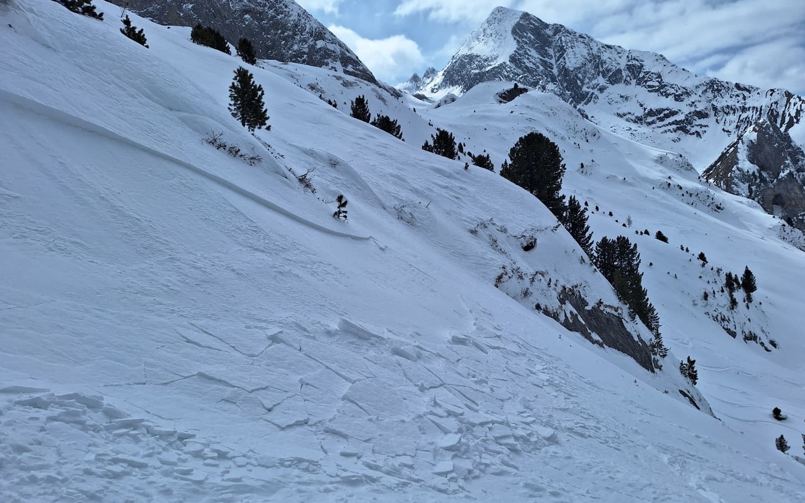
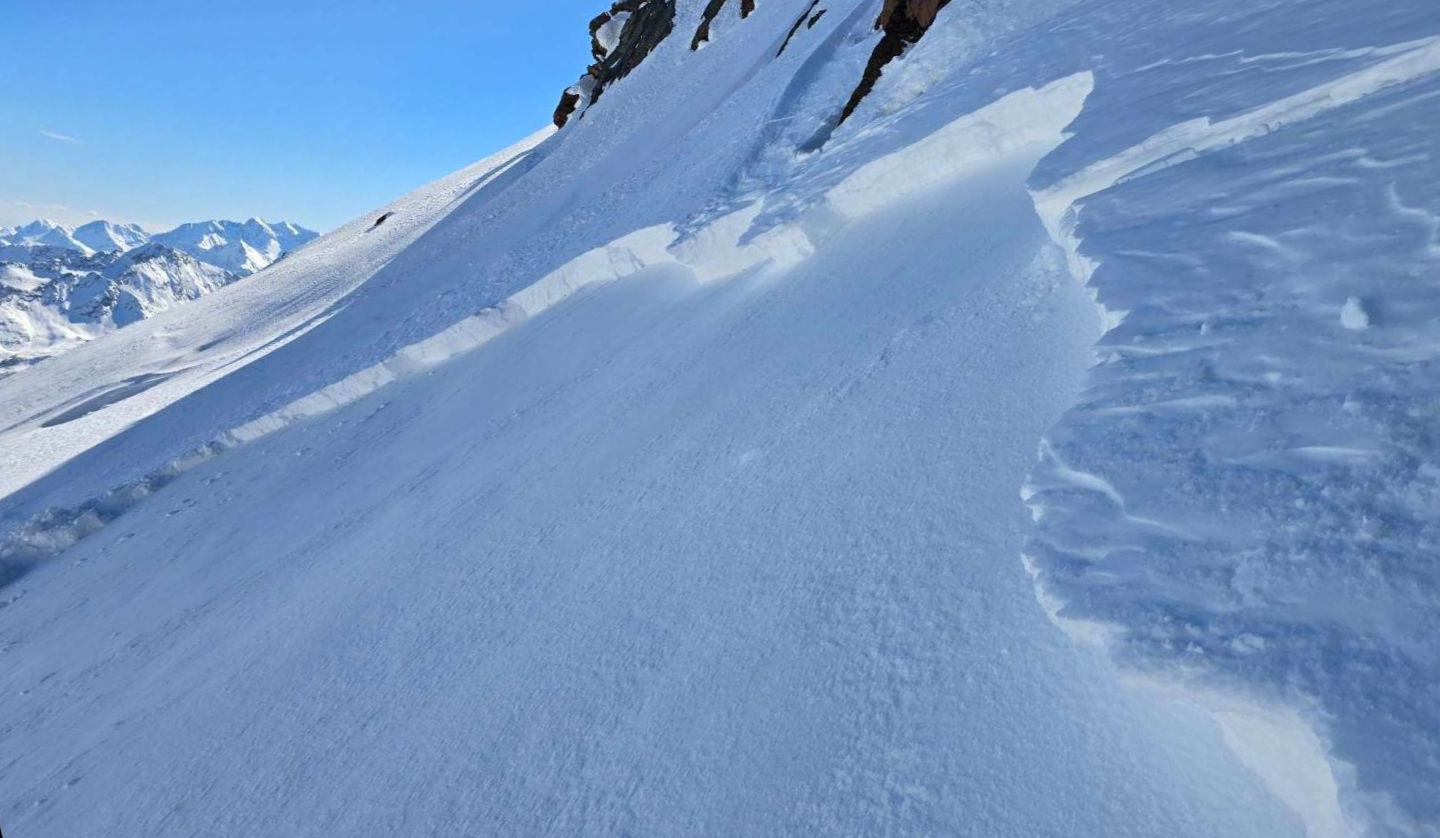
Personenausgelöste kleine Schneebrettlawine an einem Nordosthang auf rund 3200m an der Warenkarscharte in den Stubaier Alpen. Auch hier war mutmaßlich ein oberflächennahe, kantige Schwachschicht von Triebschnee überlagert. Beim Lawinenabgang kam niemand zu Schaden (©Felix Erlacher, 20.03.2026).
Small slab avalanche triggered by persons on a northeast-facing slope at about 3200m on the Warenkarscharte in the Stubai Alps. Also here, it can be assumed that the near-surface, faceted weak layer was covered by snowdrift accumulations. No one suffered injuries in the avalanche (©Felix Erlacher, 20.03.2026).
Auch bei dieser kleinen trockenen personenausgelösten Schneebrettlawine an einem Nordosthang auf 2800m in den Zillertaler Alpen war eine oberflächennahe Schwachschicht an einer Kruste ursächlich für den Abgang (©Thomas Eder, 24.03.2026).
Also in the case of this small dry-snow slab avalanche triggered by persons on a northeast-facing slopes at 2800m in the Zillertal Alps: cause of the release was a near-surface weak layer next to a crust (©Thomas Eder, 24.03.2026).

In addition, although this is of far less significance than during and right after the intense bout of precipitation at the end of February, the ground-level weak layer from early winter is also a source of danger. With the new burden of fresh snow and snowdrifts it has to be assumed that the proneness to this layer (of large cup-shaped crystals and buried hoar) triggering is again somewhat heightened. Naturally triggered and person-triggered near-surface avalanches can fracture down to this weak layer particularly on very steep shady slopes above about 2200m. The avalanche prone locations occur rather seldom, but more frequently in regions which got less snowfall this winter. This applies especially to inneralpine regions south of the Inn.
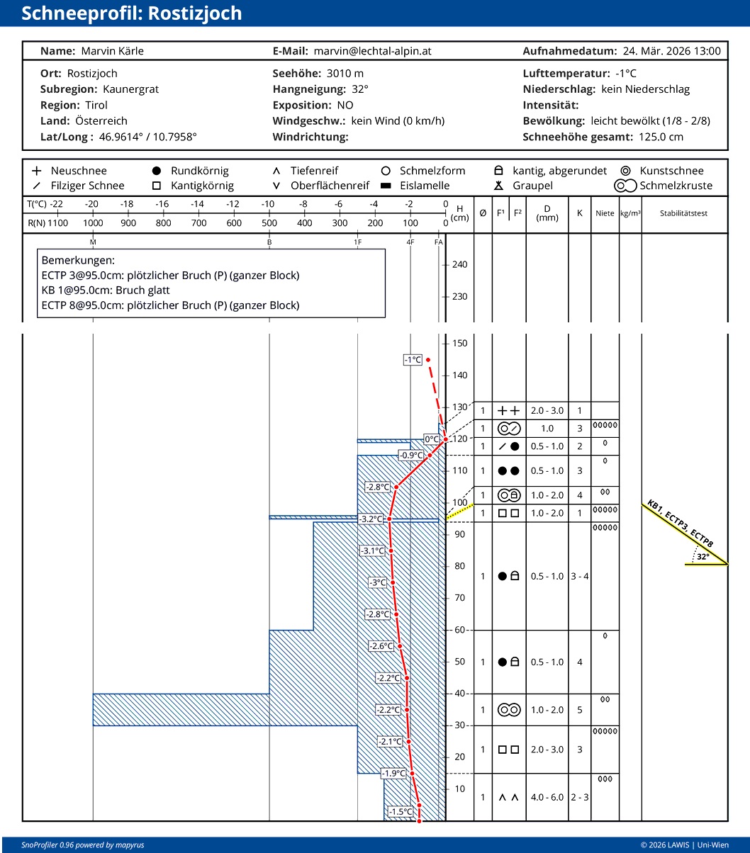
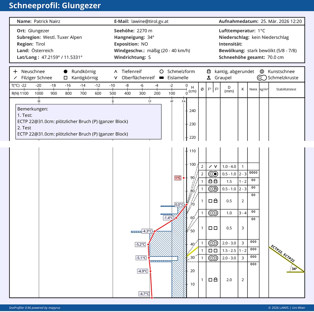
Schneeprofil vom Kaunergrat, an einem Nordosthang auf etwa 3000. Die Gruppe hat in der Nähe des Profilstandortes Setzungsgeräusche wahrgenommen. Beim Aufgraben der Schneedecke konnte auch hier eine dünne Schicht aus kantigen Kristallen unterhalb einer Schmelzharschkruste identifiziert werden. Das stark aufgebaute Fundament der Schneedecke konnte beim Stabilitätstest an diesem Standort nicht mehr angesprochen werden.
Snow profile from Kaunergrat on a northeast-facing slope at about 3000m. Settling noises were heard near this location in the massif. When the snowpack was excavated, a thin layer of faceted crystals was identified beneath a melt-freeze crust. The strong fundament could not be disturbed in the stability test at this location.
An diesem etwas schneeärmeren Standort in den westlichen Tuxer Alpen hingegen war die bodennahe Schwachschicht noch störanfällig.
At this location in the western Tux Alps where the snow was rather shallow, the ground-level weak layer was still prone to triggering.
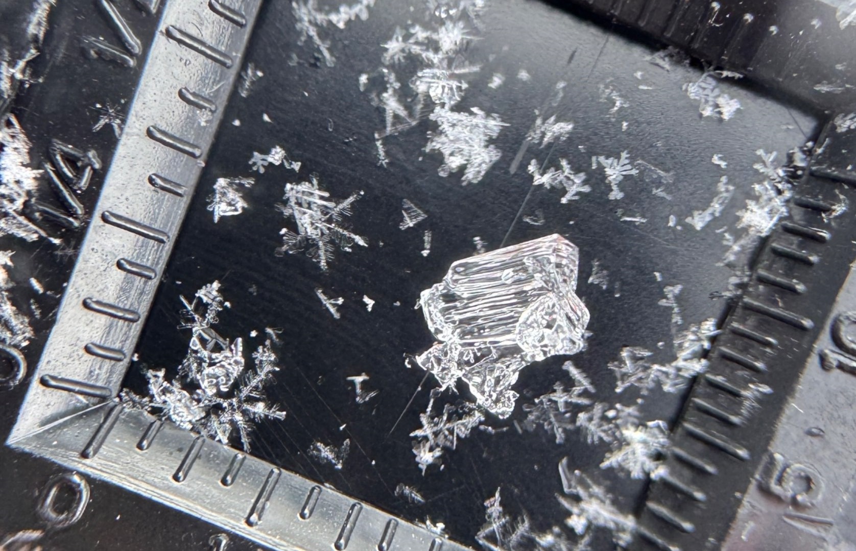
Ein Becherkristall unter der Lupe. Typisch für das Becherkristall (auch Tiefenreif genannt) ist neben der Größe und dreidimensionalen Form insbesondere die gut erkennbare Linienstruktur. Daneben sind auch Neuschneekristalle erkennbar (©Günter Chwojan, 21.03.2026).
A cup-shaped crystal beneath the magnifying glass. Typical of this snow crystal (also called buried hoar) is – apart from the size and three-dimensional shape – the easily discernible linear structure. Next to it, crystals of fresh snow are easily recognizable (©Günter Chwojan, 21.03.2026).

On first fine-weather day: Restraint

On Saturday, 28.03, we anticipate a beautiful sunny day which will entice many people to undertake backcountry and freeriding tours. However, we also anticipate at the same time a very trigger-sensitive snowpack. All the above-mentioned weak layers are relevant in this situation. Also the short-lived soft layers inside the fresh snow and snowdrifts have not had enough time to consolidate. As a result of the large amounts of fresh snowfall, danger zones are very difficult to spot or to predict. They occur in all aspects.

We advise in the areas of major snowfall: a defensive route selection. That means: consequentially avoid large, steep north-facing slopes above 2200m, steep west and east-facing slopes above 2500m and steep drifted slopes behind abrupt changes in the terrain. In freeriding terrain, important: feel your way carefully, gain a clear picture of the snowpack’s stability, take danger signs seriously.

In central and southern East Tirol, freshly generated snowdrift accumulation are easily recognized. They should be avoided in steep terrain. Caution also urged particularly on very steep shady slopes, where avalanches can fracture down to deeper weak layers and grow to medium size.

Outlook: moist-cold weather to continue

As soon as Sunday, a weak cold front will again bring clouds and lower temperatures. Next week, active front systems will reach us from the northwest, bringing strikingly intensifying winds, also heavy precipitation is possible. The moist-cold wintery weather character is here to stay for a bit.
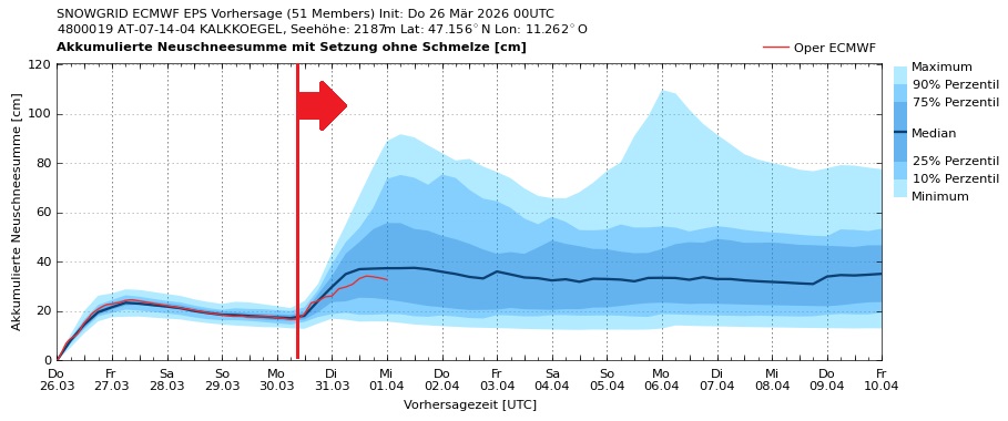
Bis Montag, 30.03. zeigt sich eine recht gesicherte Entwicklung der akkumulierten Neuschneesumme für die Region Kalkkögel. Die weitere Entwicklung ist noch mit großen Unsicherheiten behaftet (©GeoSphere Austria).
Until Monday, 30.03, the development is certain for the accumulated fresh snow in the Kalkkögel region. Thereafter, developments are still highly uncertain (©GeoSphere Austria).

Review of last week in pictures
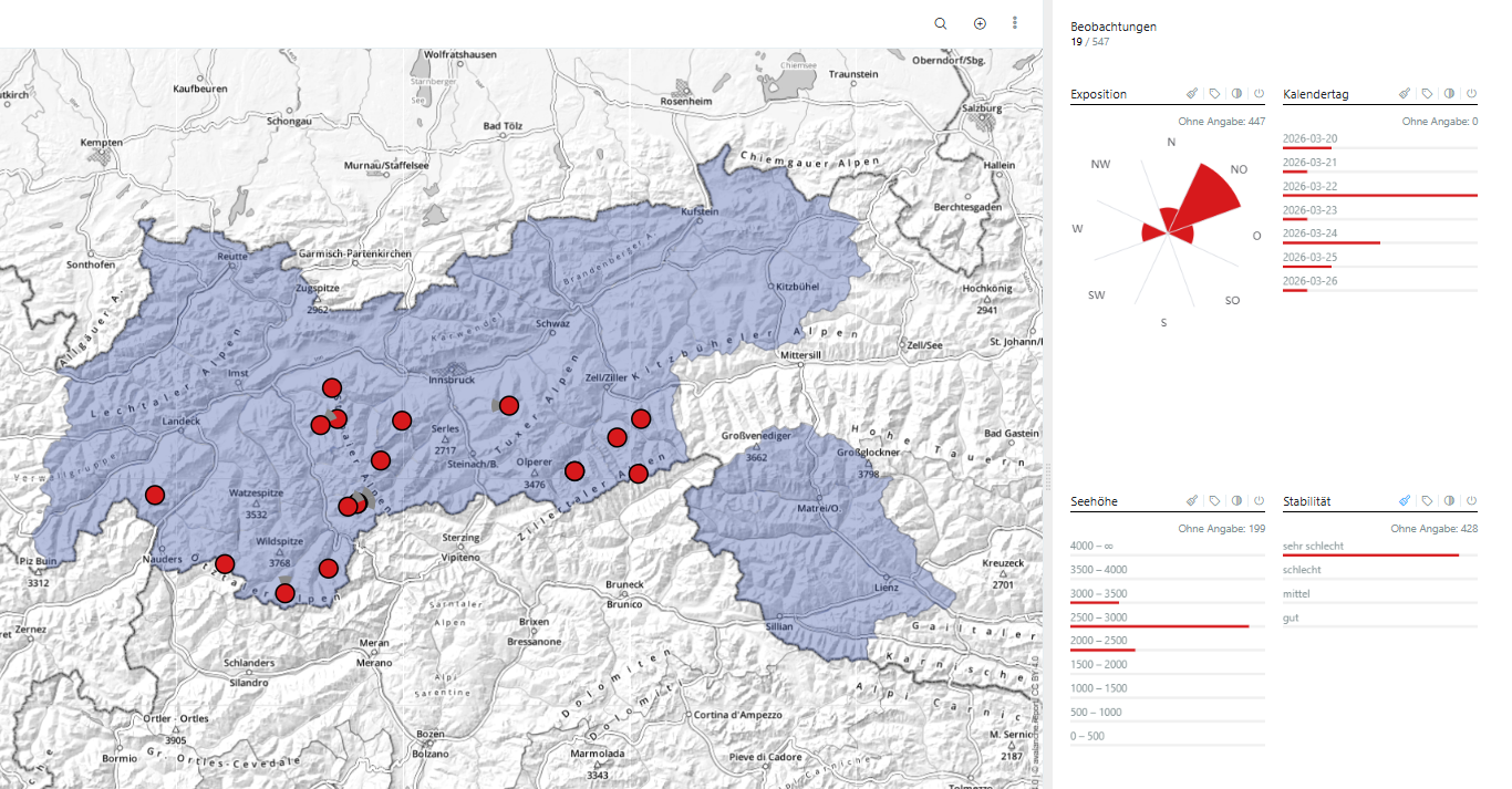
In den vergangenen 7 Tagen wurden uns 19 Lawinenabgänge rückgemeldet. Alle wurden im Sektor West – Nord – Ost verzeichnet. Die Lawinen brachen oberflächlich und blieben klein. Bei 6 Lawinenabgängen ist uns Personenbeteiligung bekannt, bei keinem der Unfälle kamen jedoch Personen zu Schaden.
Over the last 7 days, 19 avalanche releases were reported. All of them are pinpointed above in the West – North – East sectors. The avalanches fractured near the surface, remained small-sized. Persons were involved in 6 of the avalanche releases, no one suffered injuries.
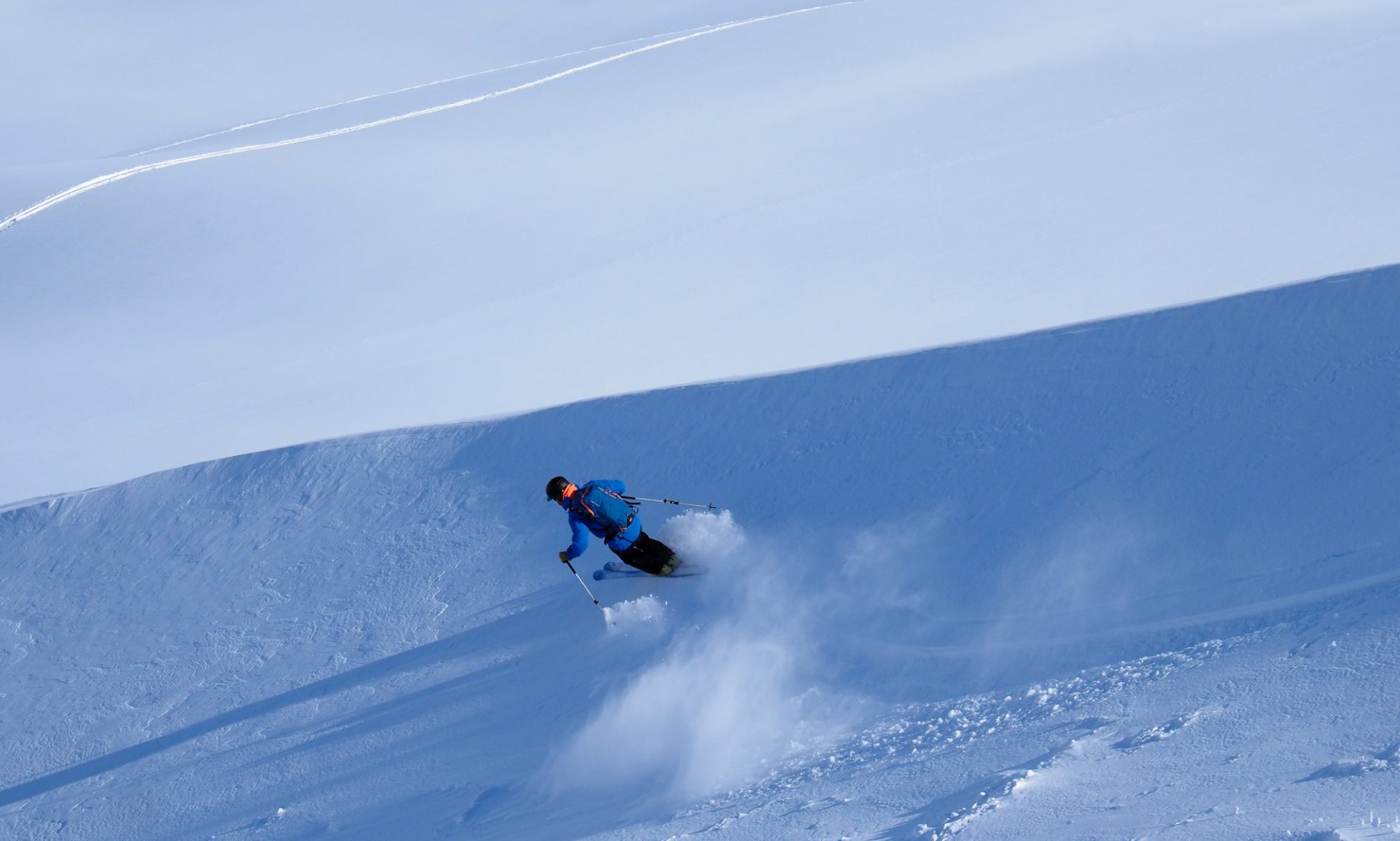
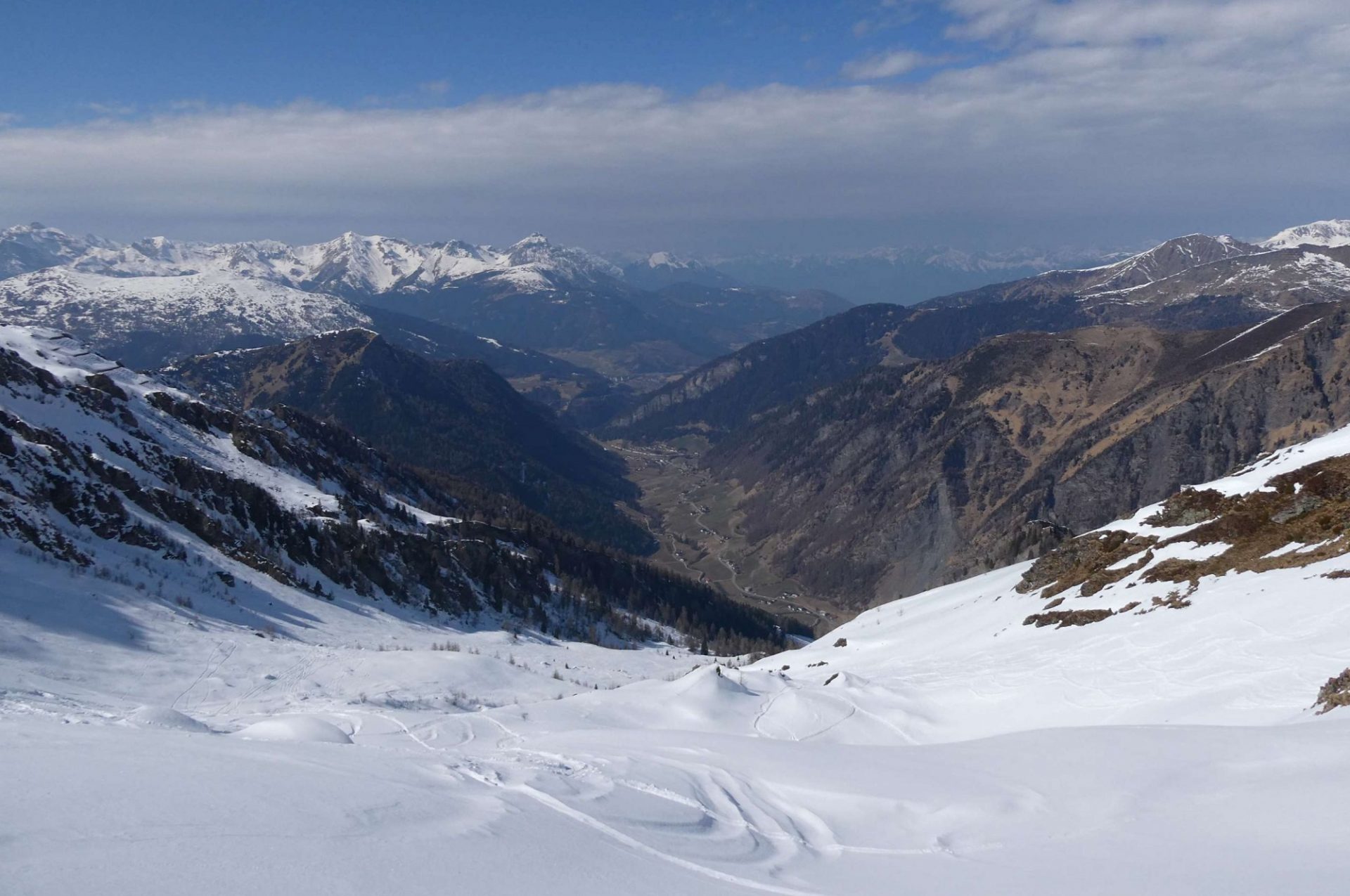
Gebietsweise guter Pulverschnee an etwas geschützten Schattenhängen… (©LWD Tirol, 19.03.2026).
In some regions, good powder snow on wind-protected shady slopes… (©LWD Tirol, 19.03.2026)
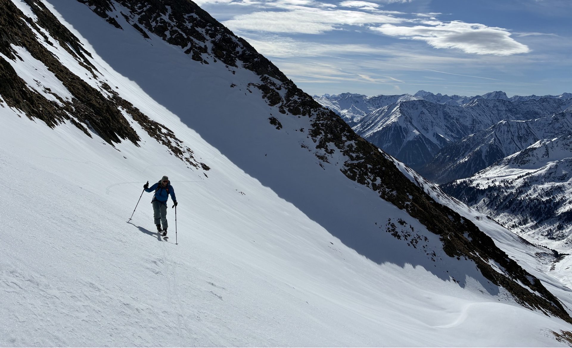
…sowie Firn an Sonnenhängen konnten bei guter Tourenplanung angetroffen werden (©LWD Tirol, 25.03.2026).
…and firn snow on sunny slopes, insofar as the time-planning for the backcountry tour was good (©LWD Tirol, 25.03.2026).
Mit Südföhn bildeten sich in den Föhngebieten ab Sonntag, 22.03. vereinzelt kleine, störanfällige Triebschneeansammlungen. Bereich Hauser Spitze, Zillertaler Alpen Nordwest (©Julia Hitthaler, 23.03.2026).
As a result of southerly foehn wind, isolated small, trigger-sensitive snowdrift accumulations were generated in the foehn-impacted regions as of Sunday, 22.03. Area of Hauser Spitze, Zillertal Alps Northwest (©Julia Hitthaler, 23.03.2026).
Etwas Schauertätigkeit und wenig Wind sorgten gebietsweise für Wildschnee. Wie hier an der Wildspitze (©Marvin Kärle, 23.03.2026).
Some showers and a bit of wind generated wild snow in some regions, such as above on the Wildspitze (©Marvin Kärle, 23.03.2026).
Apere Sonnenhänge, winterliches Bild an Schattenhängen. Bereich Silleskogel, Brennerberge. Am Horizont kündigt sich bereits die markante Kaltfront an (©Barbara Fink, 25.03.2026).
Sunny slopes bare of snow, a wintery picture on shady slopes. Area of Silleskogel, Brenner mountains. On the horizon, a marked cold front announces itself (©Barbara Fink, 25.03.2026).