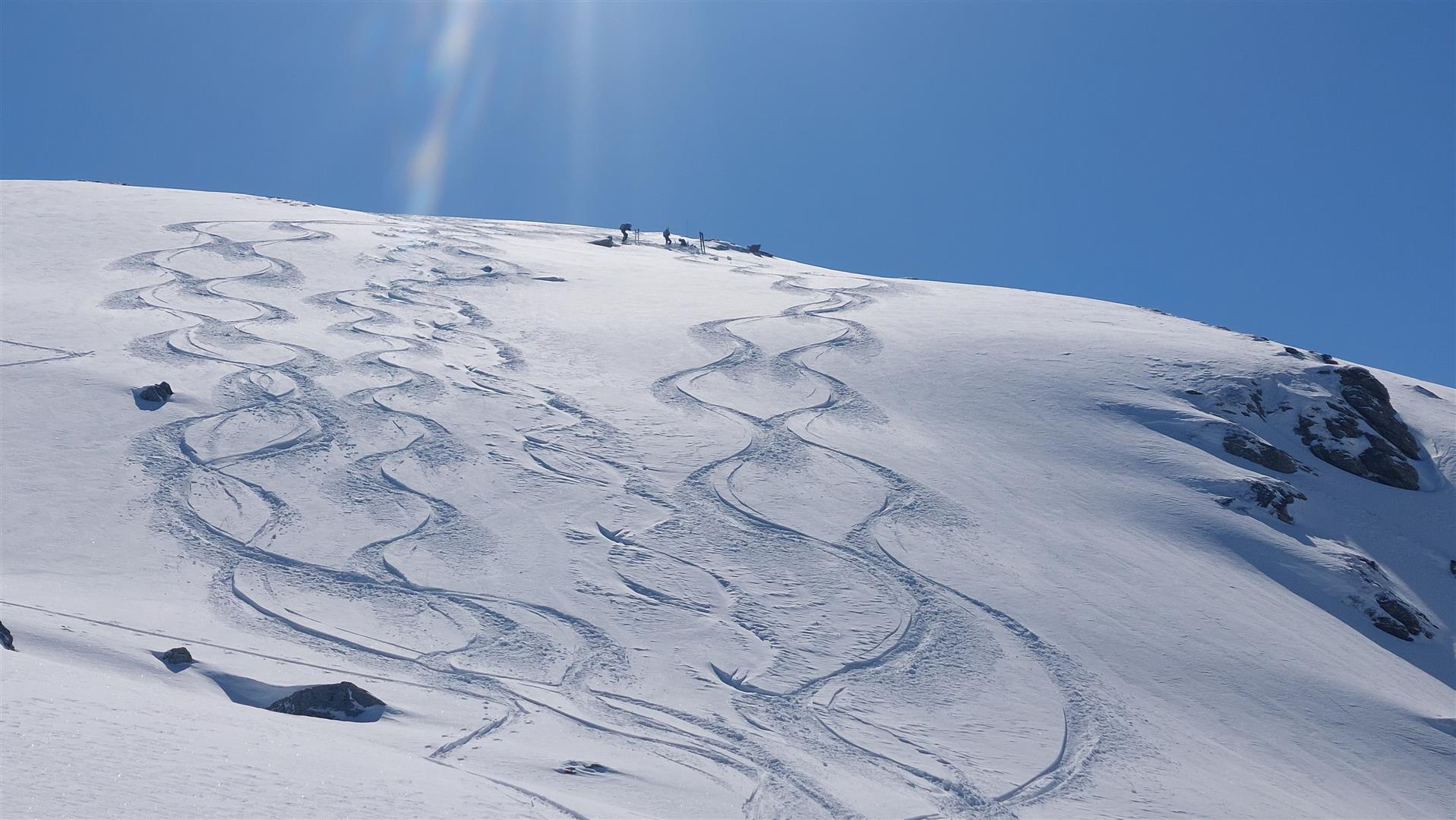
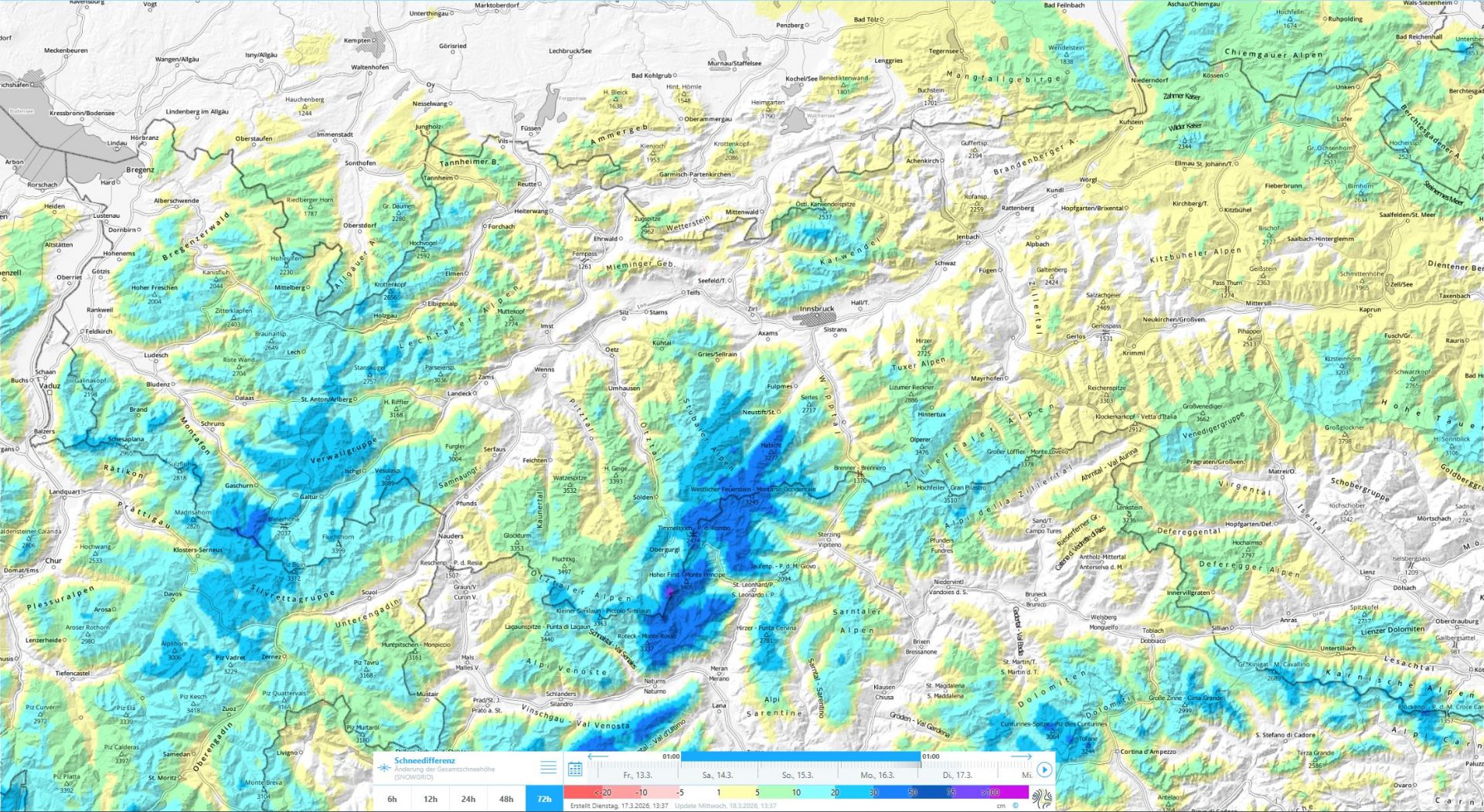
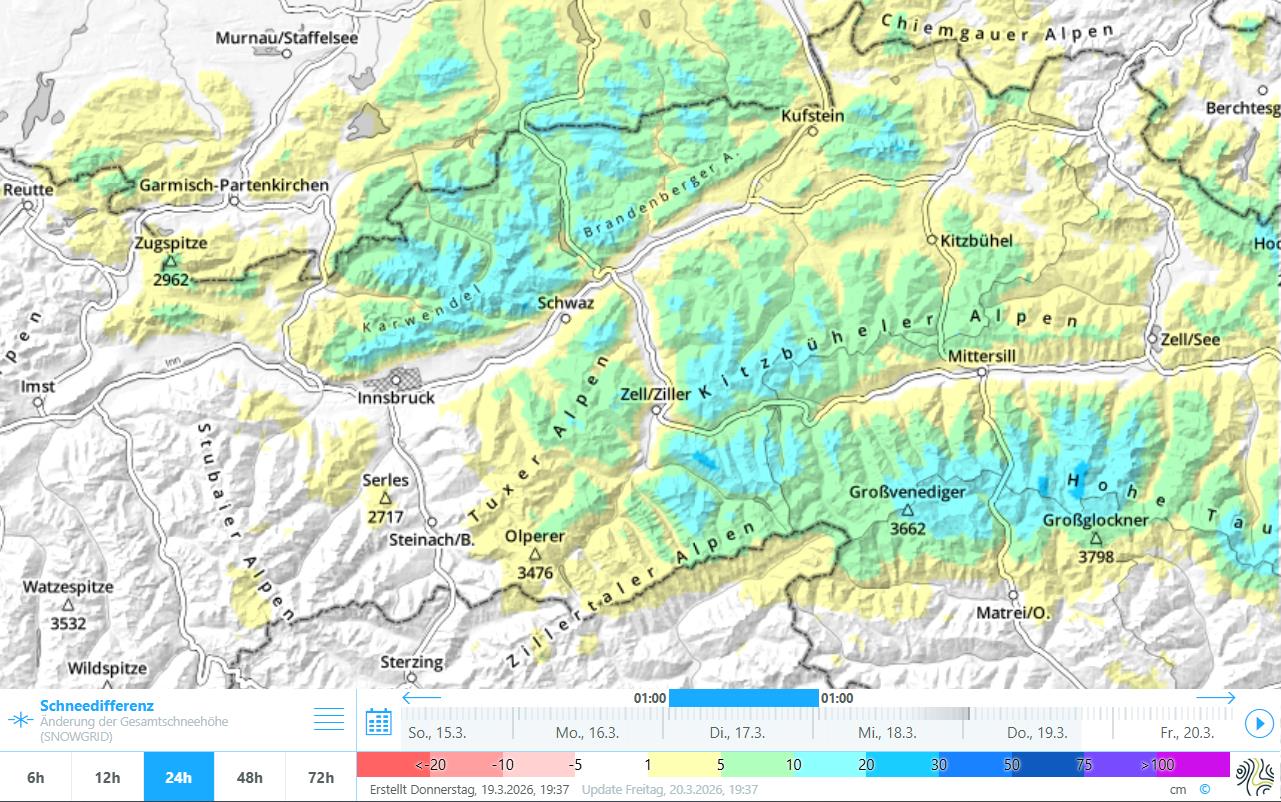
Last week brought us generally between 10 and 20cm of fresh snow, more in Hohe Tauern and in southern Ötztal and Stubai Alps up to 50cm at high altitudes. Coupled with wind impact, a snowdrift problem was generated. Avalanches we know of involving persons usually stemmed from fresh drifts, often from the well-known but less serious problem of a persistent weak ground-level layer. Nevertheless, isolated large-sized avalanches can still be triggered in the old snow. On very steep sunny slopes above about 2500m, a near-surface persistent weak layer seems to be newly forming in places.
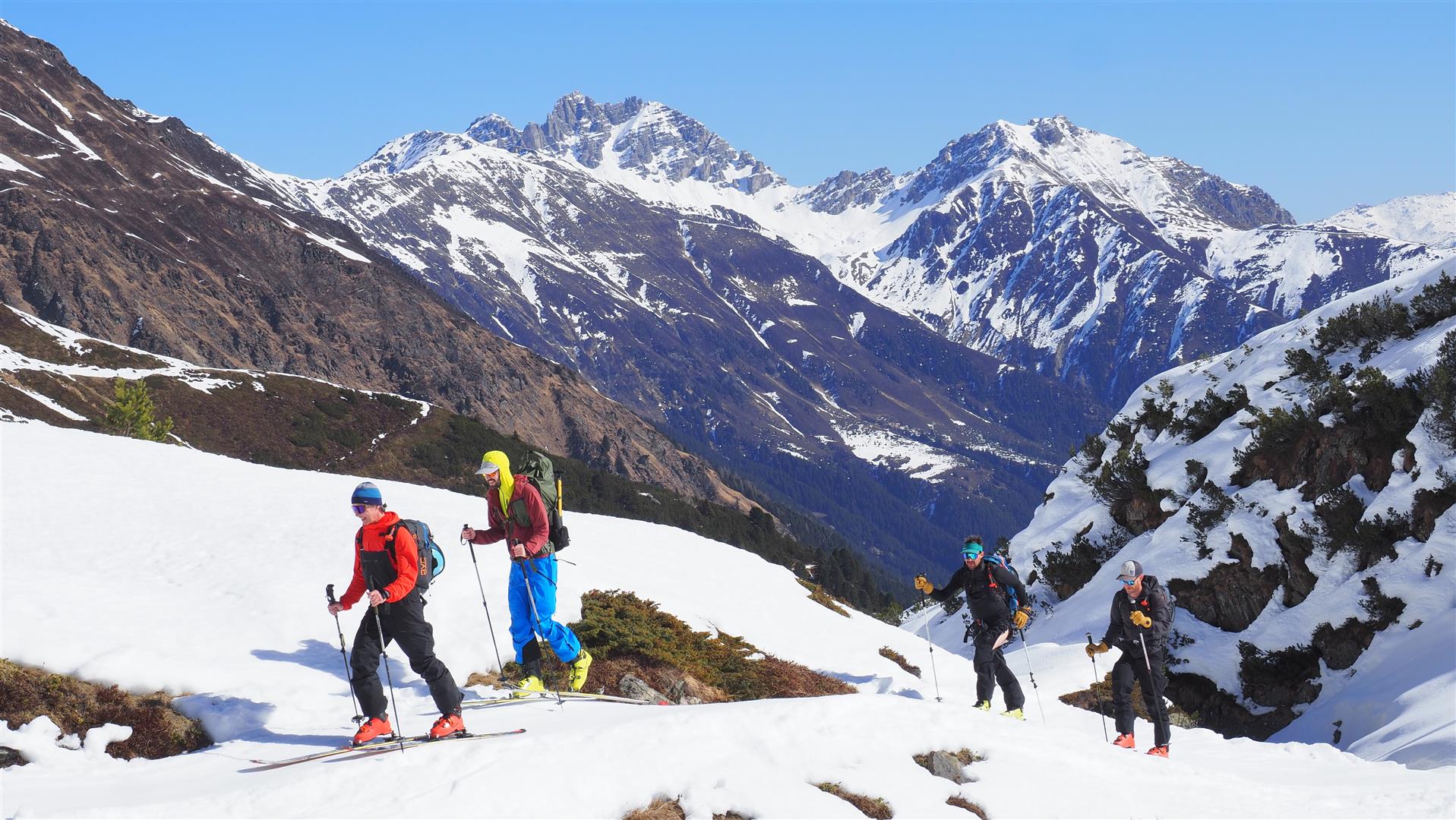
The last few days were marked by good powder snow and, corresponding to the juncture of the season, a frequently variable snowpack surface depending on aspect and altitude.
Brief review of weather
Following an intermediate high on Friday, 13.03, rather variable, cool April weather conditions set in. Snow fell between 14 and 17 March, most in the southern sector of the Main Alpine Ridge near the Ötztal and Stubai Alps. Starting on Wednesday, 18.03, sunshine has predominated the scene.
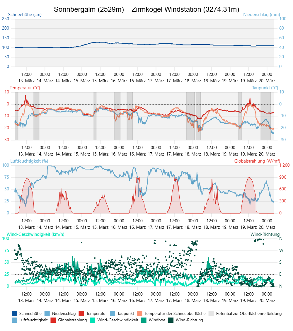
Snowfall between 14 and 17 March
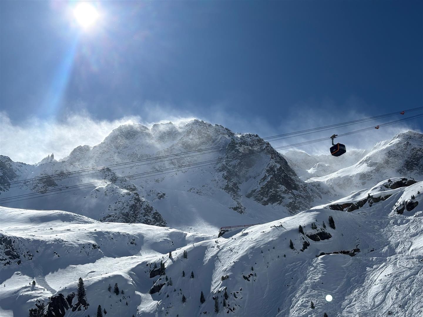
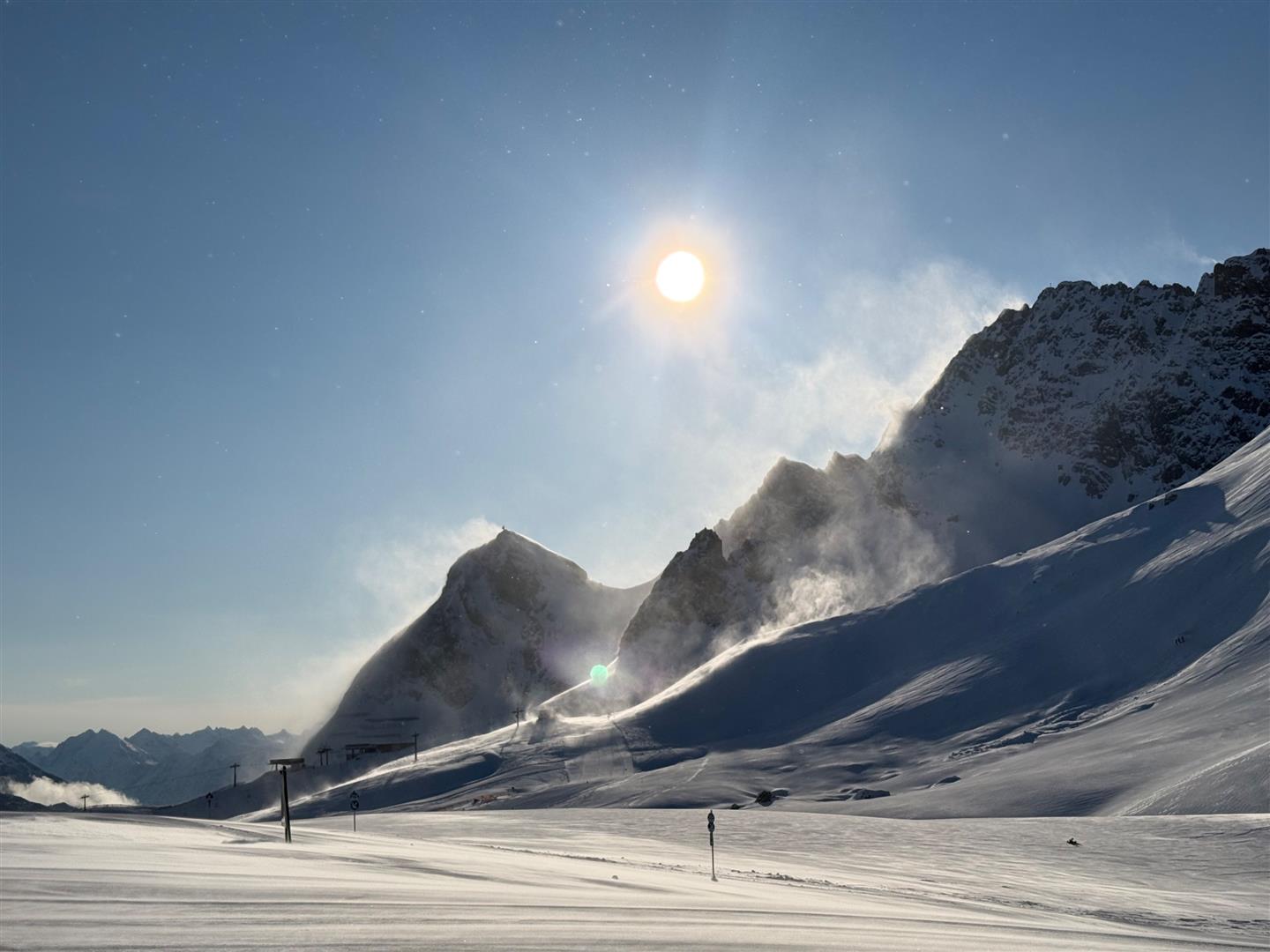
Wind impact, again and again
Problem: fresh snowdrifts
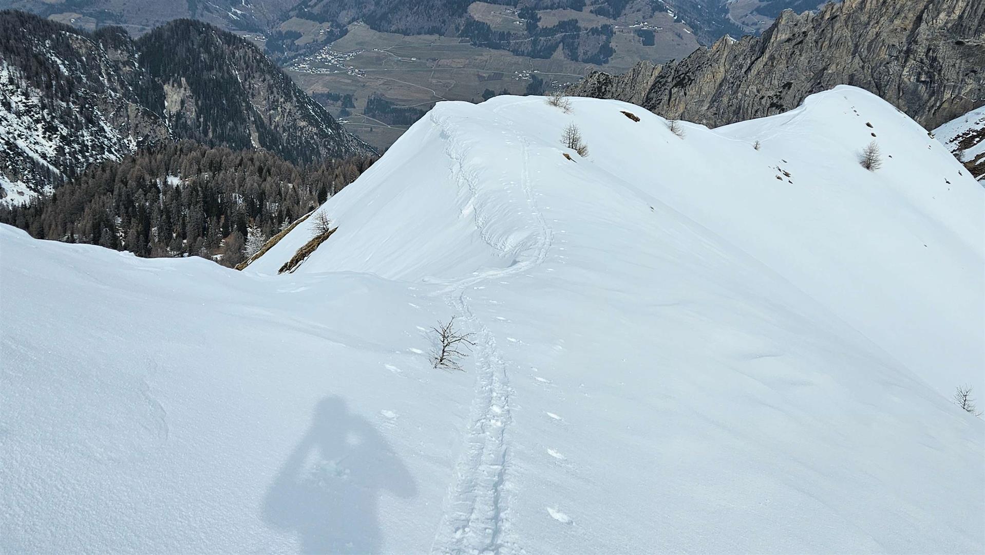
When fresh snowfall combines with cold temperatures and wind impact, a snowdrift problem is automatically generated. This is most prevalent and serious in the regions of precipitation already referred to. However, it requires attentiveness at high altitude in far-reaching parts of Tirol. Caution is urged particularly near ridgelines, in gullies, bowls and behind sharp drops in the terrain. Proneness to triggering of the freshly generated snowdrifts was quite high to start with, but diminishes somewhat with each passing day. The higher the altitude, the more trigger-sensitive the snowdrifts!
Isolated problem: persistent weak layer
A persistent weak layer at ground-level
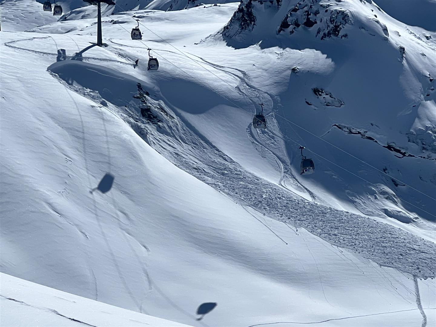
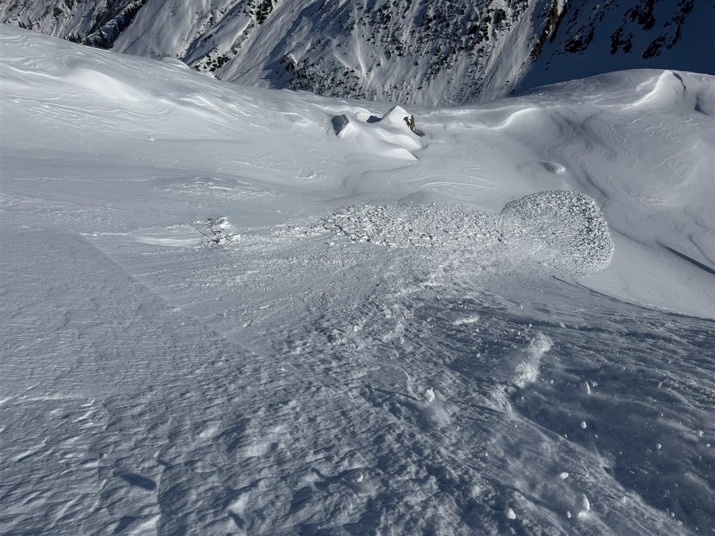
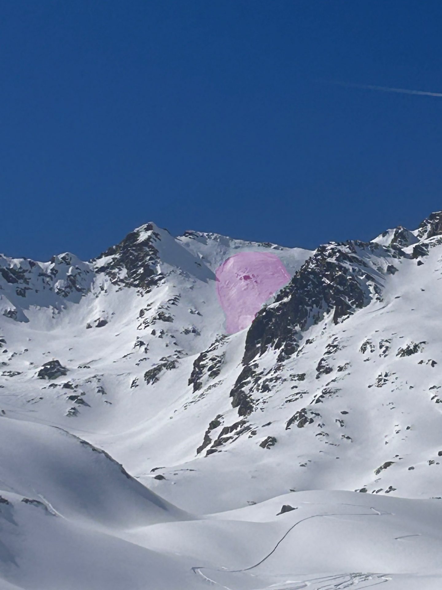
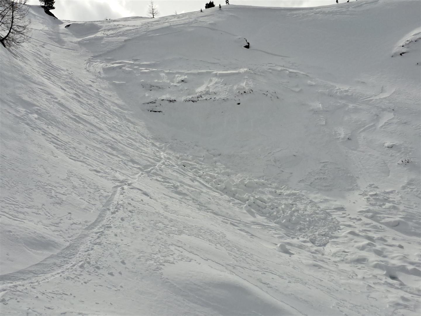
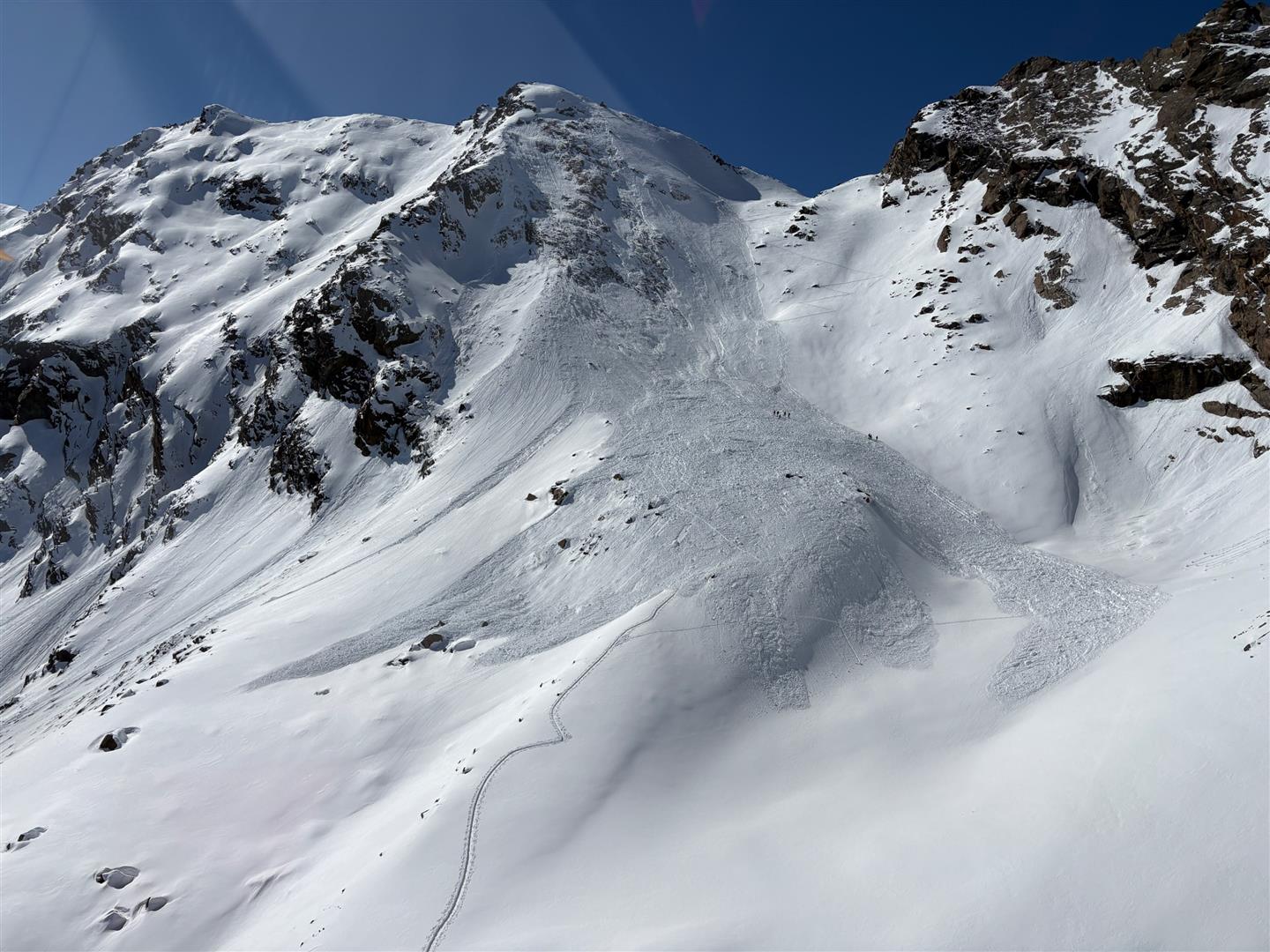
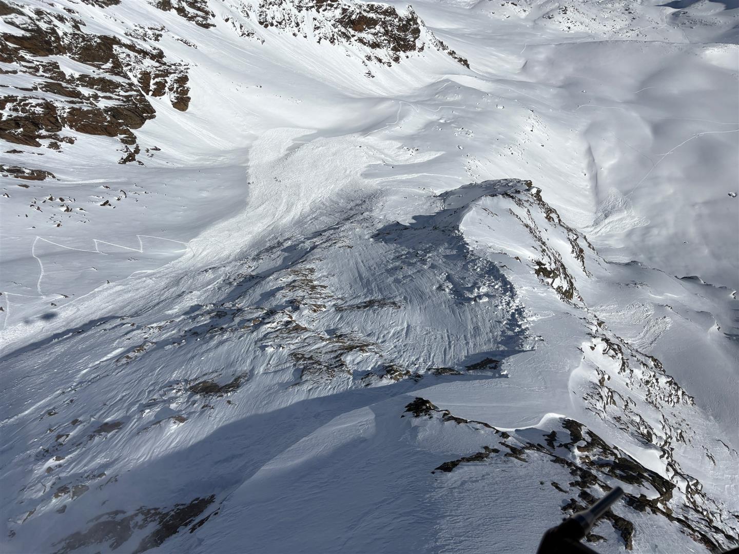
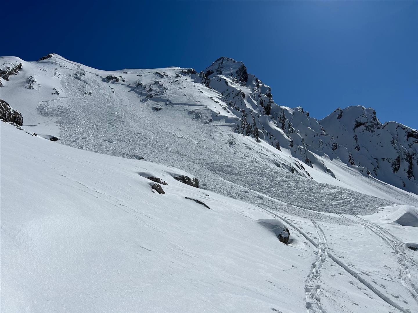
During this last week there were only a few reports of avalanches triggering in the weak ground-level layer of old snow. This is because the frequency of such avalanche prone locations has significantly decreased in the interim. Avalanches can currently trigger especially in very steep terrain, in transitions from shallow to deep snow and in areas where the snow is shallow. The latest prognosis is: at altitudes above 2200m on west, north and east-facing slopes where snow is shallow, and the shady (north-facing) slopes appear to be more endangered. This was evidenced on 19.03 by an avalanche in which persons suffered injuries on 19.03 on an extremely steep north-facing slope at about 2500m altitude near the Rotmoos Glacier in the Gurgl Massif.
Whereas an avalanche in the summit zone of the northern Daunkogel in the Mid-Stubai Alps region, on a very steep northeast-facing slope at about 3000m altitude fortunately ended with no damages registered.
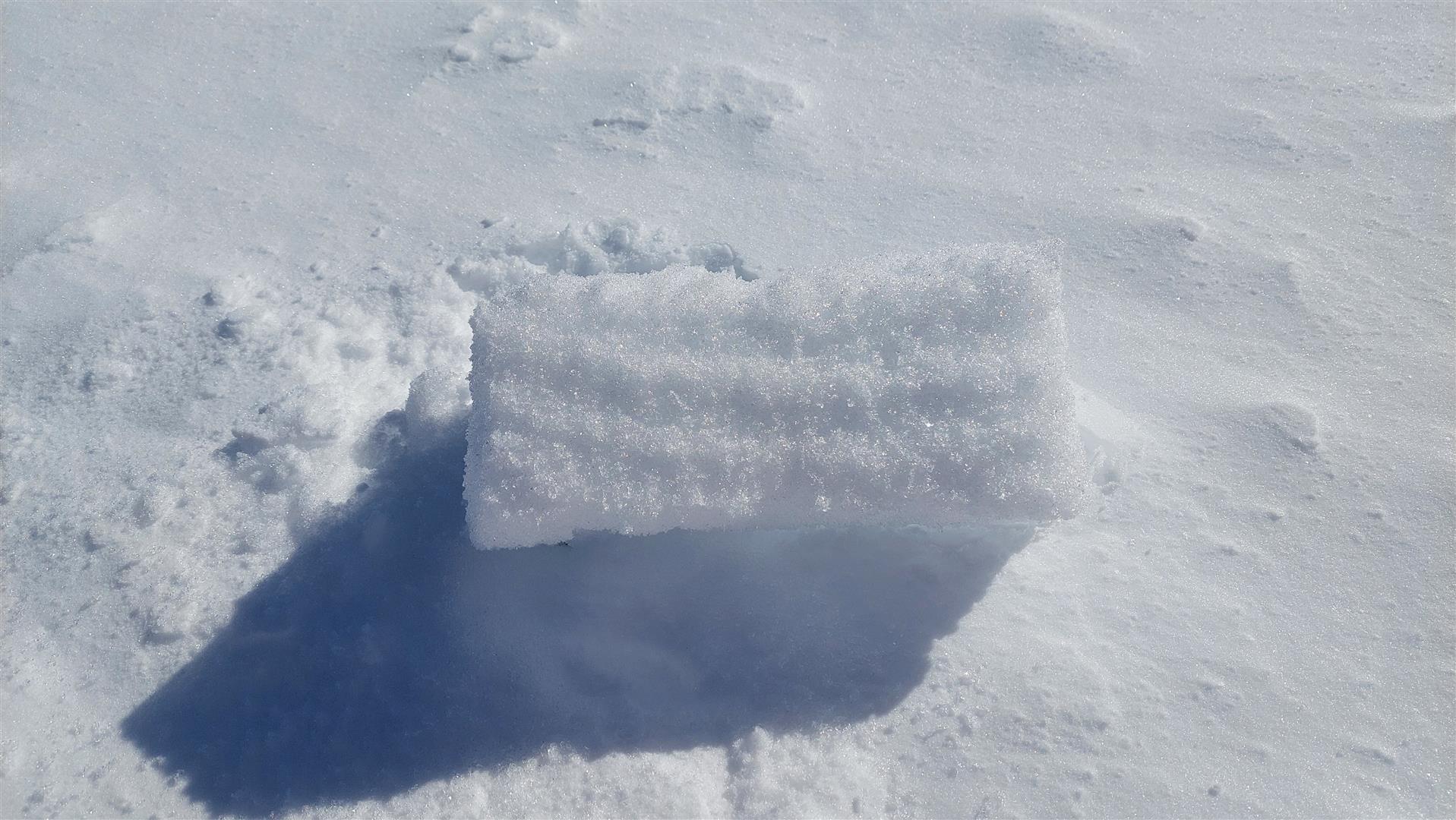
Possible new problem: potential near-surface persistent weak layer
Following the recent snowfall, we seem to be confronting a new persistent weak layer, namely, near the surface. This is the result of the period of fine weather starting at the beginning of March. Currently of significance: in the regions with the heaviest fresh snowfall and wherever larger amounts of snowdrifts have been generated recently. This means in particular, at the moment, altitudes starting at about 2500m. The following picture is now coming into focus.
Shady slopes at high altitudes
During an elongated period of fine weather and dry air masses, the snowpack surface in shady, wind-protected areas transformed to faceted crystals, in other words, to recycled powder snow. This layer which extends to about 10cm below the surface may well generate a potential weak layer for the fresh snowfall which was recently deposited on top of it.
Very steep sunny slopes at high altitudes
On sunny slopes, on the other hand, melt-freeze crusts of greater or lesser strength were generated during the period of fine weather. On south-facing slopes they are thicker, on west-facing and east-facing slopes they are thinner and become shallower with decreasing altitude. Beneath these melt-freeze crusts, the snow has begun to metamorphose expansively. Faceted crystals have formed. Our brief snowpack analysis tests have mostly shown no striking fracture propagation. Nevertheless, some reports from backcountry have pointed out a significantly striking weak layer which could be of importance for avalanches. At the moment, we have no clear-cut picture of the current situation, but presume potential avalanche prone locations to threaten on very steep west-facing and east-facing slopes above about 2500m, and on very steep south-facing slopes presumably above about 3000m.
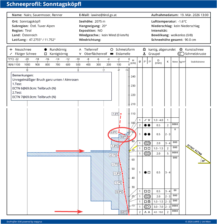
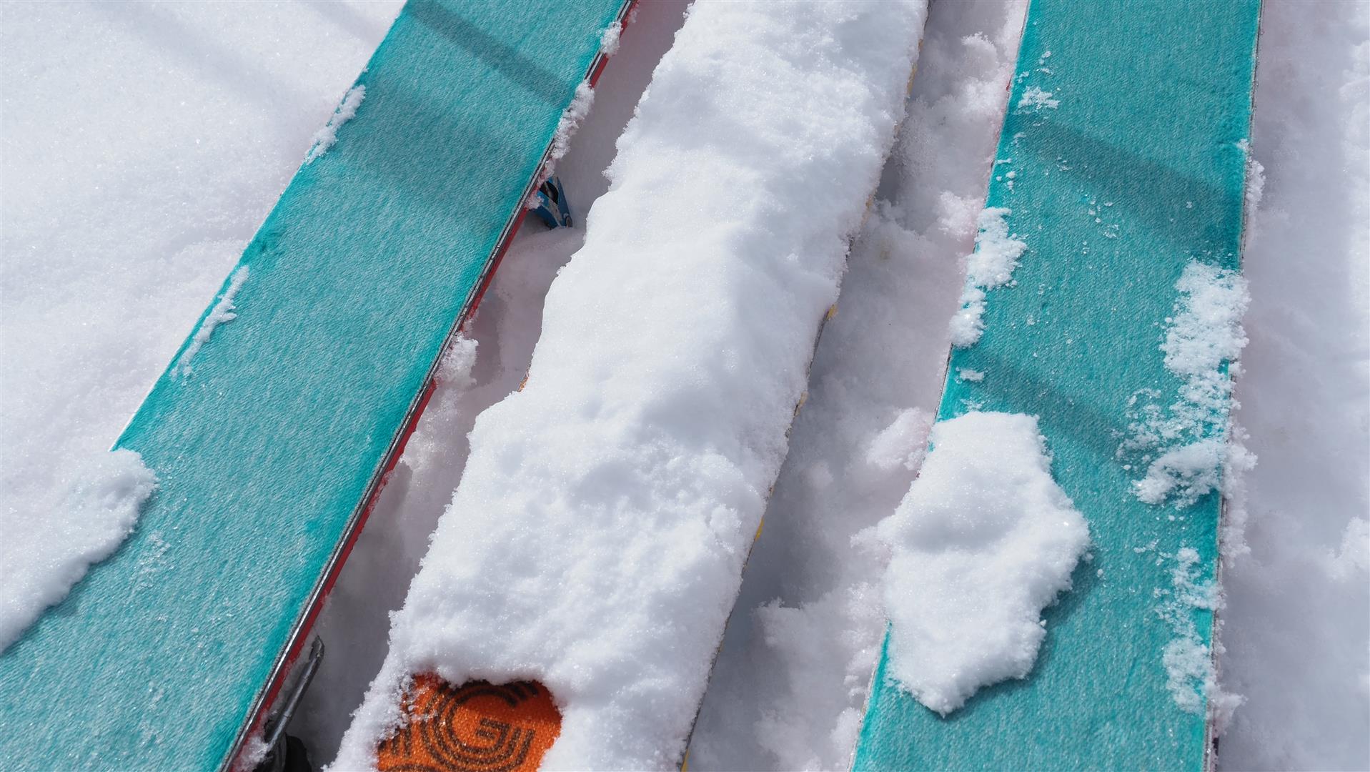
What is typical of springtime is a process taking place near the snowpack surface: already intensive solar radiation, dry air masses, loosely-packed powder snow and cool temperatures. This is known by avalanche experts as “radiation recrystallisation.” The shortwave solar radiation penetrates a few centimetres through the loose powder on the surface and leads to a moistening of the snowpack. In the snow profile picture above, the course of temperatures corresponding to this process is visible. That means: while the snowpack surface still consists of loose powder snow, there is a thin, moist layer just beneath that. During clear nights, the snowpack surface cools down massively. In the immediate area of the moist zone, a very intense temperature gradient develops, potentially generating a faceted weak layer for coming snowfall. Currently, as we can conclude from ongoing weather forecasts, it does not appear that this will happen.
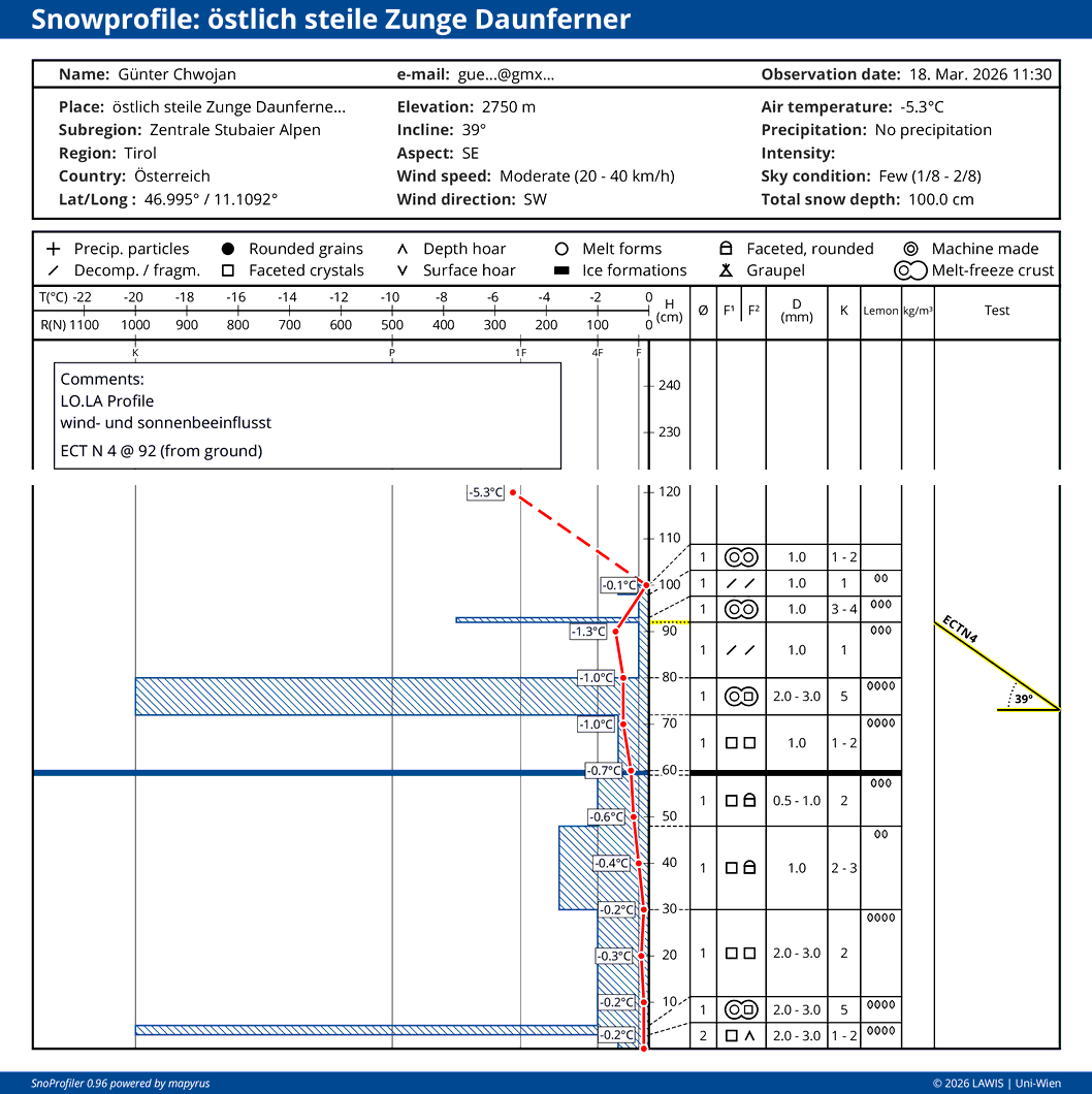
We are grateful for your incoming reports from backcountry about how striking/strong the near-surface weak layers are. Please report to: SNOBS – SNow OBServation LO.LA or send an email to lawine@tirol.gv.at
Powder and firn snow
Highly important: backcountry snow in the mountains of Tirol can currently be enjoyed to the fullest!
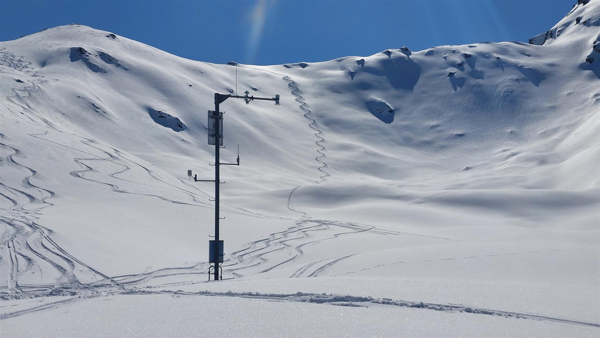
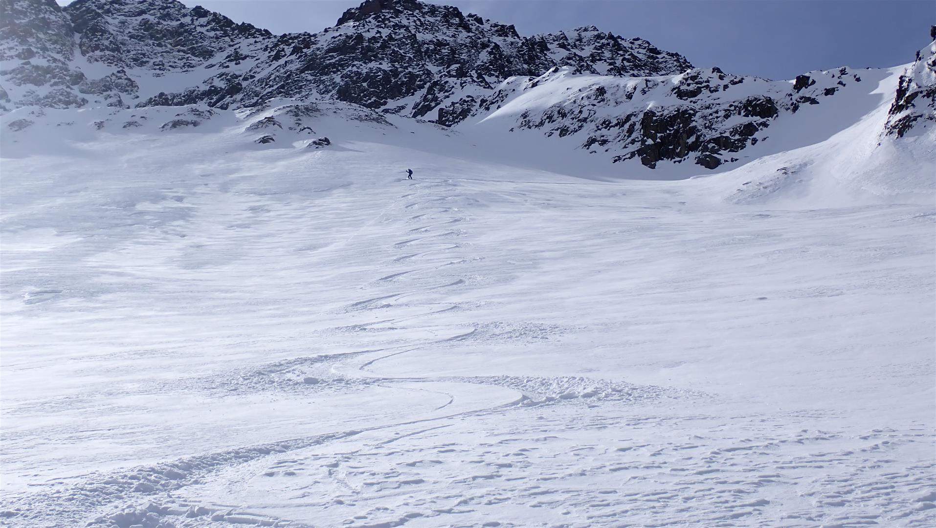
On shady slopes, at least above about 2000m, there is frequently good powder. If you head towards slopes which are not overly steep, the enjoyment is flawless, i.e. NO DANGER. In some places, you still need to watch out for sharks: the rocks hiding just below the surface.
On steep south-facing slopes below about 2500m, there is frequently good firn snow after the nocturnal melt-freeze crusts have softened up during the course of the day. This is particularly true of regions where there has been less amounts of fresh snowfall. In the major areas of precipitation, the transformation process isn’t over yet, so breakable crusts are still part of the show. The same can be assumed for somewhat less sunny high-altitude slopes.
The snow situation
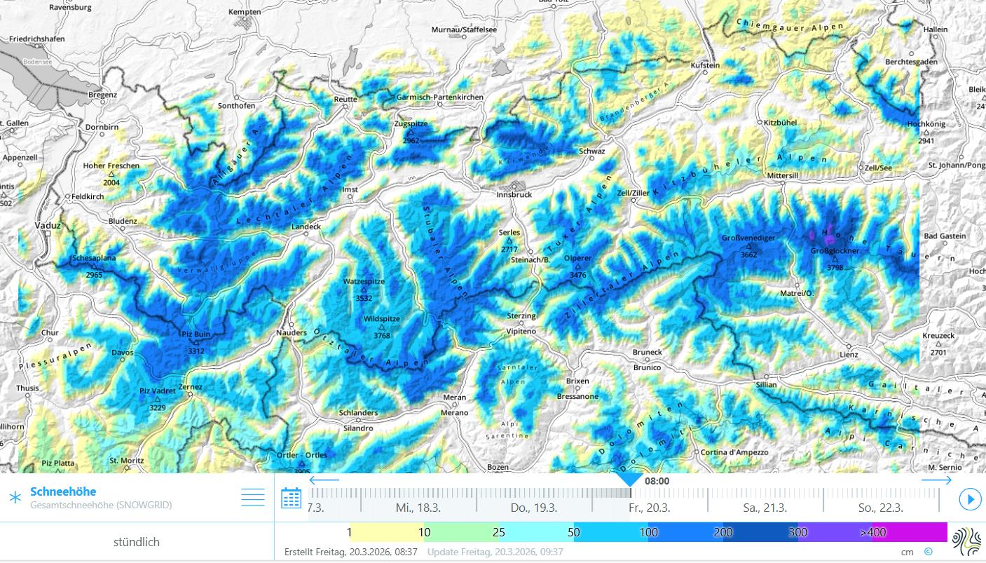
In Tirol, we are faced with below-average snow depths. On south-facing slopes there is often very little or even no snow whatsoever, up to intermediate altitudes.
Outlook
According to Geosphere Austria (GSA), “a high-pressure front will determine the weather in the land starting today, 20.03. Over the weekend, a high-low front with cold air masses from eastern Europe will move into the Alpine region towards northern Italy and provide variable weather conditions.” To begin with, the avalanche situation is not expected to change.