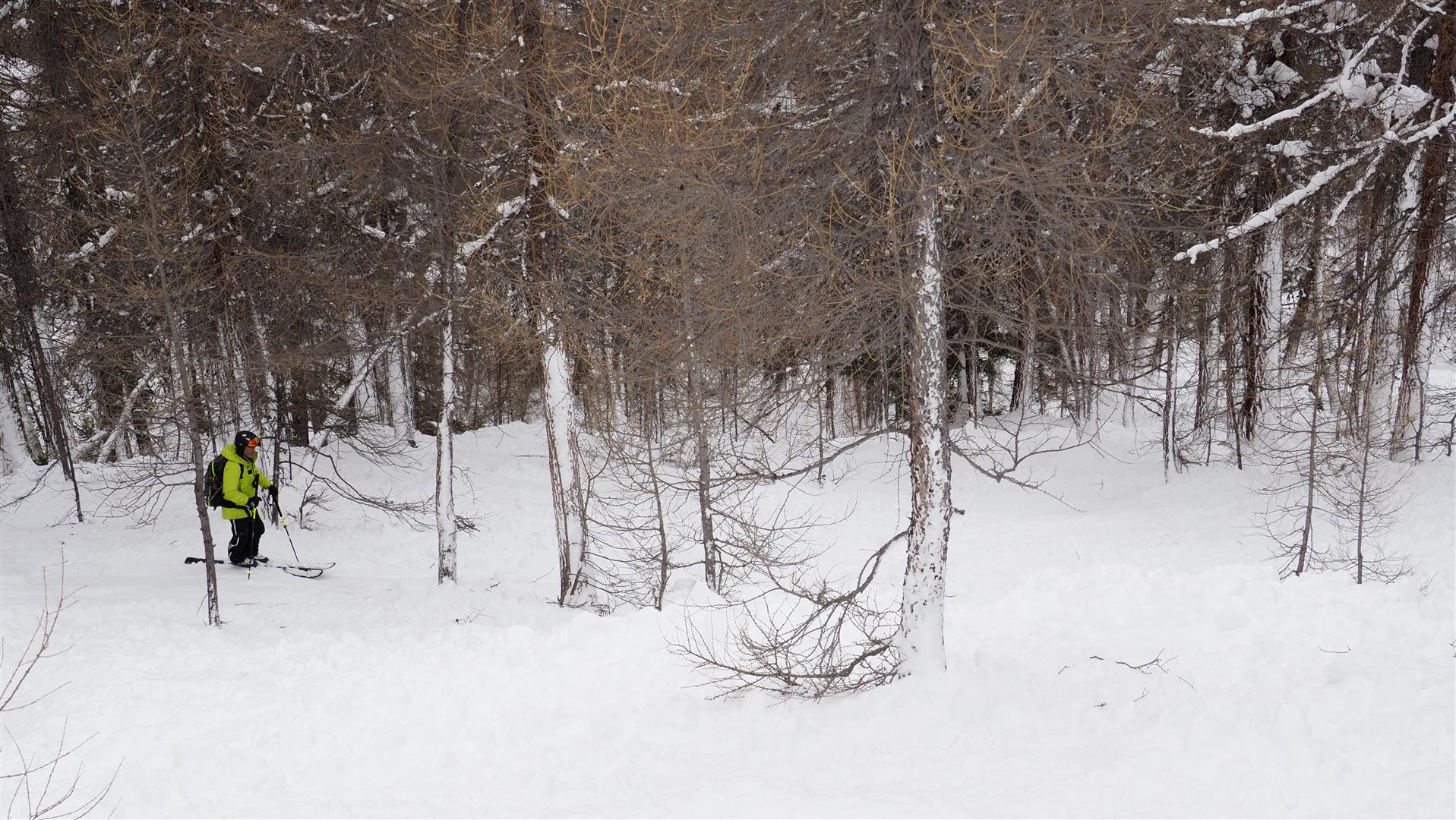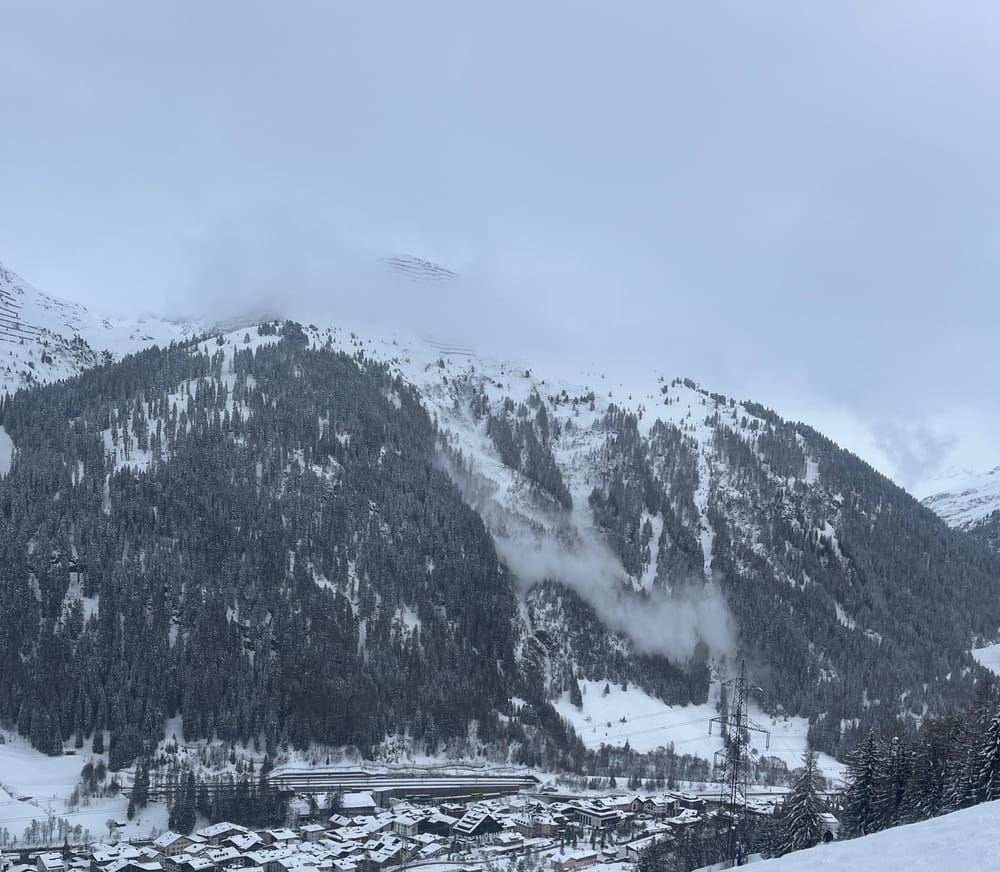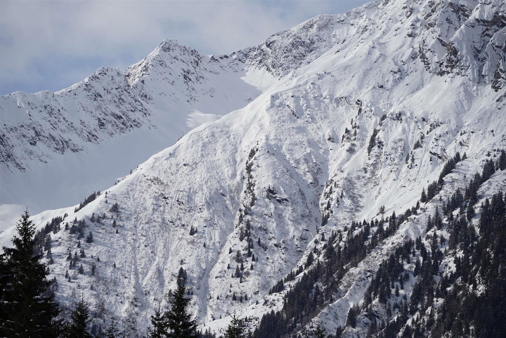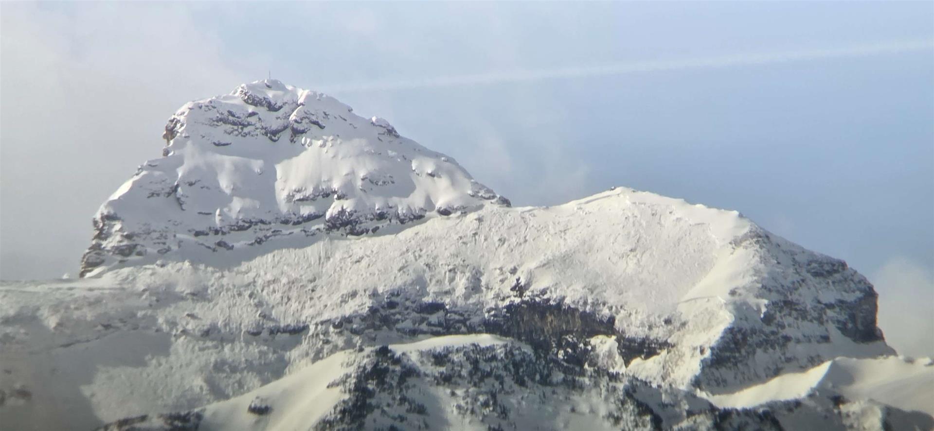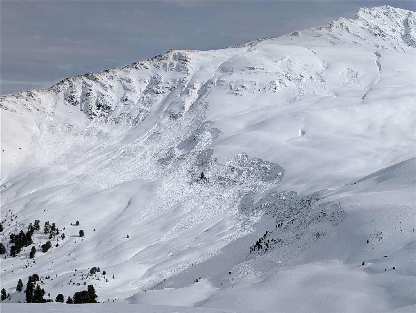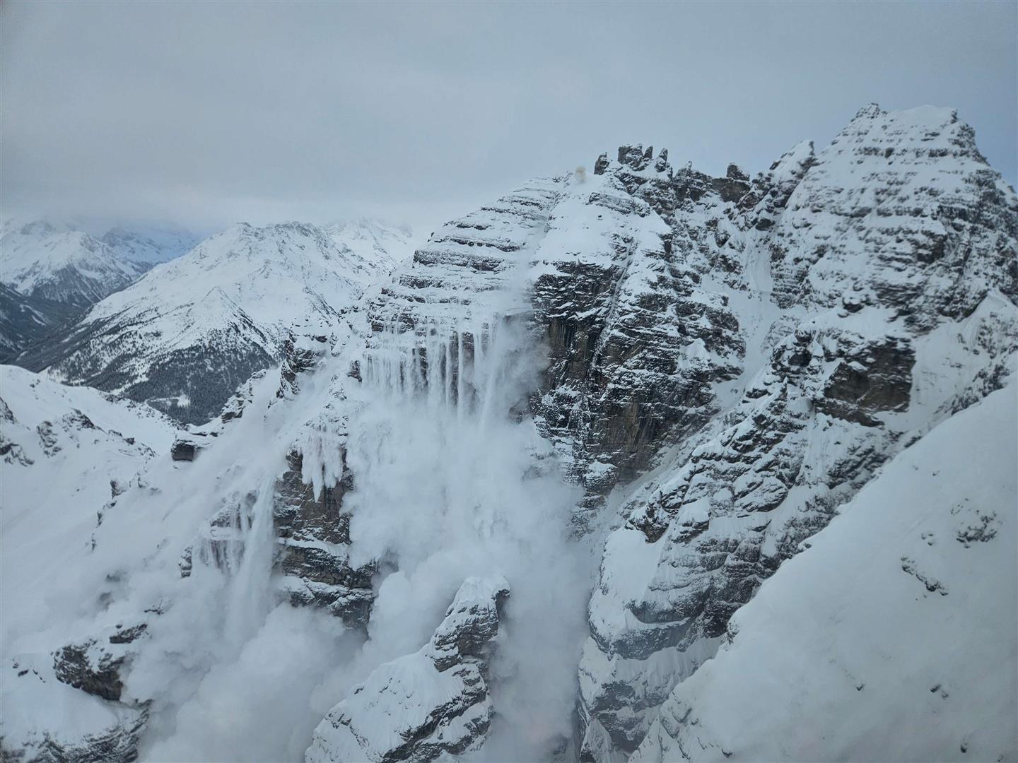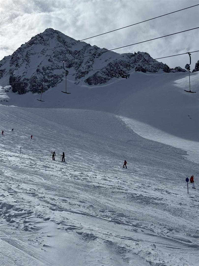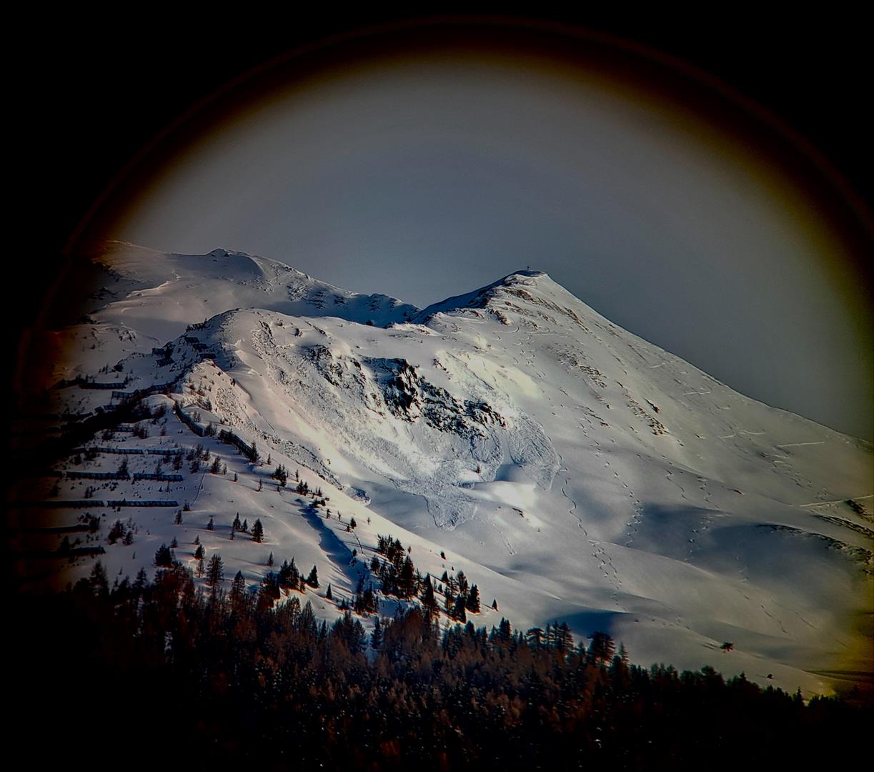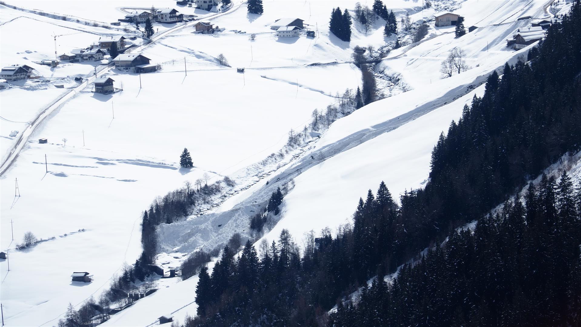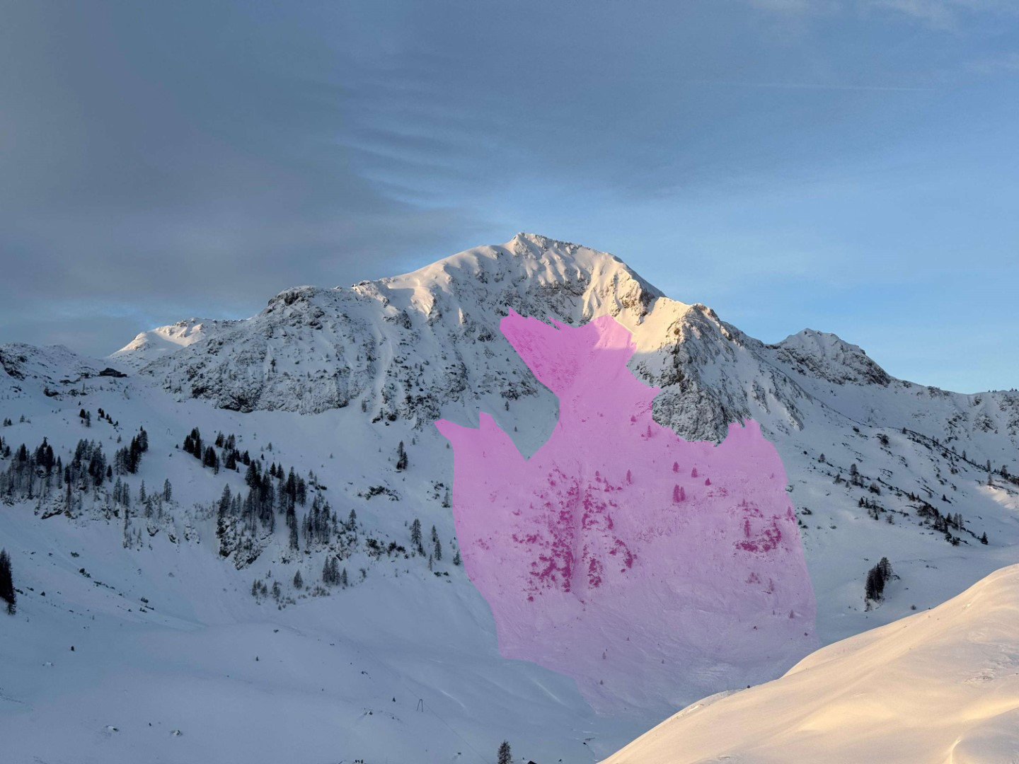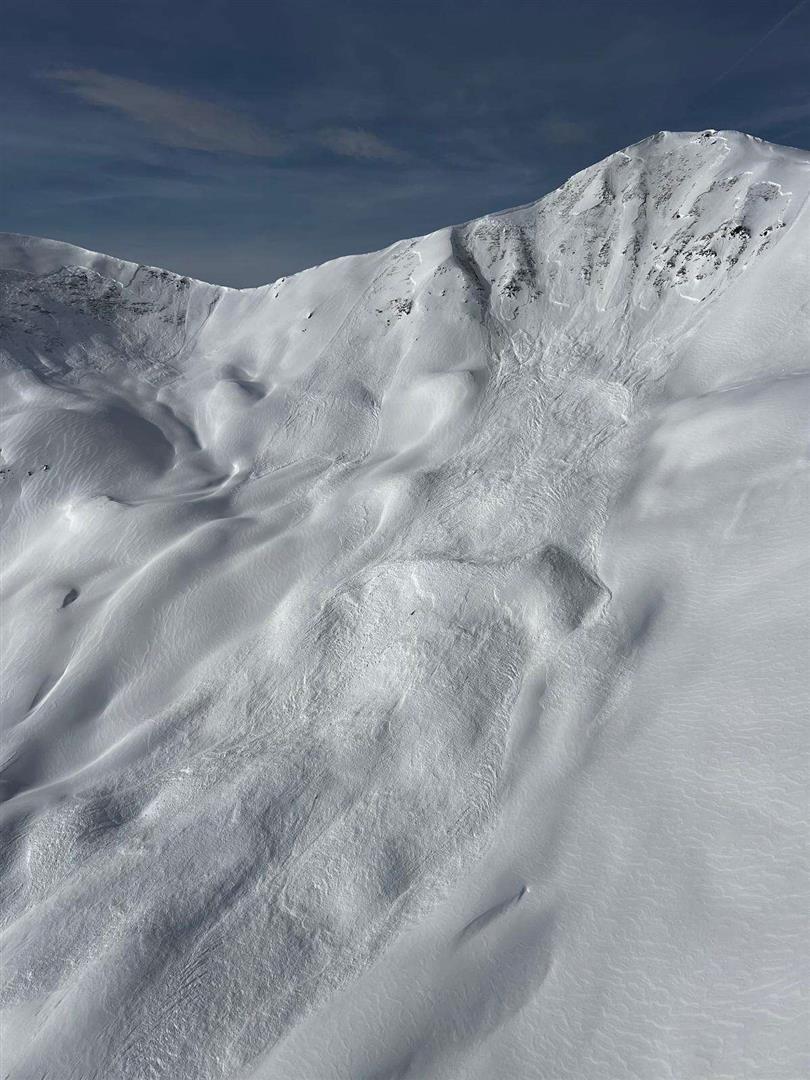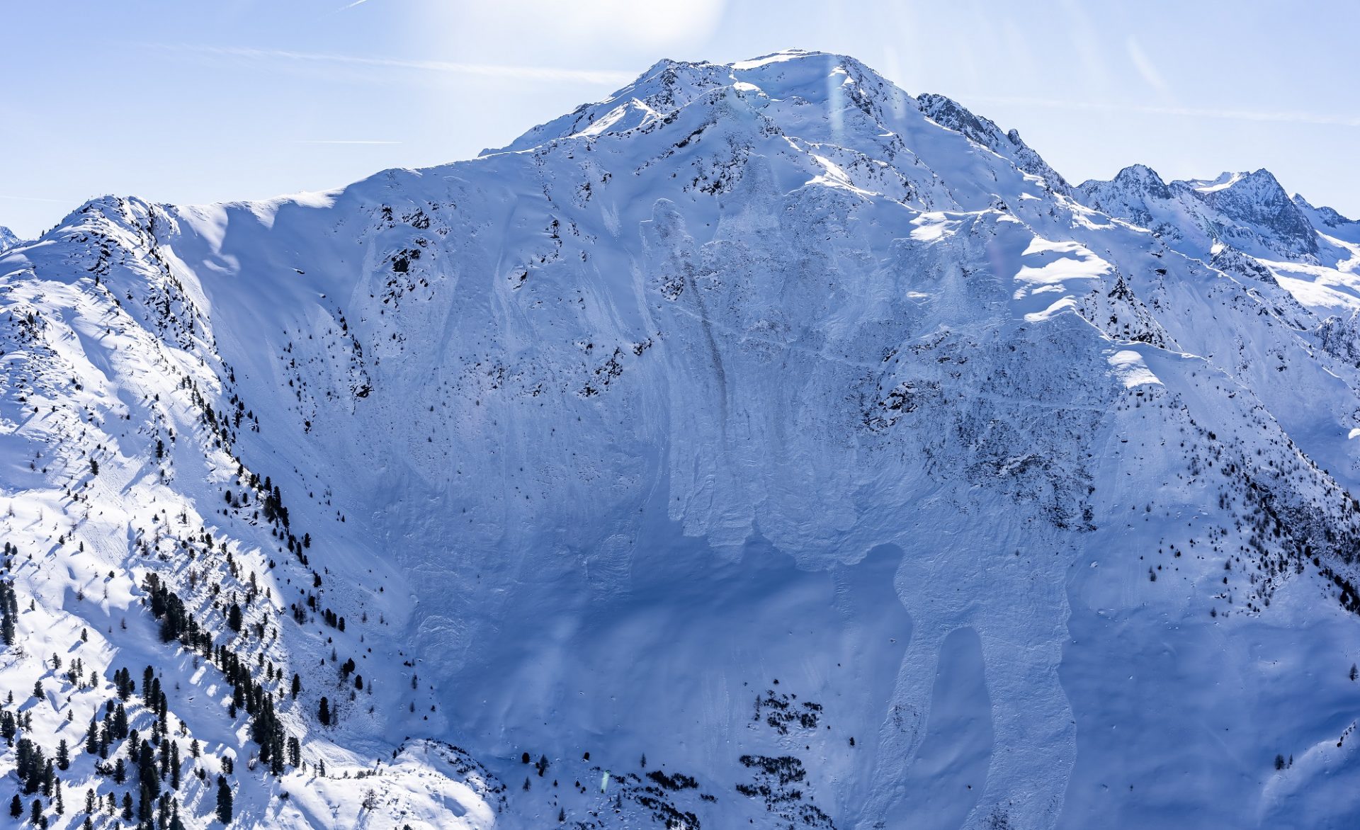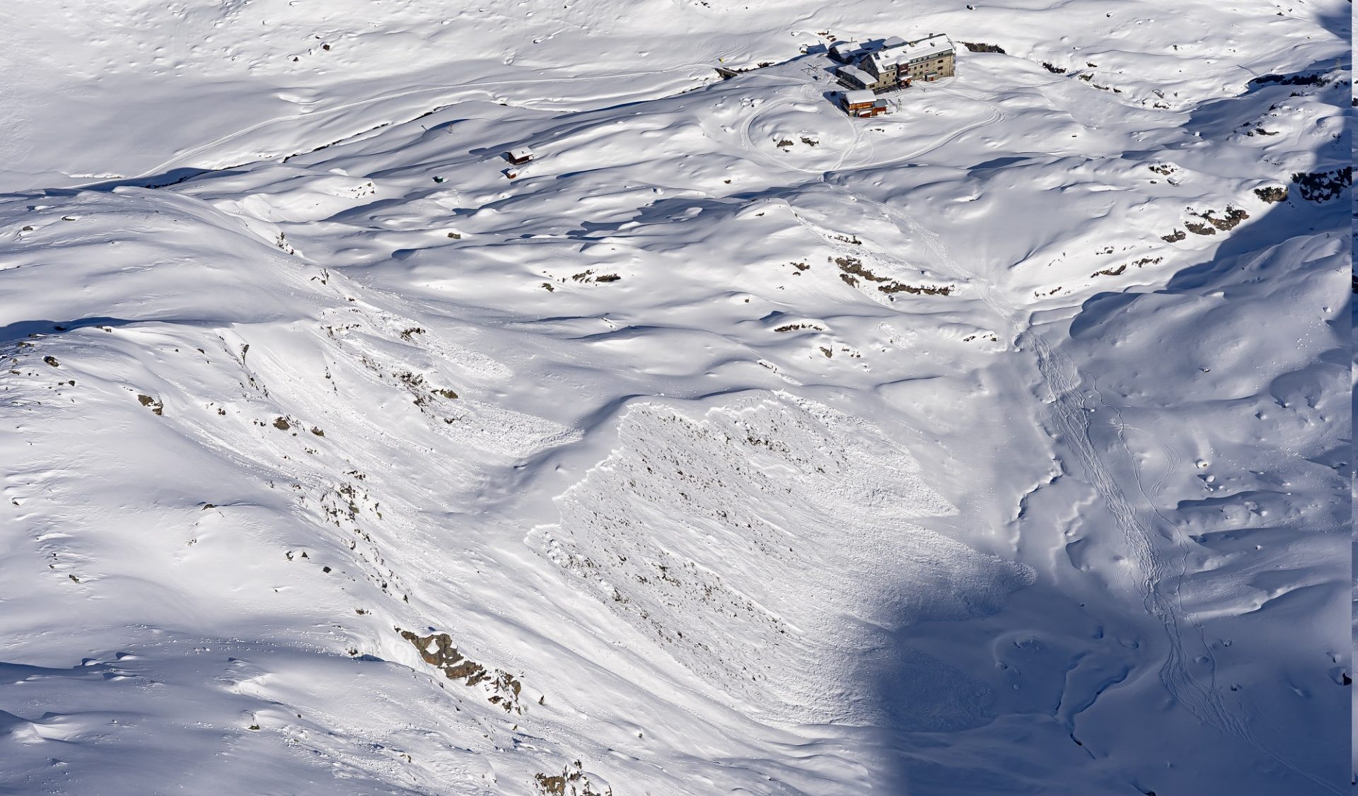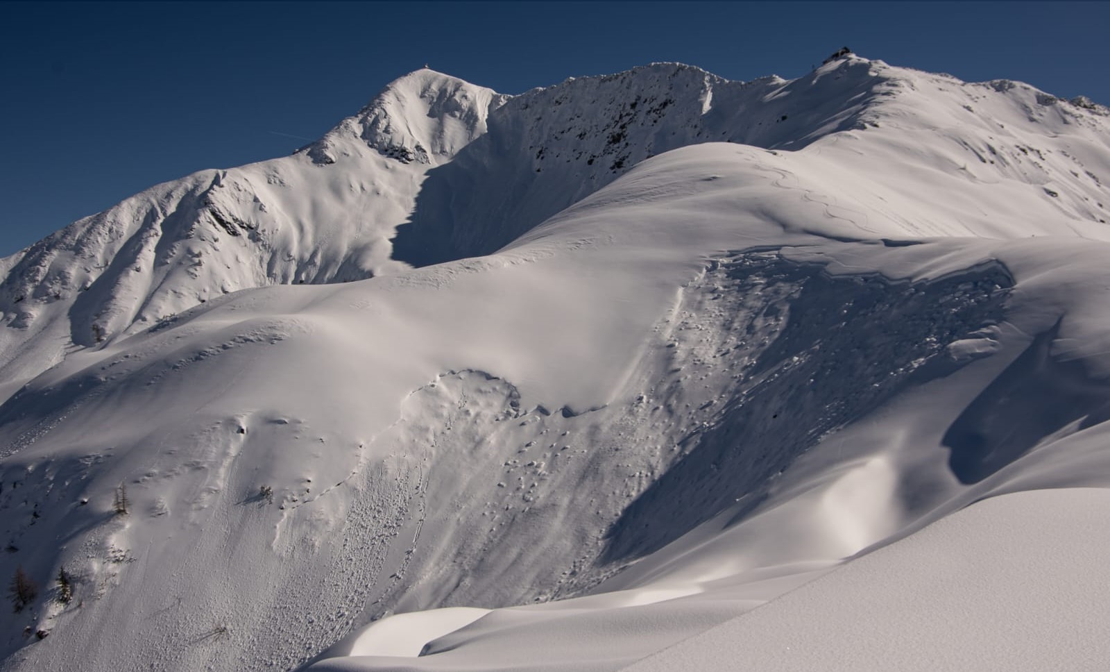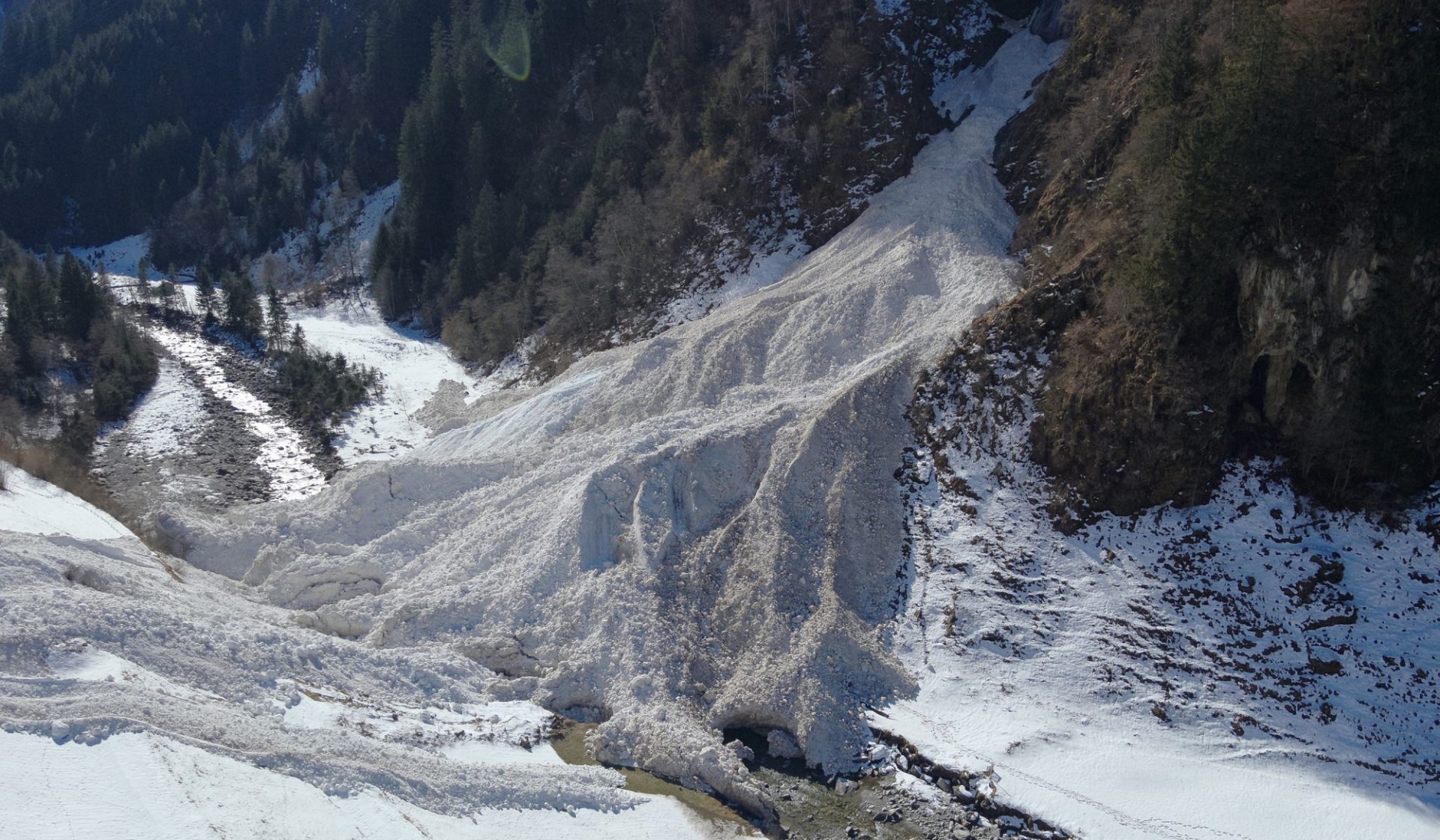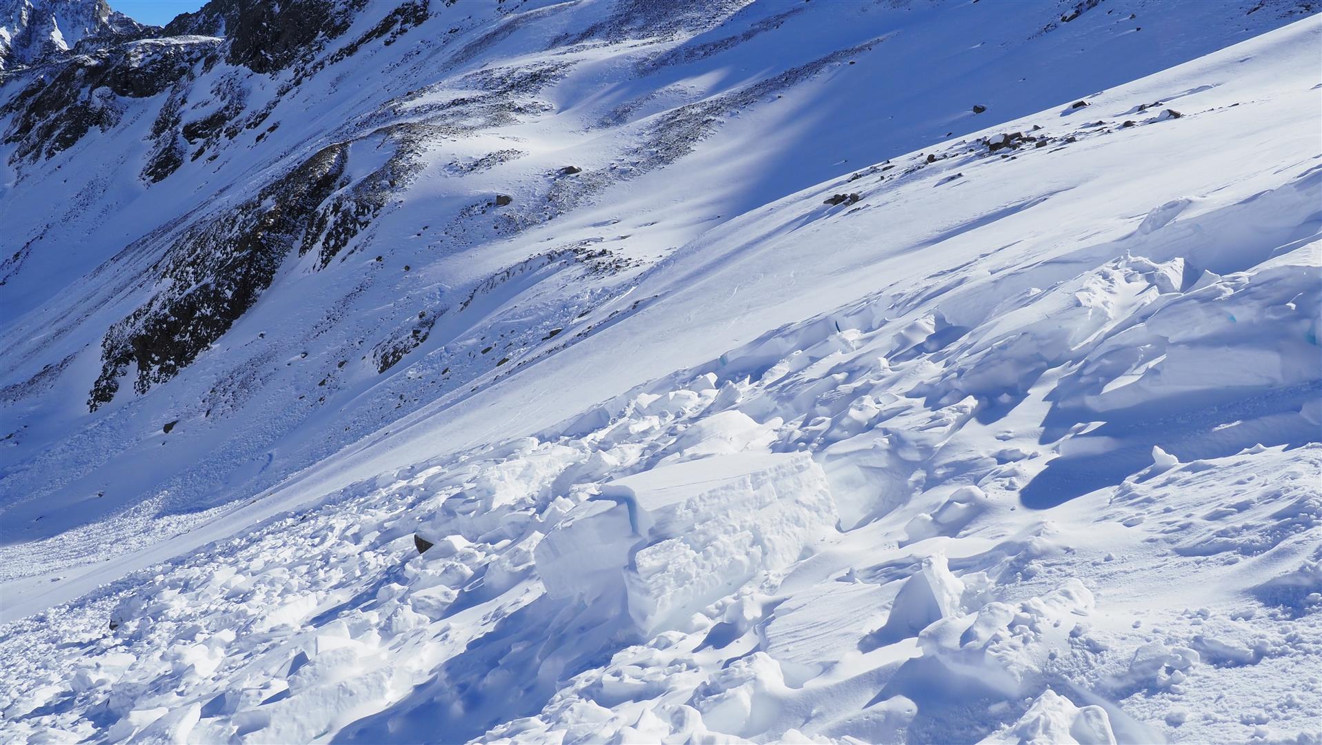
Spontaner Lawinenabgang in den Alpeiner Bergen (© LWD Tirol, 25.02.2026)

Review of last 2 weeks, including avalanche incident analysis

In retrospect, it all began with turbulent conditions on 11.02, then intensified starting on 16.02: a truly marked avalanche period. Extraordinary interval: 10 days (16-25.02) of persistently high avalanche danger.

Since 15.02, 10 persons in Tirol have lost their lives in avalanches (including the person who was totally buried in snow masses below the Jufenkamm on 18.02 who died on 25.02). What stands out was the high number of 9 fatalities in freeriding terrain. An explanation for this can be read in the blog of 20.02.2026, coupled with our observation that the backcountry tourers heeded our warnings in exemplary fashion. Even in the most popular backcountry ski touring regions, we found practically no ski tracks on slopes normally full of them.

Extremely turbulent weather

A whole series of unusual of weather events were responsible for the heavy precipitation over the last 14 days: the first bout occurred on 11-12 February, with its focus in western North Tirol. Most of the precipitation came in the barrier cloud situation which followed on 15-17 February, where there was between 60 and 90cm of fresh snow registered in the western and northern regions of North Tirol. On 19-20 February, a combined front – to start with from the south, then shifting to north/northwest – brought far-reaching snowfall. During this period, also central and southern East Tirol were struck by snowfall. And finally, as the result of two warm fronts on 21.02 and on 24.02, there was widespread precipitation in North Tirol, including rainfall up to 1800-2200m.

Winds were often blowing at strong to storm strength during the rounds of precipitation, thus transporting the fresh snow intensively. Corresponding to the direction of the air currents, winds mostly came from the west.

Die Niederschlagsumme der vergangenen 14 Tage: am wenigsten Niederschlag ist im zentralen Osttirol (20 bis 40mm) gefallen. Mit gebietsweise über 200mm Niederschlag am meisten wurde in den Nordstaulagen von den Ammergauer Alpen bis zum Kaisergebirge verzeichnet (©GeoSphere Austria).
The overall sum of precipitation in the last 14 days: least of all was registered in central East Tirol (20-40mm). Most was registered in the northern barrier cloud zones (more than 200mm) from Ammergau Alps to Kaiser Massif. (©GeoSphere Austria).
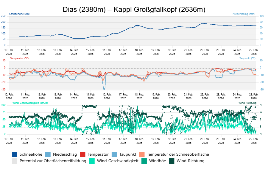
Die vergangenen zwei Wochen bescherten uns sehr turbulentes und niederschlagsreiches Wetter. Der markanteste Schneefall an der Wetterstation Dias in der Verwallgruppe wurde im Zeitraum von 15. bis 17. Februar verzeichnet. Die Schneehöhe wuchs dabei um über einen Meter an. Der Wind blies oft stark bis stürmisch aus West.
The last two weeks brought extremely turbulent weather and lots of precipitation. The most massive snowfall at the Dias weather station in the Verwall Masif was registered between 15 and 17 February. Snow depths more than one metre. Winds were westerly, often blowing at strong to storm strength.

High avalanche activity

The outlined turbulent conditions full of precipitation of recent days brought us a period of unusually heightened avalanche activity: 673 reports arrived of avalanche releases between 15.02 and 26.02. As mentioned, 10 persons lost their lives between 15 and 21 February in 7 difference avalanches; 20 persons were injured in 15 different avalanches between 15 and 26 February. We will here analyse the fatal avalanche incidents which were not treated in earlier blogs; and also outline further select avalanches. At the end, some impressions of this extraordinary avalanche period wrap up the blog.

Fatal avalanche incident Piengkopf / Nauders / Glockturm Massif region (20.02.2026)

The unfolding event

Father and son were in the Nauders-Bergkastl ski area, they left red ski run number 12 and entered open skiing terrain. After they had traversed the first steep slope, they skied down into a sparsely wooded zone. A large slab avalanche then triggered which swept both persons into the forest below. The son was not buried in snow, injured his leg; the father was partially buried and suffered fatal injuries from being slammed into a tree.

The avalanche

The avalanche was a large-sized slab avalanche with a length of 500m and a breadth of 400m. The size of the avalanche is explained by the combination of a solid slab above an equally marked and regularly spread weak layer. The avalanche slope faced northwest, had an average 35° steepness gradient. The fracture was at 2340m, the average fracture depth was 50cm.

Die großflächige Schneebrettlawine am Piengkopf. Die zwei Personen fuhren von der orographisch linken (an diesem Bild nicht ersichtlichen) Seite in den Hang ein. (© LWD Tirol, 20.02.2026)
The large-scale slab avalanche on Piengkopf. The two persons skied from orographically left into the slope (not visible in above photo). (©LWD Tirol, 20.02.2026)
Eingezeichnet ist die Einfahrtsspur. Die im Hintergrund ersichtliche Lawine ist die Unfalllawine, im Vordergrund eine Sekundärlawine. (© LWD Tirol, 20.02.2026)
The entry track is indicated. The avalanche visible in background is the incident avalanche, in foreground is a secondary avalanche. (©LWD Tirol, 20.02.2026)
Der an den Bäumen haftende Schnee lässt die Wucht der sich zu einer Staublawine entwickelten Schneebrettlawine erahnen. (© LWD Tirol, 20.02.2026)
Snow that stuck to the trees shows the force which the powder-snow developed out of the slab avalanche. (©LWD Tirol, 20.02.2026)
Die verstorbene Person wurde bei dem im Vordergrund befindlichen Baum aufgefunden. Blick Richtung Lawinenanriss. (© LWD Tirol, 20.02.2026)
The deceased person was found in the tree in photo foreground. View toward avalanche fracture (©LWD Tirol, 20.02.2026)

The snowpack

During our examinations of the snowpack, we once again found a snowpack which was extremely prone to triggering and a marked persistent weak layer. The primary weak layer consisted of faceted crystals and rotten snow which was embedded between old melt-freeze crusts. Secondarily, the avalanche fractured at the relatively loosely-packed fundament near ground level.
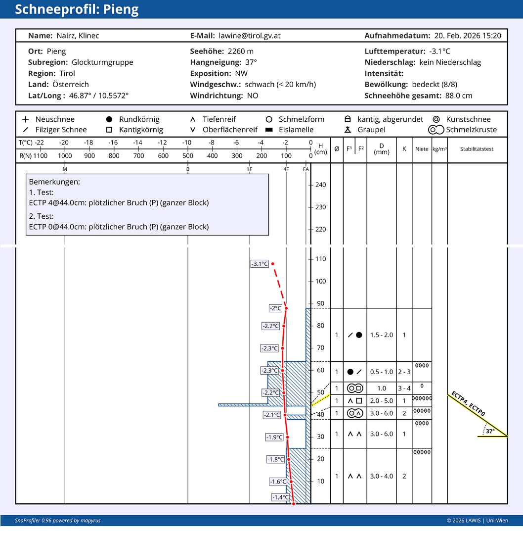
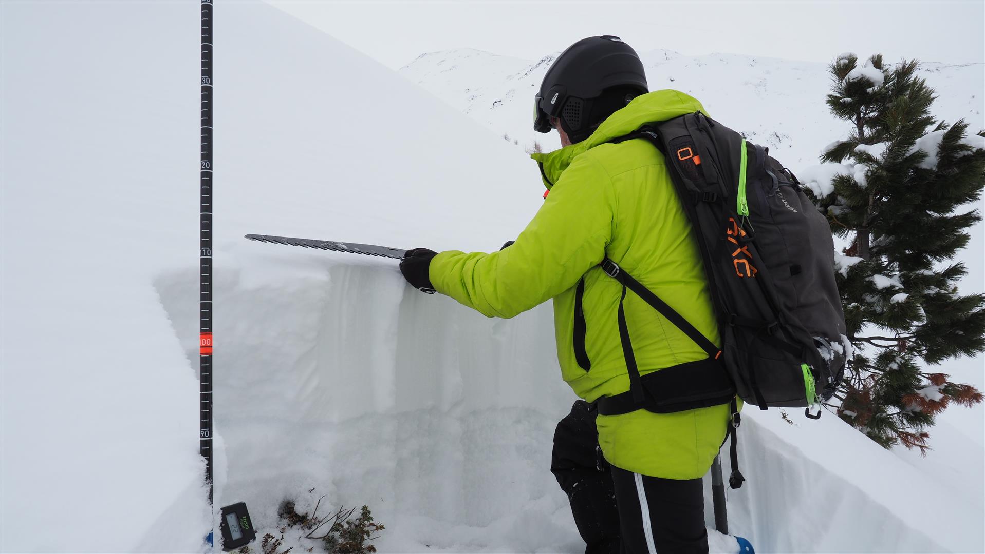
Schneeprofil Piengkopf: Bei den Stabilitätstests zeigte sich eine hohe Störanfälligkeit. Man erkennt gut den "Krustensandwich" mit der eingebetteten Schwachschicht aus kantigen Kristallen und Schwimmschnee.
Snow profile Piengkopf: stability tests showed high proneness to triggering. Also visible is the crust sandwich with the embedded weak layer of faceted crystals and rotten snow.
Am Lawinenanriss. Farblich gut zu unterscheiden: Dunklerer Altschnee und weißlich, matter Neuschnee. (© LWD Tirol, 20.02.2026)
At the avalanche fracture. Easily differentiated by the colors: dark old snow and whiteish, dull fresh snow. (©LWD Tirol, 20.02.2026)

Fatal avalanche incident Gampberg / St. Anton / Mid-Verwall Massif region (20.02.2026)

The unfolding event

A group of five freeriders had already descended a number of times in the St. Anton am Arlberg ski area during the course of the day. In early afternoon they left the secured ski area below the Gampberg near the “Gertrud-Gabl-Rinne,” when one of them triggered a large-sized slab avalanche. All five persons were caught in the avalanche and swept along. The avalanche was seen by a number of observers and the powder cloud was visible from the valley. A large-scale rescue operation was immediately set in motion with numerous groups taking part, including Mountain Rescue, Ski-slope Rescue, Mountain Guides, Ski Teachers, Fire Department, Ambulance Team, Emergency Doctors, (Alpine) Police, Dog Guides, and various helicopters. Two persons were quickly located by means of LVS beamers at an altitude of 1340m and 1560m and dug out of 1.2 metres and 1.6 metres-deep snow. Both had already died. A further person had no LVS beamer and was found by means of plungers about 2 hours after the avalanche released at a depth of 1.8 metres. After reanimation attempts were undertaken, the person was flown to the hospital in Innsbruck, where he died the same day. The fourth person, who was partially buried and injured, was flown to the hospital in Zams. The fifth person was not buried in snow masses.

The avalanche

It was a large to very large-sized slab avalanche with a breadth of about 450m and a length of about 1200m. In this case as well, the size of the avalanche can be explained by the interaction of a marked slab on top and an equally marked and widely expansive weak layer. The slab avalanche triggered on a very steep to extremely steep northwest-facing slope at an altitude of 2040m. The plummet path of the avalanche can be characterized as a marked, extremely steep gully and gorge system with high disparities. The avalanche divided into several cones, some of which ended in huge deposits.
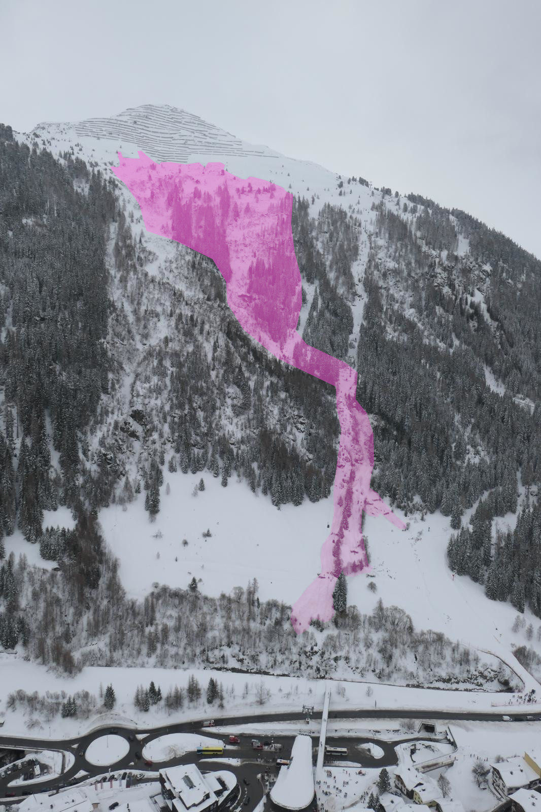
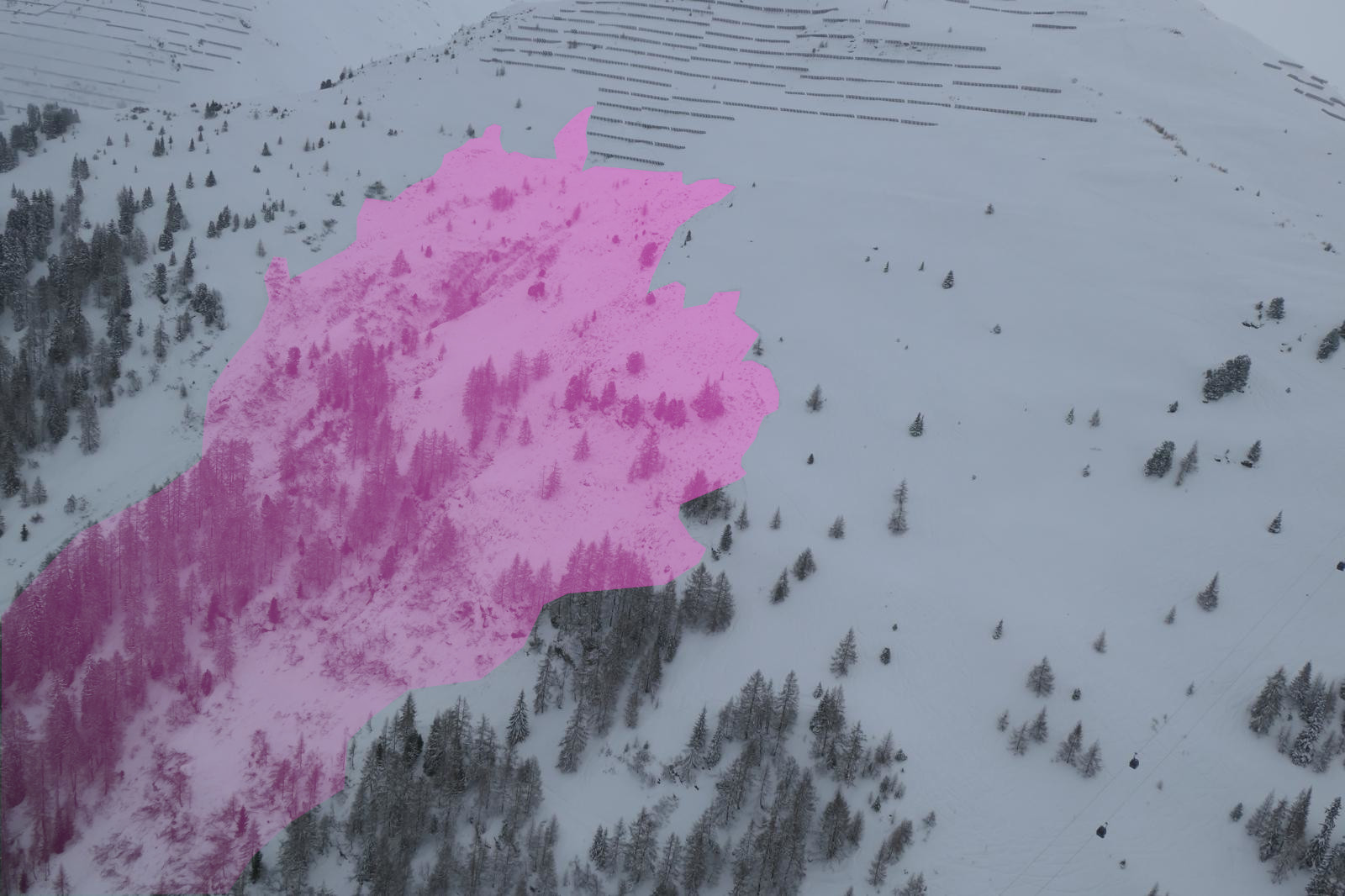
Lawine am Gampberg im Überblick (© Alpinpolizei, 20.02.2026)
Overview of avalanche on Gampberg (©Alpinpolizei, 20.02.2026)
Das Anrissgebiet der Lawine am Gampberg (© Alpinpolizei)
Fracture zone of avalanche on Gampberg (©Alpinpolizei, 20.02.2026)
Die Lawine während ihres Abgangs. Man erkennt den Staubanteil. (© Anton Klaus Schmid, 20.02.2026)
The avalanche during its release. The powder cloud is visible. (©Anton Klaus Schmid, 20.02.2026)

The snowpack

Due to the unusual avalanche situation it was not possible to carry out analysis at the spot of the release. Nevertheless, it is possible to say with near certainty that the avalanche’s cause is to be found in the well known persistent weak layer problem.

Fatal avalanche incident Untermotzwiesen / Serfaus / Samnaun Massif region (21.02.2026)

The unfolding event

Two persons left the secured ski run of the Serfaus ski area and skied beneath the Komperdellbahn into freeriding terrain in a sparsely wooded area. Above the Untermotzwiesen at an altitude of approximately xxx, one person traversed an extremely steep northeast-facing slope and came to a stop in a flat zone at the foot of the slope in order to wait for the second person. At that moment, a slab avalanche triggered above the waiting person, who was completely buried in snow masses. The second person, who was outside the avalanche path, immediately skied to the spot where the other person was buried in snow and began to search with the LVS beamer. Other persons in the vicinity participated in the search. By means of the LVS beamer, the person buried in snow was dug out from a depth of about 2.4 metres and with reanimation measures was flown to the hospital in Innsbruck, where the person died.

The Avalanche

The avalanche was a medium-sized, approximately 60m broad and 50m long slab avalanche. It triggered on an extremely steep northeast-facing hillside (earth pyramid) at an altitude of approximately 1670m. The average depth of the fracture is estimated to have been about 40-50cm.
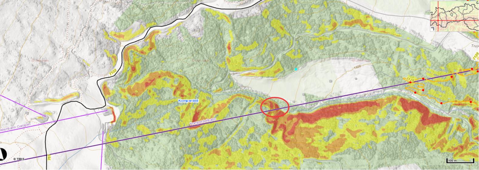
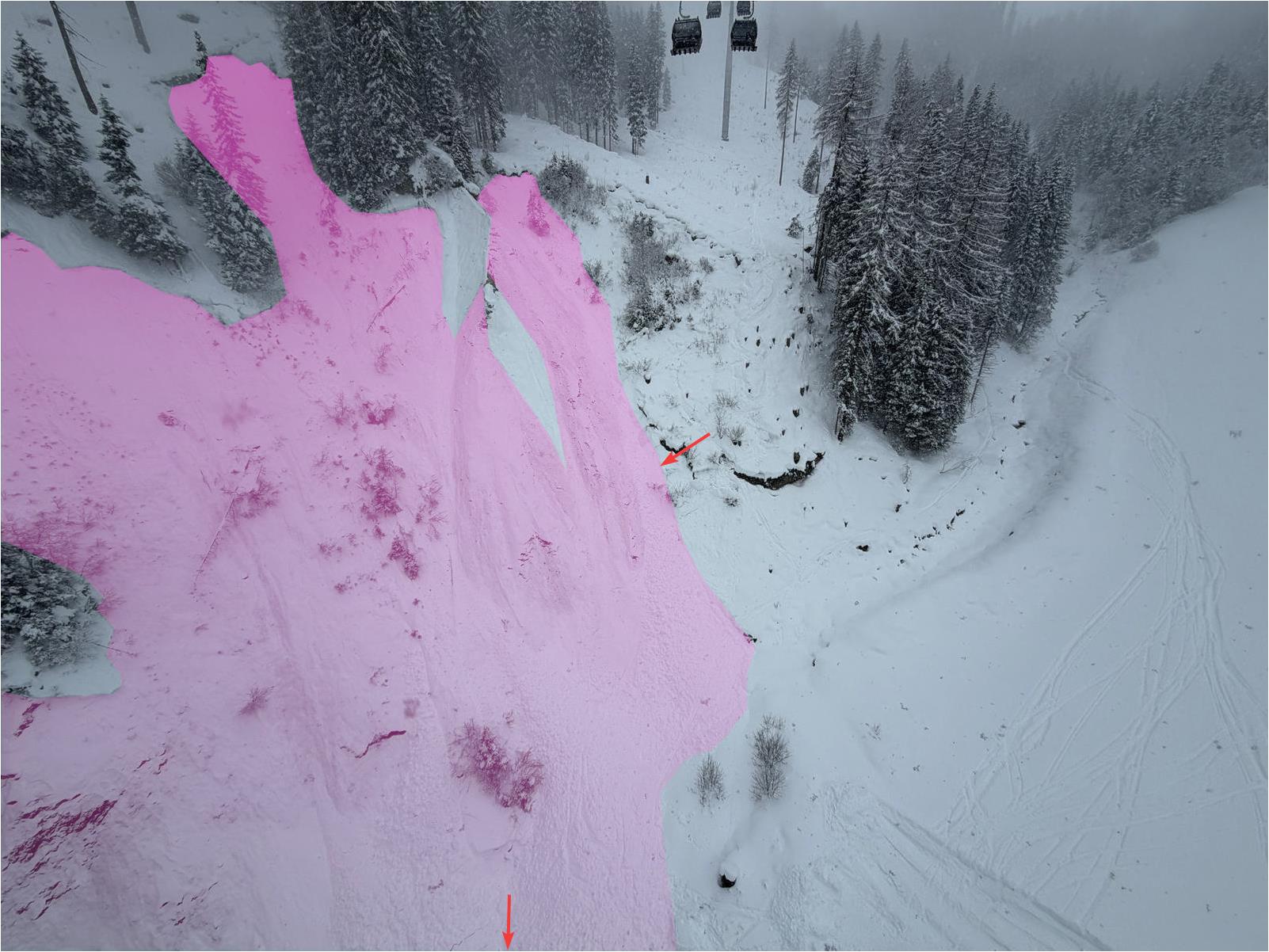
Eingezeichnet ist der Bereich des Lawinenabgangs unterhalb der Komperdellbahn (©tiris).
Avalanche area is circled, beneath the Komperdellbahn. (©tiris).
Die Lawine im Bereich der Untermotzwiesen. Eingezeichnet ist die Einfahrtsspur. Weiters zeigt der untere Pfeil in Richtung der Verschüttungsstelle. (© Alpinpolizei, 21.02.2026)
The avalanche in the Untermotzwiesen area. The entry track is indicated. The lower arrow points to the spot where the person was buried in snow.(©Alpinpolizei, 21.02.2026)
Der orographisch rechte Teil der Lawine Untermotzwiesen. (© Alpinpolizei, 21.02.2026)
The orographically right part of the Untermotzwiesen avalanche (©Alpinpolizei, 21.02.2026)
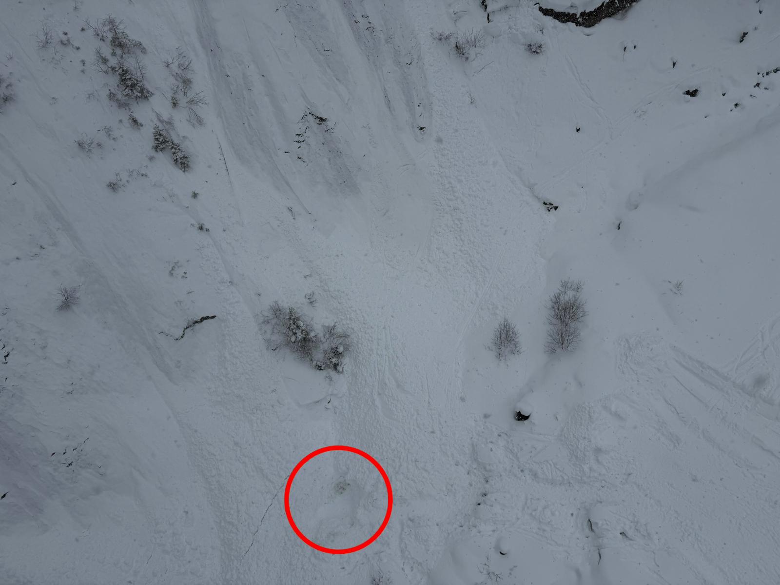
Die Verschüttungsstelle  der Lawine Untermotzwiesen im relativ flachen Hangfuß (© Alpinpolizei, 21.02.2026)
The spot of burial of the Untermotzwiesen avalanche in relatively flat terrain at the foot of the slope (©Alpinpolizei, 21.02.2026)

The snowpack

Due to the unusual avalanche situation it was not possible to carry out examinations of the snowpack directly at the scene. However, we can say with near certainty that the avalanche was caused by the persistent weak layer as main underlying problem. The snowpack was further weakened, moreover, due to the ascending snowfall level. According to reports on location there is reason to believe that ultimately the avalanche was unleashed by a remote triggering in the flat terrain of the stream bed.

Avalanche Diasalpe / Kappl / Verwall Massif East region (20.02.2026)

Shortly after midday, 12 persons were in freeriding terrain on a very steep east-facing slope above the Diasalpe when a slab avalanche triggered at an altitude of 2260m. All the persons were struck by the plummeting snow masses and swept along with them, 9 persons were partially buried in snow, 3 persons completely buried. The latter 3 could be rapidly located and dug out by their companions thanks to LVS beamers. Two persons suffered (slight) injuries.
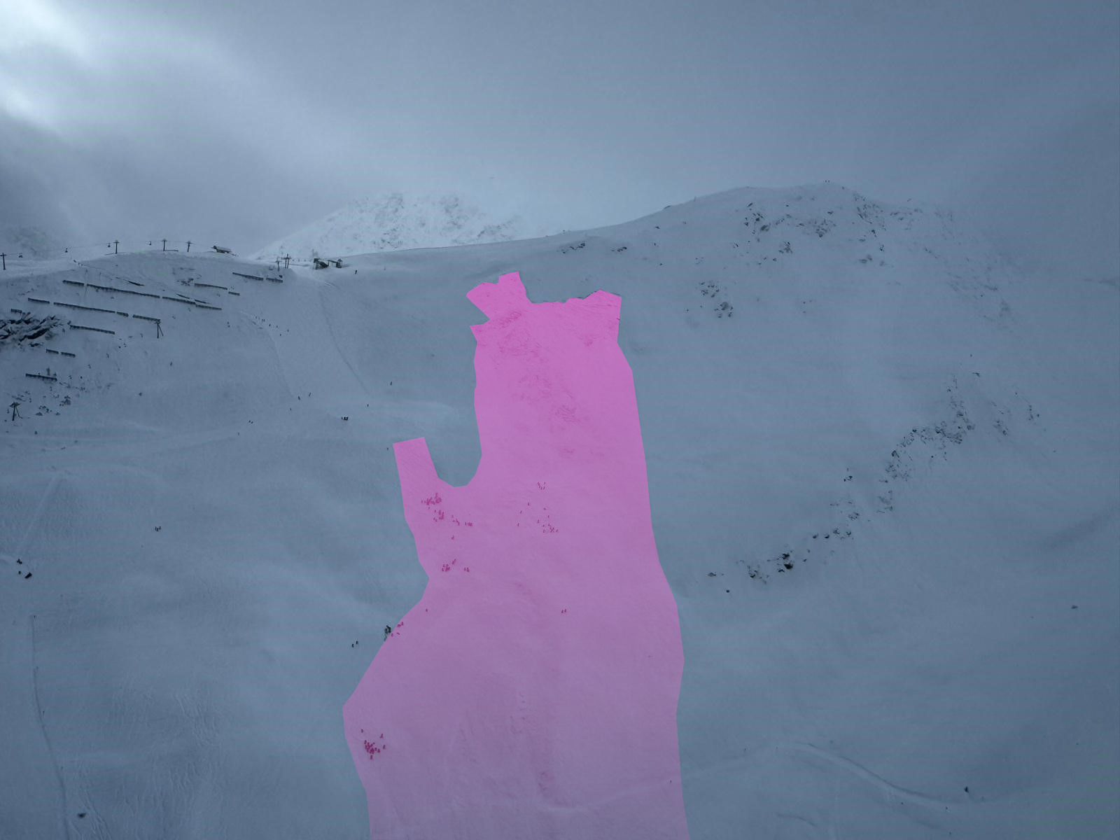
Lawinenabgang Diasalpe / Kappl (© Alpinpolizei, 20.02.2026)
Avalanche release Diasalpe / Kappl (©Alpinpolizei, 20.02.2026)

Avalanche operations near Lärmstange / Zillertaler Alps Northwest region

In the Lärmstange zone of the Hintertux Glacier ski area there were two avalanche operations conducted on two different days. One was on 21.02, in which two winter sports enthusiasts were injured; another was on 25.02 without anyone being buried in snow masses, nevertheless necessitating a large-scale search operation.
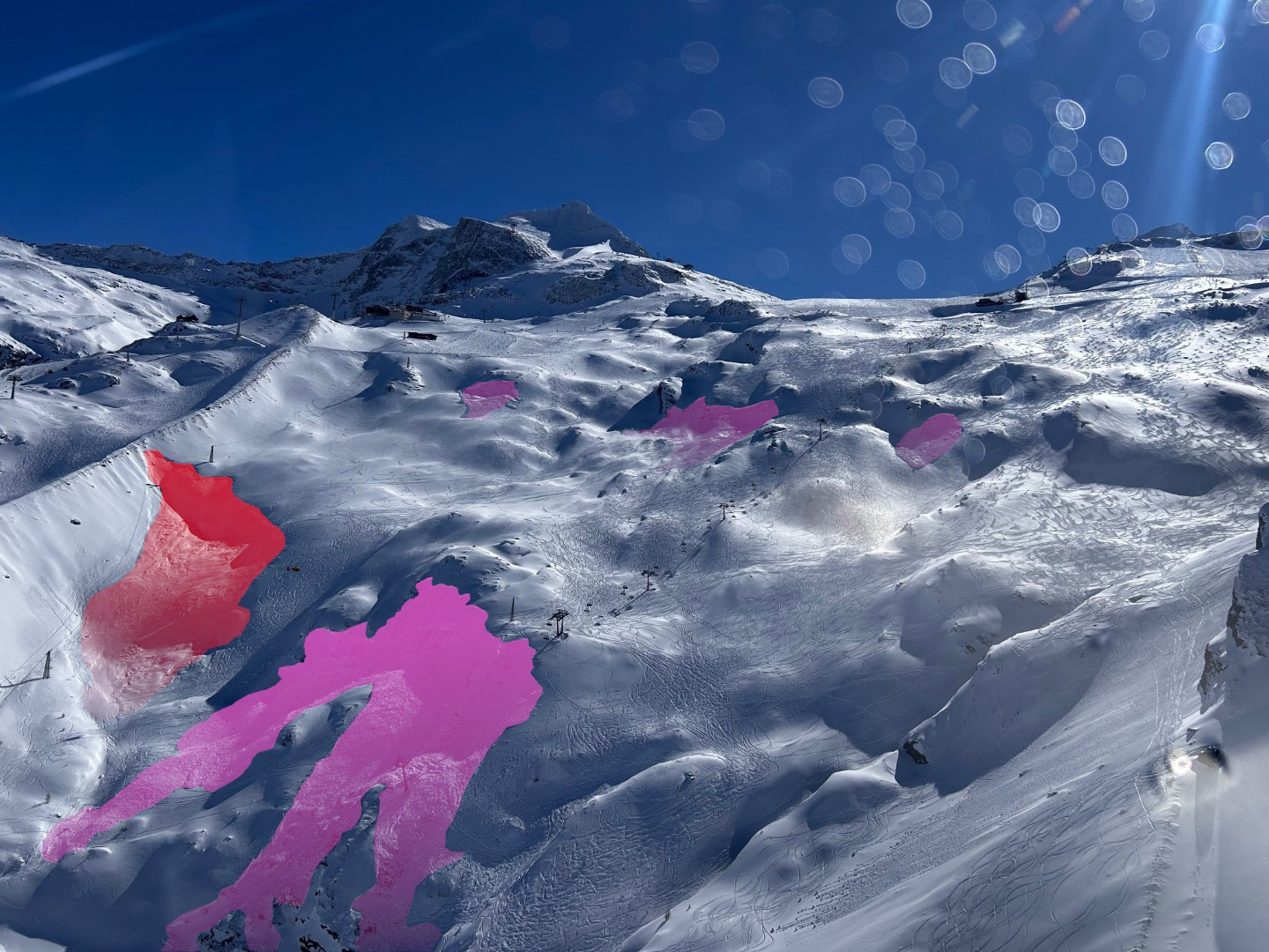
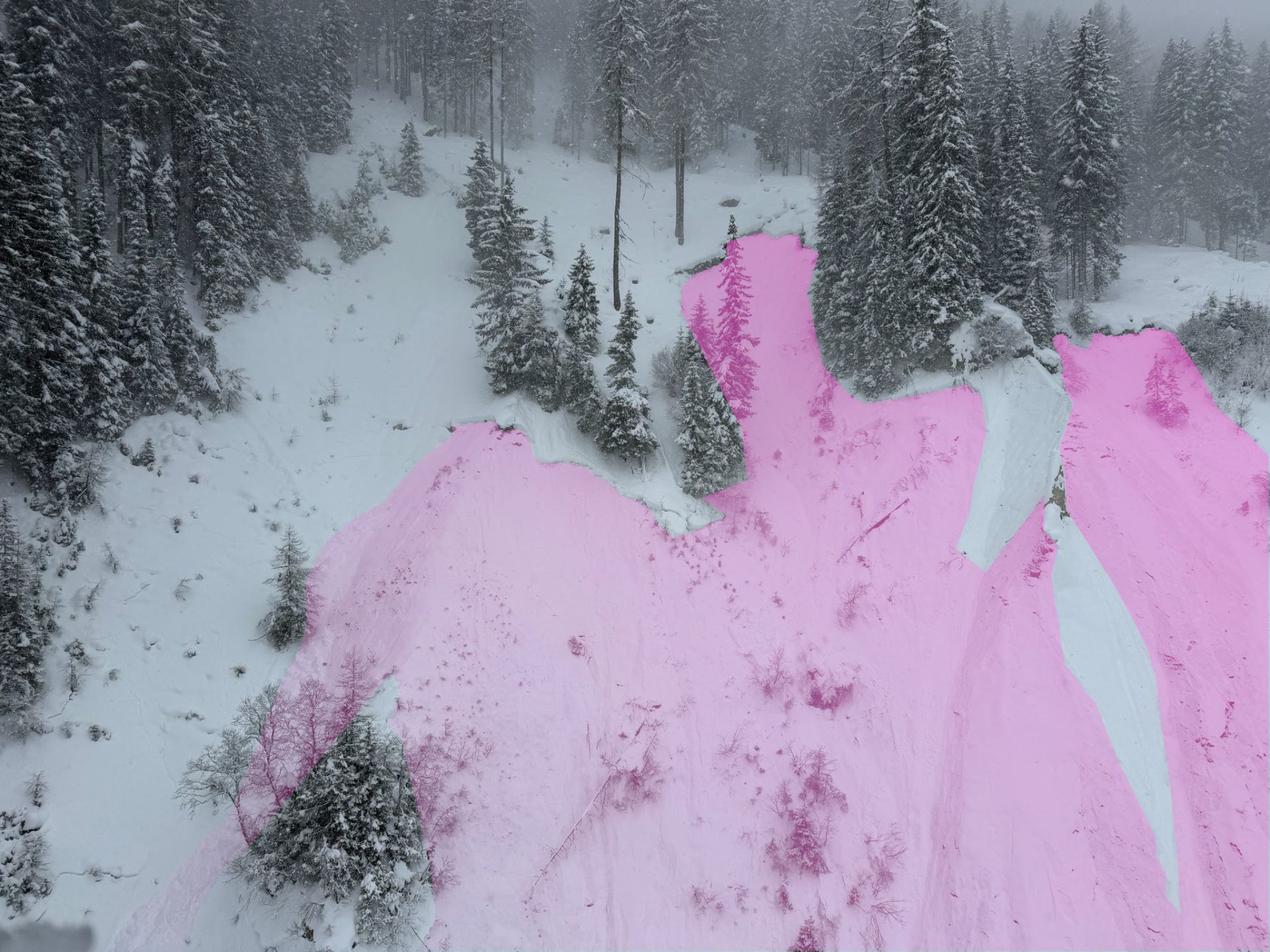
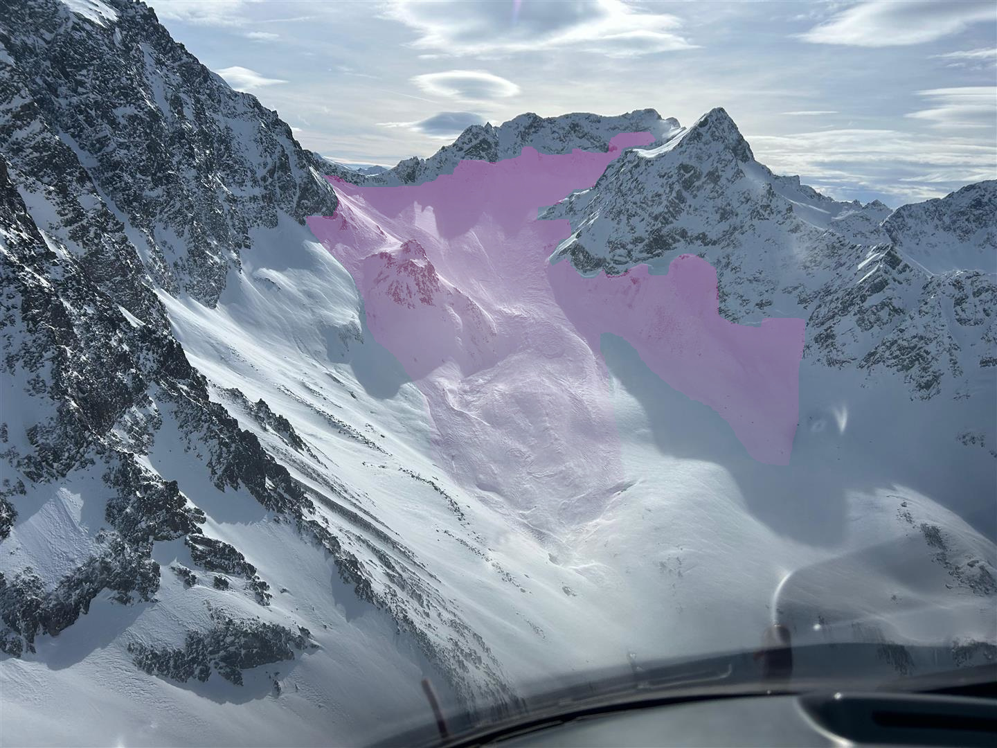
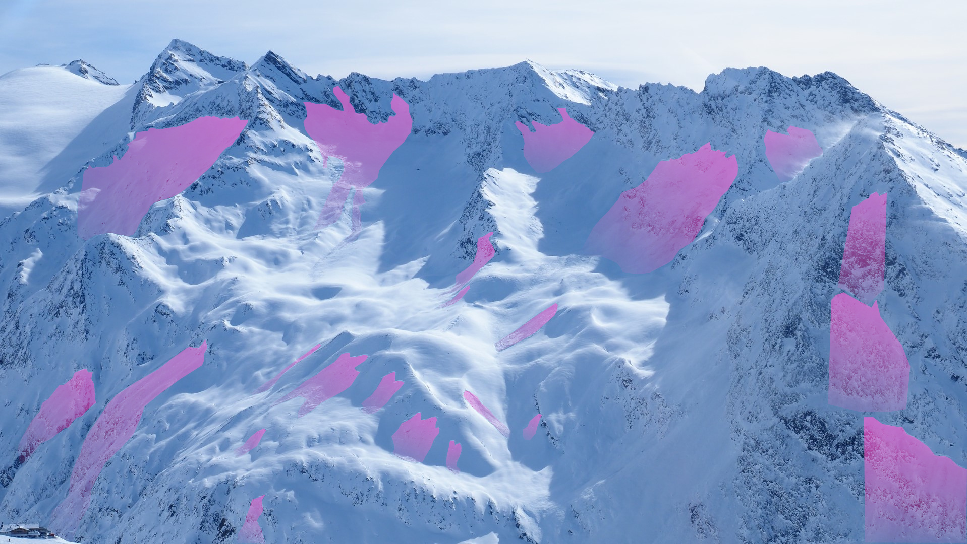
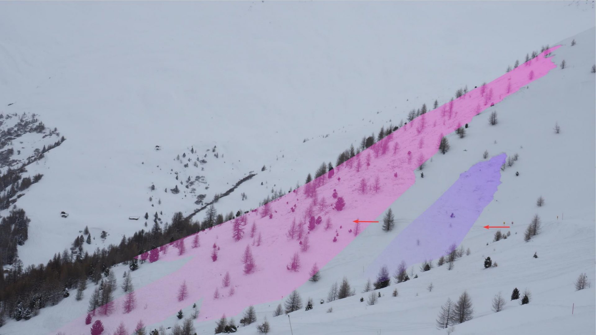
Lawineneinsätze im Nahbereich. Am Bild eingezeichnet Lawinenabgänge Lärmstange. Eindrucksvolles Bild einerseits über die Störanfälligkeit der Schneedecke,
In the avalanche indicated in red on 21.02, two persons were injured. The medium-sized avalanche in magenta, in foreground, unleashed a search operation. In background, further slab avalanches releasing during the search operation. (©Alpinpolizei, 25.02.2026)

Innumerable naturally triggered avalanches. A long period of high avalanche danger.

Apart from the avalanche incidents described above, some of which ended tragically, countless naturally triggered dry-snow slab avalanches released in particular during and just following the period of precipitation which started on Tuesday, 17 February and lasted through Tuesday, 24 February. Some of the avalanches grew to Magnitude No. 4, very large-sized. What was astonishing was the huge fracture propagation potential and the correspondingly far-reaching, cohesive fractures. This, as has already been noted, can be explained by the fact that an extremely widespread weak layer that was prone to triggering had an area-wide slab deposited on top of it.

Due to the extremely poor snowpack layering, coupled with a sequence of precipitation bouts and persistently strong winds between the events, the assigned and published avalanche danger in far-reaching parts of Tirol was HIGH, danger level 4, for the unusually long period of time of 10 days (16.02 – 25.02). The naturally triggered avalanche activity, avalanches triggered by persons and artificially triggered avalanches by means of explosives in combination with the observed magnitude of the avalanches confirm this assessment. In the major areas of precipitation in western regions, the danger estimate lay in the uppermost part of Danger Level 4. We are aware of no extremely large-sized avalanches having triggered, also of no damages to forests, fields or crops having been caused.
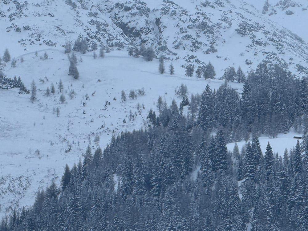
Anriss einer sehr großen Schneebrettlawine an der Wildebnerspitze in den Lechtaler Alpen. Der Anbruch erfolgte im lichten Hochwald. Die Anrissmächtigkeit beträgt geschätzt zwischen 1m und 2m (©Marvin Kärle, 20.02.2026).
Fracture of a very large-sized slab avalanche on Wildebnerspitze in the Lechtal Alps. The fracture broke in sparsely wooded high altitude forest terrain. The depth of the fracture was estimated at between 1m and 2m. (©Marvin Kärle, 20.02.2026).
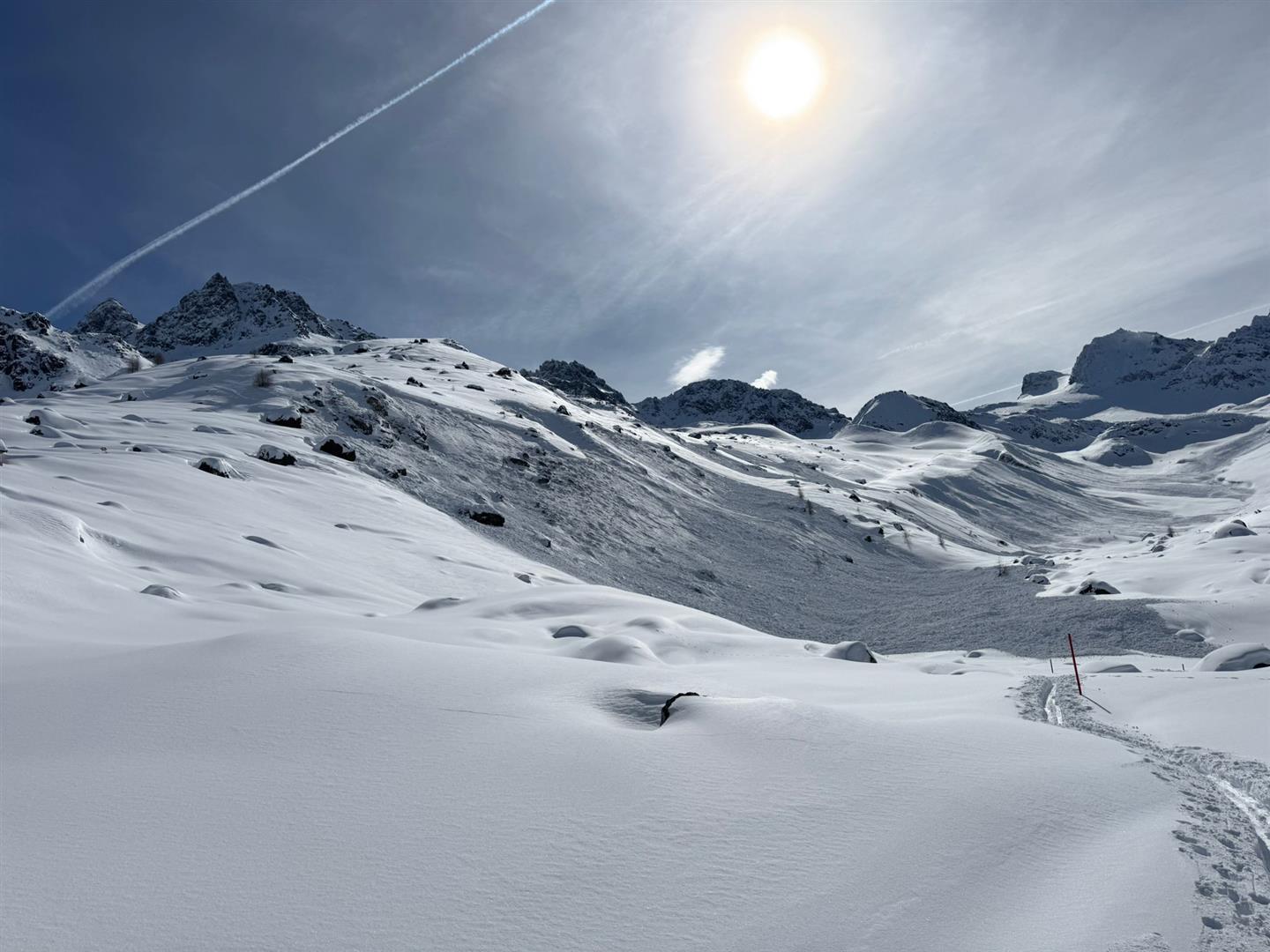
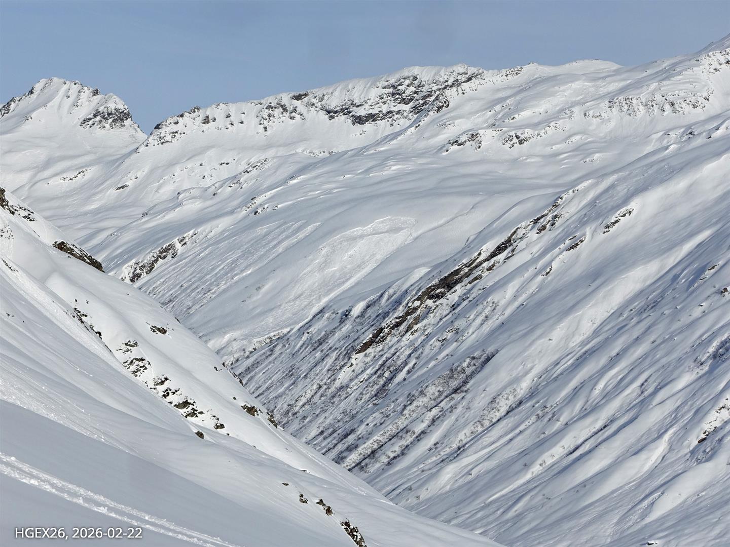
Am Sonntag, 22.02. konnte man bei Schönwetter in ganz Tirol die Zeichen der hohen Lawinenaktivität während der Niederschlagsphasen eindrucksvoll beobachten. Kleinvermunt, Silvretta (©Karel Kriz, 22.02.2026).
On Sunday, 22.02, in a phase of fine weather, one was able to see throughout Tirol the marks left behind by high avalanche activity during the period of precipitation. It was a most impressive sight. Kleinvermunt, Silvretta (©Karel Kriz, 22.02.2026).
Großflächige Anrisse im Bereich der Kalkwand oberhalb von Gschnitz in den Stubaier Alpen (©David Reymair, 22.02.2026).
Large-scale fractures near the Kalkwand above Gschnitz in the Stubai Alps (©David Reymair, 22.02.2026).
Eine weitere beeindruckende Schneebrettlawine beim Längentaler Weißerkogel in der Region Sellrain - Alpeiner Berge (©Alpinpolizei, 22.02.2026)
A further, rather imposing slab avalanche on Längental Weisskogel in the Sellrain – Alpeiner Berge region (©Alpinpolizei, 22.02.2026)
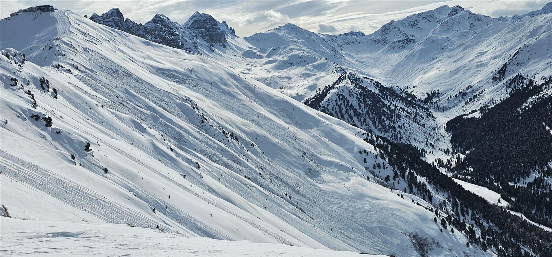
Zahlreiche kleine bis mittelgroße Schneebrettlawinen zwischen Hoadl und Pleisen in den Kalkkögeln (©Patrick Kropfreiter, 22.02.2026).
Numerous small to medium-sized slab avalanches between Hoadl and Pleisen in the Kalkkögeln (©Patrick Kropfreiter, 22.02.2026).
Mittelgroße, frische Schneebrettlawine an einem Nordwesthang auf 2200m unmittelbar hinter der Jamtalhütte. Im Hintergrund erkennt man bei der Moräne weitere, etwas ältere spontane Lawinenabgänge. Am 28. Dezember 1999 ereignete sich an eben diesem Hang ein folgenschwerer Lawinenunfall mit 9 Todesopfer (©Gottlieb Lorenz, 22.02.2026).
Medium-sized, freshly triggered slab avalanches on a northwest-facing slope at 2200m right behind the Jamtal refuge. Visible in background: somewhat older naturally triggered avalanche releases near the moraine. On 28 December 1999 on this slope, a tragic avalanche incident occurred with 9 fatalities. (©Gottlieb Lorenz, 22.02.2026).
Spontane Schneebrettlawine an einem Nordosthang auf 2700m unterhalb der Kirchdachspitze am Serleskamm (©Marco Knoflach, 22.02.2026).
Naturally triggered slab avalanche on a northeast-facing slope at 2700m below the Kirchdachspitze on Serleskamm (©Marco Knoflach, 22.02.2026).
Zahlreiche Schneebrettlawinen an Nordwesthängen auf etwa 2200m im Bereich der Feldringer Böden in der Grieskogelgruppe (©Lukas Ruetz, 22.02.2026).
Numerous slab avalanches on northwest-facing slopes at about 2200m near the Feldringer Böden in the Grieskogel Massif (©Lukas Ruetz, 22.02.2026).
Viel Staubentwicklung bei Lawinenauslösesprengarbeiten in der Schlick2000 in den Kalkkögeln (©Dominik Jenewein, 22.02.2026).
Massive powder clouds developing during artificial triggerings in the Schlick2000 in the Kalkkögeln (©Dominik Jenewein, 22.02.2026).
Anriss und Ablagerung einer großen durch Sprengung ausgelösten Schneebrettlawine im Skigebiet Stubaier Gletscher (©Günter Chwojan, 22.02.2026).
Fracture and deposit of a large-sized slab avalanche triggered artificially through explosives in the Stubai Glacier ski area (©Günter Chwojan, 22.02.2026).
Zumindest ein Teil der Schneebrettlawinen an der Vennspitze im Valser Tal wurden durch in der Abfahrt befindliche Personen fernausgelöst (©Matthias Kröll, 22.02.2026).
At least one part of the slab avalanches on Vennspitze in Valser Tal were remotely triggered by persons who were descending. (©Matthias Kröll, 22.02.2026).
Einige Lawinen drangen bis in die Talschaften vor, wie hier im Sellrain (©LWD Tirol, 22.02.2026).
Several avalanches pushed down toward valley settlements, as above in Sellrain. (©LWD Tirol, 22.02.2026).
Auch in den Kitzbüheler Alpen gab es einzelne große Lawinenabgänge, wie hier am Nordosthang des Wildseeloder oberhalb von Fieberbrunn (©Manuel Margesin, 22.02.2026).
Also in the Kitzbühel Alps, isolated large-sized avalanches occurred, such as above on the northeast-facing flank of Wildseeloder above Fieberbrunn. (©Manuel Margesin, 22.02.2026).
Auch für diese Schneebrettlawine innerhalb einer Lawinenverbauung an einem Nordhang auf etwa 2400m in der Gurgler Haide war das bodennahe, schwache Altschneefundament ursächlich (©LWD Tirol, 22.02.2026).
Also for this slab avalanche which triggered on a north-facing slope at about 2400m on the Gurgler Haide, the weak old snowpack fundament at ground-level was the cause. (©LWD Tirol, 22.02.2026).
Die größten Auslösungen wurden dort verzeichnet, wo Schwachschichten im Altschnee vorhanden waren. Dies war v.a. an West-, Nord- und Osthängen oberhalb etwa 1700m der Fall. Oberhalb etwa 2600m waren auch Südhänge betroffen. Im Bild spontane mittlere bis große Schneebrettlawinen am Schartlkopf (2810m) oberhalb von Nauders in der Glockturmgruppe (©Florian Maas, 23.02.2026).
The largest triggerings occurred where the weak layers were already present in the old snow. This was the case on west-, north- and east-facing slopes above about 1700m more than anywhere else. Above about 2600m, it also included south-facing slopes. In photo above, naturally triggered medium to large-sized slab avalanches on Schartlkopf (2810m) above Nauders in the Glockturm Massif (©Florian Maas, 23.02.2026).
Dieses Bild steht gewissermaßen stellvertretend für viele Regionen Tirols: die spontane Lawinenaktivität während der vergangenen Niederschläge war außergewöhnlich und beeindruckend. Gurgler Gruppe (©LWD Tirol, 22.02.2026).
The above photo might be said to represent many regions of Tirol: naturally triggered avalanche activity during the recent precipitation rounds was truly extrordinary and impressive. Gurgl Massif (©LWD Tirol, 22.02.2026).
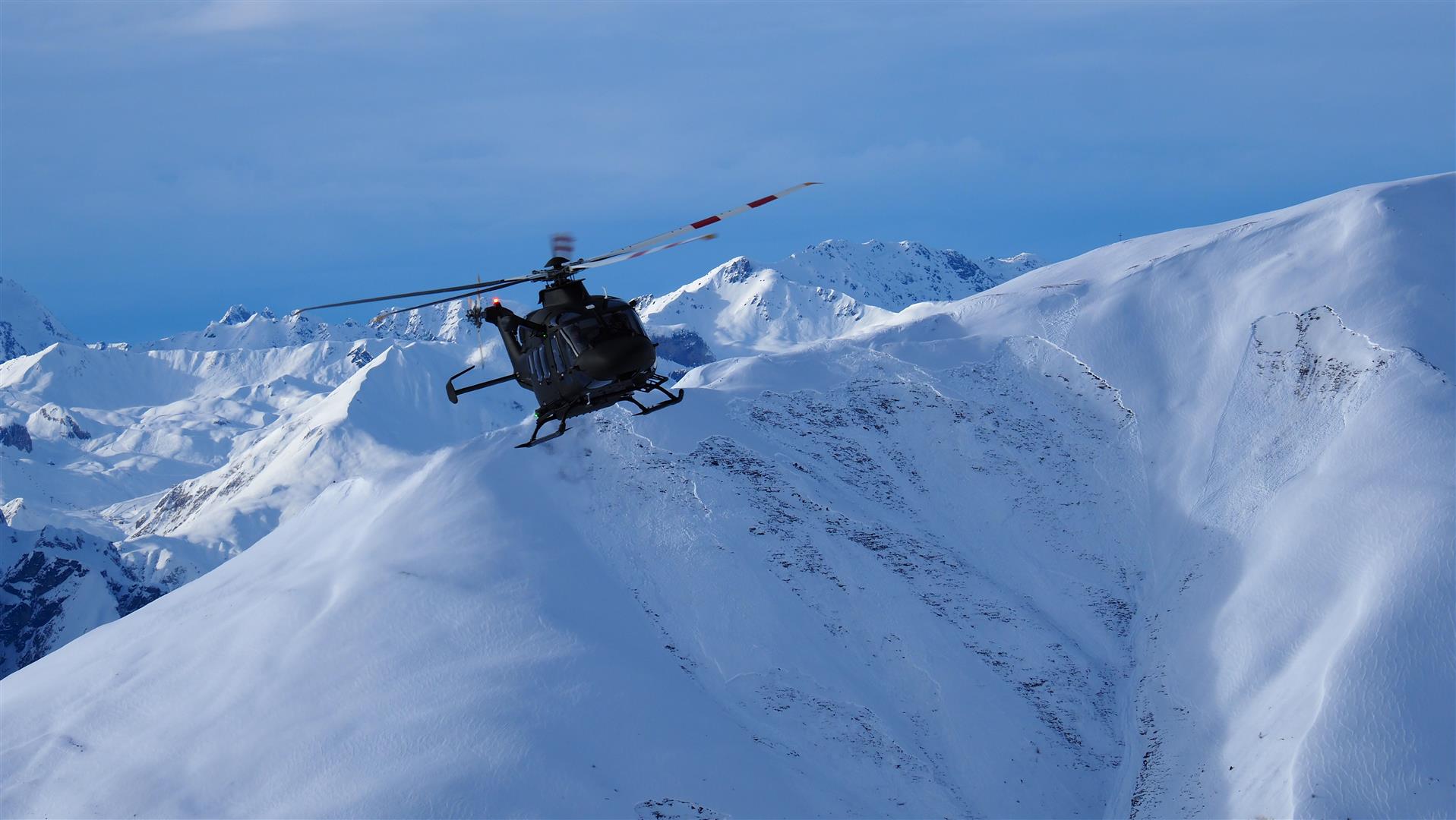
Das Bundesheer ermöglichte uns am Sonntag, 22.02. einen Überblick über die Situation in den westlichen Landesteilen zu erlangen (©LWD Tirol, 22.02.2026).
The National Military made it possible for us to gain an overview of the entire avalanche situation in western regions on Sunday, 22.02. (©LWD Tirol, 22.02.2026).
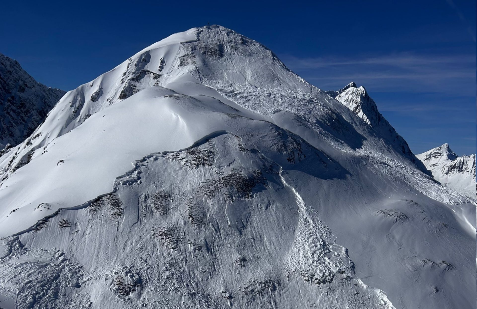
Spontane Schneebrettlawinen an Nord- und Osthängen unterhalb des Alpleskopf (2258m) in den östlichen Lechtaler Alpen (©Christoph Silberberger, 25.02.2026).
Naturally triggered slab avalanches on north- and east-facing slopes below the Alpleskopf (2258m) in the eastern Lechtal Alps (©Christoph Silberberger, 25.02.2026).
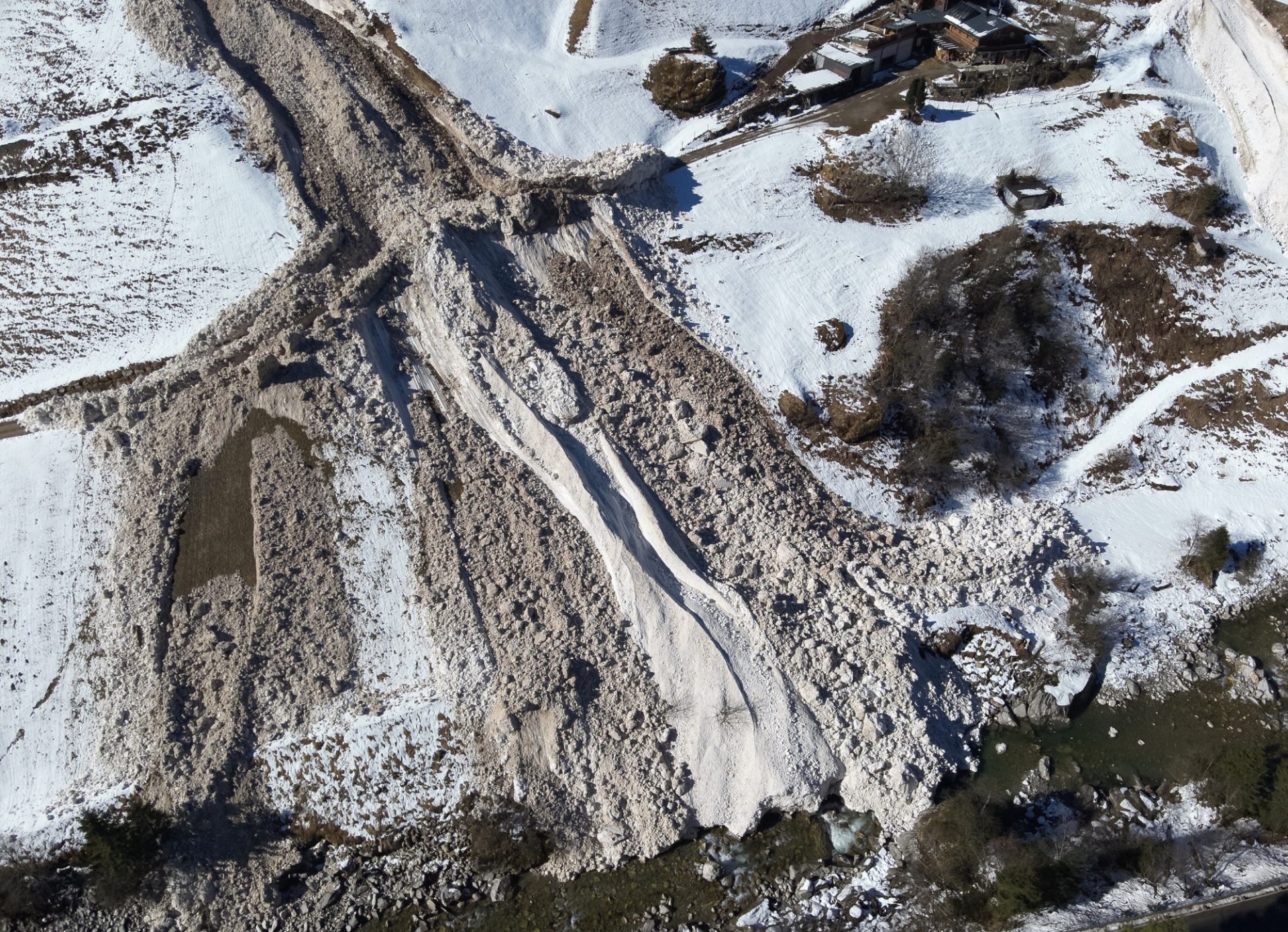
Ablagerung einer sehr großen spontanen Schneebrettlawine, welche sich am Mittwochvormittag, 25.02. am Gamsberg an einem Osthang auf etwa 2100m in den Zillertaler Alpen spontan löste und über eine sehr steile Runse kanalisiert den Talboden erreichte (©Tom Eder, 25.02.2026).
Deposit of a very large-sized naturally triggering slab avalanche which released Wednesday morning, 25.02, on the Gamsberg on an east-facing slope at about 2100m in the Zillertal Alps, then after getting canalized over a very steep gully, reached the valley floor. (©Tom Eder, 25.02.2026).
Spontane Lawinenaktivität in der Region Zillertaler Alpen Nordwest (©Lukas Ruetz, 25.02.2026).
Naturally triggered avalanche activity in the Zillertal Alps Northwest region (©Lukas Ruetz, 25.02.2026).
Im Vordergrund eine mittelgroße, vermutlich während des Niederschlags am 24.02. durch Personen fernausgelöste Schneebrettlawine an einem Osthang auf rund 2250m im Nahbereich der Franz-Senn- Hütte (©Lukas Ruetz, 25.02.2026).
In foreground, a medium-sized slab avalanche on an east-facing slope at about 2250m near the Franz-Senn-Refuge, presumably remotely triggered by persons during the bout of precipitation on 24.02 (©Lukas Ruetz, 25.02.2026).
Bereits etwas überschneiter Anriss einer Schneebrettlawine, welche sich an einem Nordwesthang auf etwa 2050m unterhalb des Kellerjochs in den Tuxer Alpen vermutlich spontan löste (©Siegfried Sauermoser, 25.02.2026).
The fracture, already partially blanketed over by fresh snowfall, of a slab avalanche which presumably triggered naturally on a northwest-facing slope at about 2050m below the Kellerjoch in the Tux Alps (©Siegfried Sauermoser, 25.02.2026).
Eindrücklicher Lawinenkegel der Schrahnbachkarlawine bei Ginzling im Zillertal. Auch diese sehr große Lawine löste sich am Mittwochvormiitag, 25.02. an einem Osthang spontan (©Tom Eder, 25.02.2026).
Imposing avalanche cone of the Schrahnbachkar avalanche near Ginzling in the Zillertal. This very large-sized avalanche also triggered naturally on Wednesday morning, 25.02, on an east-facing slope (©Tom Eder, 25.02.2026).