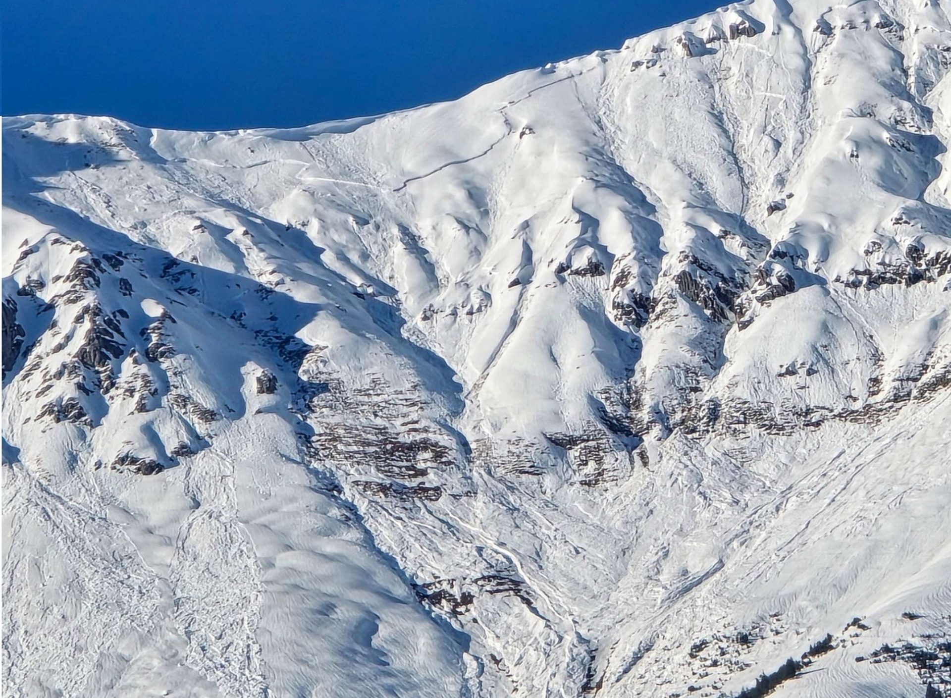
Treacherous persistent weak layer. Wet snow during the day.

Don’t let your guard down: following a long phase of high avalanche danger, urgent warnings and lots of intensive reporting, it is now gradually calming down, both weather-wise and in the reports – however, the avalanche interval persists, the situation remains treacherous and requires high attentiveness and caution.

The marked weak layers in the old snow are still prone to triggering. They occur widespread on west-, north- and east-facing slopes above 1800m and beneath the fresh snow and drifts of recent weeks and can be triggered by one single person. Danger zones cannot be seen.

A defensive route selection and avoiding large, steep slopes under all circumstances are the decisive steps in the current dangerous situation. During the course of the day, likelihood of wet-snow avalanches triggering will increase due to rising temperatures and solar radiation.

Stable, mild high-pressure weather

As turbulent as the weather was over the last few weeks, the coming days will provide very stable and tranquil conditions. The current high-pressure front will persist until further notice. Be prepared for sunny weather with only light winds. The one exception: on Sunday, 1 March, a weak cold front is expected to pass through and bring gray skies.

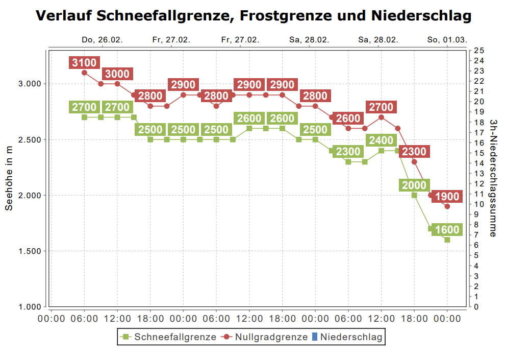
The zero-degree level currently lies above 3000m, the cold front will make it descend significantly. It will then fluctuate between 2200m and 2400m next week.
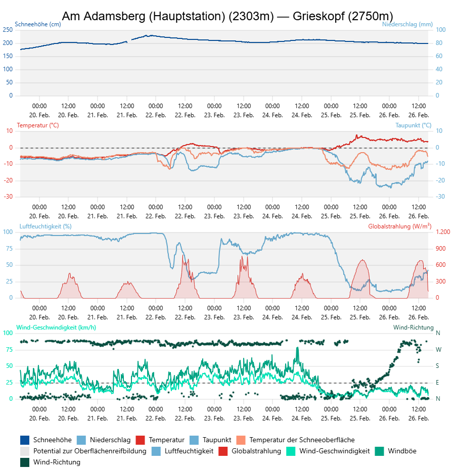
An der Wetterstation Am Adamsberg in der Verwallgruppe ist gut zu erkennen, wie nach dem Abziehen der Warmfront in der Nacht auf Mittwoch, 25.02. der Wind abflaute und die Luft rasch austrocknete. Die relative Luftfeuchtigkeit betrug am Mittwoch nur rund 15%. Die Lufttemperaturen stiegen markant an. An der Messstation auf 2300m liegt die Temperatur seit Mittwochvormittag beständig zwischen 4 und 8 °C.
At the Adamsberg weather station in the Verwall Massif, easily visible is how the warm front withdrew on Tuesday night, 25.02, winds slackened off and the air turned dry. The relative air moisture on Wednesday was only about 15%. Air temperatures rose measurably. At the measurement station at 2300m the temperature since Wednesday morning has hovered between 4 and 8°C.
Bis Samstag, 28.02. bleibt es für die Jahreszeit deutlich zu mild, am Sonntag sinkt die Frostgrenze mit Durchzug einer schwachen Kaltfront in mittlere Lagen ab (©Oberlandwetter).
Until Saturday, 28.02, it will be far too mild for this juncture of the season, on Sunday the zero-degree level will drop to intermediate altitudes as a weak cold front moves through. (©Oberlandwetter).

The devil or the deep blue sea

Every impassioned freerider, every committed backcountry ski tourer is just itching to get moving. At long last, the mountains are again covered with wintery snow, and the weather is fantastic. But the innocent-looking pure white snow-covered surface is deceptive: the fundament is still weak. The proneness to triggering has not gone away. Each and every day we get reports of avalanches – naturally triggered and unleashed by persons – and of remote triggerings, fractures on the surface and whumpf noises.

Avalanche danger continues to be considerable. The marked and expansive weak layers near ground level are making the danger recede only very slowly. Triggered slab avalanches frequently are large-sized (see photo below about remote triggering on Madlenerkopf).
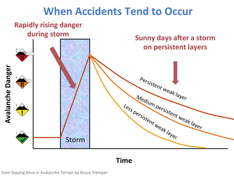
Diese Grafik zeigt die Abnahme der Gefahr in Abhängigkeit der Zeit. Umso ausgeprägter eine langlebige (persistente) Schwachschicht in der Schneedecke ist, umso länger dauert es, bis die Lawinengefahr nach einem Schneefall zurückgeht (©Bruce Tremper).
This graph depicts the diminishing of danger in terms of time. The more marked a persistent weak layer in the snowpack is, the longer it takes for the danger of avalanches to decrease after snowfall occurs. (©Bruce Tremper).

How to stay safe in backcountry this weekend?

  • Avoid large, steep west- north, east-facing slopes under all circumstances. Only exception: when the slope has clearly already had its slab avalanche discharged.
  • Maintain sufficient distance from above-cited slopes (key word: remote triggerings).
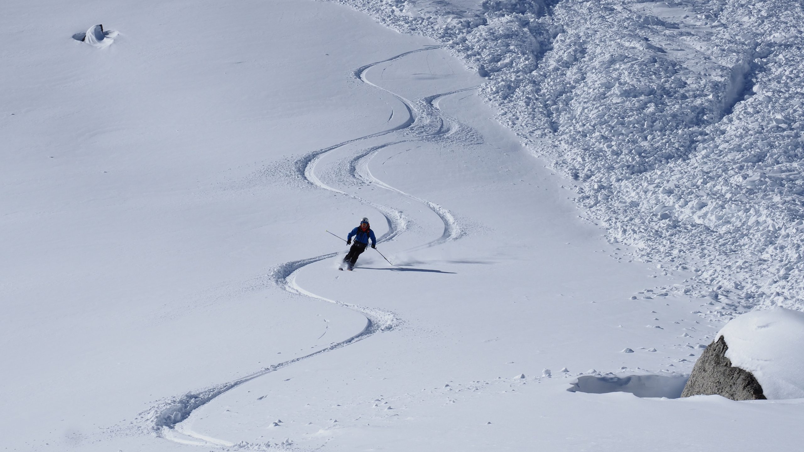
  • Following nights with clear skies: enjoy safe firn-snow on south-facing slopes, particularly below about 2400m.
  • Springtime scenario: get started early, get back early. On extremely sunny slopes, naturally triggered avalanches become possible during the course of the day.
  • Beware runout zones of glide-snow and wet-snow avalanches.
  • Safety equipment: don’t leave home without it. Standard safety measures: don’t ever neglect them (never go alone, maintain distances on descents, choose safe meeting places).
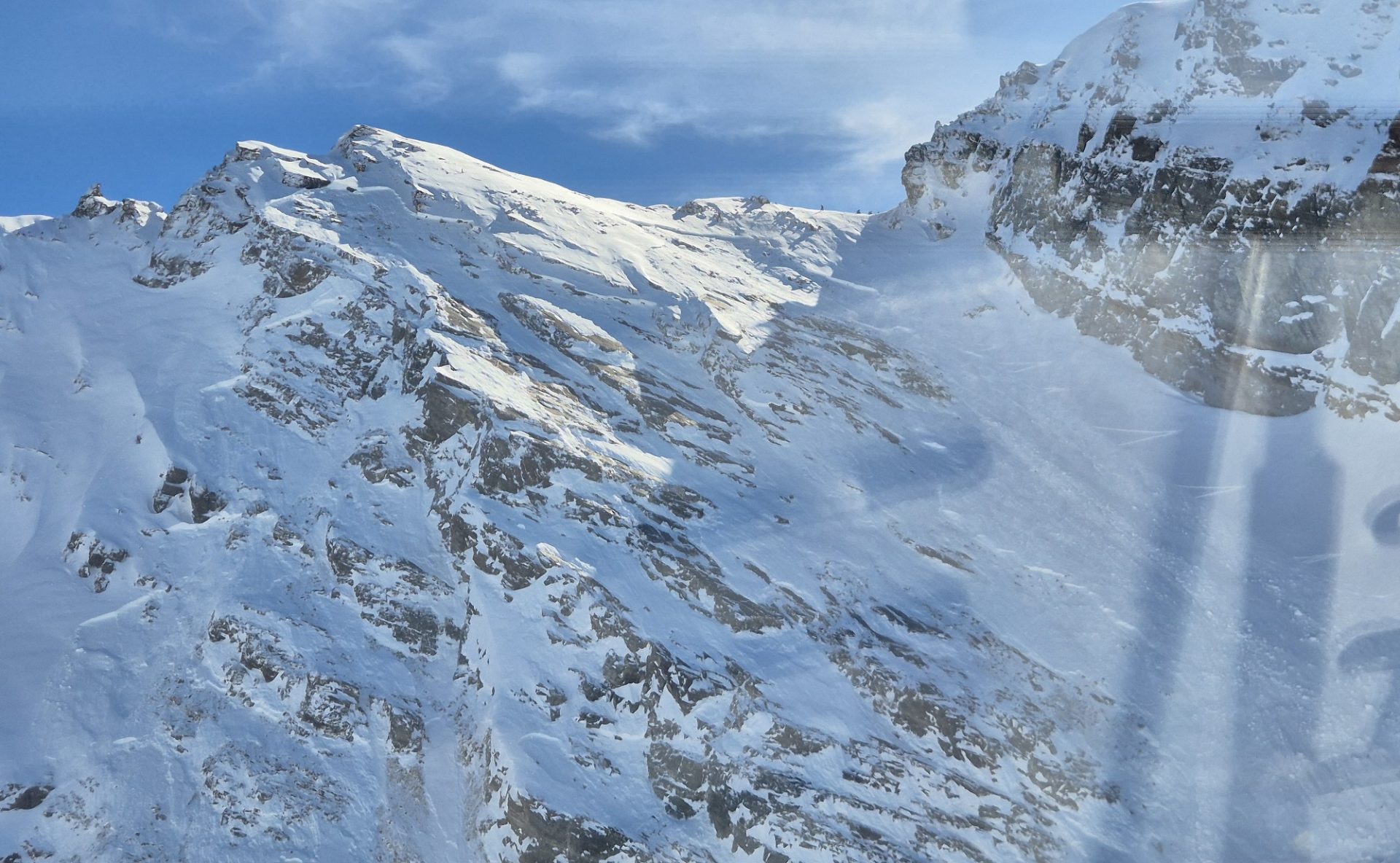
Diese große Schneebrettlawine an einem Nordwesthang auf rund 2900 unterhalb der Madlenerspitze im Bereich der Bielerhöhe in der Silvretta wurde heute Donnerstag, 26.02. von drei Personen (in der Scharte als drei kleine Punkte erkennbar) nach dessen Aufstieg über diesen Hang fernausgelöst. Das Bild zeigt eindrücklich das enorme Gefahrenpotenzial, das derzeit noch anzutreffen ist. Hier war sehr viel Glück im Spiel, dass niemand zu Schaden kam. (©Gallus 3, 26.02.2026).
This large-sized slab avalanche on a NW slope at about 2900m below the Madlenerspitze near the Bielerhöhe in the Silvretta Massif was remotely triggered today, Thursday, 26.02, by three persons (recognizable in the ridge as three tiny points) after they ascended this slope. The photo shows in impressive ways just how great the danger potential currently is. In this case, Lady Luck played a big part: no one suffered injuries. (©Gallus 3, 26.02.2026).
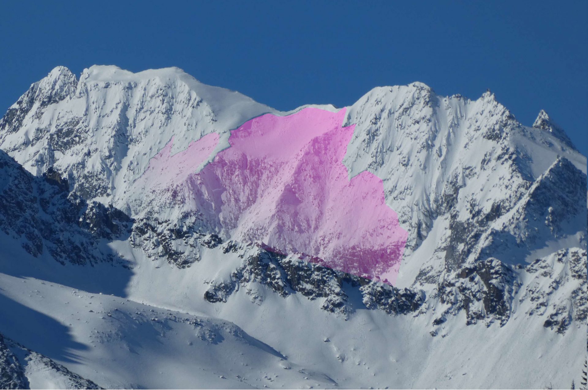
Diese sehr große spontane Schneebrettlawine an einem Osthang auf 3300m am Hochgall in der Rieserfernergruppe löste sich am Mittwoch, 25.02. spontan (©Daniel Kleinlercher, 25.02.2026).
This very large-sized naturally triggered slab avalanche on an east-facing slope at 3300m am Hochgall in the Riesenferner Massif triggered naturally on Wednesday, 25.02. (©Daniel Kleinlercher, 25.02.2026).
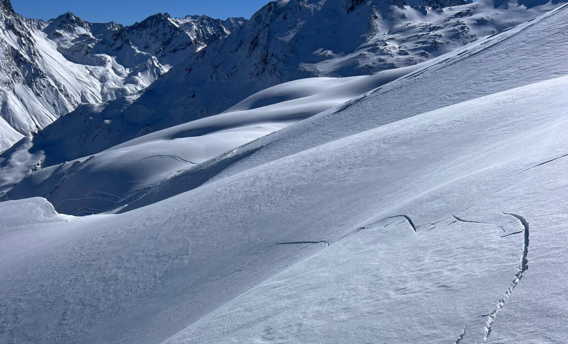
Risse und Wummgeräusche sind eindeutige Zeichen eines schlechten Schneedeckenaufbaus. Fotografiert in der Abfahrt von der Lampsenspitze in den Stubaier Alpen (©Susanne Süssmeier, 25.02.2026).
Fractures and whumpf noises are crystal-clear signs of poor snowpack layering. Photographed in the descent from Lampsenspitze in the Stubai Alps (©Susanne Süssmeier, 25.02.2026).
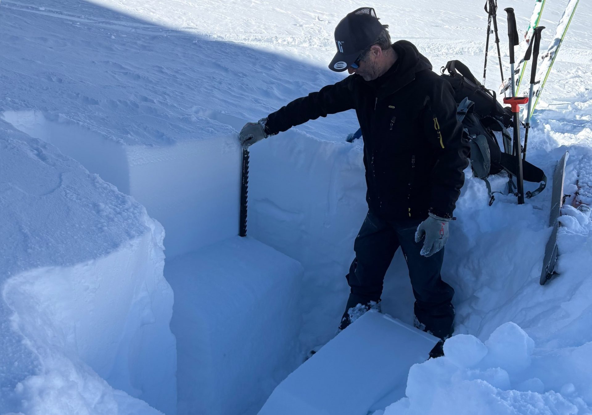
Wer aktuell v.a. an Schattenhängen in die Schneedecke gräbt, kann in eindrücklicher Weise die unterschiedlichen Eigenschaften von einem gut ausgebildeten Schneebrett auf einer sehr markanten Schwachschicht feststellen. In Stabilitätstests können oft Brüche initiiert werden, welche sich dann durch den gesamten Block ausbreiten (©Anton Riepler, 25.02.2026).
Whoever digs into the snow currently, particularly on shady slopes, can see impressively the highly varied characteristics of a well-formed slab atop a very marked weak layer. In stability tests, fractures can often be initiated which then spread throughout the entire blodk. (©Anton Riepler, 25.02.2026).
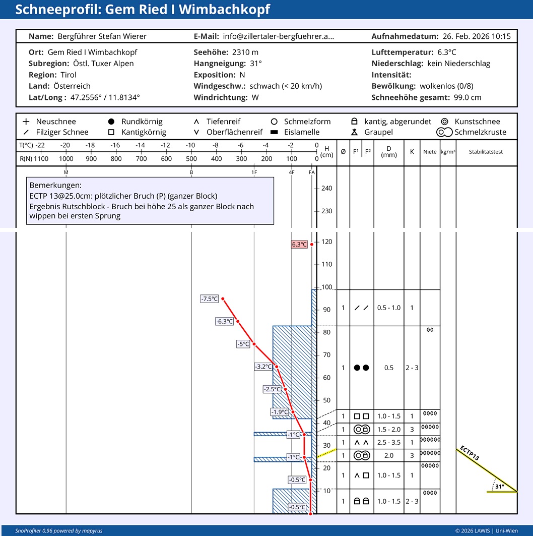
Im unteren Teil der Schneedecke sind ausgeprägte Schwachschichten erkennbar, welche sich im Frühwinter ausbildeten und an West-, Nord- und Osthängen sehr verbreitet anzutreffen sind. Der obere, stärker verfestigte Stock bildet das Schneebrett aus dem Neu- und Triebschnee der vergangenen Woche. Die Stabilitätstests weisen auf eine schlechte Schneedeckenstabilität hin. Tuxer Alpen, 2300m, N, 31° (©Stefan Wierer, 26.02.2026).
In the lowermost part of the snowpack, marked weak layers are recognizable that were generated in early winter on west-, north, and east-facing slopes and are widespread. The upper, more firmly consolidated block forms the slab from the fresh snow and fresh drifts from last week. Stability tests indicate poor snowpack stability. Tux Alps, 2300m, N, 31° (©Stefan Wierer, 26.02.2026).
Wie hier am nach Südost orientierten, rund 2250m hohen Langen Sattel an der Nordkette, können sich auch in den nächsten Tagen mit Sonne und Wärme noch Nassschneelawinen spontan lösen. Vorsicht auch in Auslaufbereichen (©Philipp Schulz, 25.02.2026).
Just as is visible here, on the southeast-facing Langen Sattel at about 2250m, wet-snow avalanches will trigger naturally over the next few days as a result of sunshine and warmth. Caution is urged in runout zones. (©Philipp Schulz, 25.02.2026).