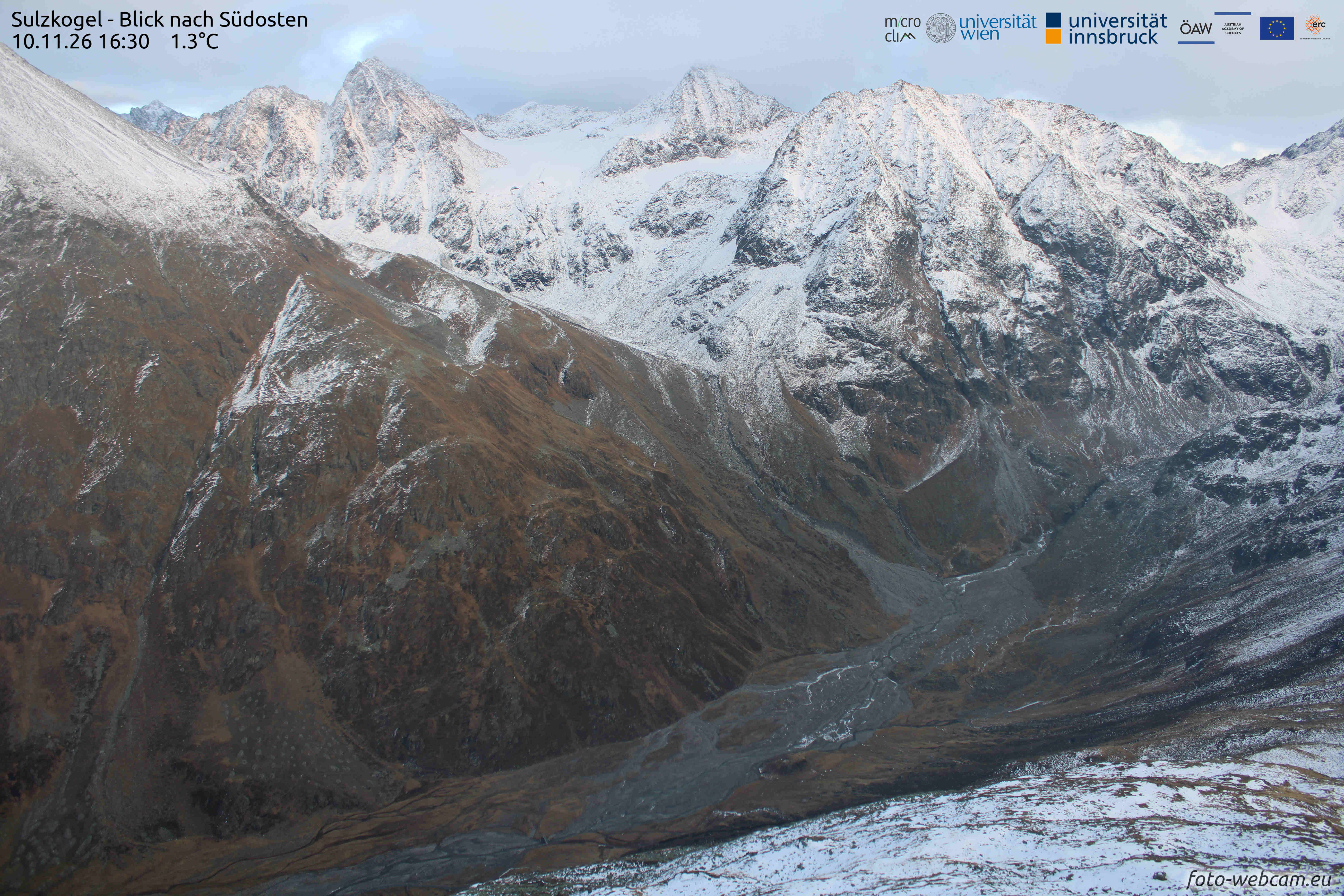
At the end of October, a shallow and sparse early winter snowpack was generated through minor precipitation in high alpine regions. In the next few hours, another round of fresh snowfall is anticipated. At high altitudes, fresh snowdrift accumulations are being generated by prevailing winds which can be triggered as small-sized avalanches, particularly in shady gullies and bowls. Least favorable are transitions into steep, glaciated and leeward zones, where the drifts are being deposited atop a regularly distributed shallow old snowpack. In the areas of major snowfall, avalanches can in isolated cases grow to medium size.
On high-alpine tours, attentiveness towards possible avalanche danger is essential. Appropriate emergency equipment should be in your backpack.
Snowpack and avalanche danger
Snowpack layering
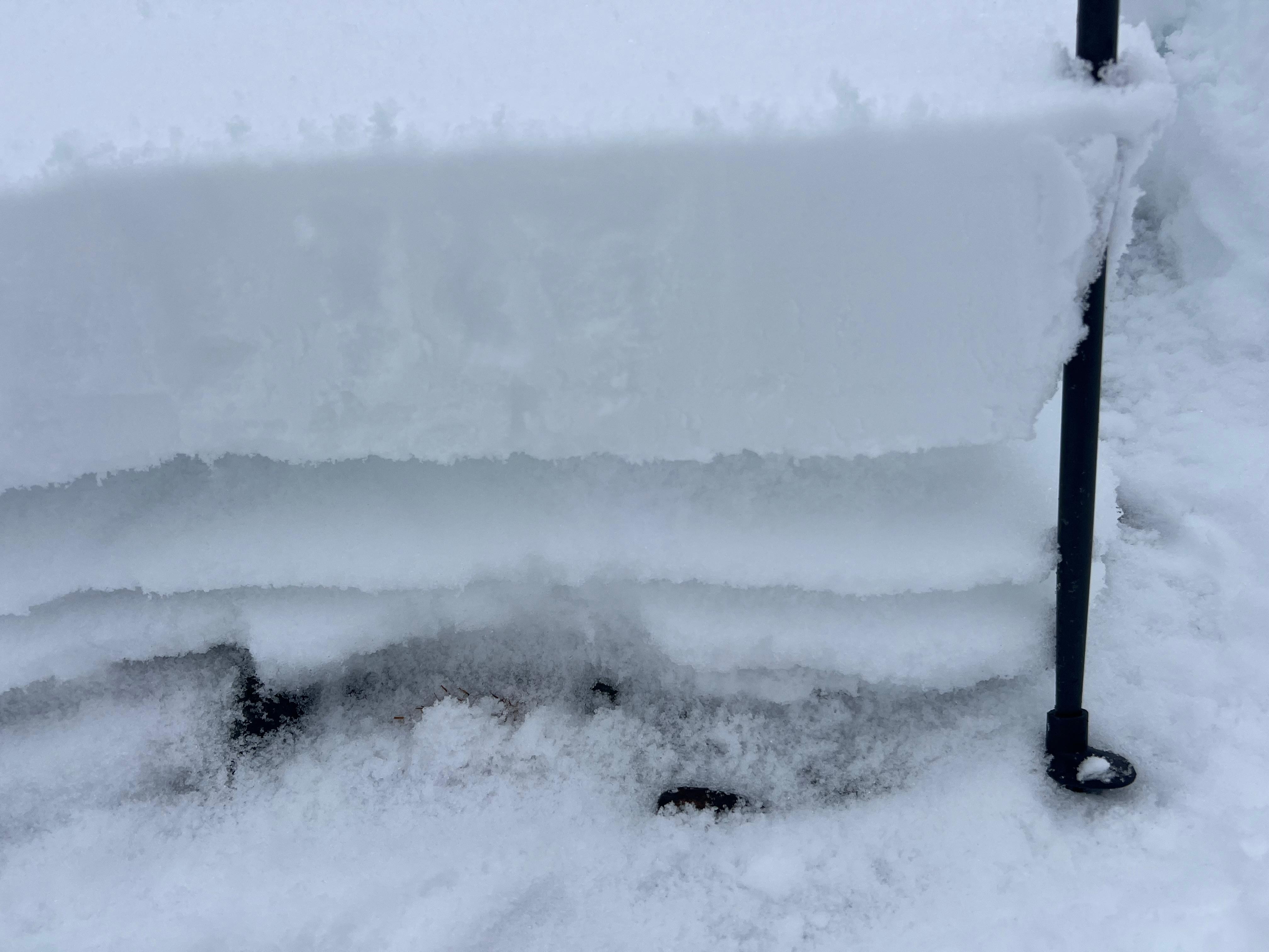
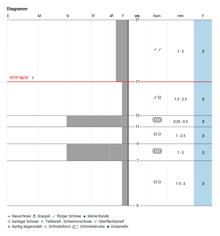
Various precipitation spells over the last few weeks (see below) have generated a shallow snowpack on shady slopes above 2500m, about 20 – 50 cm of snow. Due to minor amounts of precipitation, fluctuating snowfall levels and interims of fine weather, several crusts with embedded faceted (expansively metamorphosed) crystals have formed. These layers of faceted crystals could well constitute weak layers for slab avalanches.
This nominally unfavorable snowpack layering is not atypical for this juncture of the season. As a result of minor amounts of snow on the ground, the snowpack is often not area-wide and cohesive, the snow is simply too shallow. As regards potential slab avalanches, this is a relevant factor: large-scale weak layers don’t exist.
Therefore, in considering potential future slab avalanches, we can focus on those areas where there is already a cohesive area-wide snow cover. This is limited primarly to windblown gullies, bowls and snowdrifted slopes near the ridgeline. On glaciers, the surfaces are generally less raw, so weak layers can exist over large areas and a correspondingly large fracture is conceivable.
Weather developments and avalanche danger
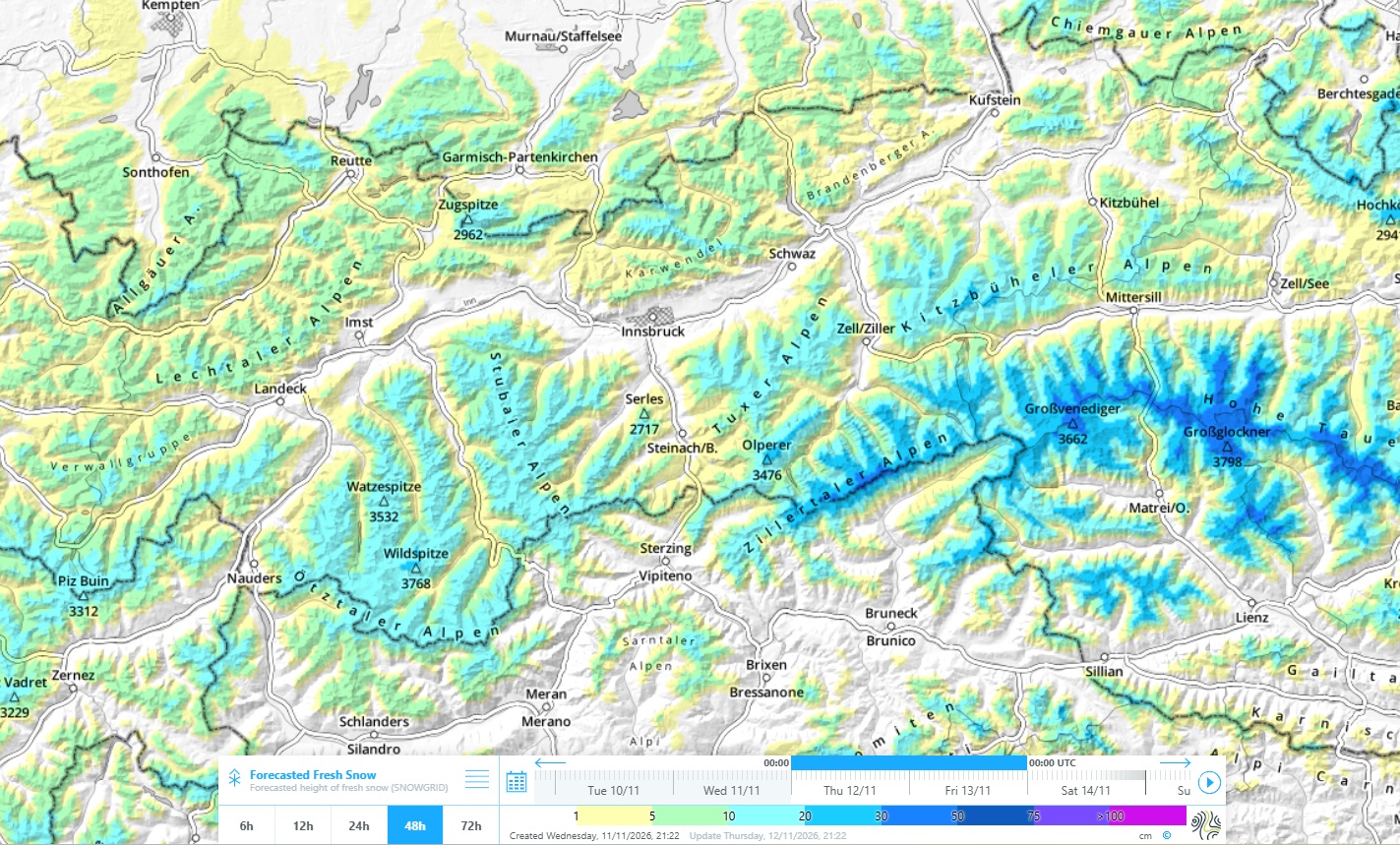
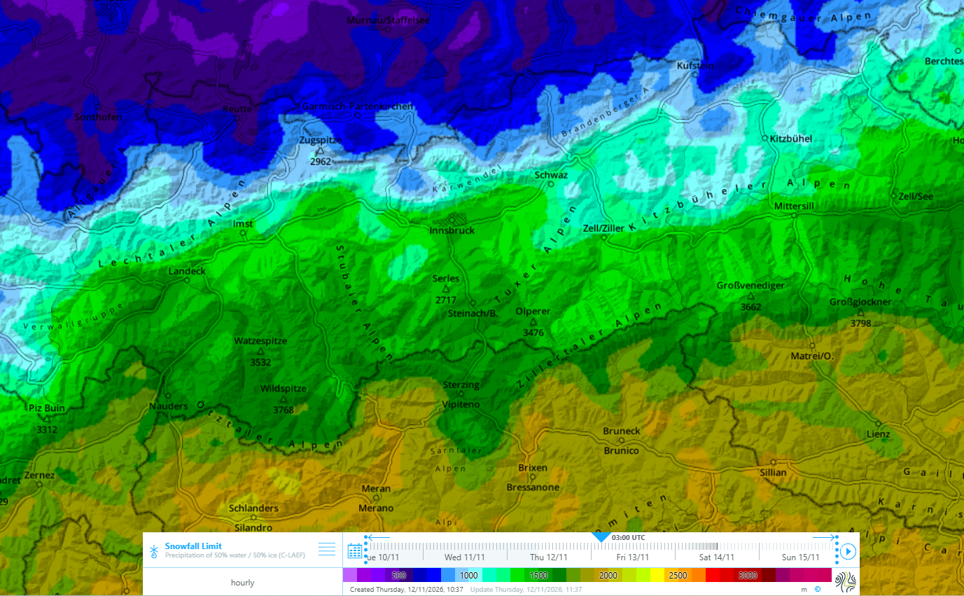
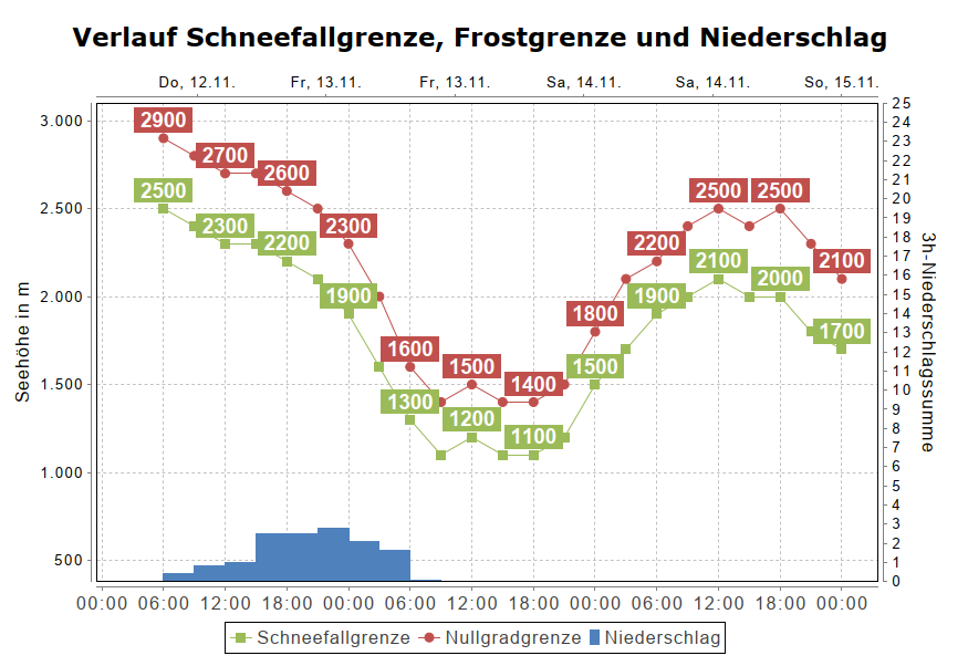
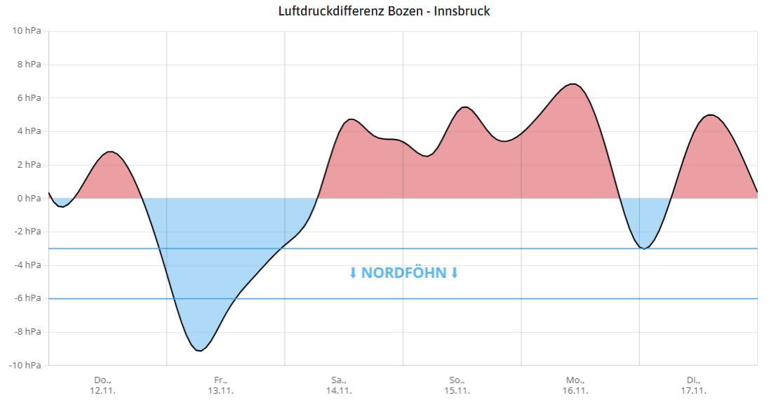
The precipitation which moved over the land until early Friday morning (13.11) brought 15 to 30mm of precipitation widespread. The snowfall level initially lay above 2400m, then on Thursday night gradually dropped to below the timberline. Winds were blowing at moderate to strong velocity particularly at summit level, in the Hohe Tauern and in East Tirol strong foehn winds have arisen.
Effects on avalanche danger
As a result of fresh snow and wind, new snowdrift masses will accumulate. Wherever these drifts are deposited atop a regular old snowpack, slab avalanches can be triggered even by one single person. Such trigger-sensitive locations are found in shady gullies, bowls and drifted slopes near ridgelines above about 2500m. The avalanche prone locations increase in frequency with ascending altitude. Avalanches are mostly small-sized. Particularly in extremely steep terrain, attentiveness is required due to danger of possible injuries in an avalanche.
In steep glacier terrain the situation is somewhat more favorable. As described above, weak layers near crusts are possible over large surfaces. Special caution is necessary behind transitional spots in the terrain or in the vicinity of rock walls, where fresh snowdrift accumulations are often deposited. Such areas should be avoided wherever possible.
As always at this point in the season, we have very little information from outlying terrain available to us. Therefore, we look forward even more to your reports about the snow cover, snowpack layering and avalanche danger. Observations can be easily transmitted to us via our SNOBS.LIVE platform.
Further developments
On Saturday, 14.11, a warm front will arrive in the mountains. In North Tirol, southerly foehn winds will set in. Next week, highly variable windy, late-autumn weather conditions are forecast. At the moment, heavy precipitation or an onset of winter down to low altitudes is not in sight.
Avalanche danger is limited to high alpine regions until further notice. There, freshly generated snowdrift accumulations in particular need to be evaluated with caution.
Review
End of October: first snowfall
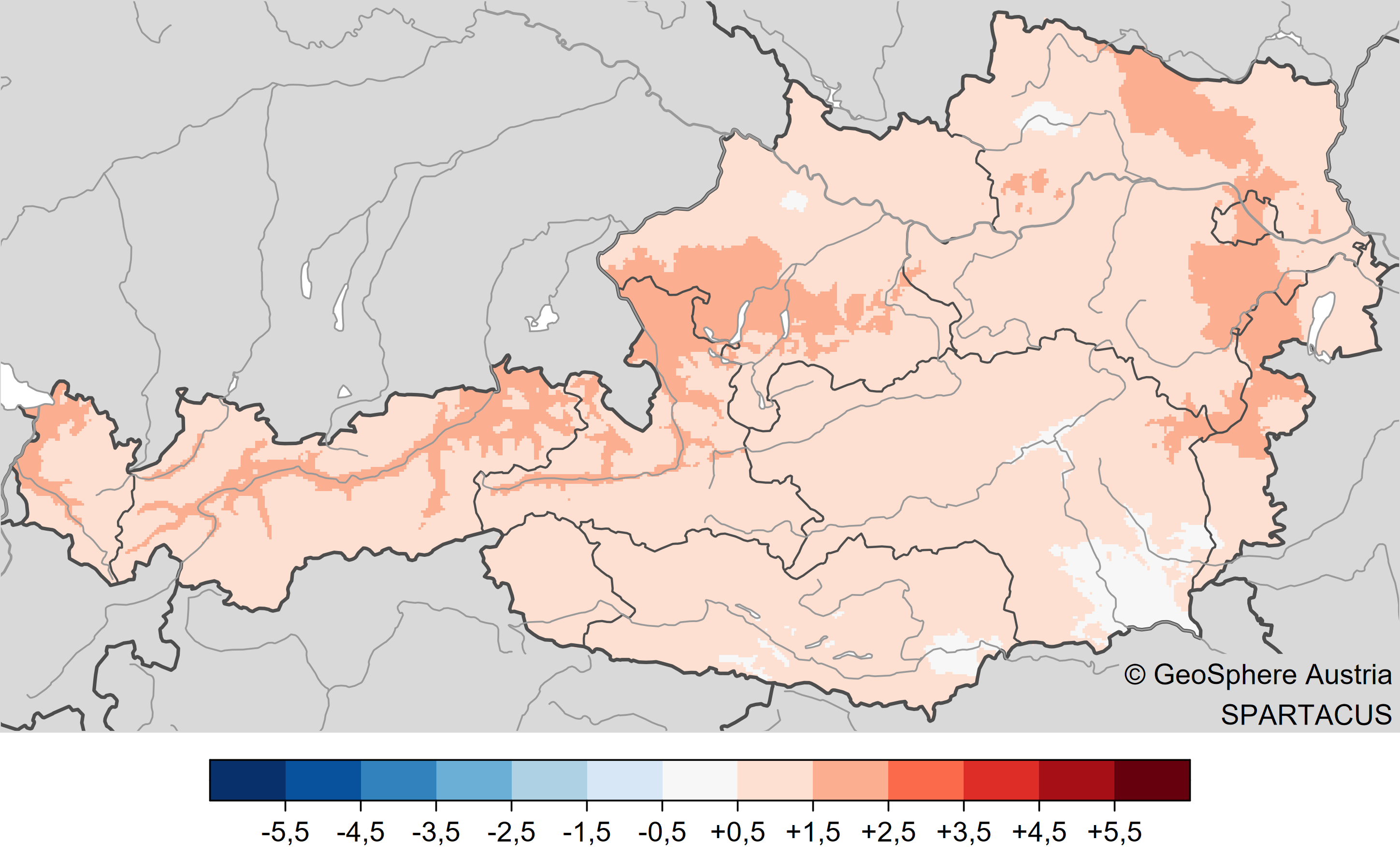
In the footsteps of a summer which was much too dry followed a similarly dry October (-23% deviation in precipitation compared to climatically normal periods 1991 – 2020) in Tirol. The medium temperature deviation in Tirol was equally significant: +1.5° C (GeoSphere Austria).
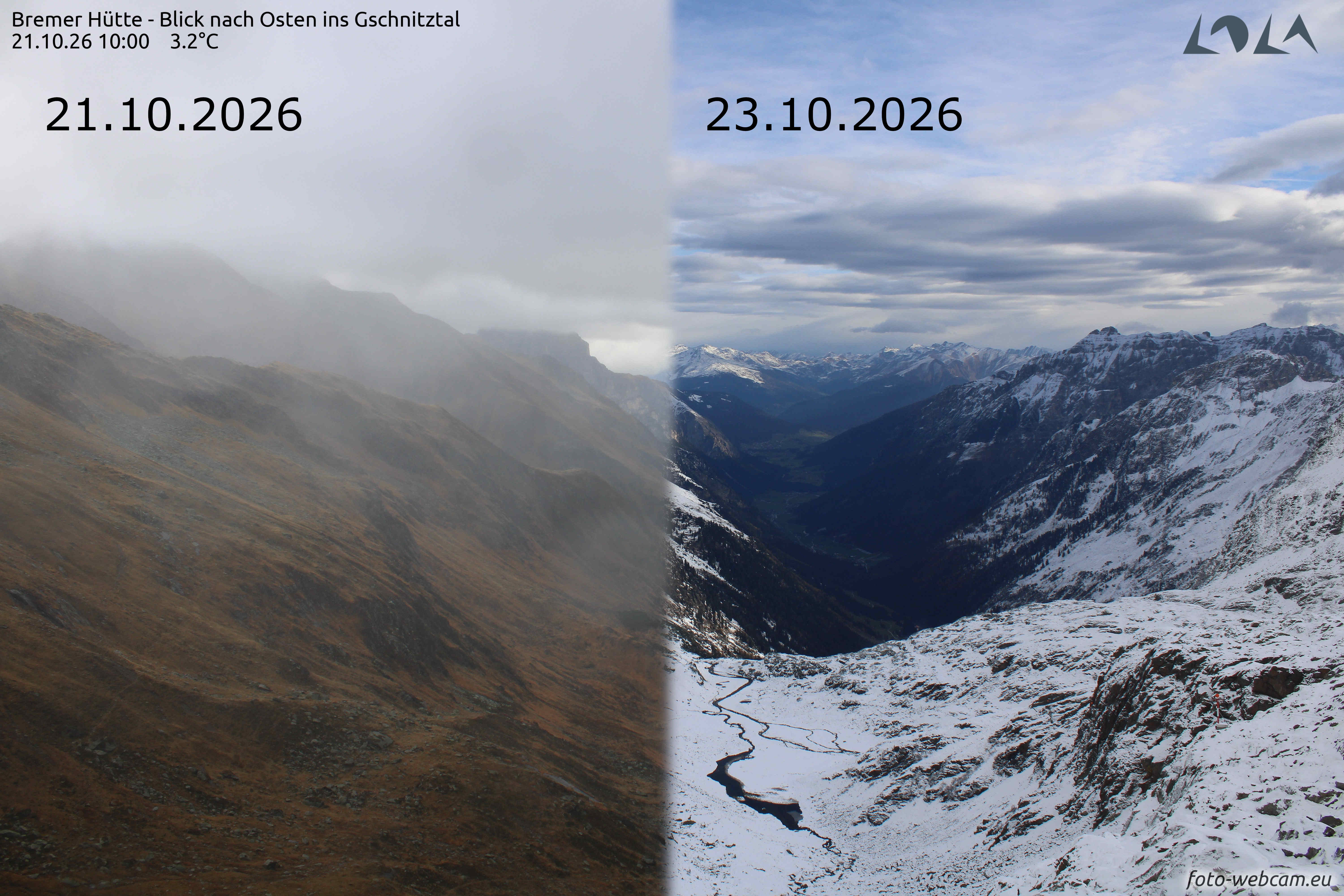
On 22 October a cold front from the west brought the first significant snowfall to the Alps. Snowfall level dropped from over 2500 down to about 1200 to 1500 metres. At higher altitudes, 5 to 10 cm, from place to place up to 20 cm of fresh fallen snow was registered. On 25 October, another round of snowfall followed in its wake under the influence of a low pressure front and a W/NW air current. The snowfall level dropped to approximately 1000 metres, while temperatures of about -4° C prevailed at 2000 metres altitude. Both meteorological events brought about an early onset of winter in the month of October, the first wintery wisp in the mountain regions.
Precipitation in November
On 1 November, the next noticeable bout of snowfall below the timberline occurred, bringing more snow particularly to the northern and eastern regions of Tirol. The snowfall level lay between 900 and 1200 metres. Especially the Lower Inn Valley and the Central Inn Valley were struck, where up to 15 cm of fresh snow was registered in Wilden Krimml, for example. East of the Wipptal, the magnitude of snowfall was often less, and East Tirol continued to be sunny. In the eastern parts of the land, fresh snow fell at altitudes above 2500m atop an already existing snowpack.
Due to stable high-pressure front conditions and as a consequence, warm-weather days, snow depths receded in a very short time.
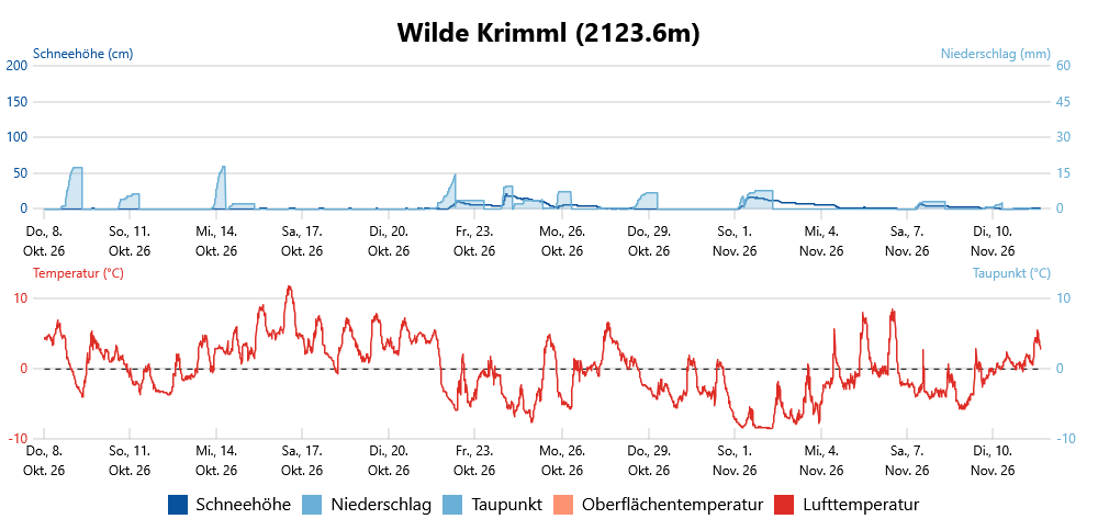
From 9-10 November 2026, Austria was caught in the influence of a strong westerly air current that brought moist and relatively mild air masses our way. During the afternoon of 9 November on the northern rim of the Alps and on the Main Alpine Ridge, light snowfall set in above 1700 to 2200m. However, very little snow accumulated, even at high altitudes. In the evening and during the night, rainfall and snowfall followed, the snowfall level ascended to approximately 2300 metres.
On 10 November in North Tirol, there was often heavy rainfall over the midday hours. Above approximately 2200 m to 2400 m some fresh snow was registered. Amidst strong-velocity westerly winds, precipitation slackened off in the afternoon and the clouds dispersed from the southwest.