Avalanche incident Ransen/ Elfertürme – Serleskamm on 08.03.2026

In the Ransen zone beneath the Elfertürme in the Stubai Alps on 08.03.2026, a snowshoe hiker was caught in a medium-sized slab avalanche while trasversing a gully along the Panoramaweg near the Elferhütte and swept several hundred metres over extremely steep terrain. For this person, all rescue measures came too late.

The relevant weak layer which was responsible for the release of the slab avalanche was, once again, located at ground level of the old snow.

Unfolding of the event

Three friends undertook a snowshoe hike late on Sunday morning on the 08.03.2026, from the Elferhütte above Neustift im Stubaital along the Panoramaweg in a southerly direction. On the Sommerweg where they were en route, there were visible tracks of persons who had tread that selfsame path prior to them at an unknown time.

When, after approximately 600 metres, the group reached a very steep gully filled to the brim with snow, they decided to traverse it. As one person went ahead, the other two waited behind in a secure spot.

The first snowshoe hiker had already traversed the greater part of the gully when a slab avalanche triggered about 50 metres of altitude above the path. The person was swept along for about 500 metres of altitude through an extremely steep ditch and visibly buried in snow masses in the upper area of the avalanche runout. The other two persons were not caught in the avalanche and were able to notify the emergency service and set the rescue operation in motion. The alarmed rescue team was able to unbury the snowshoe hiker a short time later, who was however already dead. He died of physical/mechanical injuries which were suffered during the fall.

The deceased person was the sixteenth fatal victim of avalanches in the ongoing season.
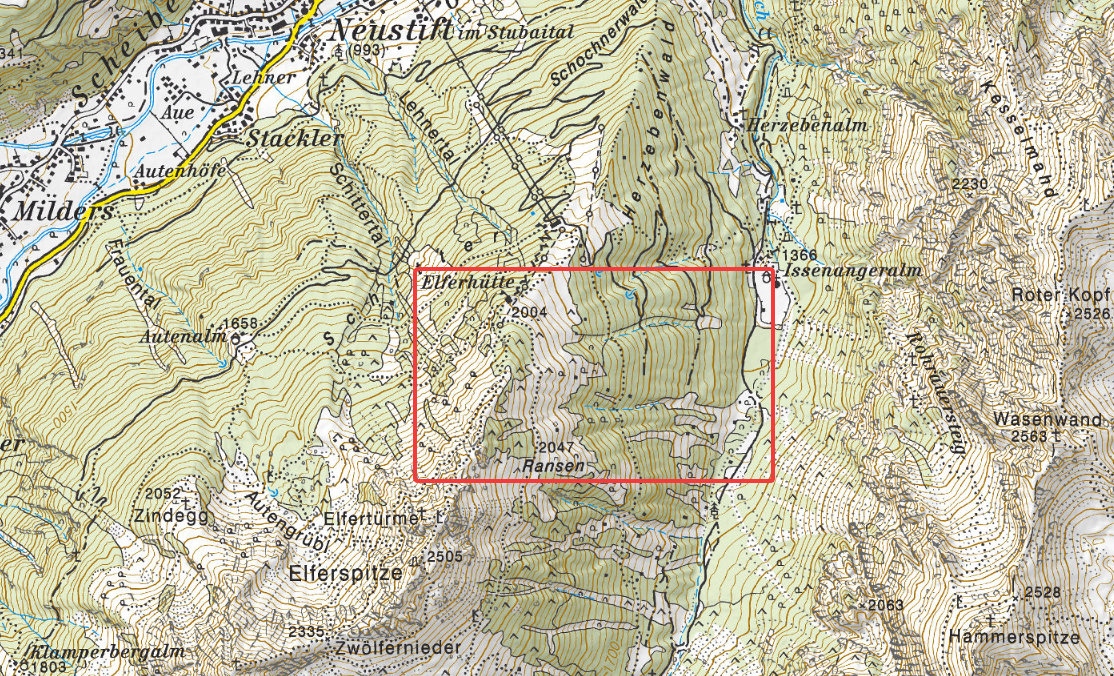
Übersichtbild: Der Unfall ereignete sich im Bereich der Elferhütte oberhalb von Neustift im Stubaital. Zwischen dem Habichtkamm im Westen (links) und dem Serleskamm im Osten (rechts) liegt das Pinnistal (©TIRIS).
Overview: the accident occurred near the Elferhütte above Neustift im Stubaital. Between the Habicht Ridge to the west (see left) and the Serles Ridge to the east (see right) is the Pinnistal (©TIRIS).
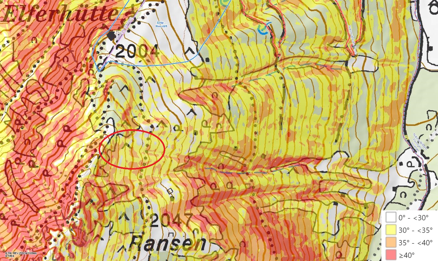
Detailausschnitt der Unfalllokalität mit Hangneigungen: Die rote Ellipse markiert den Anbruchbereich der Schneebrettlawine zwischen Elferhütte und Ransen. Die gepunktete Linie illustriert den Panoramaweg (©TIRIS).
Detailed view of the incident spot including slope steepness gradients: the red ellipse depicts the fracture zone of the slab avalanche between Elferhütte and Ransen. The dotted line depicts the Panoramaweg (©TIRIS).

The avalanche

This avalanche was a medium sized wet-snow slab avalanche (Magnitude 2) which triggered on an east-facing slope at 2150m. The steepness gradient in the fracture zone was 35 to 40°, the avalanche breadth in this part was about 30m, the depth of the fracture was an average 40cm.

The plummet path of the avalanche runs through gulley-like, very steep to extremely steep terrain. The snow masses were able to plummet down a path of approximately 650 metres of altitude, from the uppermost fracture to the lowermost runout deposit.
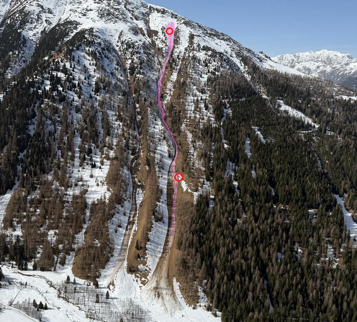
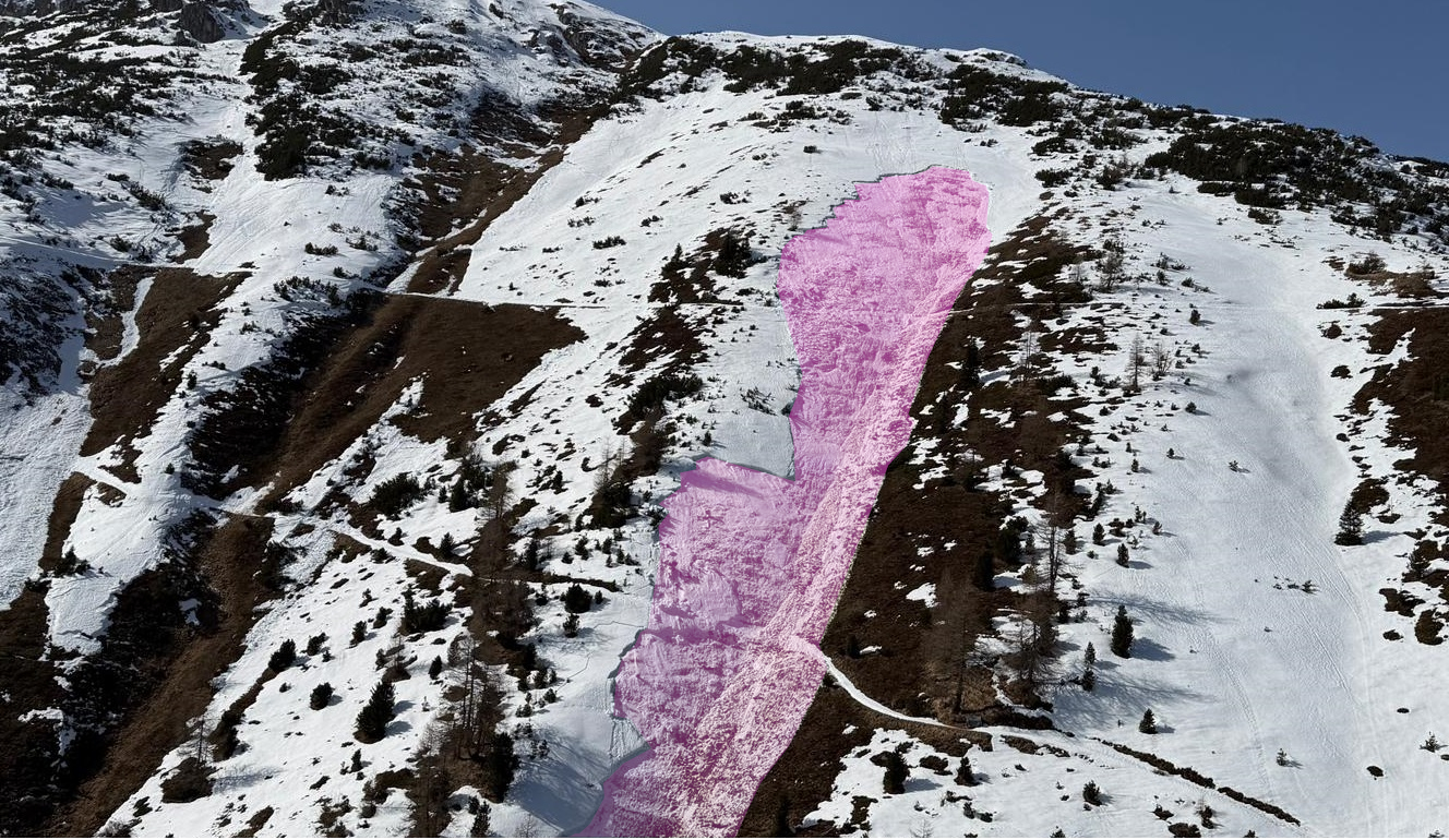
Übersichtsbild der Unfalllawine: Der rote obere Kreis beschreibt den Auslöse- bzw. Erfassungspunkt des Schneeschuhwanderers, die untere Ellipse markiert die Verschüttungsstelle. Im Talboden sind Ablagerungen älterer Lawinen zu erkennen (©Alpinpolizei, 08.03.2026).
Overview photo of the avalanche incident: the red upper ellipse depicts the triggering and the point where the avalanche caught the snowshoe hiker, the lower ellipse marks the spot where the person was buried in snow masses. On the valley floor, deposits of older avalanches are visible (©Alpinpolizei, 08.03.2026).
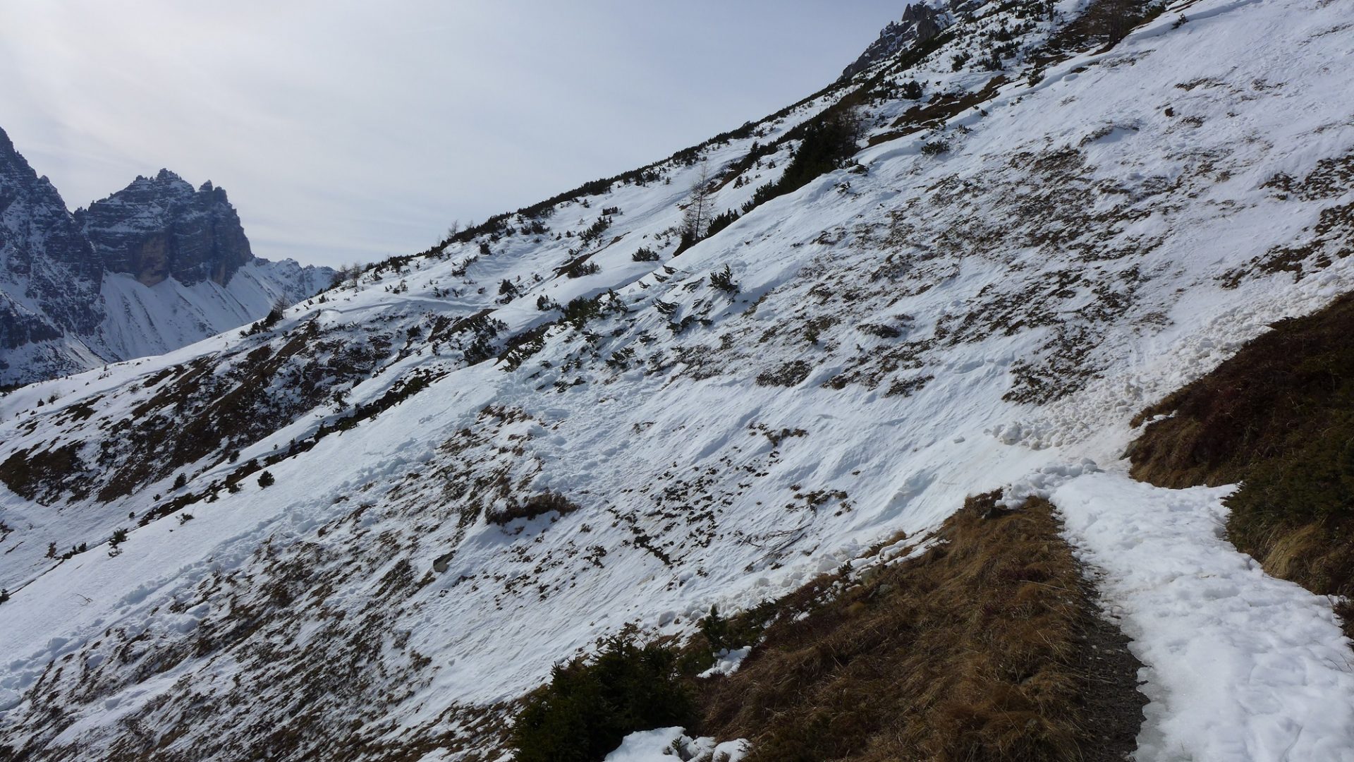
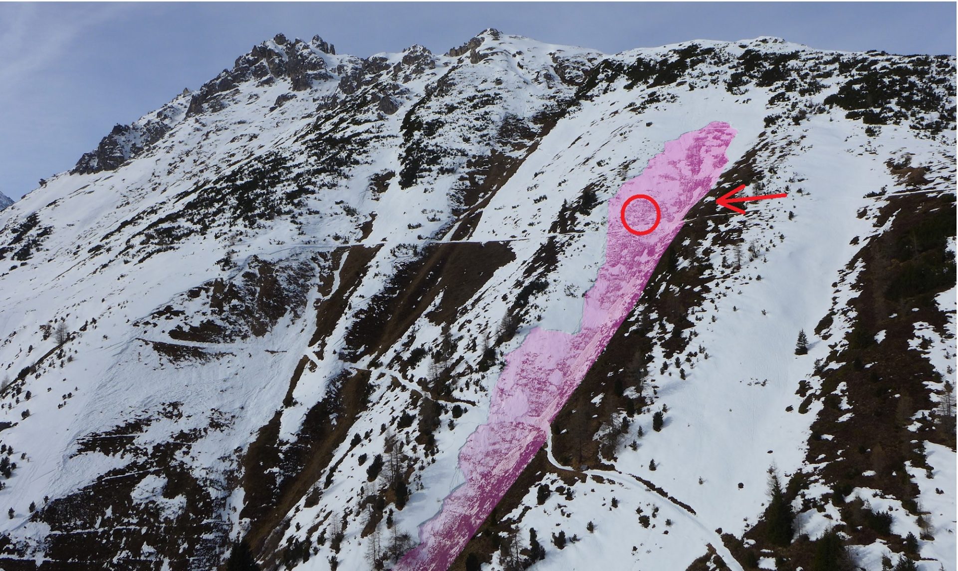
Die Personengruppe folgte dem Panoramaweg von der Elferhütte (rechts außerhalb des Bildes) in Richtung Süden. Zwei Personen warteten im Bereich des roten Pfeiles, während der vorausgehende Schneeschuhwanderer alleine die Rinne querte. Der rote Kreis markiert den Erfassungspunkt der verunfallten Person (©LWD Tirol, 09.03.2026).
The group followed the Panoramaweg from the Elferhütte (right, outside the photo) to the south. Two persons waited near the red arrow while the first member of the group of snowshoe hikers traversed the gully alone. The red circle depicts the point at which this person was caught (©LWD Tirol, 09.03.2026).
Blick in Richtung Süden: Im Vordergrund der Unfallhang, im Hintergrund erkennt man Anrisse von wenig älteren Schneebrettlawinen in ähnlicher Exposition und Höhenlage (©LWD Tirol, 09.03.2026).
View to the south: in foreground, the slope where the incident took place, in background, fractures of slab avalanches triggering slightly prior to this one in similar aspects and at similar altitudes (©LWD Tirol, 09.03.2026).

The snowpack

We carried out examinations of the snowpack in the area of the avalanche incident on 09.03, together with the Alpine Police and with the support of the Airbourne Police.

The overall picture on the east-facing slopes just above the timberline near the area where the incident occurred revealed a zone where the springtime snowpack was already slowly becoming bare of snow. On the south-facing slopes and the broad ridge, the ground was frequently bare of snow; in more wind-protected areas facing somewhat more to the east or northeast, there was still a generally shallow snowpack evident.

The snowpack on the slope where the incident took place was interspersed with frequently snowbare sections. The fracture revealed a relatively constant snow depth. In the snow profile, a ground-level fundament of rotten snow could be identified, which in this case must once again be seen as the cause of the incident. The slab immediately above was extremely shallow, but at the time of the incident apparently sufficient to propagate a fracture in the weak layer over large-scale areas. The snowpack was thoroughly moist down to the ground, which is why the avalanche is classified as a wet-snow slab avalanche.
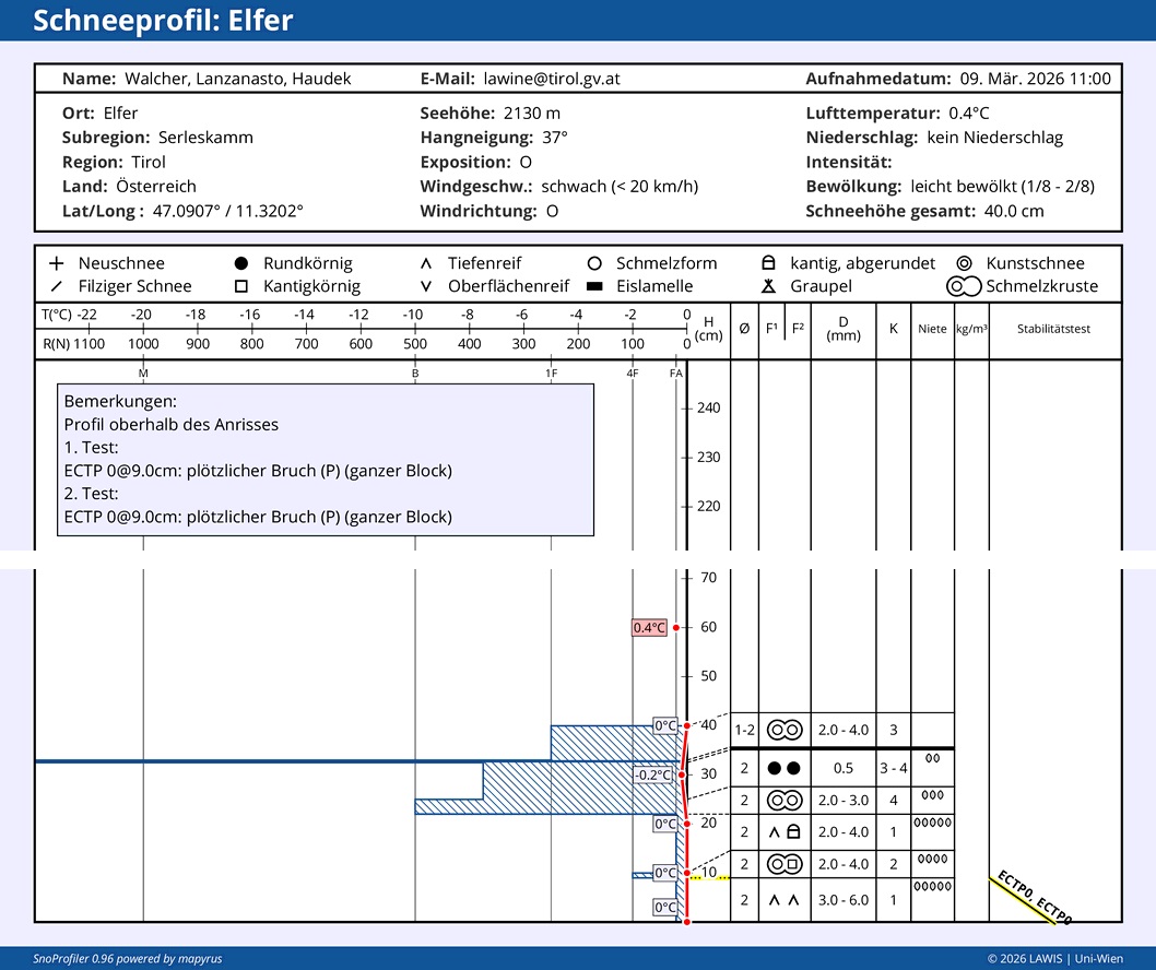
Das Schneeprofil wurde im Bereich des oberen Anrisses aufgenommen. Der untere Teil der Schneedecke zeigt zwei markante Schwachschichten in Form von Becherkristallen. Im Stabilitätstest am Profilstandort reagierte die untere dieser beiden Schwachschichten. Für die Unfalllawine waren letzten Endes beide Schwachschichten relevant. Der obere Teil der Schneedecke zeigt das wesentlich härtere Schneebrett, das aus mehreren Schmelzkrusten aufgebaut war. Die gesamte Schneedecke war feucht und nullgradisotherm.
The snow profile was taken in the upper zone of the fracture. The lowermost part of the snowpack shows two marked weak layers in the form of cup-shaped crystals. In the stability test at the spot of the snow profile, the lower of these two weak layers reacted. For the avalanche in question, these two weak layers were the crucial ones in the final analysis. The uppermost part of the snowpack depicts the much harder slab which was constituted out of several melt-freeze crusts. The entire snowpack was moist, zero-degree isotherm.
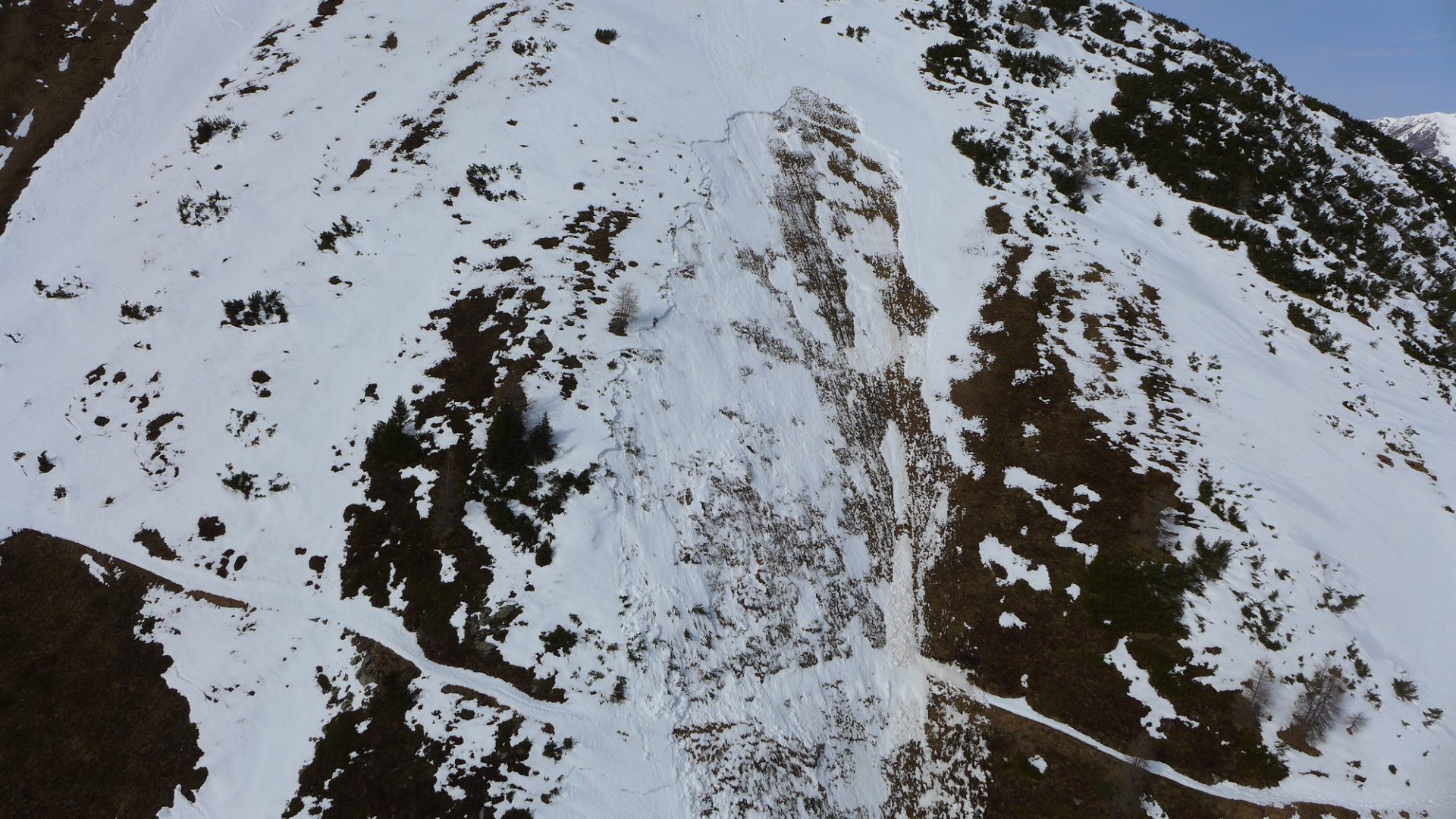
Obwohl das Schneebrett im Durchschnitt nur etwa 20 bis 30 cm mächtig war, konnte sich der Bruch dennoch über eine größere Fläche fortpflanzen. Eindrücklich ist auch die unmittelbare Nähe sehr gefährlicher Hangpartien in den mit Schnee gefüllten Rinnen oberhalb extrem steiler Runsen, unmittelbar neben aperen und damit entsprechend sicheren Rücken (© LWD Tirol, 09.03.2026).
Although the slab was on average only 20-30cm thick, the fracture was still able to propagate over a large-scale surface. What stands out is the immediate nearness of dangerous slope sectors where snow-filled gullies above extremely steep ditches lie immediately adjacent to snowbare and, therefore, correspondingly safe ridges (© LWD Tirol, 09.03.2026).