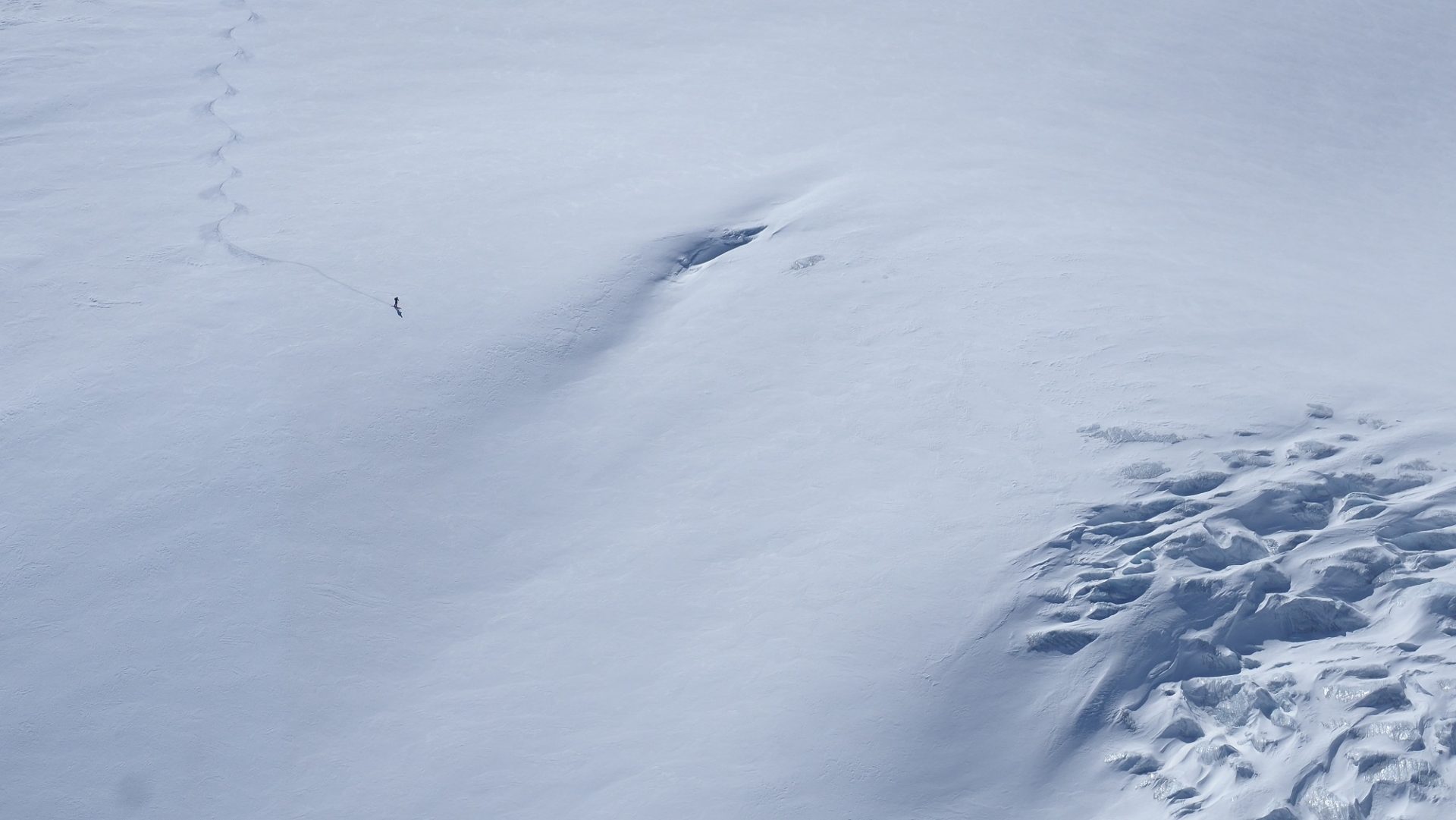
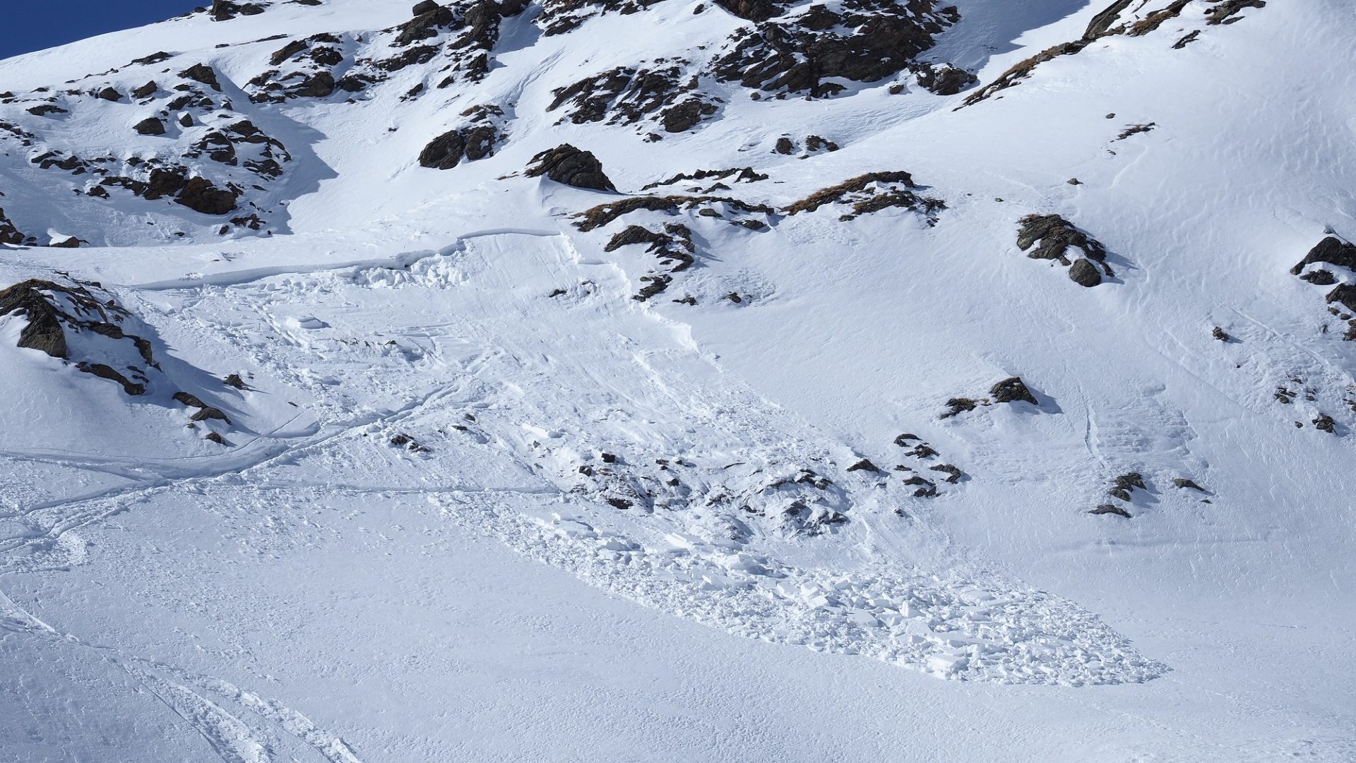
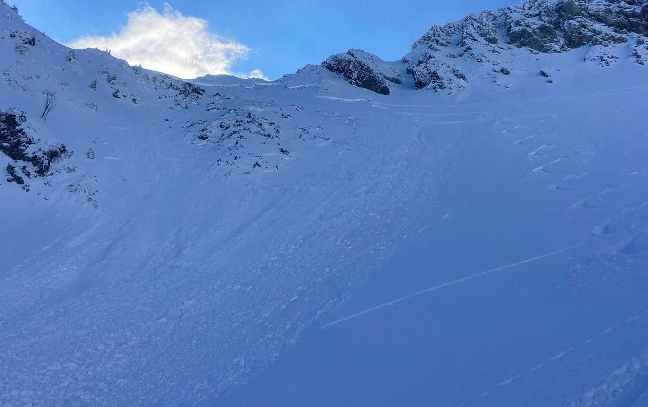
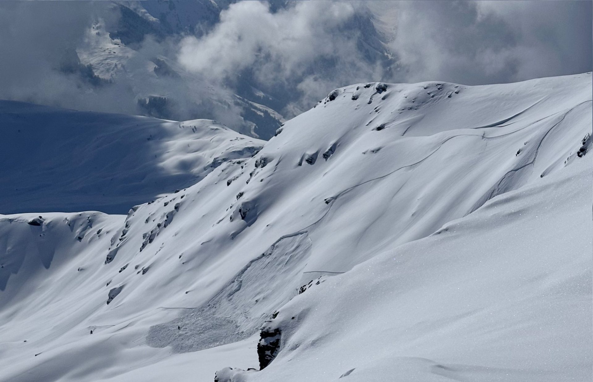
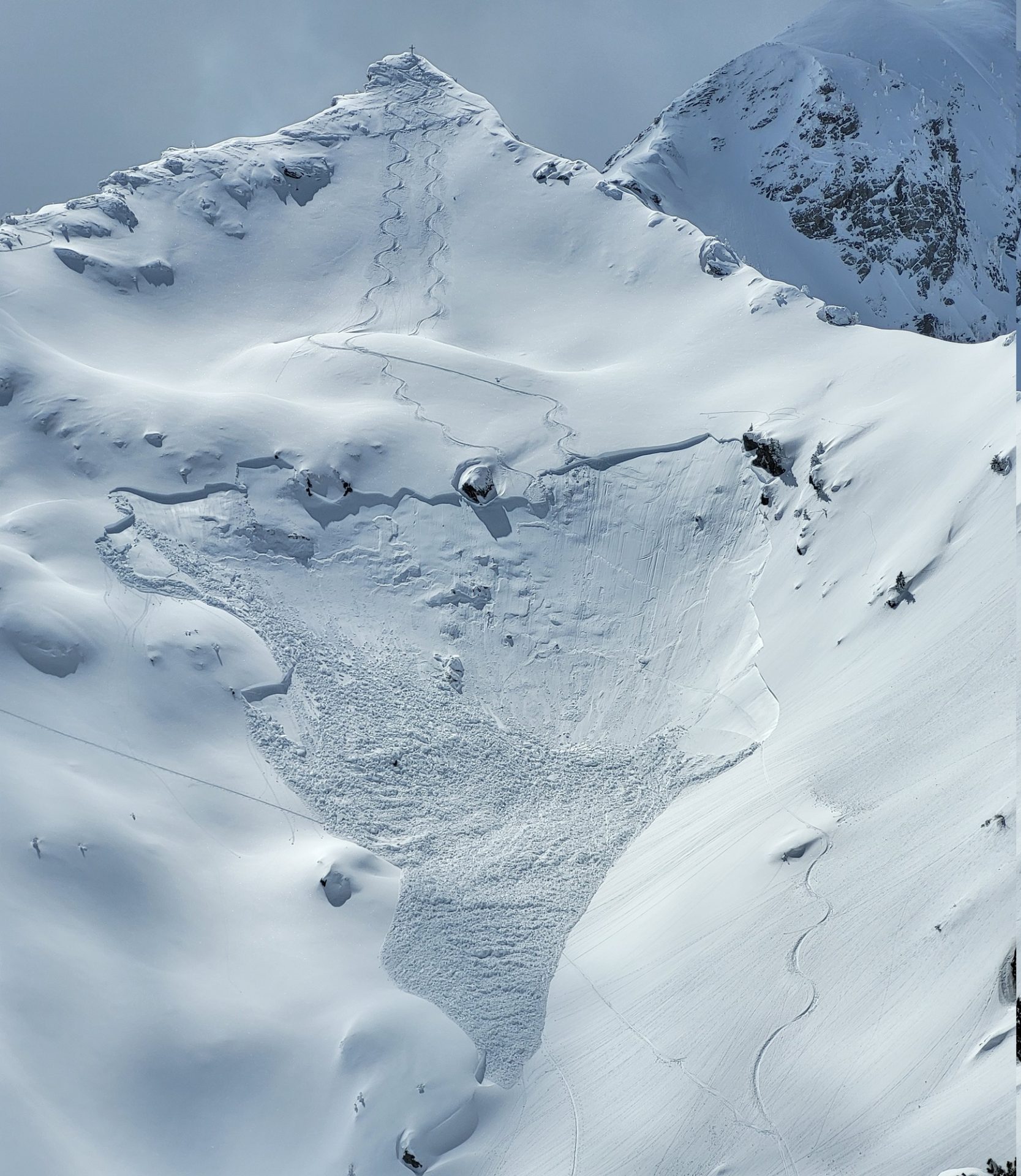
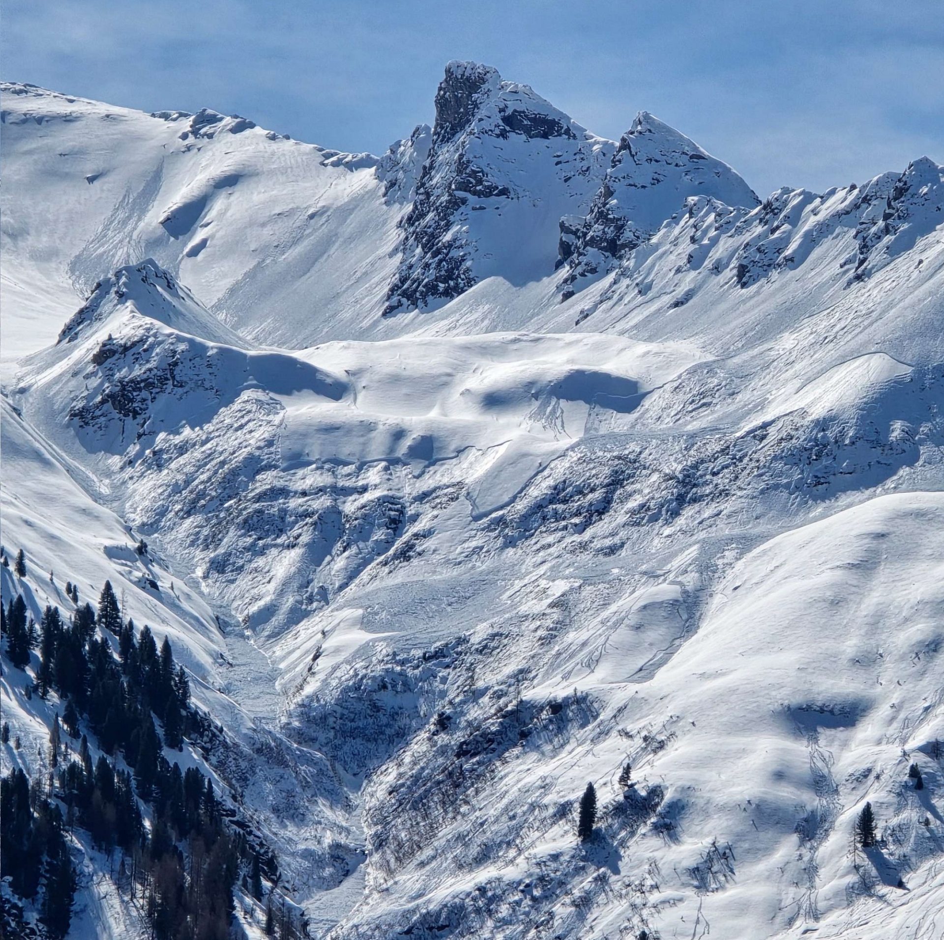
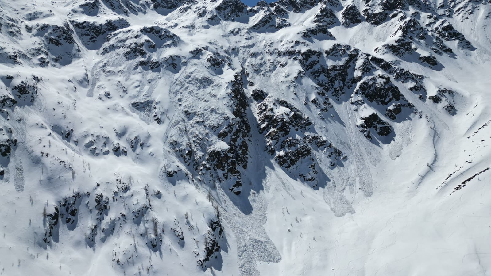
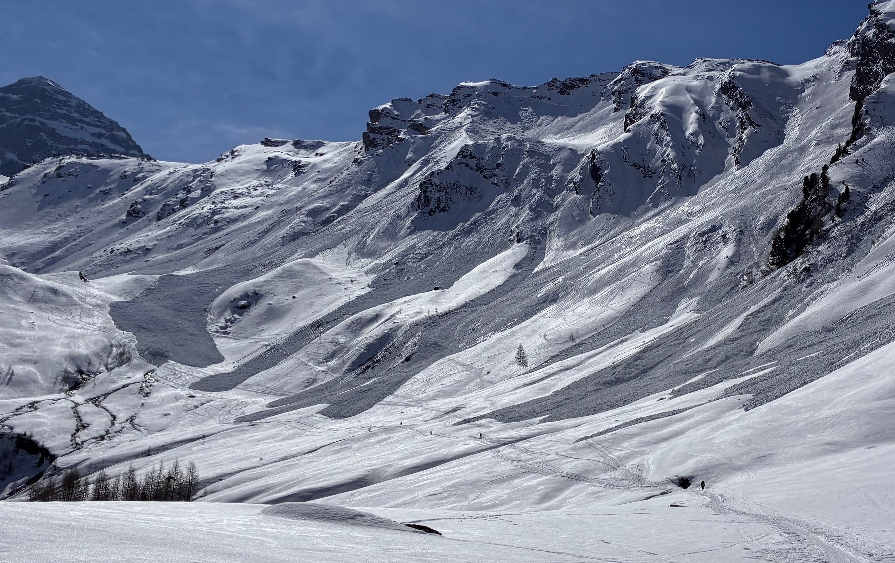
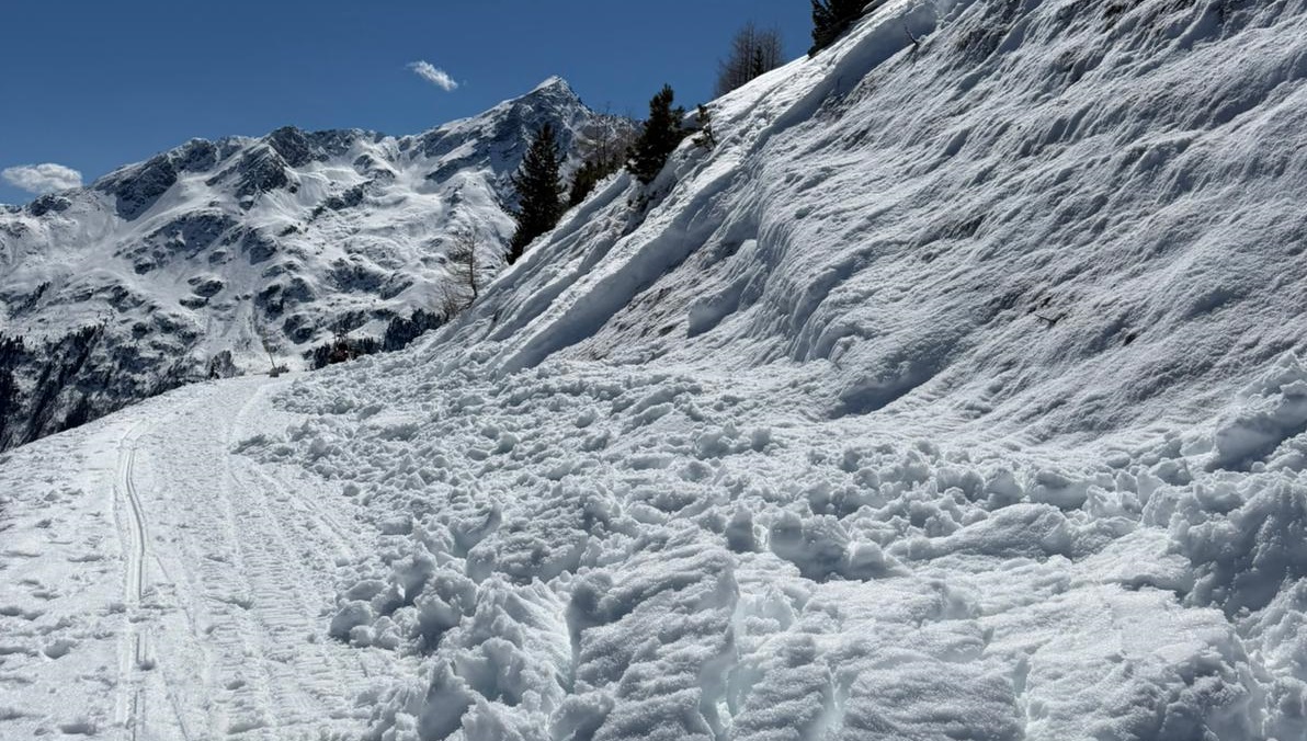
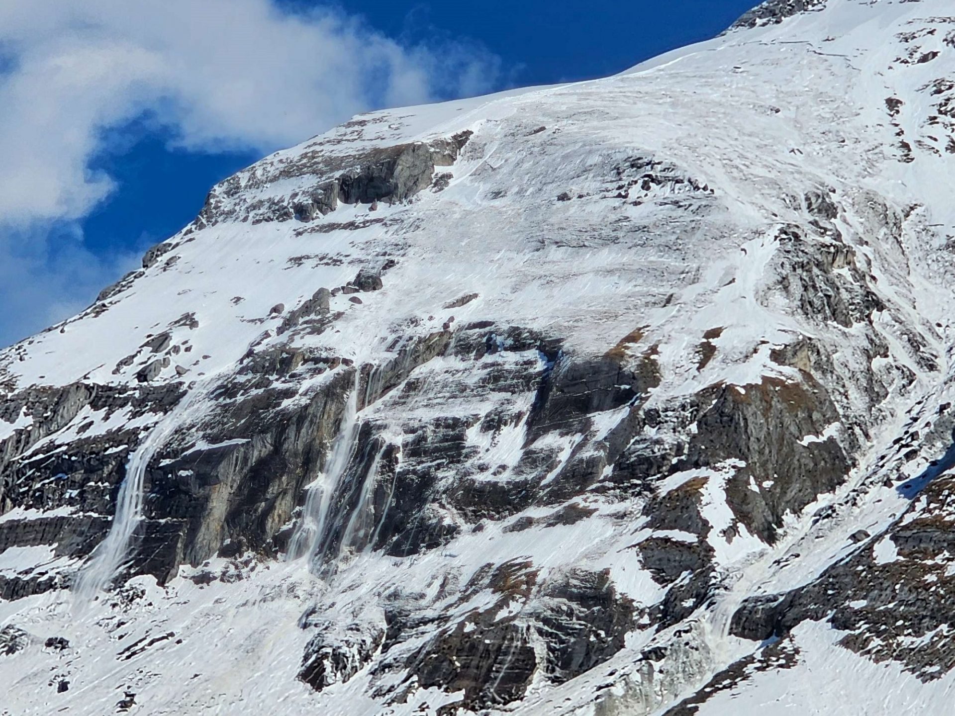
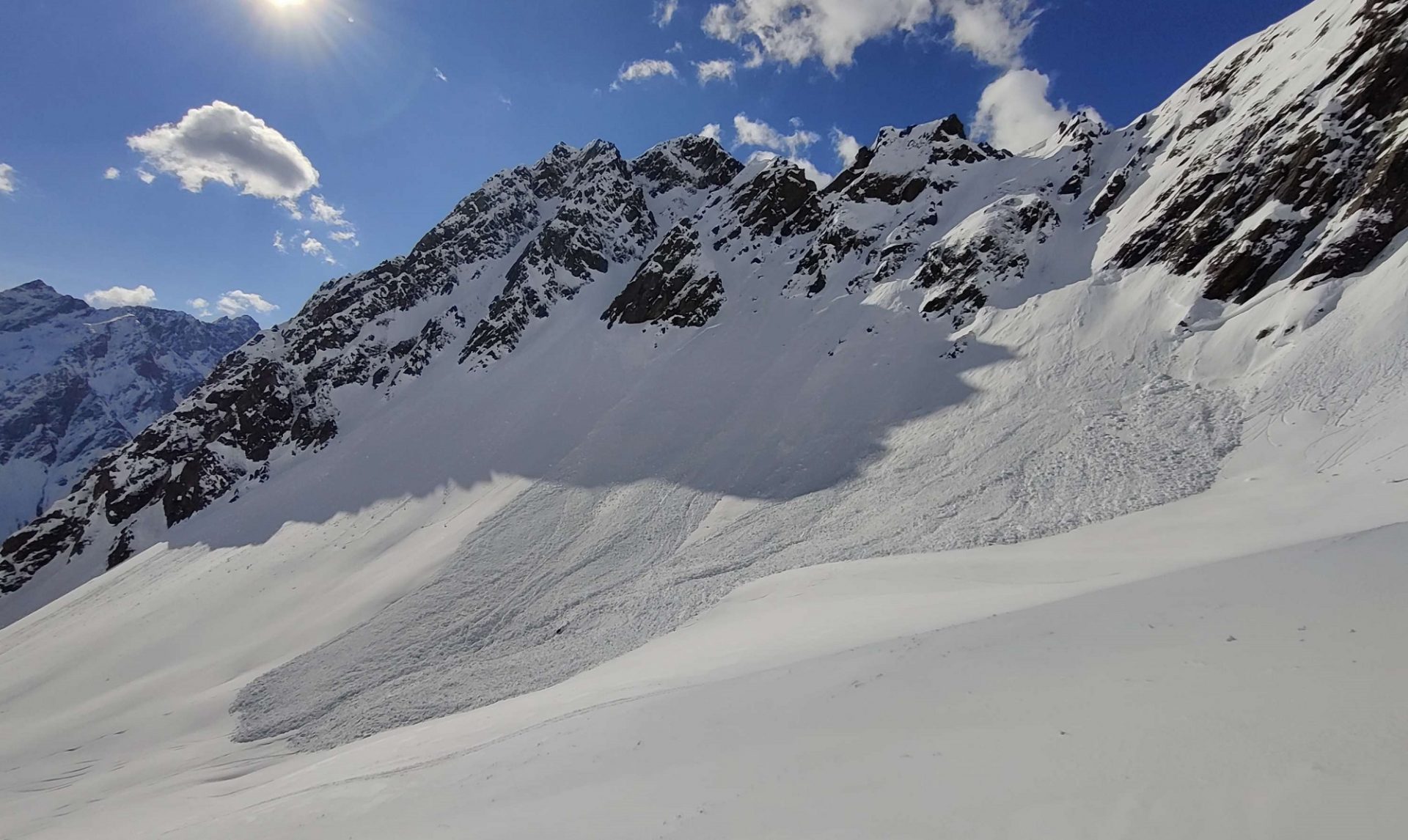
Lawinenabgänge im Rotmoostal am Weg zum Eiskögele (©Hugo Reindl).

Snowpack becoming increasingly wet, heightening avalanche activity

Whereas it still felt like deep winter at the end of last week, in the interim spring seems to have arrived. Warm temperatures, solar radiation are making the snowpack thoroughly wet. It is forfeiting firmness through water seepage, leading to numerous wet loose-snow and slab avalanches.

Also on the weekend, the springlike April weather will persist. The wet-snow problem determines avalanche danger.

The developing situation

Highly varied weather conditions

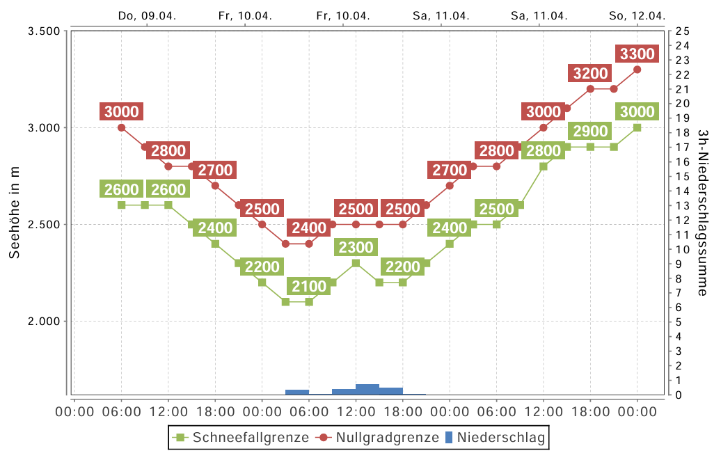
On Friday, 10.04, a weak cold front brushes past Tirol. Skies are often overcast, there is intermittent minor snowfall on the northern flanks of the Main Alpine Ridge. The snowfall level lies at 2200-2500m. The following night is mostly cloudy, seen from today’s perspective, the snowpack’s outgoing longwave radiation is limited. On Saturday, high-pressure front conditions predominate: brilliant sunshine, rising temperatures (the zero-degree level rises to nearly 3000m).

On Sunday the pleasant conditions continue, although the air is less stable and isolated showers during the daytime seem possible. As we move into the new week, weather is unsteady, cloudy skies return, temperatures recede.

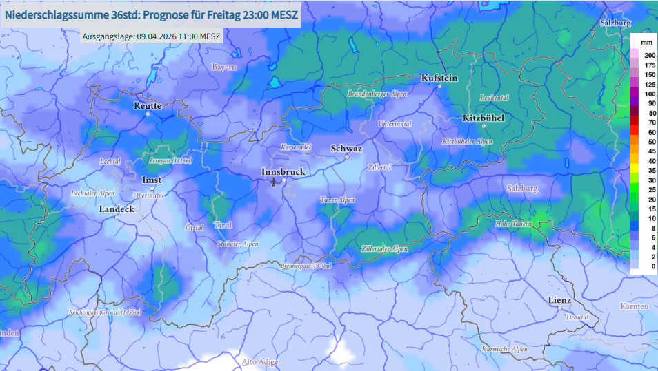
Die Kaltfront am Freitag, 10.04. bringt v.a. in Nordtirol gebietsweise bis zu 10mm Niederschlag (©GeoSphere Austria).
The cold front on Friday, 10.04, brings up to 10mm of precipitation to parts of North Tirol (©GeoSphere Austria).
Prognostizierter Verlauf der Schneefallgrenze sowie der Nullgradgrenze. Nach dem kurzzeitigen Rückgang der Temperaturen am Freitag, steigen diese zum Wochenende hin wieder an (©Oberlandwetter).
Forecast development of snowfall level and zero-degree level. Following the brief drop in temperatures on Friday, they rise again over the weekend (©Oberlandwetter).

Wet slab avalanches are the major danger

To what altitudes the snowfall level rises and how much precipitation actually is registered is determined on Friday, 10.04, by just how wet the snowpack becomes. During the following night, cloudiness seems in the offing with limited outgoing radiation – that’s the only way a thin melt-freeze crust can be generated. And when next day solar radiation and daytime temperatures soften that up, the snowpack will become wetter and wetter still.

These conditions cause the marked weak layers deep down inside the snowpack to become thoroughly wet for the first time, depending on altitude, aspect and steepness. This wetness weakens the bonding between individual crystals and thus, heightens the likelihood of wet slab avalanches triggering. Observations of the last few days show that the snowpack on northern flanks is currently moist down to the ground up to about 2200m, on west-facing and east-facing slopes up to nearly 2500m. All in all, it is the steep west, north and east-facing slopes starting at about 2200m where wet slab avalanches can be expected as a result of the snowpack becoming even wetter. These are the expectations mostly because we know that the marked weak layer is widespread, in other words, is just waiting to become thoroughly wet for the first time. The question is not whether it will, the question is when.

Apart from potential naturally triggered avalanches, the loss of firmness also causes the likelihood of persons triggering avalanches, of course. Please note: old tracks are not a sign of safety! The weak layer is buried deep inside the snowpack and is not influenced by any tracks on the surface. The fatal avalanche incident on Wednesday, 08.04, on the Mute in Kühtai on a northeast-facing slope at about 2250m is tragic proof of that fact. A separate blog will analyze that avalanche incident, soon to be published.

Nasse Schneebrettlawinen können durch Personen ausgelöst werden. Vielbefahrenes Gelände ist nicht als günstiger zu beurteilen. Bereich Finstertal, Kühtai (©LWD Tirol, 09.04.2026).
Wet slab avalanches can be triggered by persons. Terrain which shows evidence of having been skied plentifully must not be viewed as more favorable or safe. Area: Finstertal, Kühtai (©LWD Tirol, 09.04.2026).
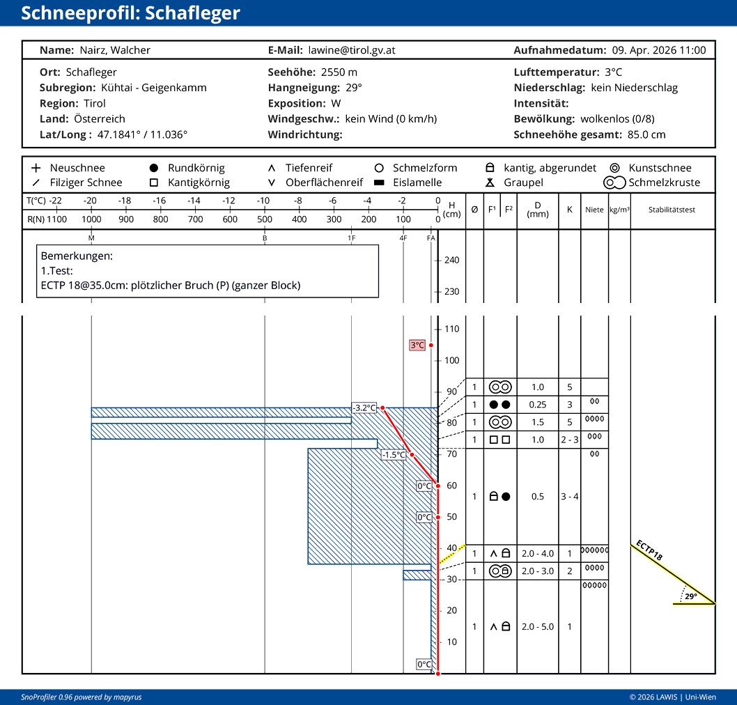
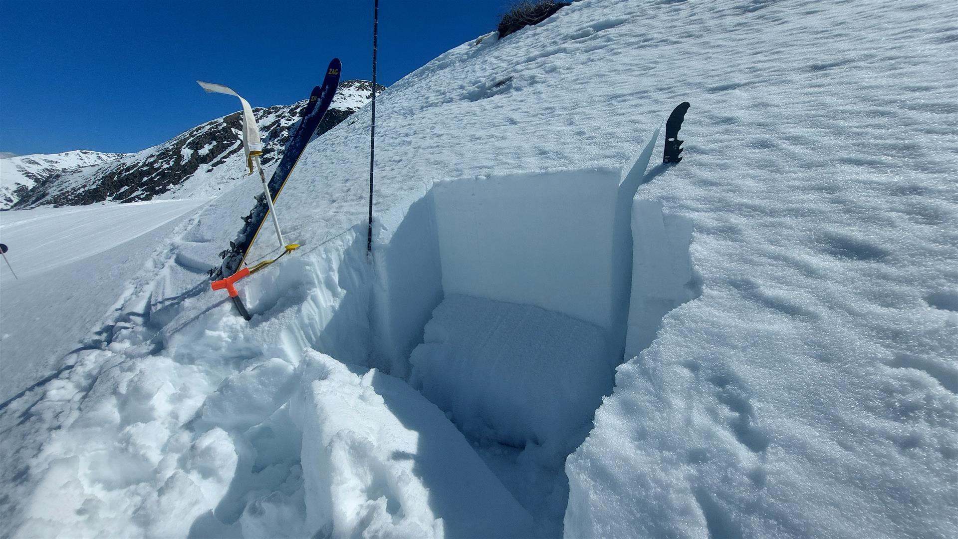
An diesem Westhang auf 2550m wurde die Schneedecke bereits bis zum Boden hin feucht. Die Schneeoberfläche konnte in den Nachtstunden offensichtlich gut Wärme abstrahlen, es bildete sich ein recht dicker Schmelzharschdeckel. Im bodennahen Altschneefundament konnte ein Bruch initiiert werden, welcher sich fortzupflanzen vermochte.
On this west-facing slope at 2550m the snowpack was moist all the way down to the ground. The snowpack surface was able to radiate outwards ample warmth during the night so that a thick melt-freeze crust formed. In the ground-level old snowpack fundament, a fracture was initiated which was able to propagate.
In Stabilitätstests sprecht die bodennahe Schwachschicht wieder vermehrt an (©LWD Tirol, 08.04.2026).
In stability tests, the ground-level weak layer is ever more sensitive to triggering. Kühtai, 2280m, North (©LWD Tirol, 08.04.2026).

Weather developments, as described above, are and will remain highly variable. Not unusual for this juncture of the season. For an enjoyable and safe backcountry tour, weather needs to be meticulously observed: how clear were nighttime skies? How good is the melt-freeze crust which formed? How much time is there before it softens, i.e. how much time for a tour? For this type of risk management, it helps to launch the day very early. If the melt-freeze crust softens faster than planned, then it’s time to consider turning around.

A map forecasting the cloud cover can be found at the Portal der GeoSphere Austria. In early morning, also Webcam- Bilder or Stationsdaten (snow surface temperatures) are a big help in trying to assess the actual outgoing radiation which occurred.

Dry-snow avalanches in shady, high-altitude terrain

In places on very steep shady slopes above about 2600m, in addition, small snowdrift accumulations are prone to triggering. They occur primarily near ridgelines and behind sharp drops in the terrain and are quite easily recognized. They can be triggered with ease.

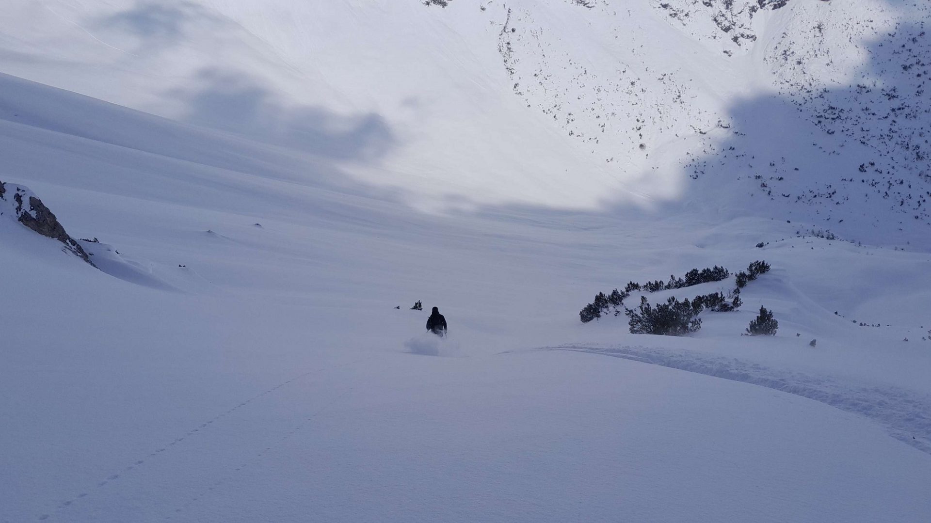
An Schattenhängen in der Höhe ist der Schnee noch trocken und mitunter auch noch pulvrig. Sulzenauferner, Stubaier Alpen (©LWD Tirol, 05.04.2026).
At high altitudes the snow is still dry, on certain shady slopes even still powdery. Sulzenauferner Glacier, Stubai Alps (©LWD Tirol, 05.04.2026).
Kleine Triebschneeansammlungen können an kammnahen Schattenhängen stellenweise durch Personen ausgelöst werden. Als Schwachschichten kommen hier kantige Kristalle, vereinzelt auch Oberflächenreif in Frage. Vorsicht im absturzgefährdeten Gelände (©LWD Tirol, 09.04.2026).
Small snowdrift accumulations can be triggered by persons in places near ridgelines on shady slopes. The weak layers are faceted crystals, in isolated cases also surface hoar. Caution urged in terrain where you can be forced to take a fall (©LWD Tirol, 09.04.2026).

Last week

From deep winter to springtime

A week ago it was possible, amid low temperatures and fine powder snow down to the timberline and in places even further down, to fully enjoy the conditions. In the interim, things have changed: temperatures and the strong solar radiation corresponding to this juncture of the season have permitted us to feel the slow oncome of summer. This abrupt change has left its effect behind on the snowpack. The snowmelt led to a significant loss of snow depths, easily visible at our weather stations.

Particularly on Friday, 03.04, we received numerous reports of dry-snow slab avalanches which fractured primarily in weak layers in the form of faceted crystals or, in isolated cases, from surface hoar in the uppermost part of the snowpack. Starting on Saturday, 04.04 (at low altitudes, especially in northern regions), at latest on Sunday, 05.04, sunshine, moist air and as a result loss of firmness inside the snowpack. The result: heightened likelihood of wet-snow avalanches triggering, both naturally and released by persons.
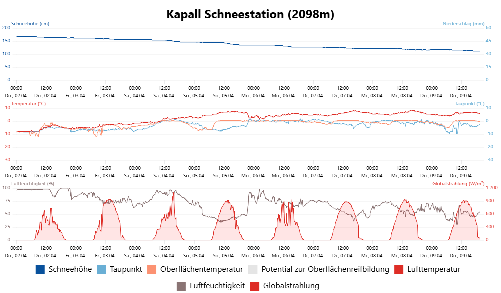
Während die Lufttemperatur an der Wetterstation Kapall in den Lechtaler Alpen West am Donnerstag vor einer Woche noch bei knapp minus 8°C lag, liegt sie seit Samstag beständig im positiven Bereich der Skala. Mit den warmen Temperaturen ging die Schneehöhe im selben Zeitraum um über 50cm zurück.
Whereas air temperature at the Kapall weather station in the Lechtal Alps West was nearly minus 8°C on Thursday, a week ago, it is now, since Saturday, above zero on the scale. As a result of higher temperatures, the snow depths receded by no less than 50cm, often more.
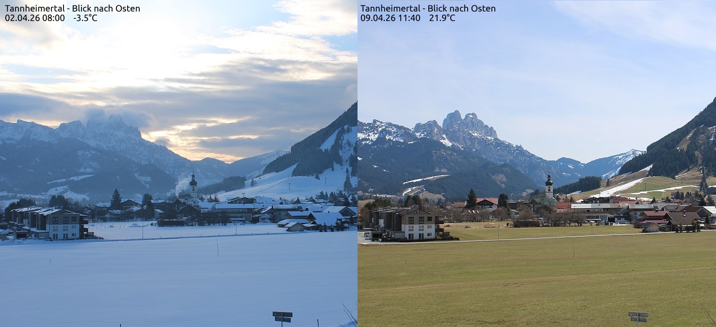
Blick in Richtung Tannheim mit den Tannheimer Bergen bzw. dem Gimpel (2173m) im Hintergrund. Das linke Bild stammt vom vergangenen Donnerstag, 02.04., das rechte Bild von heute, 09.04. (©foto-webcam.eu).
View towards Tannheim with Tannheim mountains, including Gimpel (2173m) in background. The left picture ws taken last Thursday, 02.04, the right picture was taken today, 09.04 (©foto-webcam.eu).

Chronology in pictures

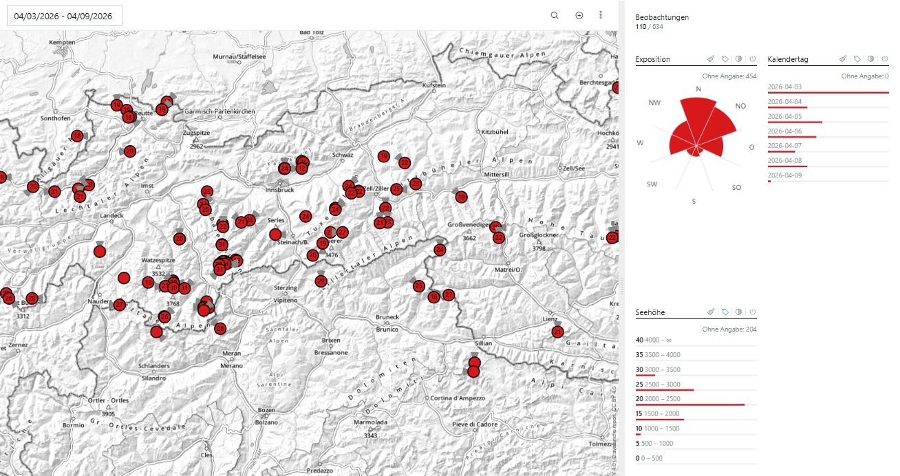
Rückgemeldete Lawinen der vergangenen 7 Tage. Die meiste Lawinenaktivität ereignete sich im Sektor West–Nord–Ost zwischen etwa 1800m und 2500m.
Reported avalanches over the last 7 days. Greatest avalanche activity was on west-north-east facing slopes between 1800 and 2500m
Powder (von kurzer Dauer) im Halltal am Freitag, 03.04. Spätestens am darauffolgenden Samstag wurde der Pulvertraum mit etwas Regen, feuchter Luft und diffuser Strahlung zerstört (©Alexander Radlherr, 03.04.2026).
Powder (short-lived) in Halltal on Friday, 03.04. By the following Saturday, at latest, the powder had transformed and was destroyed by rainfall, moist air and diffuse radiation (©Alexander Radlherr, 03.04.2026).
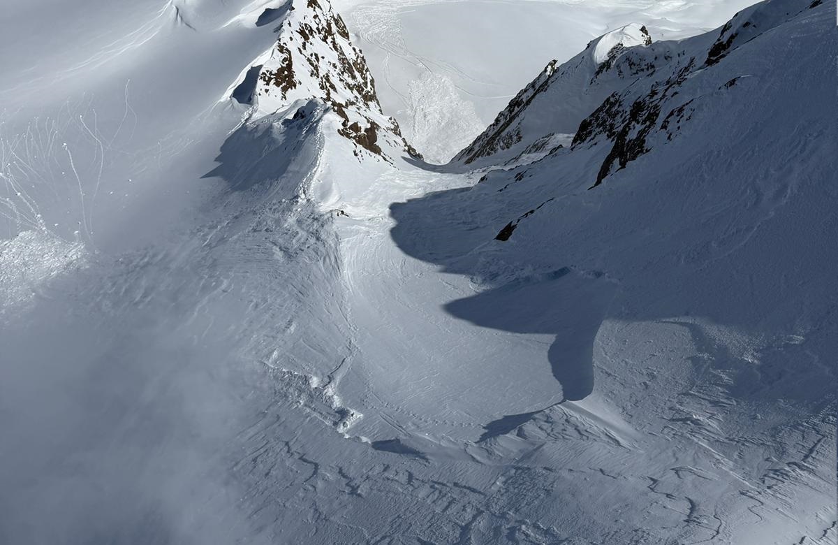
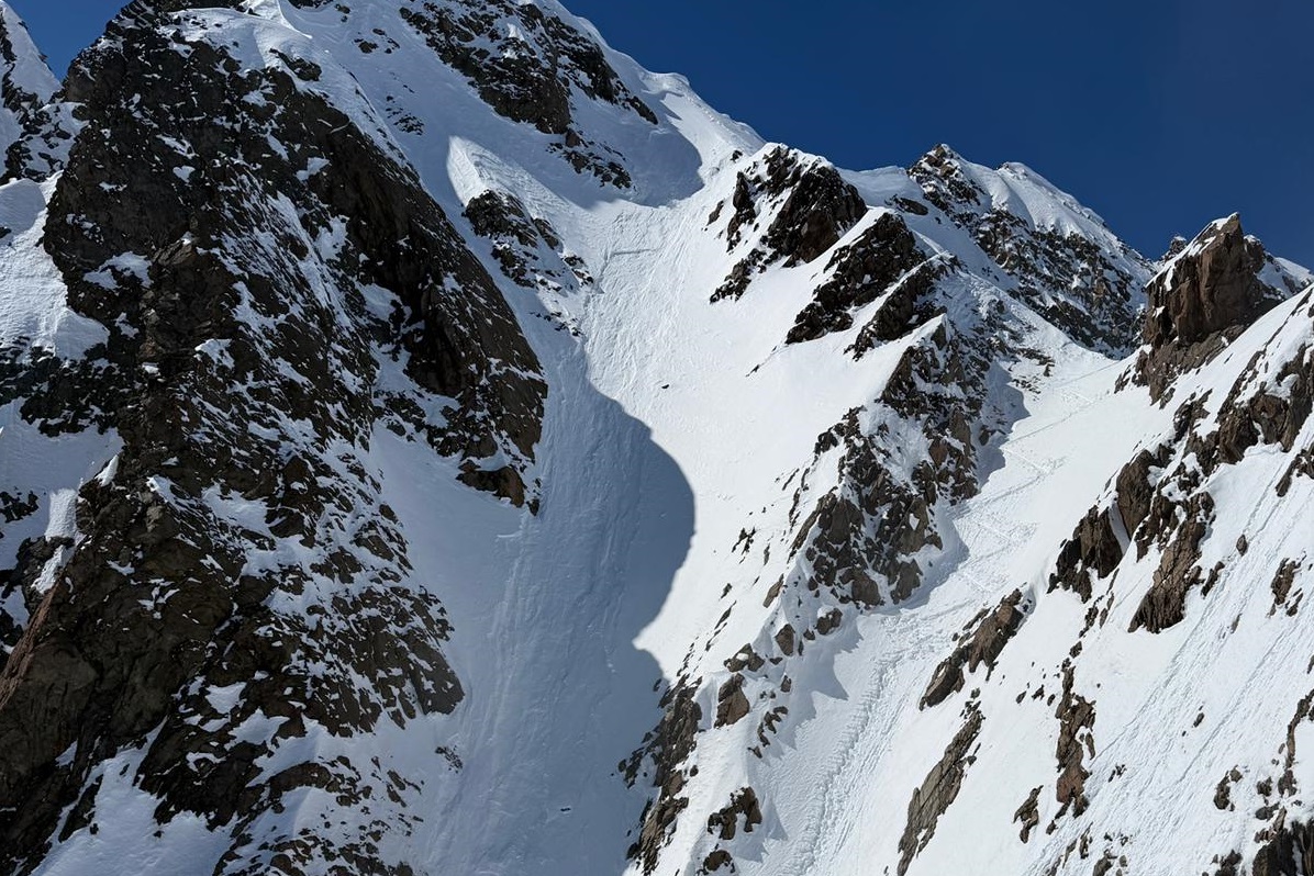
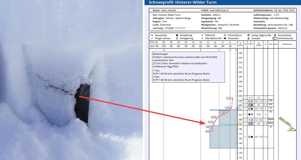
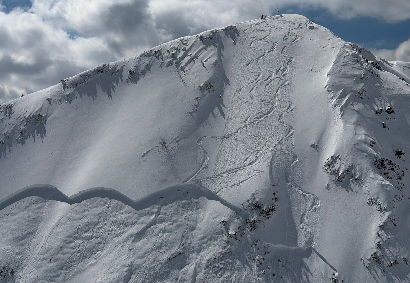
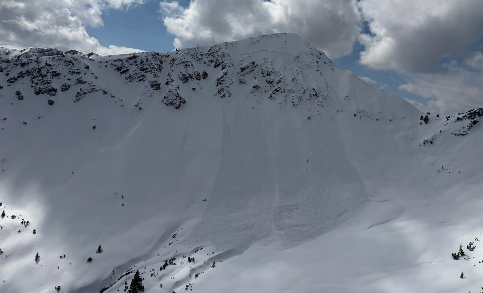
Ebenfalls am Freitag, 03.04. wurde am hinteren Wilden Turm in den Stubaier Alpen, an einem extrem steilen Nordosthang auf 3260m eine mittelgroße Schneebrettlawine durch Personen ausgelöst. Zwei Personen wurden mitgerissen, eine Person zog sich Verletzungen zu (©Alpinpolizei, 03.04.2026).
Also on Friday, 03.04, on Hintere Wilder Turm in the Stubai Alps on an extremely steep northeast-facing slope at 3260m, a medium-sized slab avalanche was triggered by persons. Two of them were swept along, one was injured (©Alpinpolizei, 03.04.2026).
Rechts im Bild ist die Aufstiegsspur zu sehen, links in der Rinne die Lawine mit dem oberen Anrissbereich direkt unterhalb des Grates (©Alpinpolizei, 03.04.2026).
Right in photo: the ascent track can be seen. Left: the avalanche in the gully with upper fracture zone directly below the ridgeline (©Alpinpolizei, 03.04.2026).
Die Unfallanalyse zeigte, dass eine Schwachschicht aus Oberflächenreif unterhalb von älterem Triebschnee für den Abgang der Schneebrettlawine relevant war. Der Oberflächenreif entstand in diesem kammnahen Bereich aufgrund des Nigg- Effekts (©LWD Tirol, 05.04.2026).
The analysis of the incident shows that the weak layer of surface hoar below the older snowdrift was relevant for the release of the slab avalanche. The surface hoar was generated in this ridgeline zone due to the Nigg Effect (©LWD Tirol, 05.04.2026).
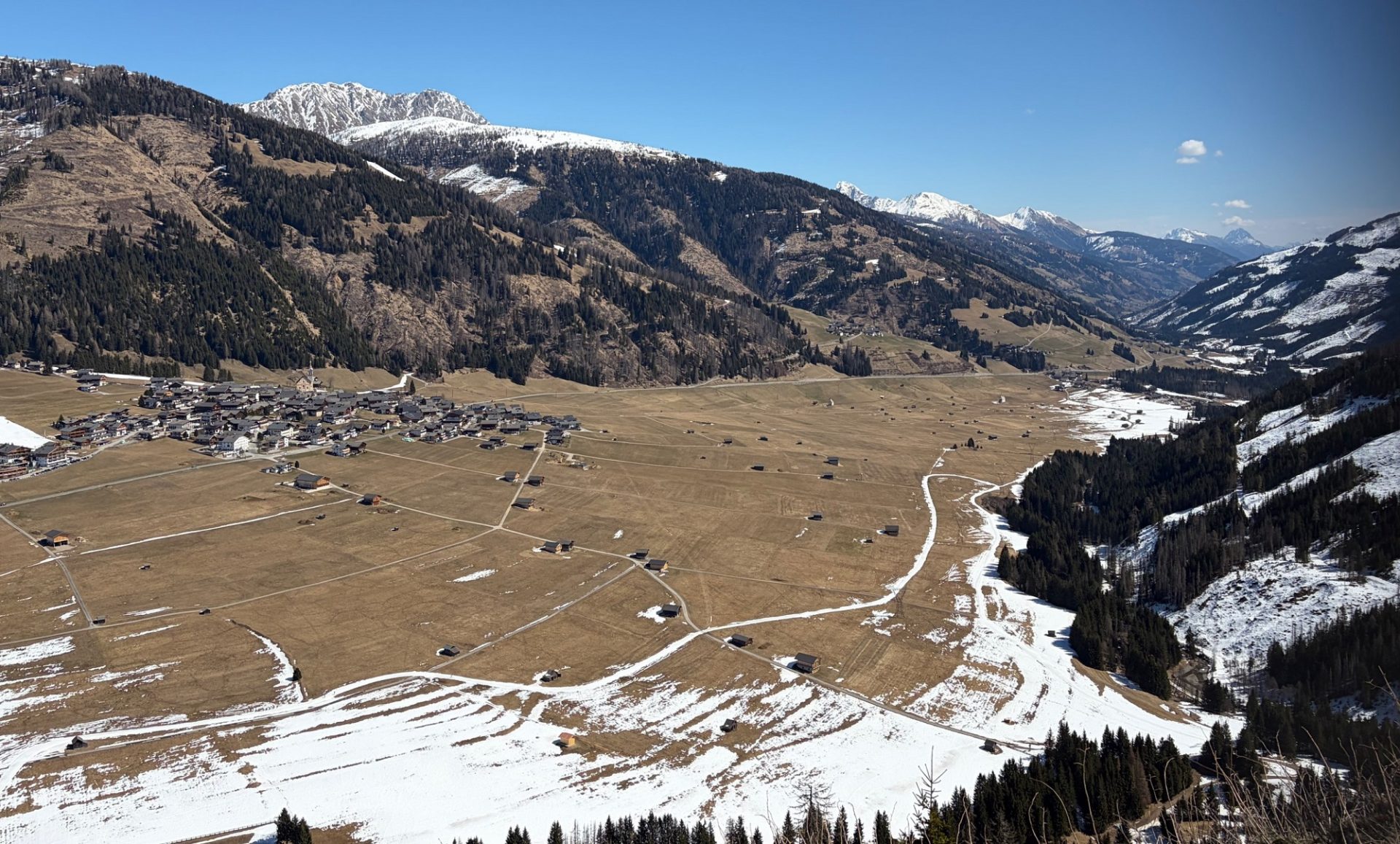
Blick nach Obertilliach und gen Osten. An den Sonnenhängen liegt in den Gailtaler Alpen kaum mehr Schnee (©Lukas Ruetz, 03.04.2026).
On sunny slopes there is hardly any snow in the Gailtal Alps (©Lukas Ruetz, 03.04.2026).
Anrissbereich einer personenausgelösten, mittelgroßen Schneebrettlawine am Kreuzkopf, an einem extrem steilen Nordhang auf 1900m in den südlichen Ammergauer Alpen (©Alpinpolizei, 03.04.2026).
Fracture zone of a medium-sized slab avalanche triggered by persons on Kreuzkopf on an extremely steep north-facing slope at 1900m in the southern Ammergau Alps (©Alpinpolizei, 03.04.2026).
Drei Personen wurden von der Schneebrettlawine mitgerissen und im Auslaufbereich teilverschüttet. Sie konnten sich selbst befreien. Eine Person wurde leicht verletzt (©Alpinpolizei, 03.04.2026).
Three persons were swept along by the slab avalanche and partially bured in snow masses in the runout zone. They were able to free themselves. One person suffered minor injuries (©Alpinpolizei, 03.04.2026).
Große personenausgelöste Schneebrettlawine am Bugschrofen bei Tannheim an einem sehr steilen Nordwesthang auf etwa 1880m. Sowohl bei dieser, als auch bei der Lawine am Kreuzkopf war mit hoher Wahrscheinlichkeit ein oberflächennahes Altschneeproblem aus kantigen Kristallen im Bereich einer Kruste unfallkausal (©Simon Niedermayer, 03.04.2026).
Large slab avalanche triggered by persons on Bugschrofen near Tannheim on a very steep northwest-facing slope at about 1880m. Also in this release, like the avalanche on Kreuzkopf, the incident was in all probability caused by a near-surface persistent weak layer problem: faceted crystals near a crust (©Simon Niedermayer, 03.04.2026).
Kleine bis mittelgroße personenausgelöste Schneebrettlawine am Gamsköpfl in den westlichen Kitzbüheler Alpen an einem Osthang auf 2400m (©Matthias Egger, 03.04.2026).
Small to medium-sized slab avalanche triggered by persons on Gamsköpfl in the western Kitzbühel Alps on an east-facing slope at 2400m (©Matthias Egger, 03.04.2026).
Mittelgroße personenausgelöste Schneebrettlawine an einem sehr steilen Nordhang an der Steinkarspitze in den Zillertaler Alpen Nordost. Auch hier war mutmaßlich das oberflächennahe Altschneeproblem maßgeblich (©Thomas Giacomelli, 03.04.2026).
Medium-sized slab avalanche triggered by persons on a very steep north-facing slope on Steinkarspitze in the Zillertal Alps NE. Also here, the near-surface old snow persistent weak layer was behind it (©Thomas Giacomelli, 03.04.2026).
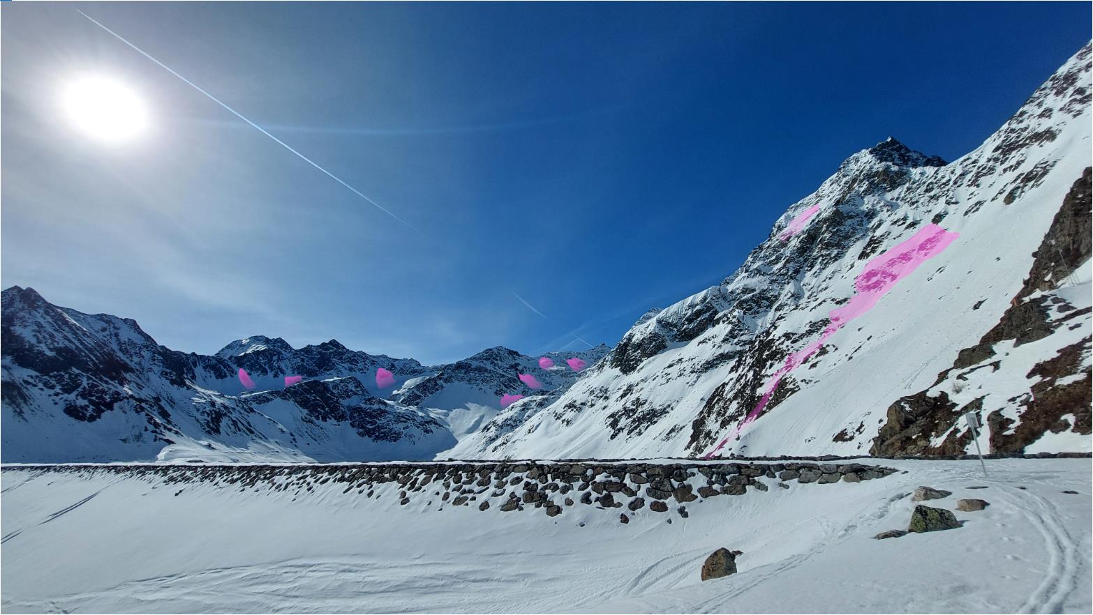
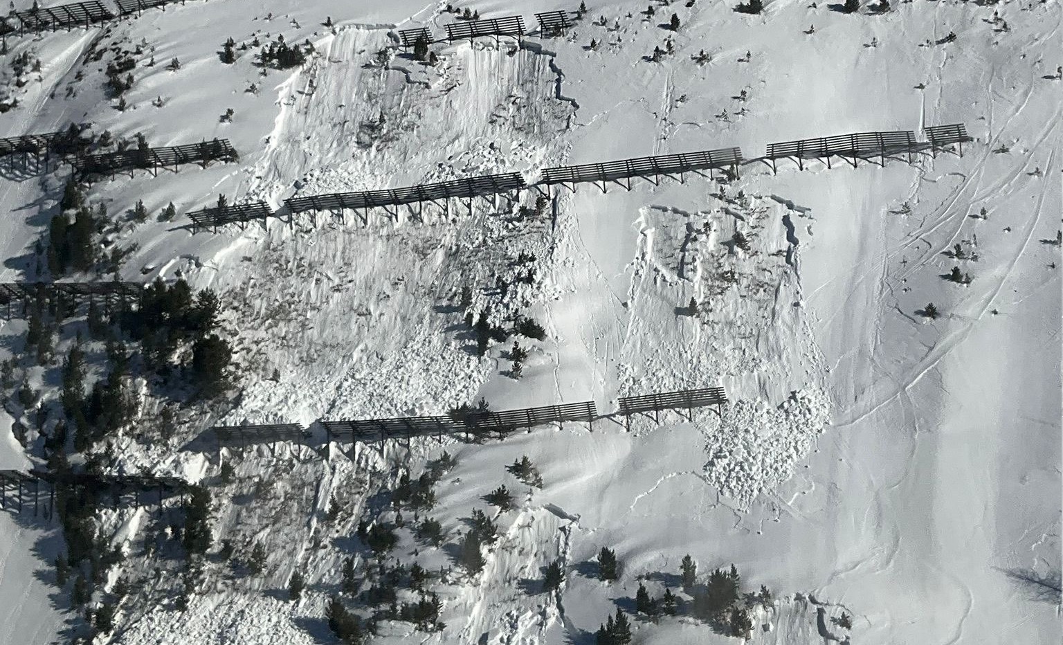
Blick vom Staudamm des Finstertaler Speichers in Kühtai in Richtung Süden. Eingezeichnet sind spontane Lawinen der vergangenen Woche. Die allermeisten davon lösten sich oberflächennah, in einer Schwachschicht aus kantigen Kristallen unter einer Schmelzkruste vom Mitte März. (©LWD Tirol, 09.04.2026).
View from reservoir bridge of Finstertal Reservoir in Kühtai towards the south. Marked are naturally triggered avalanches which occurred last weak. Most of them released near the surface in a weak layer of faceted crystals beneath a melt-freeze crust generated in mid-March(©LWD Tirol, 09.04.2026).
Mit der Durchfeuchtung löste sich am 4.4. diese sehr große spontane Schneebrettlawine an der Ahornspitze in den Zillertaler Alpen an einem Nordosthang auf 2100m. Während die Schneebrettlawinen ganz rechts im Bild noch oberflächennah anrissen, brach die Lawine in Bildmitte bis zum bodennahen Altschneefundament (©Philipp Schulz).
As the snowpack became thoroughly wet, a very large slab avalanche triggered on 04.04 on the Ahornspitze in the Zillertal Alps on a northeast-facing slope at 2100m. While the slab avalanches on far right fractured near the surface, the avalanche at the center of the photo fractured down to the old snowpack fundament at ground level (©Philipp Schulz).
Auch diese große spontane Schneebrettlawine am Gschritt in den Deferegger Alpen brach in der ausgeprägten Schwachschicht vom Frühwinter (©Mark Kleinlercher, 05.04.2026).
Also this large-sized naturally triggered slab avalanche on Gschritt in the Deferegger Allps fractured in the marked weak layer generated in early winter (©Mark Kleinlercher, 05.04.2026).
Hohe spontane Aktivität von Nassschneelawinen auch an den Nordosthängen im Wildlahnertal, Zillertaler Alpen Nordwest (©Simon Messner, 06.04.2026).
Heightened naturally triggered wet-snow avalanche activity also on northeast-facing slopes in Wildlahnertal, Zillertal Alps Northwest (©Simon Messner, 06.04.2026).
Spontane mittelgroße Schneebrettlawine an einem Nordosthang auf 2850m im Bereich der Schöntalspitze in den nördlichen Stubaier Alpen. Diese Lawine brach in der oberflächennahen Schicht aus kantigen Kristallen von Mitte März (©Simon Legner, 06.04.2025).
Naturally triggered medium-sized slab avalanche on a northeast-facing slope at 2850m near the Schöntalspitze in the northern Stubai Alps. This avalanche fractured in the near-surface layer of faceted crystals from mid-March (©Simon Legner, 06.04.2025).
Festigkeitsverlust in der Schneedecke und folglich spontane Böschungsrutsche im Skigebiet Sölden (©Tobias Holzknecht, 06.04.2026).
Loss of firmness in the snowpack resulted in naturally triggered hillside slides in the Sölden ski area (©Tobias Holzknecht, 06.04.2026).
Spontane, große bis sehr große Schneebrettlawine in Hintertux (Kjell Tauscher, 07.04.2026).
Naturally triggered, large to very large slab avalanche in Hintertux (Kjell Tauscher, 07.04.2026).
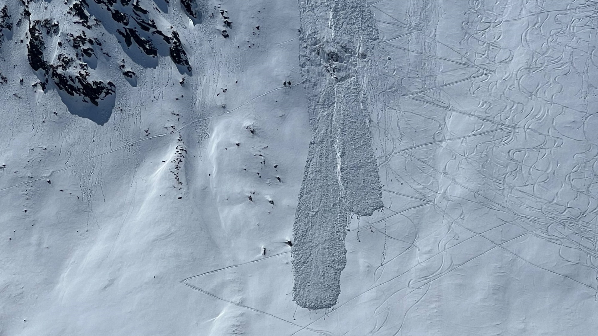
Spontane Lawinen und zahlreiche Risse auch im Bereich vom Festkogel in Obergurgl. Eindeutig war auch hier die bodennahe Schwachschicht für die Auslösungen relevant (©Hugo Reindl, 07.04.2026).
Two persons triggered this avalanche near the Festkogel in Obergurgl. They escaped without injuries. The ground-level weak layer was clearly responsible for the release (©Hugo Reindl, 07.04.2026).