Category: Current situation
-
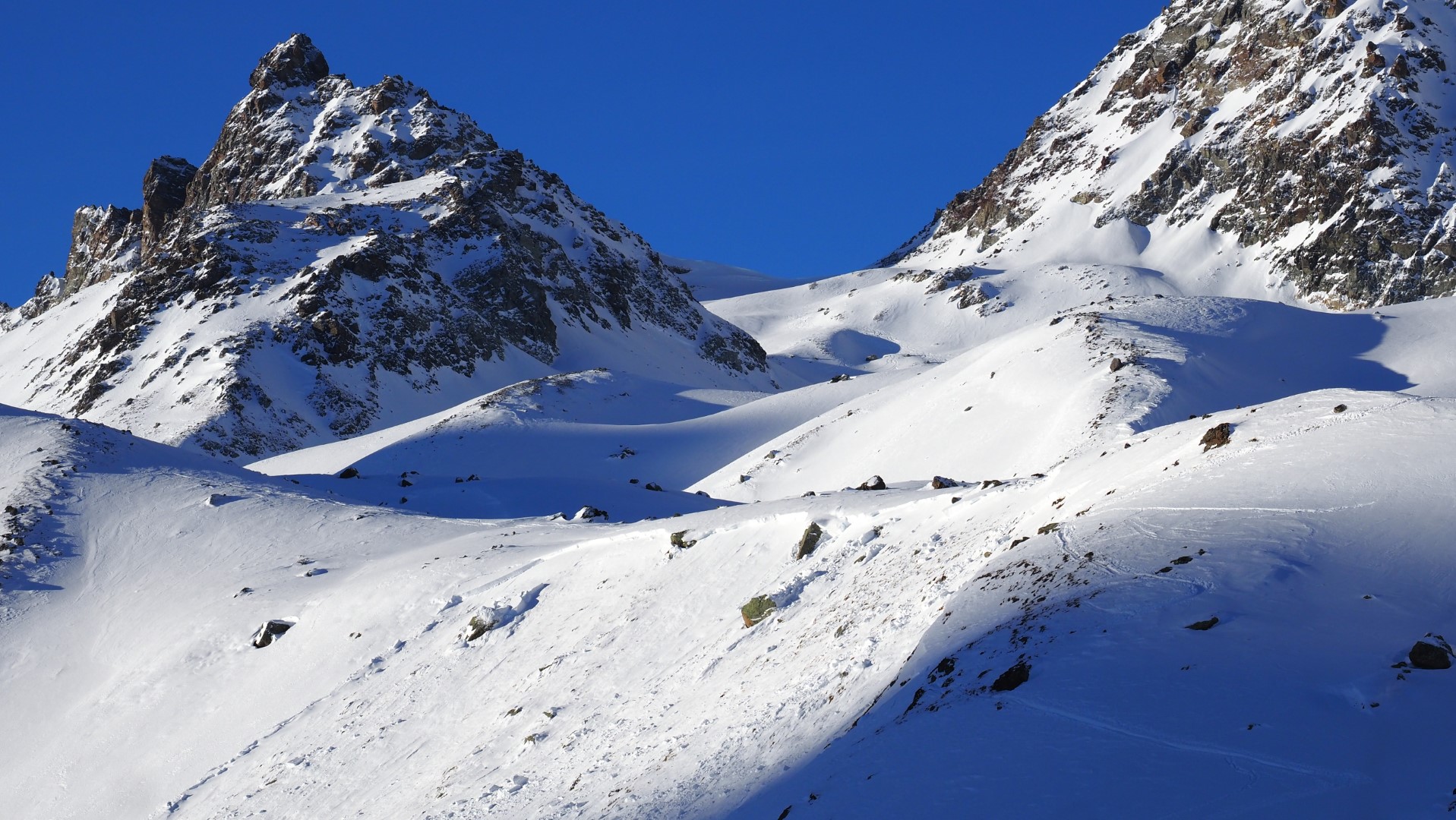
Despite calm situation, avalanche risks still threaten
All last week we were confronted by a rather treacherous avalanche situation. The dominant problem: persistent weak layers. In the interim it is clear, at least in those regions with less snow, how the near-surface layers are metamorphosing expansively to an increasing degree or else are going through melt-freeze processes on very steep sunny slopes.…
-
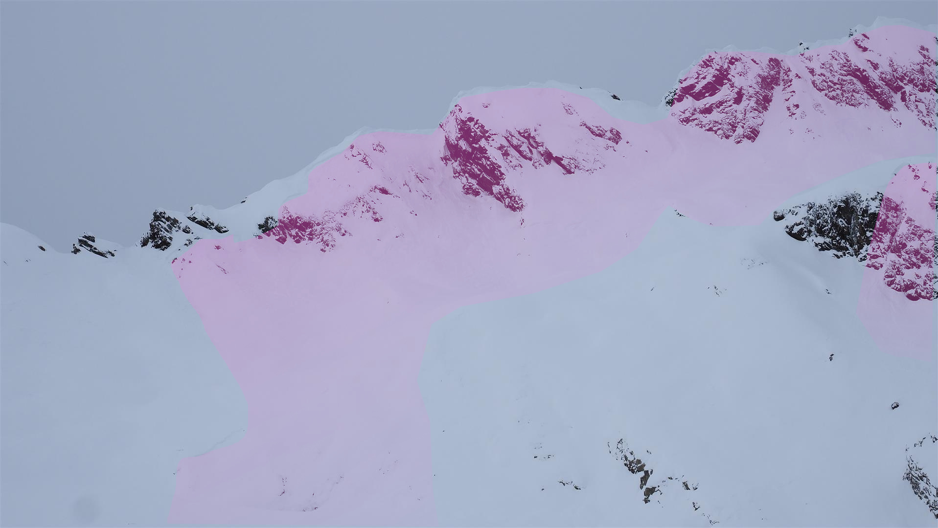
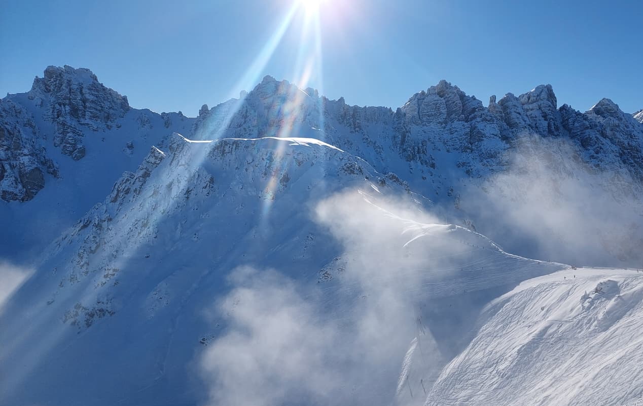
Only gradually receding avalanche danger. Wetterkreuz avalanche incident analysis.
Without much change, we are still faced with an extremely prone-to-triggering snowpack widespread. Reports we receive daily including today, 15.01, corroborate this assessment: reports of avalanche releases from winter sports enthusiasts, of settling noises, fractures on the surface and remote triggerings. Avalanche danger is receding continually, but only slowly. Experience and restraint are thus imperative…
-
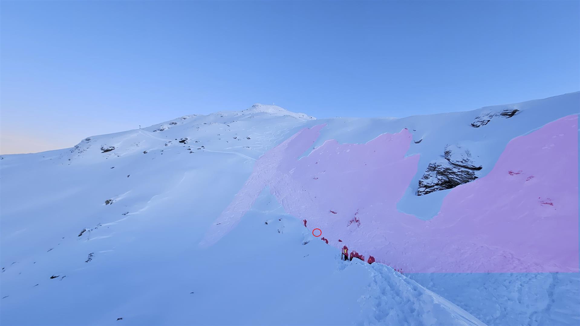
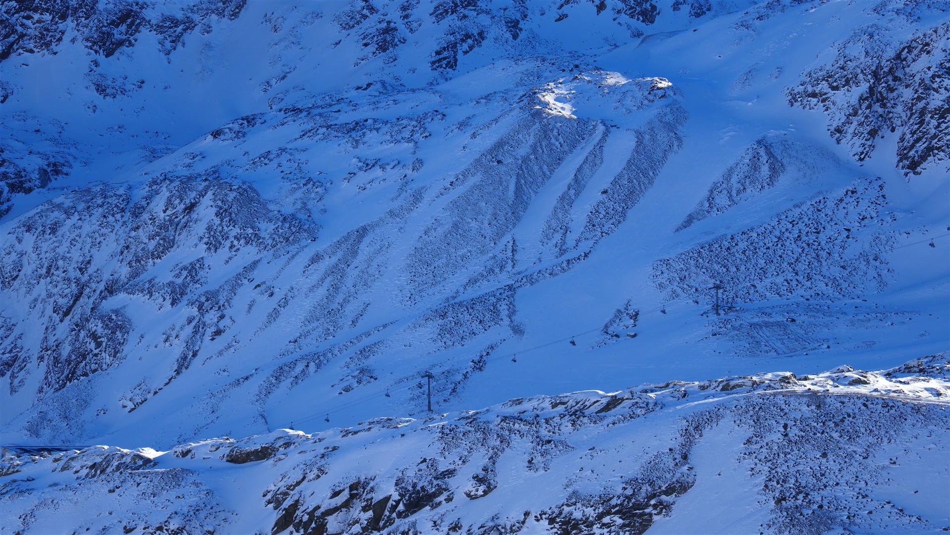
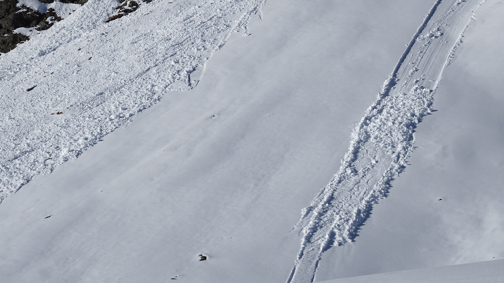
Sunday, 11.01.2026, numerous alarm signals: avalanche releases, fractures, settling noises, remote triggerings / A fatal avalanche incident
Our forecasts of an extremely trigger-sensitive snowpack on Sunday, 11.01, have been fully confirmed. Among numerous avalanche releases with personal involvement, 1 person was killed and 2 were injured. The regionally delicate avalanche situation and often highly prone-to-triggering snowpack will continue Avalanche releases: an overview Not an ordinary day: at Headquarters Tirol, 15 avalanche releases…
-
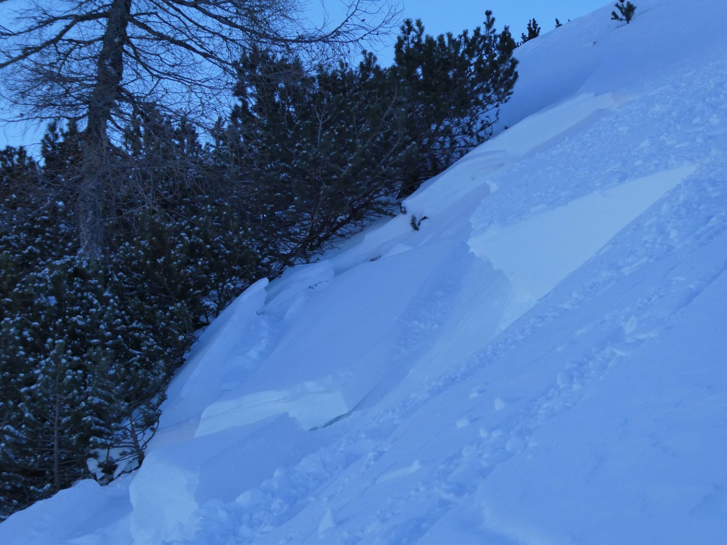
Snowfall after long period of cold – regionally a delicate, increasingly accident-prone avalanche situation
Following an extended period with very little precipitation and, in the end, very cold weather, a frontal system is bringing heavy snowfall to the western regions, expected to last through Sunday, 11.01.2026. The snow will fall on an unfavorably structured snowpack. Consequence: at least in the major areas of precipitation we will be subjected to…
-
2026 starts with scant snow, mostly low avalanche danger
High-pressure weather conditions prevailed last week, skies turning gray only briefly and little precipitation from region to region. But strong-to-storm strength winds, particularly along the Main Alpine Ridge, generated fresh, generally small snowdrift accumulations. The main danger for winter sports enthusiasts stems from these drifted masses, which are easy to recognize. Due to lack of…
-
Some fresh snow in East Tirol. Moderate avalanche danger regionally.
Punctually on Christmas Eve temperatures dropped to wintery levels and snowfall arrived down to the valley floor in East Tirol. About 10-20cm was registered in the mountains, nearly nothing in North Tirol. As a result of stiff easterly winds, snowdrifts accumulated from place to place, particularly where there was fresh fallen snow. Most were small…
-
Low danger, isolated avalanche prone locations, esp.in high alpine regions
Low avalanche danger continues to prevail in Tirol. The possibilities for tours in outlying terrain are still quite limited. Isolated danger zones for slab avalanches occur mostly in high alpine regions, increasingly frequently near ridgelines and behind protruberances in the terrain. The risks of falling often outweigh those of being buried in snow masses. Caution:…
-
Low avalanche danger widespread, not much snow
The avalanche situation in Tirol is favorable, but adequate backcountry tours are scant due to lack of snow. At least until the end of next week, high-pressure front weather will predominate, thus, no change is in sight. For this juncture of the season: too mild, too sunny, too dry. Few danger zones for avalanches to…
-

Avalanche prone locations mostly in very steep shady terrain above 2400m
Avalanche danger has receded over the course of the week. Moderate danger still prevails above 2400m from region to region in North Tirol, otherwise the danger level is low. Caution still urged especially on very steep shady slopes at high altitudes. Only few avalanche prone locations, lots of spots lacking much snow The Snowpack A…
-
Daily avalanche bulletins start. Caution: weak old snow, esp. on high shady slopes.
Slab avalanches triggered by persons today, Thursday, 27.11.2025, demonstrate the current situation: very unstable. Caution urged particularly on very steep shady slopes above 2200m, where faceted weak layers in the old snow are prone to triggering. One single individual can release an avalanche in some places. In the regions of North Tirol with the most…