Author: Jeffrey McCabe
-
Tense avalanche situation: self-restraint imperative over the next few days
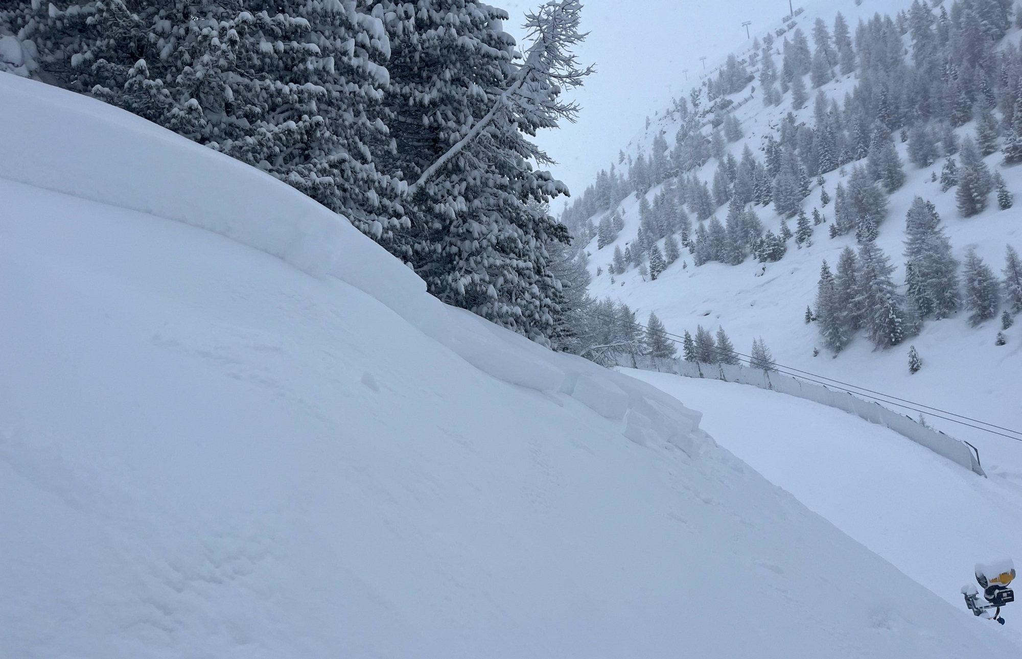
Since Tuesday afternoon (05.03) there has been up to 80 cm of fresh snow registered regionally in the mountains. The fresh fallen snow covers an old snowpack which has marked weak layers in the uppermost part. Reports from observers about naturally triggered avalanches and artificial triggerings with explosives confirm the tense situation. Over the next…
-
Snowpack moistened, weakened by variable weather
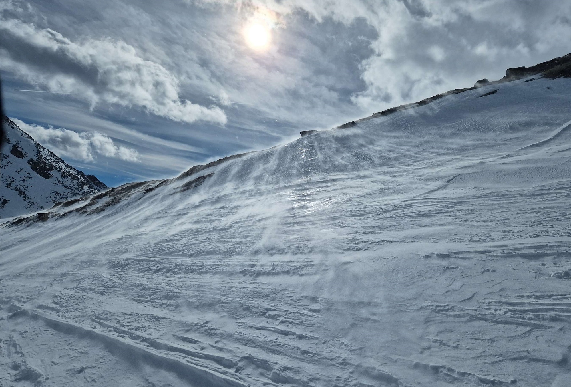
For the coming days Geosphere Austria has forecast variable weather conditions. Rainfall is expected up to intermediate altitudes at least. Starting Saturday, 2 March, southerly foehn winds will arise, reaching storm-strength on Sunday, with more clouds in the south than in the north, and very mild. The variable weather includes diffuse light conditions which will…
-
Review of last weekend
At the forefront, fresh-snow problem, persistent weak layer The degree of each particular avalanche problem is what determines the Danger Level. Over the weekend (23-25.02) there was a fresh-snow problem and a persistent weak layer problem. The persistent weak layer came about due to shallow weak layers beneath near-surface crusts of the old snowpack until…
-
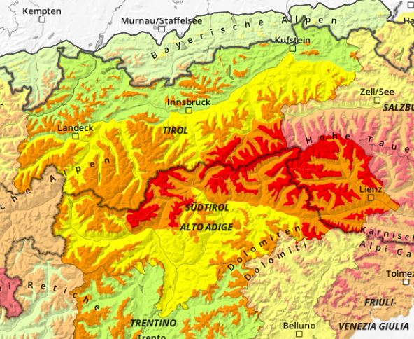
High avalanche danger regionally, lots of fresh snow
As a consequence of fresh snow, avalanche danger is increasing markedly throughout Tirol. Most of the snowfall is anticipated in East Tirol and in the eastern sector of the Main Alpine Ridge, where Danger Level 4, High, will be reached above the timberline. Particularly on Friday, naturally triggered medium-to-large sized slab avalanches are likely. For…
-
Predominantly favorable avalanche conditions
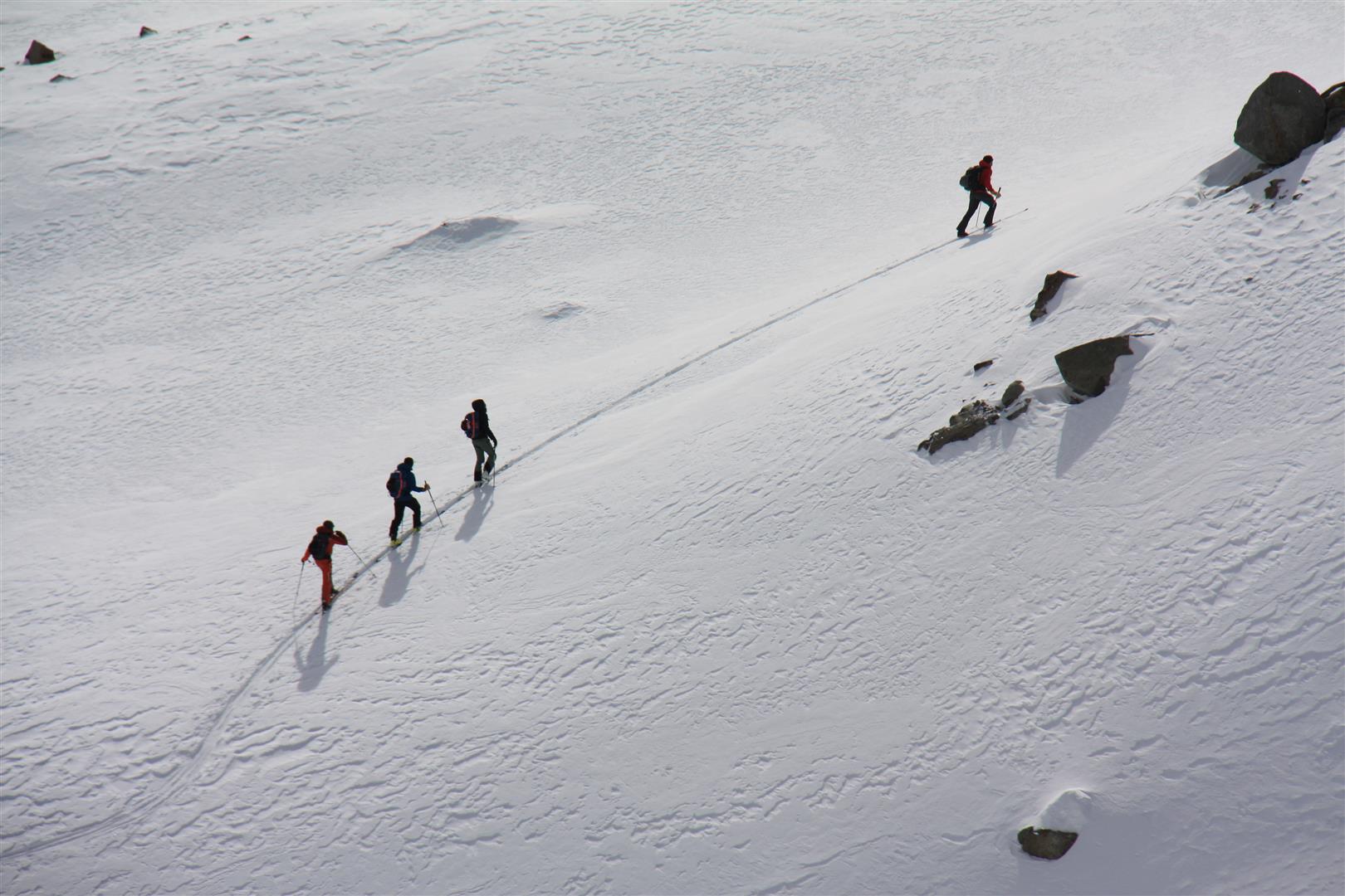
Last week there was a bit of snowfall: on the one hand, powder snow; on the other, trigger-prone snowdrift accumulations. All in all there were, and there continue to be, only a few avalanche prone locations in outlying terrain. We are saddled with a latent gliding snow problem and, for a short time, loose-snow avalanches…
-
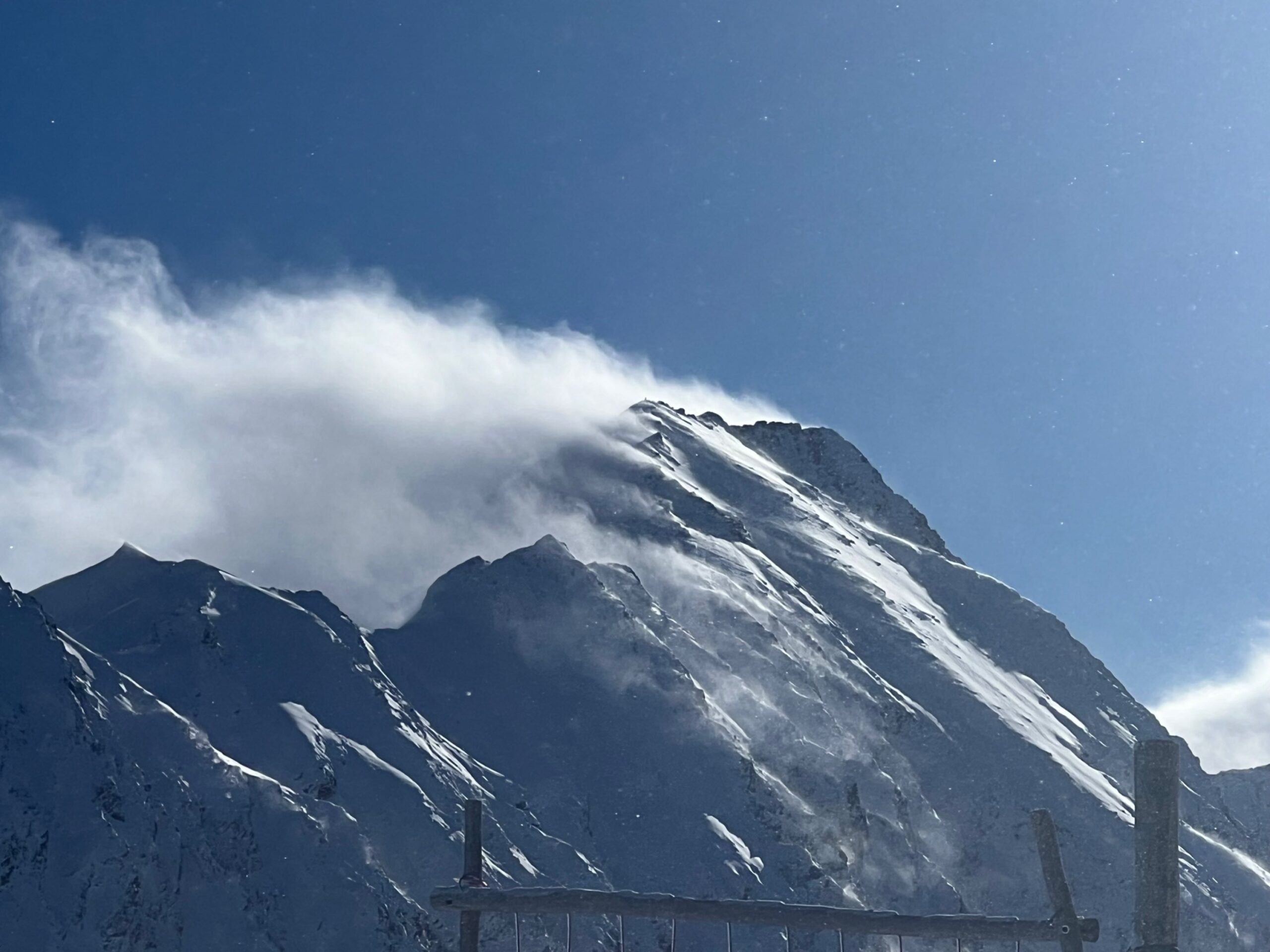
Increased avalanche danger due to fresh snow and wind esp. in the south
A southerly airstream will bring fresh snow to East Tirol starting on Friday, 9 February. On Sunday the precipitation will spread to North Tirol. Only minor amounts of fresh snow are anticipated. Due to strong-velocity southerly winds, fresh snowdrift accumulations will be generated which on shady slopes will be prone to triggering. In regions where…
-
Short-lived snowdrift problem, loose-snow/glide-snow avalanches
In North Tirol and northern East Tirol it is snowing on 1-2 February amid strong NW winds and generating fresh snowdrift masses. These will be prone to triggering for a brief spell. At latest on Saturday, 3 February, we expect (due to solar radiation) increasingly frequent loose-snow avalanches in extremely steep terrain. Glide-snow avalanches are…
-
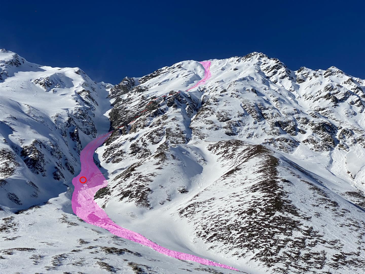
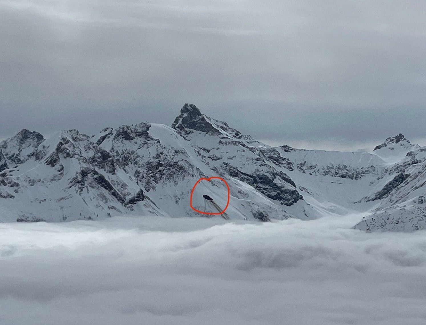
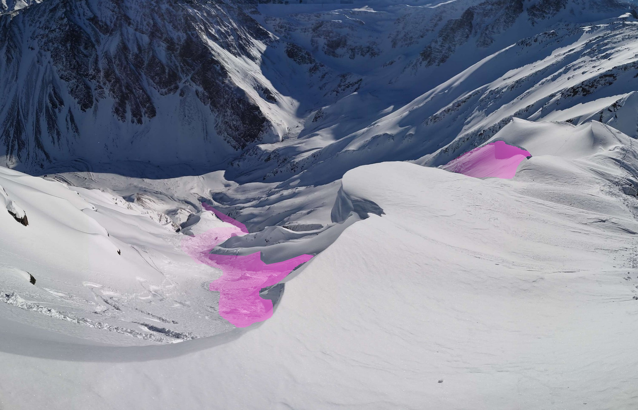
Avalanche incident analysis Gaiskogel (27.01.2024)
A fateful avalanche incident on the Gaiskogel in the Kühtai-Gegenkamm region caused a fatality on 27.01.2024. The cause was a near-surface persistent weak layer including the snowdrift accumulations recently deposited on top of it. Sequence of events Three persons marched from the Kühtai ski area to the Gaiskogel (2820 m) east of the Dreisenhütte. On…
-
Near-surface persistent weak layer regionally above 2600 m! Caution esp. on very steep sunny slopes!
The avalanche triggerings and reports from 27.01.2024 corroborate the approaching persistent-weak-layer problem reported in the Blog on 26.01.2024. For that reason we had to update the 27.01 report in the evening and ratchet up the danger level in the relevant regions to considerable. We advise for the moment to circumvent very steep sunny slopes above…
-
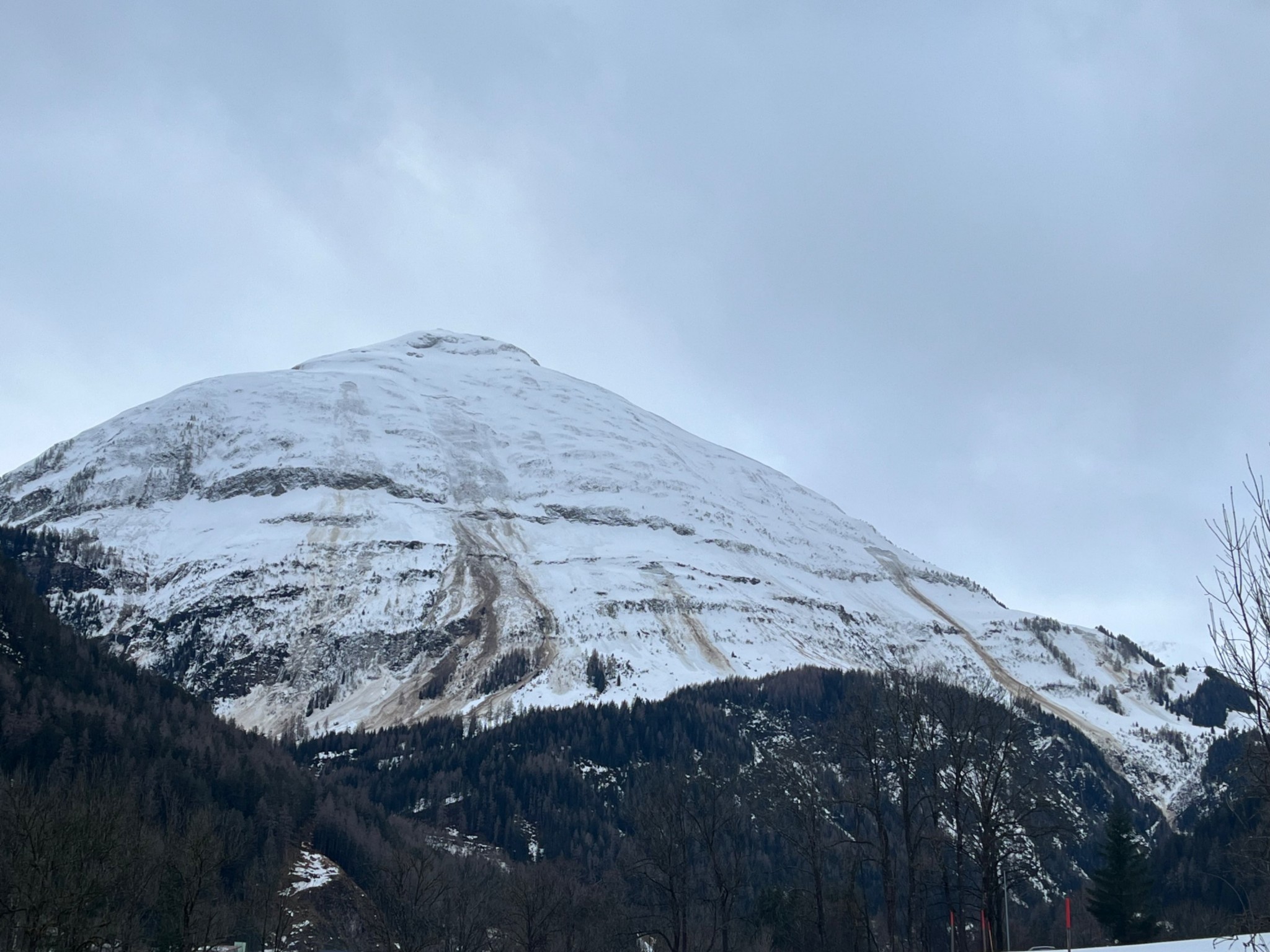
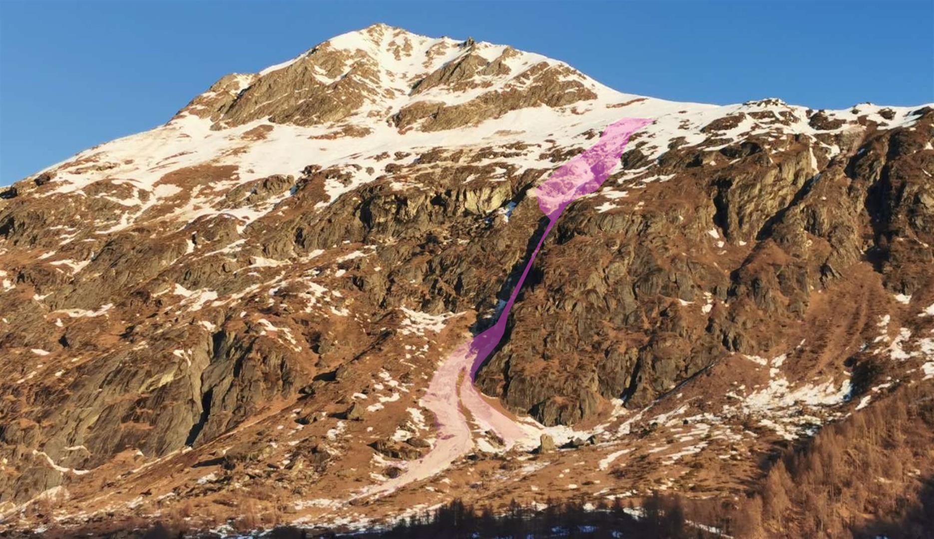
Increased gliding snow, high altitude snowdrifts
Yesterday, 26.01.2024, four avalanche reports were received at Tirol headquarters, two in which persons were involved. One person was severely injured. Both gliding snow and snowdrifts were the underlying problems/causes. Avalanches where gliding snow was the main problem Marchlehn gulley near Tieflehn The most serious avalanche occurred yesterday on 26.01.2024 in rear Pitztal. In the…