Unregelmäßige Schneeverteilung und wenig Schnee (© LWD Tirol, 18.12.2025)

Low danger, isolated avalanche prone locations, esp.in high alpine regions

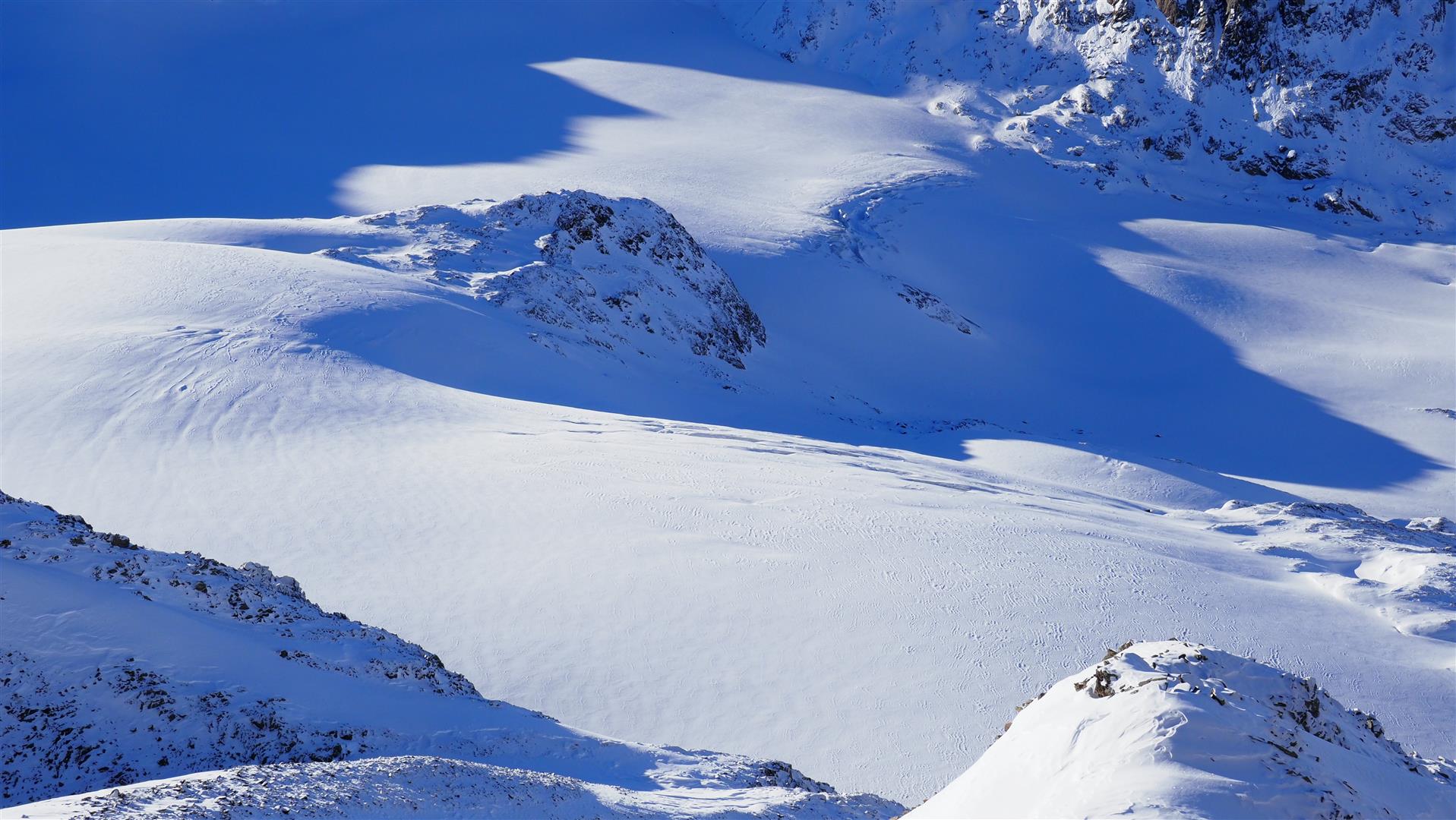
Low avalanche danger continues to prevail in Tirol. The possibilities for tours in outlying terrain are still quite limited. Isolated danger zones for slab avalanches occur mostly in high alpine regions, increasingly frequently near ridgelines and behind protruberances in the terrain. The risks of falling often outweigh those of being buried in snow masses. Caution: injury threatens through “sharks” since the snowpack is so shallow.

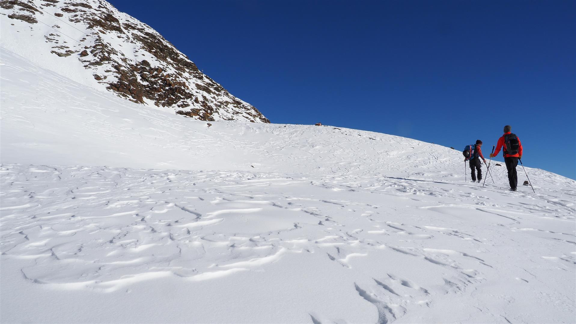
Favorable avalanche conditions, generally unfavorable touring conditions

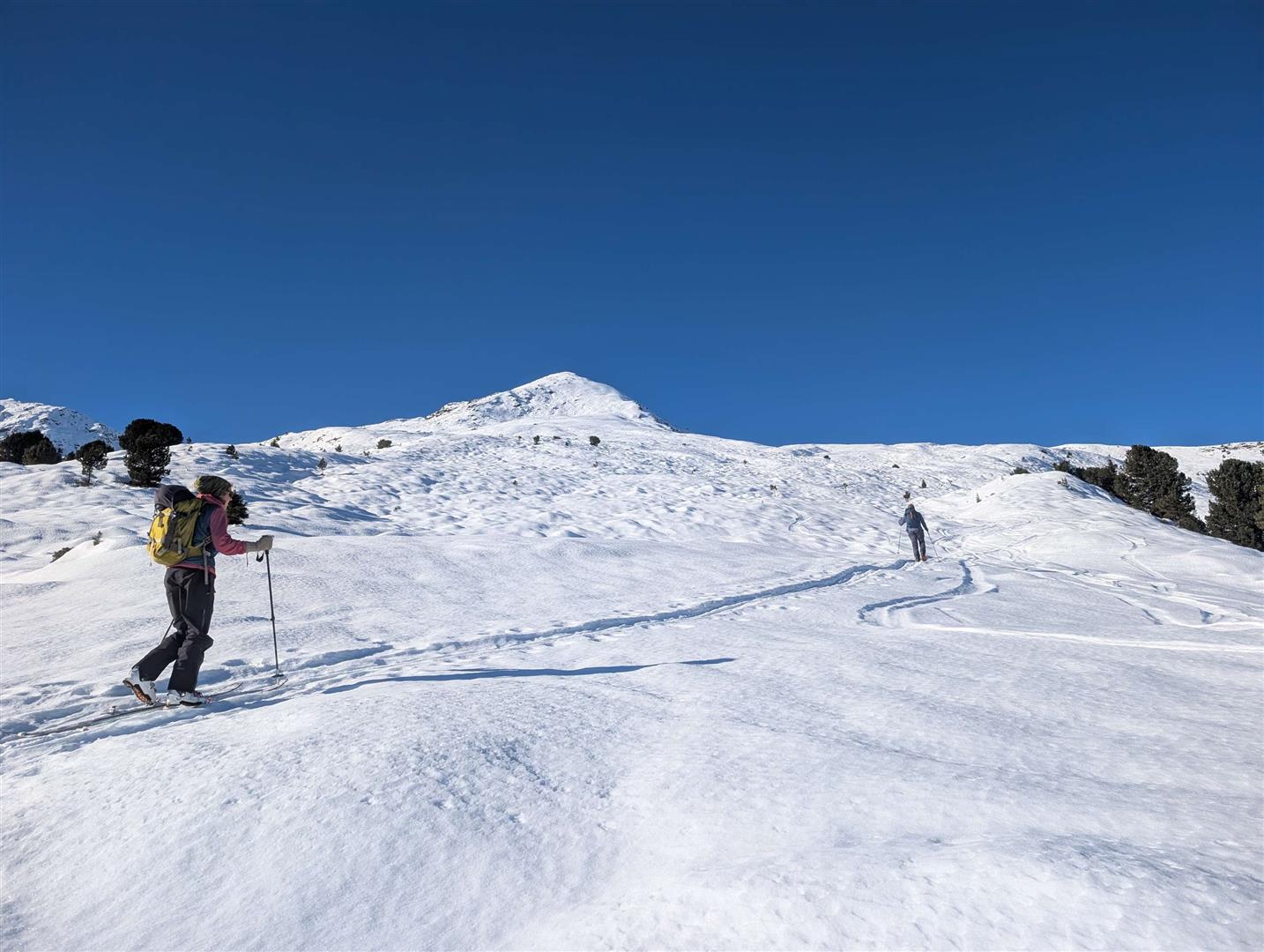
Since our last Blog not much has changed, neither in the avalanche situation nor the snow situation and backcountry touring conditions. Avalanche danger continues to be low, the snow continues to be lacking up to highest altitudes, tours in outlying terrain are correspondingly scant.

The weather

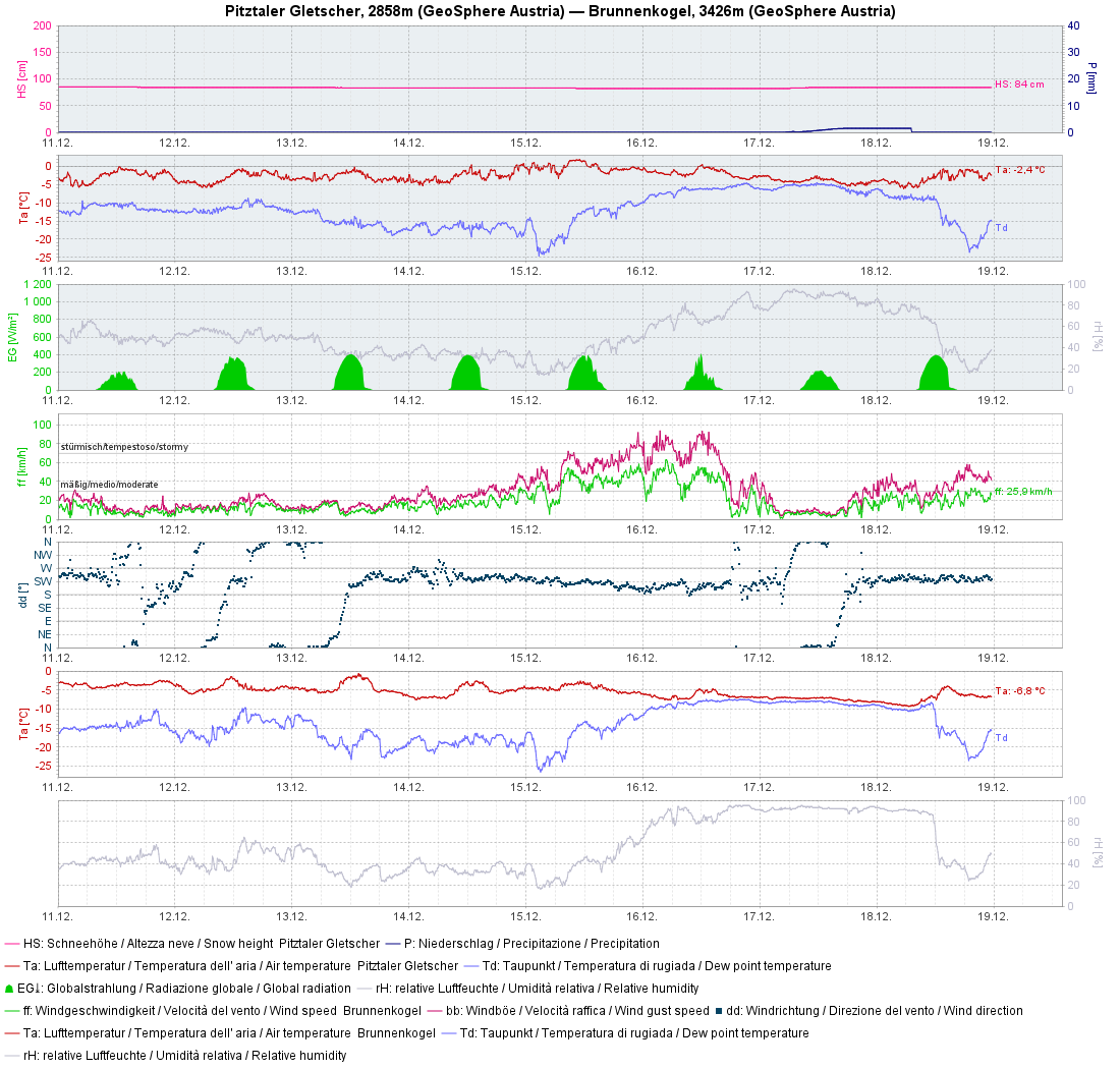
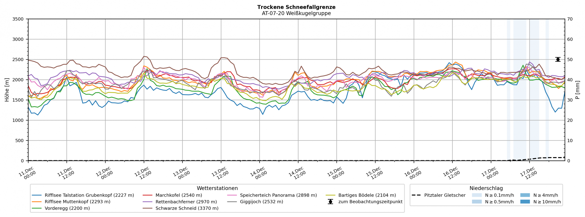
When examining weather conditions over the last week, three points jump to view: splendid weather prevailed for the most part, only on 15-16 December was there strong-to-stormy southerly wind and on 17 December a bit of precipitation (mostly rain up to 2000m). The dry-snowfall level (the altitude where snowfall is no longer moist, falls dry from the sky) fluctuated between 2200m and 2500m.

Wetterstationsgrafik vom Pitztaler Gletscher der vergangenen Woche: Anfangs durchgängig schönes Wetter, zunehmender Windeinfluss am 15.12. und 16.12. Am 17.12. etwas Niederschlag, dann wieder Wechsel zu Hochdruckeinfluss.
Graph from Pitztal Glacier weather station from last week: fine weather to start with, increasing wind impact on 15 and 16.12, some precipitation on 17.12, then high-pressure conditions returned.
Die berechnete trockene Schneefallgrenze während der vergangenen Woche: Niederschlag gab es nur am 17.12., der dort in Form der blauen Balken eingezeichnet ist. Die geringe Farbschattierung der Balken weist auf die geringe Niederschlagsintensität hin.
The calculated dry-snowfall level last week: precipitation occurred only on 17.12 (blue line in the graph). The weak color shade of the line indicates low intensity.

The snowpack

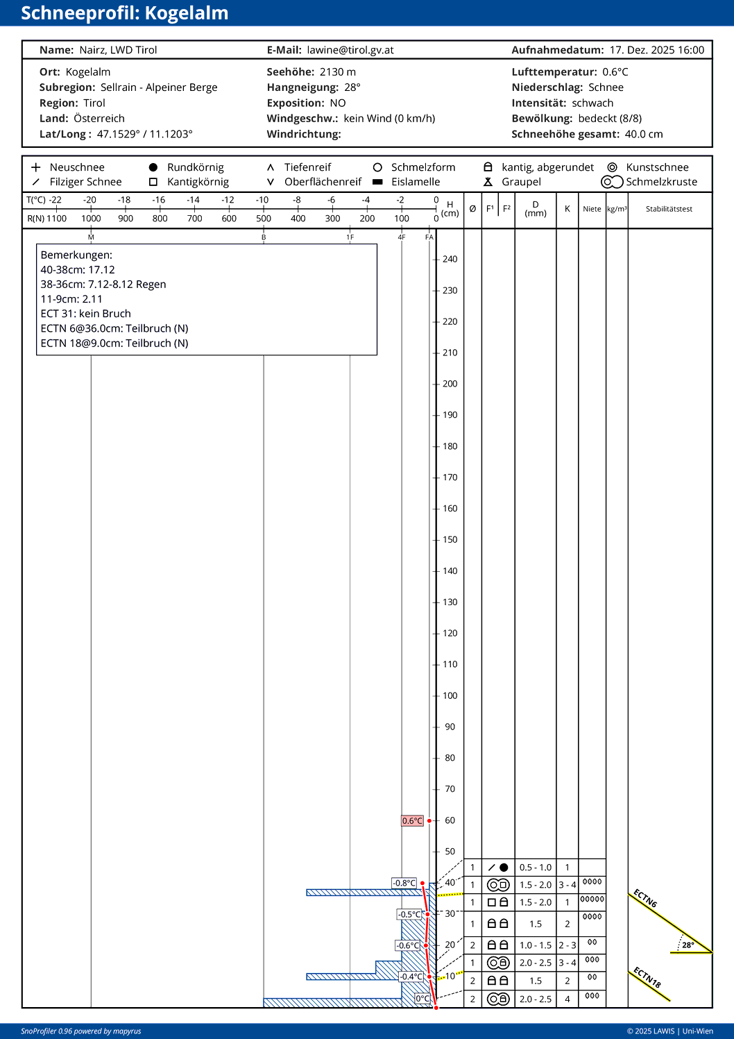
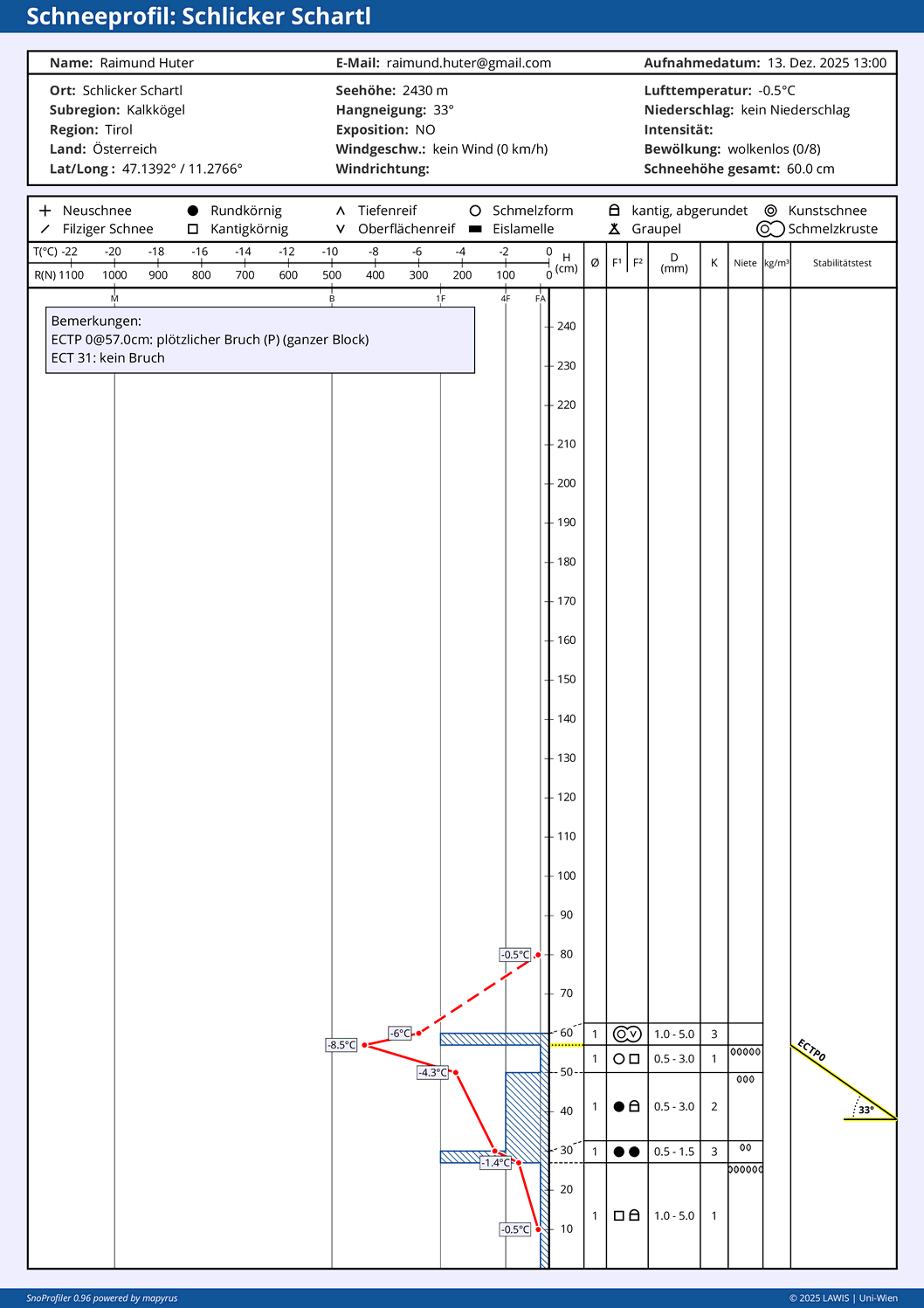
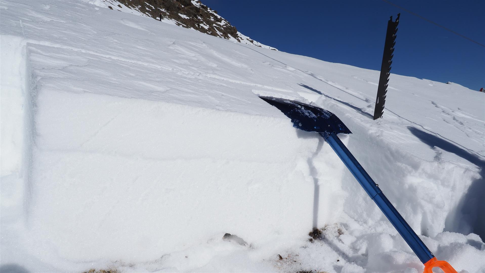
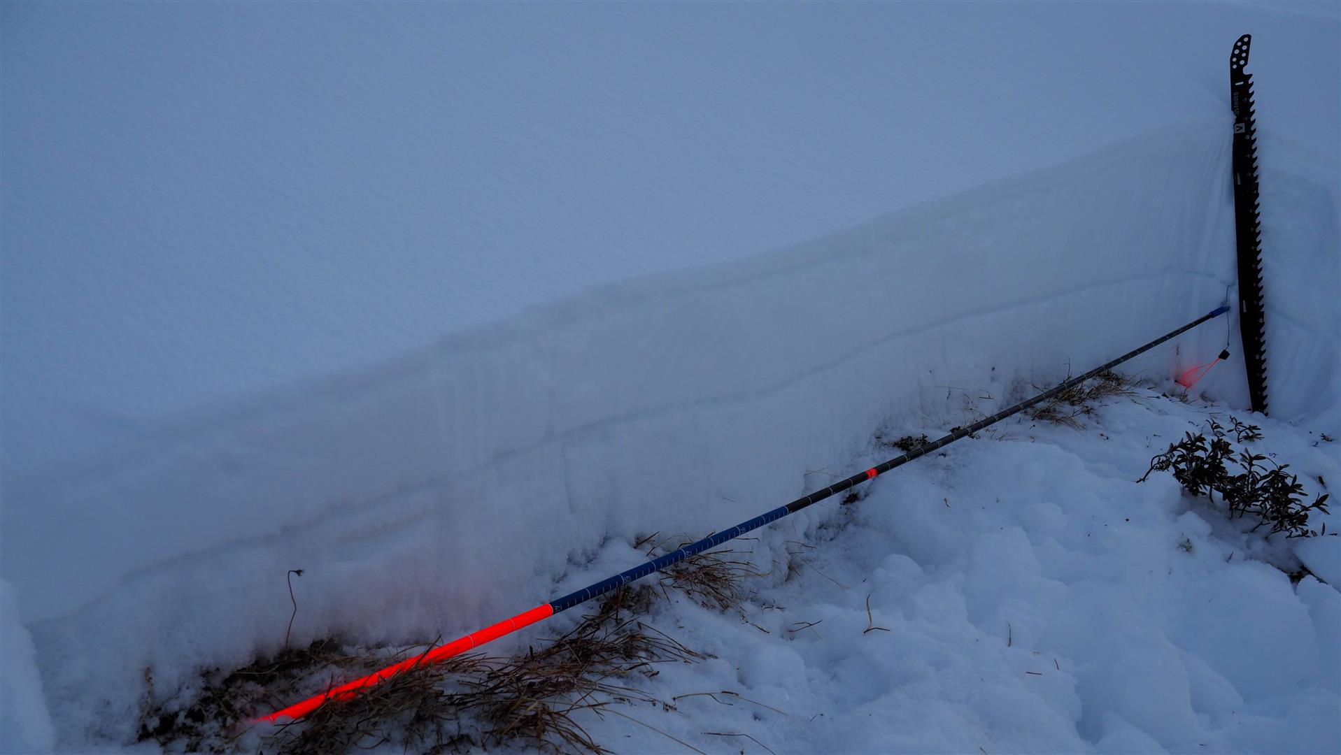
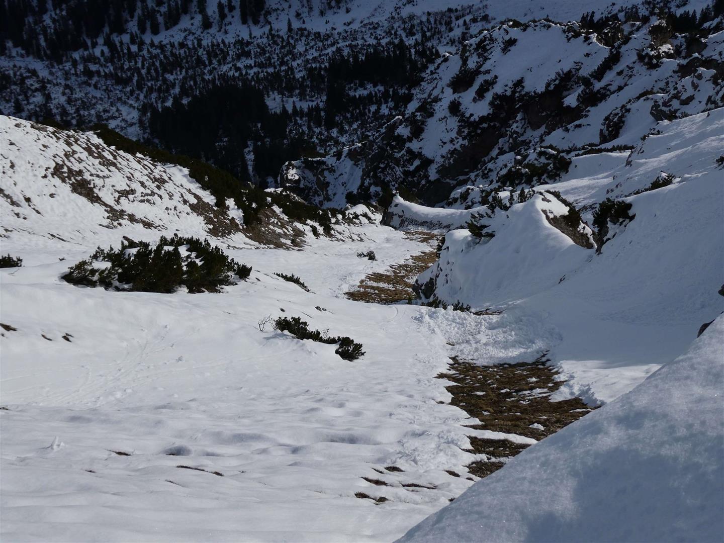
Apart from below-average snowdepths for this juncture of the season, it is the poor snow quality that jumps into view. What is striking is the persistent rain crust that formed as a result of rainfall on 7 and 8 December up to at least 2500m. Breakable melt-freeze crusts and “leg-breaking” snow was the result. In the interim on nights with clear skies, faceted crystals have often formed beneath the crusts. Simultaneously, these crusts are increasingly dissolving on shady slopes, in other words, slowly being “engulfed.”

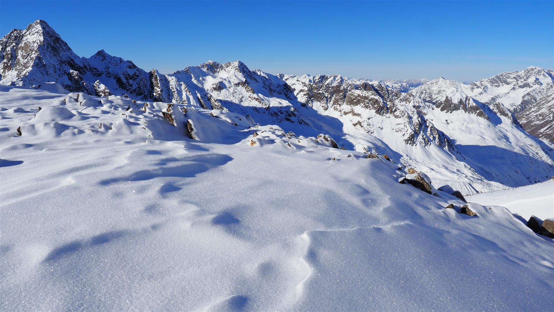
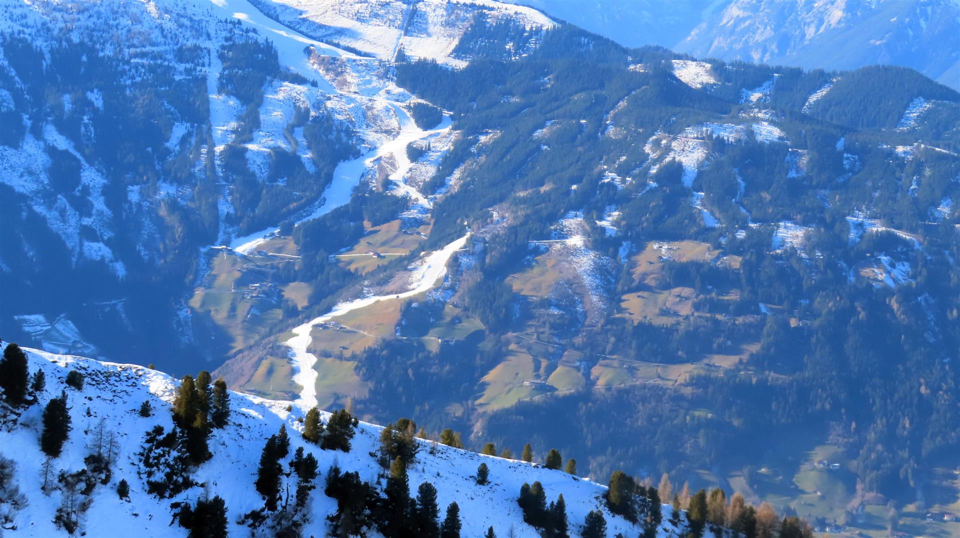
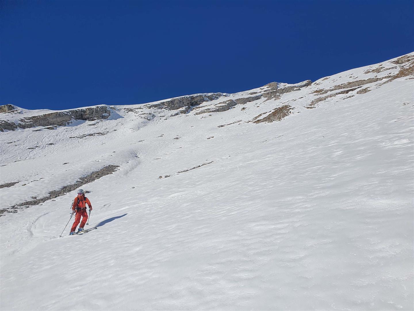
On sunny slopes, contrarily, the ground is increasingly becoming bare of snow. No wonder, when you consider conditions more reminiscent of spring! Accordingly, the snowpack (where there is one) moistened superficially on very steep sunny slopes during the daytime, then froze over during nights with clear skies so that a melt-freeze crust formed. We received some reports of good firn-snow descents.

Weak layers for slab avalances are currently found mostly in the form of faceted crystals (usually near crusts), occasionally also in the form of near-surface surface hoar blanketed by snowfall. Frequently the slab necessary for slab avalanches is lacking. Foehn-wind impact on 15-16 December generated new, small danger zones.

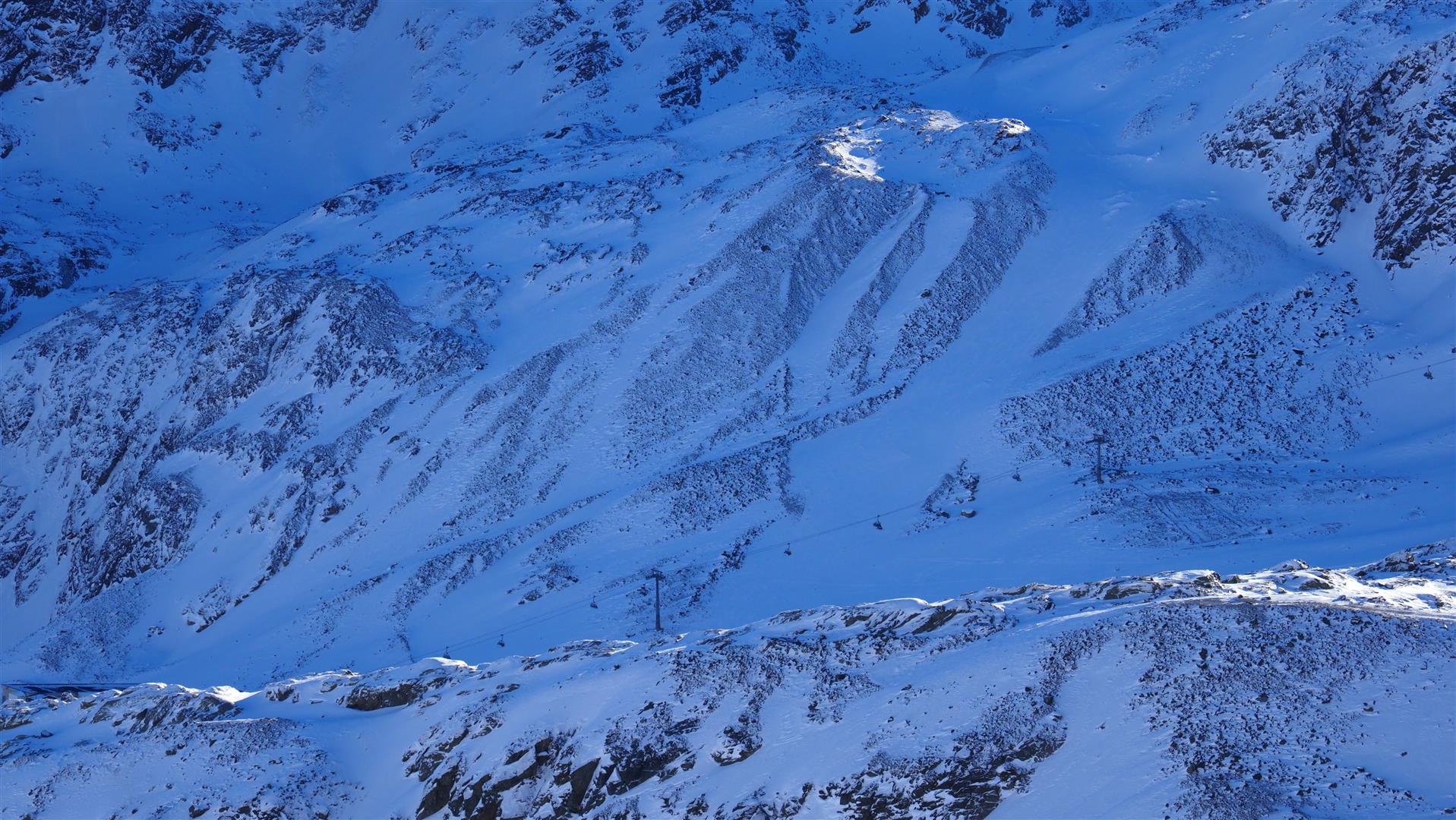
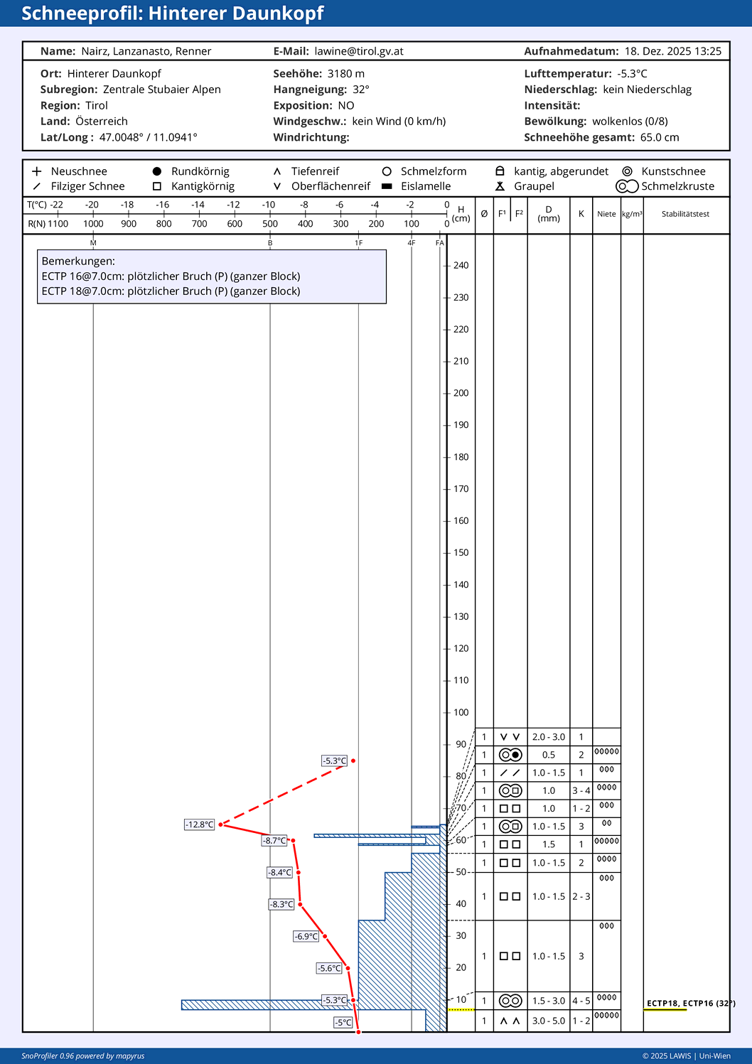
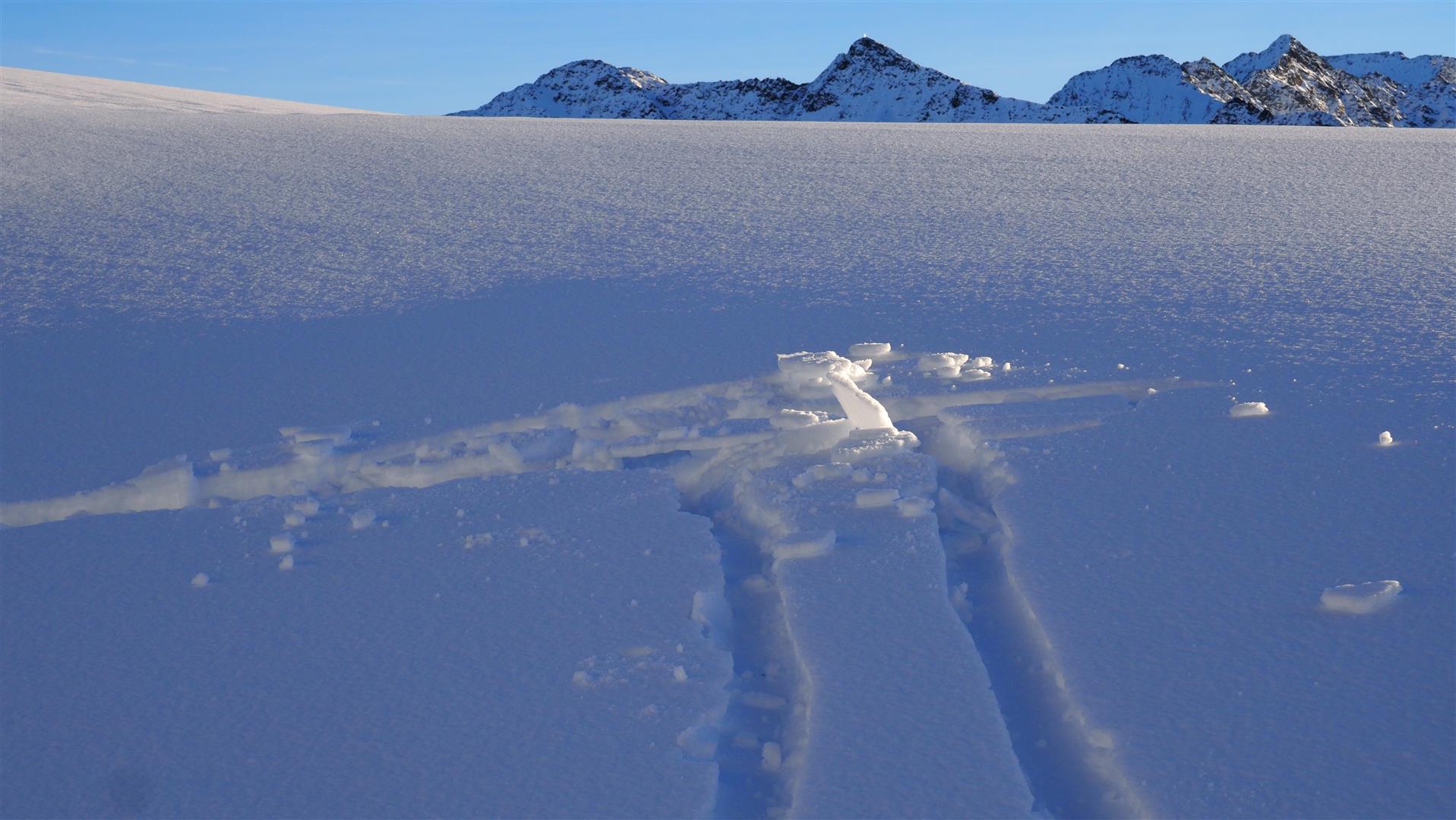
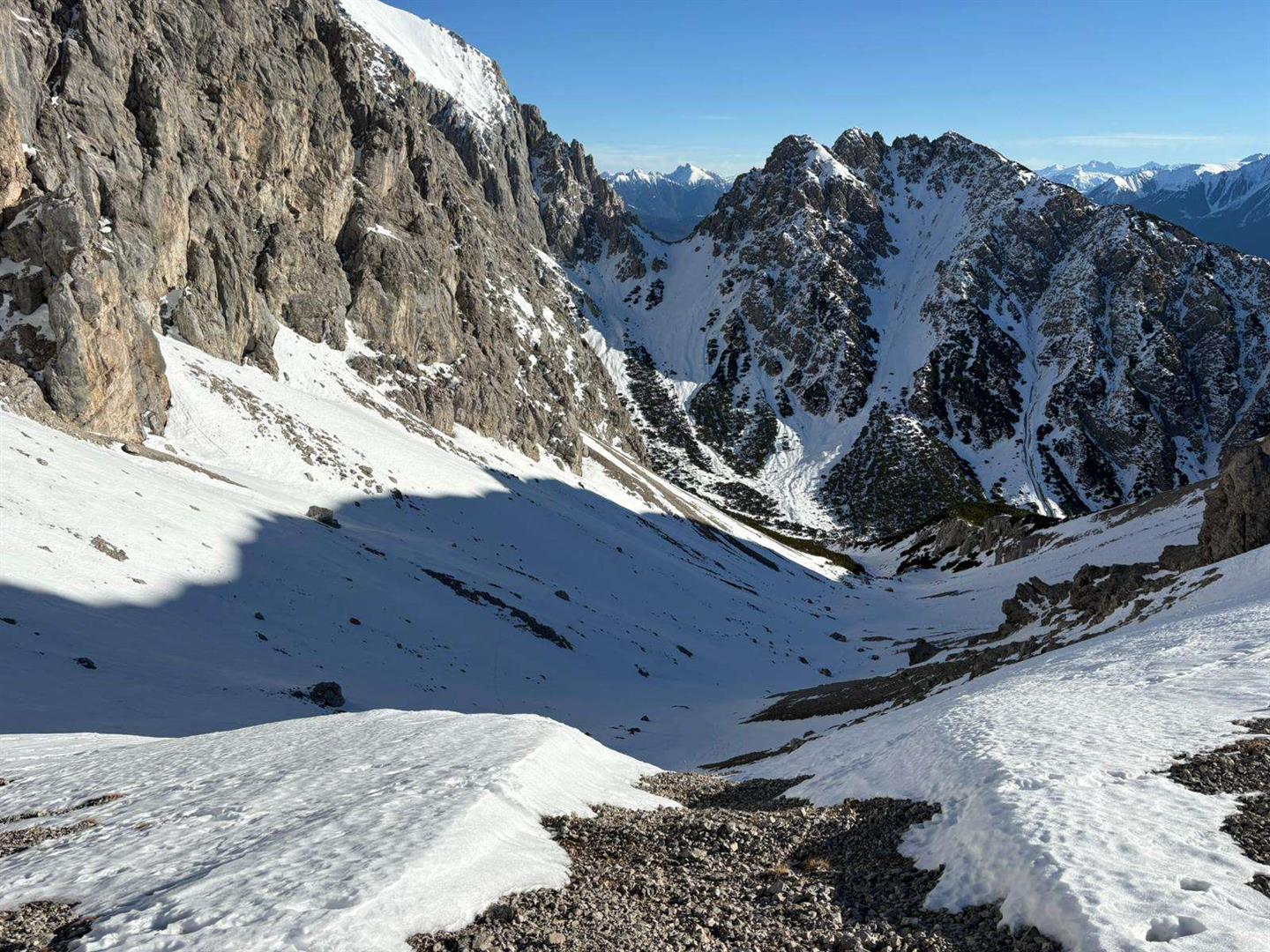
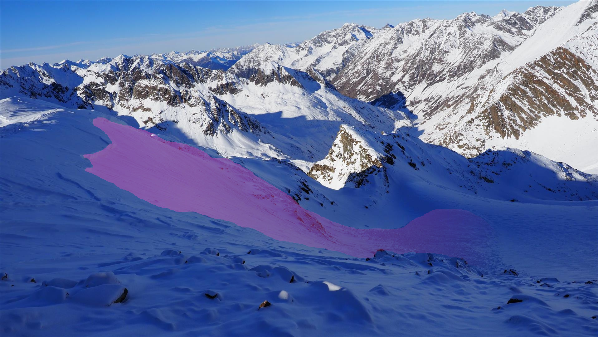
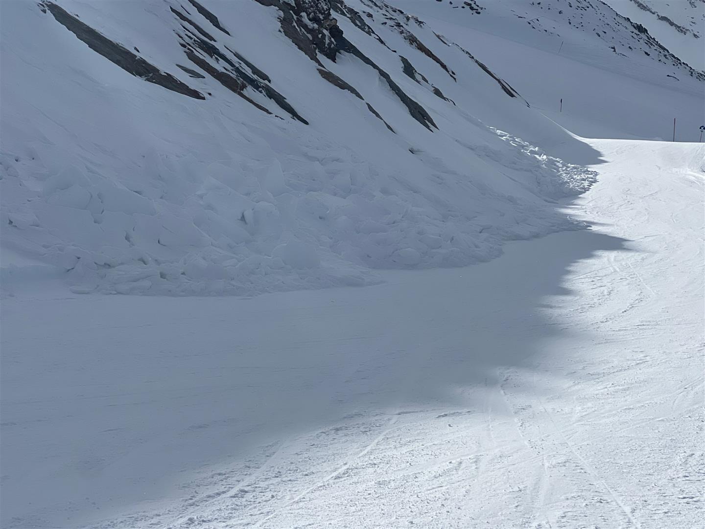
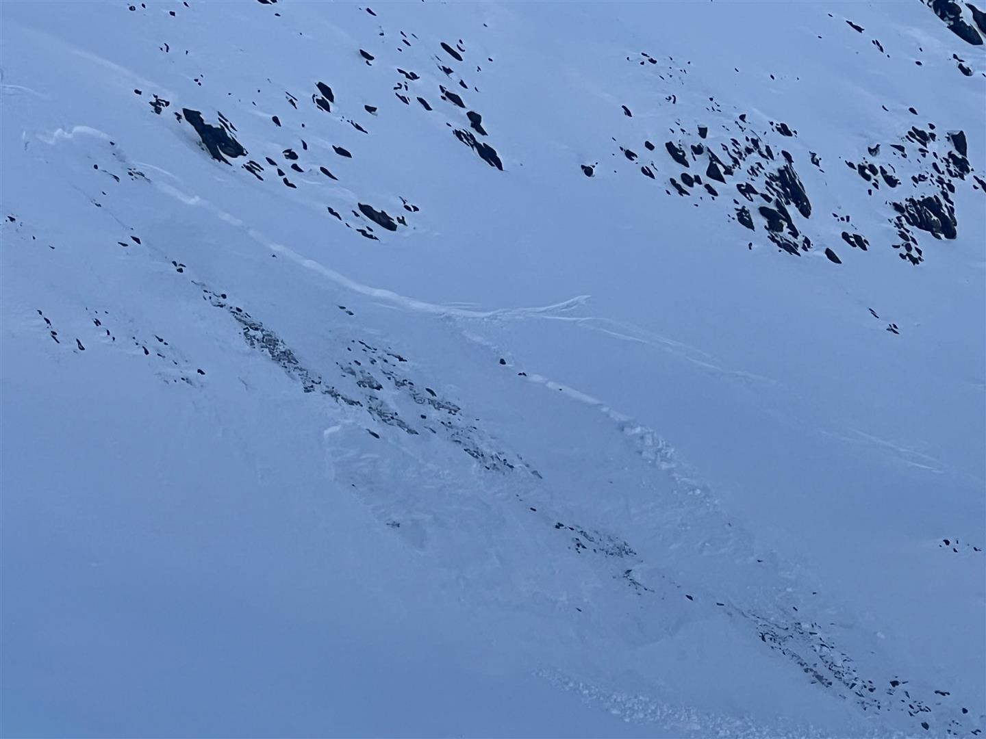
Weak layers in high alpine regions constitute the exception to a lacking slab, usually in the form of ground-level faceted crystals and rotten snow (often on glacier ice). Triggering this weak layer is currently unlikely, nevertheless it is possible. This was confirmed by an avalanche on Hinterer Daunkopf in the Stubai Alps on 13.12.2025, fortunately without injuries (see photo below).

Currently, the rainfall on 17.12 together with the relatively high temperatures has led to a further moistening of the snowpack up to about 2200m. During the nights of clear skies, a melt-freeze crust has again been able to form on the surface. After the perturbance had passed, reports of surface hoar again reached us.

Oberflächenreif vom 18.12.2025 auf ca. 3100m in den Stubaier Alpen (© LWD Tirol)
Surface hoar on 18.12.2025 at 3100m in the Stubai Alps (© LWD Tirol)

A few exemplary snow profiles

Schneeprofil in mittlerer Höhenlage. Nahezu 0°-isotherme Schneedecke. Markant die oberflächennahe Schmelzkruste vom 08.12., darunter bereits kantig.
Snow profile at intermediate altitude. Nearly 0°-isotherm snowpack. Striking: the near-surface melt-freeze crust on 08.12, the crystals beneath it already faceted.
An der Oberfläche die Schmelzkruste  vom 08.12. (samt Oberflächenreif), darunter ein inzwischen recht lockeres Gefüge.
On the surface, the melt-freeze crust of 08.12 (with surface hoar), beneath it a combination which in the interim is very loosely-packed.
Hochalpin bodennahe Schwachschicht. Profilstandort bei einem Lawinenanriss nördlich des Hinteren Daunkopfs vom 13.12.2025
In high alpine regions, a weak layer near ground level. Location of the profile: near an avalanche fracture north of Hinterer Daunkopf on 13.12.2025
Mögliche Schwachschichten findet man v.a. oberflächennah. Stubaier Alpen (© LWD Tirol, 18.12.2025)
Potential weak layers are found mostly near the surface. Stubai Alps (© LWD Tirol, 18.12.2025)
Markant war an diesem Profilstandort am Predigberg oberhalb von Galtür eine ausgeprägte Schwachschicht aus Oberflächenreif. (Die am 08.12.2025 aufgrund der Warmfront abgegangenen Schneebrettlawinen lösten sind meist bei dieser Schwachschicht) (© LWD Tirol, 11.12.2025)
The marked weak layer of surface hoar was conspicious at this snow profile location on the Predigberg above Galtür (which triggered slab avalanches on 08.12.2025 as a result of the warm front, mostly stemming from this weak layer). (© LWD Tirol, 11.12.2025)

Generally poor snow quality, danger of “sharks”

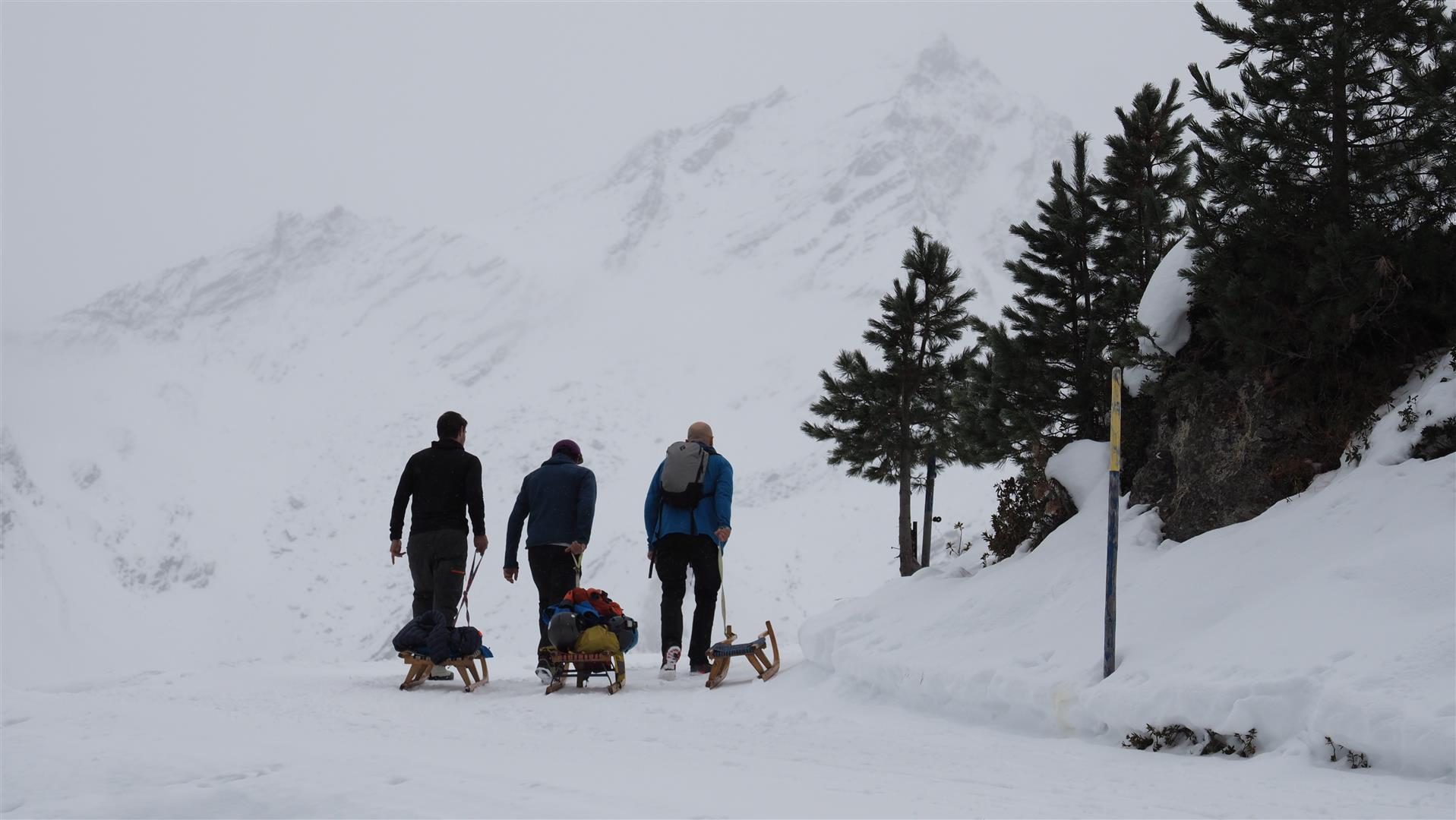
Photos speak more than a thousand words…

Bruchharsch trübt das Abfahrtsvergnügen. Hochalter, Grieskogelgruppe (© LWD Tirol, 09.12.2025)
Melt-freeze crusts cut short the joys of untroubled descents. Hochalter, Grieskogel Massif (© LWD Tirol, 09.12.2025)
Unterwegs im Großglocknerresort (© LWD Tirol, 18.12.2025)
En route in Grossglockner territory (© LWD Tirol, 18.12.2025)
Unregelmäßige Schneeoberfläche hochalpin aufgrund des Windeinflusses vom 15.12. und 16.12. Stubaier Alpen (© LWD Tirol, 18.12.2025)
Irregular snowpack surface in high alpine regions due to wind impact on 15-16.12. Stubai Alps (© LWD Tirol, 18.12.2025)
Unterwegs am Standkopf in den Kitzbüheler Alpen (© Reinhold Oblak, 15.12.2025)
Out in open terrain on Standkopf in the Kitzbühel Alps, often on a very hard snowpack surface (© Reinhold Oblak, 15.12.2025)
Abfahrt vom Pitzenegg im Außerfern (© Adrian Roth, 13.12.2025)
Descent from Pitzenegg in Ausserfern (© Adrian Roth, 13.12.2025)
Höllscharte im Mieminger Gebirge (© Daniel Haas, 13.12.2025)
Höllscharte in Mieming Massif (© Daniel Haas, 13.12.2025)
Am Weg zum Fotscherwindegg im Sellrain. (© Marina Hausberger, 13.12.2025)
On the way to Fotscherwindegg in Sellrain (© Marina Hausberger, 13.12.2025)

Avalanches

Following numerous naturally triggered avalanches during the night of 7-8 December (see the last Blog), very few reports of avalanche releases have been reported. The largest of them was triggered by persons on a north-facing slope of Hinterer Daunkogel (3180m, NE) in the Stubai Alps on 13.12. No one was injured.

Mittelgroße Schneebrettlawine vom 13.12. unterhalb des Ht. Daunkogels (© LWD Tirol, Foto: 18.12.2025)
Medium-sized slab avalanche on 13.12 beneath Hinterer Daunkogel (© LWD Tirol, photo: 18.12.2025)
Kleinräumig frischer, störanfälliger Triebschnee in Hochgurgl in den Ötztaler Alpen (© Hugo Reindl, 16.12.2025)
Small, freshly generated snowdrifts in Hochgurgl, Ötztal Alps (© Hugo Reindl, 16.12.2025)
Personenausgelöste Schneebrettlawine im Nahbereich des Wurmkogels in den Ötztaler Alpen (© Hugo Reindl, 12.12.2025)
Slab avalanche triggered by persons on 11.12.2025 near Wurmkogel at 2750m on a north-facing slope in Ötztal Alps (© Hugo Reindl, 12.12.2025)
Kleine Gleitschnee-Rutsche auf Grashängen können vereinzelt noch auftreten. (© Barbara Fink, 12.12.2025)
Small glide-snow slides on grass-covered slopes are still possible. (© Barbara Fink, 12.12.2025)

Assorted information

Crevices are only scantly covered on the glaciers…

Gut zu erkennen: Zahlreiche, wenig überdeckte Gletscherspalten, Sulztalferner (© LWD Tirol, 18.12.2025)
Easy to recognize: numerous, scantly blanketed glacier crevises, Sulztalferner glacier (© LWD Tirol, 18.12.2025)

A possible alternative…

Manche Rodelbahnen in Tirol sind immer noch in einem guten Zustand. (17.12.2025)
Some sledding runs in Tirol are still in relatively good shape. (17.12.2025)