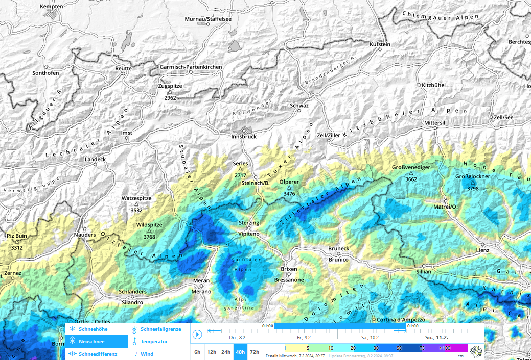
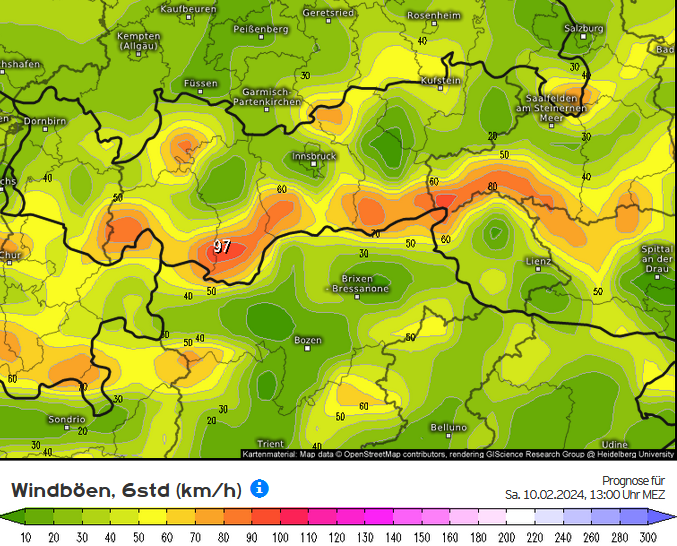
A southerly airstream will bring fresh snow to East Tirol starting on Friday, 9 February. On Sunday the precipitation will spread to North Tirol. Only minor amounts of fresh snow are anticipated. Due to strong-velocity southerly winds, fresh snowdrift accumulations will be generated which on shady slopes will be prone to triggering. In regions where snowfall is heavy, avalanches can reach medium size.
Current situation
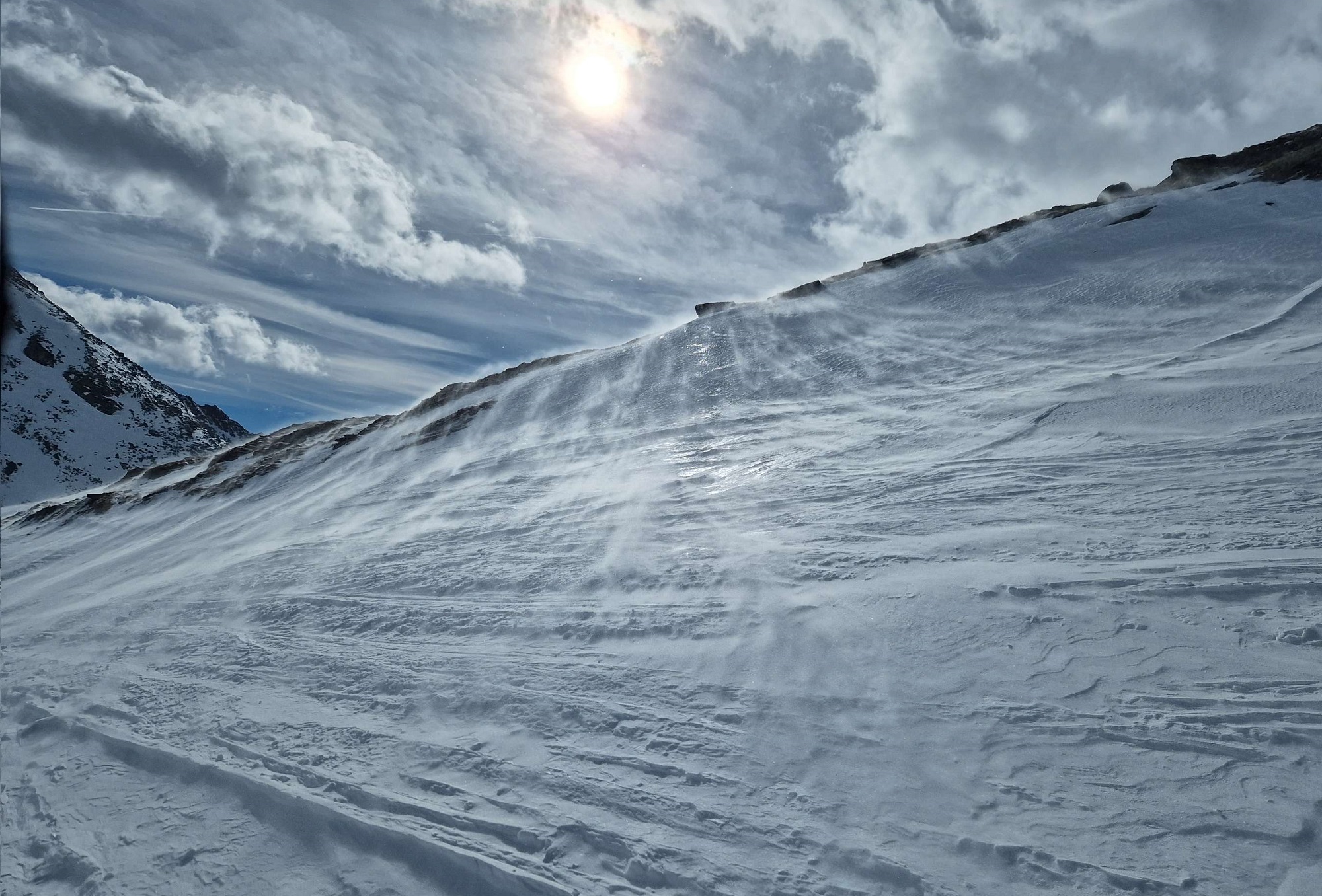
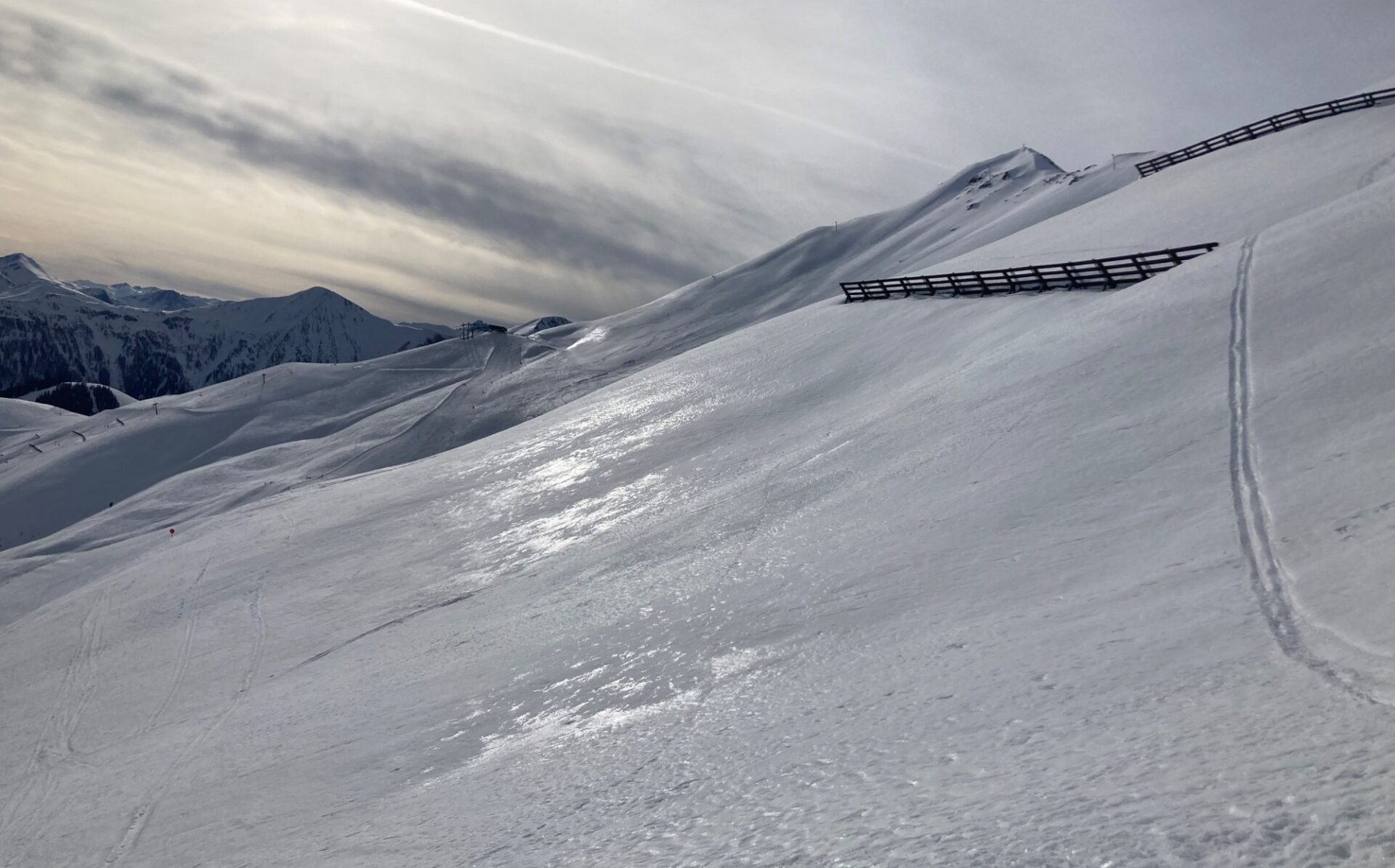
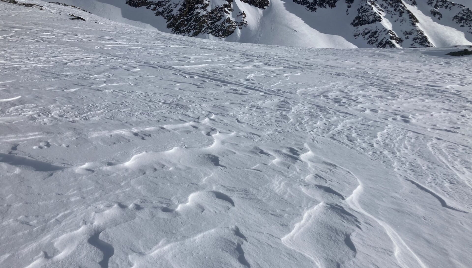
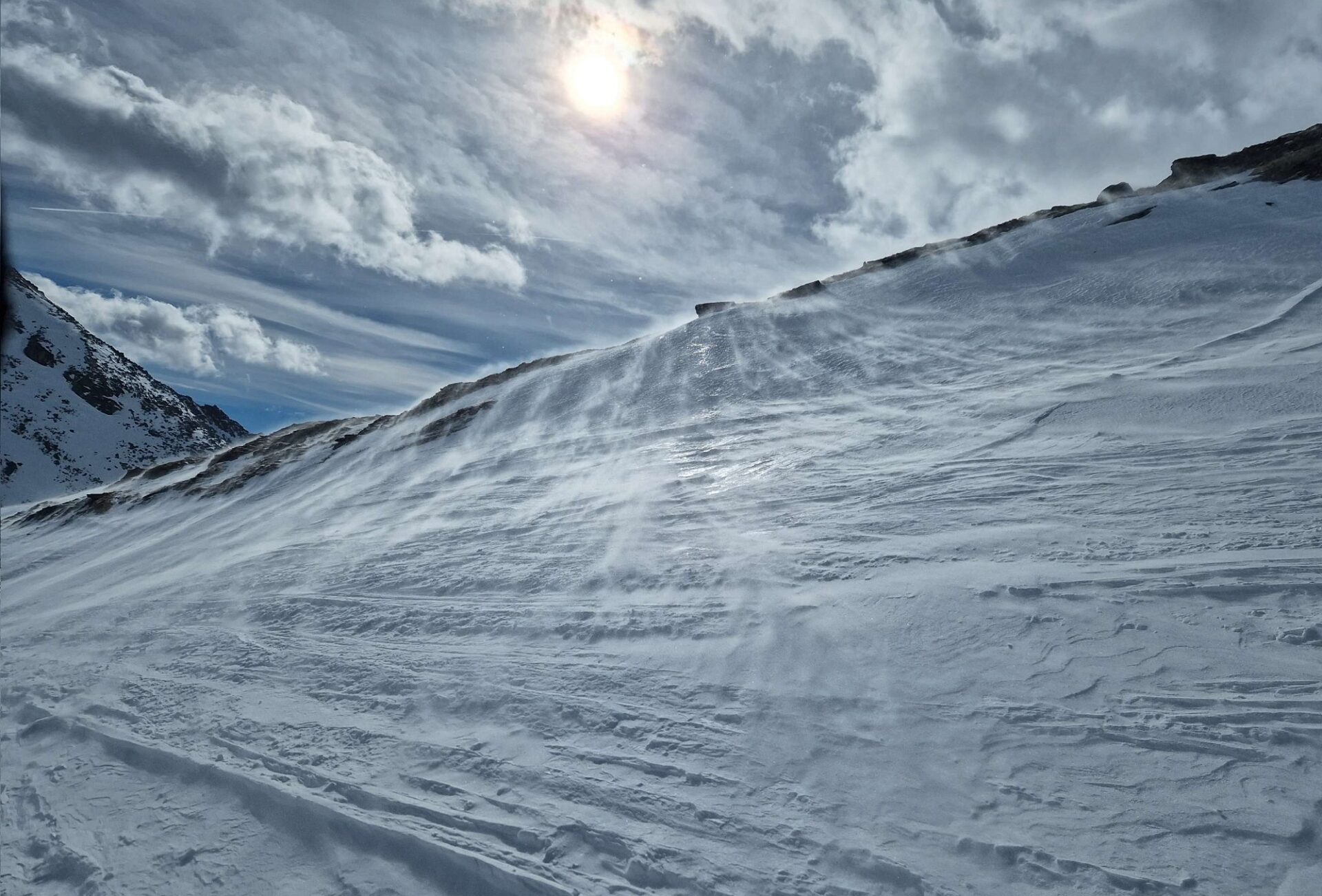
Snowdrift problem
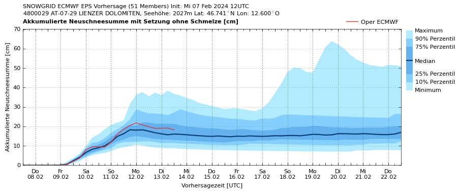
While in East Tirol the snowfall will commence early on Friday morning (09.02), in North Tirol there will only be strong-velocity southerly foehn wind blowing. Along the Main Ridge and southwards therefrom, 10 to 20 cm of fresh snow is expected, snowfall level at 1500-1700 m, more from place to place.
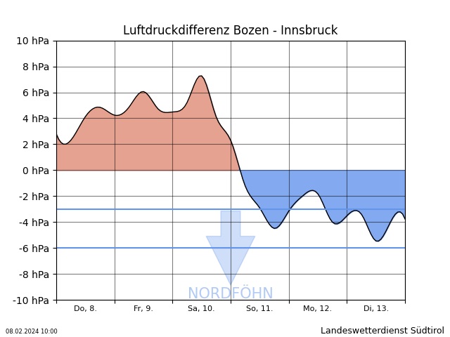
The southerly foehn wind will collapse on Sunday. By nighttime on Monday, 12.02, an additional 5-15 cm of fresh snow is expected, based on today’s forecasts.
The southerly foehn wind (as of Sunday, also westerly winds) will transport the loose fresh fallen snow and deposit it in wind-free areas behind discontinuities in the terrain, in gullies and bowls. The snowdrifts will often lie atop an irregular snowpack surface marked by winds, sun and higher temperatures. In those places the snow will bond well with the surface. The situation is less favorable on shady slopes, where there is often still loose snow in wind-free zones. This loose snow can – as soon as it is covered by snowdrift accumulations – serve as a weak layer. Avalanche prone locations occur above the timberline, esp at high altitudes, where such zones are more frequent and are also more trigger-prone. The snowdrift accumulations will often be small, but where more than 20 cm of fresh snow has fallen, medium-sized avalanches will be possible. In case of poor visibility the avalanche prone locations will be hard to recognize. Therefore, we advise avoiding very steep shady slopes, esp. in regions where there has been heavy snowfall.
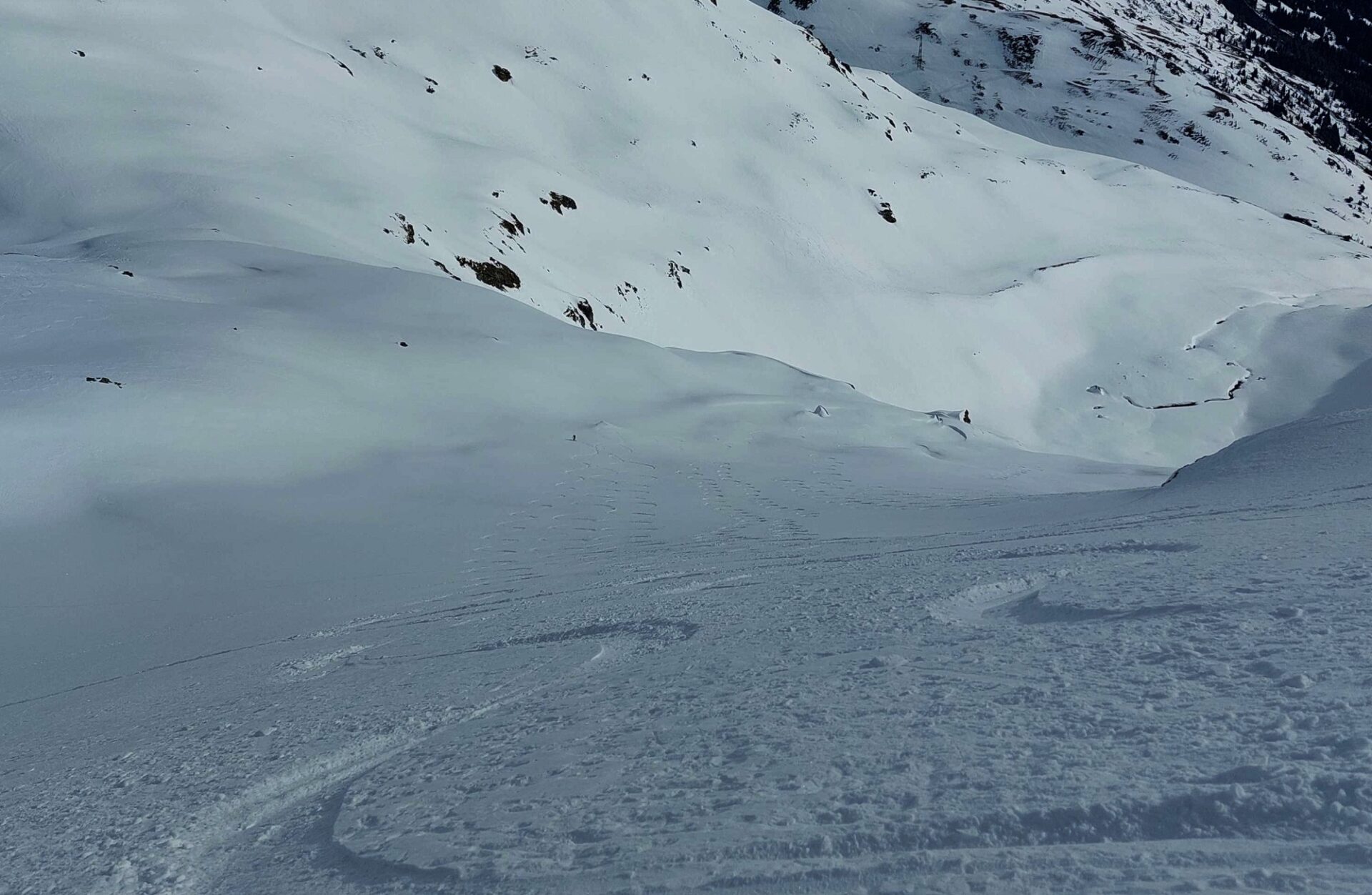
Gliding-snow problem
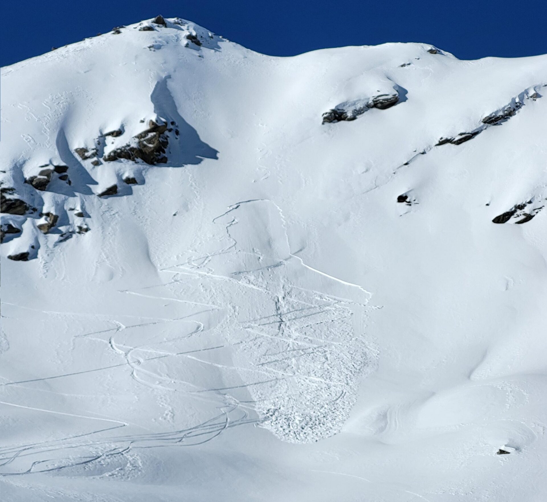
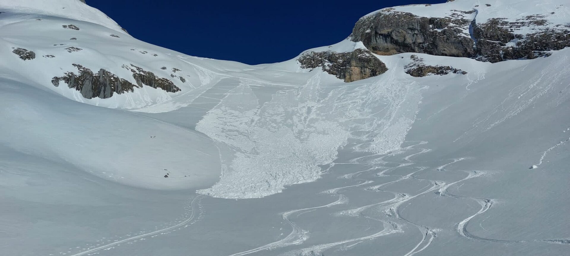
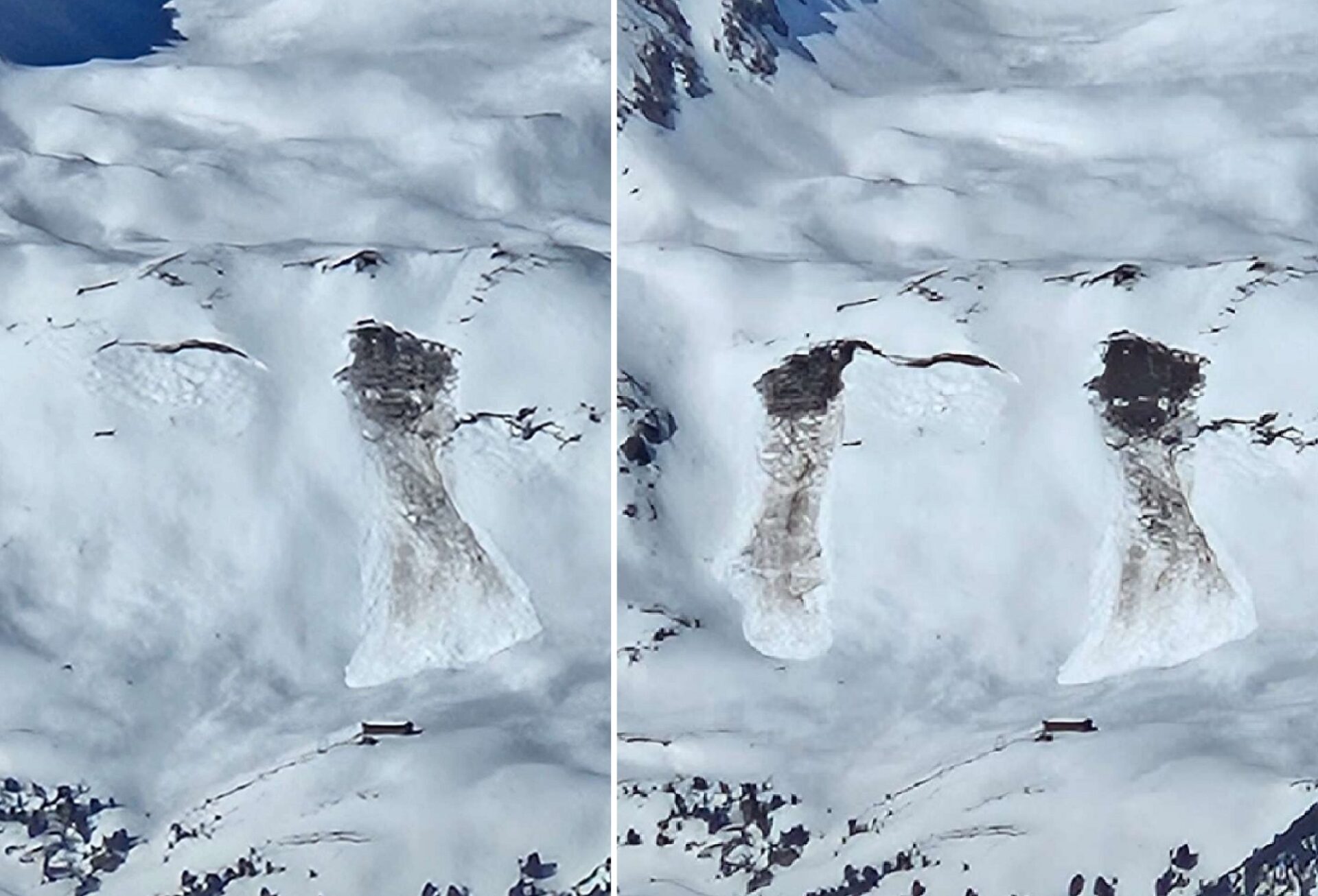
No blog is possible this winter without a shot of a glide-snow avalanche. The latent danger will persist onward. What matters most: glide-snow avalanches are utterly unpredictable. Zones below glide cracks or slopes with obvious signs of gliding snow masses should be avoided whenever possible.
A brief review
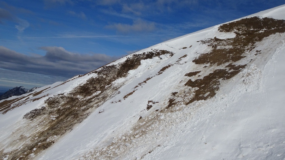
There isn’t much to report from last week. Following minor snowfall during the early hours on Friday, 02.02, sunny and overly mild weather took over. The NW winds were strong, esp. on the weekend and shortly thereafter. Snowdrift accumulations were small and rarely prone to trigger. The gliding snow problem was at the forefront of all considerations of danger.
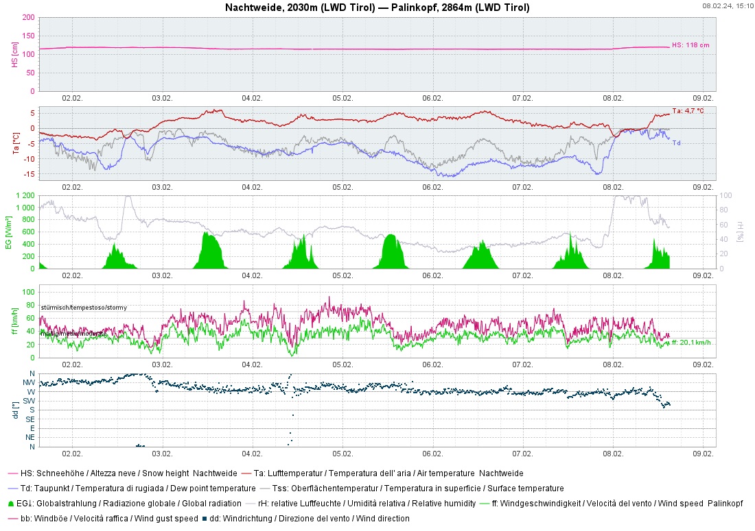
The snowpack surface, as referred to above, was extremely variable. Even some loose, dry snow could be found. Occasionally after nights of clear skies, there was a reward on sunny slopes: firn snow. All in all, the snow quality was meager. Since avalanche danger tended to be low, it was the winter climbers who benefited most.
Outlook
After the weekend the winter will be quite variable, a precise forecast is not yet possible. Colder air masses will move in from the north and temperatures will recede noticeably.
Main problem: still snowdrifts, still gliding snow. In case of higher temperatures and solar radiation, in addition, small loose-snow avalanches can be expected in rocky terrain.