Heightened wet-snow avalanche activity. Beware daytime cycle of avalanche danger.

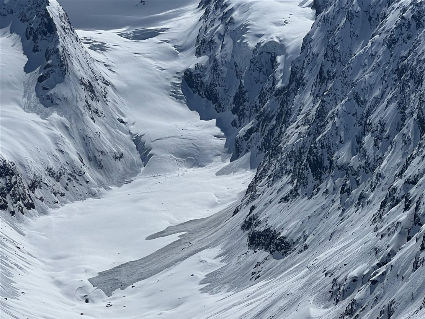
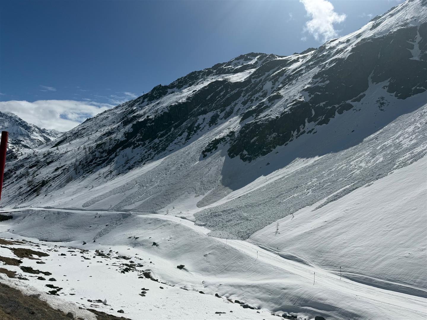
Last week was marked by the increasing wetness and weakness of the snowpack. This was the case particularly on north-facing slopes at 2200-2600m and on high-altitude sunny slopes. Most of the avalanches triggered on northern flanks , either naturally or as a result of additional loading. In general, they were moist or wet slab avalanches. In the regions where there was more fresh snow (above all, in the southern Ötztal Alps) there were also numerous wet loose-snow avalanches observed, whereas in the snowy northwestern regions of the land, there were also occasional glide-snow avalanches.

Over the next few days, a classic springtime situation – with a marked daytime cycle of avalanche danger – can be expected.

Weak snowpack – numerous avalanche releases

As was expected, last week had heightened avalanche danger and a correspondingly higher number of naturally triggered avalanches. Most of the time the avalanche danger level assigned was “considerable,” in some regions the danger level assigned was “high.” One time, on 15.04, we changed the early morning level of “high” down to “considerable” because the nighttime skies proved to be less cloudy than was anticipated the previous day, based on weather forecasts.

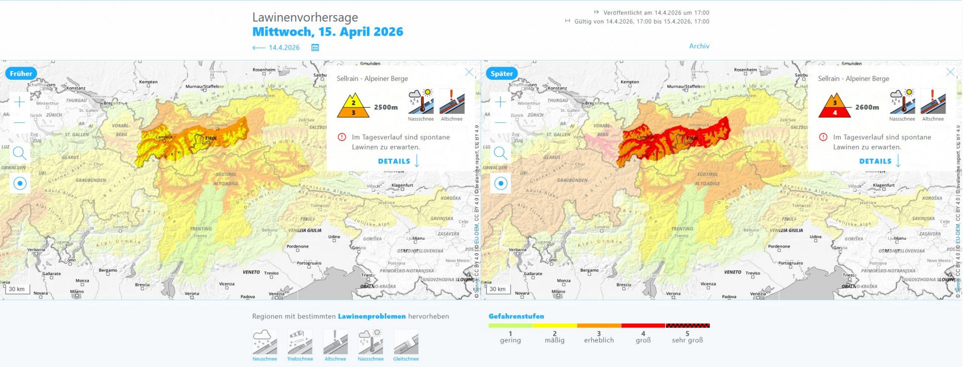
Prognostizierte Lawinengefahr für den 15.04.2026 mit einem Tageszeitlichen Anstieg der Lawinengefahr auf "groß"
Forecast avalanche danger for 15.04.2026 with daytime rise in avalanche danger to “high.” The high avalanche danger was reassigned as “considerable” in early morning on 15.04.

In spite of this reassessment, the avalanche scenario remained unfavorable during these days. We experienced an extremely dynamic avalanche situation, where even tiny changes in the weather led to big consequences in avalanche danger, both in positive and negative ways. For that reason, it is extremely important currently to be thoroughly informed hour-by-hour of the avalanche dangers and to react rapidly to the changing conditions.

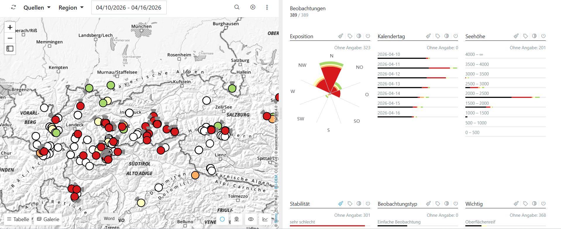
Rückmeldungen an den Lawinenwarndienst der vergangenen Woche: Die roten Punkte beziehen sich auf Beobachtungen mit einer schwachen Schneedecke bzw. von Lawinenabgängen.
Reports last week received by the Avalanche Warning Service Tirol: the red points depict observations of a weak snowpack and avalanche releases. Most of the reports cited north-facing slopes.

Review of avalanche releases last week

Last week not only bore the signature not only of numerous avalanche releases, but also of guardian angels. The balance sheet: one injured person on 16.04 brought by emergency services from Pitztal Glacier. In other words, we got away with just a black eye, nothing worse, considering the level of danger, a blessing.

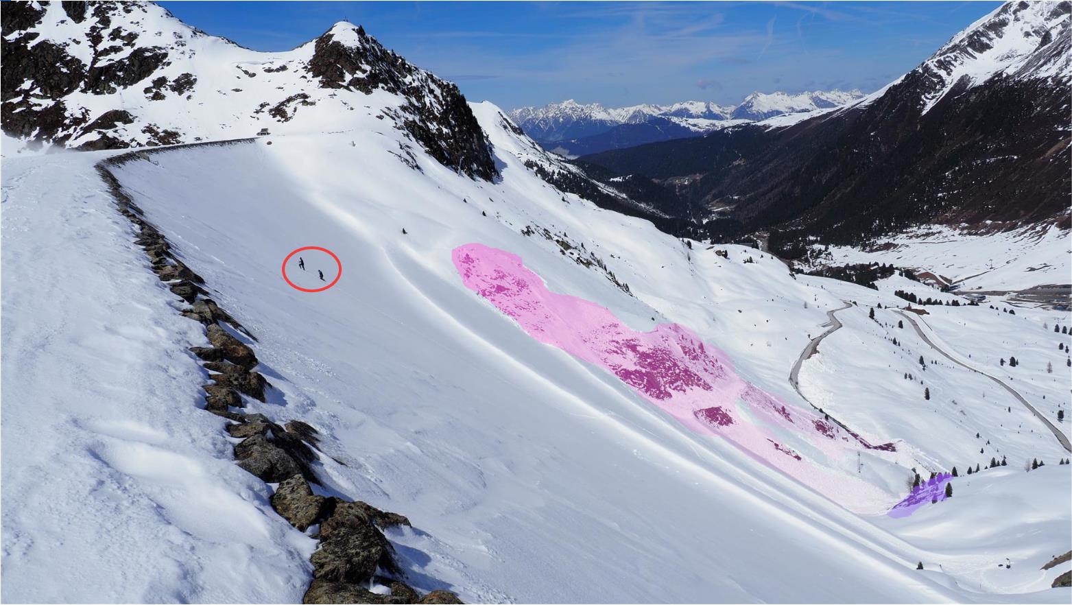
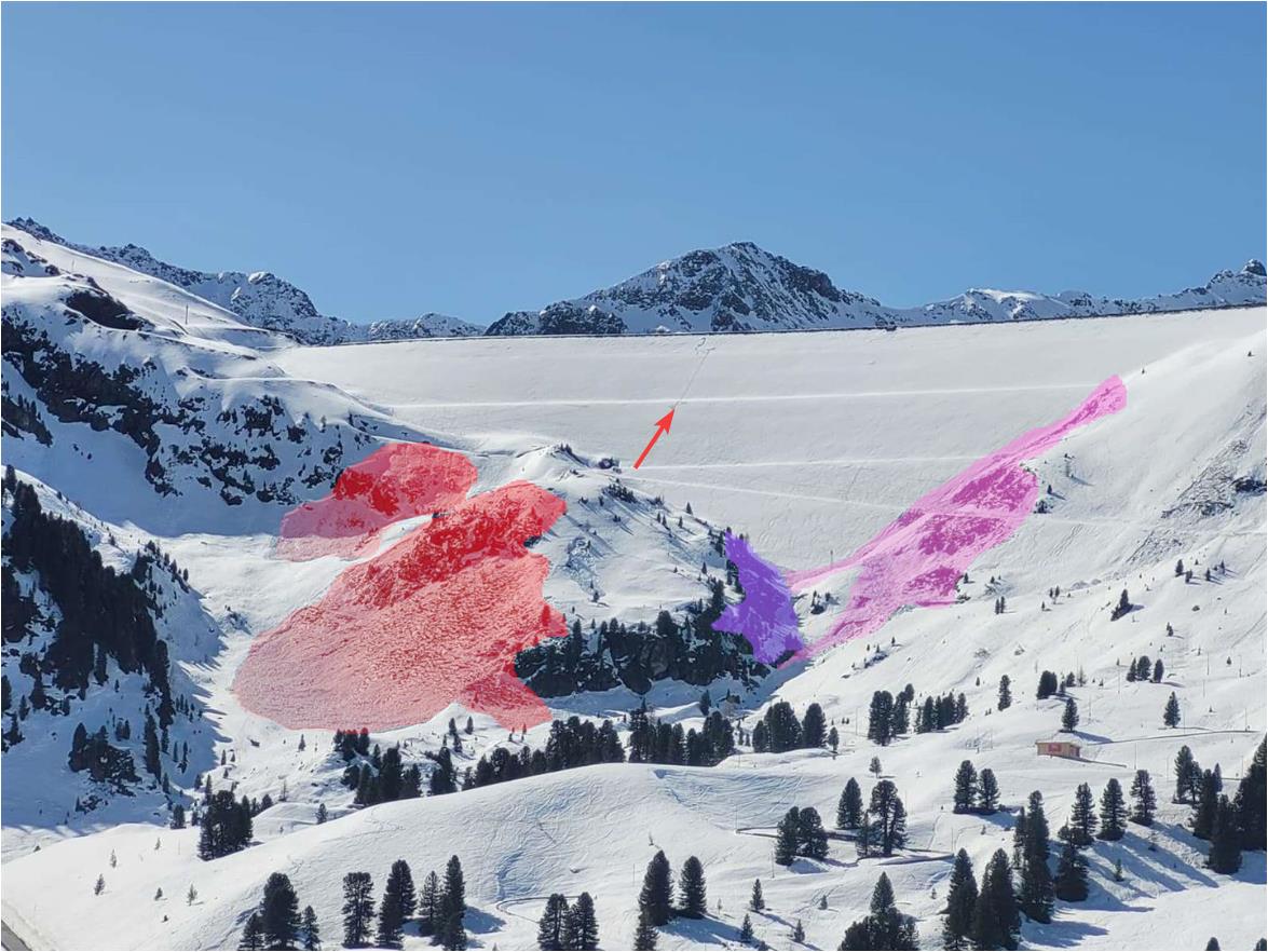
Das Foto zeigt im Hintergrund die Unfalllawine vom 08.04.2026 unterhalb der Mute im Kühtai. Im Vordergrund musste ich mit großer Sorge mit ansehen, wie zwei Personen den sehr steilen Staudamm hochstapften. Jeden Moment erwartete ich eine Lawinenauslösung, die zum Glück nicht eintrat. (©LWD Tirol, 11.04.2026)
Photo shows in background the avalanche incident on 08.04.2026 below the Mute in the Kühtai (see blog from 10.04.2026). In foreground, we had to watch highly anxiously as two persons climbed up the very steep reservoir dam. At any moment, we expected an avalanche, which fortunately never happened. (©LWD Tirol, 11.04.2026)
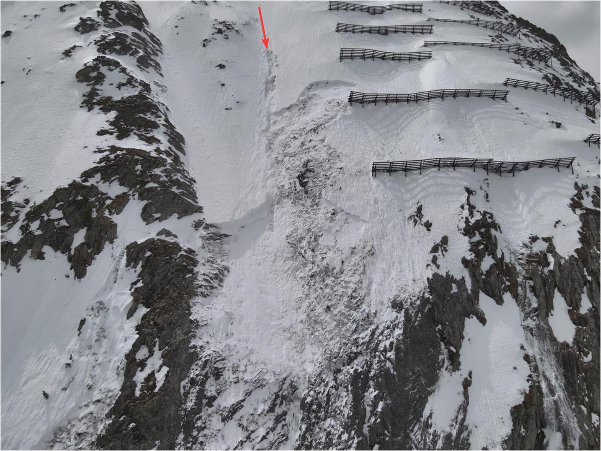
Die unverändert hohe Störanfälligkeit der Schneedecke wurde einen Tag später durch zwei spontane Lawinenabgänge in unmittelbarer Nähe zur Unfalllawine (rechts im Bild) und den Stapfspuren der 2 Personen (Pfeil) bestätigt. Diese Lawinen lösten sich in einem Bereich, der während des Winters vielfach von WintersportlerInnen befahren wurde (©David Winkler, 12.04.2026).
The persistently high degree of trigger-sensitivity of the snowpack was confirmed a day later by two naturally triggered avalanches in the immediate vicinity of the avalanche incident (photo right) and the stomping tracks of the two persons (arrow). These avalanches triggered in an area which was plentifully skied on throughout the winter by winter sports enthusiasts. It was a unique feature of this winter season: much-skied on terrain was definitely NO SAFER than seldom skied-on terrain (©David Winkler, 12.04.2026).
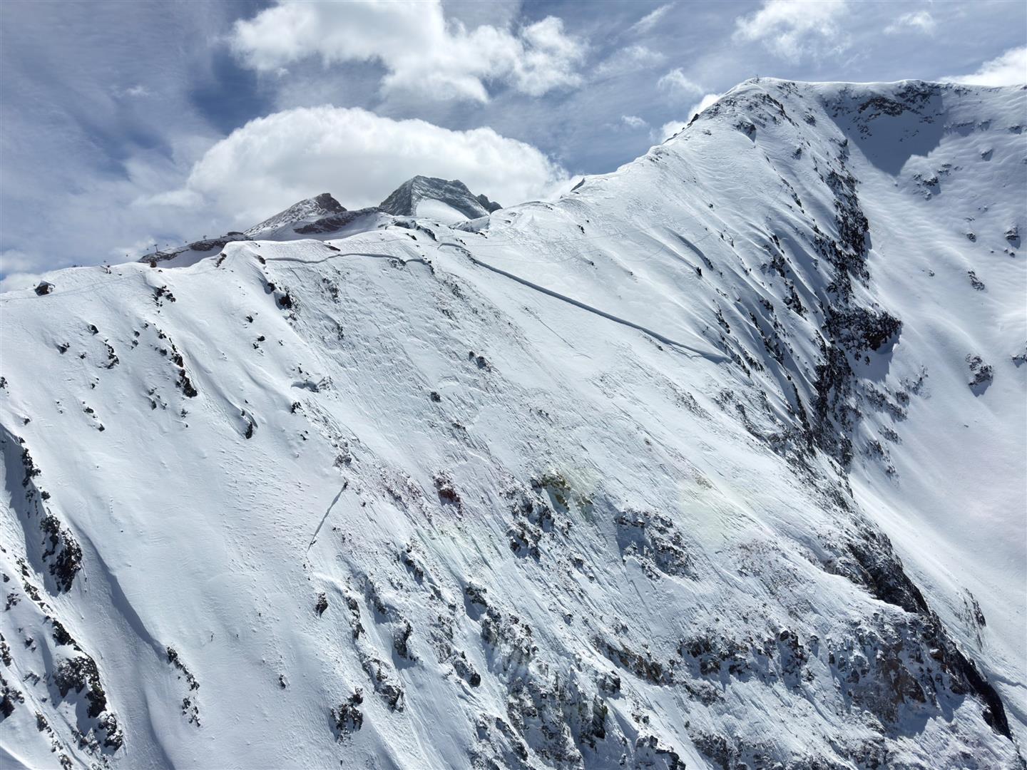
Diese große Schneebrettlawine wurde am Grat zum Kleinen Kaserer in der Region Zillertaler Alpen Nordwest von WintersportlerInnen ausgelöst. Es kam niemand zu Schaden (©Stefan Pichlsberger, 11.04.2026)
This large-sized slab avalanche was triggered by winter sports enthusiasts on the ridge of the Kleinen Kaserer in the Zillertal Alps Northwest region. No one suffered injuries. 3000m, Northwest (©Stefan Pichlsberger, 11.04.2026)
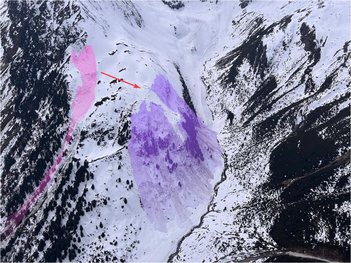
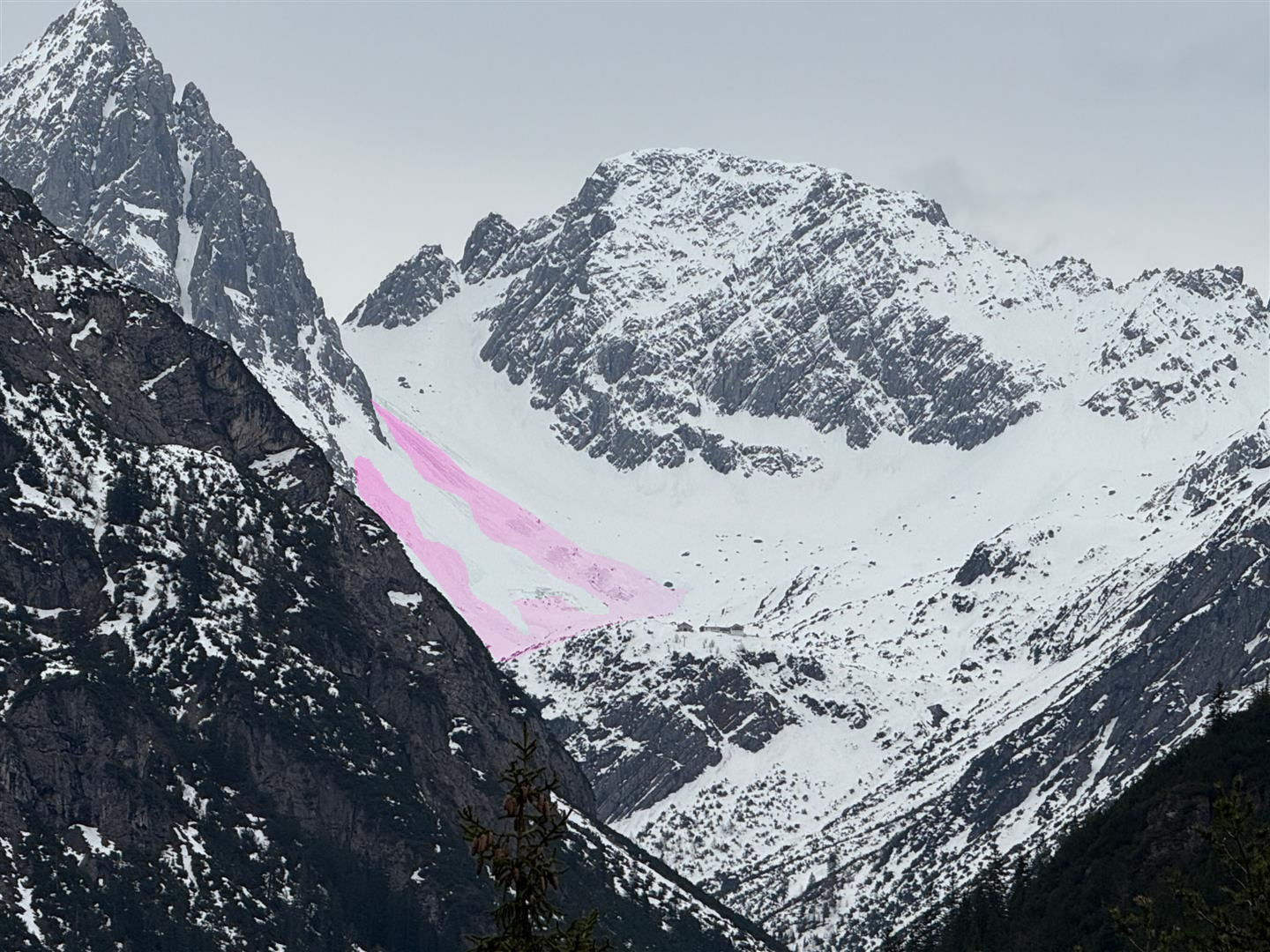
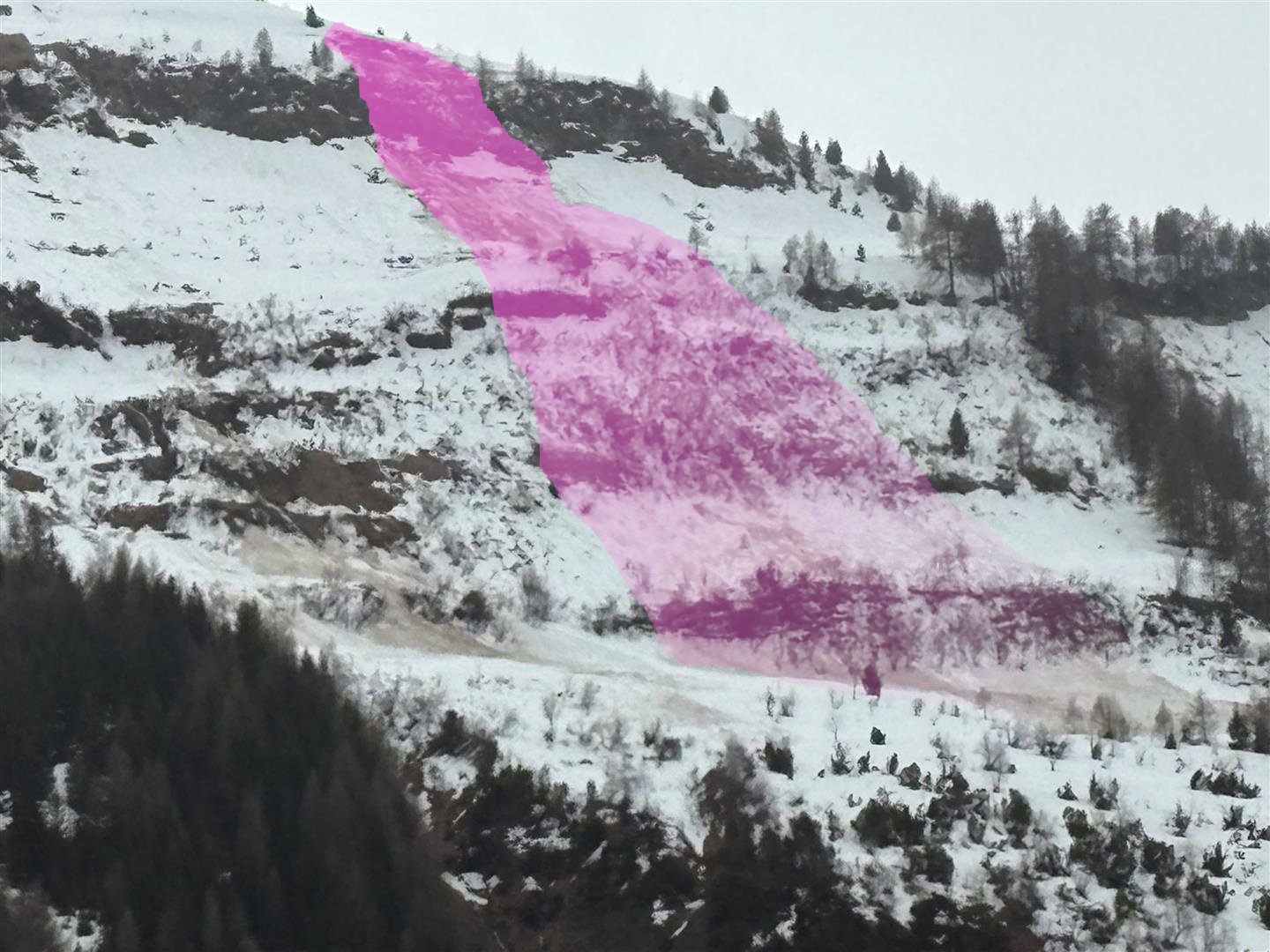
Von der im Bild links dargestellten primären spontanen Schneebrettlawine pflanzte sich ein Bruch innerhalb der ausgeprägten, bodennahen Schwachschicht vom Frühwinter über relativ flaches Gelände nach recht fort (roter Pfeil), wo sich in Folge eine sehr große sekundäre Lawine (violett) löste. Diese Lawine überspülte in Folge die Skiroute der Wilden Grube. Zum Glück kamen bei diesem Abgang keine Personen zu Schaden. Region Stubaier Alpen Mitte (©Alpinpolizei, 12.04.2026)
From the primary naturally triggered slab avalanche depicted (photo left), a fracture propagated itself inside the marked ground-level weak layer which formed in early winter and spread over relatively flat terrain towards the right (red arrow), where subsequently a very large-sized secondary avalanche (violet) triggered. This avalanche subsequently unleashed over the ski route of the Wilden Grube. Fortunately, after a comprehensive search operation and interrogating many witnesses, no persons were found in the endangered zone. Mid-Stubai Alps region (©Alpinpolizei, 12.04.2026).
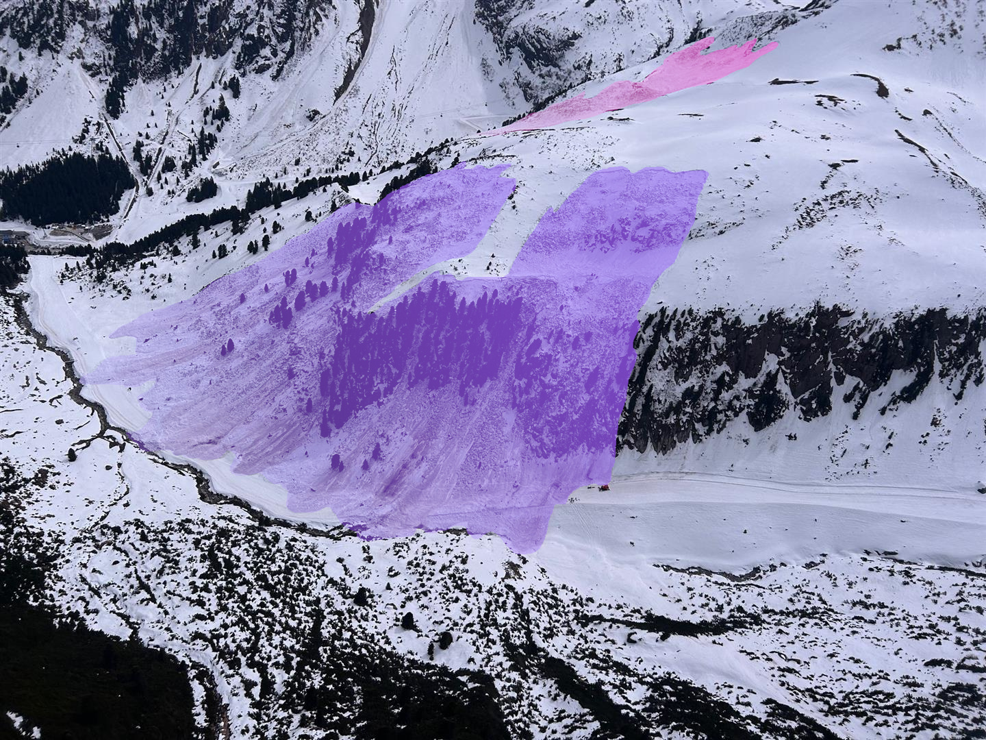
Hier ein anderer Blickwinkle auf die Lawine im Bereich der Wilden Grube in der Region Stubaier Alpen MItte (©Alpinpolizei, 12.04.2026)
The same event seen from another perspective: the avalanche near the Wilden Grube in the Mid-Stubai Alps region. Incidentally, the people responsible for the security of the area were on a control run at the time of the release and just before the release made a decision to close the ski route at once (©Alpinpolizei, 12.04.2026).
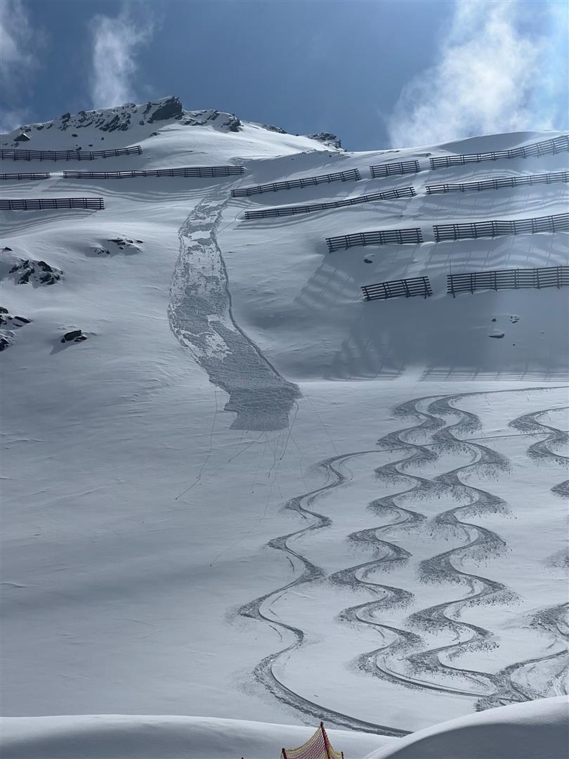
Immer wieder beobachtete man auch, dass durch einen Impuls einer Lockerschneelawine in Folge eine Schneebrettlawine ausgelöst wurde. Zillergründl, Region Zillertaler Alpen Nordost (©Thomas Eder, 12.04.2026)
Again and again it was observed that the impulse of a loose-snow avalanche led to a slab avalanche being triggered as a consequence. Zillergründl, Zillertal Alps Northeast region (©Thomas Eder, 12.04.2026)
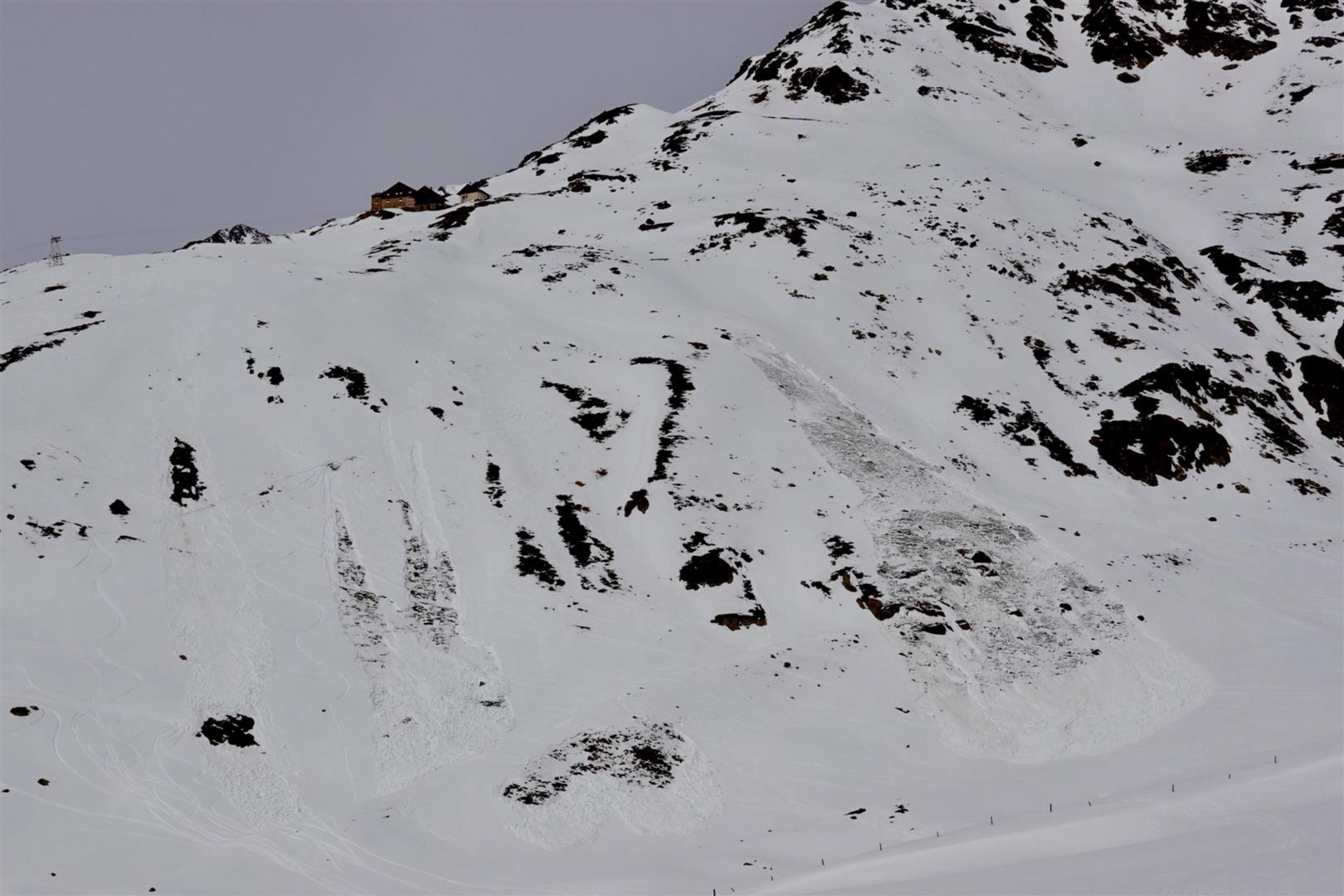
Von Personen ausgelöste Schneebrettlawinen unterhalb der Pforzheimer Hütte in der Region Sellrain-Alpeiner Berge. Auch hier kam niemand zu Schaden (©Lukas Ruetz, 11.04.2026)
Slab avalanches triggered by persons below the Pforzheim Refuge (visible on the ridge) in the Sellrain-Alpeiner Berge region. Also here, no one suffered injuries. (©Lukas Ruetz, 11.04.2026)
Aufgrund der geringeren Schneemächtigkeit im Vergleich zu Nordtirol lösten sich in Osttirol vergleichsweise etwas früher Schneebrettlawinen im schattigen Steilgelände der selben Seehöhe. Dort drang das Schmelzwasser entsprechend früher in die Schneedecke ein und schwächte diese entsprechend. Region Deferegger Alpen Ost (©Daniel Kleinlercher, 12.04.2026)
As a result of the shallow snow depths in East Tirol, compared to North Tirol, slab avalanches triggered somewhat earlier in steep shady terrain at the same altitudes, compared to North Tirol, which led to earlier weakening of the snowpack. Deferegger Alps East region. (©Daniel Kleinlercher, 12.04.2026)
Spontane Lawinenabgang im Nordsektor im Bereich der Hanauer Hütte in der Region Lechtaler Alpen Ost (©Klaus Friedl, 14.04.2026)
Naturally triggered slab avalanches on north-facing slopes near the Hanau Refuge in the Lechtal Alps East region (©Klaus Friedl, 14.04.2026)
Lawinenabgänge im (gesperrten) Rettenbachtal in der Gurgler Gruppe (©Tobias Holzknecht, 15.04.2026)
Avalanche releases in the (closed) Rettenbachtal in the Gurgl Massif (©Tobias Holzknecht, 15.04.2026)
Gleitschneelawine mit mächtigem Anriss in der Region Allgäauer Alpen Ost (©Adi Kerber, 10.04.2026)
Glide-snow avalanche with deep fracture in the Allgau Alps East region (©Adi Kerber, 10.04.2026)
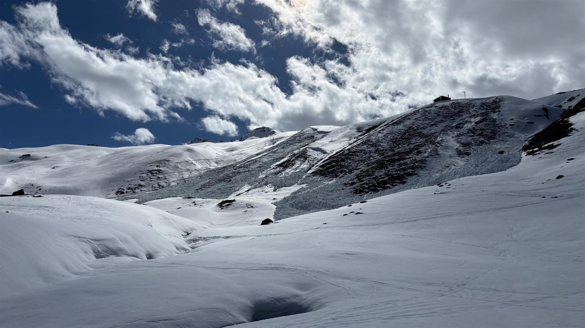
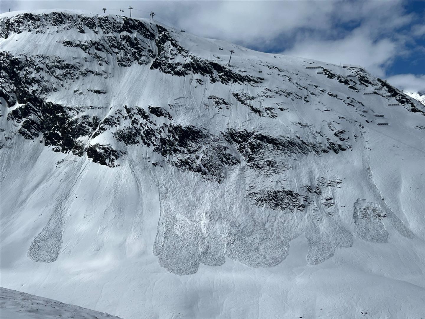
Unterhalb der Breslauer Hütte lösten sich aufgrund der fortschreitenden Nässe v.a. nasse Lockerschneelawinen. (Während dieses Winters löste sich an diesem Hang bereits eine große Schneebrettlawine) (©Michael Schinner, 12.04.2026)
Below the Breslau Refuge mostly wet loose-snow avalanches triggered as a result of the increasingly wet snowpack. (A large-sized slab avalanche had already triggered on this selfsame slope this winter.) (©Michael Schinner, 12.04.2026)
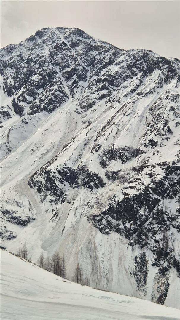
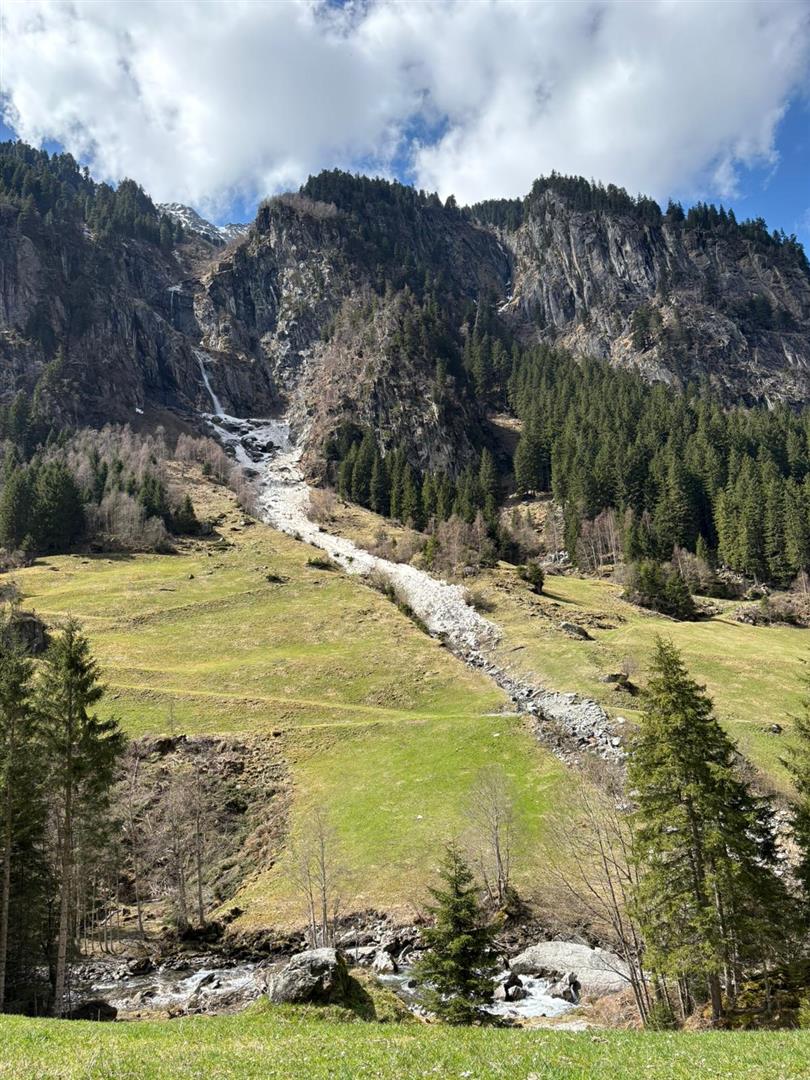
Lawinen stießen immer wieder auch ins Grüne vor, wie hier im Zillergrund in der Region Zillertaler Alpen Nordost (©Leo Dornauer, 15.04.2026)
Avalanches repeatedly plummeted down into green zones, such as here in the Zillertal in the Zillertal Alps Northeast region (©Leo Dornauer, 15.04.2026).
Lockerschneelawinenabgänge nach den Schneefällen als Initiatoren von sekundären Schneebrettlawinen. Region Gurgler Gruppe (©Hugo Reindl, 15.04.2026)
Loose-snow avalanche releases following the snowfall as initiator of secondary slab avalanches. Gurgl Massif region (©Hugo Reindl, 15.04.2026)

A review of weather developments last week

We are, let there be no doubt about it, in April. That alone says a great deal about the weather last week. Moist-warm conditions were prevalent. The nighttime skies were more or less cloud-covered. Even during the daytime hours, cloud cover dominated the scene or else convective cloud build-up arrived later in the day. Around the 12th of April, Sahara dust filled the atmosphere. There were repeated bouts of precipitation, most of it it the southern Ötztal Alps and in southern East Tirol. In some regions there was a blanket of typical “laundry-room weather” as a result of the combination of diffuse solar conditions, residual clouds or medium-altitude cloud cover, moist air masses and warm temperatures.

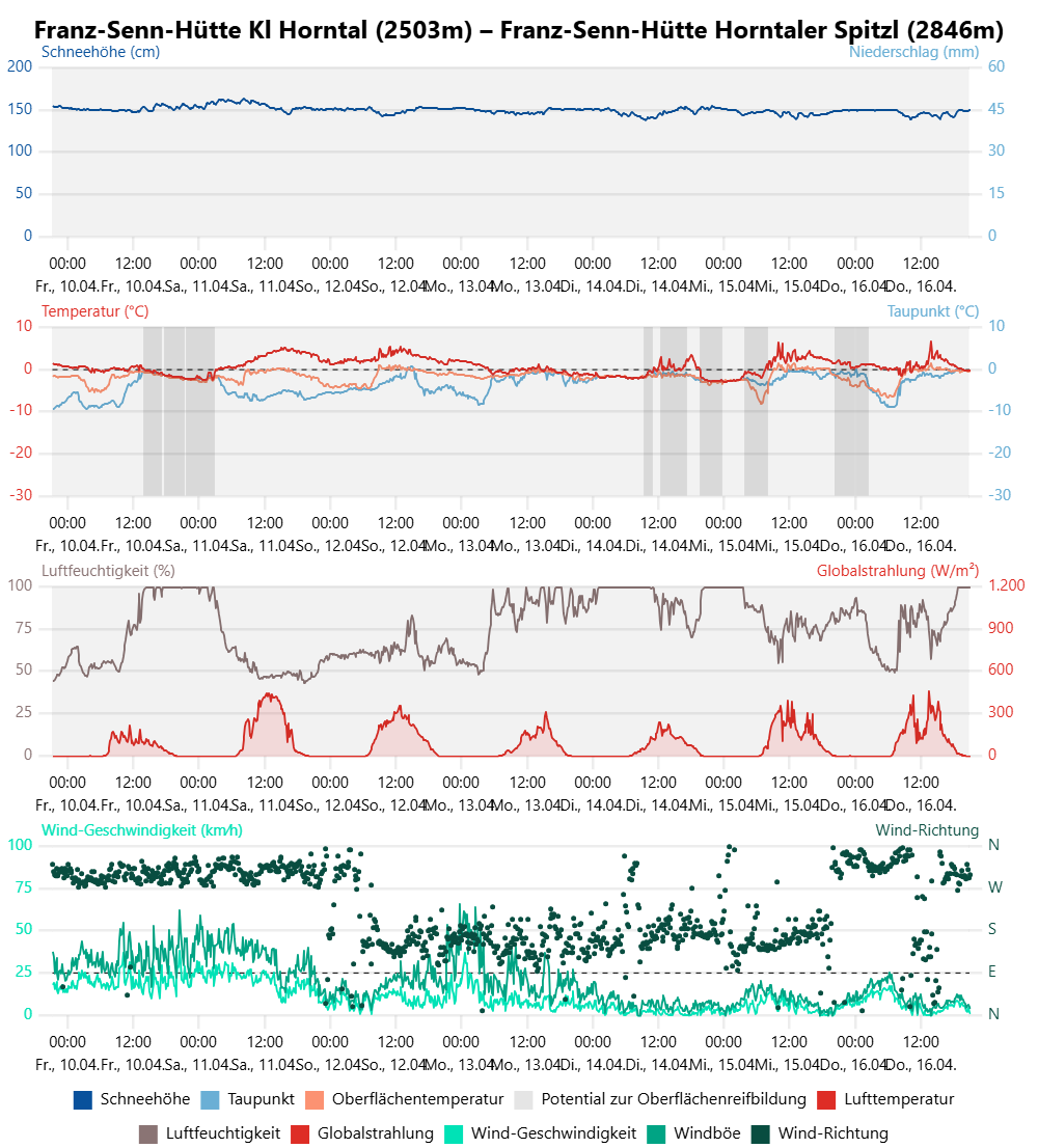
Ein Blick auf die Wetterstation Horntal in der Region Sellrain-Alpeiner Berge zeigt den wechselhaften Wetterverlauf der vergangenen Woche. Meist nur geringe Ausstrahlung während der Nachtstunden. Die Schneeoberflächentemperatur lag meist im Nahbereich von 0°C.
A glance at the Horntal weather station in the Sellrain-Alpeiner Berge region shows the roller-coaster, highly variable weather developments last week. Generally there was minimum outgoing longwave radiation during the nocturnal hours. The snowpack surface temperature generally was close to 0°C.
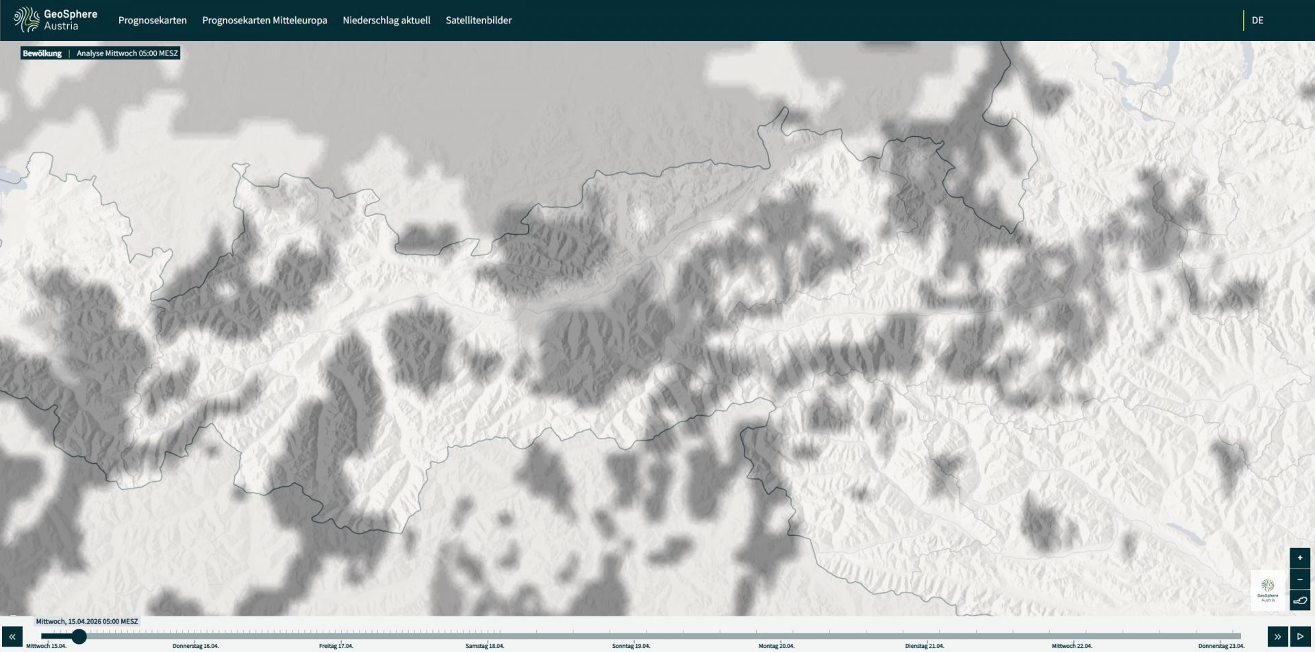
Ein Blick auf Bewölkungskarten kann die Einschätzung der Lawinengefahr in Hinblick auf die nächtliche Ausstrahlung der Schneedecke erleichtern. Ausschnitt der Wolkenbedeckung in der Nacht vom 14.04. auf den 15.04.2026 über Tirol (©GSA)
A glance at the cloud maps makes it easier to understand the nocturnal outgoing radiation and, thus, make appropriate adjustments to avalanche danger assessments. Above: an excerpt of cloud cover over Tirol on the night of 14-15 April. Shaded areas depict the zones without cloud cover (©GSA).
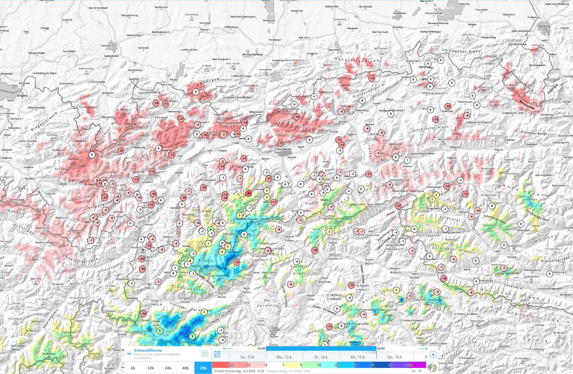
An der Schneehöhendifferenzkarte erkennt man jene Regionen, wo es mehr geschneit hat. Am meisten Schnee fiel in der Gurgler Gruppe von Montag, 13.04. auf Dienstag, 14.04. mit etwa 20cm oberhalb etwa 2500m mit leicht fallender Tendenz während des Niederschlags. Darunter kam Regen an. Gleichzeitig in rot: Die Schneeschmelze schreitet rasch voran.
On the snow depths map above, those regions where there was greater snowfall are recognizable. Most of the snow fell in the Gurgl Massif between Monday, 13.04 and Tuesday, 14.04: about 20cm above approximately 2500m, tending to taper off during the bout of precipitation. Below that altitude there was rainfall. Depicted in red: the rapidly advancing snowmelt.
Frontaufzug am 10.04.2026, der eine bedeckte Nacht und etwas Niederschlag und eine ungünstige Ausgangslage für den Folgetag brachte (©LWD Tirol, 17.04.2026)
An approaching weather front on 10.04.2026 which brought cloudy nocturnal skies and some precipitation, as well as an unfavorable point of departure for the following day (©LWD Tirol, 17.04.2026).
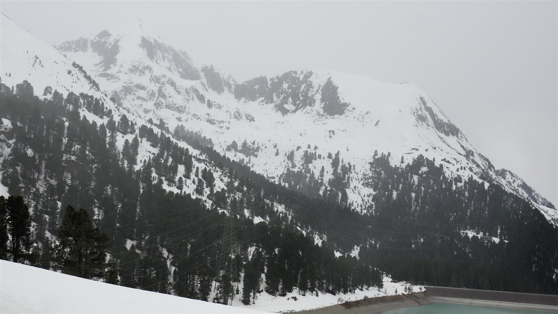
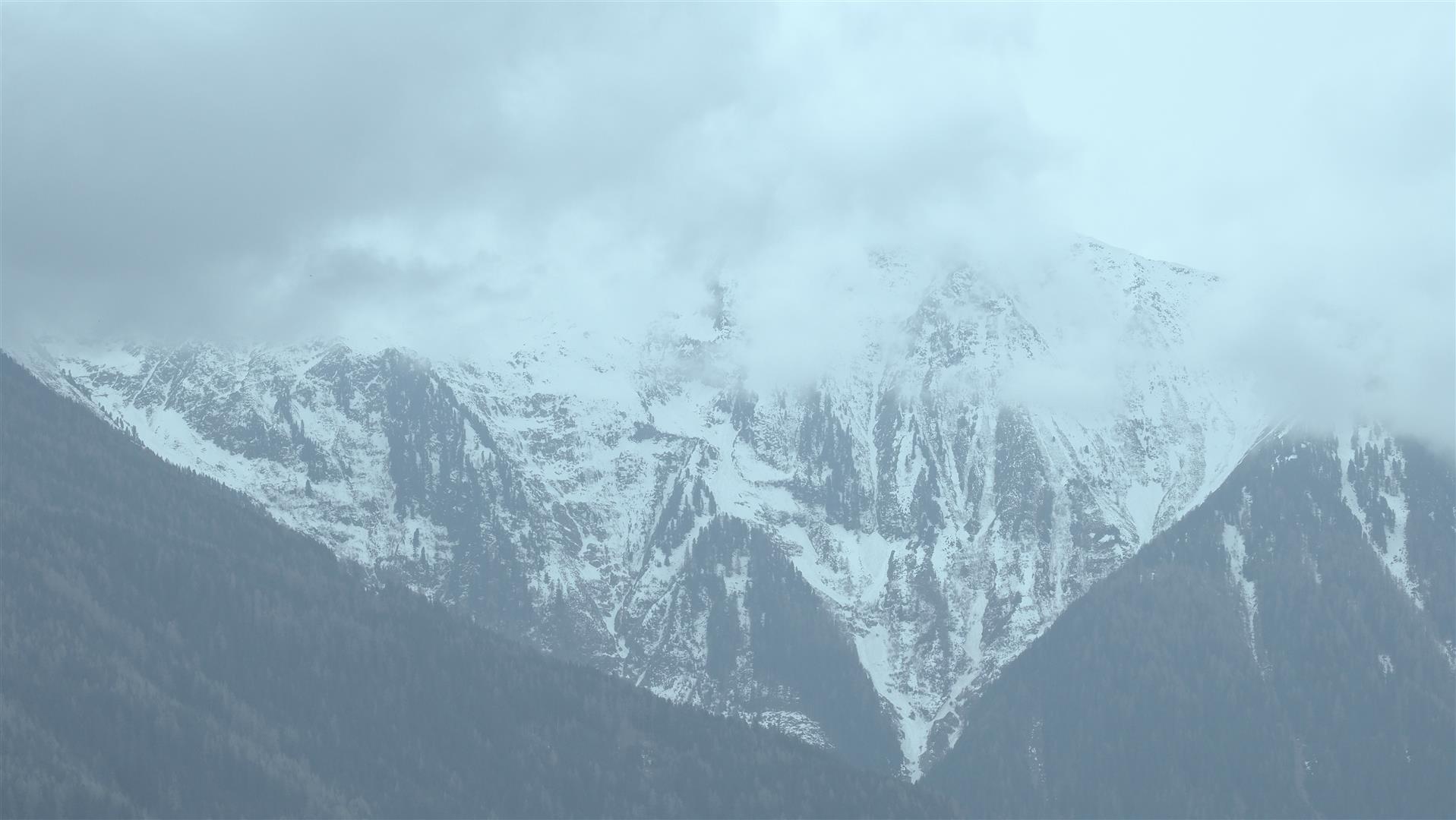
"Waschkuchlwetter" am 12.04. in der Grieskogelgruppe. Massiver Feuchteeintrag in die Schneedecke (©LWD Tirol, 12.04.2026)
“Laundry-room weather” on 12.04 in the Grieskogel Massif. A massive blob of moisture penetrated the snowpack (©LWD Tirol, 12.04.2026).
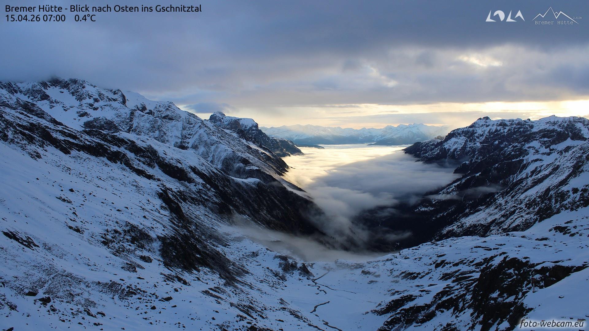
Mehrschichtige Bewölkung im Gschnitztal am 15.04. 07:00 Uhr (©fotowebcam.eu)
Several layers of cloud stream into Gschnitz Valley on 15.04, 7:00 am… (©fotowebcam.eu)
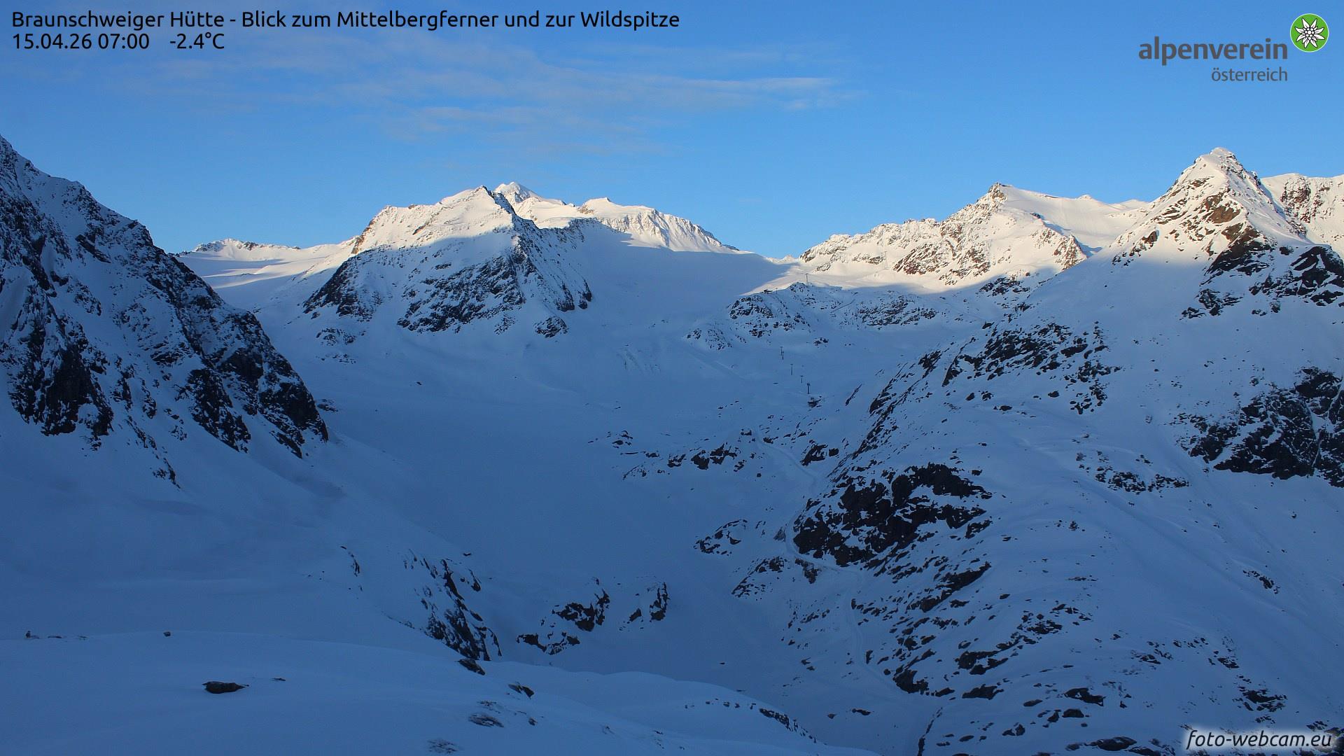
...während es zur selben Zeit in der Region Weißkugelgruppe aufgeklart hatte (©fotowebcam.eu)
…whereas at the very same time in the Weisskugel Massif, skies had cleared (©fotowebcam.eu).

The April weather presents its challenges not only to weather forecasters but also to winter sports enthusiasts, due to the often quickly-changing character of the overall scene. Our concentration of assessing avalanche danger is focused clearly on temperature and water seepage ino the snowpack. As mentioned above, both these things need to be determined not only comprehensively but also hour-by-hour.

Notable occurrences of last week

We were confronted with the most wildly divergent weather situations, but the dominant factor was surely the “deep soup” – in other words, thoroughly wet snowpack.

Wenig Schnee im südlichen Osttirol. Bei Skitouren versinkt man dort, wo kein Lawinenschnee und kein früher vom Wind massiv beeinflusster Schnee liegt, im "Sulz" (©Gerhard Figl, 16.04.2026)
Not much snow in southern Ötztal and in central East Tirol. On backcountry skiing tours, you sink in deep in “mush” where there is no avalanche snow and no wind-impacted snow from earlier in the season (©Gerhard Figl, 16.04.2026).
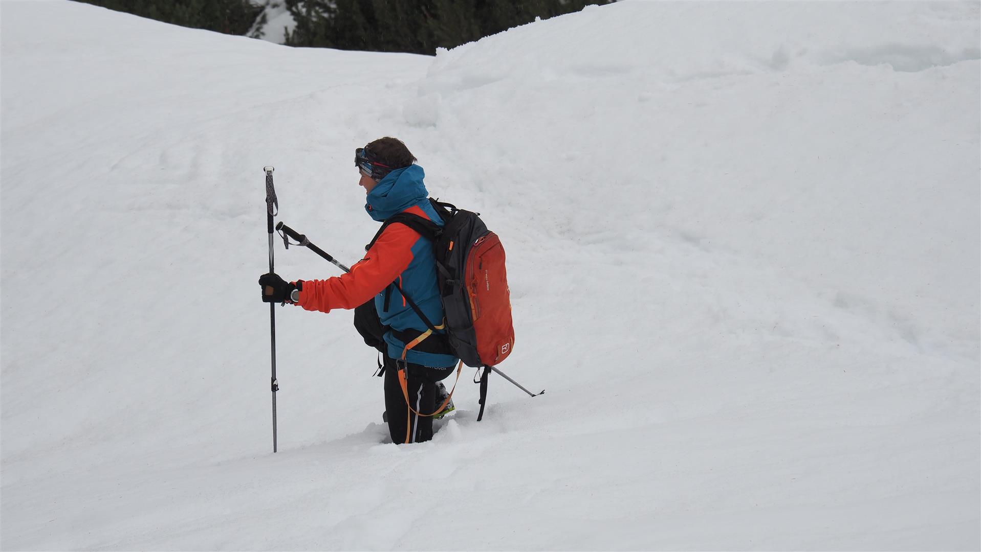
Auch Schneeschuhe verhinderten hier nicht das Versinken im durchnässten Schnee. Region Kühtai-Geigenkamm auf etwa 2000m (©LWD Tirol, 10.04.2026)
Even snowshoes are not a guarantor against sinking deep into the thoroughly wet snow. Kühtai-Geigenkamm region at about 2000m (©LWD Tirol, 10.04.2026)
Kurzfristig gabs auch Pulver, wie hier in der Gurgler Gruppe nach den Neuschneefällen vom 13.04. auf den 14.04.2026 (©Hugo Reindl, 15.04.2026)
For brief spells there was also powder, such as here in the Gurgl Massif after the snowfall on 13-14 April 2026. Typical for springtime. Fresh fallen snow reacts swiftly to the warmth. Consequently, moist loose-snow avalanches then trigger with ease (©Hugo Reindl, 15.04.2026).

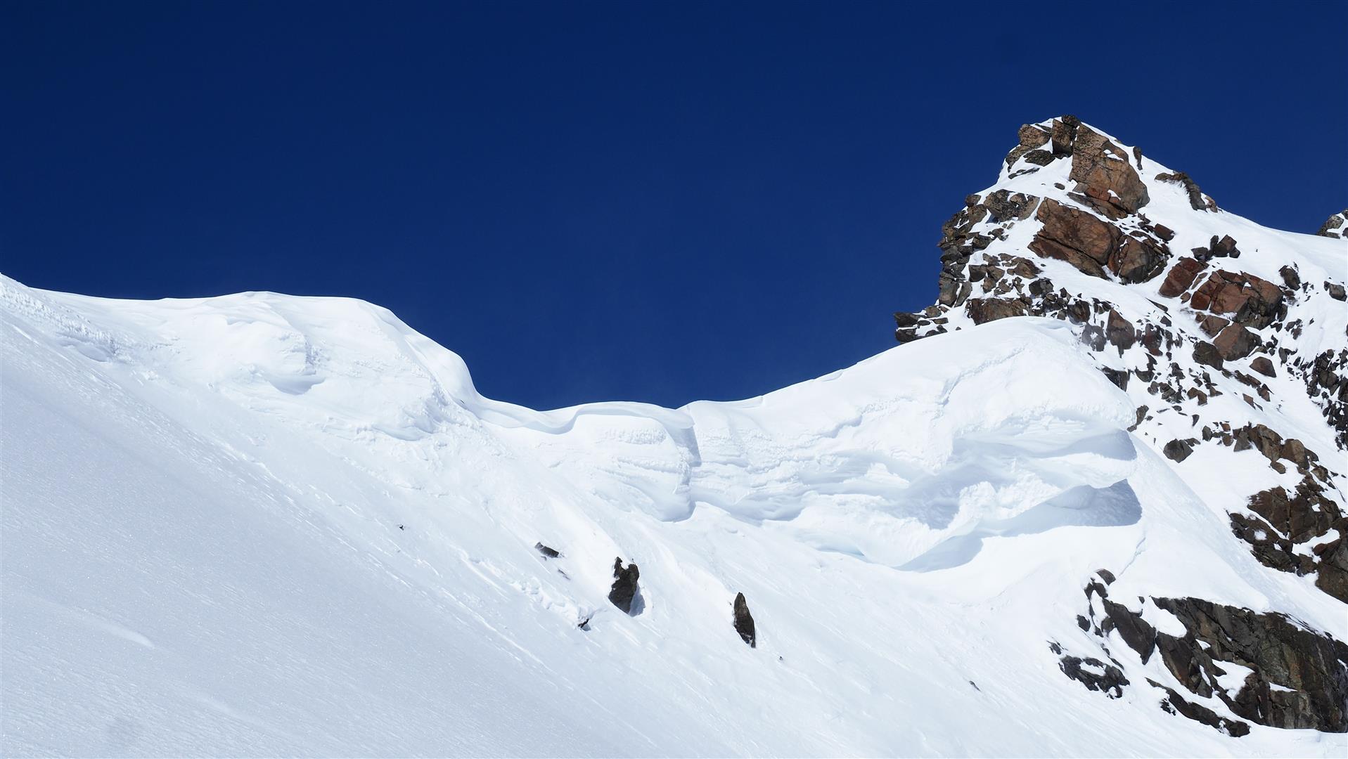
Also conspicuous are the cornices on ridges, frequently with huge overhangs (and corresponding danger of collapsing).

Auch zu beachten: Zum Teil ausgeprägte Wechtenbildung an Graten. Region Sellrain-Alpeiner Berge (©LWD Tirol, 05.04.2026)
Another thing demanding attentiveness: cornices on ridges, often strikingly formed. Sellrain-Alpeiner Berge region (©LWD Tirol, 05.04.2026)

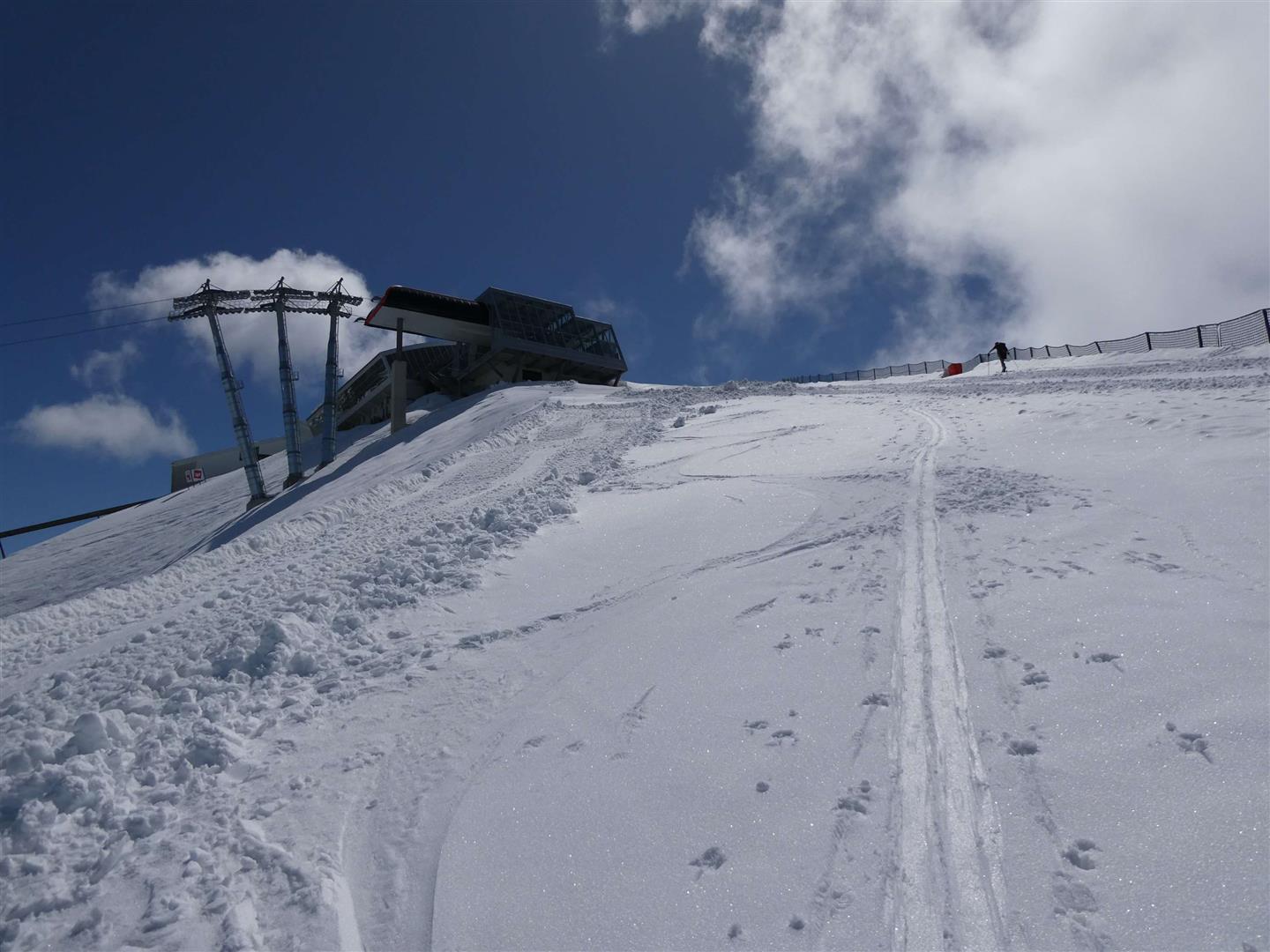
All those engaged in backcountry skiing tours switched whenever necessary to ski slopes in the ski areas which had already closed.

Pistenskitour in der Axamer Lizum in der Region Kalkkögel (©Barbara Fink, 15.04.2026)
A skiiing tour on the piste on Axamer Lizun in the Kalkkögel region (©Barbara Fink, 15.04.2026)

What’s on the horizon?

Friday and Saturday, classic springtime conditions will prevail, with the corresponding outdoing radiation of the snowpack. On Sunday, 19.04, instable conditions will return. Zero-degree level at 2500m, with possible precipitation from the convective cloud build-up. Starting on Monday, temperatures are expected to drop. The overall tendency is: it’ll continue to be highly variable.

In short: what is important above all else, is to follow the weather developments closely, then following nights of clear skies to launch tours as early as possible. And then, it is usually head to high altitudes. The main danger continues to stem from the weakness of the ground-level layer of the snowpack generated in early winter due to ongoing water seepage. Currently this concerns shady slopes above about 2200m and high-altitude west-facing and east-facing slopes above all else.