Category: Current situation
-
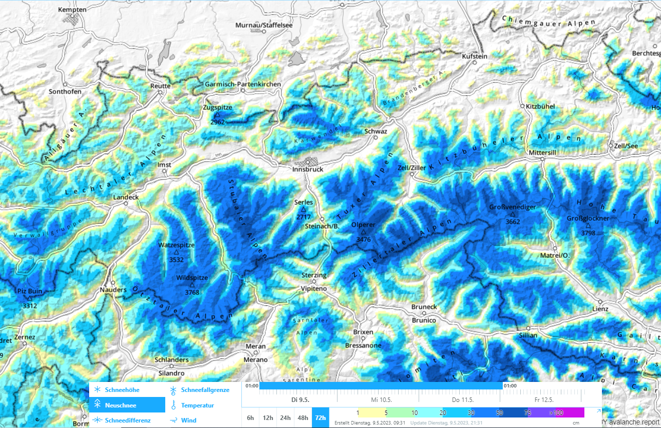
Over 50 cm of fresh snow regionally makes avalanche danger surge – Caution: naturally triggered releases!
In a nutshell It seems as if a warm winter with too little snow just woke up and wanted to make up for lost time. This evening, on 09.05.2023, a cold front is arriving which will bring lots of fresh snow to the mountains. Avalanche danger will increase. Frequent naturally triggered releases can be expected…
-
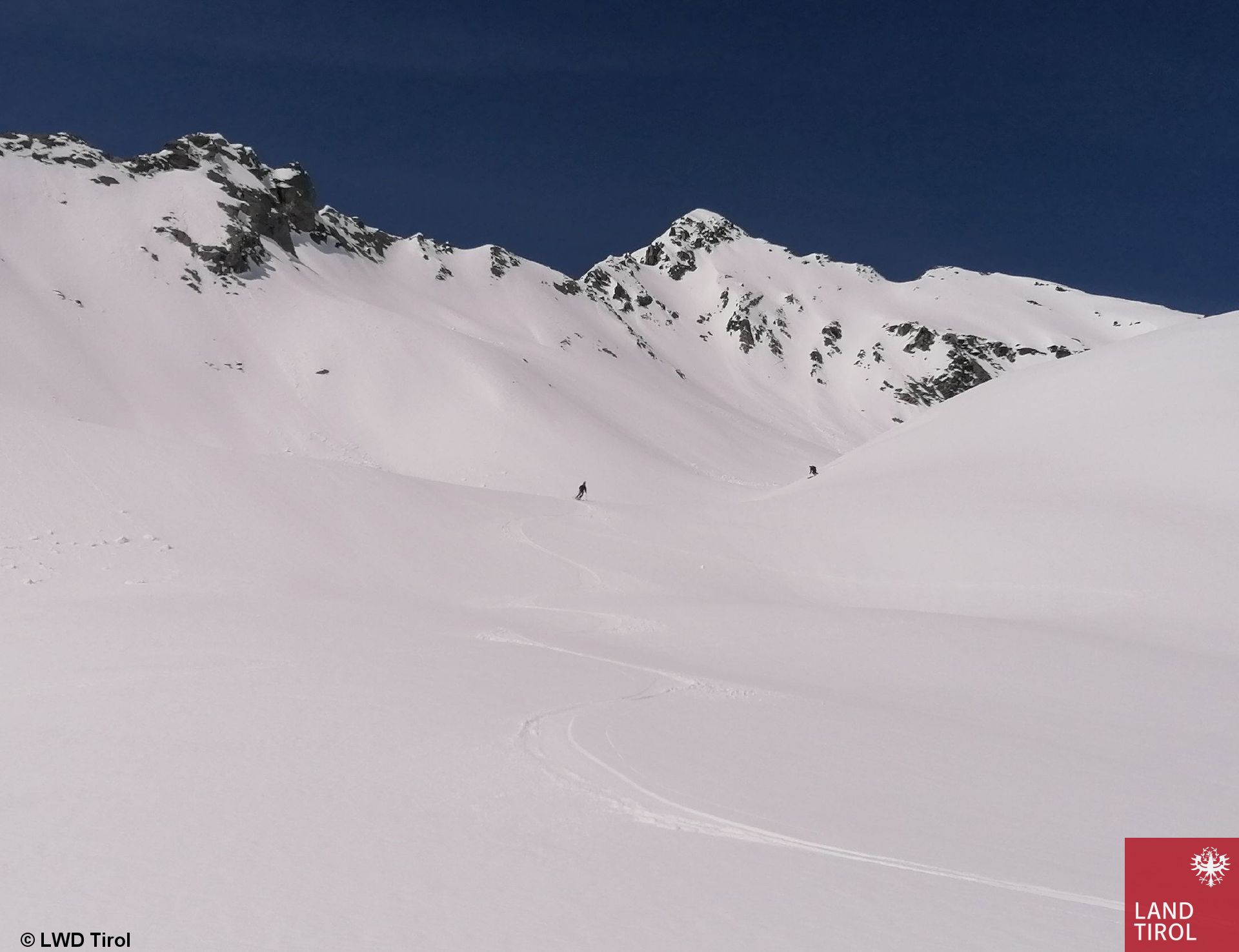
Following good firn snow conditions, new burst of warmth + rainfall
In a nutshell… After two days of flawless firn snow conditions and a daytime cycle of wet-snow avalanche danger, the weather is again becoming instable. On Saturday, 06.05, it will be a bit cooler, sunshine and clouds will alternate, showers and thunderstorms can pass through. On Sunday, 07.05, it will turn warm again, with a…
-
May is just like April – Weak snowpack at high altitudes
In a nutshell… Even if we are already in the month of May, April-weather persists. The variable conditions of recent days have further weakened the snowpack. Rain, high temperatures and repeated bouts of rainfall or fresh snow have weakend it especially on shady slopes above 2300 m. On Saturday, 29.04, there was heightened avalanche activity,…
-
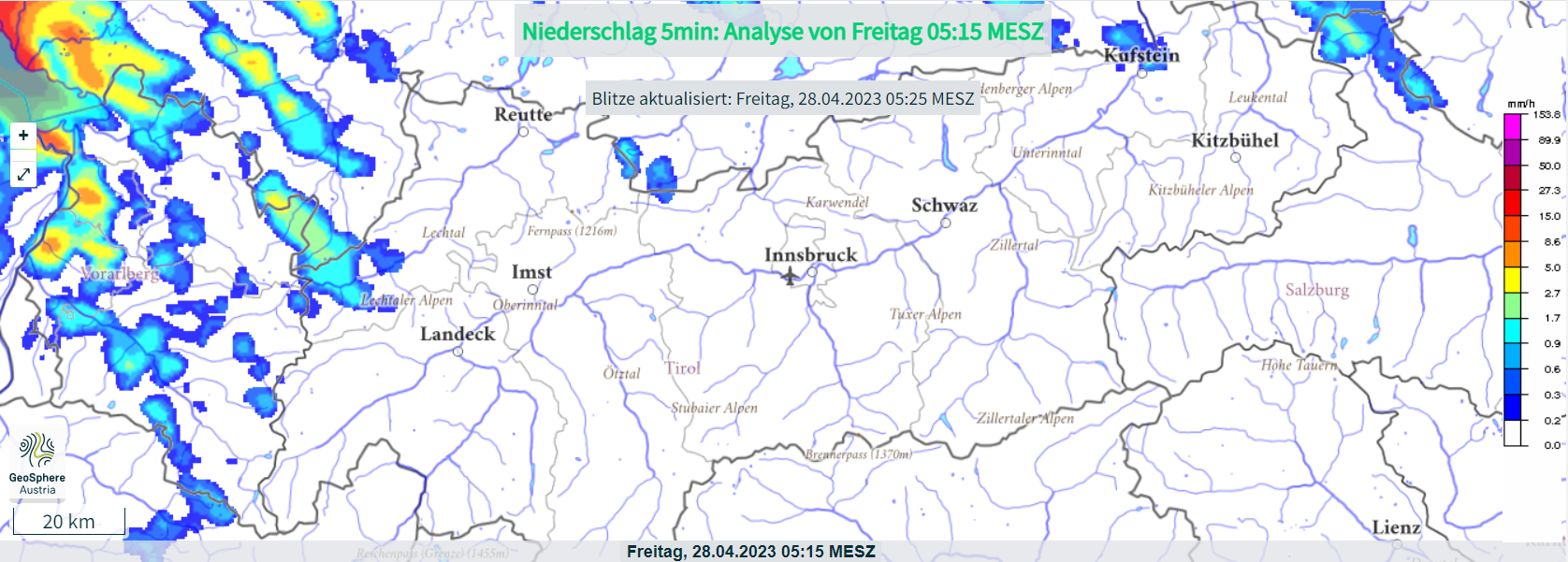
Mostly moderate avalanche danger – Rain + warmth weakening the snowpack
In a nutshell… April weather conditions persist. A warm front today and tomorrow (28-29.04) is bringing rain up to 2300 m, most of which (30mm) will be north of the Inn. At high altitudes, strong westerly winds will be blowing. On the weekend, dispersed clouds, more pleasant weather before on 1 May slight foehn-impact and…
-
Highly variable April weather leads to quickly shifting avalanche dangers
In a nutshell… April is quite justly famous for its caprices with the weather. This is having rapid effects on avalanche dangers. Due to an expected surge in temperatures tomorrow (Saturday, 22.04) the danger will increase during the course of the day. More frequent naturally triggered avalanches will be the result. Savvy tour planning and…
-
Considerable avalanche danger due to heavy snowfall in places
In a nutshell… A cold front is delivering fresh snow down to intermediate altitudes. At elevated altitudes conditions for a short time will be like in deep winter. Simultaneously, avalanche danger in many places has increased to considerable. We expect higher likelihood of slab avalanches getting triggered by winter sports enthusiasts, and also increasingly frequent…
-
Mostly favorable avalanche situation – Near-surface weak layer esp. on extremely steep slopes above 2600m
In a nutshell… Till now the Easter holidays have been much too cool for this juncture of the season (Easter has been colder than Christmas). On the other hand, that meant that the snow which fell this week was able to remain good powder for a long time. The near-surface weak layer problem generated by…
-
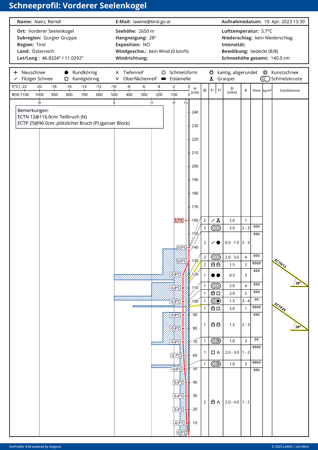
Danger Pattern 4 (cold on warm) possibly important at high altitudes. Complex situation regionally.
In a nutshell… Rounding out the recent Blog, we want to draw your attention to the potential development of a weak layer due to cold on warm (dp.4). All signs currently point to a layer at very high altitudes on sunny slopes (bordering on a layer which last week was the moist-to-wet snowpack surface, then got blanketed…
-
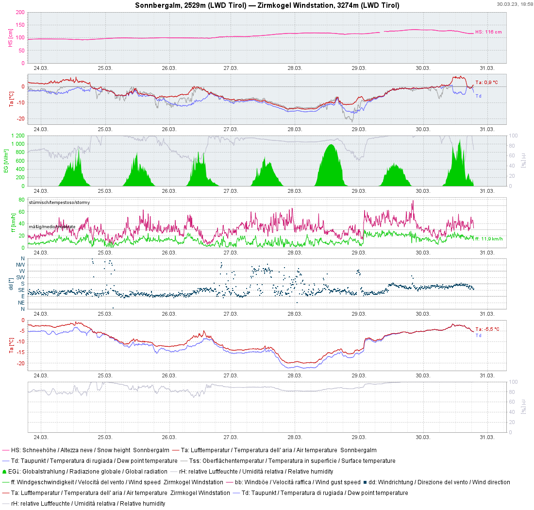
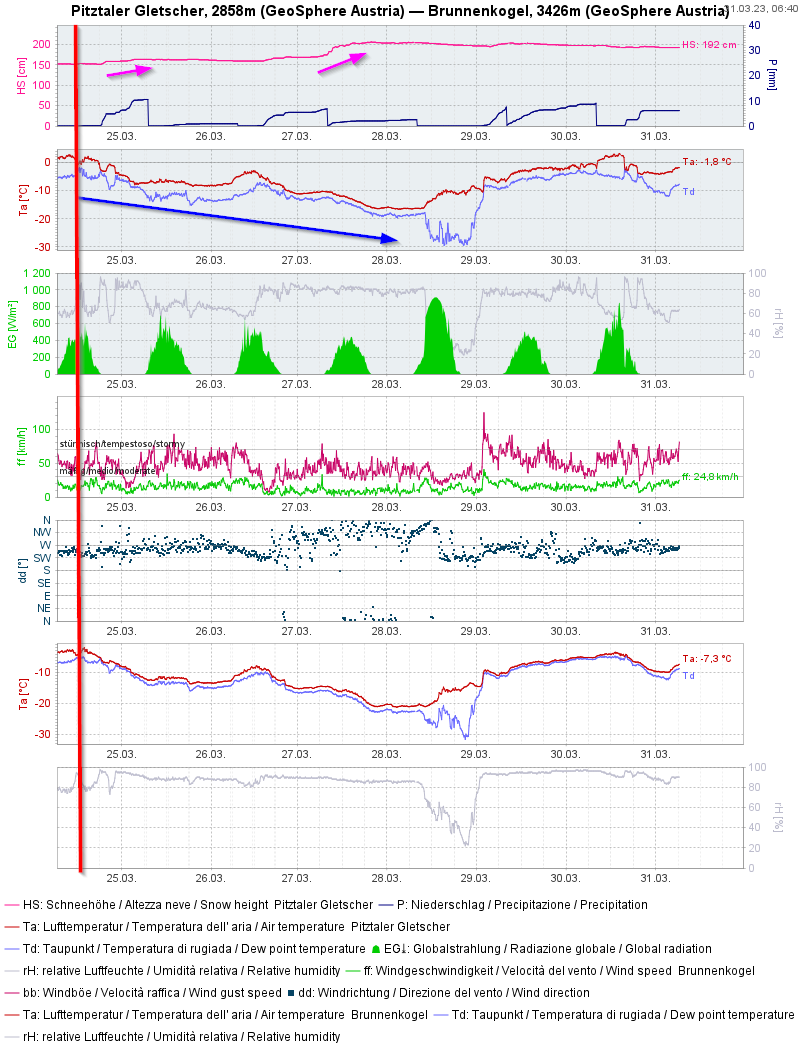
April weather – Snowdrift problem at high altitude – Wet snow at intermediate altitude
In a nutshell… Today (Thursday, 30.03.2023) the recently fallen snow was moistened up to high altitudes by the warm April weather. Thereby, a pronounced “slab” was formed. An avalanche is likely to trigger wherever there are weak layers inside the snowpack. Most of the slab-avalanche prone locations currently occur on very steep NE/E facing slopes…
-
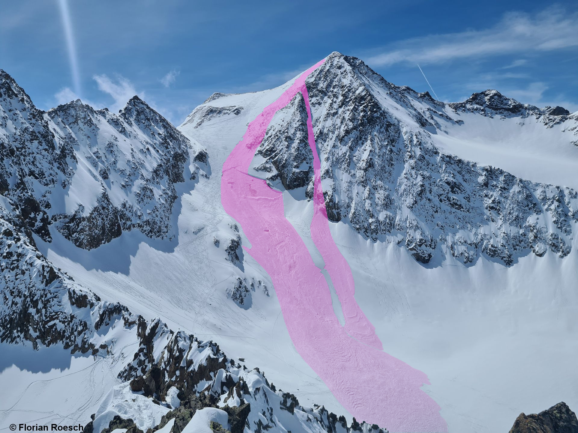
Accident prone avalanche situation in major areas of precipitation for a brief spell
In a nutshell… Lots of fresh snow regionally, strong-to-storm strength winds, low temperatures and anticipated solar radiation are all adding up to an accident-prone avalanche situation. Winter sports enthusiasts can easily trigger slab avalanches in steep terrain in the areas of major precipitation. Tomorrow (28.03 which is expected will weaken the snowpack further, despite low…