Category: Current situation
-
Considerable avalanche danger in far-reaching parts of Tirol
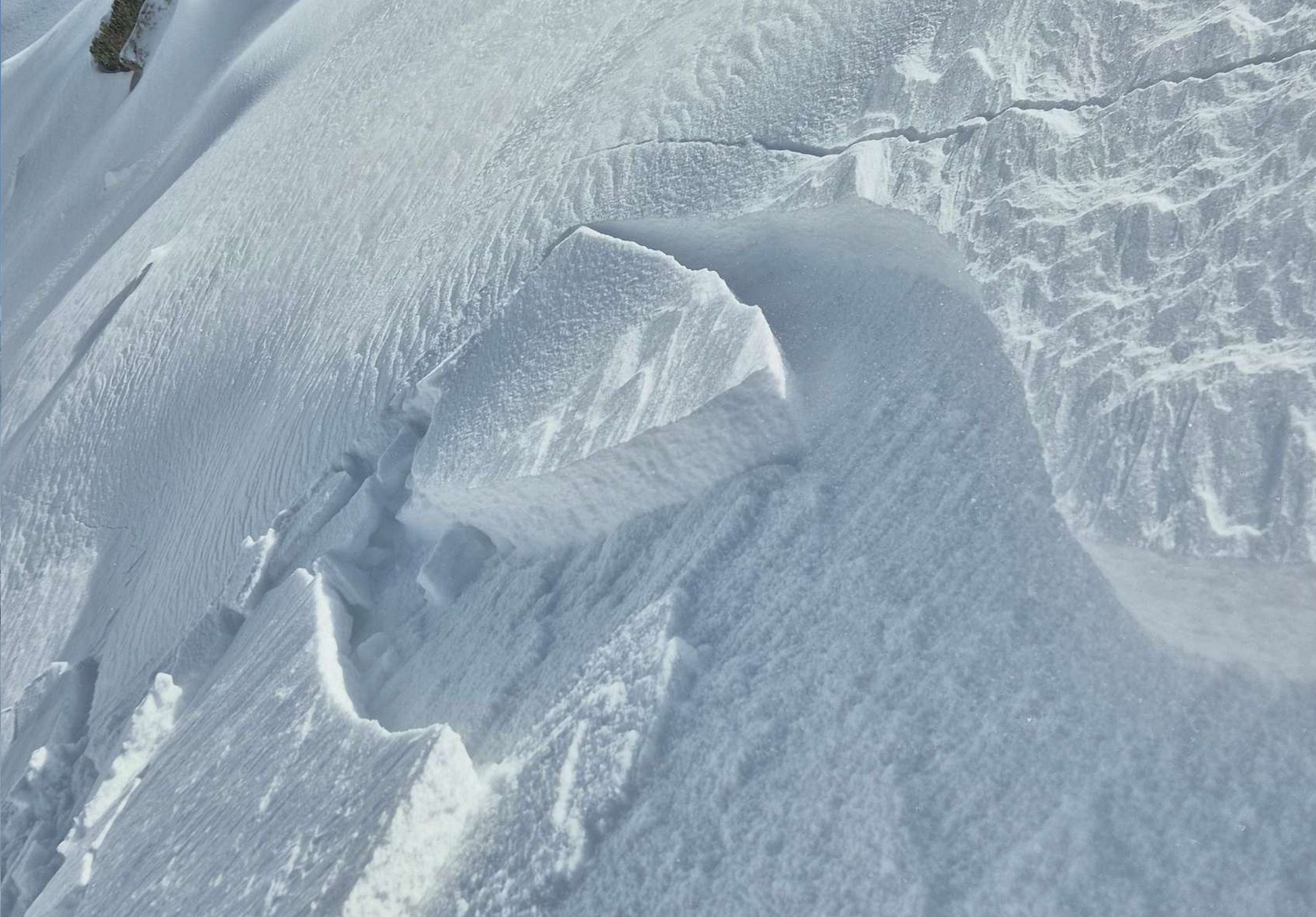
Over the last few days there has been heavy snowfall in our northern and eastern regions. Precipitation was often accompanied by storm-strength winds. High-pressure front conditions are will bring serene and sunny weather starting on Wednesday, but the avalanche situation will improve only slowly. One sole person can easily trigger slab avalanches in some places,…
-
Advanced wetness of snowpack stopped, fresh snow in sight, esp. in north
Last week was marked by variable conditions and advancing snowpack wetness. In that scenario, glide-snow and loose-snow avalanches frequently released. In addition, a persistent weak layer threatens in places on the Main Alpine Ridge and in East Tirol. It will turn wintery again over the next few days, esp. in North Tirol. Fresh snowdrifts will…
-
Treacherous persistent weak layer – On weekend southerly air-current full of moisture
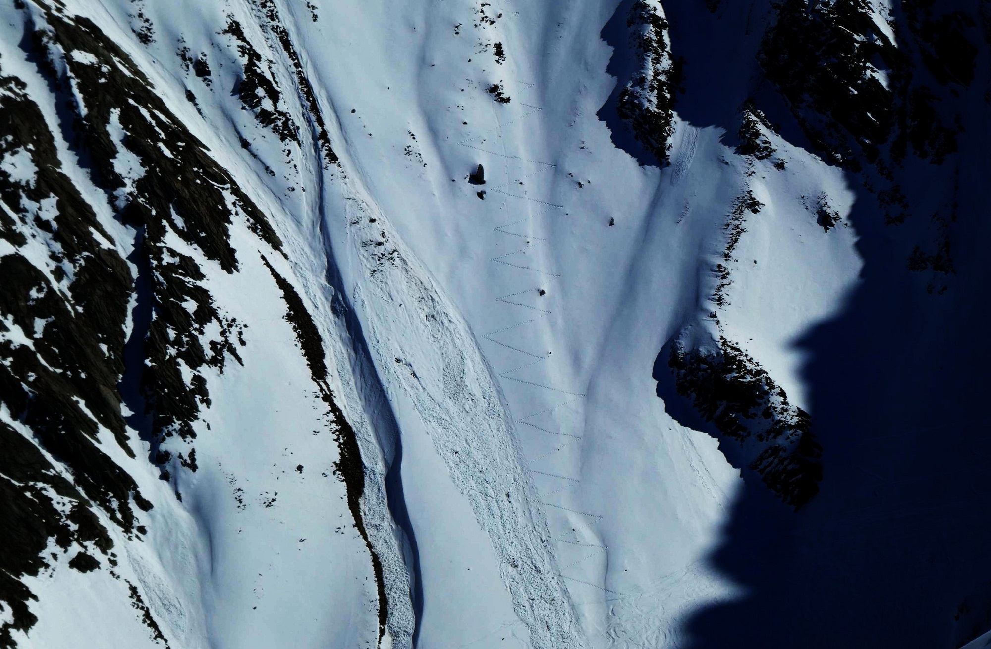
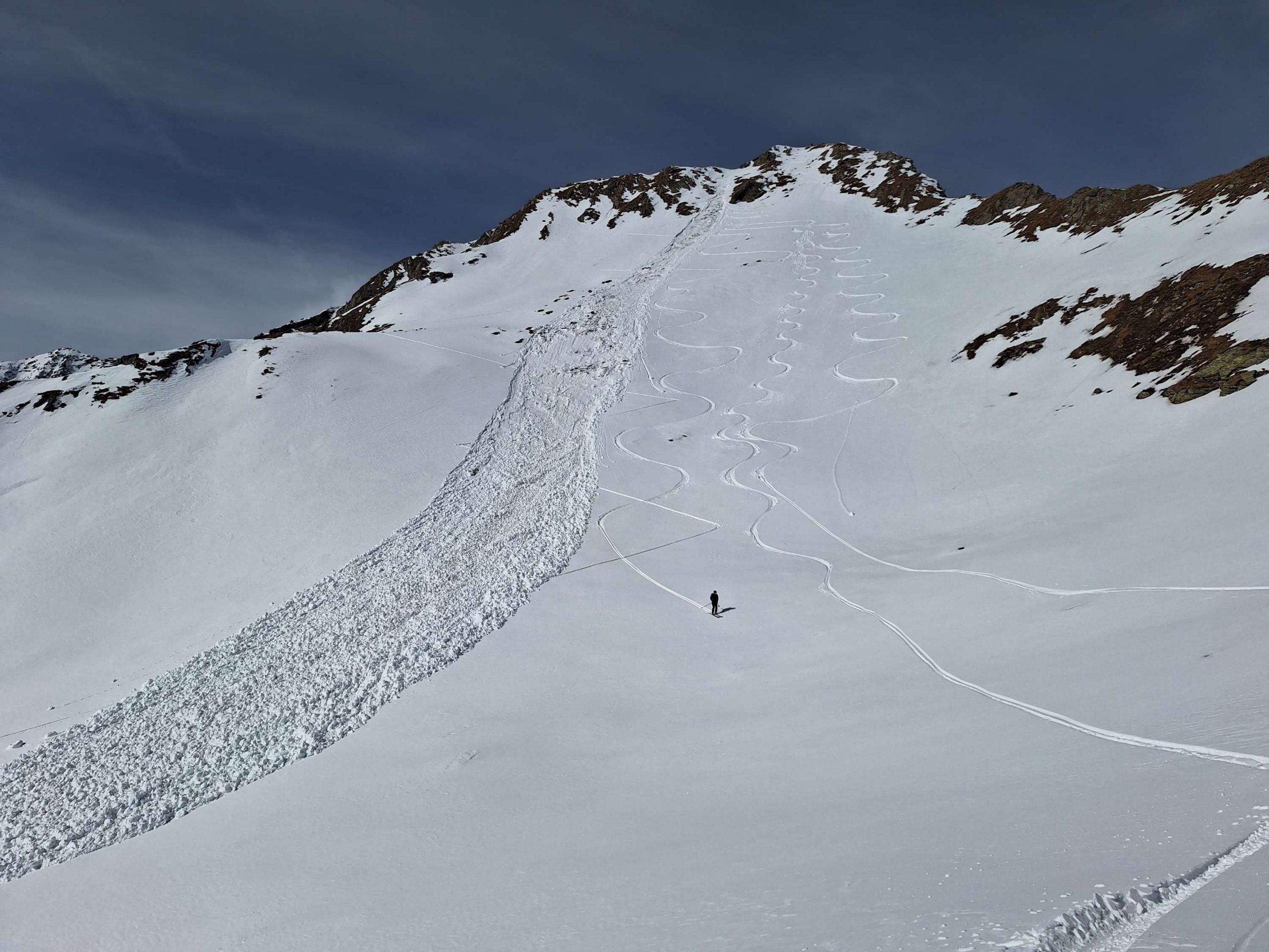
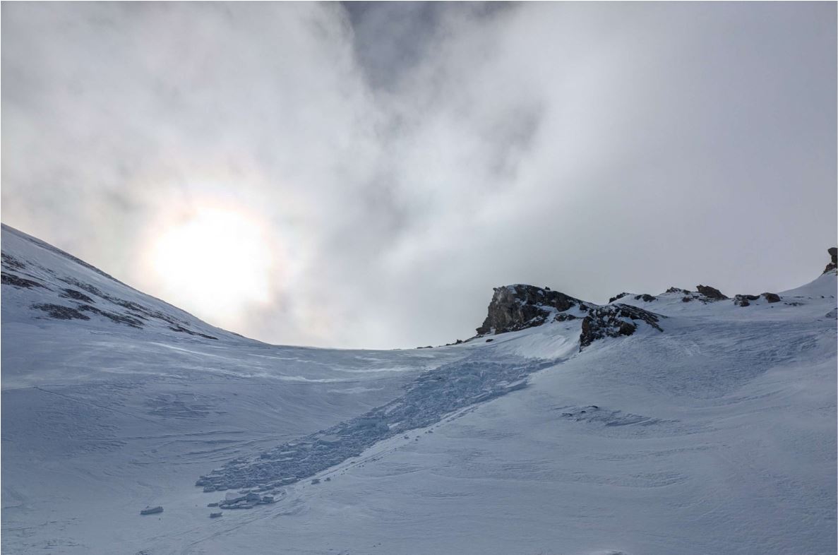
Particularly on the Main Alpine Ridge towards the south, weak old snowpack layers are still prone to triggering. Slab avalanches of medium size can be triggered by one sole person in places. Danger zones are difficult to recognize, they occur esp. in little-tracked, shady steep terrain. Defensive route selection is crucial. A weak southern barrier…
-
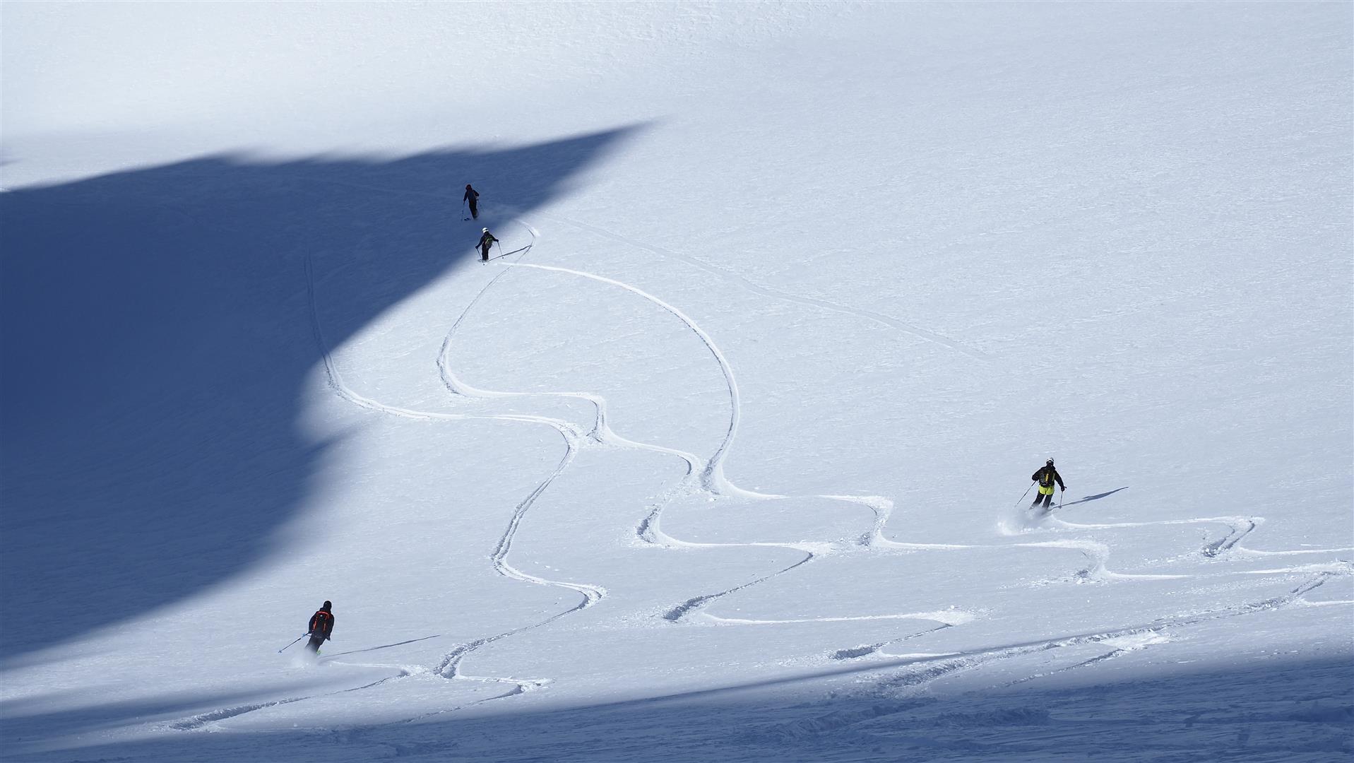
Considerable avalanche danger in major areas of precipitation in the south
Following an unusually long, dry period, weather conditions changed on Sunday, 09.03. Since then, avalanche danger has increased step by step. In the interim, considerable avalanche danger prevails above 2000m in the central Stubai Alps, the northern Zillertal Alps and in East Tirol. Avalanches can be quite easily triggered by winter sports enthusiasts in the…
-
Favorable conditions by and large – slight daytime danger cycle
Isolated fresh snowdrifts prone to triggering lie along the Main Alpine Ridge and in the foehn-exposed regions of North Tirol. Danger zones occur esp. on very steep shady slopes, easily recognized. During the course of the day slightly increasing likelihood of wet glide-snow and loose-snow avalanches on extremely steep sunny slopes due to wet snowpack.…
-
Isolated Danger Zones
Mostly low danger prevailed during this last week, moderate danger regionally. Dominant (contained) problems were snowdrifts and a marked persistent weak layer. Starting Sunday, 2 March, a powerful high-pressure front will move in. Springlike temperatures and often a shallow snowpack on sunny slopes will make the snowpack increasingly moist/wet. When nocturnal skies are clear, firn-snow…
-
Favorable avalanche situation widespread
For dry slab avalanches only isolated danger zones, esp. on extremely steep shady slopes above 2400m. Due to mild temperatures and solar radiation, likelihood of wet loose-snow slides and glide-snow avalanches to increase somewhat. In general, favorable conditions prevail. Risks of injury from hidden rocks outweigh those of avalanche danger. Few avalanche prone locations in…
-
Fresh snowdrift accumulations: caution. Good conditions in wind-protected zones.
From 13.02 to 14.02 some fresh snow is expected (10-20cm, locally more). Whether a snowdrift problem develops depends on wind impact. Current expectation: light-to-moderate, initially southerly wind, then shifting to N/NW. A note of caution: fresh snowdrifts in steep terrain can be quite prone to triggering due to measurably dropping temperatures. Especially dangerous is the…
-
Avalanche situation generally positive, no big changes in sight
Since the last heavy snowfall on Tuesday, 28 January, and the subsequent high-avalanche period, the overall situation has successively improved. Slab avalanches can currently be triggered only in few places in the old snowpack: steep ridgeline, little skied-on terrain, esp. on W/N/E facing slopes. That means shady slopes above 2200m, west and east-facing slopes above…
-
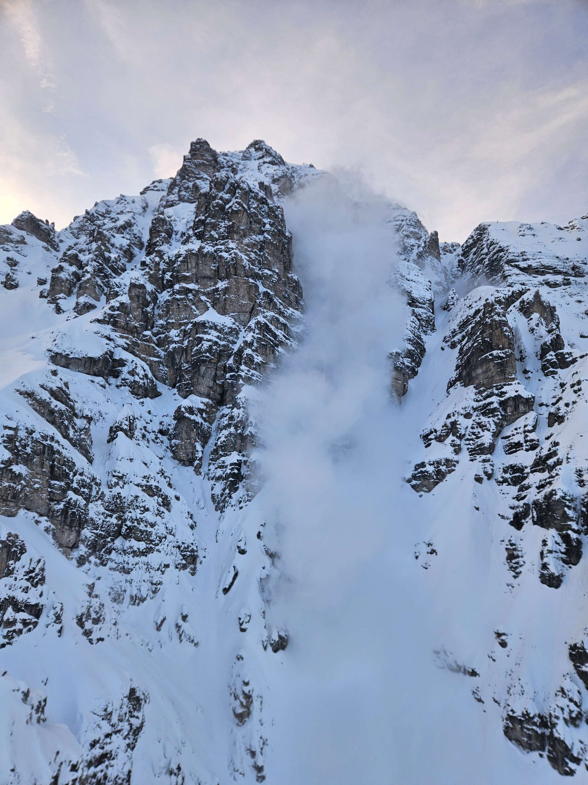
After an active avalanche period, caution plus restraint continue to be necessary regionally
On 28.01.2025 a southern foehn air current and subsequent cold front brought often considerable masses of precipitation regionally. The combination of much fresh snow at high altitudes, strong-to-stormy winds and a weak snowpack led during the course of that day to the significant increase in avalanche releases we forecast; to excellent artificial triggerings; to many…