Category: Current situation
-
NE barrier clouds will bring fresh snow regionally – heightened avalanche activity due to solar radiation
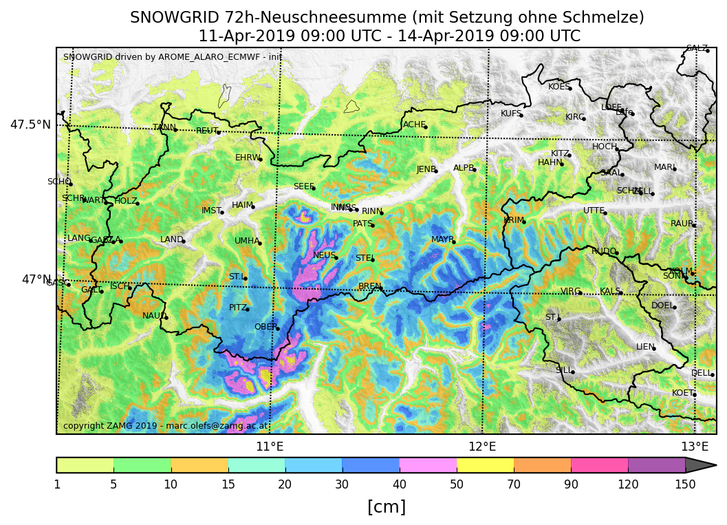
Recent weather has suffered under the the onus of a NE barrier cloud zone. In Stubai, Ötztal and parts of Zillertal Alps, up to 60 cm of fresh snow was registered from place to place. The gradient in fresh snow depths was frequently impressive. There was next to no wind. Yesterday, 14 April, heightened avalanche…
-

Small weather changes can have big effects on avalanche danger
A few items of current importance, as a supplement to the last blog. Particularly in springtime, the interplay of weather parameters – humidity, global radiation, air temperature – have decisive effects on avalanche danger. Even tiny changes in the weather can have huge effects on avalanche danger, both in positive and negative ways. A glance…
-
Favorable conditions widespread. Highly variable April weather.
Current situation & outlook The current avalanche situation is quite favorable over widespread areas. The greatest danger continues to stem from wet-snow and glide-snow avalanches. Small-to-medium glide-snow avalanches are possible below about 2200 m in all aspects. Wet loose-snow avalanches are likely only below 1800 m at the current temperatures. In East Tirol the zero-degree…
-
Loose-snow avalanches, fresh high-altitude drifts, isolated gliding snow
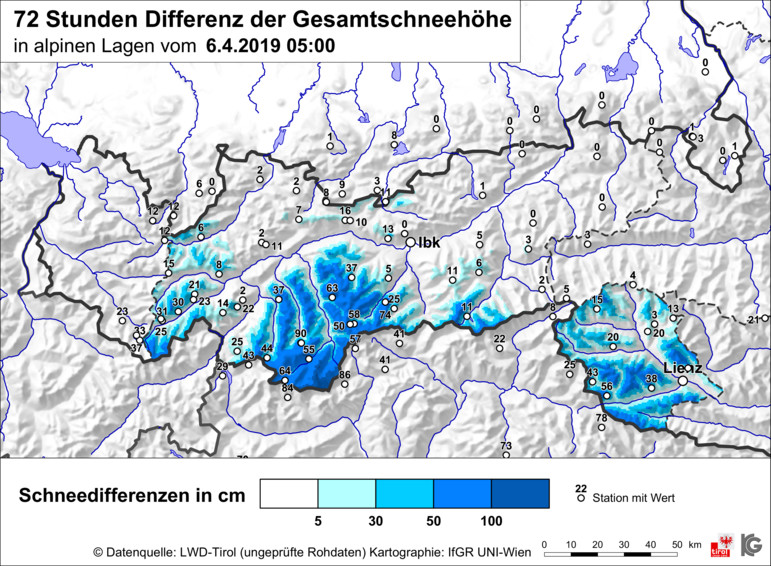
A few snapshots of the current situation Lots of fresh snow in some southern regions 100 cm of fresh snow at 3000 m in Sölden ski area (photo: 05.04.2019) In the meantime, weather conditions have improved. Hardly any wind (in western regions, such as here in the Silvretta, clear nighttime skies, sunshine from early morning).…
-

Low over Genoa bringing winter back
Current situation & outlook April, comes in like a lion, goes out like a lamb. On the heels of recent springlike temperatures, a low-pressure system over the Gulf of Genoa is bringing back a bout of late winter. In the southern barrier-cloud zones along the border to South Tirol, particularly on the Ötztal Main Ridge,…
-
Mostly favorable conditions+beautiful weekend weather
ONLINE SURVEY on new Euregio Avalanche.report We want your feedback on the new border-crossing Avalanche Bulletins. Help us to improve our product and win an attractive prize. The survey takes about 10 minutes. Thank you. Summary The outstanding weather forecast for the weekend permits us to look forward to making good use of the stable snowpack.…
-
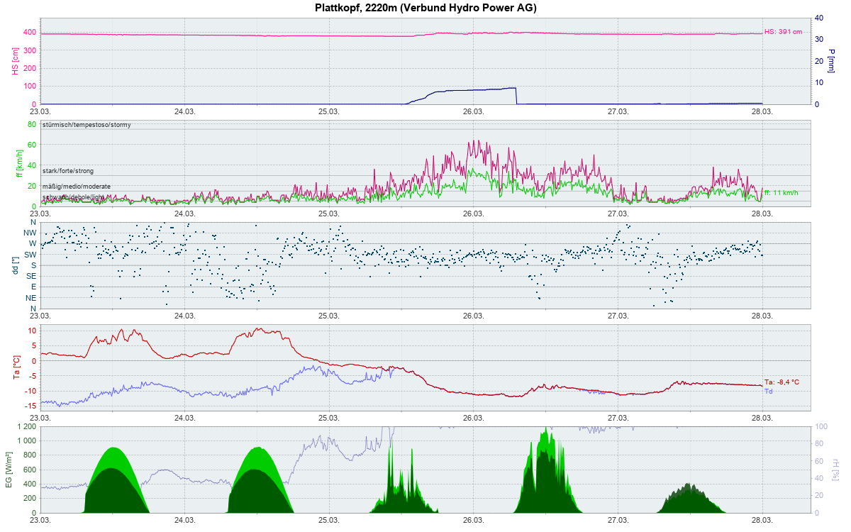
Heightened danger of wet loose-snow and isolated glide-snow + slab avalanches starting in late morning
Skies on Saturday night, 23.03, will again be star-studded and the snowpack will cool off accordingly. On steep, sunny slopes, a melt-freeze crust capable of bearing loads will form up to high altitudes in the early morning hours of Sunday. Beneath this crust the snowpack is wet or moist down to the ground at least…
-
Favorable avalanche situation. Gorgeous weather for winter sports throughout Tirol
Current situation Low avalanche danger currently prevails throughout Tirol. Brilliantly sunny-plus-no-wind weather has created unbeatable conditions for winter sports. On shady slopes and in zones where solar radiation is flat, there is still powder snow. Breiter Grieskogel, southern Stubai Alps (photo: 20.03.2019). The current avalanche situation permits steep descents with top conditions. Russkopf, Silvretta (photo:…
-
Heavy snowfall, gale-strength winds: dangerous avalanche situation!
Current situation & outlook A powerful westerly/northwesterly airstream is currently thrusting a series of cold and warm fronts towards the Alps. By Saturday morning, 16.03, we can expect heavy precipitation, according to ZAMG weather forecasts. In the mountains, 50-100 cm of fresh snow is anticipated. Winds will be blowing at strong to storm strength, even…
-
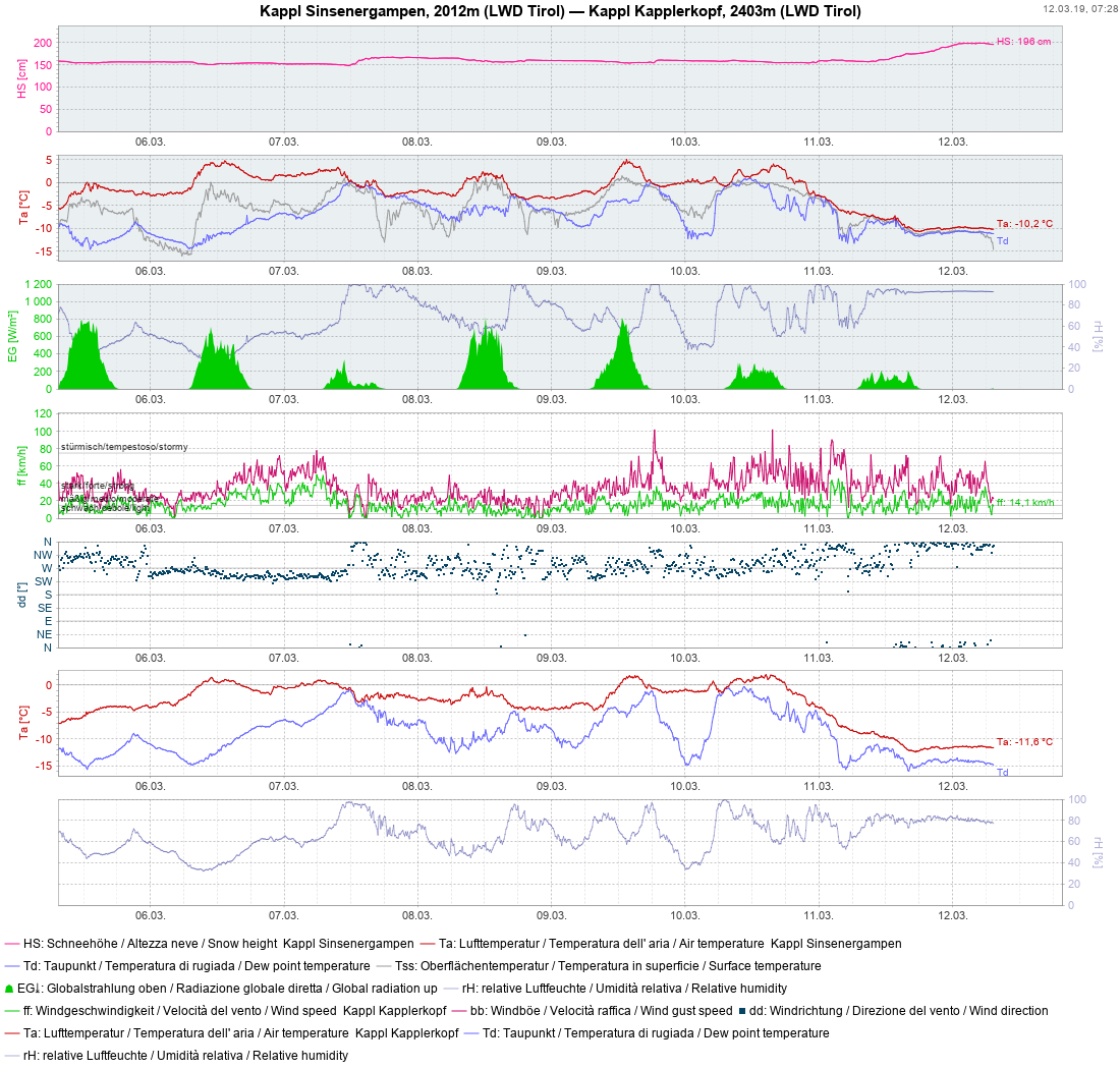
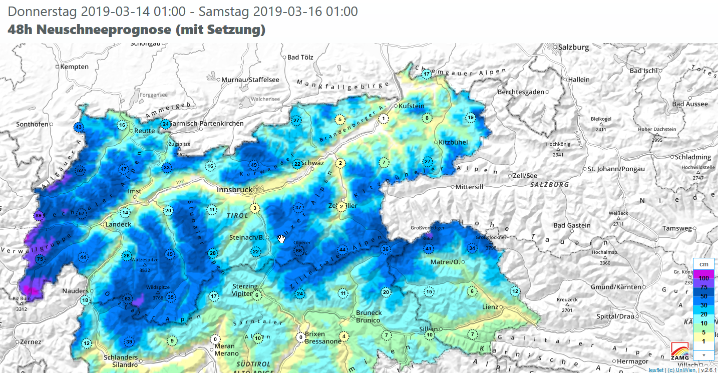
Lots of fresh snow in western regions. Beware loose-snow avalanches and trigger-sensitive snowdrifts!
Normal 0 21 false false false DE-AT X-NONE X-NONE Variable weather has brought some precipitation over the last five days, most of which fell on 11.03 and 12.03. Initially there was rainfall up to about 2000 m, regionally even higher. The measurements at Kappl weather station bear witness to the highly variable conditions over recent…