Category: Current situation
-
Regionally wintery. Main danger: fresh snowdrifts above treeline
The generally favourable conditions have deteriorated since last week as a result of snowfall and wind impact. Regionally there has been considerable avalanche danger. In East Tirol, favourable conditions still reign, but are now receding as a result of wind and some fresh snow. Weather review Variable conditions. That is the best way to describe…
-
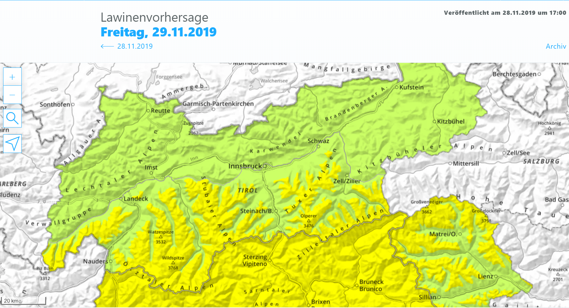
Ongoingly favourable avalanche situation
The favourable avalanche situation in Tirol persists. Even the weak cold front which is expected to brush Tirol on 7 December will not change anything significantly through Sunday, 8 December. The intensifying wind at high altitudes might generate fresh, relatively small snowdrift masses. These will sometimes be relatively easy to trigger, but can be easily…
-
Mostly favourable conditions – isolated glide-snow avalanches in regions where snowfall was heaviest. Fresh snowdrifts, esp.in the west.
Mostly favourable conditions Numerous examinations of the snowpack and reports from observers corroborate the assessment: the avalanche situation is improving to an increasing degree. The snowpack is stable over widespread areas. Weak layers are found only in isolated cases, and then, they are near to the surface at very high altitudes in the immediate vicinity…
-
Glide-snow avalanches are the main danger
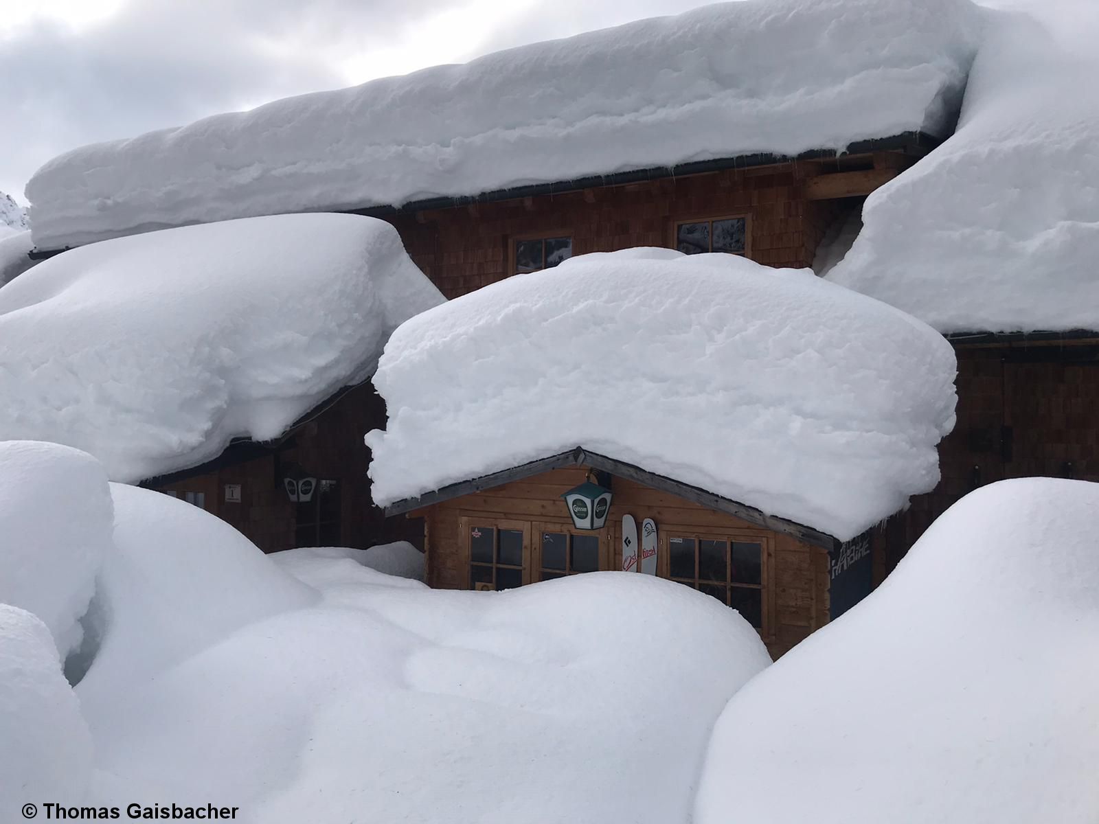
Lots of snow in the south Precipitation this last week has been unusual. The consequence: above average snow depths for this juncture of the season. “A Winter Wonderland” at the Dolomiten Hut in the Lienz Dolomites. (Photo: 18.11.2019) At low and intermediate altitudes, massive rain impact on the snowpack. Stubai Alps (Photo: 20.11.2019) The heavy…
-
Heavy precipitation with strong winds and rising temperatures driving naturally triggered avalanches to a climax
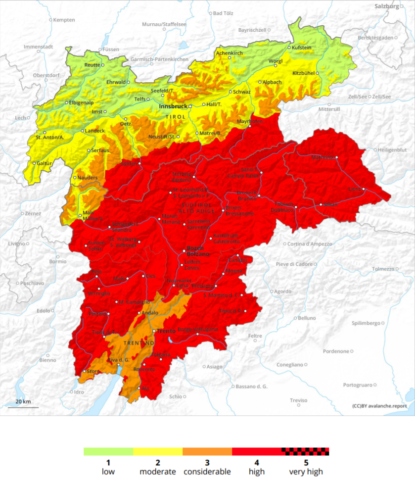
High avalanche danger in southern regions What the ZAMG Weather Service has dubbed an “extreme weather situation” is leading to an extraordinary avalanche scenario, with high avalanche danger in general in the southern regions. Danger map of the Avalanche Bulletin for 17.11.2019 The combination of heavy snowfall including storm-strength winds in the heights, and rising…
-
Critical avalanche situation with naturally triggered avalanches in regions where snowfall heaviest. Start of daily avalanche forecasts 15 November at 5:00 pm for 16 November 2019
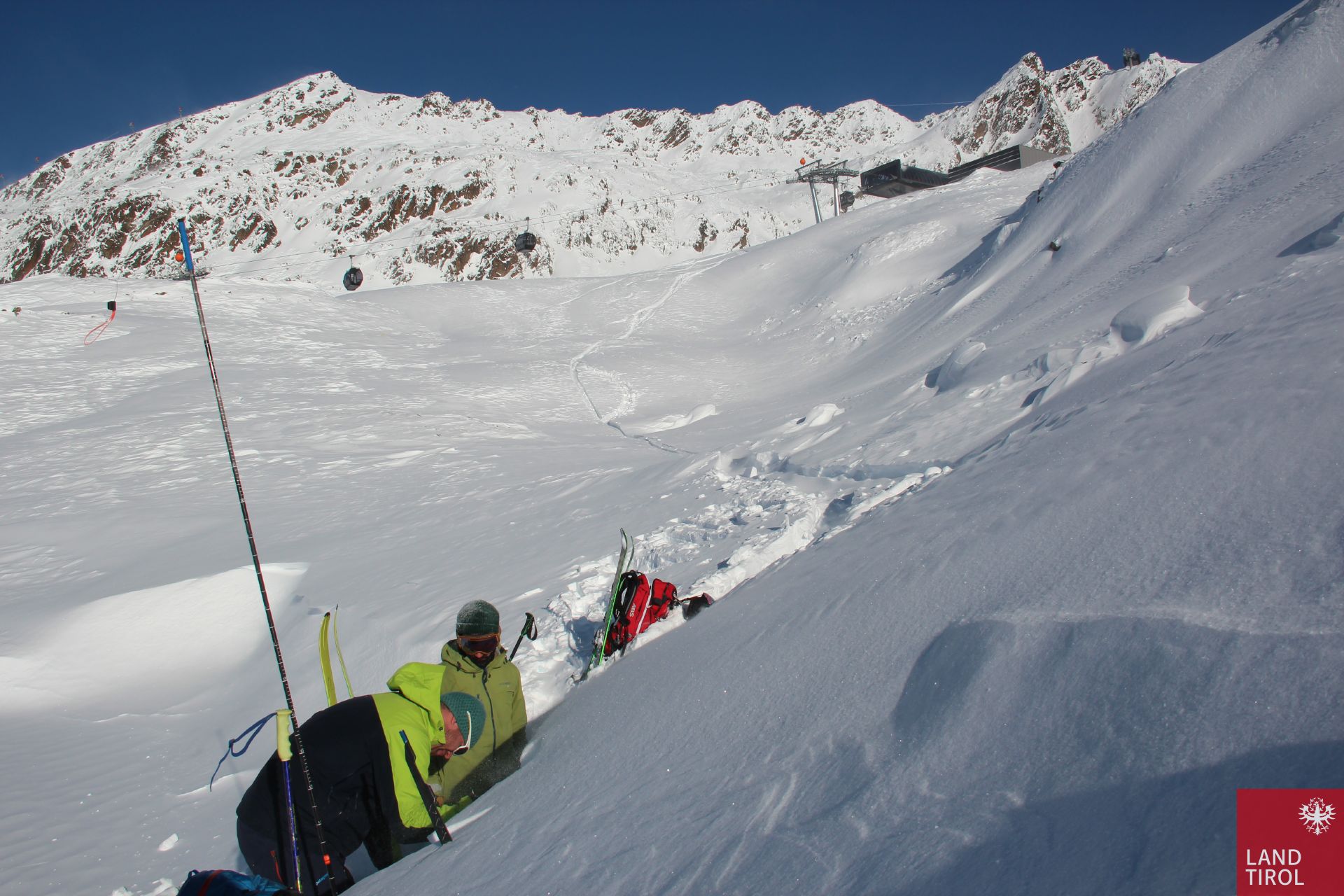
Today, 14.11, we took advantage of the window of good weather and focused on the snowpack layering, together with our team of observers. Simultaneously, Avalanche Commissions made their first exploratory flights in the regions where snowfall has been heaviest. Snowpack analysis is the basis for correct assessments of danger. (Photo: 14.11.2019) We currently face two…
-
Deep winter conditions in parts of Tirol. Heed avalanche danger!
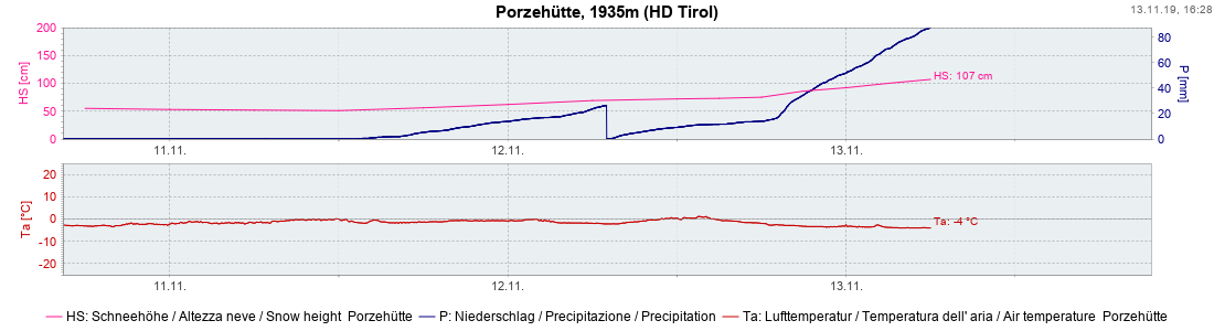
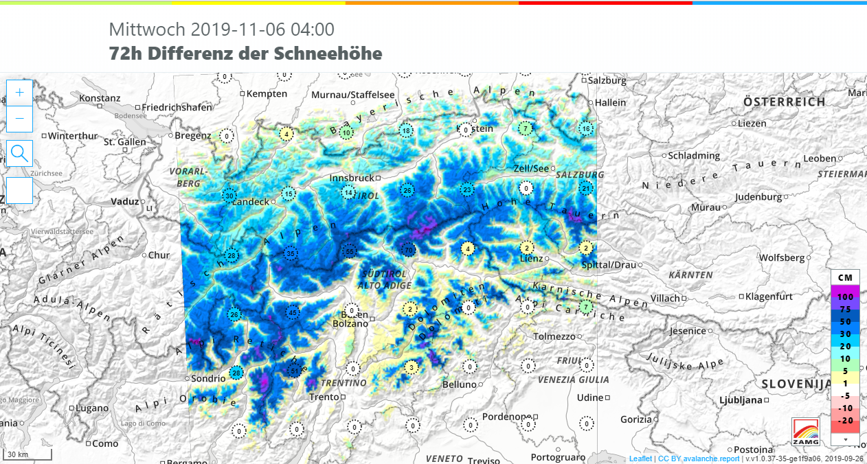
The precipitation which was forecast by the ZAMG Weather Service has arrived. In the regions along the Main Alpine Ridge from the southern Ötztal Alps eastwards and in East Tirol, 50 to 80 cm of fresh snow have frequently been registered. In southern East Tirol there was generally about 100 cm of fresh snow registered.…
-
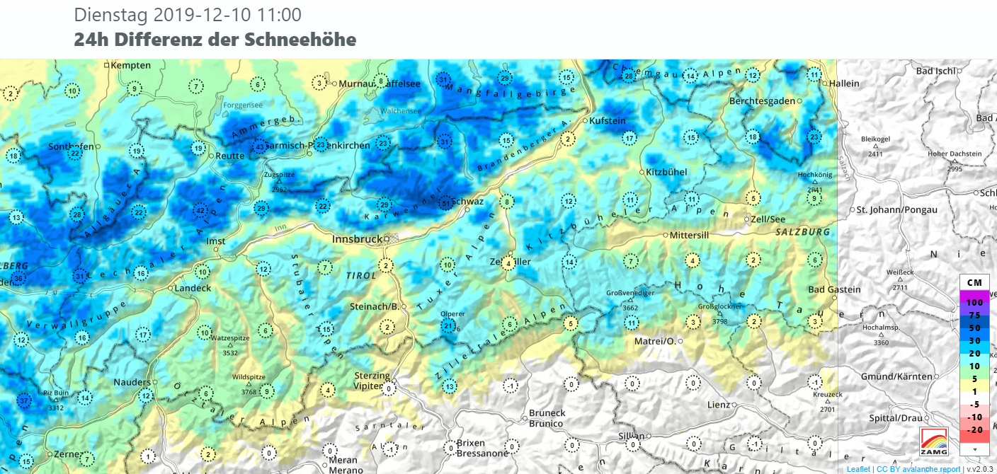
Heavy snowfall in coming days, rising avalanche danger
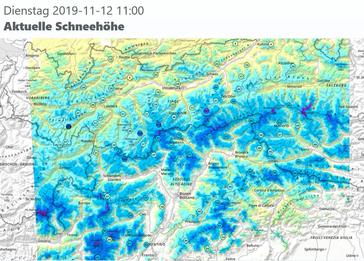
Lots of fresh snow, particularly in East Tirol and along the Main Alpine Ridge, will build up new snowpack depths. As a result, avalanche danger will rise to new heights in those regions. North of the Inn there is comparatively little snow, and less precipitation is anticipated there. Overview of snow depths in Tirol. North…
-
Caution urged at high altitudes and in high alpine zones: heightened likelihood of avalanche accidents after stormy period followed by weather improvement
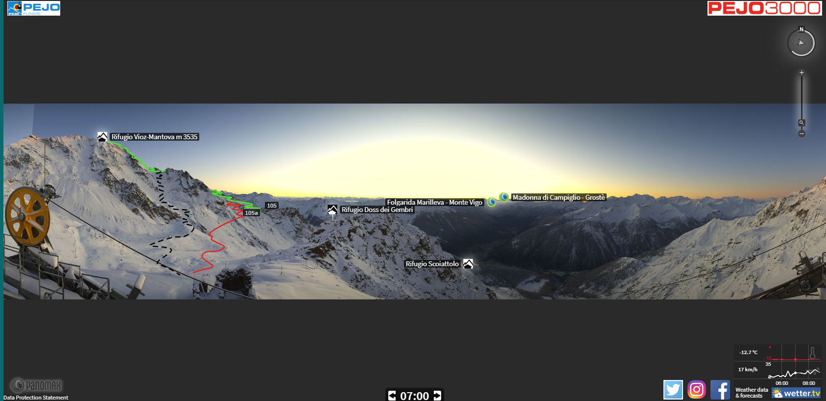
Just to round out the last blog entry: In the mountains of the Europaregion there is already snow in the heights: Webcam photo from Pejo 3000 m towards Rifugio Vioz-Mantova (07.11.2019) The bad-weather front arrived from the south. Animated depiction of the Zugspitze webcam of the bad-weather front approaching from the south. Throughout the Europaregion…
-
Winter conditions in the mountains, including possible avalanche danger
Highly variable weather conditions have brought some fresh snow to the mountains since the end of October. The snowfall was particularly heavy during the last few days. The amounts of fresh fallen snow in the regions along the Main Alpine Ridge and southwards therefrom were frequently about 50 cm, significantly more from place to place.…