Category: Current situation
-
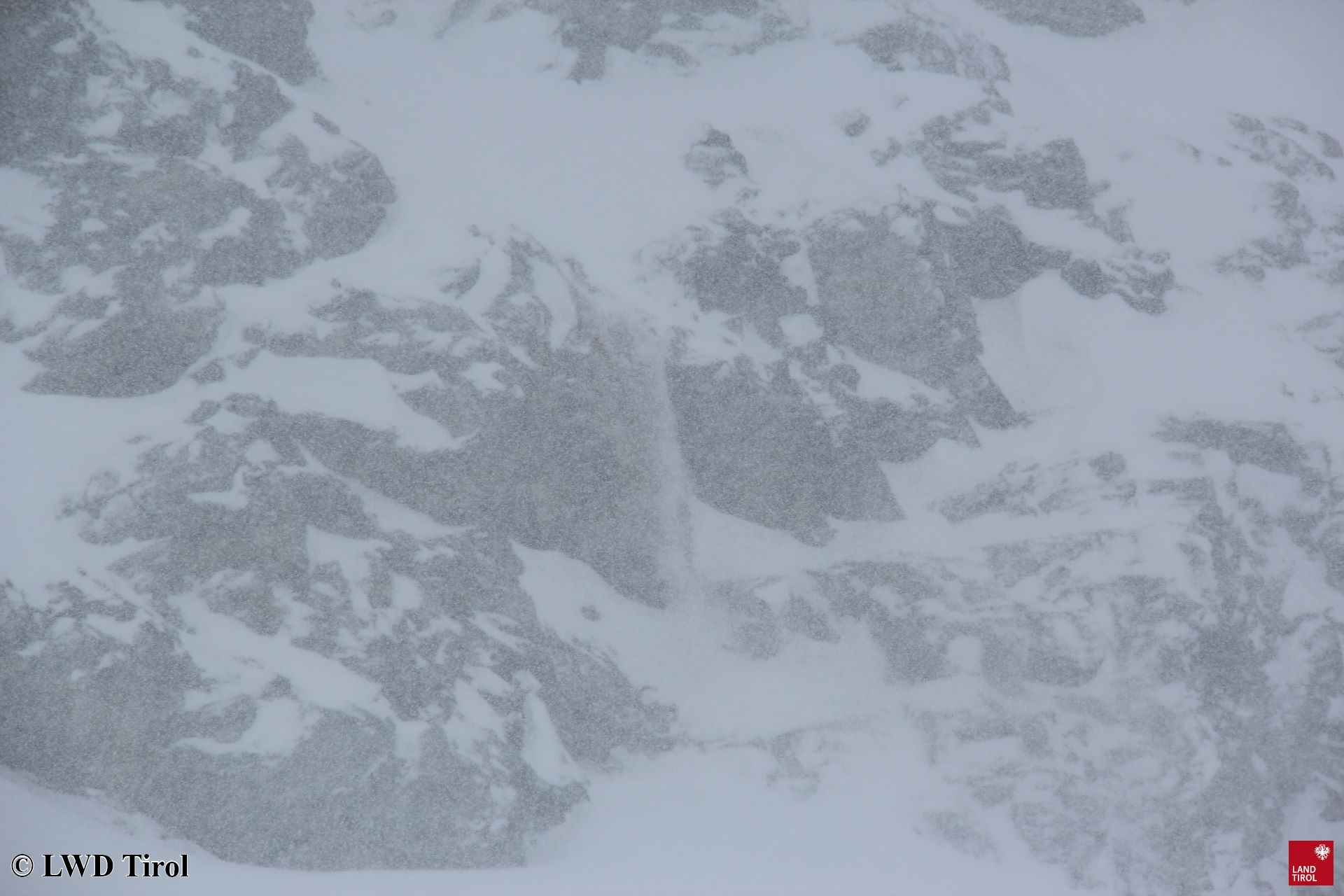
Brief delicate situation in backcountry. Be careful of naturally-triggered avalanches!
The warm front forecast by ZAMG Weather Service arrived today, 10 March, and brought widespread snowfall to Tirol, rainfall at low and intermediate altitudes. 24 hrs of precipitation (as of 10.03, 19:00) which, according to ZAMG Weather Service will terminate at about midnight. Snowfall at high altitude, increasing rainfall at low and intermediate altitudes due…
-

Mostly favorable conditions. Be careful of fresh high-altitude drifts and loose-snow avalanches.
Predominantly favorable conditions Avalanche danger in Tirol is moderate above 2200 m, elsewhere danger is low. Highest caution is necessary towards fresh snowdrift masses, especially trigger-sensitive on very steep shady and ridgeline slopes at high altitudes. In addition, the fresh snow reacts very swiftly to solar radiation and diffuse light in this season, meaning that…
-
Highly variable conditions + stormy. Main danger: snowdrifts.
Second warmest winter in history The meteorological winter 2019/2020 (01.12 – 29.02) is coming to an end. According to ZAMG Weather Service it is the second warmest winter in the 253-year history of measurement-taking. One measurement stands out: at Innsbruck Airport on 23 February in the evening the temperature was 20.5°C. (Only twice was this…
-
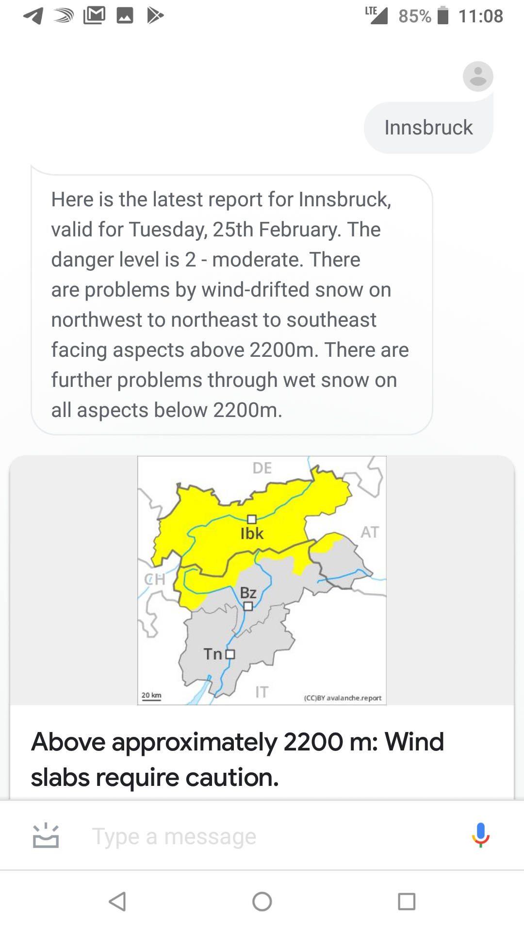
Talk to avalanche.report!
Normal 0 21 false false false DE-AT X-NONE X-NONE Thanks to the software developer Tobias Kupek (www.tkupek.eu) it is possible to interact with the avalanche report by voice via Google Assistant and as Alexa-Skill. In a conversation with the feature, you can ask for the current avalanche situation in a specific region, as well as…
-
Small-spread fresh snowdrifts. Isolated old-snow problem. All in all, quite favourable conditions.
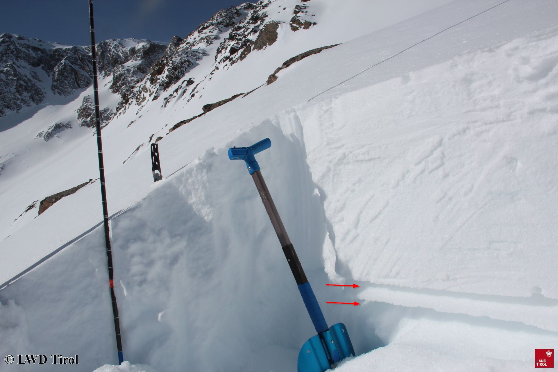
Current problems: small-spread snowdrifts, old snow Quite favourable conditions currently reign in Tirol. Avalanche danger is moderate to low today (Friday 21.02.2020). En route in Defereggental. On sunny slopes, springlike conditions often prevail, including corn snow during the descent. (photo: 18.02.2020) Avalanche danger map for Friday, 21.02.2020 We currently have 2 avalanche problems to deal…
-
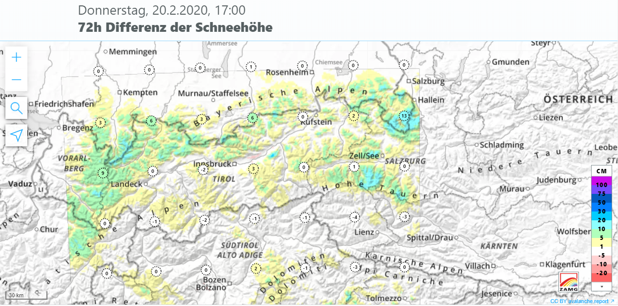
Heed snowdrifts briefly / Diffuse old-snow problem
Main problems: fresh drifts at high altitude, diffuse old-snow threat The snowdrifts which accumulated over the last week have bonded with each other well, generally speaking. More attentiveness is demanded by freshly generated drifts. These are frequently prone to triggering above about 2400 m, found especially on steep shady slopes and in high-alpine ridgeline terrain.…
-
After snowfall + storm, briefly delicate situation for backcountry winter sports enthusiasts
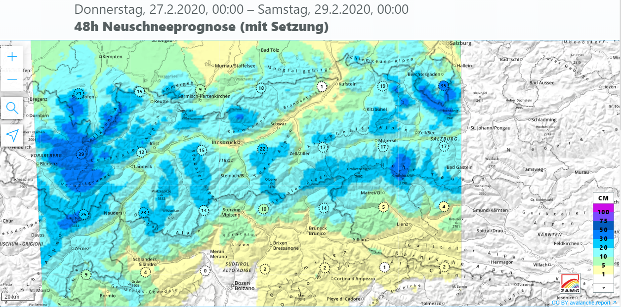
Lots of snow + wind. And now, a high-pressure front Following days with ample snowfall and storm-strength winds, beautiful weather is on the way. A turbulent week lies behind us. Windy, initially warm with rainfall, snow depths reducing slightly thereby, followed by a cold front, with lots of snowfall in places. High-pressure front starting on…
-
After rain, snowfall to low lying areas – Backcountry skiers beware
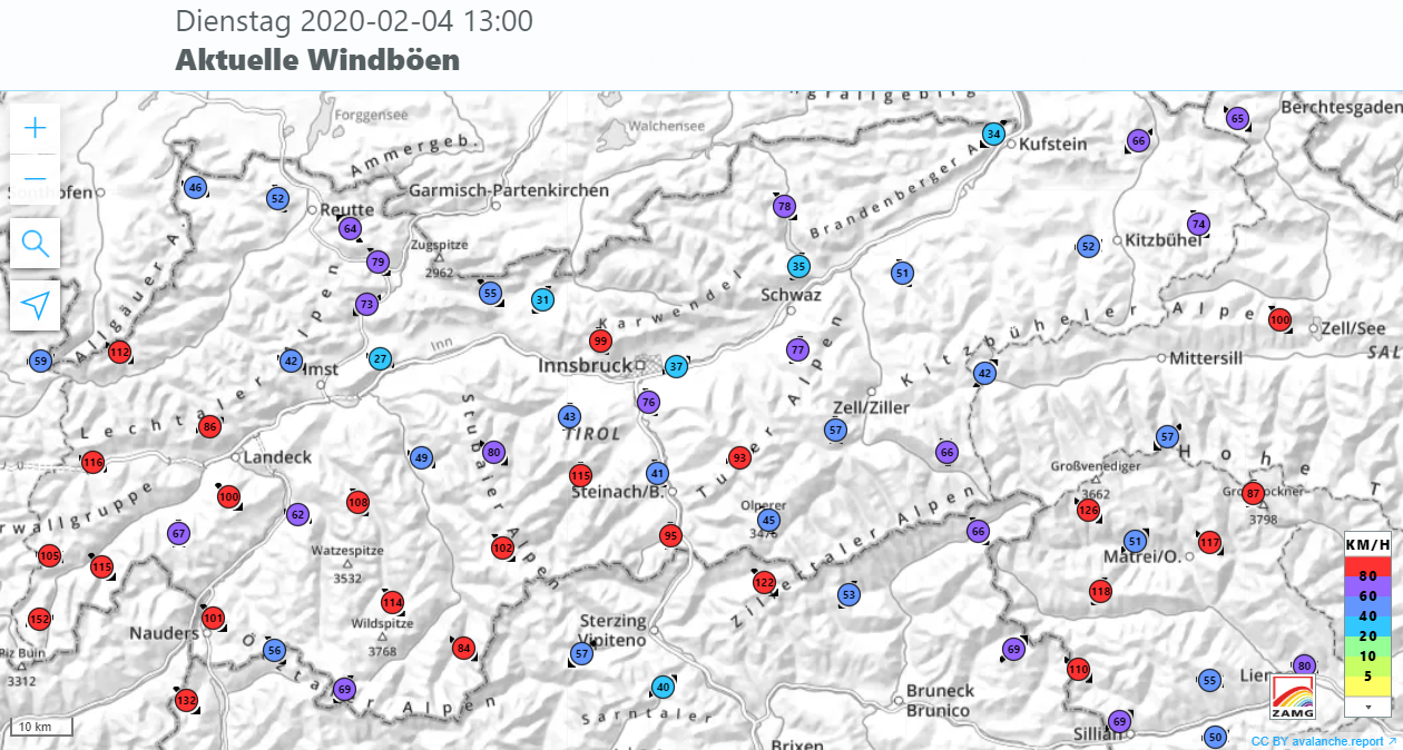
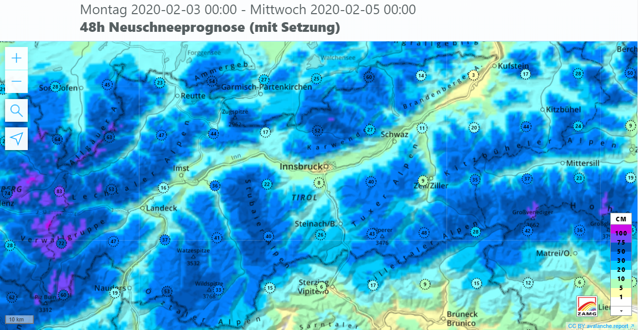
Outbreak of winter down to low lying areas Following frequently intensive rainfall with numerous, mostly medium-sized avalanches and flooding in the Lower Inn Valley, ZAMG Weather Service now announces a cold front which will bring impressive amounts of fresh snow and storm-strength winds in the mountains. The cold front will reach Tirol tomorrow, 4 February,…
-

Rain+warmth weakening snowpack, causing naturally triggered avalanches
At 6:00 pm the ZAMG Weather Service published a report about an extraordinary precipitation event for the period 2-3 February in Tirol. As the result of a warm front, mild and extremely moist air masses are being transported to Tirol. Most of the precipitation is expected on the northern rim of the Alps: 60-90 mm…
-
Regionally critical situation for winter sports enthusiasts
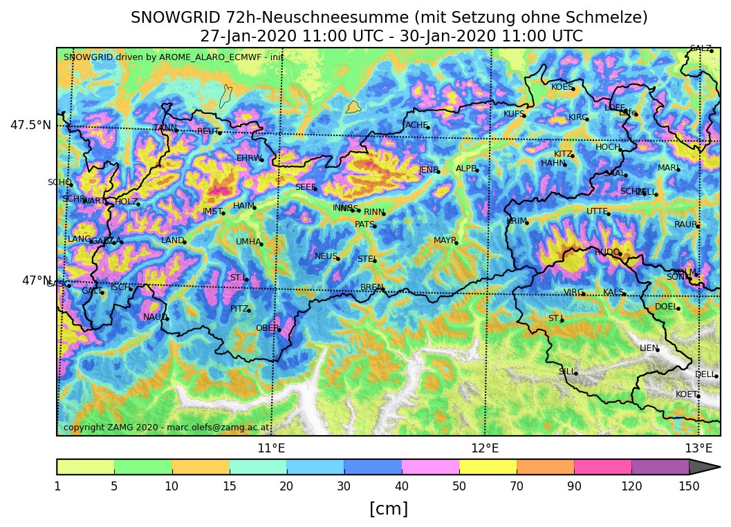
New danger zones due to fresh snow and wind A cold front passed through on Tuesday, 28.01, brought more than 50 cm of fresh snow regionally during Wednesday night 29.01. Most of the snow fell in northwestern Tirol and northern East Tirol. Weather last week. To begin with, high-pressure conditions, then weakening. Initially southerly airstream,…