Category: Current situation
-
Glide-snow avalanches in heavy-precipitation regions. Old-snow problem regionally.
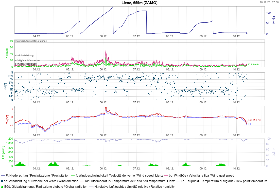
Glide-snow problem on grassy slopes. Caution: rooftop avalanches. Let’s first look at the regions where precipitation has been heaviest. There have been record-breaking amounts of fresh snow registered since Friday, 4 December. Record-setting precipitation in Lienz (measurements since 1880) Since Tirol’s Avalanche Warning Service was established in 1960, there have never been such masses of…
-
Attention winter sports enthusiasts: old-snow problem in regions with comparativfely little snow
Right off the bat: an appeal to all winter sports enthusiasts Quite deliberately we want the focus at the beginning of this blog to be on the regions of North Tirol where there is little snow. That is where winter sports enthusiasts need to be aware of a potential, difficult-to-assess old-snow problem. The old-snow problem…
-
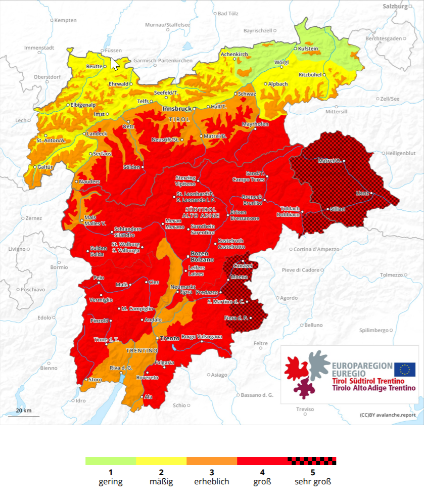
Very high avalanche danger in East Tirol
In East Tirol a dangerous situation has developed as a consequence of extraordinary amounts of snowfall plus ongoing wind impact and rain. This has led to the highest rank of risk being assigned: very high avalanche danger. Update from 06.12.2020 8:00 am: In the EUREGIO very high avalanche danger prevails regionally. In the mountains there,…
-
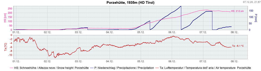
Lots of fresh snow + storm winds = high avalanche danger in South as of 5 December
Immense amounts of fresh snow, storm winds, variable snowfall altitudes The ZAMG forecasts have been confirmed: in southern regions it will snow intensively. In East Tirol the expectations are currently for 50 cm of fresh snow on the valley floors (with significant proportion of rainfall), elsewhere generally 100 cm. In the upper Gailtal/Lesachtal, according to…
-

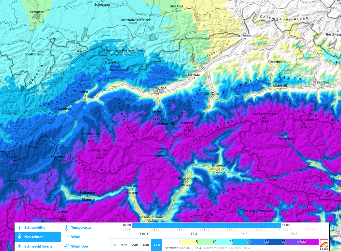
Starting Friday 4.12, heavy snowfall in South, marked increase in avalanche danger
November concludes very mild, not much precipitation The month of November 2020 will go down in history: according to ZAMG Weather Service it was among the ten driest, in the mountains the third warmest, and among the five sunniest Novembers in the entire history of weather measurement. December launch – heavy snowfall in southern regions …
-
Small drifts in high alpine regions. Danger: taking a fall on hard snowfields.
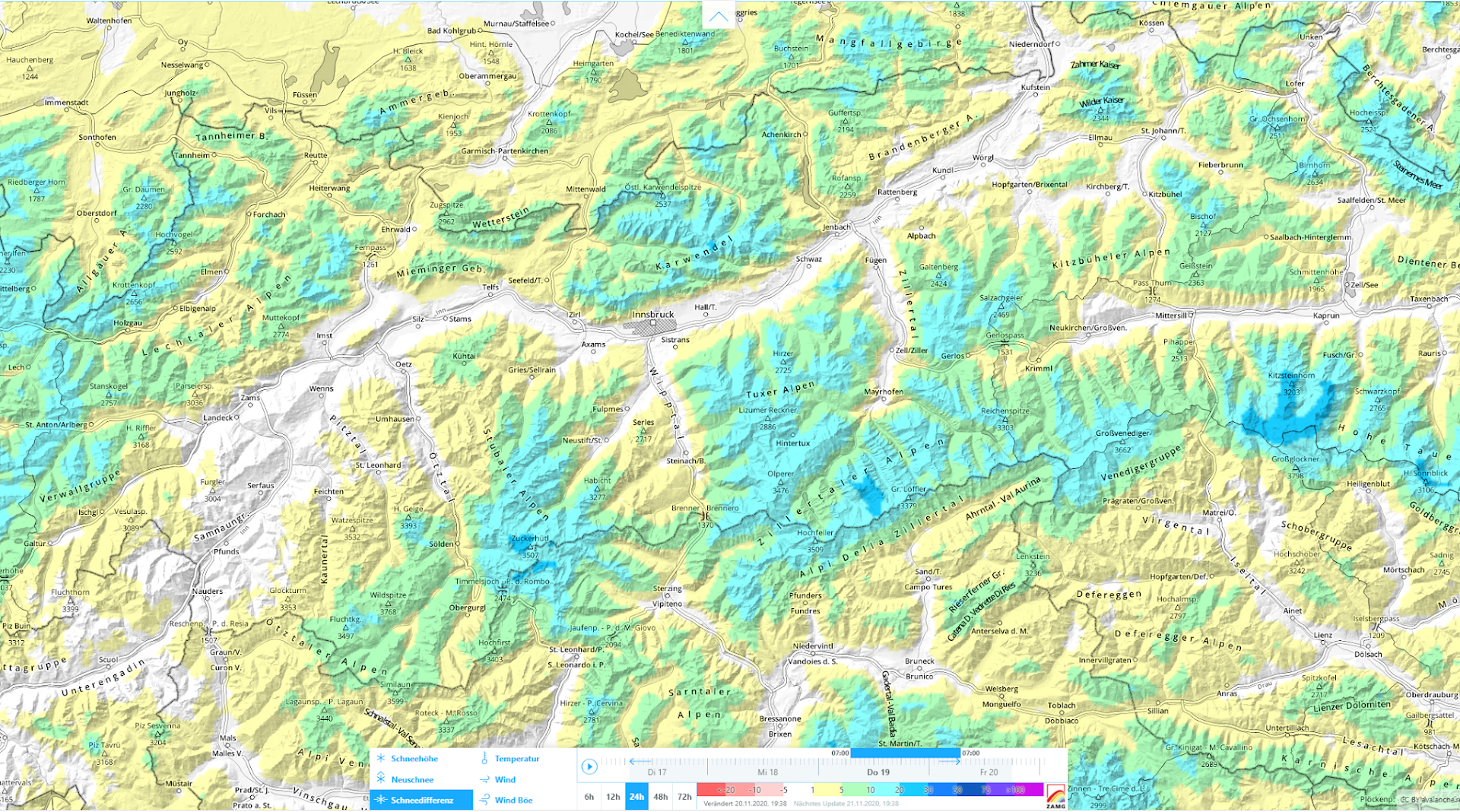
First things first: strong winds are generating mostly small, often trigger-sensitive snowdrift accumulations at high altitudes. Caution urged especially on shady, steep slopes. A cold front on 19-20. November brought generally 10-20 cm of fresh snow, locally a bit more. Fresh snow: 19-20.11.2020 Plus, in major areas of precipitation along the Main Alpine Ridge, strong…
-
Onset of winter in the mountains leads to heightened avalanche danger
Lots of fresh snow in the mountains A cold front moving swiftly across Tirol is bringing heavy precipitation to the southeastern regions of the land. ZAMG Weather Service anticipates 50-80 mm of precipitation between Monday (26.10.2020) at 6:00 pm and Tuesday (27.10.2020) at 9:00 am. As temperatures rapidly drop, the snowfall level on the Main…
-
First snowpack analysis results – Ongoing old snow problem in high alpine regions – Heed temporary snowdrift problem
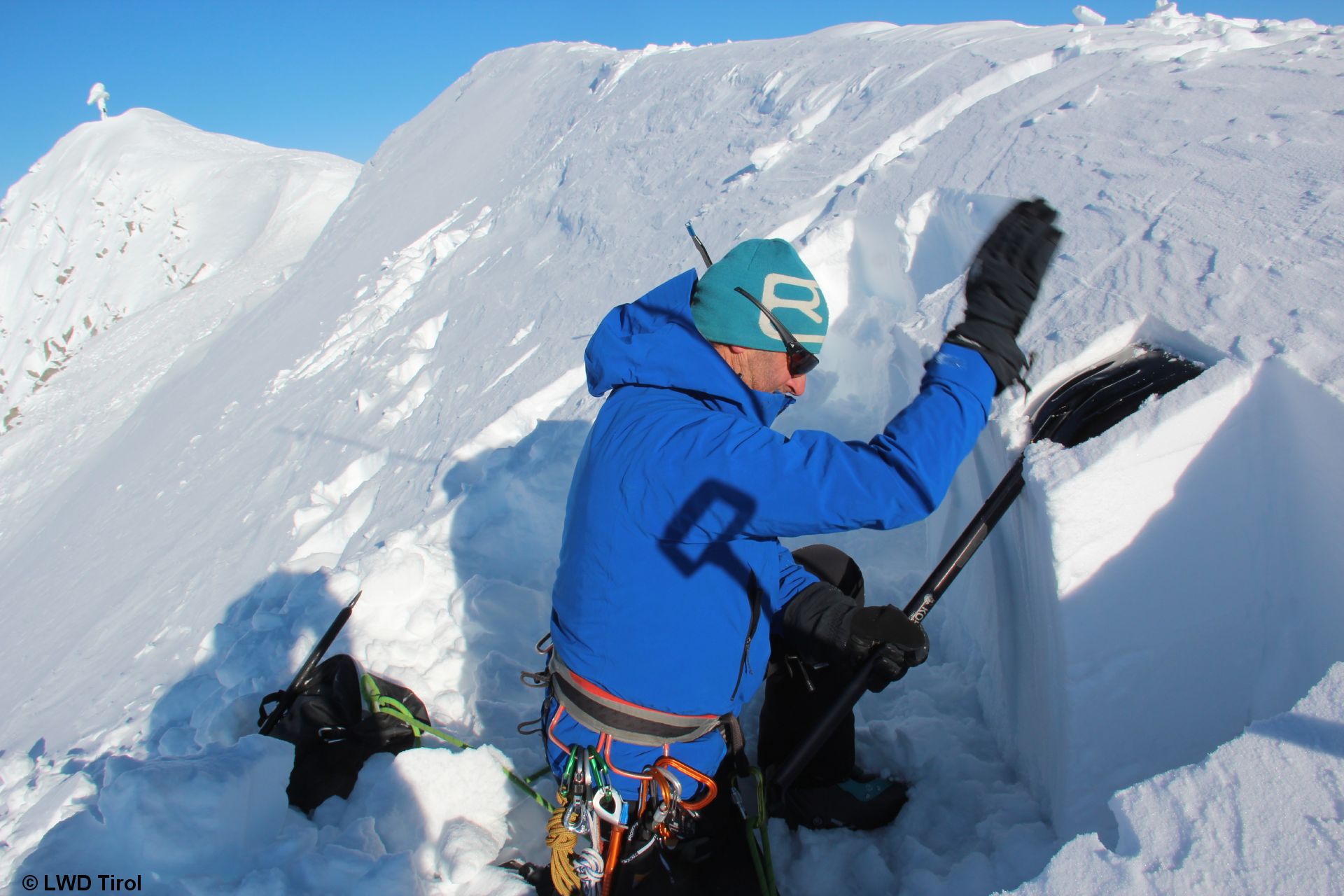
Snowpack analysis in high alpine terrain Since our last blog we have swooped far and wide in the state helicopter, dug deep in the high altitude snows in order to construct snow profiles of Tirol’s high alpine terrain. Part of this involves snowpack stability tests in order to find out how well the disparate layers…
-
Wintery conditions in some high alpine regions. Latest news: first avalanche victim of the season.
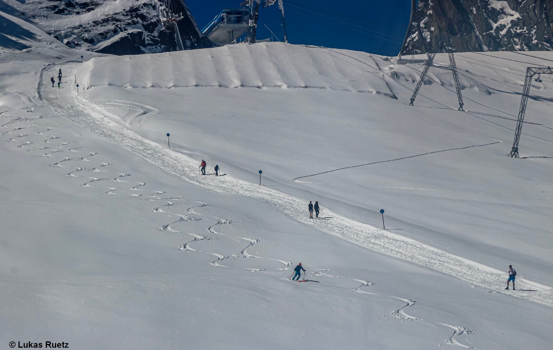
Temperatures low, precipitation, snow in the mountains After a particularly rainy August (including first snowfall down to nearly 2000m on 4 August) a warm September followed. Very early and short-lived winter joys on Stubai Glacier, 5 August (photo: 05.08.2020) Starting on 22 September, it turned wet again. On 26.09 a massive onset of winter occurred,…
-
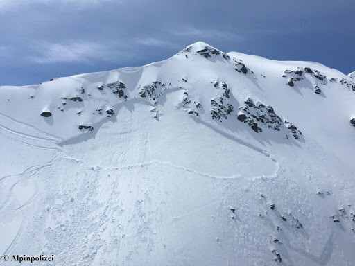
Caution: wide-ranging, large-spread northern aspect avalanches above 2800 m
Since yesterday (6 May) we have reports both from Emergency Headquarters of Tirol and from winter sports enthusiasts of additional, sometimes large-spread avalanches: Saumspitze, Verwall (about 3000 m, north), Mittlerer Spiegelkogel, Ötztal Alps (about 3300 m, north), Schrankkogel, Stubai Alps (about 2800 m, northeast), Taschachferner, Pitztal (about 2800 m, north) Schartenkogel, Stubai Alps (2800 m,…