Category: Current situation
-
Onset of unfavorable avalanche situation in north. Receding temperatures reduce wet-snow avalanche risks.
Difficult avalanche prognosis We are at a point in the season where forecasting avalanches is particularly challenging, largely because even miniscule divergencies in meteorological / nivological parameters can have astoundingly big effects on avalanche danger. Specifically, this is the current rostrum of factors which interplay: Nocturnal skies overcast Clouds forming at various altitudes during the…
-
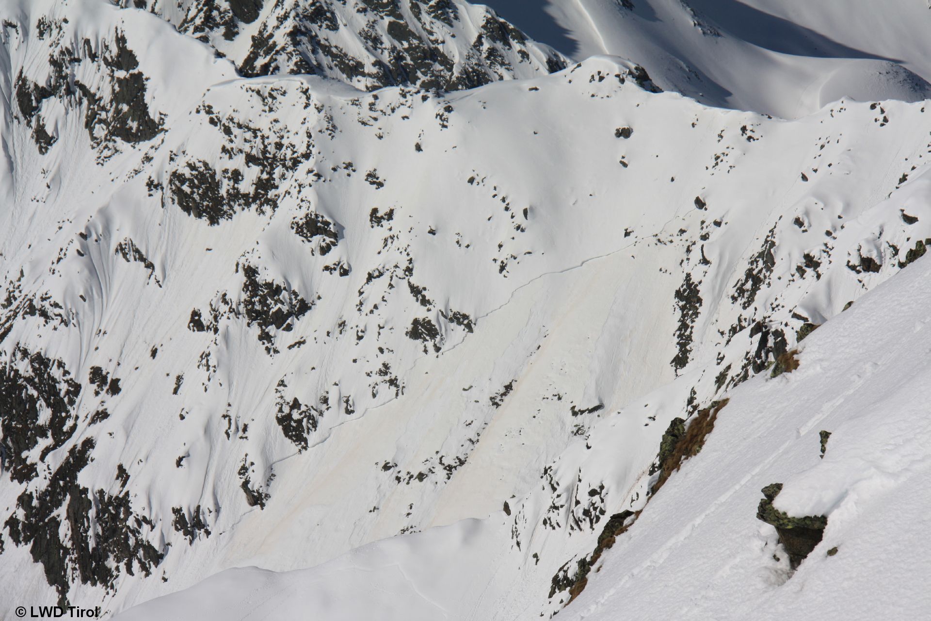
Heightened natural triggerings. Plus local old-snow problem on shady, shallow-snow, very steep slopes. Avalanche analysis: Brennerspitze.
Unusually warm: time window shrinking for backcountry tours. Naturally triggered avalanches increasing. We are currently experiencing a phase of unseasonably warm weather. The zero-degree level today lies at 3300m, according to ZAMG Weather Service. Despite nights of clear skies and outgoing longwave radiation with resultant cooling, the snowpack rapidly softens up during the daytime. Avalanche…
-
Avalanche accident Brennerspitze in northern Stubai Alps. Caution in coming days: swift daily rise in danger.
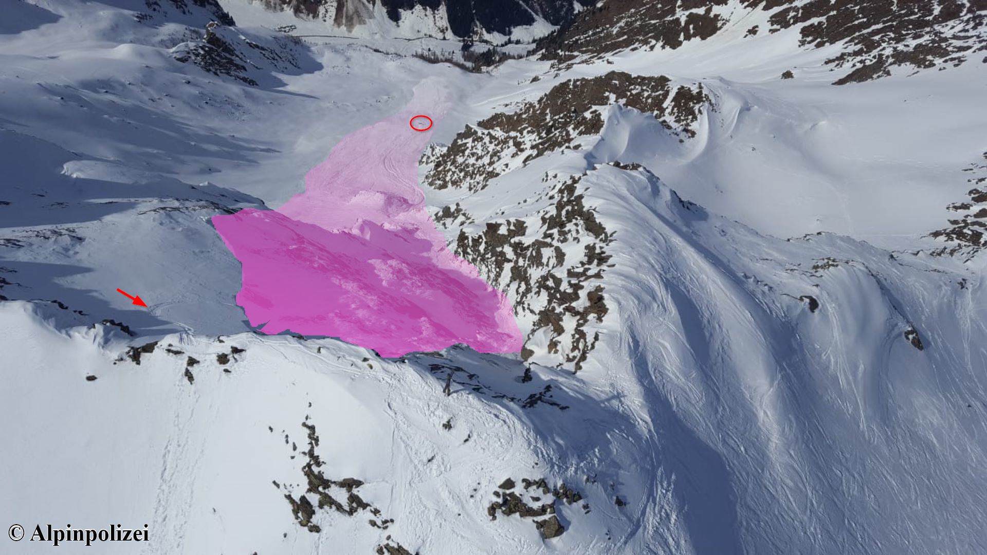
Avalanche accident Brennerspitze Today 28.03, an accident occurred below the Brennerspitze in Oberbergtal, a side valley of the Stubaital. One person skiing down from the summit was caught by a slab avalanche, swept along and totally buried. The person needed to be resuscitated and flown to the clinic in Innsbruck. The avalanche accident recalls that…
-
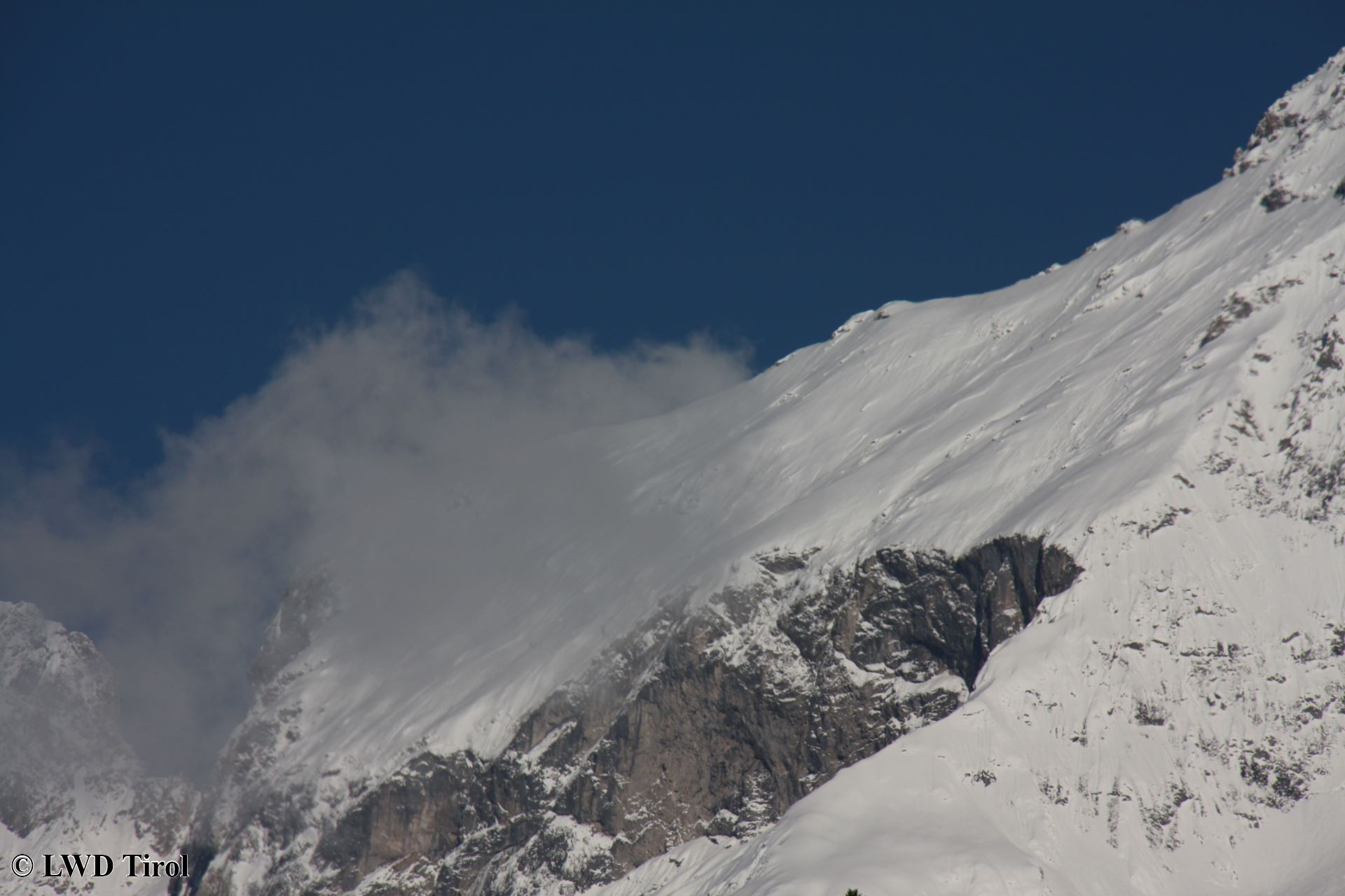
Old-snow problem still in places. Generally quite favorable conditions. Avalanche analysis Giggler Spitze.
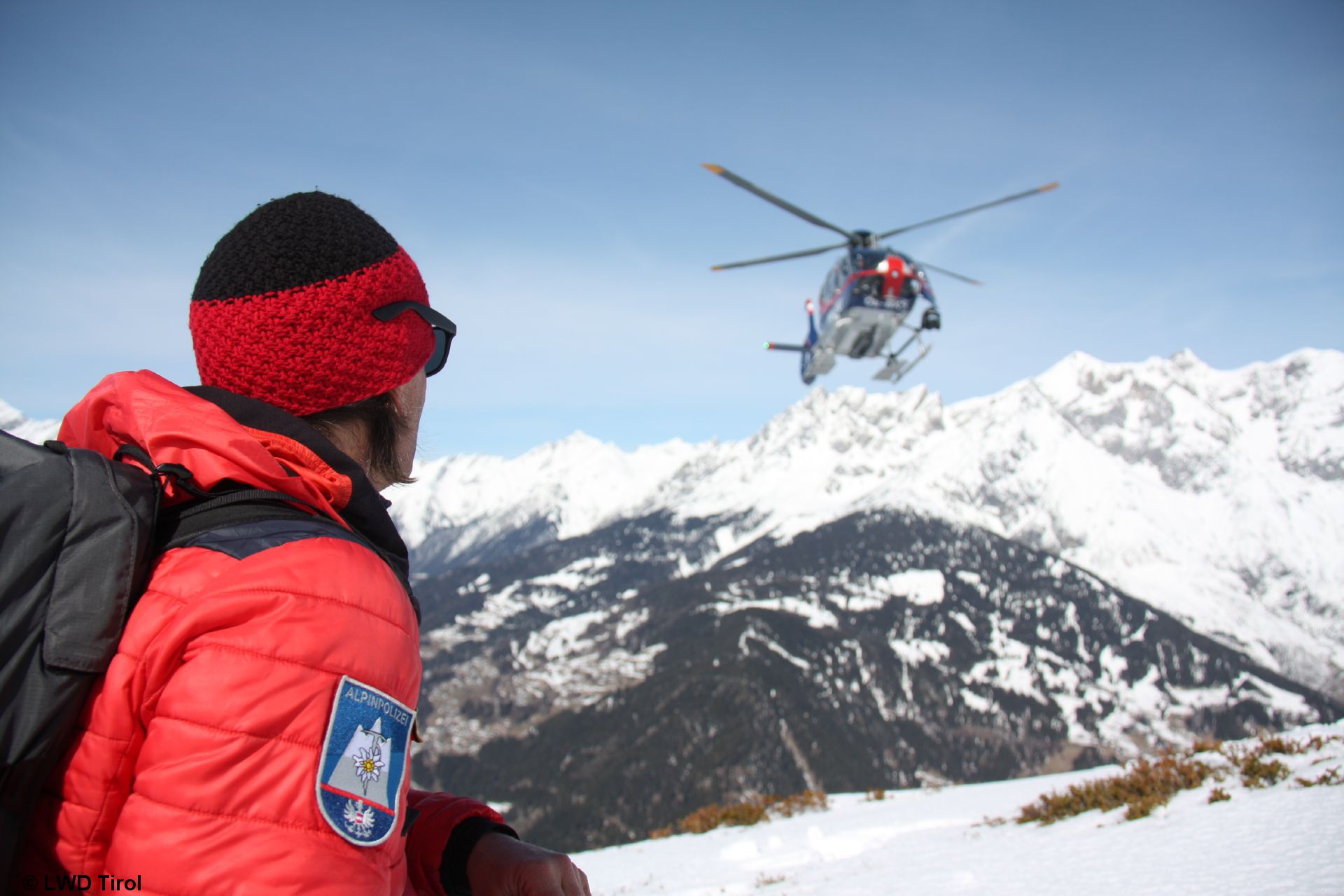
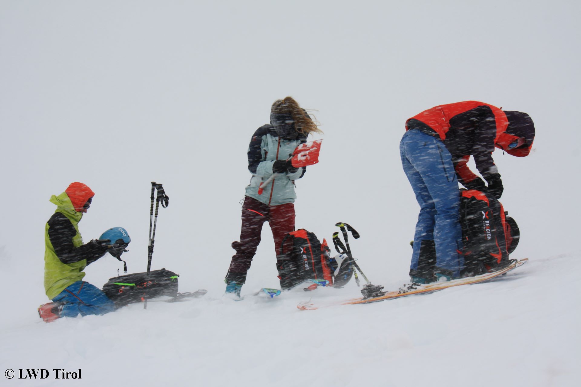
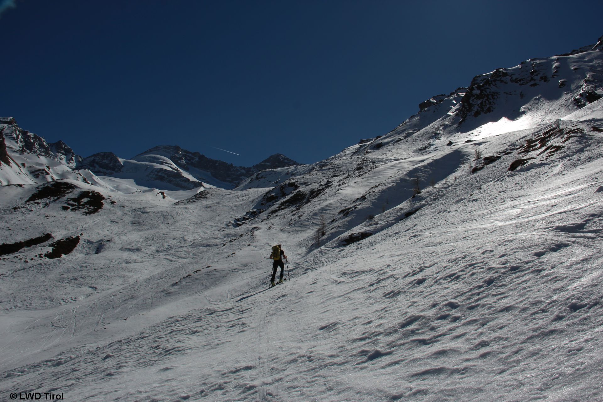
Today, 25.03, we ventured into outlying terrain in Tirol’s highlands with the Alpine Police. We were able to closely analyze the 24.03 avalanche on Giggler Spitze; observe close-up an avalanche on Hochwanner in Kühtai; and obtain a good grasp of the overall situation from the air . In backcountry with the Alpine Police (photo: 25.03.2021) In…
-
Cumulus clouds + solar radiation reinforce rapid moistening of snowpack surface. Caution: more frequent loose-snow avalanches
Supplement to yesterday’s blog: Caution: loose-snow avalanches In far-reaching parts of Tirol, cumulus cloud build-up is being observed in the mountains. The effect of diffuse solar radiation is thereby enhanced, the snowpack surface swiftly becomes moistened on the surface, despite the unseasonably low temperatures. This reinforces the likelihood of loose-snow avalanches triggering in extremely steep…
-
Main danger: recent snowdrifts, often blanketed-over, hard to recognize
Caution: near-to-surface snowdrifts Above 2000m, considerable avalanche danger currently (19.03) prevails. This is due to recently generated snowdrift accumulations which can often be triggered by minimum additional loading in very steep terrain. They occur in all aspects and are difficult to evaluate, partly because of the powder layer on top of them (since the last…
-
High avalanche danger regionally!
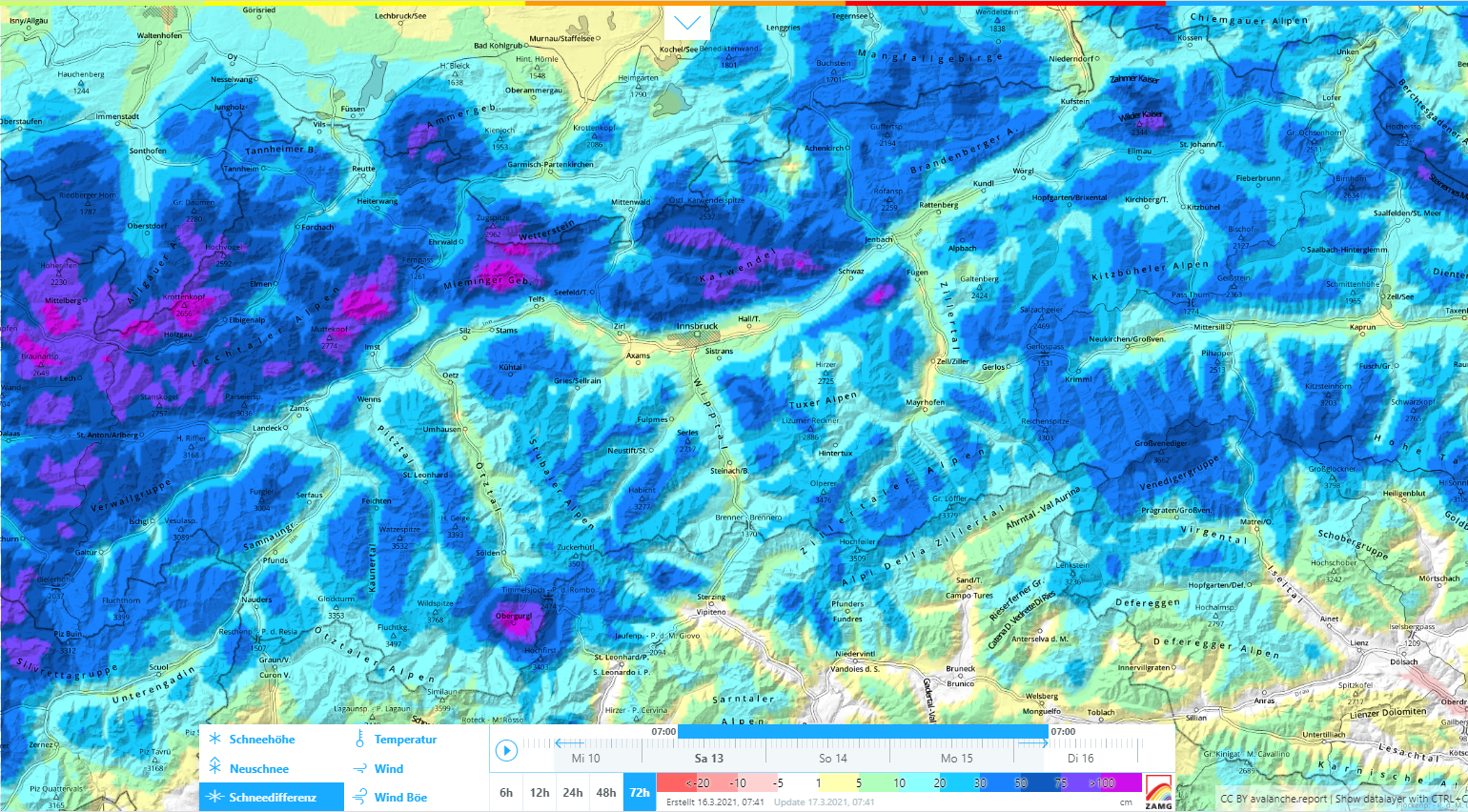
Lots of fresh snow and wind. High avalanche danger! Over the last few days there has been snowfall in far-reaching parts of Tirol, focal point in the northwestern regions. Since Sunday, 14 March, about 100 cm of fresh snow has been registered there, more from place to place. In addition, strong-velocity winds were blowing amid…
-
Caution: fresh drifts due to snowfall+wind
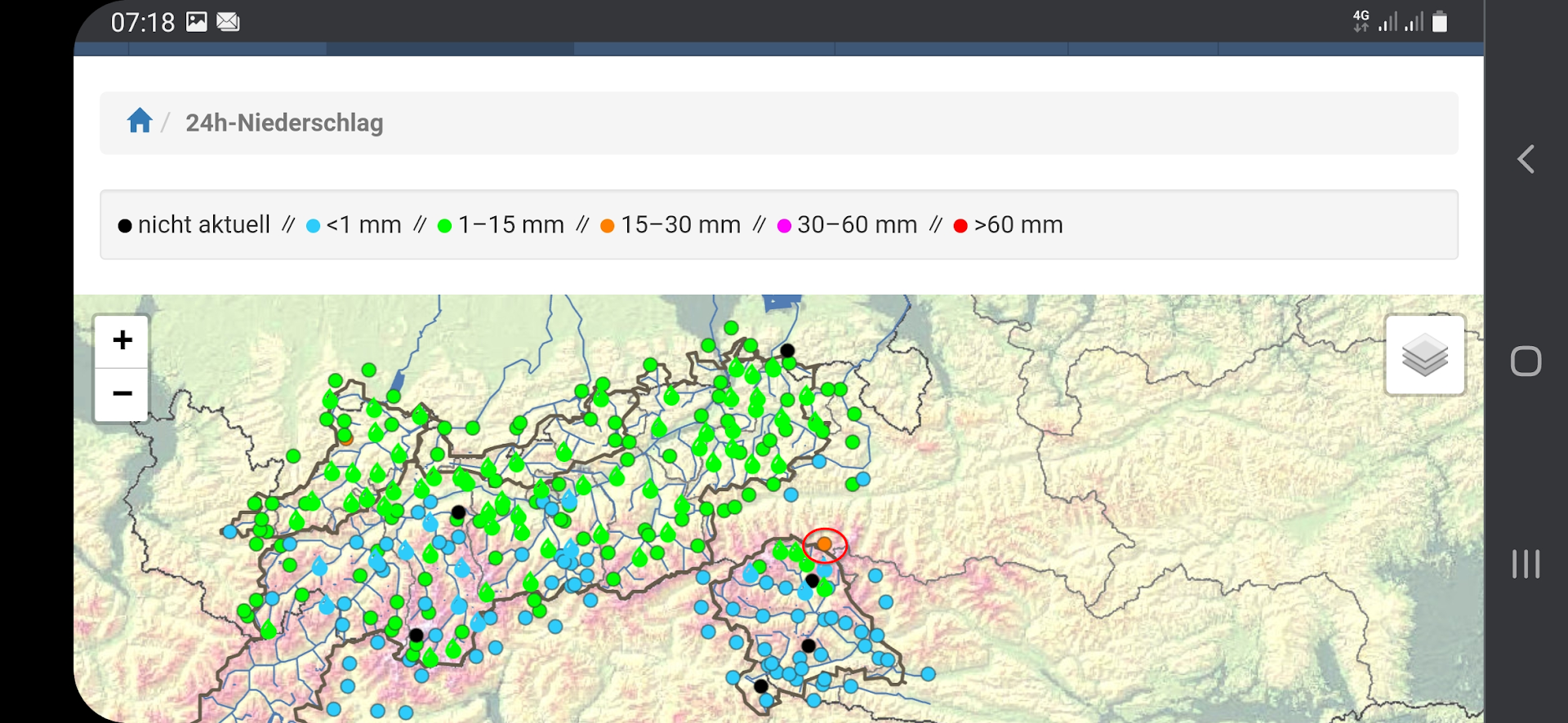
Weather review. And a peek ahead. Last week was variable. A cold front from the northwest brought 10-15 cm of fresh snow widespread in North Tirol and northern East Tirol on Thursday and Friday, 4-5 March. Locally exceptions were startling: in the central Lechtal Alps and Venediger Massif there was 30-50 cm of fresh snow…
-
It doesn’t get much better than that. Fresh snow + wind coming. Heed snowdrifts in northern regions.
Favorable avalanche situation all last week Last week was favored by a positive avalanche situation, generally lower avalanche danger levels and correspondingly fewer avalanche prone locations. This was primarily due to the very stable high-pressure weather front. The atmosphere was unusually dry, temperatures somewhat lower than the previous week, nighttime skies clear and star-studded. Thus,…
-
Attention: other alpine dangers (not avalanches)
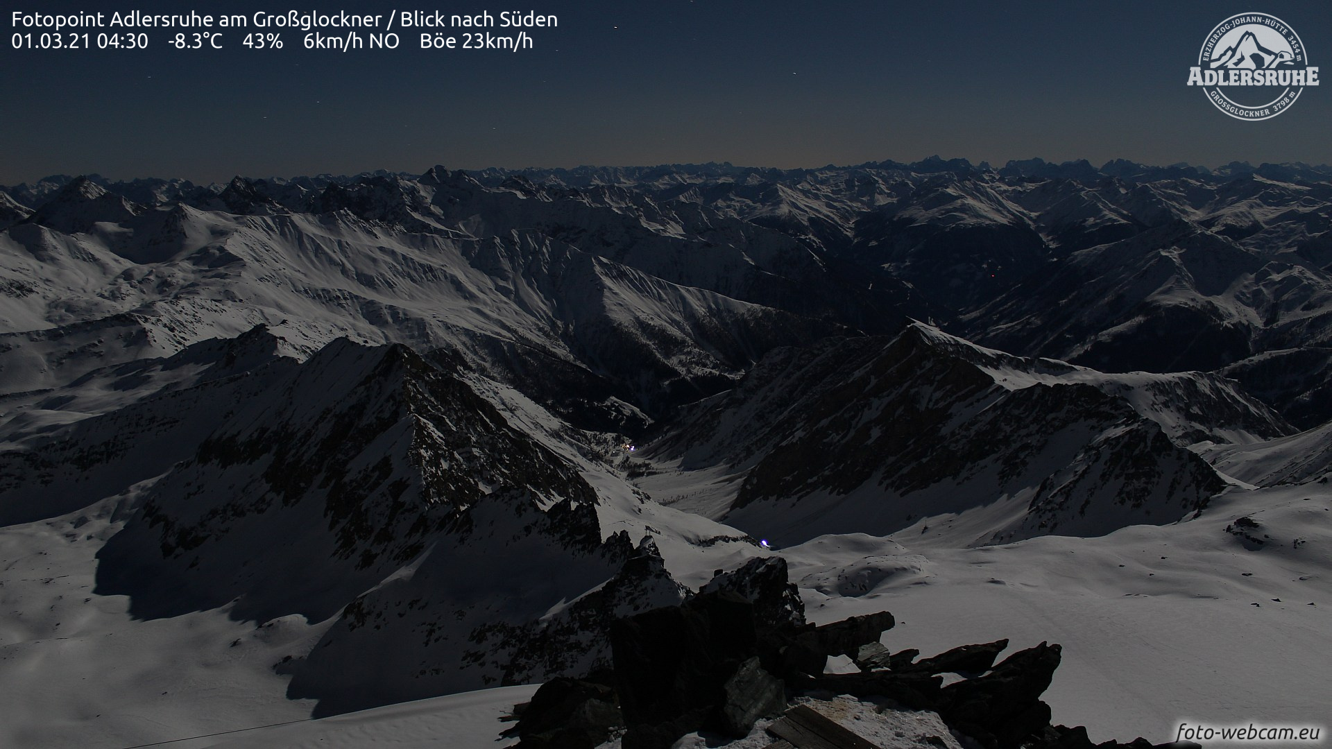
Springtime conditions The beautiful weather and clear nights will give us classic springtime conditions starting on Sunday, 28 February. In early morning, conditions are favorable. Avalanche danger subsequently increases somewhat due to daytime warming and solar radiation. Naturally triggered avalanche activity has receded compared to last week. Winter sports enthusiasts can still trigger slab avalanches,…