Category: Current situation
-
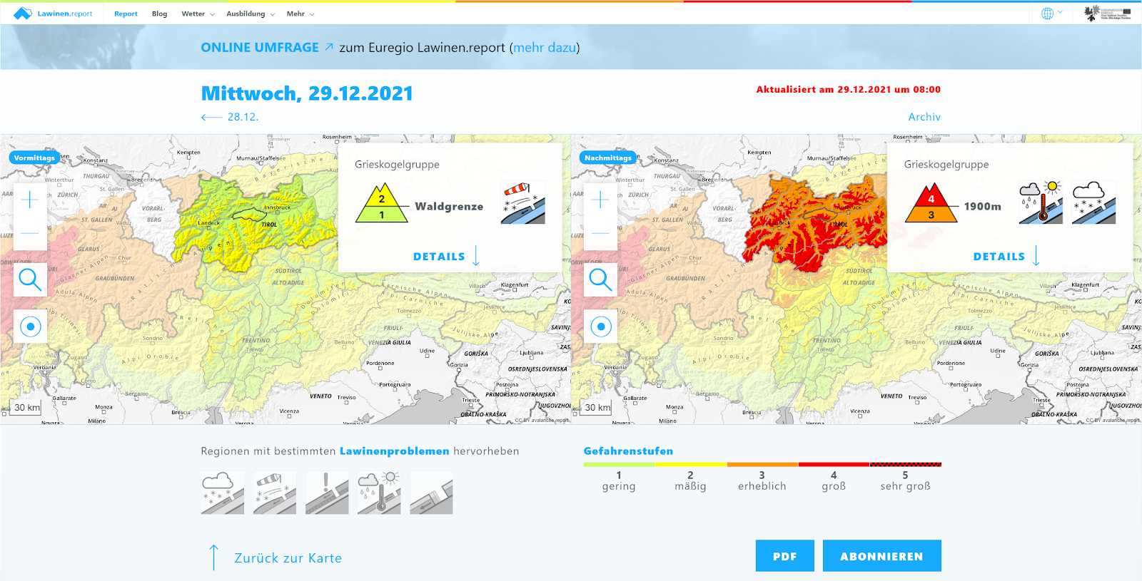
New Year’s Eve update on avalanche situation: gradually diminishing avalanche danger
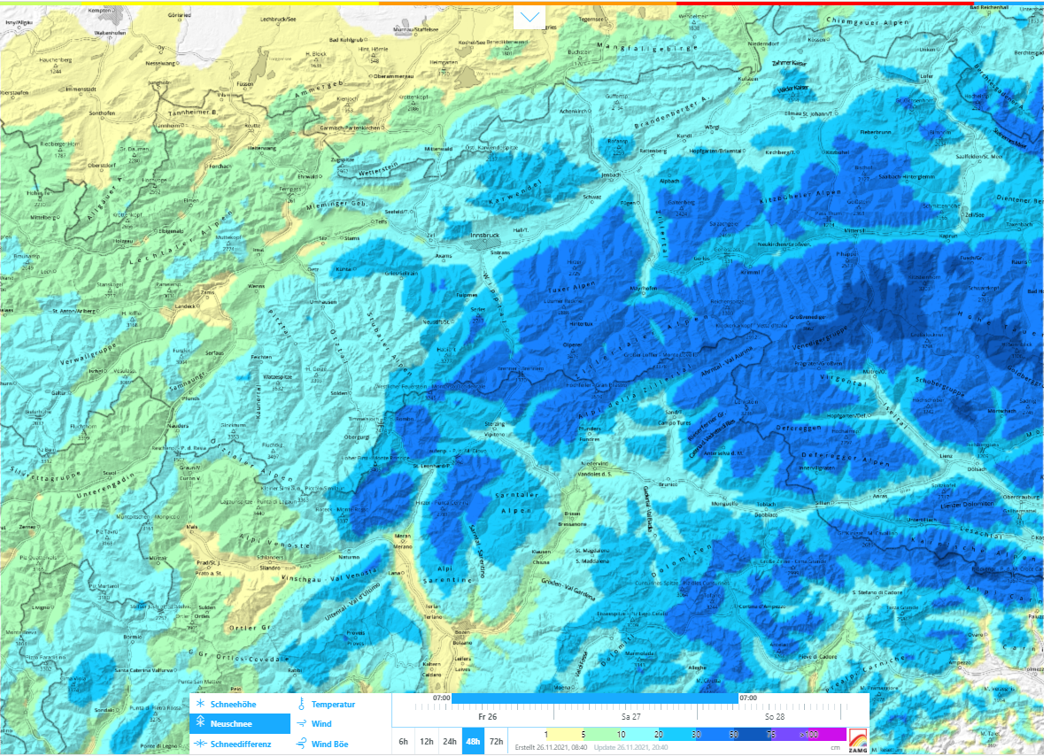
Warm front led to increased avalanches Short analysis of warm front The warm front forecast by the ZAMG Weather Service for 29.12-30.12 brought widespread 15mm to 50mm of precipitation to North Tirol and northern East Tirol. The focal point of precipitation lay in western and northwestern regions. Initially the snowfall continued for longer than expected,…
-
Warm front bringing significant increase in avalanche danger
High avalanche danger due to new snow, rain, storm winds Updated Avalanche Bulletin from this morning 29.12 shows it clearly: avalanche danger will increase significantly as of this evening, reach Danger Level 4 (“high”)! A warm front will reach us today (29.12) from the northwest, bringing lots of precipitation on the one hand, and stormy…
-
Persistent weak layer, isolated danger zones. Fresh drifts: snow quality frequently poor.
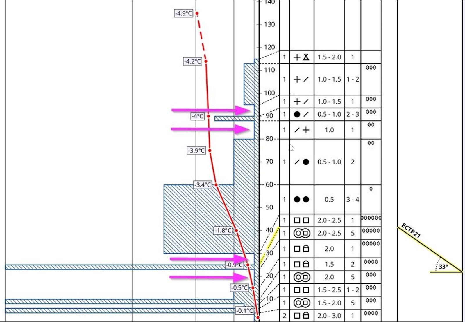
Persistent weak layer problem: isolated danger zones, esp. on very steep shady slopes Our snowpack analysis and reports from winter sports enthusiasts confirm a persistent weak layer, continually diminishing yet in isolated cases still evident and, all in all, quite delicate to discern. Avalanche prone locations are found especially on very steep shady slopes above…
-
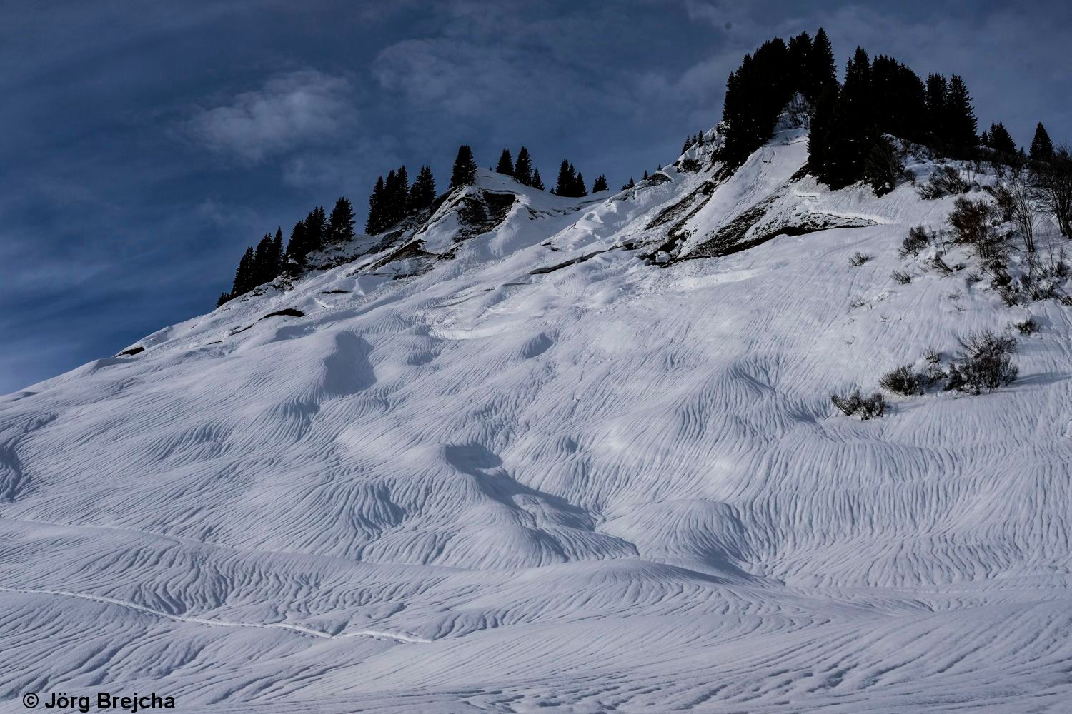
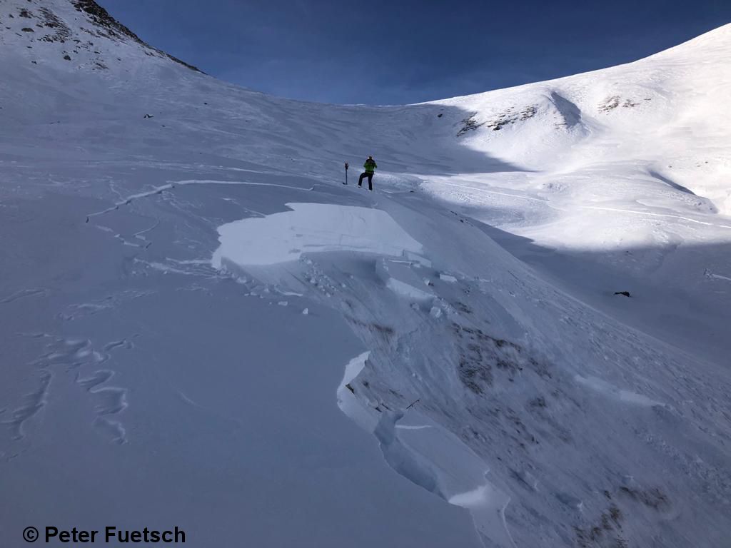
Briefly high avalanche activity! Main problem: shallow snow zones, very steep, shady slopes above treeline.
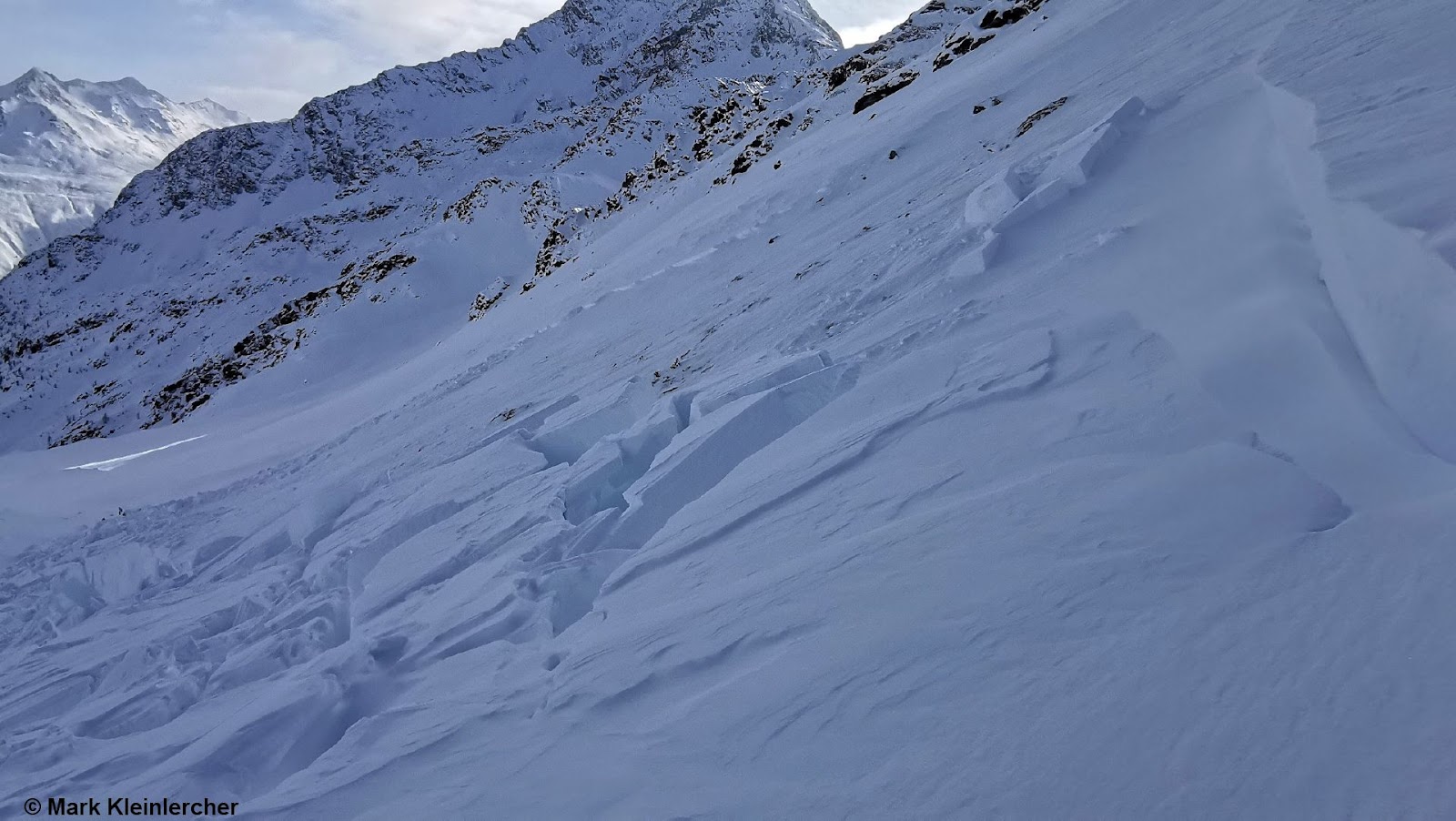
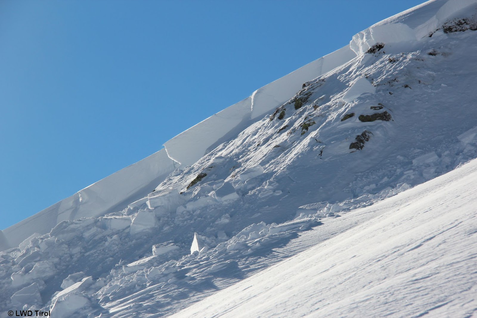
Rainfall with multiple effects Heightened glide-snow activity The most startling thing last week was the briefly heightened glide-snow activity from 12.12 until 13.12.2021. The influence of warmth combined with rainfall increased the water content of the snowpack, thereby reducing the resistance to a gliding snowpack over steep grass-covered slopes. Rain grooves, glide cracks and…
-
Complex and accident-prone avalanche situation
The situation goes on: winter sports enthusiasts advised towards special caution and restraint! Trigger-sensitive snowpack The current weather forecast (wind, snowfall and a warm front coming on Sunday, 12.12) combined with the current snowpack layering make it clear: the situation will stay tense for winter sports enthusiasts. We swing back and forth in danger evaluations…
-
Delicate avalanche situation with numerous danger zones for winter sports enthusiasts. Regional increase to danger level 4 (high).
Unfavorable influences raising avalanche danger regionally to High. The forecast of fresh snow for 8 December (often 20-30 cm) combined with strong winds, low temperatures and a snowpack which is already prone to triggering are leading to an increase in avalanche danger. The danger level will reach High in the areas of major precipitation during…
-
Red flags point to tense avalanche situation regionally for winter sports enthusiasts
Alarm signals – take them seriously! This year’s seasonal launch is a corker. Following the last two significant rounds of precipitation (26-29.11 and 30.11-01.12) avalanche danger levels shot up considerably, just as forecast. We are in the uppermost reaches of Danger Level 3 (Considerable), very close to the level known as “Skiers’ 4” with very…
-
Warning: Caution and Restraint – Snowpack highly trigger-sensitive in places – Several avalanches involving persons!
Several avalanches involving persons. High likelihood of avalanches being triggered by winter sports enthusiasts in some places…a “tense” level 3! Today on 1 December 2021, several avalanches were triggered by winter sports enthusiasts, one person suffered slight injuries. At the same time, we have received many reports of settling noises, glide cracks and even some…
-
It’s getting wintery widespread – avalanche danger rising – start of daily EUREGIO avalanche bulletins on 1 December 2021
After a “golden autumn” comes the launch of winter Meteorologists are of one opinion: the weather is changing over the long term. Right on time for winter’s meteorological start, wintery temperatures are expected throughout Tirol. To begin with, more snowfall is anticipated in the southern and southeastern regions of the land, then the precipitation will…
-

Caution: in high alpine regions already old-snow problem, potential slab avalanches! Also, snow masses can glide down grassy slopes.
Heads up: winter sports participants can trigger slab avalanches in high alpine regions! Problem zones are above approximately 2800 m. Up to a metre of fresh snow The onset of winter in Tirol’s mountains arrived in two thrusts: on 1-2 November and on 3-4 November, bringing up to 100 cm of fresh snow in places,…