Category: Current situation
-
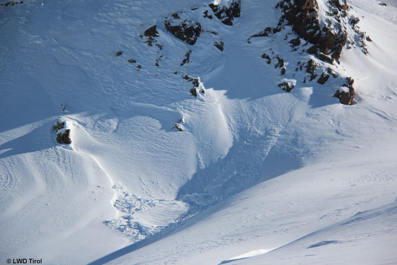
Avalanche accident analysis Schafseitenspitze, including thoughts about current persistent weak layer
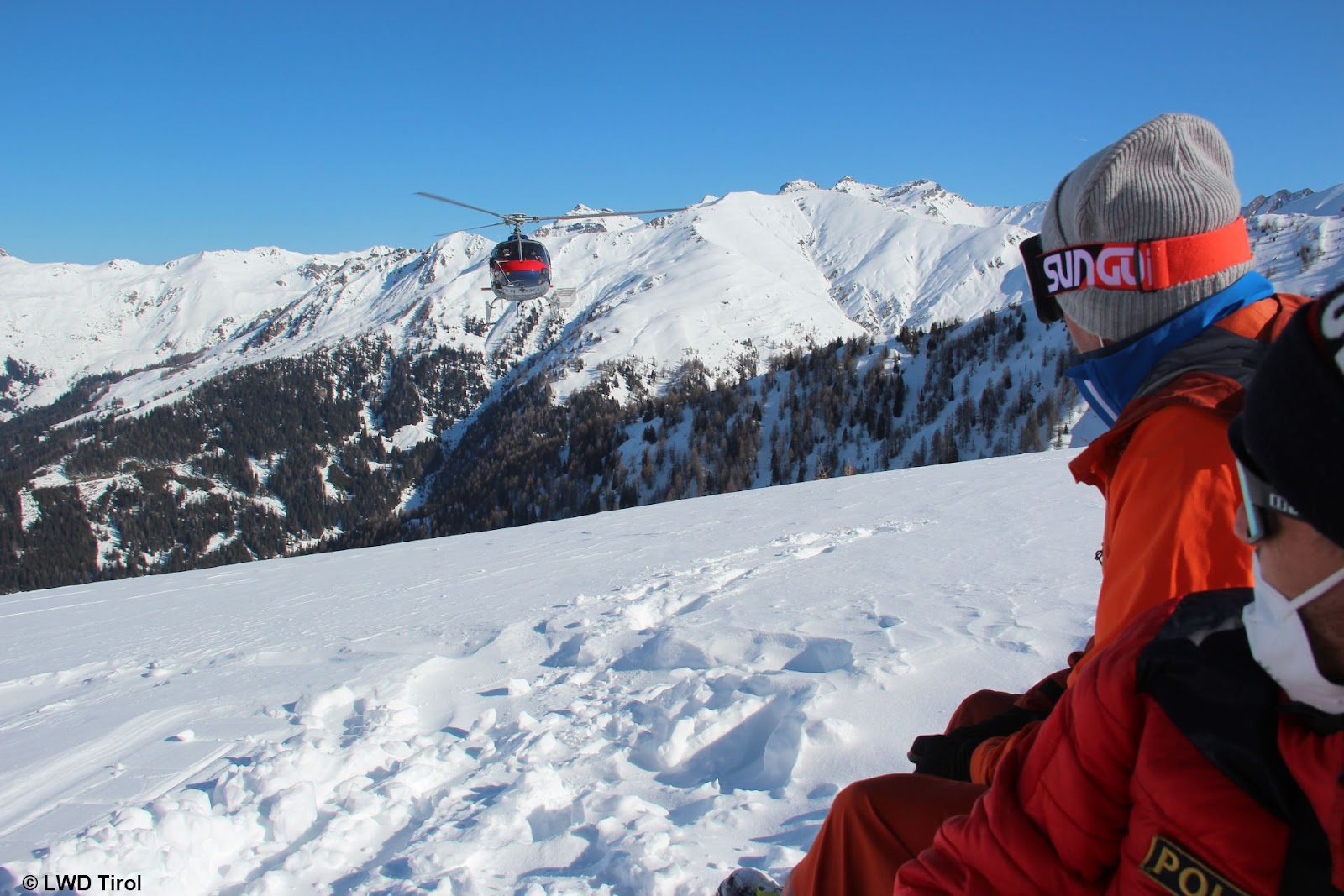
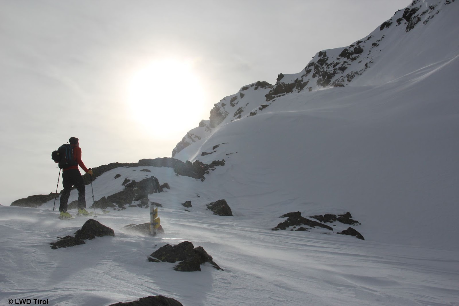
Avalanche accident Schafseitenspitze, 13.02.2022 Today, 14.02.2022, together with the Alpine Police we were below the Schafseitenspitz in the western Tux Alps in order to carry out orderly accident analysis. Support from the State Helicopter (photo: 14.02.2022) Course of accident At the time of the accident there was one person on the summit of the Schafseitenspitze, a…
-
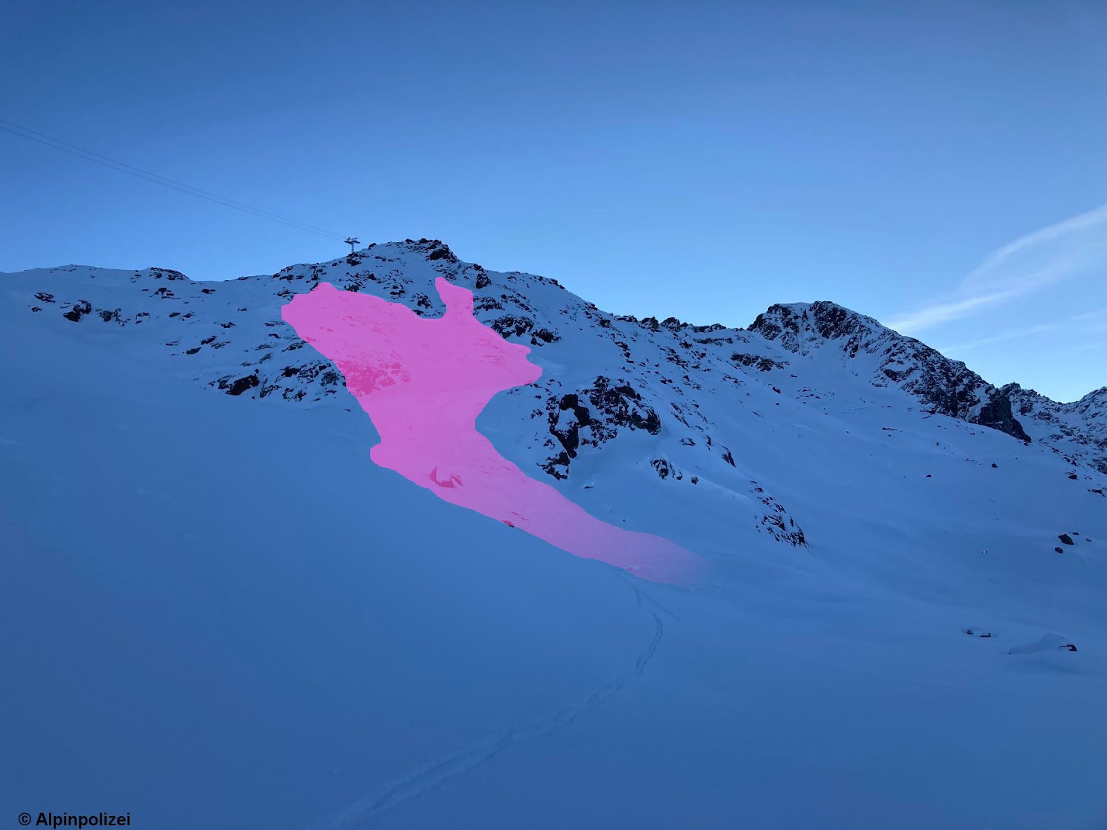
More recent avalanches involving persons. Very large avalanche on north-facing slope of Schafseitenspitze in western Tux Alps.
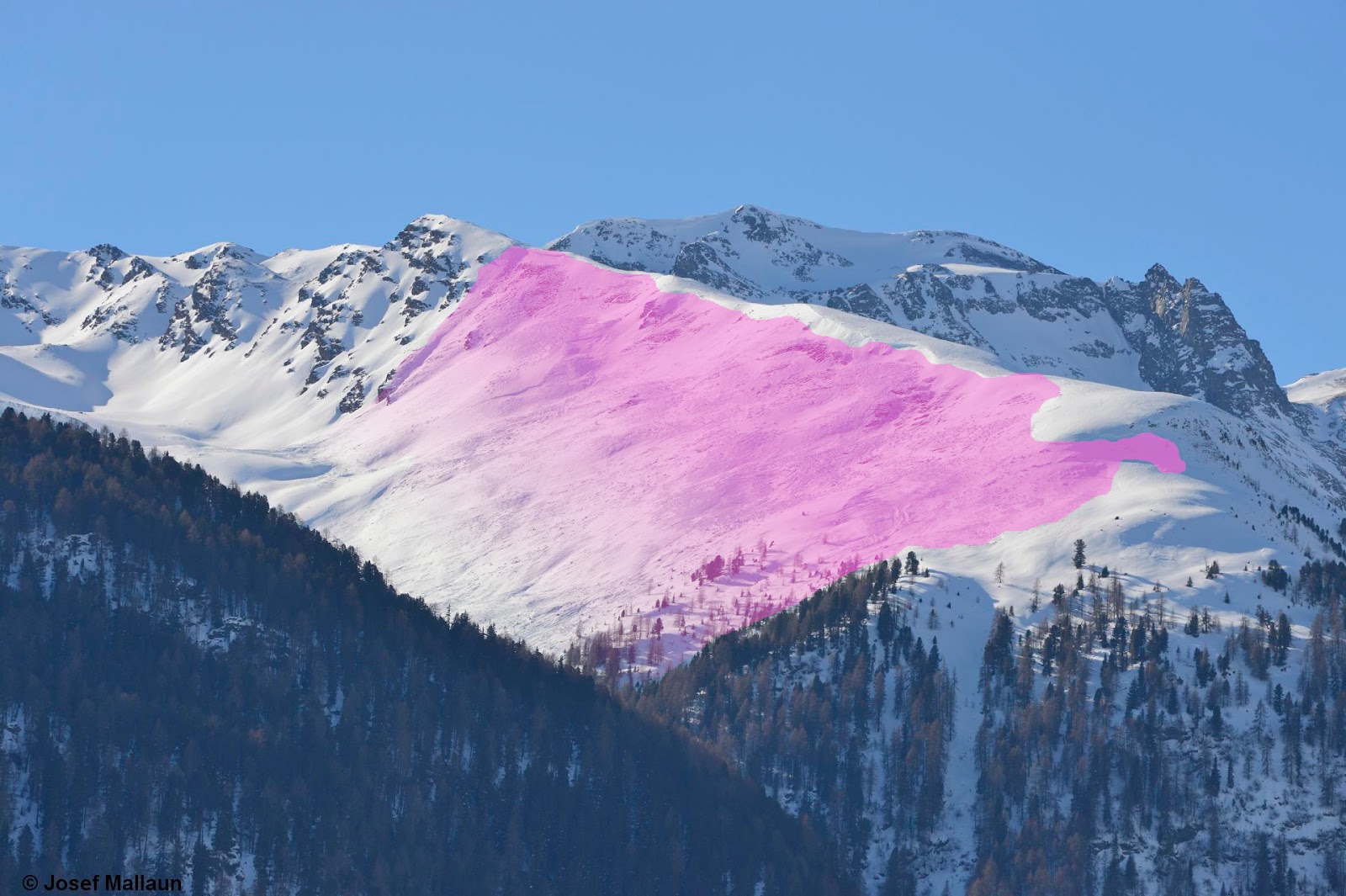
16 avalanches reported to Headquarters Tirol since Thursday, 10.02.2022 In two avalanche accidents persons were gravely injured. One was on Saturday, 12 February, in Kaunertal Glacier Ski Area freeriding terrain between Weißseejoch and Krummgampental, where a person in the descent was caught by a slab and remained atop the snowpack surface due to released avalanche-airbag. Slab…
-
Persistent weak layer: treacherous!
Danger zones often unrecognizable A persistent weak layer is characterized by a weak layer which ‘persists’ inside the snowpack, resulting in danger zones where avalanche prone locations are undetectable outside the snowpack. It is possible to localize such places only through systematic snowpack analysis and by perceiving the alarm signals (‘whumpf’ noises, triggered avalanches, fracture…
-
Accident-prone avalanche situation
Numerous danger zones leading to an accident-prone avalanche situation As forecast by ZAMG Weather Service there was abundant fresh fallen snow in far-reaching parts of Tirol, strong winds and in addition, from Tuesday 1 February to Wednesday, 2 February, rising temperatures. Avalanche danger levels are high above the treeline and in sparsely wooded zones in…
-
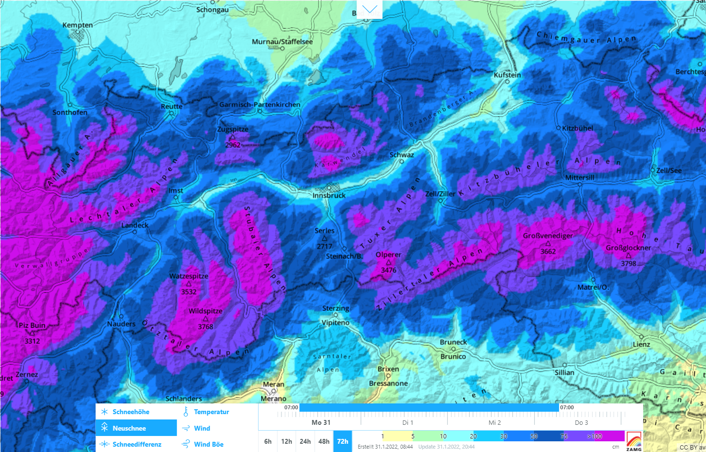
High avalanche danger widespread
Abundant fresh snow and storm winds: avalanche danger rises to “high” The cold front forecast by ZAMG Weather Service arrived at midday today, 31.01, and is already bringing intensive snowfall to far-reaching parts of North Tirol. In addition, strong-to-storm strength NW winds are raging in the mountains. By the end of the day on Wednesday,…
-
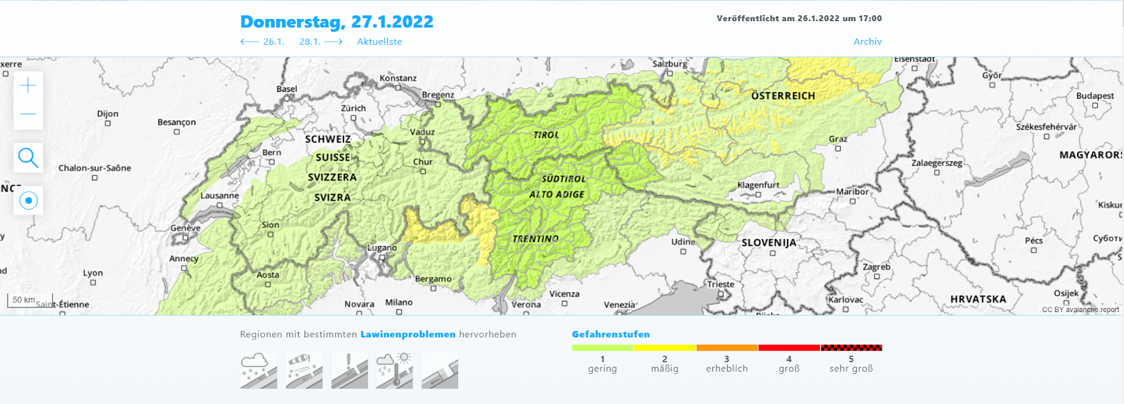
Variable weather is changing the avalanche situation
Some fresh snow and storm winds are ratcheting up avalanche danger After several days of mostly favorable avalanche conditions and low danger levels, the danger will increase somewhat over the next few days. Danger Level map for today 27.01.2022. In far-ranging areas of the Alps, low danger predominates. Starting tomorrow, 28.01, danger will rise slowly,…
-
Caution: accident-prone days in eastern regions where snowfall was heaviest! Restraint is called for.
The most important message, right off the bat: In the regions where snowfall has been heaviest, you need profound knowledge of the terrain and of avalanche science, you also have to be calm and restrained when you are in backcountry. Danger zones are widespread, often difficult to recognize, making accidents quite likely. By the way,…
-
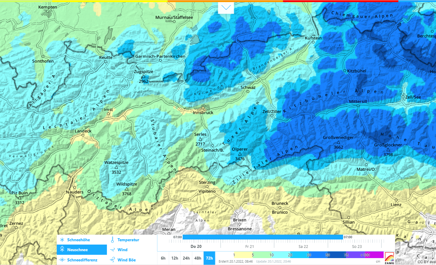
Fresh snow + wind: dangerous snowdrift accumulations being generated regionally. More and more avalanche prone locations on shady slopes and in ridgeline terrain.
Fresh snowdrift accumulations: assess them critically! Following a long phase of favorable avalanche conditions, the overall situation is undergoing a change, particularly in the regions where snowfall is heaviest. In the northern and especially in the eastern regions of North Tirol, 30-50 cm of fresh snow is expected by Sunday, 23.01.2022, even more from place…
-
Predominantly favorable situation
Main danger remains fresh snowdrifts Right off the bat: the overall situation is favorable. Caution is urged towards freshly generated snowdrift accumulations. They are likeliest to trigger in very steep terrain, often near ridgelines or behind protruberances. Weak layer: blanketed champagne powder, also faceted crystals over small areas in the vicinity of surface-near melt-freeze crusts.…
-
Considerable avalanche danger regionally due to fresh snow and wind
Cold front spikes avalanche danger Fresh snowdrifts at the main peril A cold front moved swiftly through Tirol today (05.12.2022), bringing fresh snow everywhere. Mostly it was 10-20 cm, in some places 30 cm. That plus the strong winds at high altitudes generated fresh snowdrift accumulations. These are currently the main danger for winter sports…