Category: Current situation
-
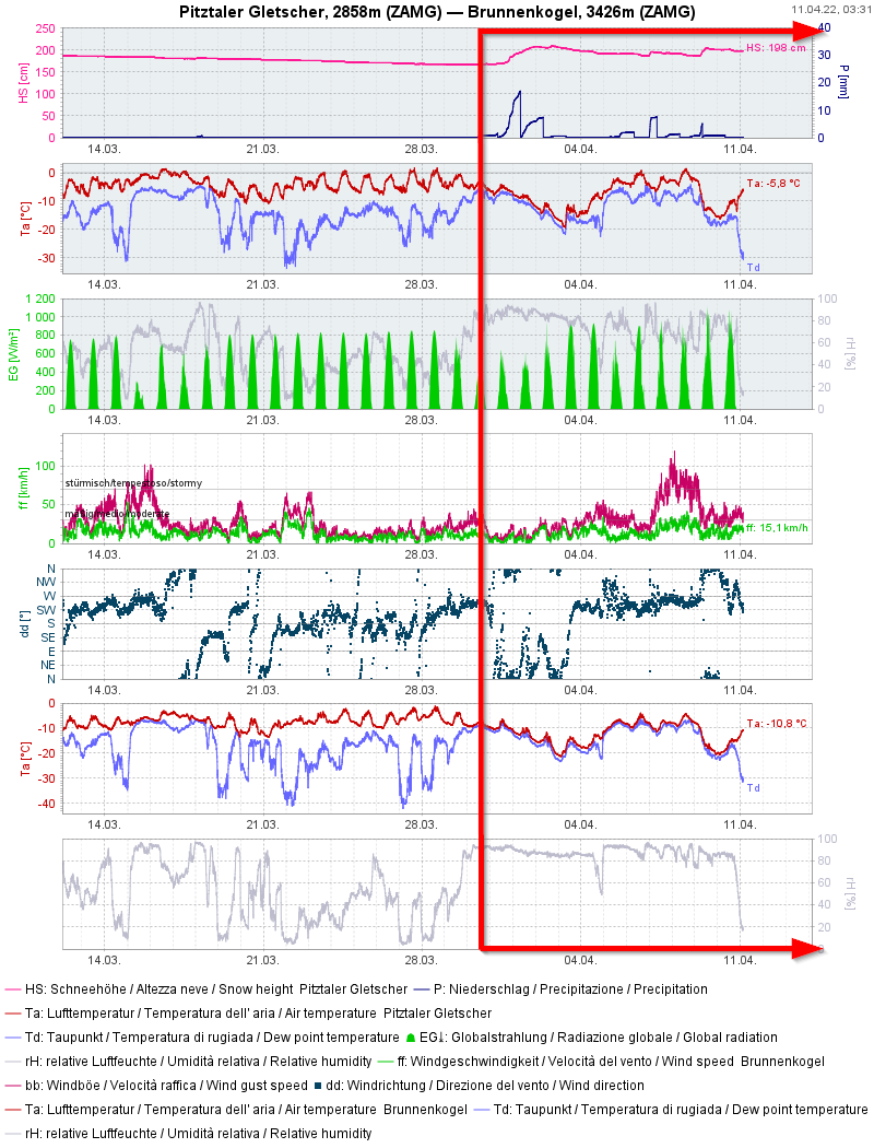
All signs point to Danger Pattern 4 (cold on warm) at high altitudes
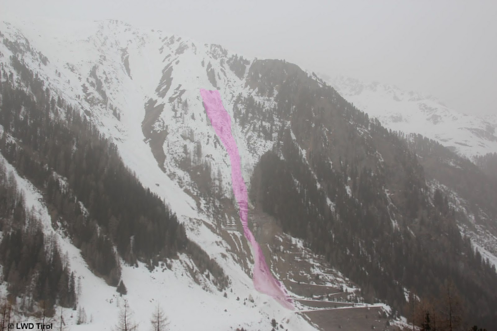
Following snowfall, trigger-sensitive weak layer highly probable due to dp.4 Weak layer caused by dp.4 (cold on warm) In our last Blog we referred to the “small snowdrift problem at high altitudes” and the possible development of Danger pattern “cold on warm” (dp.4). Back then on 07.04 we had no information about the development of a malicious weak layer.…
-
April weather generating variable snow+avalanche conditions
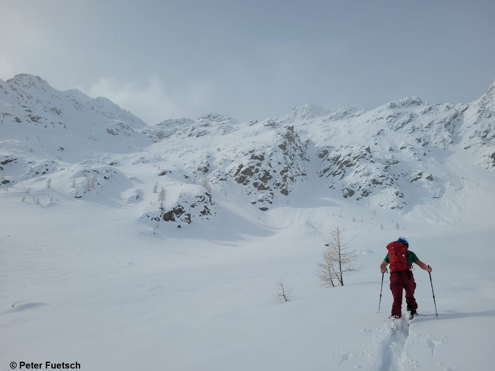
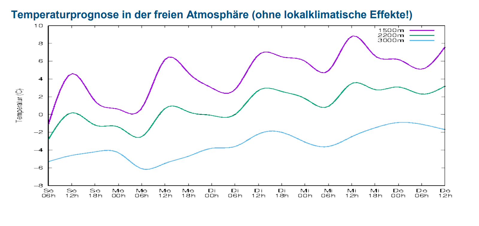
Conditions: variable! The first week of April has been highly variable. To start with, formidable amounts of snow with little wind, but strong where there was impact. All this at low temperatures. Subsequently less and less sunshine, with rainfall up to 2000 m, particularly in North Tirol. Rising temperatures. You had your work cut out…
-
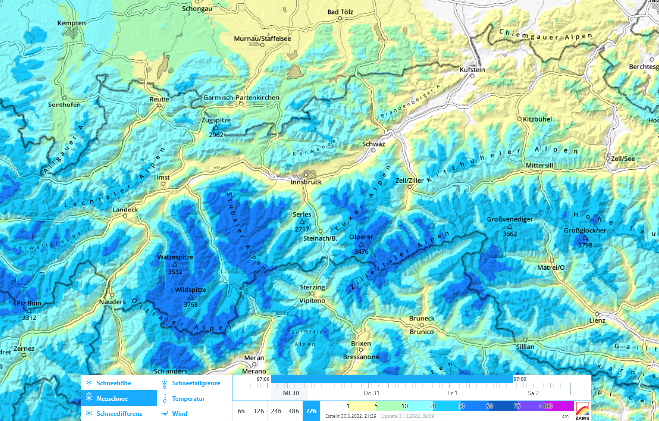
Wintery in the mountains again
One of the driest months of March in history is behind us. And now, winter is coming back. With the precipitation beginning today, 31.03, the not-quite-driest month of March in measurement history comes to an end. For Innsbruck, however, it was the sunniest March in measurement history. That is now at an end. April with its well…
-
Mostly favorable conditions, slight daytime cycle of avalanche danger
Following cycle of wet snow, mostly favorable conditions Following a period of avalanche activity until and including Sunday, 20.03.2022, the avalanche situation has quieted down. Due to very dry air masses we are currently recording extremely good nocturnal outgoing longwave radiation of the snowpack, and also delayed softening of the surface during the daytime on…
-
Fresh snow / Dust from the Sahara
Water seepage into the snowpack leads to avalanches We have landed in springtime, with a pronounced wet-snow problem. The cause is to be found in the weather and warm temperatures, (diffuse) radiation, dust from the Sahara and relatively high air moisture. Thereby, the snowpack becomes moister and wetter from day to day up to ever…
-
Heed daytime cycle of avalanche danger & small drifts in foehn lanes
Increasingly weakened snowpack due to water seepage The time window of nearly perfect conditions and low avalanche danger, for the moment, is over. Springtime is making itself felt. That means the snowpack is becoming moister by the day, due to rising temperatures, increasing air moisture and solar radiation (sometimes diffuse). This process is still heavily…
-
Danger of falling on frozen surfaces outweighs avalanche danger
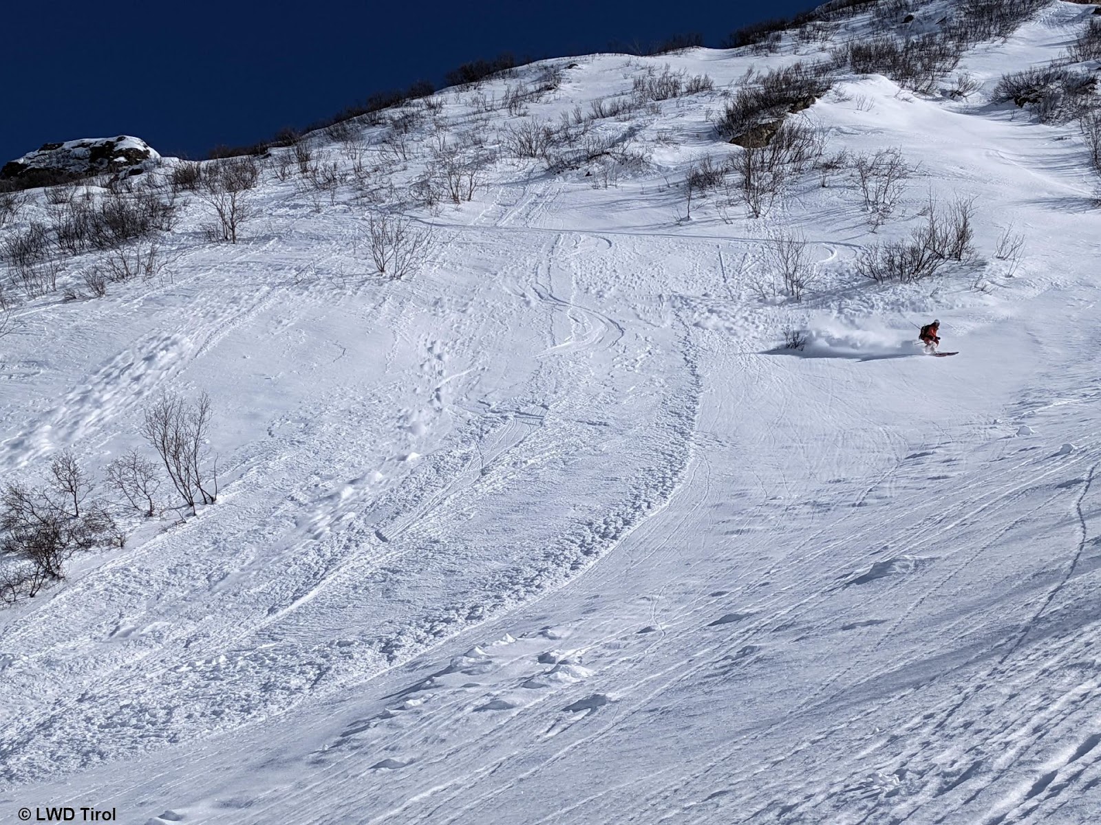
Favorable avalanche situation, generally low danger All week long, extremely steep terrain was skied throughout Tirol without avalanches getting triggered. At the same time, stability tests have shown a snowpack which is low in tensions, highly stable. In short: this is a favorable avalanche situation. Very few avalanche prone locations Dry loose-snow avalanches in extremely…
-
Mostly favourable avalanche situation, only few danger zones
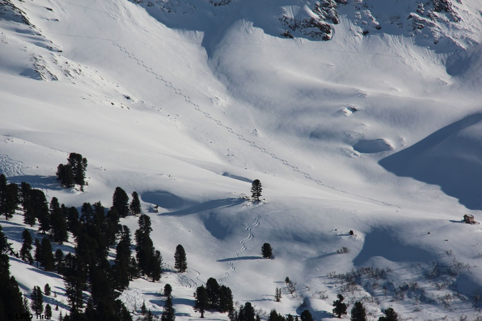
Snowpack with few tensions Snowpack analysis and reports from the field reveal that the snowpack is generally low in tensions in the interim. For that reason this blog will deal primarily with the positive aspects of the situation. On shady slopes there is powder for skiing widespread, while on sunny slopes at least up to…
-
Main danger: weak layers in old snow
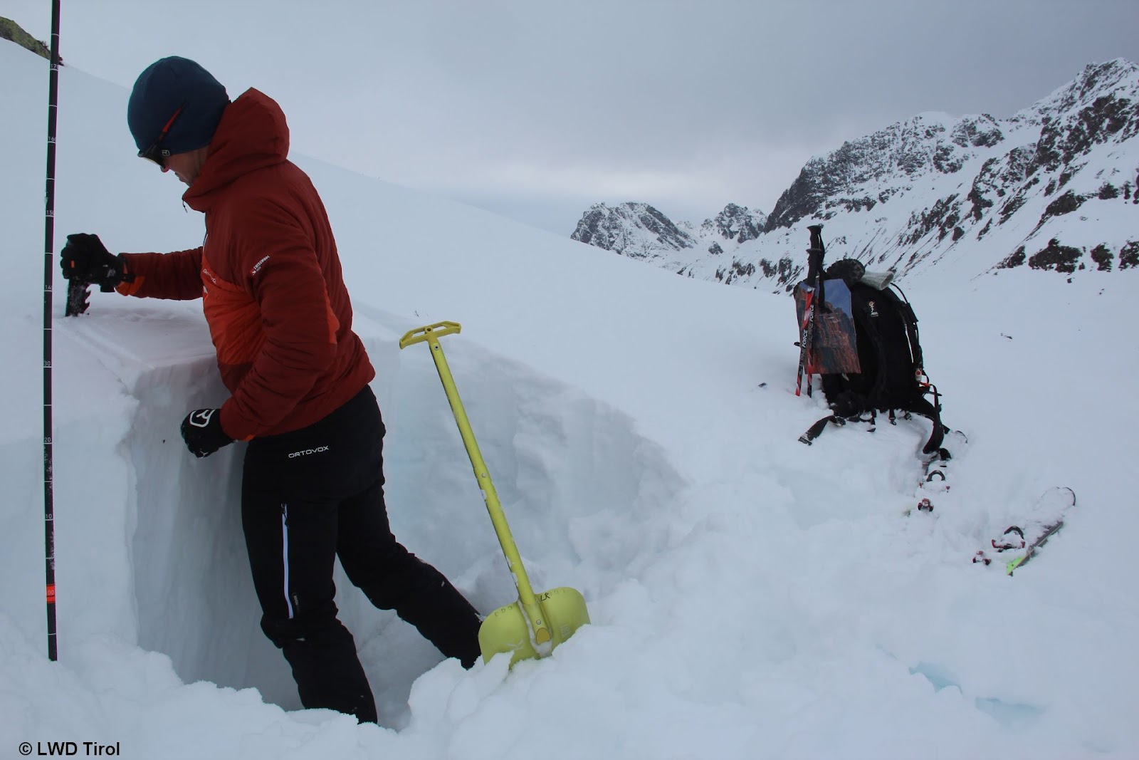
Still weak layers in old snow in places Through snowpack analysis, stability tests and snowpack computer models we have been able to follow the development of the persistent weak layer since the beginning of the month. It has become clear that the danger zones are continually diminishing in frequency, but that under unfavorable circumstances avalanches…
-
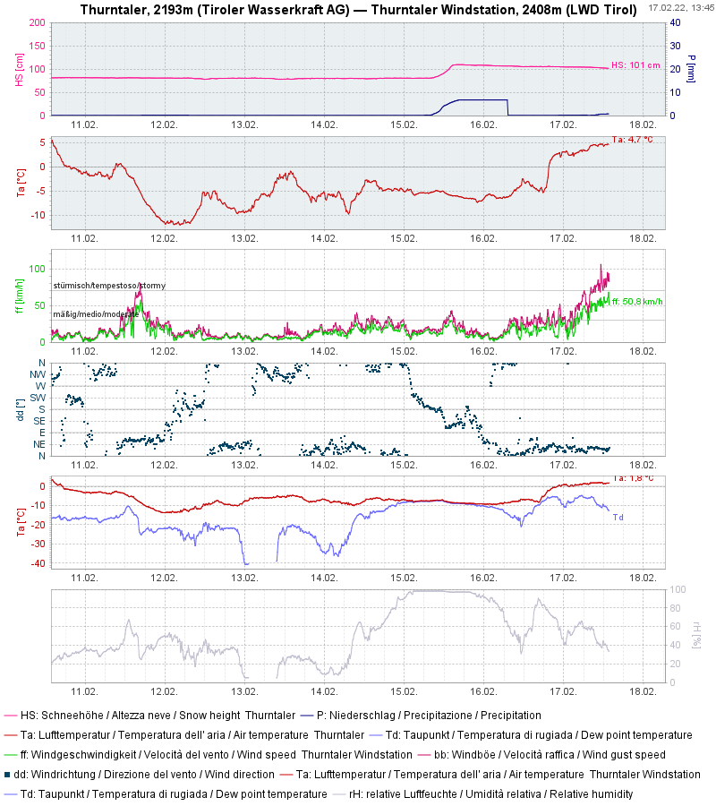
Turbulent weather. Fresh snowdrift masses. Persistent weak layer continues. Moistened snowpack at low altitudes.
Turbulent… …that is doubtless the word which best describes current weather conditions. Precipitation (snow, followed by rain up to 2500m), gale-strength winds, fluctuating temperatures. Fresh snow on 15.02.2022. Rising temperatures. Storm-strength winds. (southern East Tirol) 24-hr overall fresh snow 15-16 February (up to 40 cm on Carnic Ridge in southern East Tirol) Precipitation on 17…