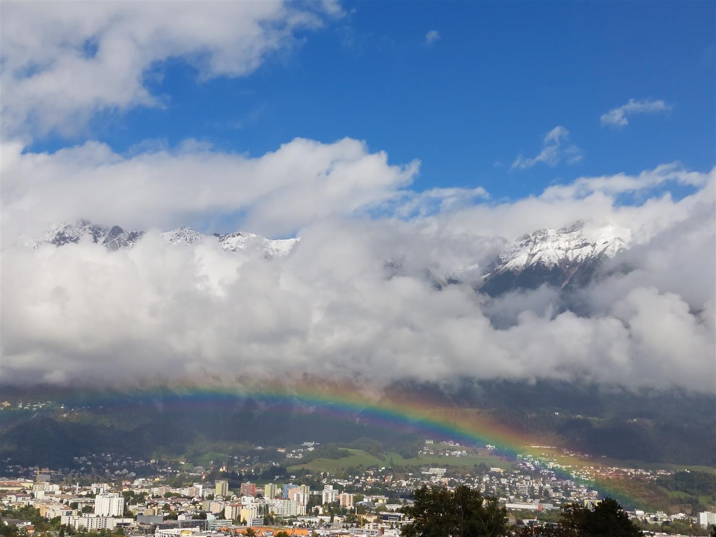
Category: Current situation
-
Weak snowpack, some releases. Start of daily EUREGIO Avalanche Bulletins on 9 December 2022.
Caution: considerable avalanche danger regionally above about 2200m In regions where snowfall has been heaviest, which includes in particular the regions along the Main Alpine Ridge, the avalanche situation is already quite unfavourable. Danger is considerable above 2200m there. This peril is corroborated not only by stability tests, but also by several avalanches which involved…
-
Caution: fresh, often highly trigger-sensitive snowdrift masses due to heavy wind impact
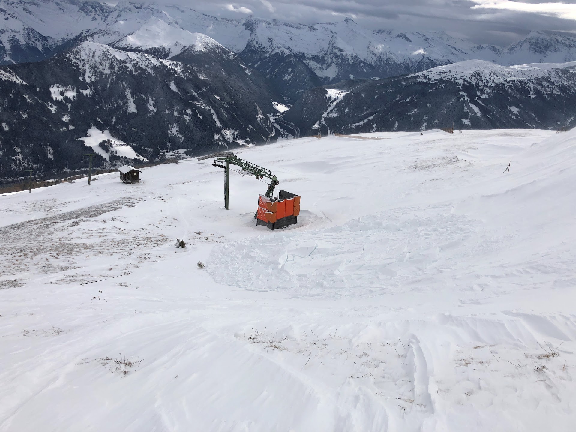
Avalanche prone locations on the increase due to wind The snowfall from the beginning of this week (28.11-29.11) fell with little wind influence but is currently being transported far-reachingly by stormy southerly winds. This is causing avalanche danger to increase. The problem: freshly generated snowdrift accumulations. Snow cover examinations and observations in outlying terrain confirm…
-
Winter sports enthusiasts, beware! At high altitudes avalanches easily triggered in some regions.
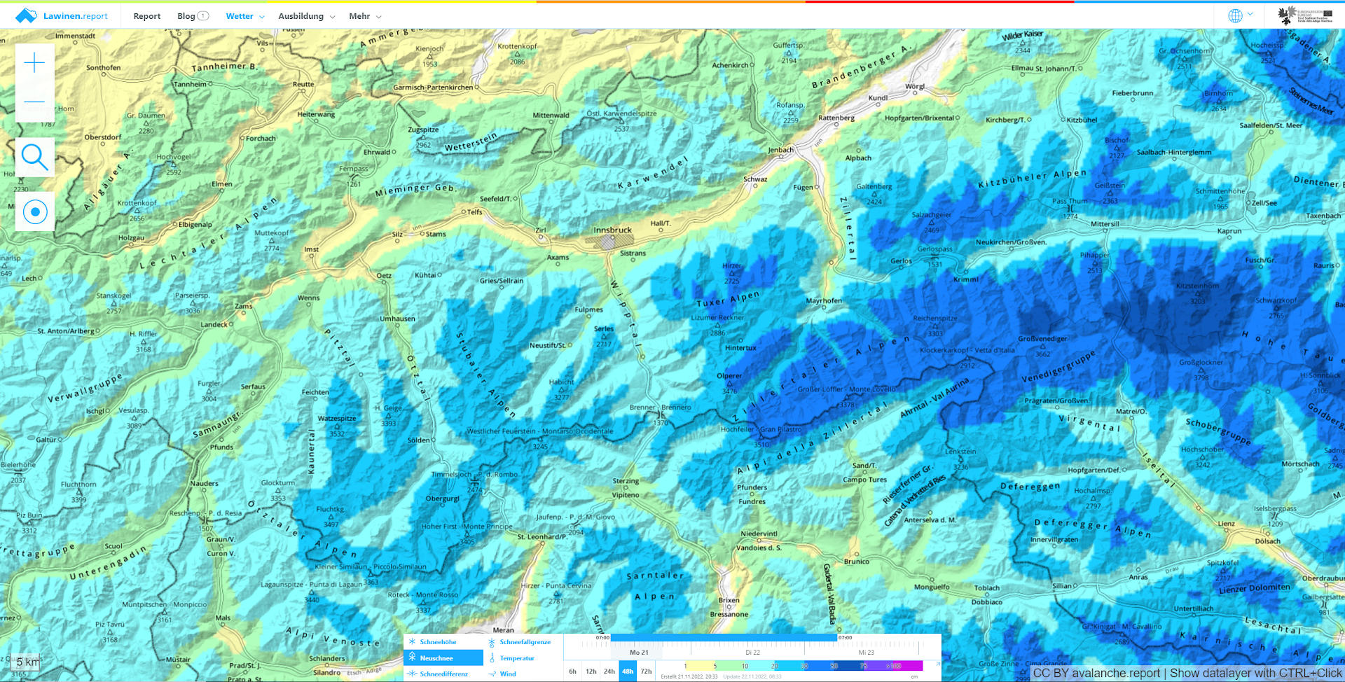
Cold front bringing snow After an initially warm, then variable November it is snowing down to low altitudes in widespread parts of Tirol. The snowfall will be heaviest today (22.11), tomorrow it is expected to taper off everywhere. According to ZAMG Weather Service the main regions of precipitation lie in the Tux and Zillertal Alps,…
-
Beware snowdrifts in high alpine terrain. Also loose-snow and glide-snow slides.
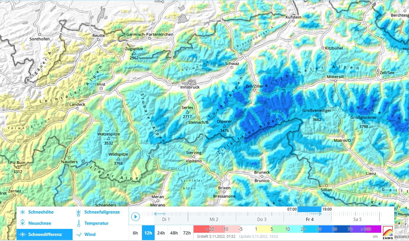
Cold front brings snowfall, most in northern Zillertal Alps Over the last 24 hours there has been precipitation throughout Tirol, above approximately 1200 m as snowfall. Maximum precipitation was registered in the northern Zillertal Alps: as much as 40 mm from place to place. Widespread 10-20 mm was registered. This corresponds to approximately 10-20 cm…
-
Caution: briefly heed avalanche danger at great heights. Raised peril of falling into glacier crevices, following snowfall.
At great heights, caution: small-area snowdrift accumulations, loose-snow avalanches, glide-snow slides on grassy slopes. Cool temperatures in late September brings snow to high altitudes Following a warm, summery early September, the latter half was gray, rainy and cool At high altitudes there was frequent snowfall accompanied by strong winds. Some of the precipitation fell as…
-
For a brief spell, glide-snow activity at high altitudes. Caution: loose-snow slides, small snowdrift accumulations.
First major snowfall of the season in northern regions An autumnal burst of winter has brought us our initiation, above 1200-1500 m the first big snowfall of the season. The major areas of precipitation are focused in the northern regions of Tirol from Arlberg/Ausserfern to the Kitzbühel Alps. From region to region there was as…
-

Danger of wet-snow avalanches
Snowpack rapidly becoming wetter According to ZAMG Weather Service, a low over Italy is depositing moist air masses in the lower layers of the atmosphere. Winds are light, conditions variable, prone to showers. Snowfall above 2300 m. In short: April weather in May. “Steamy” weather, a high degree of moisture is making the snowpack wetter…
-
Main danger: loose-snow avalanches + small snowdrift accumulations in high-alpine shady ridgeline steep terrain
Ongoing quite favorable conditions, slight daytime increase in danger The big message: currently (28.04) there are very few avalanche problems. Loose-snow avalanches on extremely steep slopes and small fresh snowdrifts in high-alpine shady terrain are the main dangers. During the course of the day the snowpack surface softens on sunny slopes and loses some of…
-
Mostly quite good conditions – Danger zones where snowpack is wet, esp. on very steep shady slopes above 2500m
Southerly foehn will bring some precipitation, esp. to southern regions Following an extremely dry month of March, April has still not brought much precipitation. A bit is scheduled to arrive starting on Sunday, 24.04 due to foehn influence, especially in southern regions in Tirol (Gurgler Massif incl. East Tirol). Main Alpine Ridge as weather divide on…
-
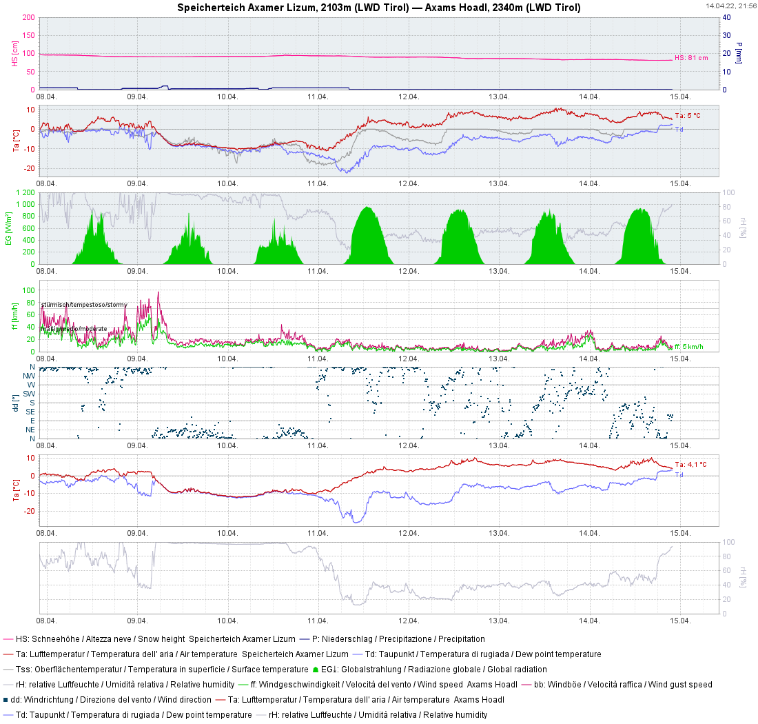
(Daytime) wet-snow problem & diminishing persistent weak layer
Snowpack becoming moister With clouds moving in during the night of 14.04-15.04, the snowpack will not cool down during the nocturnal hours. Particularly in an altitude belt around 2300m the moistness will then sink down to deeper layers which have been dry until now. Thereby, the snowpack will lose firmness. The likelihood of moist or…