Category: Current situation
-
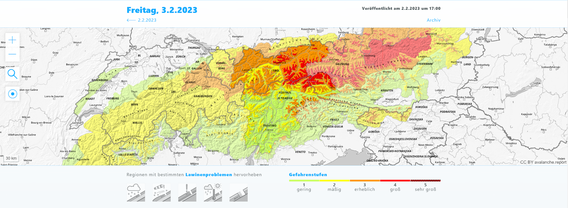
High avalanche danger, a very accident-prone situation! PLEASE: exercise restraint, act defensively!
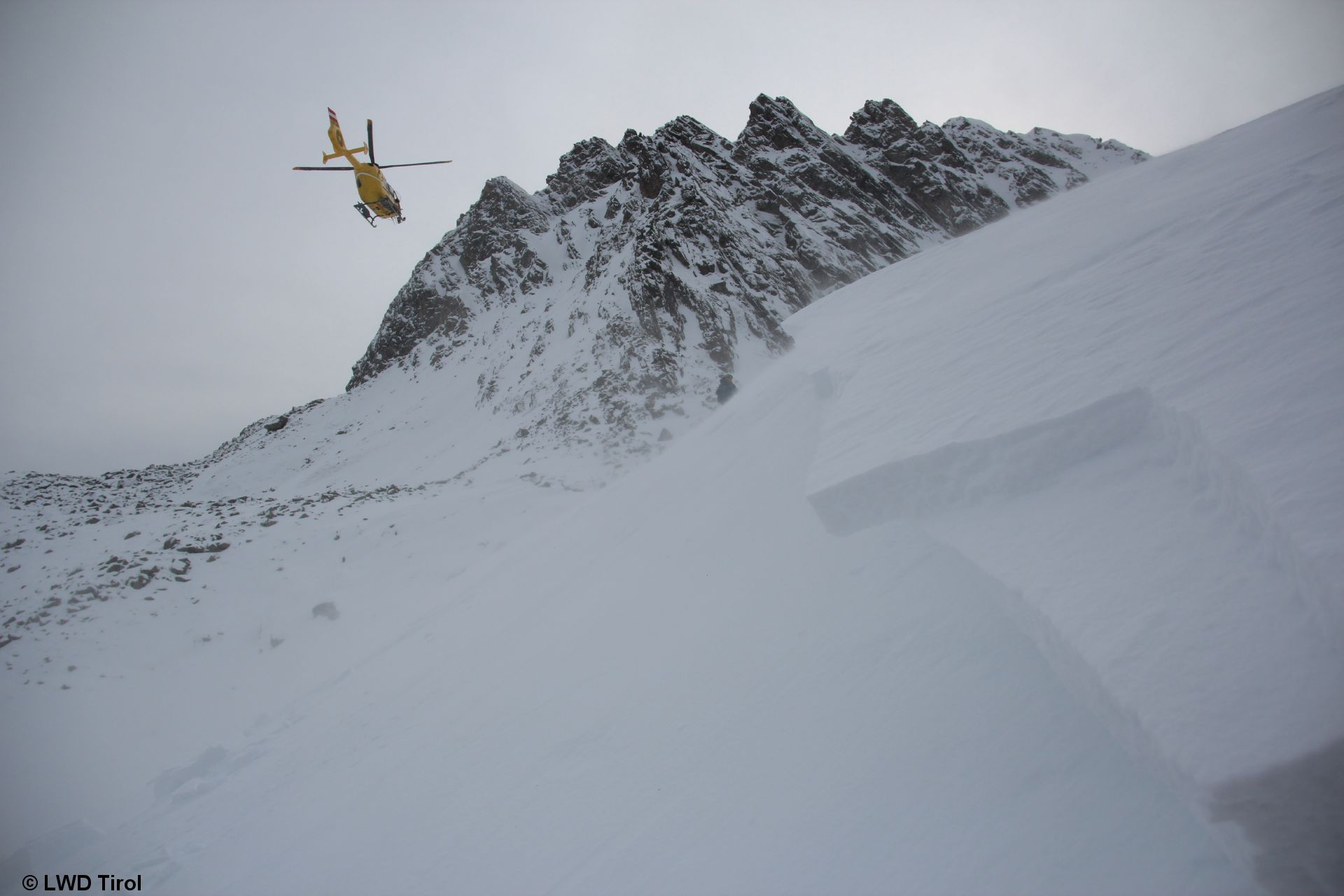
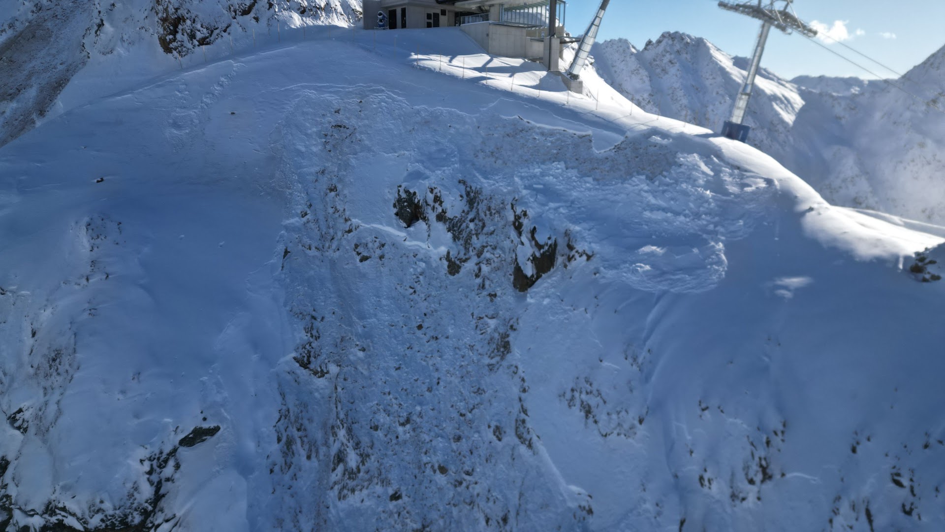
Increasingly dangerous, accident-prone avalanche situation, especially for winter sports enthusiasts To start off: during the next few days, an extremely serious and dangerous situation will develop regionally for winter sports enthusiasts. Starting tomorrow, Friday 02.02, in the eastern regions of Tirol, high avalanche danger will prevail above the timberline. Naturally triggered avalanches are to be…
-
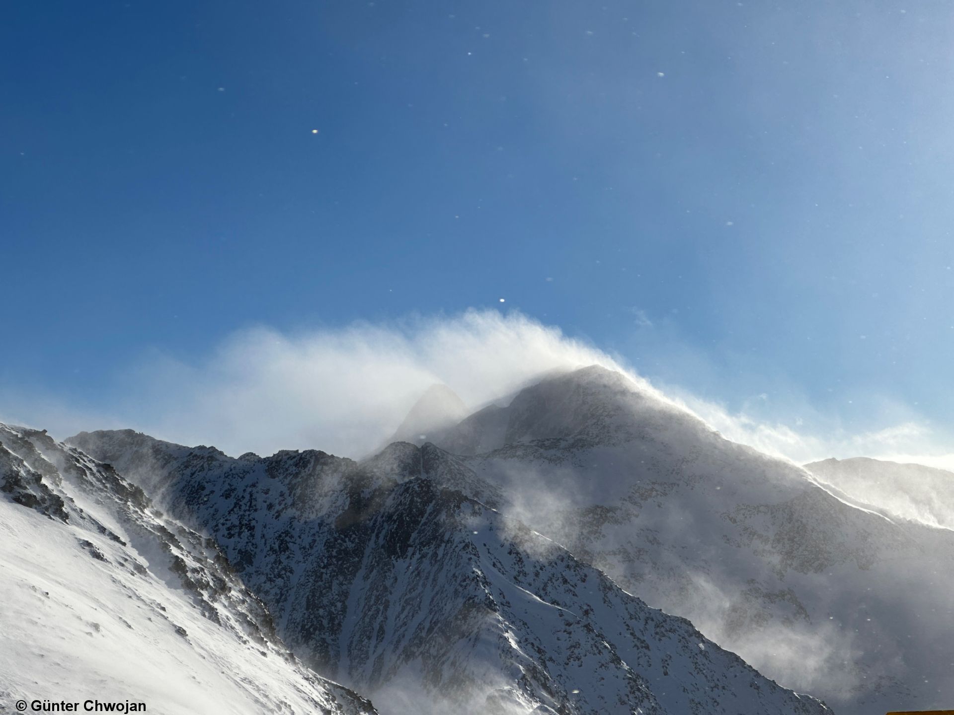
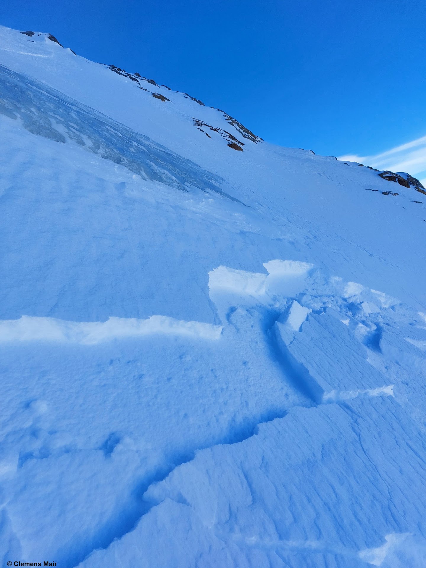
What’s safe + what’s dangerous: often right next to each other. Most fresh snowdrifts are prone to triggering.
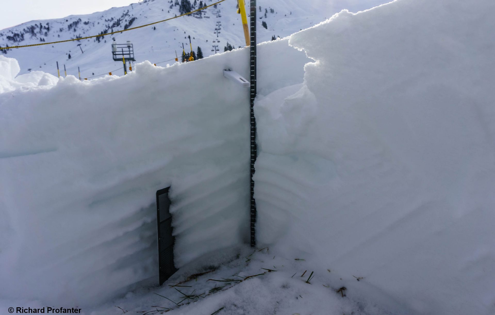
Cold, loose powder constitutes an explosively reactive weak layer To round out the last blog we want to call your attention to the fact that freshly generated snowdrift accumulations are, as a rule, prone to triggering. This is because of the weak layer consisting of loose, cold powder snow. In wind-protected terrain this is amazingly…
-
Fresh snowdrifts easily triggered by winter sports enthusiasts. Persistent weak layer in places starting at 2200m.
Main problem: fresh snowdrifts Finally we have reached temperatures which are appropriate to the season. Currently we lie at the long-term mid-level of air temperature measurements for this juncture. Thus, the fresh fallen snow of recent days is frequently loose wherever there was no wind. And where wind was blowing, the fresh snow was swiftly…
-
Sequence of warm-cold fronts. Very windy. Ongoing: persistent weak layer and snowdrift problem.
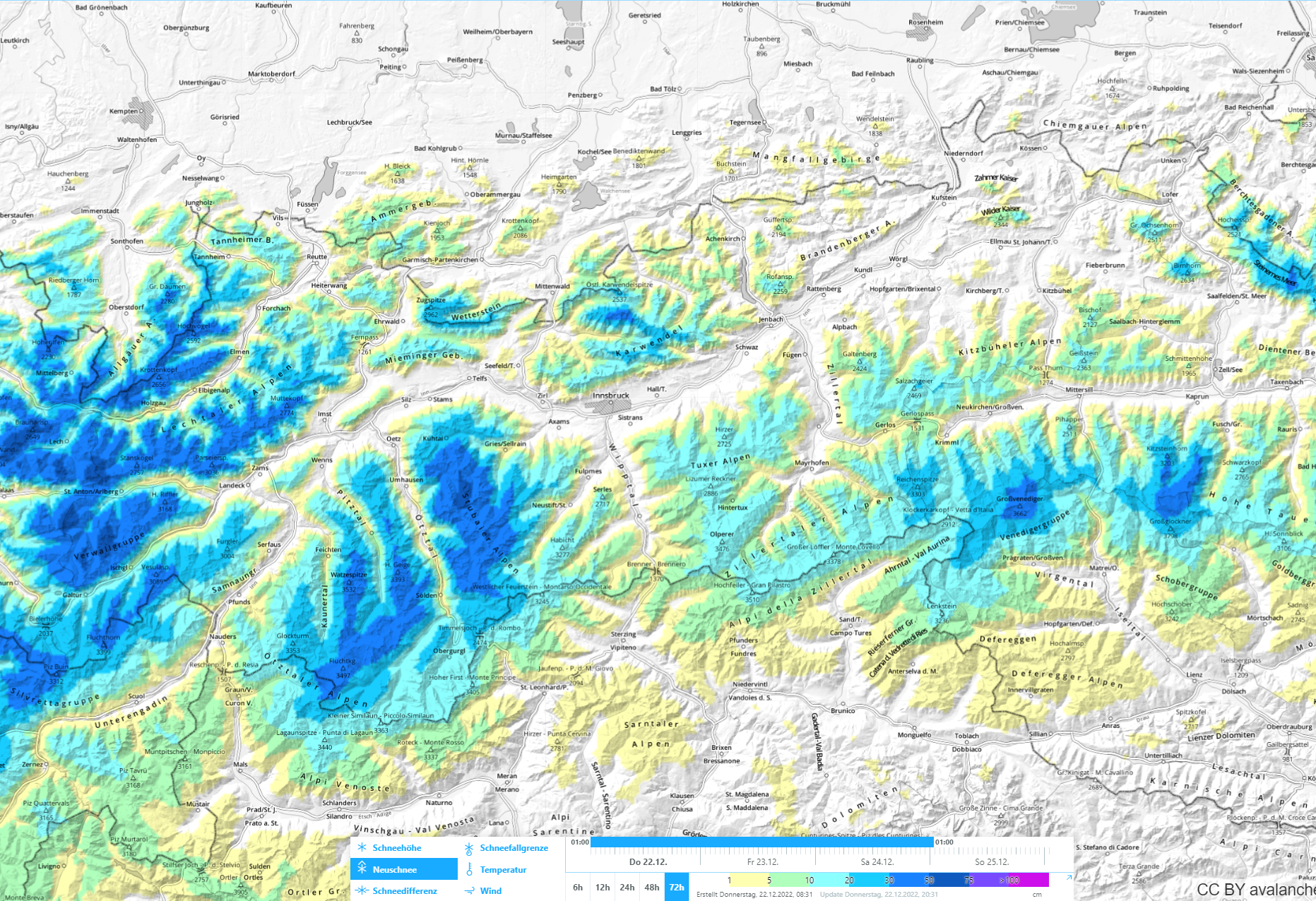
Highly variable conditions The best way to describe the current weather, snow and avalanche situation is with the phrase “highly variable.” Last week was marked by a sequence of warm and cold fronts, repeated snowfall, most of it in the western regions and in northern East Tirol, maximum 50-75 cm, but generally 30-50 cm. Strong…
-
Caution: fresh snowdrifts and persistent weak layer. Danger zones increase with ascending altitude.
Fresh snowdrift masses generally small, but very prone to triggering Strong westerly winds are currently raging at high altitudes. They are transporting the few centimetres of fresh snow that fell on 3 January and 5 January. The fresh fallen snow is generating (particularly in wind-protected shady terrain) a potential weak layer for the fresh snowdrift…
-
Persistent weak layer is still the dominant problem. Danger zones start at 2200 m.
Danger zones hard to spot, even for experts Avalanche danger in the western regions of North Tirol and in northern East Tirol above 2200m and above 2400m continues to be considerable. The underlying problem is the persistent weak layer. That means we are confronted with weak layers in the old snowpack which remain prone to…
-
One more plea to all winter sports enthusiasts: 1st fine-weather day after windblown precipitation is accident-prone!
“Lump Risk” : the snowpack is prone to triggering – brilliant and fine weather – high likelihood of avalanche releases involving persons! Caution urged particularly in Tirol’s western regions above 2400 m. Once the clouds and the fogbanks have dispersed, particularly in the northern regions, Christmas Day according to ZAMG Weather Service will be brilliantly…
-
Turbulent weather: snowfall, rainfall, wind & warmth. Increase of avalanche danger to “winter sports high”
Significant increase in avalanche danger Warm front and cold front A warm front will bring instabile, stormy and very mild mountain weather our way on Friday, 23.12.2022, according to ZAMG Weather Service Innsbruck. In places there will be intensive precipitation, in many places below about 2000 m as rain. Precipitation will be most intensive in…
-
Unchanged: persistent weak layer starts at 2000 m – Fresh drifts at high altitude
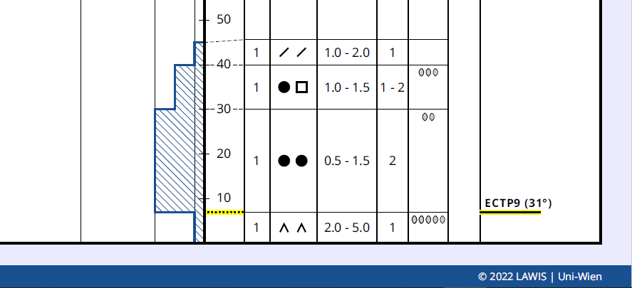
Peristent weak layer, still not enough snow Starting at about 2000 m there are weak layers of faceted crystals inside the old snowpack. These often border against a crust. Frequently, a “crust sandwich” is observed: a weak layer between two crusts. For a slab avalanche, a hardened, deeper layer is required atop the weak layer,…
-
In wind-exposed zones highly trigger-sensitive snowdrifts being generated
The evil weak layer: cold loose fresh snow Since Saturday 10.12 temperatures have plummeted. For that reason, the snow which fell on Friday through Sunday was often deposited as cold, loose-fluffy powder. For this snow to be transported, very little wind is required. Currently new snowdrifts are accumulating which are being deposited on top of…