Author: Jeffrey McCabe
-
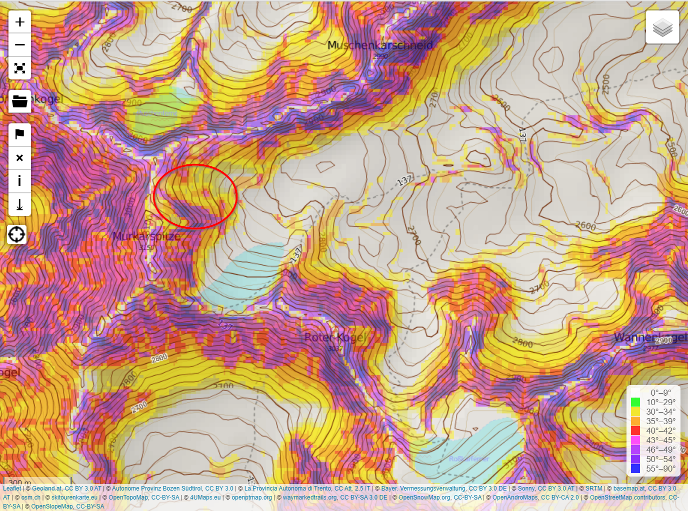
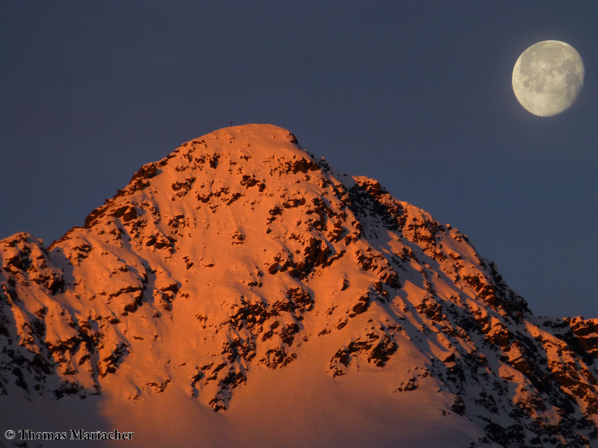
Avalanche Accident Murkarspitze (updated)
Just before noon today, 9 February 2020, headquarters reported that there was an avalanche at the Murkarspitze in the northern Ötztal/Stubai Alps. The avalanche was triggered when at least one person was in the descent at the summit slope. One person died at the scene of the accident. More precise information will have to wait,…
-
After snowfall + storm, briefly delicate situation for backcountry winter sports enthusiasts
Lots of snow + wind. And now, a high-pressure front Following days with ample snowfall and storm-strength winds, beautiful weather is on the way. A turbulent week lies behind us. Windy, initially warm with rainfall, snow depths reducing slightly thereby, followed by a cold front, with lots of snowfall in places. High-pressure front starting on…
-
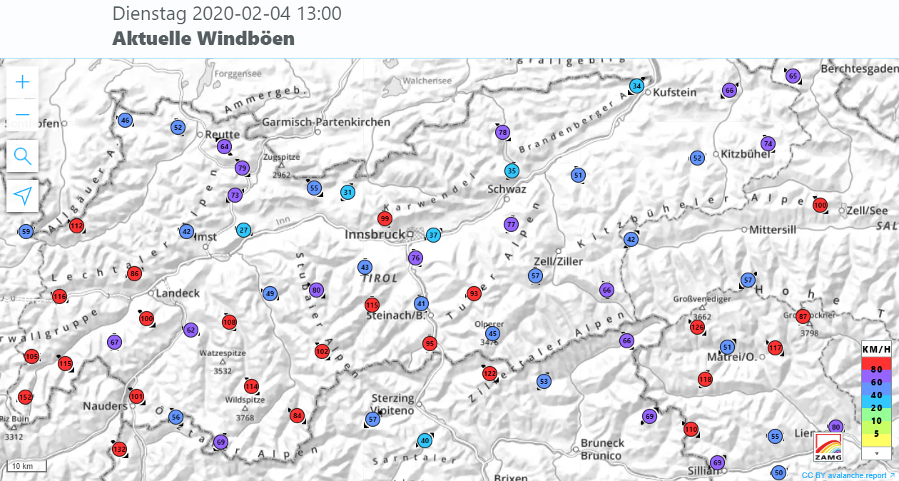
After rain, snowfall to low lying areas – Backcountry skiers beware
Outbreak of winter down to low lying areas Following frequently intensive rainfall with numerous, mostly medium-sized avalanches and flooding in the Lower Inn Valley, ZAMG Weather Service now announces a cold front which will bring impressive amounts of fresh snow and storm-strength winds in the mountains. The cold front will reach Tirol tomorrow, 4 February,…
-

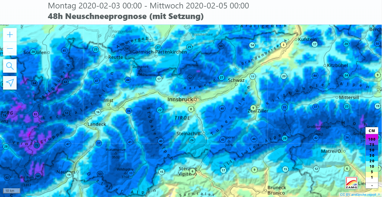
Rain+warmth weakening snowpack, causing naturally triggered avalanches
At 6:00 pm the ZAMG Weather Service published a report about an extraordinary precipitation event for the period 2-3 February in Tirol. As the result of a warm front, mild and extremely moist air masses are being transported to Tirol. Most of the precipitation is expected on the northern rim of the Alps: 60-90 mm…
-
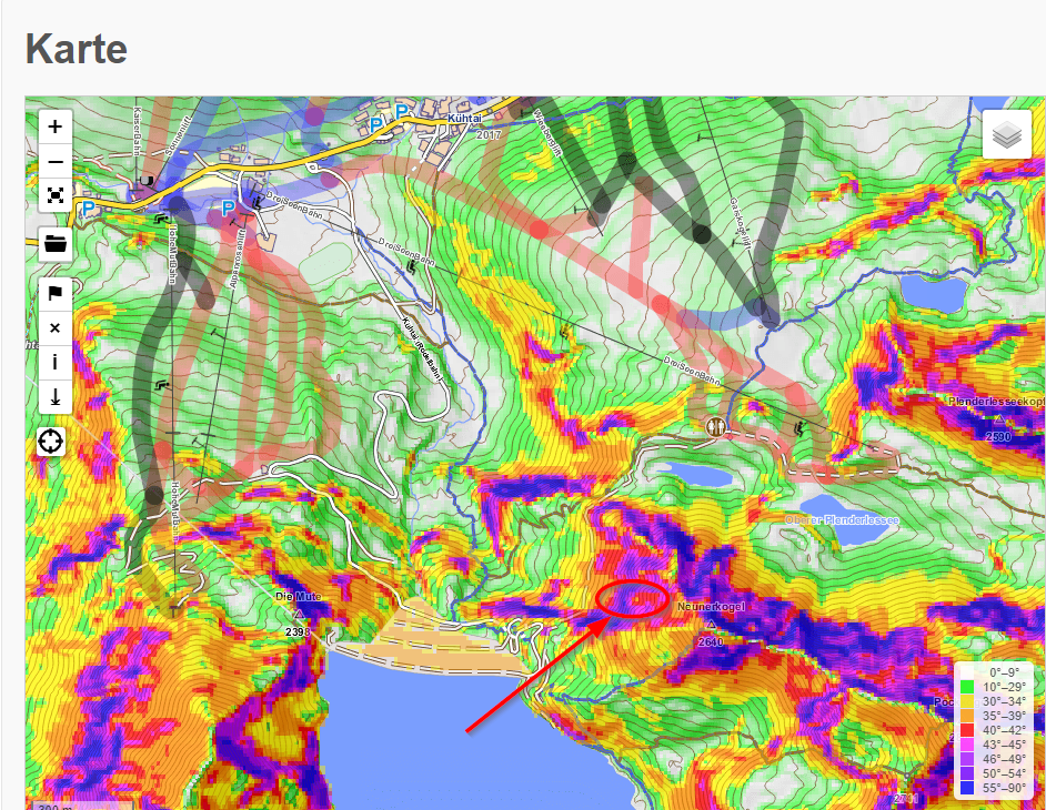
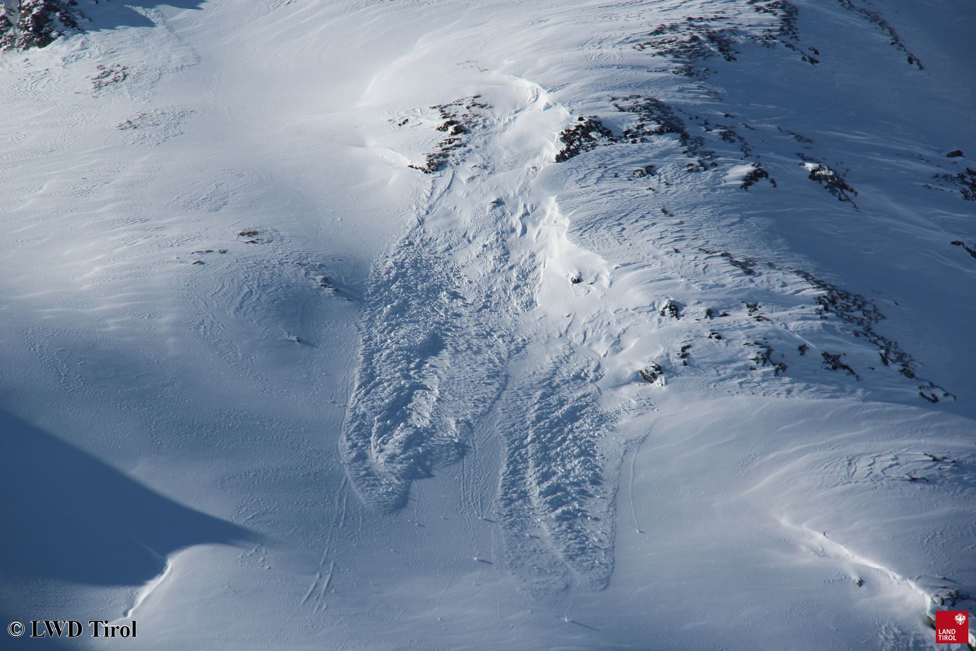
Avalanche on Neunerkogel in open skiing terrain near Kühtai
Today, 31.01, at 1:46 pm headquarters in Tirol reported an avalanche on Neunerkogel south of Kühtai. A slab avalanche triggered in extremely steep terrain as one person was in the descent. The arrow and ellipse show the area of the avalanche. In the foreground is the Finstertal Reservoir. To the north, Kühtai is visible. The…
-
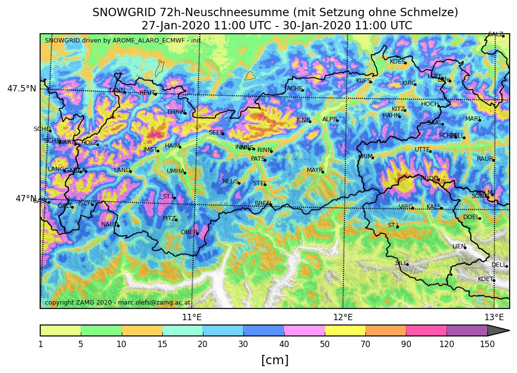
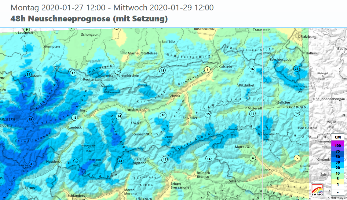
Regionally critical situation for winter sports enthusiasts
New danger zones due to fresh snow and wind A cold front passed through on Tuesday, 28.01, brought more than 50 cm of fresh snow regionally during Wednesday night 29.01. Most of the snow fell in northwestern Tirol and northern East Tirol. Weather last week. To begin with, high-pressure conditions, then weakening. Initially southerly airstream,…
-
Significant increase in avalanche danger due to snowfall + wind
After an extended period of beautiful weather, the big change has arrived. It will bring noticeable precipitation after a long dry spell. Fresh snow and winds will swiftly lead to a striking increase in avalanche danger. In the regions where snowfall is heaviest, avalanche level 4 (high) will be reached. Backcountry skiers and freeriders are…
-
Main danger: fresh, easily recognizable drifts
Last week, high-pressure weather conditions were again prevalent, with short pauses (see previous blog). Winter sports enthusiasts usually enjoyed favourable conditions. Good powder could be found especially in regions where there was lots of fresh snow. Elsewhere, snow quality was modest-at-best except in wind-protected, shady zones. Once again, superb backcountry touring conditions. On the way…
-
Caution: fresh snowdrift accumulations very easily triggered
In wind-impacted regions a serious snowdrift problem threatens winter sports enthusiasts. Freshly generated drifted masses are bonding (for a brief spell) extremely poorly with the frequently very loosely-packed (and cold) new fallen snow from 18-19 January 2020. (Inside the fresh snow there is also graupel that could form an additional weak layer, otherwise relatively insignificant).…
-
On 18.01, a cold front ends 11-day period of low avalanche danger
Rising avalanche danger due to fresh snow+wind During the last week, uninterrupted low avalanche danger prevailed throughout the European region Tirol-South Tirol-Trentino. All in all, including 17 January, it lasted for eleven days. On 18 January avalanche danger will increase somewhat as a cold front passes through. Winter sports enthusiasts then need to exercise caution…