Author: Jeffrey McCabe
-
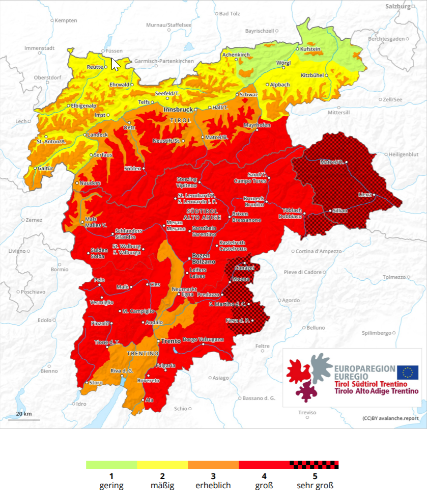
Regionally delicate situation for winter sports enthusiasts. In southern East Tirol, HIGH danger for backcountry skiers.
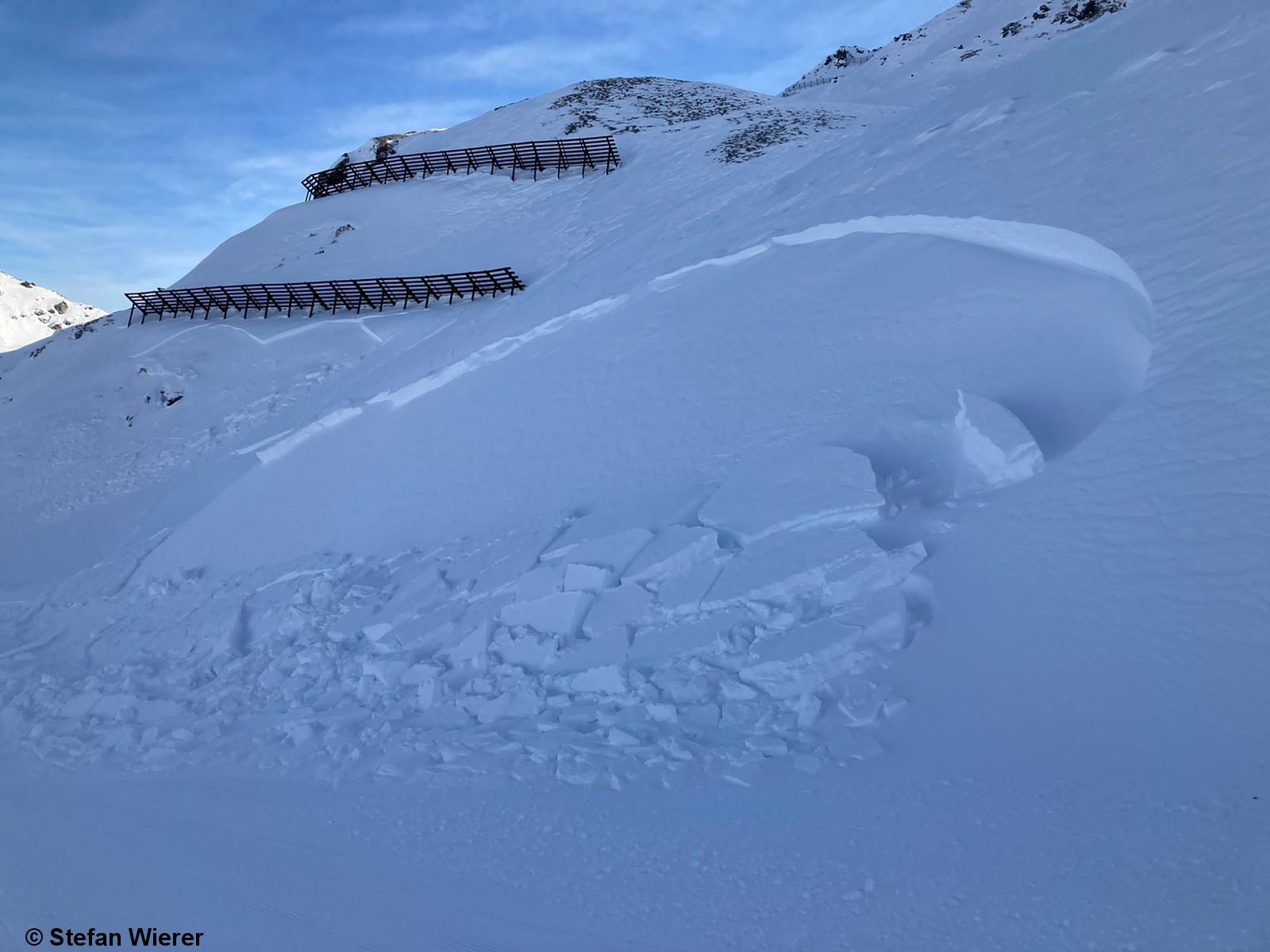
Avalanche releases, fractures, settling noises: clear signals of alarm. Fresh snowdrifts in steep terrain need to be circumvented. Our prior assessment of a delicate situation regionally for winter sports enthusiasts was confirmed today, 29.12. We received repeated reports of mostly medium-sized, in isolated cases also large-sized naturally triggered avalanches. In addition, slab avalanches were triggered…
-
Fresh drifts often easily triggered. More frequent naturally triggered avalanches expected.
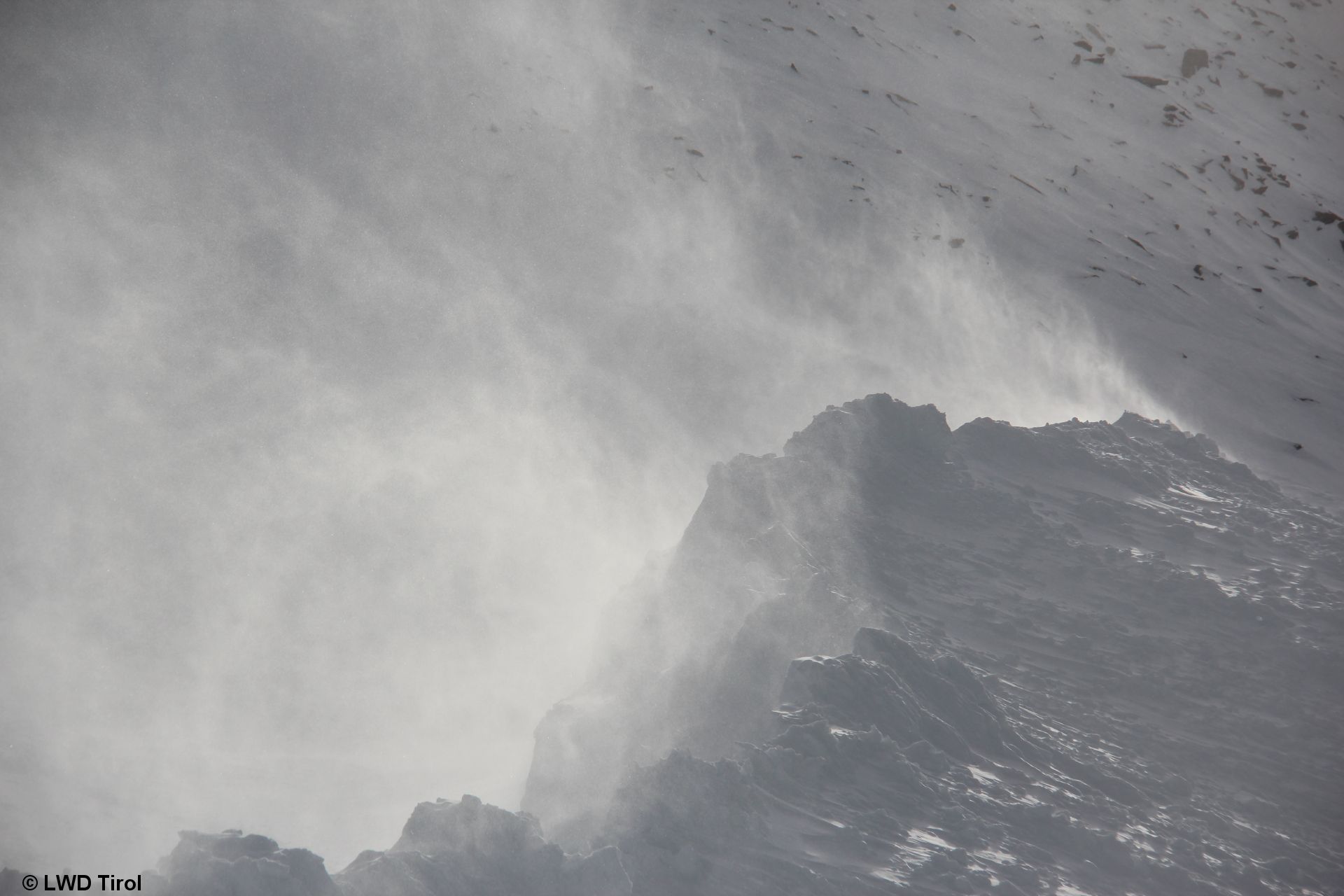
Cold, loose powder generating highly trigger-sensitive weak layer for fresh snowdrifts. As a supplement to our last blog, a short notice to all winter sports enthusiasts: the Christmas holidays were marked by high quality powder. That is now over. In the interim, winds have increased in general, including distant from high peaks and distant from typical…
-
Fresh snow + wind heightening avalanche danger over the holidays
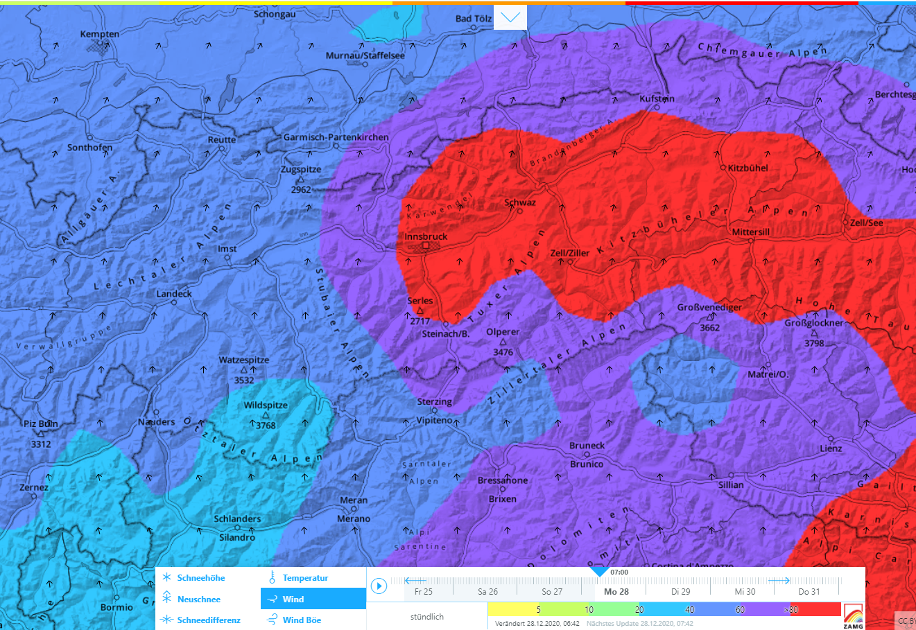
Intensifying snowdrift problem at higher altitudes Since Monday (21.12), quite strong westerly winds have been blowing at high altitudes, generating new snow transport. The fresh snowdrift accumulations are currently (23.12) prone to triggering particularly above about 2400 m. This borderline will descend when a cold front strikes on 24-25 December. Snow plumes at about 2900…
-
Old-snow problem in western regions. Glide-snow problem where ample snow.
In North Tirol, a treacherous old-snow problem regionally, particularly on north-facing slopes above approximately 2200 m Avalanches in the last few days involving people, together with our own snowpack analysis, confirm a quite treacherous old-snow problem in some regions. It is most pronounced in the northwestern regions of North Tirol where there has been little…
-
Fresh drifts often deposited on surface hoar, making them highly prone to triggering
Rigorously circumvent fresh drifts in steep terrain During a night of clear skies on Thursday/Friday (10-11 December) surface hoar formed on the snowpack in widespread areas of Tirol. This now lurks atop an already cold, loosely-packed snow surface, at least in the major areas of precipitation, since wind impact terminated during the last phase of…
-
Glide-snow avalanches in heavy-precipitation regions. Old-snow problem regionally.
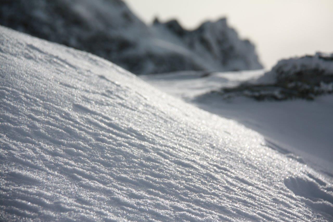
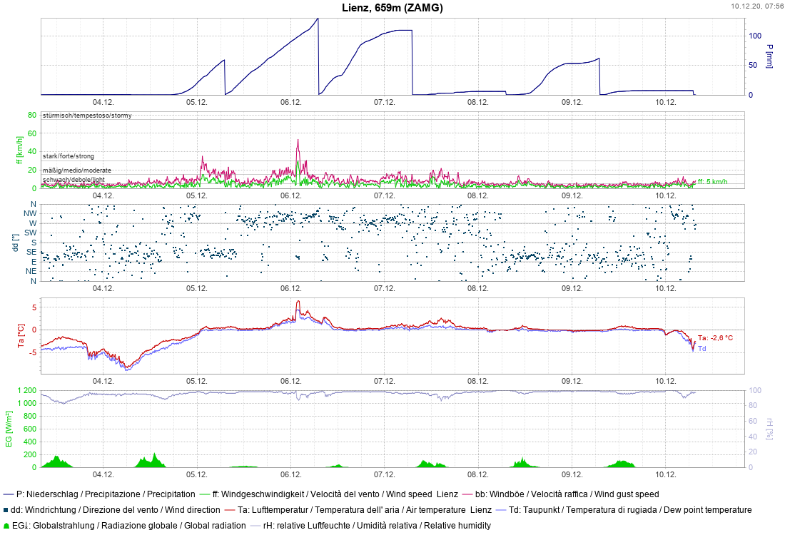
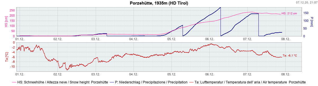
Glide-snow problem on grassy slopes. Caution: rooftop avalanches. Let’s first look at the regions where precipitation has been heaviest. There have been record-breaking amounts of fresh snow registered since Friday, 4 December. Record-setting precipitation in Lienz (measurements since 1880) Since Tirol’s Avalanche Warning Service was established in 1960, there have never been such masses of…
-
Attention winter sports enthusiasts: old-snow problem in regions with comparativfely little snow
Right off the bat: an appeal to all winter sports enthusiasts Quite deliberately we want the focus at the beginning of this blog to be on the regions of North Tirol where there is little snow. That is where winter sports enthusiasts need to be aware of a potential, difficult-to-assess old-snow problem. The old-snow problem…
-
Very high avalanche danger in East Tirol
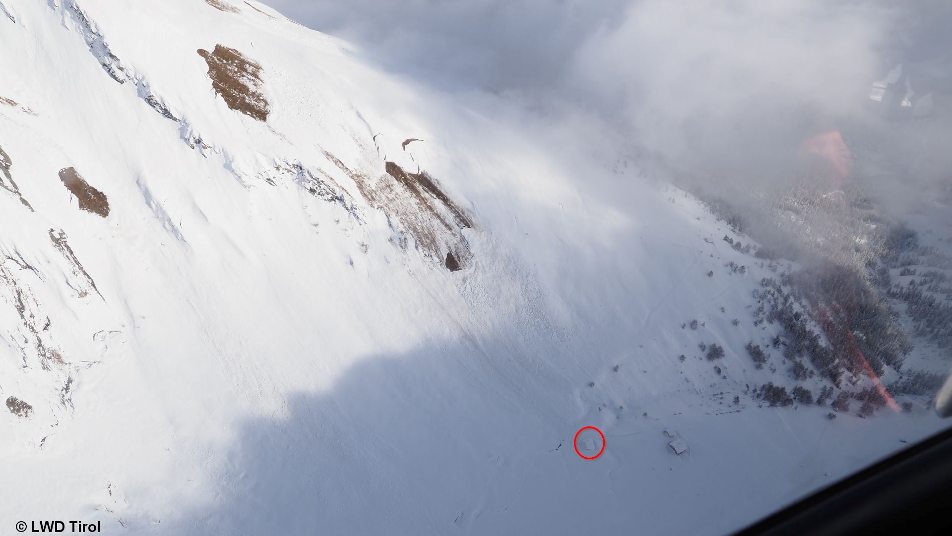
In East Tirol a dangerous situation has developed as a consequence of extraordinary amounts of snowfall plus ongoing wind impact and rain. This has led to the highest rank of risk being assigned: very high avalanche danger. Update from 06.12.2020 8:00 am: In the EUREGIO very high avalanche danger prevails regionally. In the mountains there,…
-
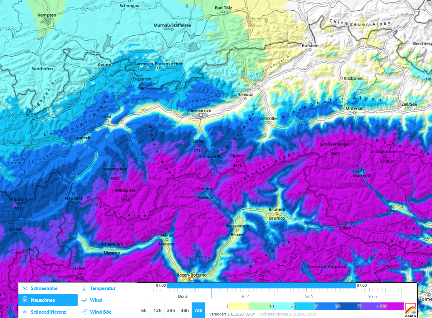
Lots of fresh snow + storm winds = high avalanche danger in South as of 5 December
Immense amounts of fresh snow, storm winds, variable snowfall altitudes The ZAMG forecasts have been confirmed: in southern regions it will snow intensively. In East Tirol the expectations are currently for 50 cm of fresh snow on the valley floors (with significant proportion of rainfall), elsewhere generally 100 cm. In the upper Gailtal/Lesachtal, according to…
-

Starting Friday 4.12, heavy snowfall in South, marked increase in avalanche danger
November concludes very mild, not much precipitation The month of November 2020 will go down in history: according to ZAMG Weather Service it was among the ten driest, in the mountains the third warmest, and among the five sunniest Novembers in the entire history of weather measurement. December launch – heavy snowfall in southern regions …