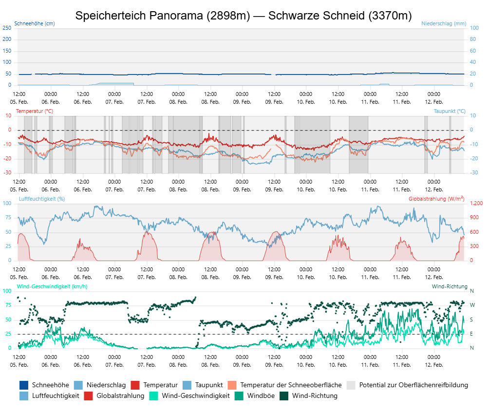
In the next few days, quite turbulent weather conditions await us: precipitation, frequently strong winds and fluctuating temperatures. Fresh snow and drifts will be deposited on top of a very weak snowpack. Avalanche prone locations will again increase in number, avalanches can be triggered by one single person. Alarm signals such as whumpf noises and fractures are clues of potential danger. The situation will be highly unfavorable, demanding caution, restraint.
Snowpack and avalanche situation
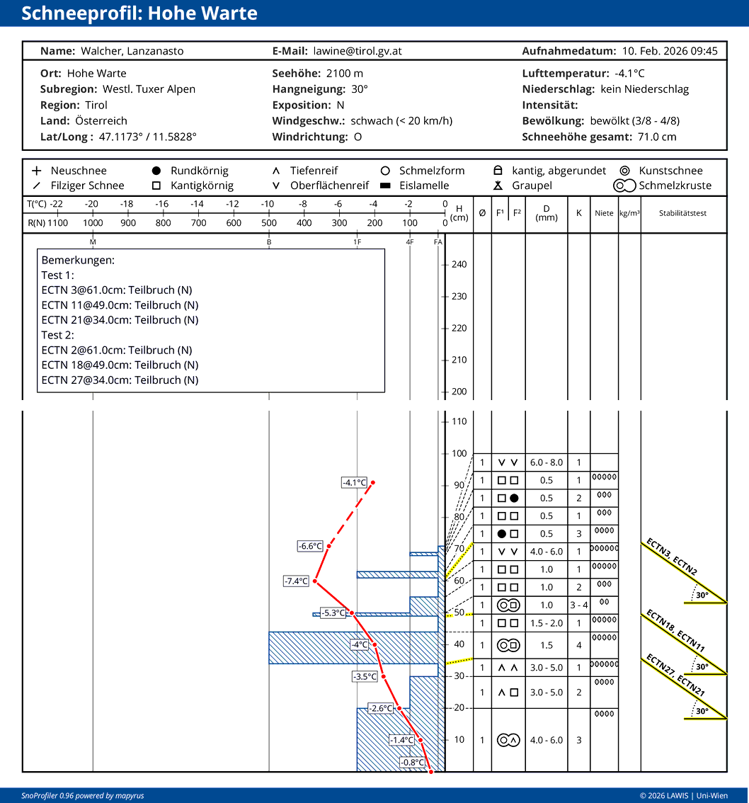
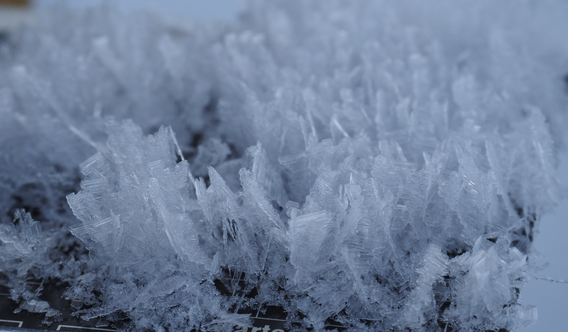
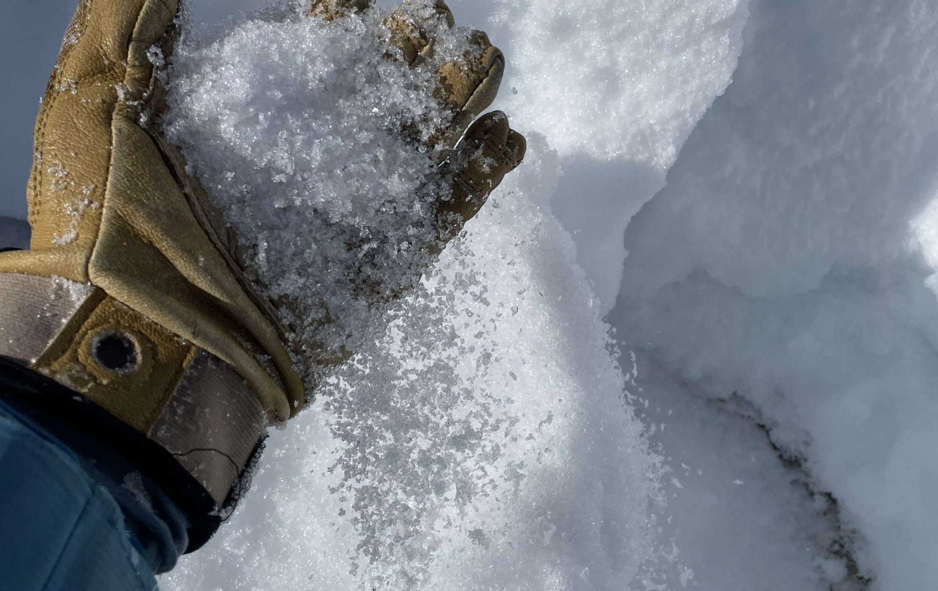
The snowpack layering on west-facing, north-facing and east-facing slopes near the treeline and further up is weak widespread. In the lower and middle parts of the snowpack are weak layers of large-sized faceted crystals or embedded hoar, often beneath or on top of melt-freeze crusts. Higher up inside the snowpack, especially in wind-protected zones, are layers of blanketed surface hoar.
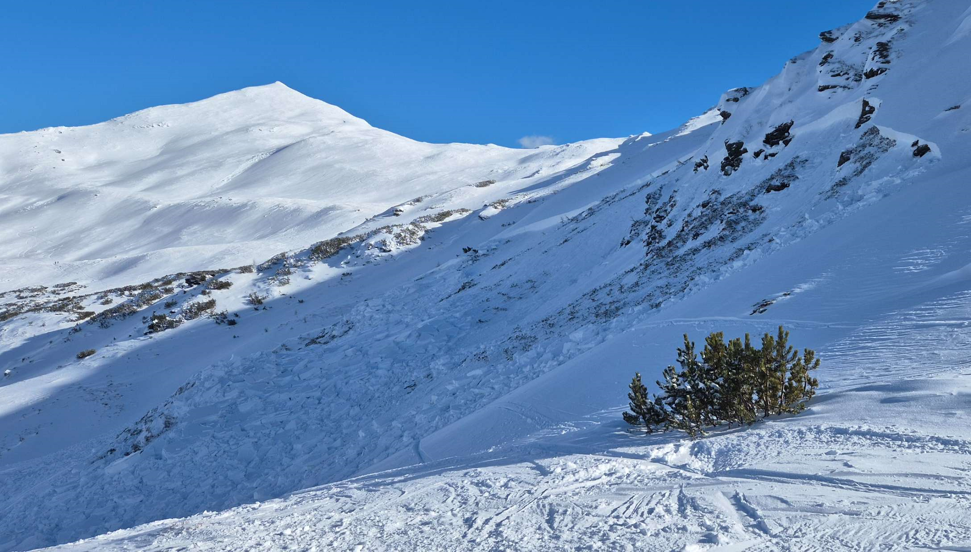
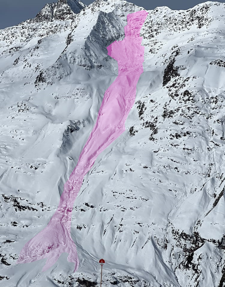
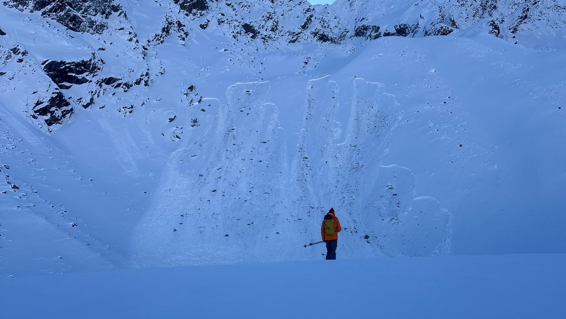
In East Tirol a very solid slab was generated atop the weak layers in the snowfall last week. Particularly on the weekend and at the launch of the new week, we got numerous reports of avalanches, remote triggerings and alarm signals, thus confirming how unfavorable the situation was. Ongoingly and throughout the weekend and beyond, we can presume there will be many spots where slab avalanches can be triggered, particularly on very steep shady slopes. Because 40-100cm of snow lies deposited on top of the weak layers, avalanches in some terrain can grow to correspondling large size.
In North Tirol the number of reports of freshly unleashed avalanches and alarm signals decreased of late. This is because the slab which had formed gradually forfeited its qualities in the high-pressure weather conditions and expansive metamorphosis which resulted, so that fractures no longer could propagate as well.
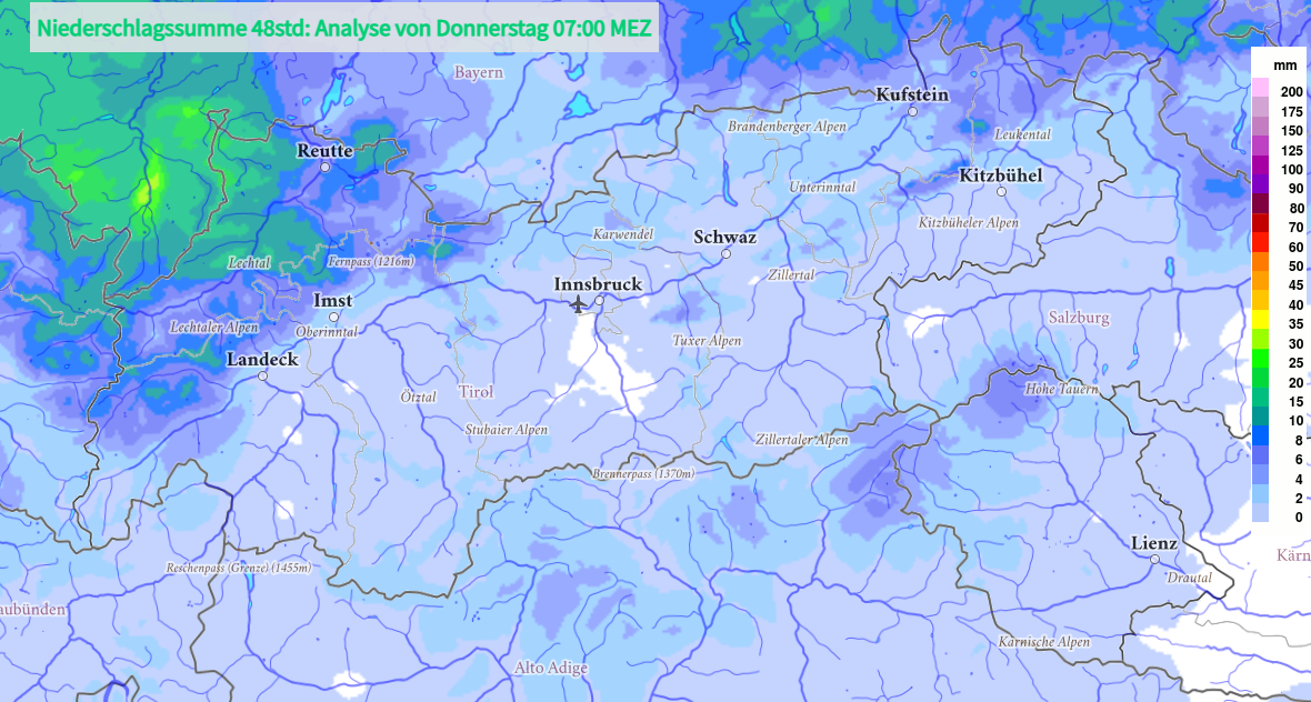
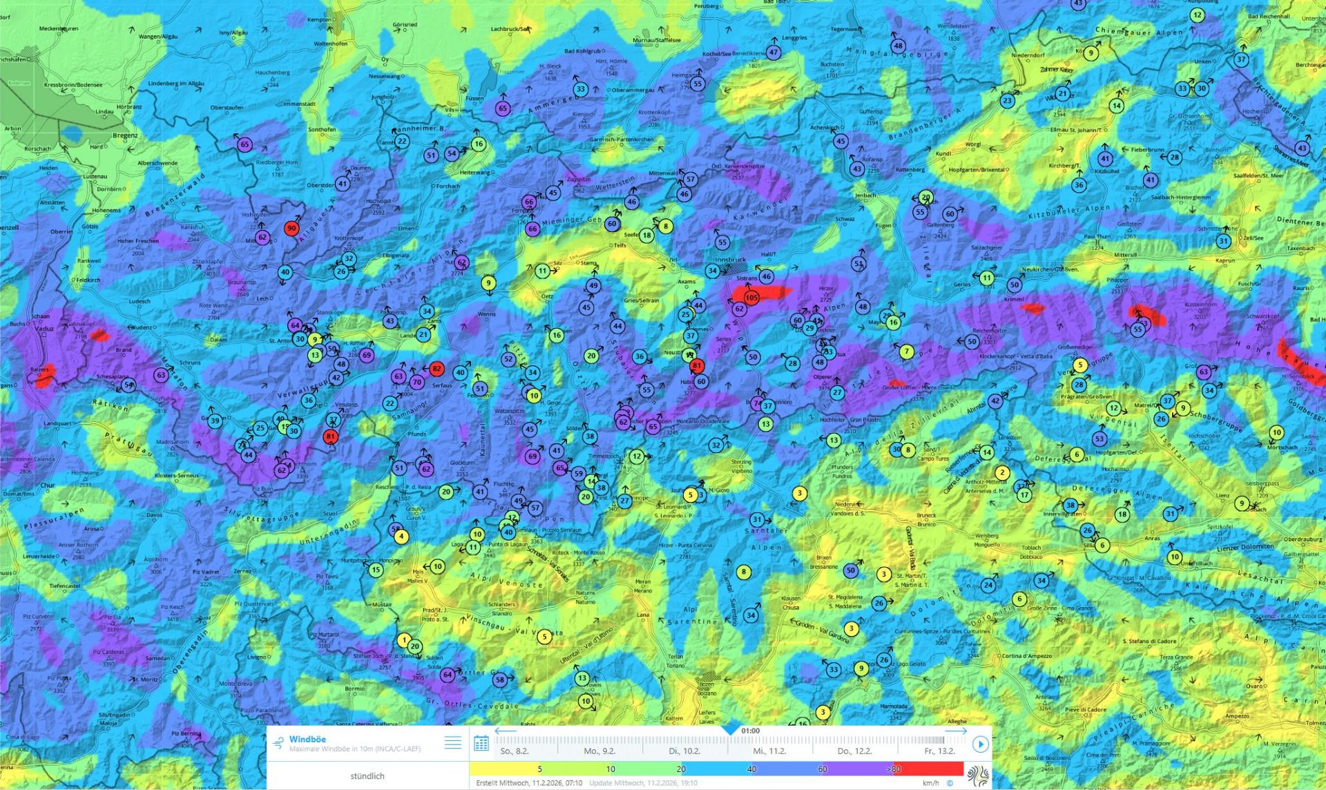
As a result of some snowfall and, in particular, of strong to storm-strength westerly winds which set in on Tuesday, 10 February, this trend then got turned around. The surface hoar once again got blanketed by fresh snow and fresh drifts (wherever winds or warmth hadn’t dissipated it beforehand). As a result of the precipitation over the next few days, the situation will become increasingly more unfavorable. Slab avalanches can be easily triggered and grow to medium size. Caution is urged particularly in gullies and bowls which are loaded with snowdrifts.
Coming weather developments: turbulent
GeoSphere Austria forecasts extremely instable weather conditions over the next few days. Fundamentally, we are in the claws of a persistently powerful westerly air current which is delivering moist air masses to the Alps.
Weather developments will thus ensure that a solid slab can form and thereby, fractures in the weak layers referred to above will be able to propagate. If the forecast snowfall comes to pass, we can reckon with a period of higher avalanche activity.
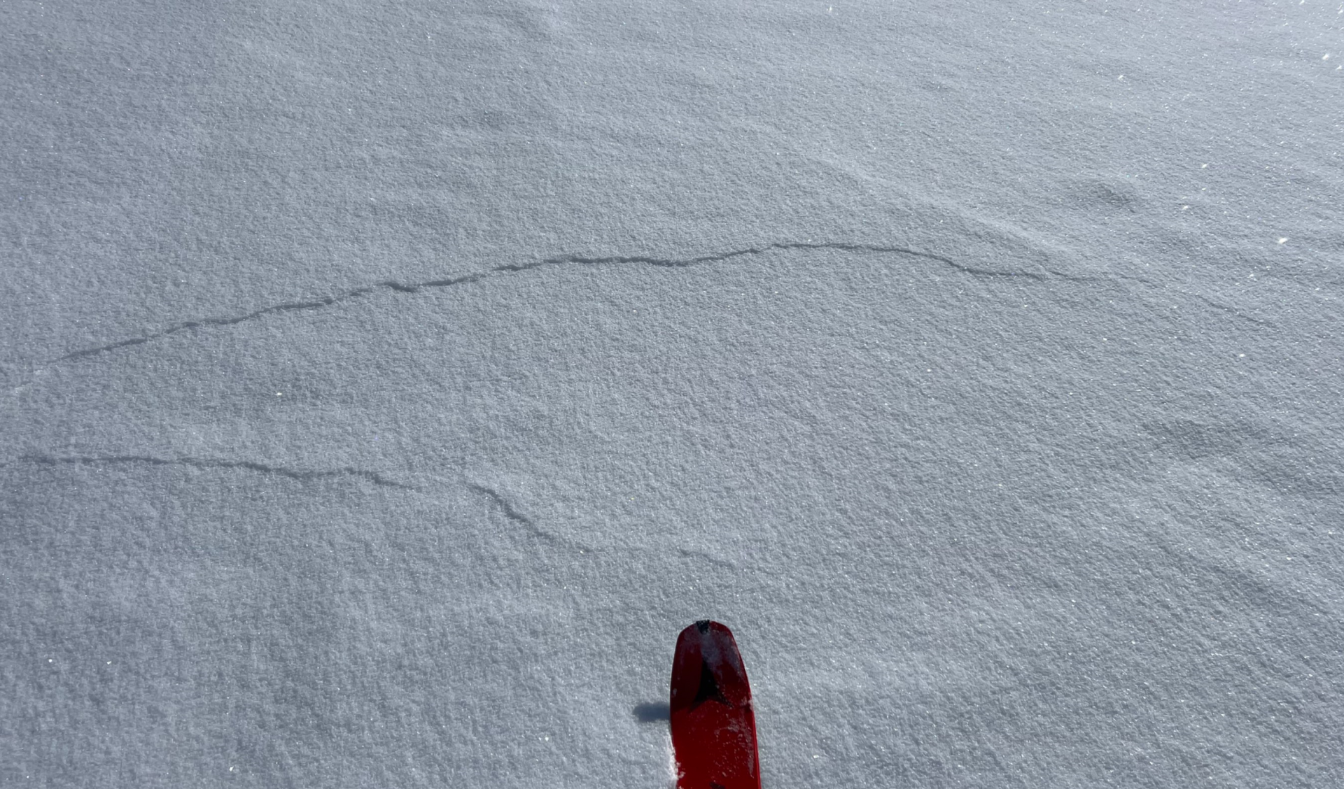
Due to high proneness to triggering and widespread weak layers, increasingly frequent remote triggerings will again be possible. Danger zones will be nearly impossible to see, even for the experienced eye. Caution and restraint will be the most important tools to get through this approaching dangerous situation.
How long will the persistent-weak-layer problem continue this winter?
Short answer: until the snowpack melts.
The current snowpack layering means there is little hope that the character of the snow will change significantly this winter. The widespread very weak snowpack fundament with particularly well formed weak layers – large-sized faceted crystals or embedded hoar – will continually become an active threat this winter, bringing us intervals of heightened avalanche danger. It becomes a real threat whenever weather conditions provide a marked slab above the weak layer, meaning in conjuntion with snowfall and/or wind. That is precisely the situation which is now approaching.
Following situations like this, with heightened proneness to triggering and/or avalanche activity, danger levels decrease only very slowly, the situation improves only very gradually. There are two reasons for this: (1) the slab gets “gobbled up” by the expansive metamorphosis brought about by high-pressure weather conditions, so that fractures can no longer propagate as well. Or (2) significantly more fresh snow gets deposited atop the weak layer, leading to the weak layer being triggerable as an avalanche in fewer places, on the one hand, and on the other, the burden of the snow and narrower temperature gradient inside the weak layer gradually leads to melding inside the weak layer, i.e. reinforcing the contact points between the individual snow crystals.
What remains treacherous in both situations: even when the danger zones gradually diminish through the processes described above, the dangerous spots in the terrain are not visible, thus can become veritable hot spots for continuing slab avalanches in the old snow. In regions where snowfall is heaviest, these can also become triggerings of large magnitude. That’s the situation we describe as a “low risk – high consequences” scenario. In other words, a “slumbering” persistent weak layer which due to the wide distribution of avalanche prone locations is often assigned Danger Level 2.
Such a winter, marked by persistent weak layers, usually comes to an end through a “grande finale” in spring, when the weak layer becomes thoroughly wet for the first time and numerous avalanches (ranging from large to very large, depending on snow depth) unleash.
A major, sustained improvement this winter can only be brought about by a massive burden of the snowpack by large precipitation events or else a swooping mass of warmth that reaches all the way to the weak layers, dissipates them and starts generating a new snowpack all over again. Both of these events are highly improbable.
Avalanche incident Schafseitenspitze
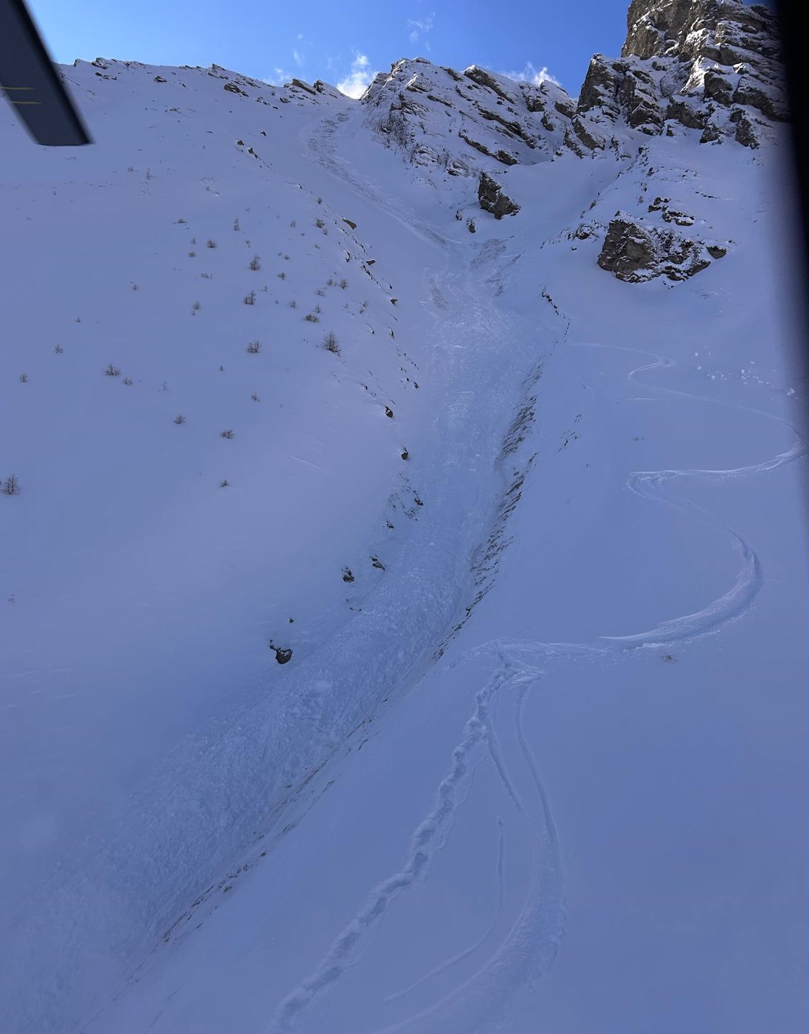
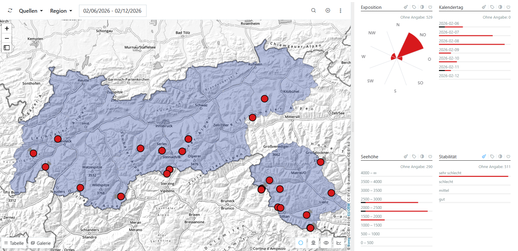
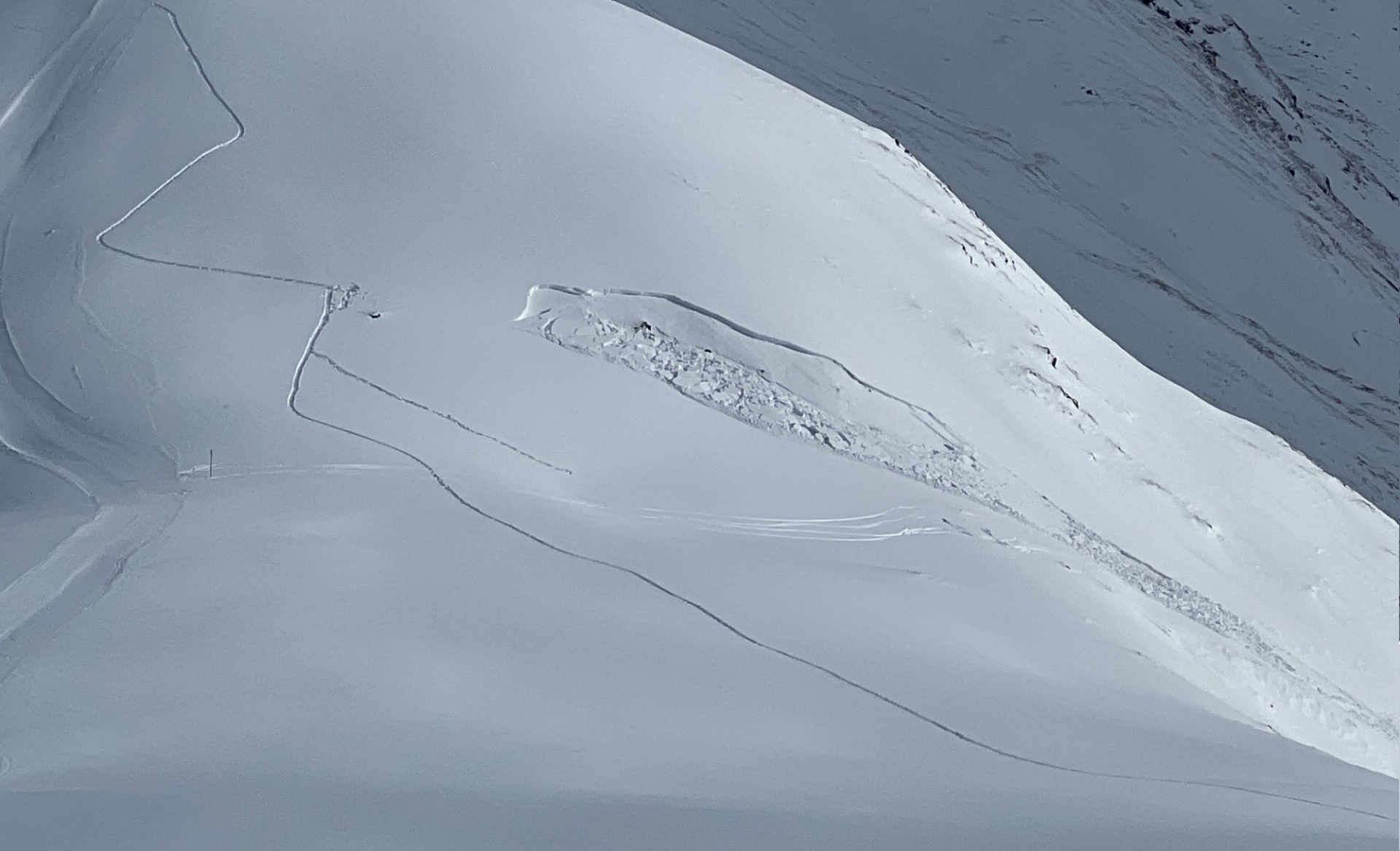
Apart from approximately 20 further avalanche releases which have been reported to headquarters by our observers and via SNOBS over the last 7 days, there was one avalanche incident which occurred on Sunday, 8 February on the Schafseitenspitze (2602m) above Navis which luckily was without serious consequences.
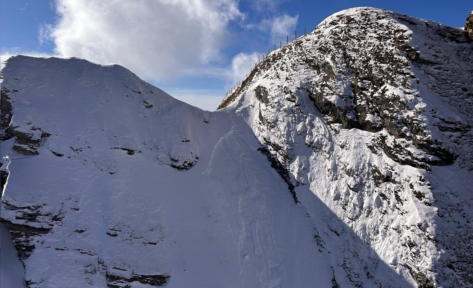
On the descent over an extremely steep, northeast-facing slope south of the summit structure of the Schafseitenspitze in the western Tux Alps, a slab avalanche triggered in which one person was swept along for about 500 metres of altitude. The other group member was able to alarm the mountain rescue squad. Both persons escaped without injuries.