Daily avalanche bulletins start. Caution: weak old snow, esp. on high shady slopes.

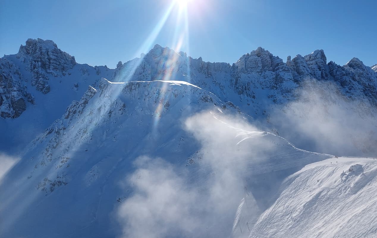
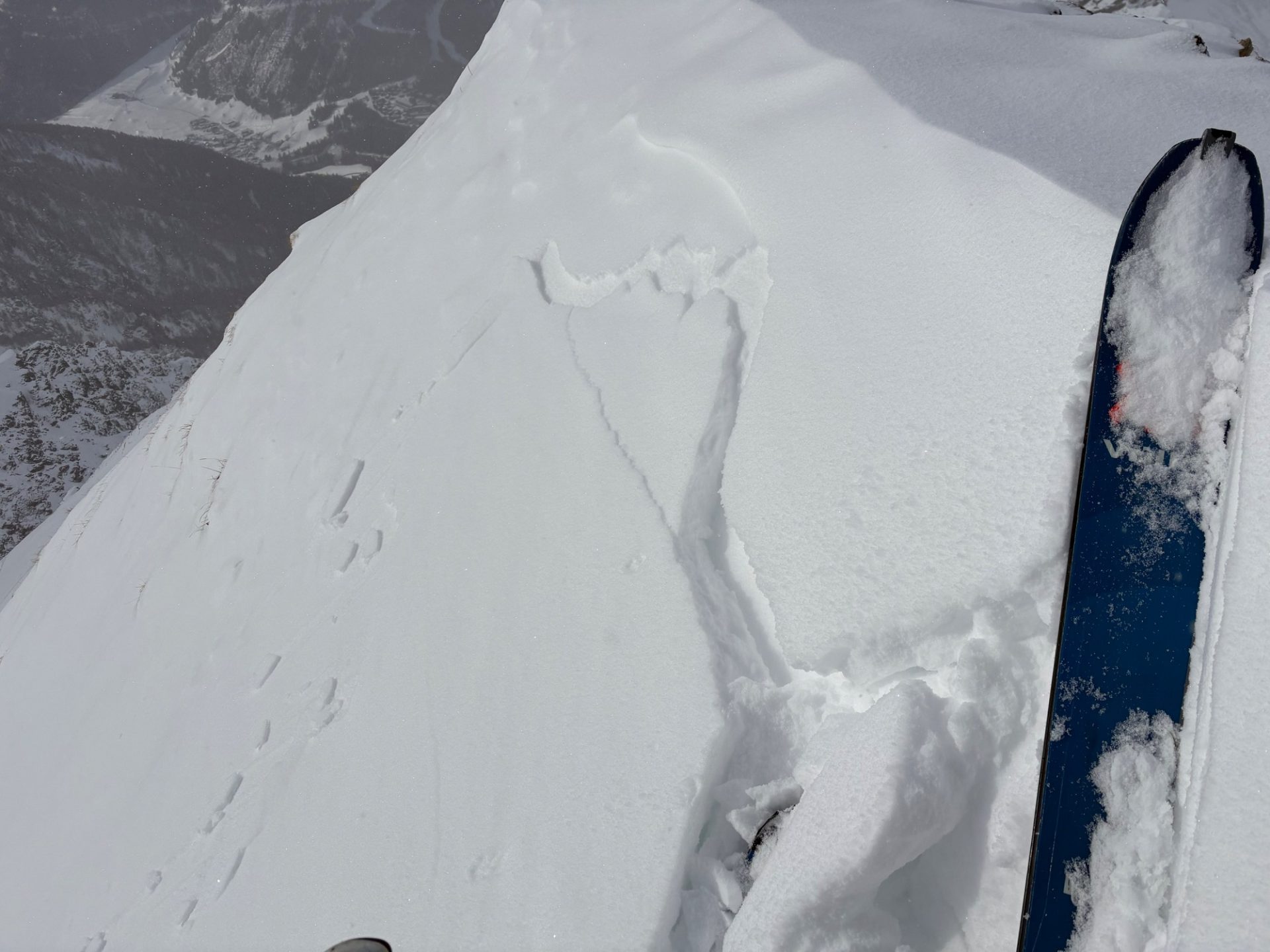
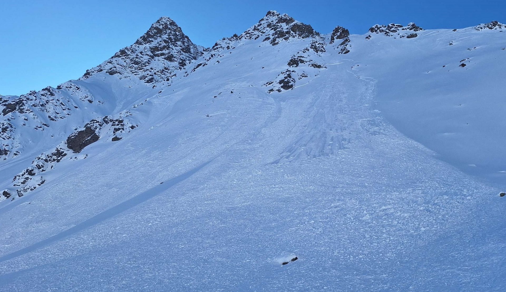
Slab avalanches triggered by persons today, Thursday, 27.11.2025, demonstrate the current situation: very unstable. Caution urged particularly on very steep shady slopes above 2200m, where faceted weak layers in the old snow are prone to triggering. One single individual can release an avalanche in some places. In the regions of North Tirol with the most snow, the releases are mostly medium-sized, in isolated cases large-sized.

On Friday, 28.11 at 5:00 pm, the first Avalanche Bulletin of the season will be published.

Current situation demands restraint

Main problem: persistent weak layer

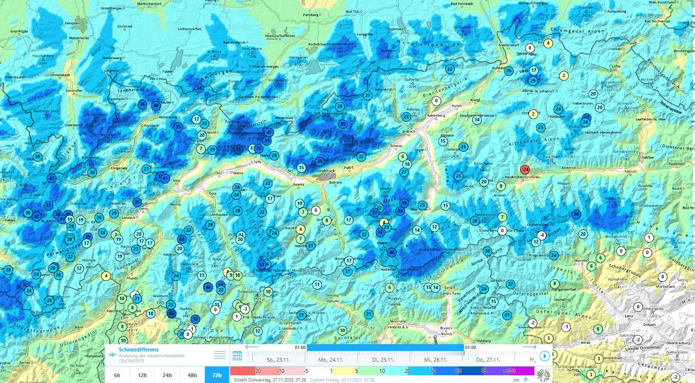
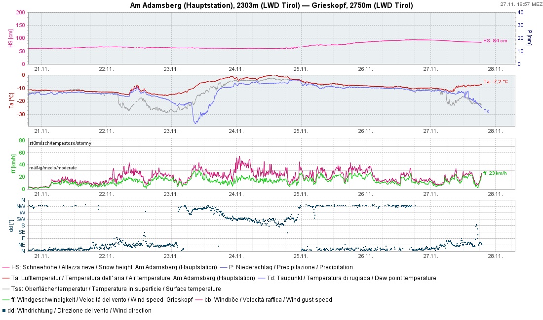
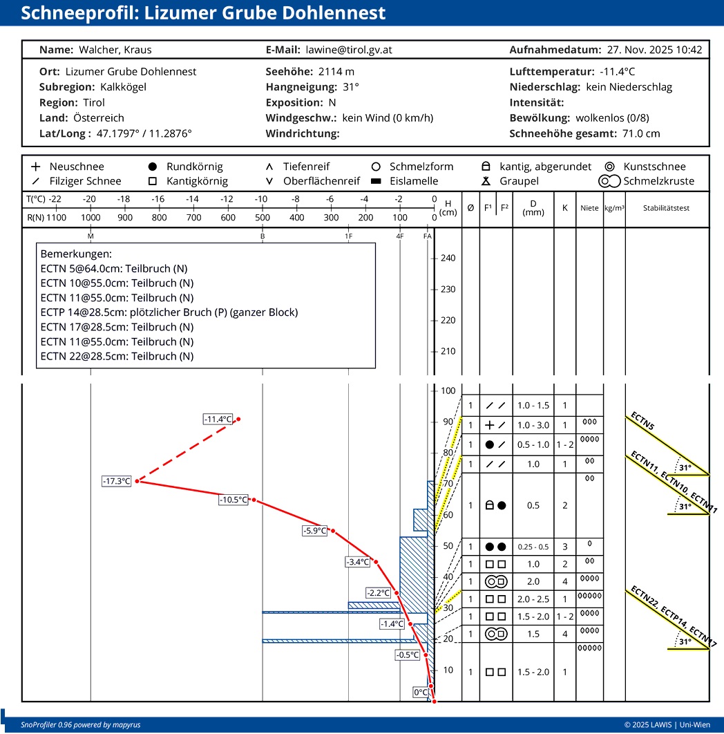
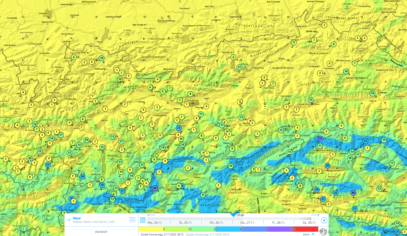
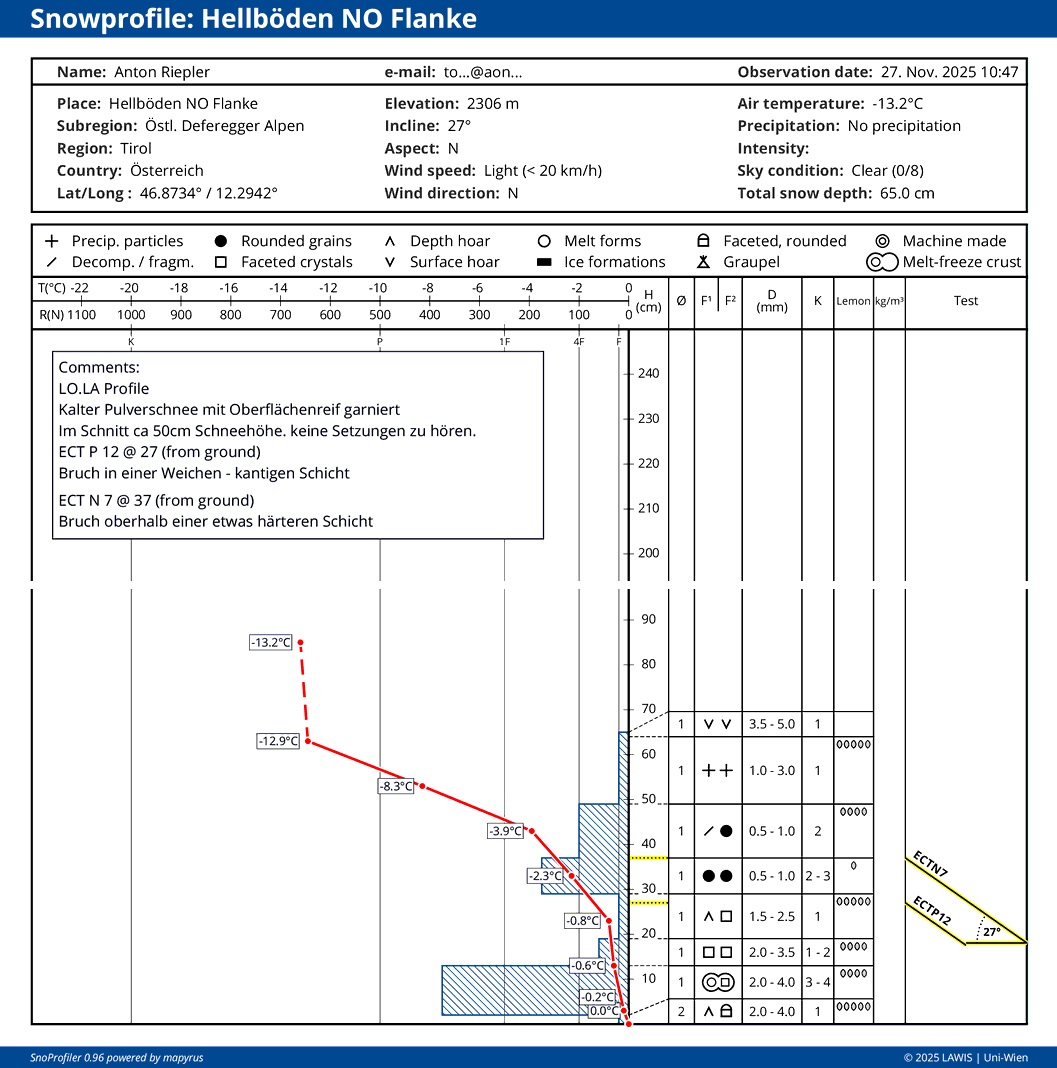
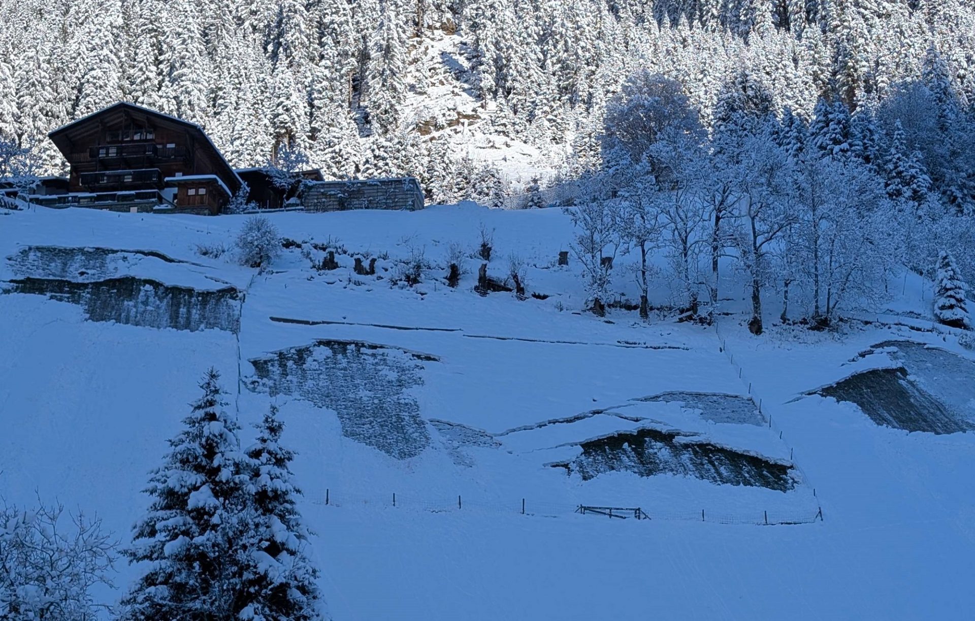
Since Monday evening, 24.11, there has been 20 to 40cm of snowfall registered in North Tirol and northern East Tirol. Particularly on west, north and east-facing slopes above 2200m, this fresh fallen snow lies deposited atop a shallow and often weakly metamorphosed base of old snow. Potential weak layers occur in the form of faceted crystals, frequently blanketed by a melt-freeze crust (from rainfall on 2 November). In isolated cases, there is also trigger-sensitive surface hoar (formed on 22-23.11) in protected bowls, now blanketed by fresh snow.

Neuschneesumme der vergangenen 3 Tage: Verbreitet sind 20 bis 40cm Neuschnee gefallen, im Norden und Westen mitunter auch etwas mehr.
Sums of fresh snow in the last 3 days: widespread 20-40cm, in northern and western regions often more.
Messdaten der vergangenen 7 Tage an der Wetterstation Am Adamsberg in der Verwallgruppe: Gut zu erkennen ist das Potenzial für die Bildung von Oberflächenreif am 22.- 23.11. (Schneeoberflächentemperatur fällt unter den Taupunkt), sowie die abnehmenden Temperaturen und der schwach bis mäßige Wind während des Niederschlags der vergangenen Tage.
Measurement data of the last 7 days from Adamsberg weather station in the Verwall Massif. Easily identified is the potential for surface hoar being generated on 22-23.11 (snowpack surface temperature drops beneath thawing point), as well as the descending temperatures and weak-to-moderate winds during the precipitation.
Im unteren Teil des Schneeprofils erkennt man kantige Schwachschichten, welche in Stabilitätstests angesprochen werden können.
In lower part of snow profile, faceted weak layers are visible. Stability tests showed they are liable to release.
Das oben dargestellte Schneeprofil als Bild: Neuschnee und etwas älterer Triebschnee bilden das Schneebrett, sie erscheinen matt- weiß, in Bodennähe findet man weiche, kantig aufgebaute und grau erscheinende Schichten zwischen Schmelzharschkrusten (©LWD Tirol, 27.11.2025).
The above snow profile here displayed above as a photo: fresh snow and somewhat older snowdrifts constitute the slab (dull white). Near ground level are soft, faceted expansively metamorphosed layers (gray) between melt-freeze crusts (©LWD Tirol, 27.11.2025).

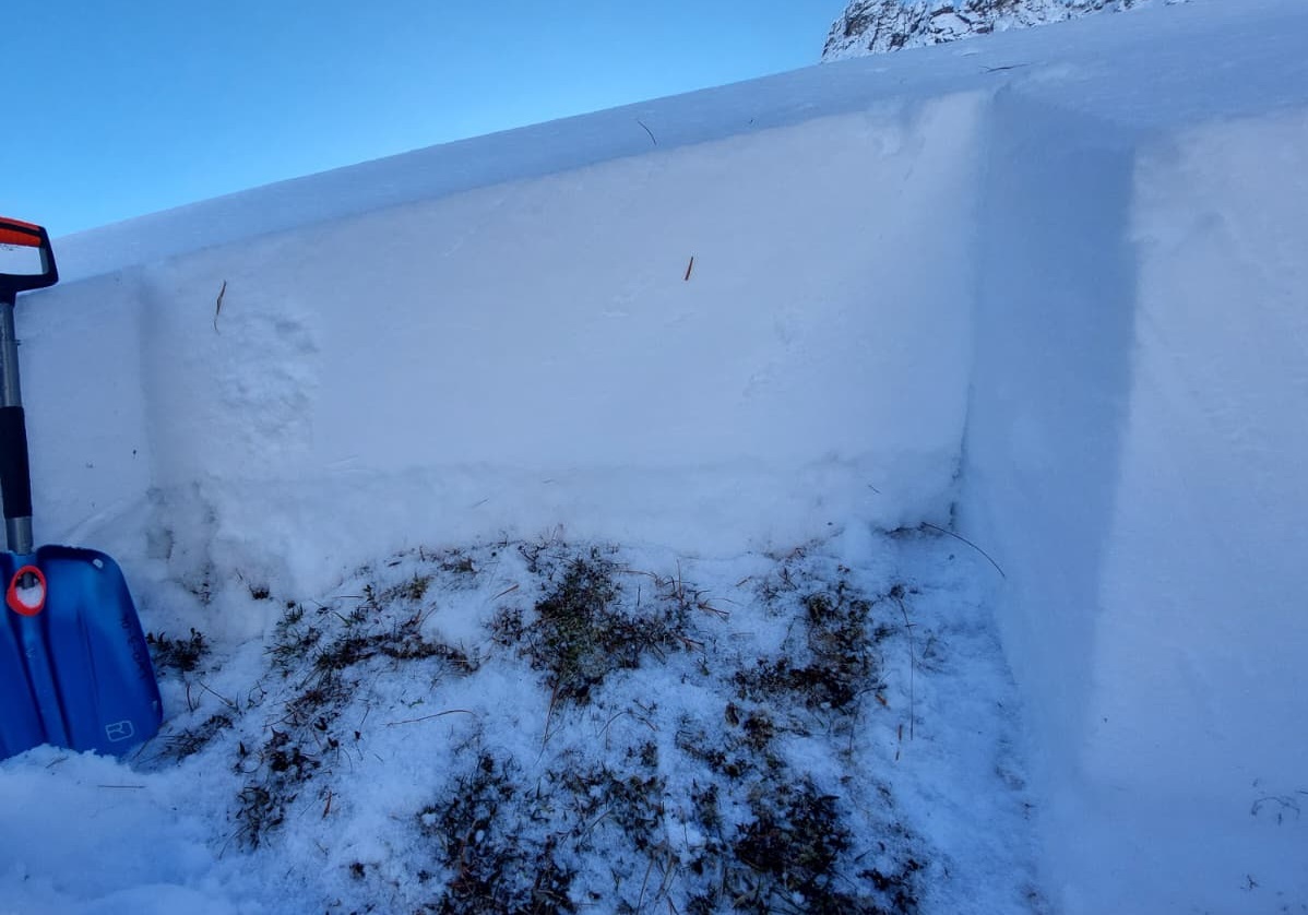
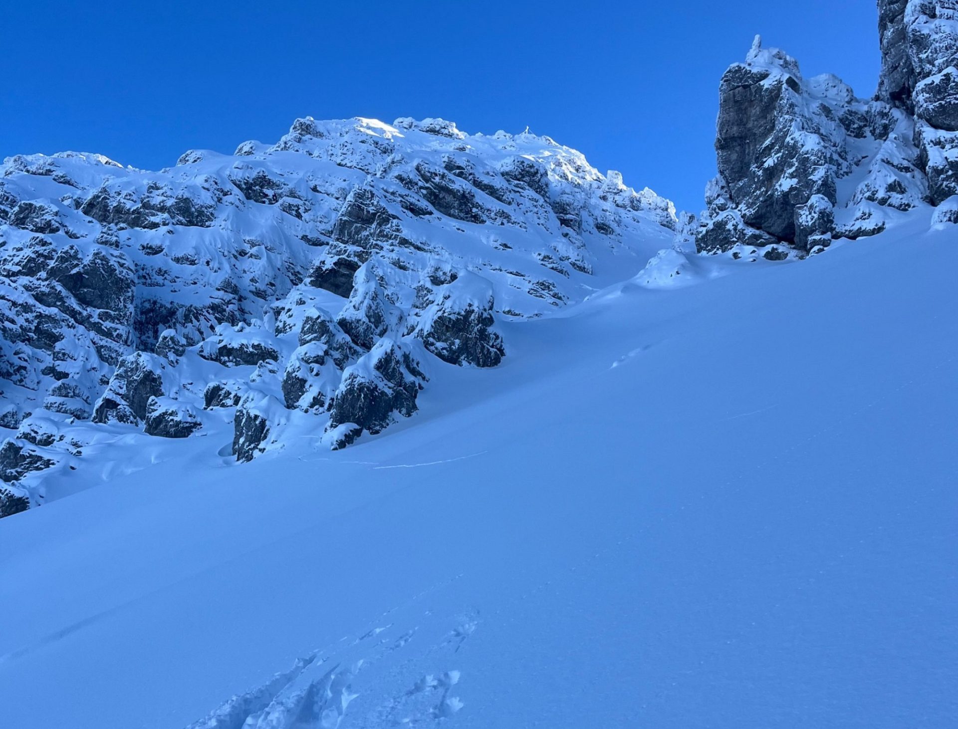
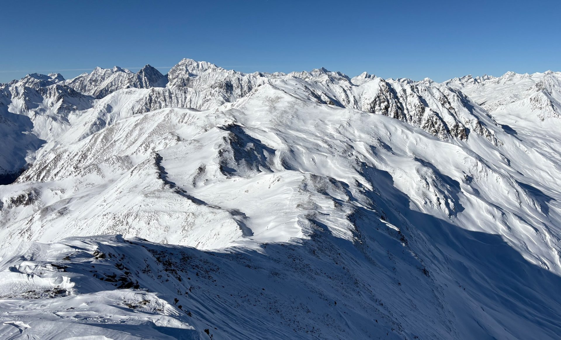
Slab avalanches can in some places be triggered in the weak layers of the old snow. Danger zones are difficult to recognize, particularly because the fresh fallen snow north of the Main Alpine Ridge fell with relatively little wind. Such avalanche prone locations tend to become more frequent with ascending altitude. Least favorable are very steep, wind-protected shady slopes, e.g. bowls, basins and zones at the foot of rock cliffs starting at about 2200m. Avalanches can grow to medium size. Especially in glaciated terrain above 2800m, avalanches can also fracture down to the ground and grow to large size.

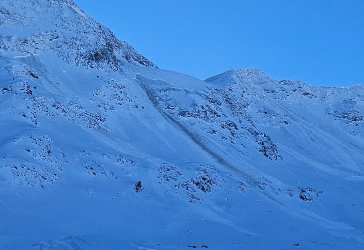
Reports from slab avalanches triggered by persons today, 27.11, confirm the situation described above quite startlingly:

Vermutlich durch Variantenskifahrer am 27.11. ausgelöste mittelgroße Schneebrettlawine an einem Nordosthang auf ca. 2850m am Daunferner am Stubaier Gletscher (©Nico Metz, 27.11.2025).
A medium-sized slab avalanche involving persons on 27.11 on a NE-facing slope at about 2850m on Daunferner (freeriding terrain, Stubai Glacier; ©Nico Metz, 27.11.2025).
Ebenfalls mutmaßlich durch Personen ausgelöste mittelgroße Schneebrettlawine an einem Nordhang auf 2600m im Variantengelände am Hintertuxer Gletscher (©Stefan Pichlsberger, 27.11.2025).

A medium-sized slab avalanche involving persons on a north-facing slope at 2600m in freeriding terrain on the Hintertux Glacier (©Stefan Pichlsberger, 27.11.2025).
Durch Personen ausgelöste kleine Schneebrettlawine an einem Osthang auf 3200m im Variantenbereich am Pitztaler Gletscher (©Samuel Leitl, 27.11.2025).
A small slab avalanche involving persons on an east-facing slope at 3200m in freeriding terrain on Pitztal Glacier (©Samuel Leitl, 27.11.2025).
Setzungsgeräusche und Risse sind deutliche Zeichen eines schwachen Schneedeckenaufbaus und können auf die Gefahr hinweisen: Hier im Aufstieg zum Ampferstein in de Axamer Lizum (©N.N., 27.11.2025).
Settling noises and glide cracks are clear signals of weak snowpack layering and can point to danger: here on the ascent to Ampferstein in the Kalkkögeln (©N.N., 27.11.2025).
Ebenso sind frische Lawinen ein deutliches Zeichen einer instabilen Schneedecke: hier spontane Lawinen an einem Nordosthang auf 2600m am vorderen Grieskogel im Sellrain (©Joscha Kotlan, 27.11.2025).
In equal measure, fresh avalanches are a clear sign of an instable snowpack: here a naturally triggered avalanche on a northeast-facing slope at 2600m on the Vordere Grieskogel in the Sellrain is visible. Blanketed surface hoar could be the cause of the weak layer which unleashed it (©Joscha Kotlan, 27.11.2025).
Gesprengte Schneebrettlawinen am Kaunertaler Gletscher, nordseitig auf ca. 3100m. Die Schwachschicht befand sich hier direkt oberhalb des Gletschereises und hat sich mit Schönwetter Anfang Oktober ausgebildet. Diese Schwachschicht ist besonders im vergletscherten, schattseitigen Gelände sowie in geschützten Karen oberhalb von 2800m im Bereich des Alpenhauptkammes ein Thema (©Daniel Kleinlercher, 27.11.2025).
Slab avalanches artificially triggered by explosive on Kaunertal Glacier, north-facing slopes at 3100m. The weak layer was located just above the glacial ice, it formed in the period of fine weather at the start of October. This weak layer is an ongoing theme particularly in glaciated, shady-slope terrain and in wind-protected basins above 2800m near the Main Alpine Ridge (©Daniel Kleinlercher, 27.11.2025).

Snowdrifts accumulate on weak persistent layer south of Main Alpine Ridge

In East Tirol, distant from the Main Alpine Ridge, there was much less snowfall. The northerly foehn wind was strong, blowing ridges and crests free of snow. Freshly formed snowdrifts accumulated in gullies and bowls, and also atop a weak old snowpack surface, where they can be triggered as small-to-medium sized slab avalanches. Danger zones lie south of the Main Alpine Ridge. Due to the wind signs they can be spotted, should be avoided.

Die Windkarte, dass am unmittelbaren Hauptkamm und südlich davon Nordwind ein Thema war und den lockeren Neuschnee verfrachten konnte.
The wind map shows that directly on the Main Ridge and southwards thereof, northerly winds were evident: the loosely-packed fresh snow was transported.
Deutliche Windzeichen vom Nordföhn in den Deferegger Alpen (©Anton Riepler, 27.11.2025).
Clear signs of northerly winds in the Deferegger Alps (©Anton Riepler, 27.11.2025).
Mit dem Nordwind bildeten sich stellenweise störanfällige Triebschneepakete. Schobergruppe (©Anton Riepler, 26.11.2025).
Wind generated trigger-sensitive snowdrift accumulations in places. Schober Massif (©Anton Riepler, 26.11.2025).
Es hat in Osttirol weniger geschneit, Neu- und Triebschnee liegen aber auch hier auf einer schwachen Altschneedecke und können als kleine bis mittlere Schneebrettlawine ausgelöst werden. 2500m Nord, Gamsburg, Deferegger Alpen (©Alois Mariacher, 27.11.2025).
There was less snowfall in East Tirol, but also here the fresh snow and snowdrifts lie deposited on top of a weak old snowpack, can be triggered as small-to-medium sized slab avalanches. 2500m, north, Gamsburg, Deferegger Alps (©Alois Mariacher, 27.11.2025).
Wenngleich etwas geringmächtiger, auch im zentralen Osttirol findet man an Schattenhängen stellenweise einen sehr schwachen Schneedeckenaufbau.
Even though the snow is shallower, there are also shady slopes in central East Tirol with very poor snowpack layering.

Avalanche incident Daunferner

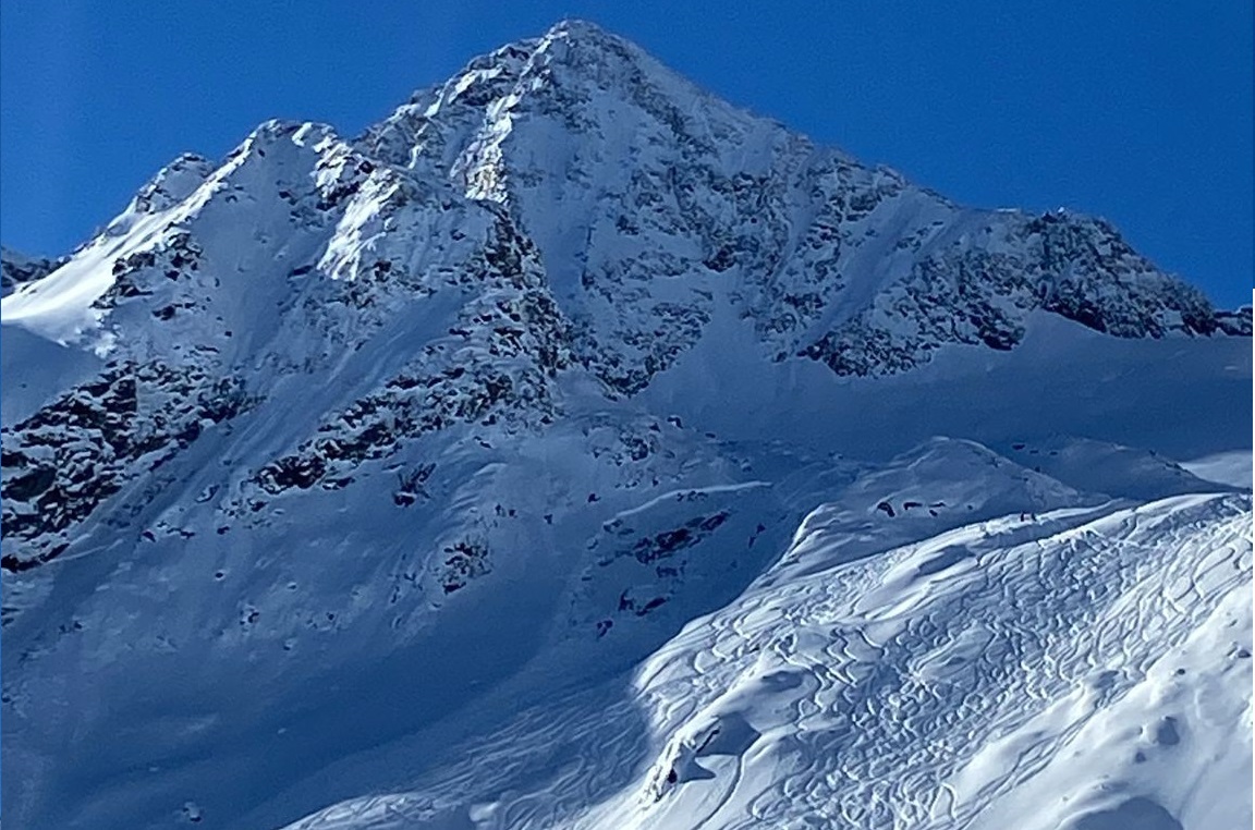
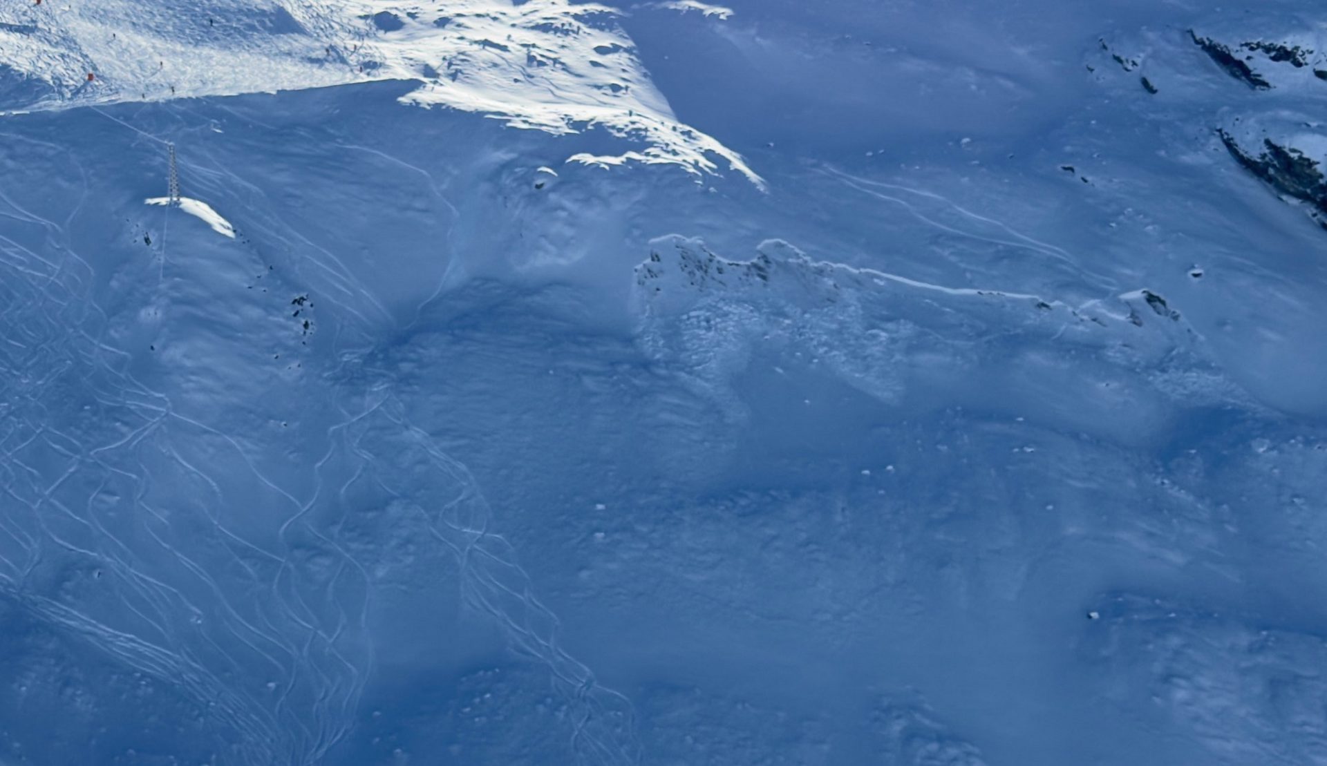
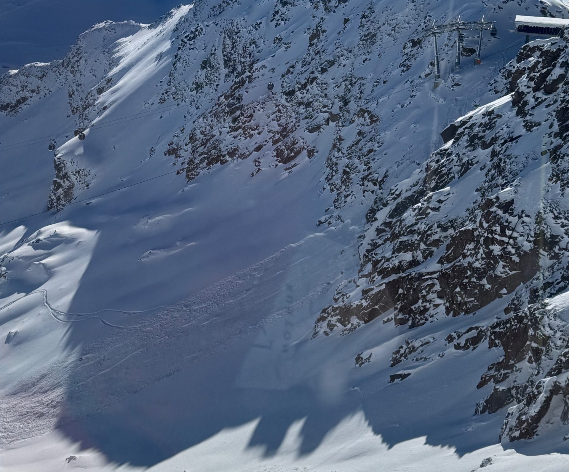
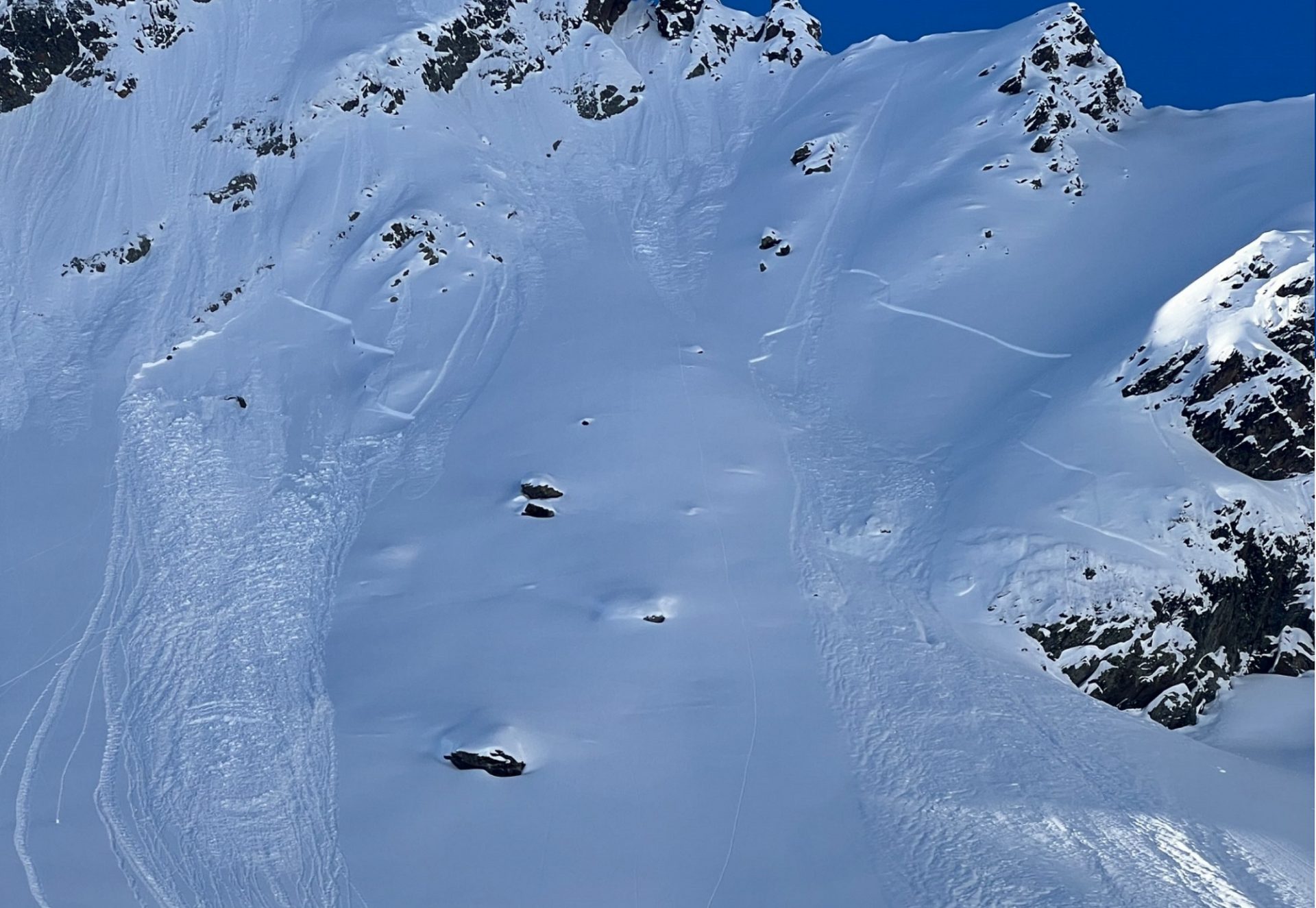
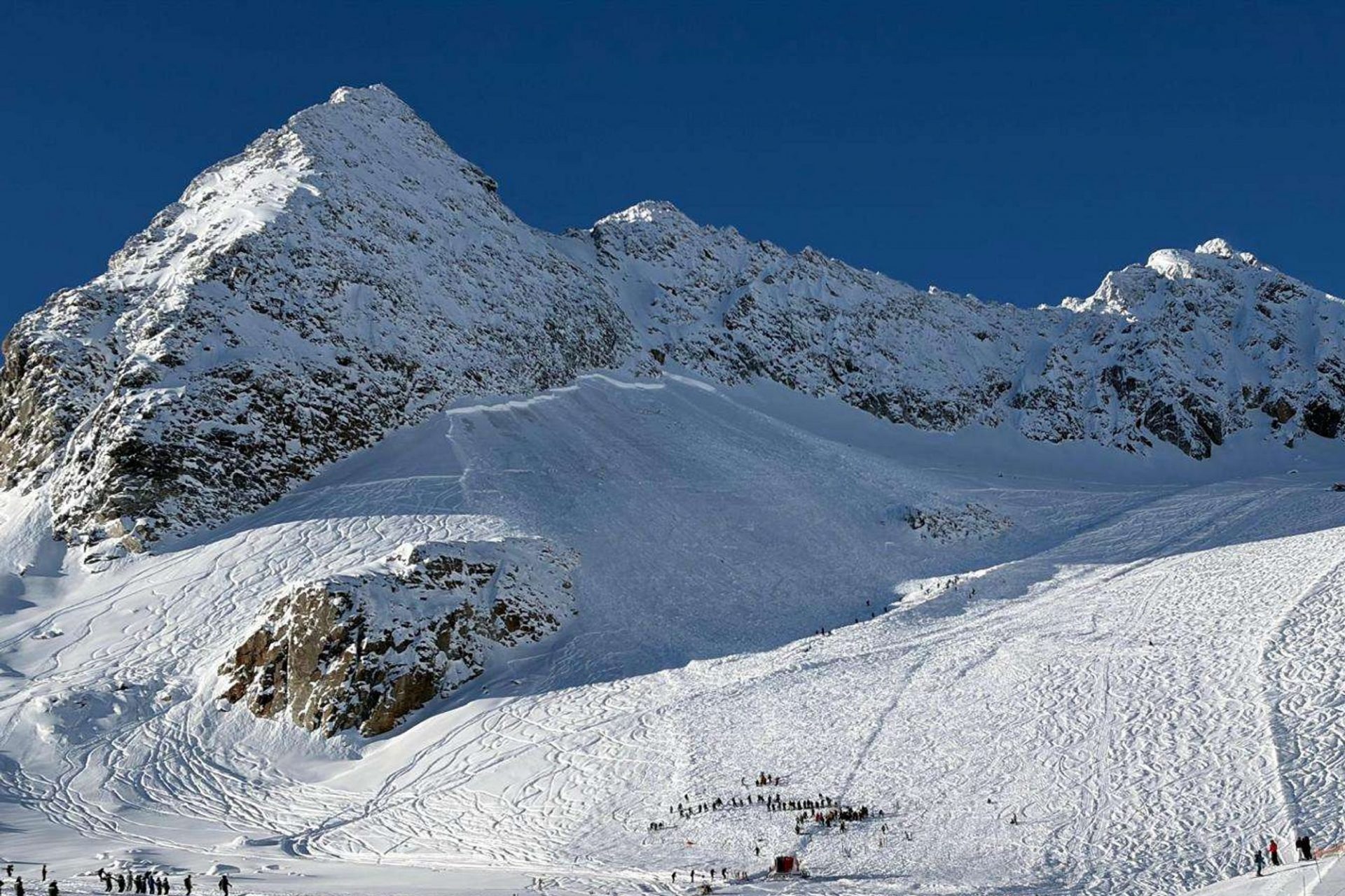
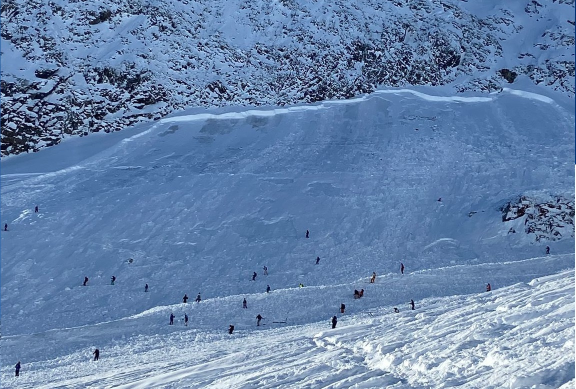
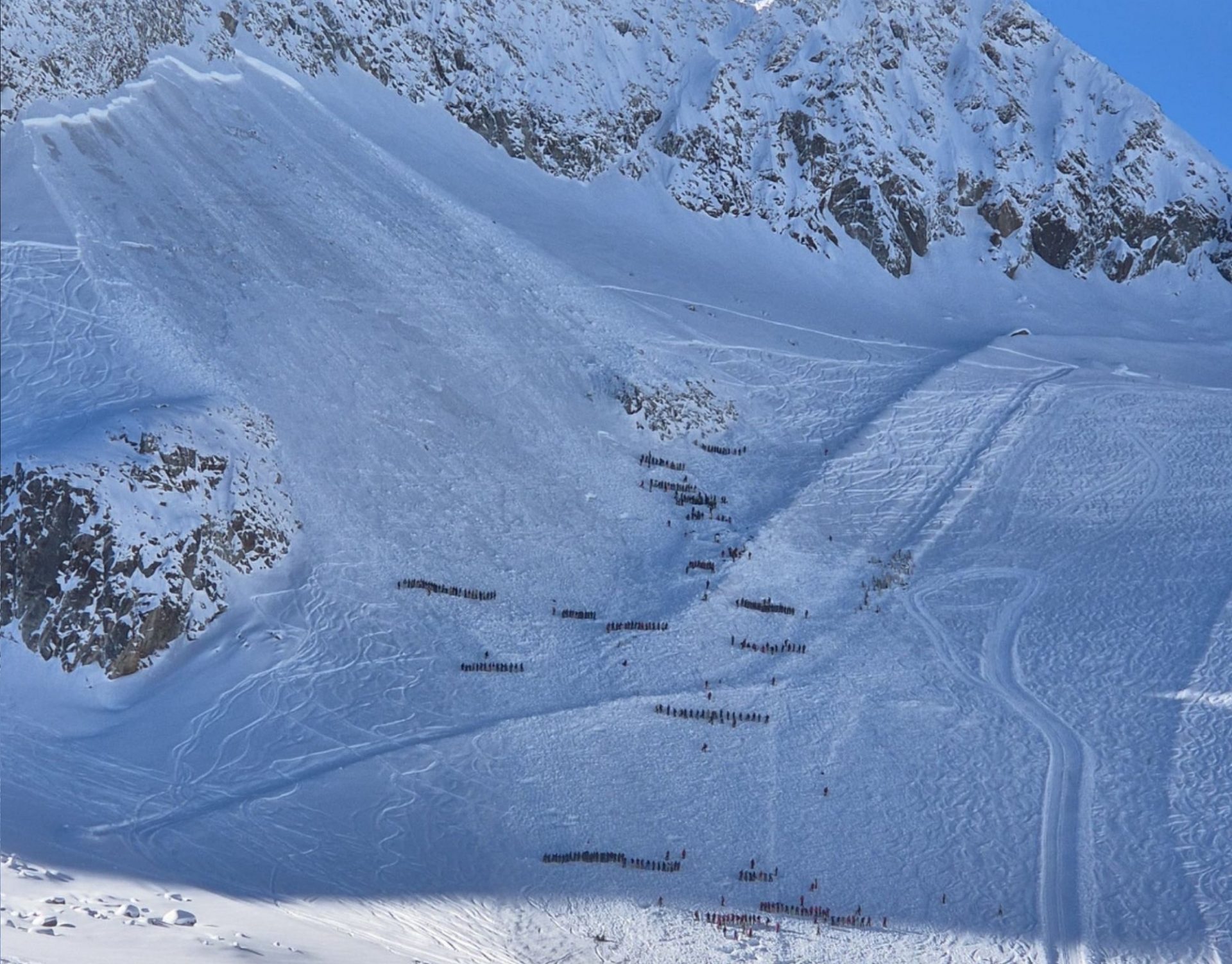
Southeast of the Daunscharte, below the eastern Daunkogel, this morning at about 9:15 am on a very steep north-facing slope at about 3100m, a large slab avalanche was triggered. As far as can be derived from photographs and first reports, the avalanche fracdtured near ground level in the snow fundament which formed at the beginning of October.

The avalanche caught 8 freeriders in its plummet path, spread to a piste below them where it spilled only shallowly over it, due to the constructed rock dam. All the persons struck were able to free themselves after the plummeting snow masses came to a halt. Several injured persons were flown to the hospital in Hall. A large-scale search team found no others and was called off in late afternoon.

Übersichtsbild der großen Schneebrettlawine am Daunferner unterhalb des östlichen Daunkogels (©N.N., 27.11.2025).
Overview of large-sized slab avalanche on Daunferner glacier below the eastern Daunkogel. Near the border of light and shadow, the snow dam is visible (©N.N., 27.11.2025).
Die Lawine brach – vergleichbar mit den gesprengten Schneebrettlawinen am Kaunertaler Gletscher – in einer Schwachschicht direkt oberhalb des Gletschereises. Der Anriss der Lawine ist schätzungsweise 1,5 bis 2m hoch (©Nico Metz, 27.11.2025).
The avalanche broke loose, comparably to the artificially triggered slab avalanches on Kaunertal Glacier, in a weak layer directly above the glacier ice. The fracture is an estimated 1.5 to 2 metres deep (©Nico Metz, 27.11.2025).
Sondierketten der Rettungsmannschaften während der Suche nach möglichen Verschütteten. Die Suche blieb erfreulicherweise erfolglos (©Günter Chwojan, 27.11.2025).
The rescue team used probe chains during their search to locate possible buried victims. Fortunately there were no persons buried in the snow masses, their search uncovered no one (©Günter Chwojan, 27.11.2025).

Avalanche report season is launched

Starting on Friday, 28.11 at 5:00 pm, the Euroregion Avalanche Bulletin will be published daily. In the mountains there is not much snow on the ground. Caution: rocks beneath the surface!

Vorsicht: Verletzungsgefahr. Im Blockgelände ist die derzeit noch geringe Schneehöhe gut zu erkennen, andernorts täuscht die aktuell jungfräuliche Neuschneeoberfläche über die grenzwertige Schneelage hinweg (©Tobias Holzknecht, 27.11.2025).
Caution: danger of injuries. In the terrain, the shallow snow depths are easily recognized, and the recent snowfall-covered surfaces are deceptive about the not-so-snowy situation (©Tobias Holzknecht, 27.11.2025).
Gleitschneelawinen sind ein aktuell etwas untergeordnetes Thema. Kleine bis mittelgroße spontane Gleitschneelawinen sind besonders an steilen, sonnigen Grashängen möglich. Unterhalb von Gleitschneerissen sollte man sich besser nicht aufhalten (©Lukas Ruetz, 27.11.2025).
Glide-snow avalanches are of secondary importance at the moment. Small-to-medium sized naturally triggered glide-snow avalanches are possible particularly on steep, sunny grass-covered slopes. It’s advisable not to linger below glide cracks in the surface (©Lukas Ruetz, 27.11.2025).