Kalte Temperaturen brachten bis in tiefe Lagen Neuschnee (© Tobias Holzknecht, 21.11.2025)

Fresh snowdrifts in the heights, but also danger of injuries from rocks

Avalanche danger is currently being determined by wind impact. Avoid fresh drifts in the heights and beware sharks, i.e. rocks hidden just below the snow surface!

Fresh snow + Wind = Snowdrifts

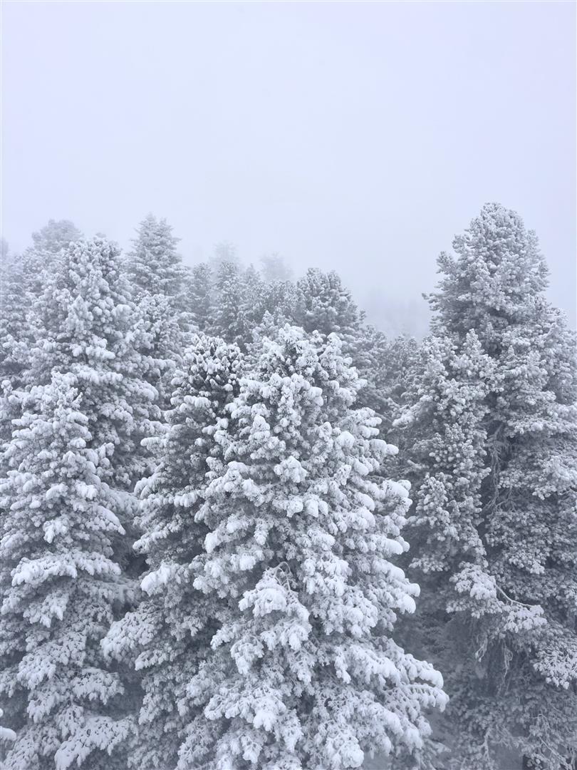
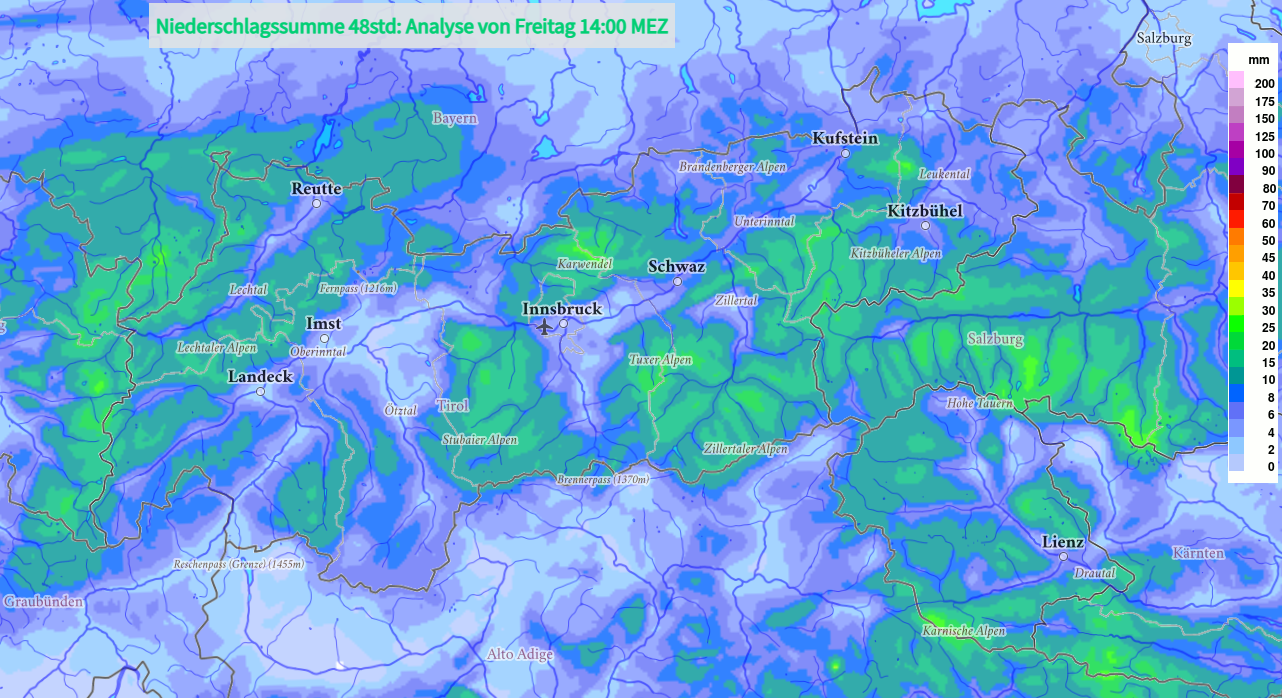
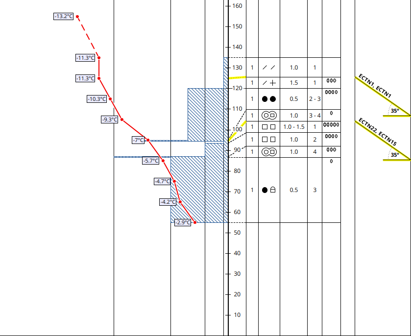
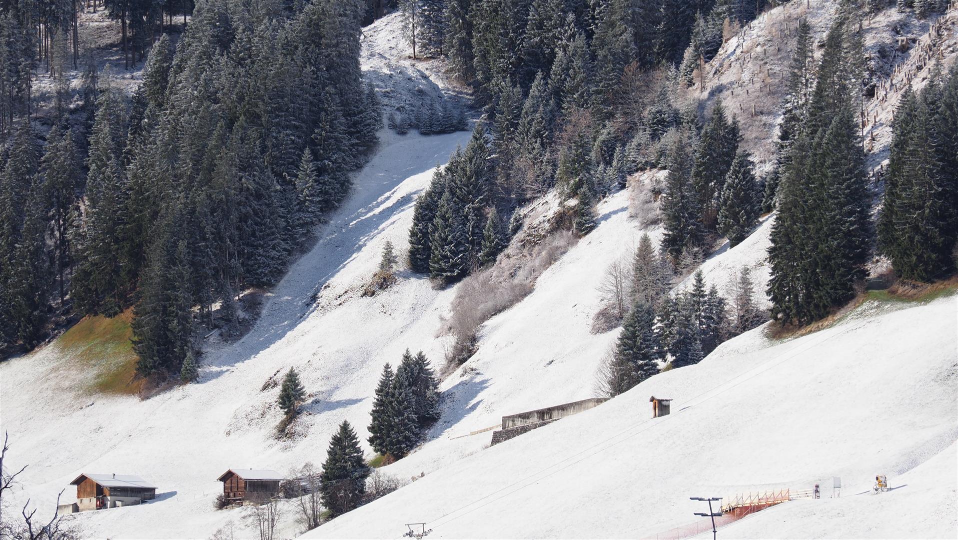
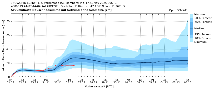
Since Monday, 17.11.2025, 24-45cm of fresh snow has been registered along the Main Alpine Ridge, locally more. Due to the significant drop in temperatures, there is often “champagne powder” in zones without wind (usually blanketing an old snowpack surface rippling with rocks). In wind-impacted zones, on the other hand, fresh, generally easy-to-recognize snowdrift masses extremely prone to triggering were generated, esp. behind protruberances in the landscape and in gullies and bowls.

Auf der Karte wird die 48h-Niederschlagssumme (in mm) vom 20.11. auf den 21.11.2025 dargestellt. (© GSA)
On the map, the 48-hr sums of precipitation (in mm) from 20.11 to 21.11.2025 are depicted. (© GSA)
Prognose der Windböen für Samstag, 22.11. 02:00 Uhr. Entlang des Alpenhauptkammes in der Höhe wird vermehrt Schnee verfrachtet werden. (© GSA)
Forecast of wind gusts for Saturday, 22.11, 2:00 am. Along the Main Alpine Ridge at high altitudes, snow transport from wind is expected in grand style. (© GSA)
Schnee wird vom Wind verfrachtet. Hintertuxer Gletscher (© LWD Tirol, 18.11.2025)
Snow being transported by wind. Hintertux Glacier (© LWD Tirol, 18.11.2025)

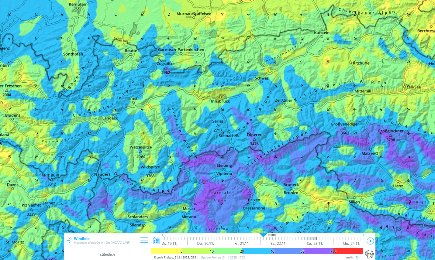
Snowdrifts + Weak layer = Prerequisite for slab

The snowdrift accumulations lie atop cold, loosely-packed powder snow. This, for a short time, creates a highly reactive weak layer. If a winter sports enthusiast disturbs such drifts on a very steep slope, slab avalanches can be triggered as a result. Most often currently, this is generally a small-to-medium sized slab avalanche. Nevertheless, even small avalanches can sweep along persons in steep to very steep terrain and have grave consequences. Beware most of all sharp drops in the terrain (e.g. ditches and terrain where falls threaten).
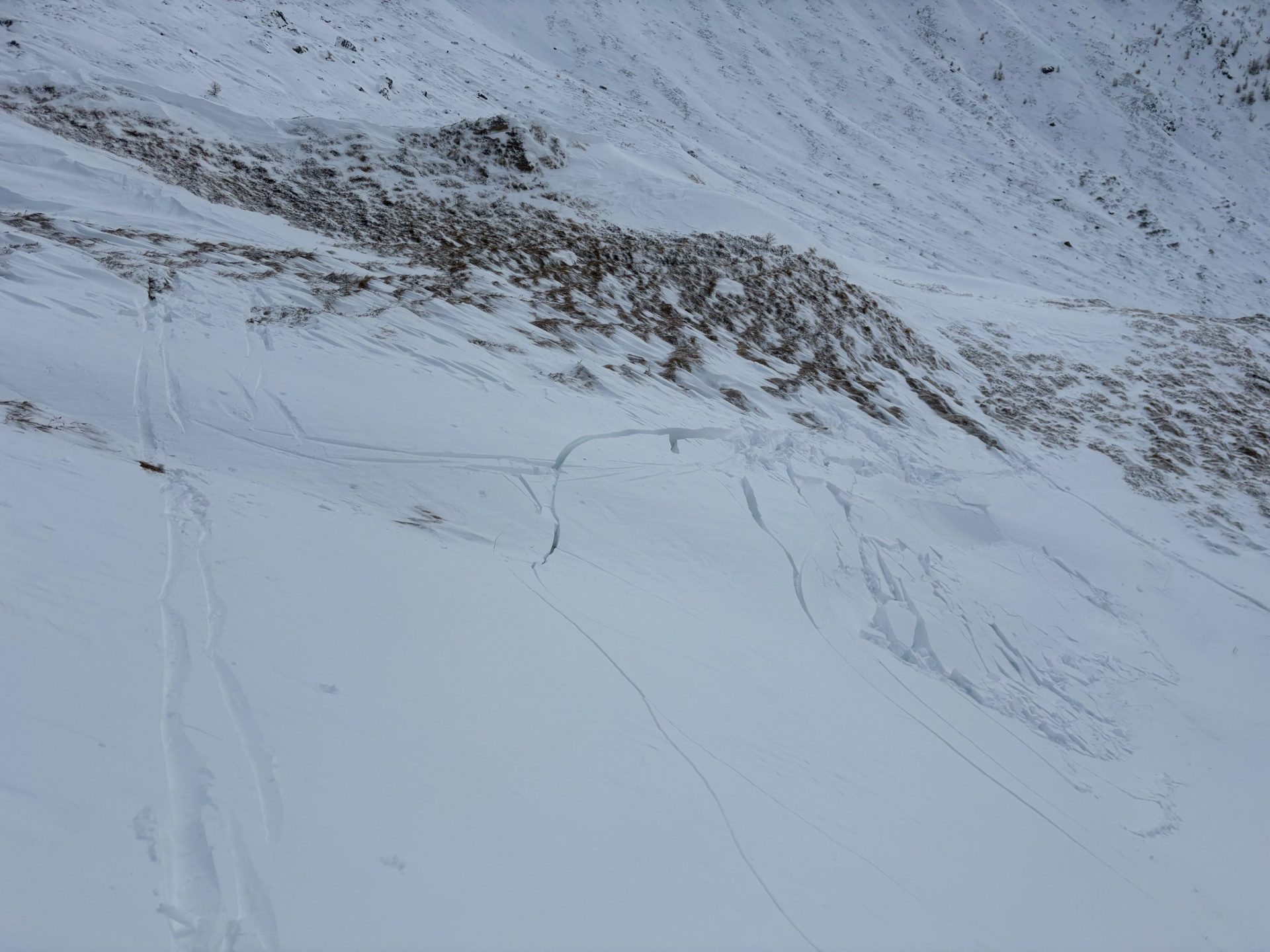
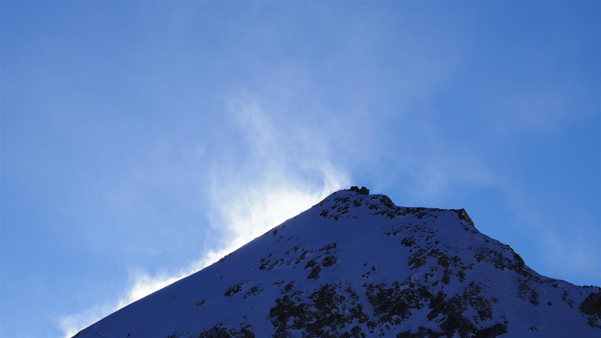
Insbesondere der Neuschnee kommt derzeit als Schwachschicht für Schneebrettlawinen in Frage (erst dann, wenn von Triebschnee überlagert). Vereinzelt könnte aber auch noch die ab dem 02.11. entstandene kantige Schicht unterhalb der dünnen Schmelzkruste (bei 100cm) bedeutsam sein. Profilstandort: Hintertuxer Gletscher, 3030m, NO, 35°. (20.11.2025)
Particularly the fresh fallen snow is a potential weak layer (as soon as it is blanketed by snowdrifts). In isolated cases, also the faceted layer generated as of 2 November beneath the thin melt-freeze crust (at 100cm) is a danger. Area of snow profile: Hintertux Glacier, 3030m, NE, 35°. (20.11.2025)
Kleines Schneebrett im Glocknergebiet (© Anton Riepler, 21.11.2025)
Small slab in the Glockner region (© Anton Riepler, 21.11.2025)

Beware “sharks”

Im freien Gelände lauern derzeit noch viele "sharks", die zu Stürzen und Verletzungen führen können. (© LWD Tirol, 18.11.2025)
In open terrain, sharks are currently a hidden danger leading to falls and injuries. (© LWD Tirol, 18.11.2025)

In open terrain, skiing is currently pure stress due to the numerous rocks. Particularly just below the snow surface are lots of invisible sharks, i.e. rocks that can cause winter sports enthusiasts to take a fall.

At high alpine altitudes, glaciated terrain is currently also not free of stress. There, a different hidden danger threatens: heavily blanketed glacier crevices.

What’s otherwise worth knowing

Skigebiete nützen die kalten Temperaturen zum Beschneien. Hintertuxer Gletscher (© LWD TIrol, 18.11.2025)
Ski zones take advantage of the low temperatures to spread artificial snow. Hintertux Glacier (© LWD TIrol, 18.11.2025)
Es schneite bis in tiefe Lagen. Der Schnee wird trotz der aktuell sehr tiefen Temperaturen nicht von allzu langer Dauer sein. (© LWD Tirol, 18.11.2025)
Snow fell down to low altitudes. Despite the extremely low temperatures at the moment, it won’t last long. (© LWD Tirol, 18.11.2025)
Die Neuschneeprognose zeigt v.a. für den kommenden Dienstag, den 25.11. weiteren Neuschnee.
Forecasts for fresh snowfall promise more snow coming on Tuesday, 25.11.

We look forward to your reports from off-piste terrain

As always at this juncture of the season, not much information from off-piste terrain is available. You could help us, through your feedback, to better understand the snow situation and avalanche situation, and thereby improve our avalanche reports.

So, when you’re on skis, on foot or with on snowshoes in off-piste terrain, we hope to receive your photos and reports via SNOBS.LIVE. About the snow situation, alarm signals or dangers you have spotted, or simply about the quality of the snow itself.

The next blog will be published next Thursday, 27 November 2025.