Caution: fresh snowdrifts esp. on shady slopes at great heights

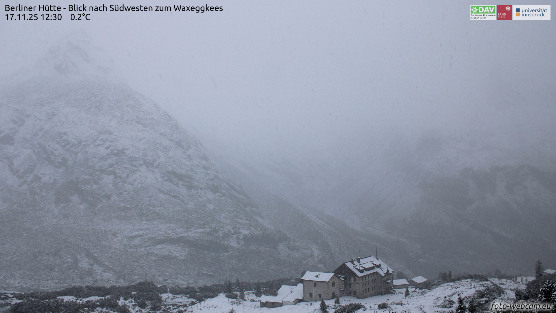
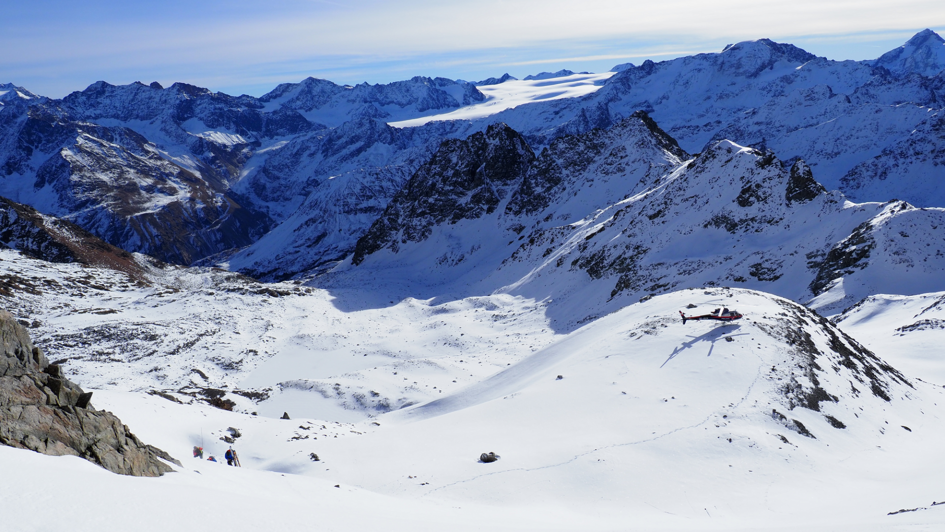
Some fresh fallen snow and intermittent strong-velocity northerly winds particularly along the Main Alpine Ridge are leading to freshly generated snowdrift masses. These masses are prone to triggering in places, especially in protected bowls and basins at great heights and in glaciated terrain.

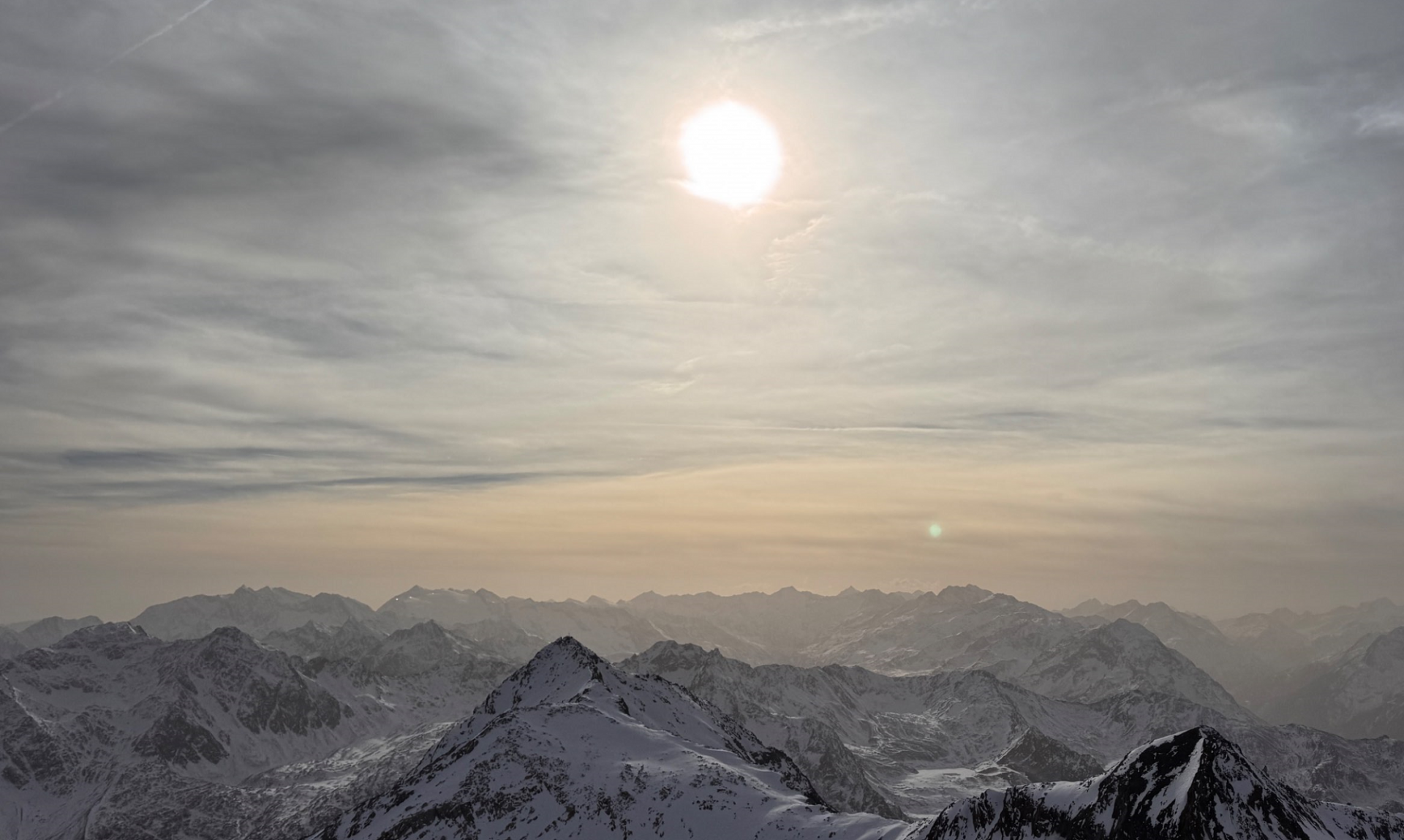
As a result of fine weather in coming days, avalanche prone locations will be easily recognizable for practiced mountaineers; they should be avoided, particularly above sharp drops in the terrain.

Current situation

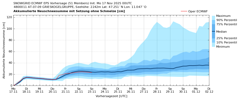
Weather: some fresh snow and significant descent in temperatures

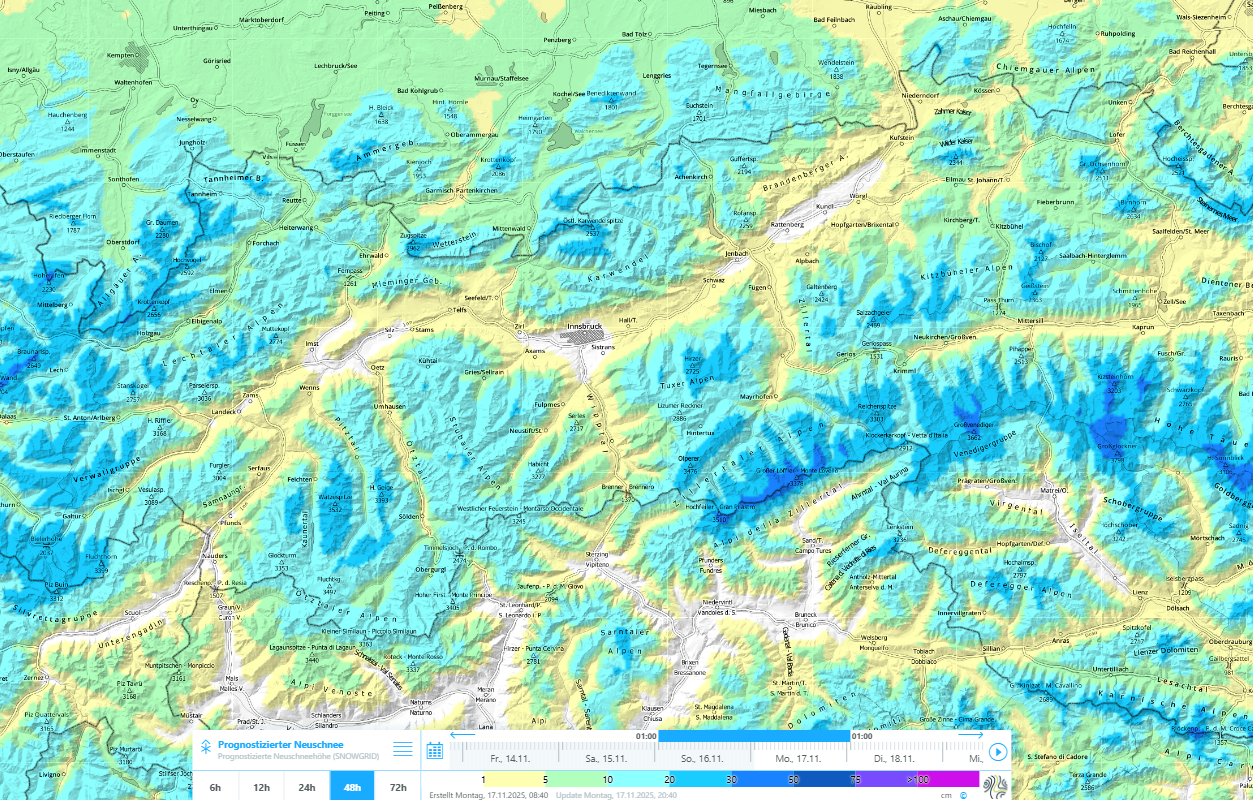
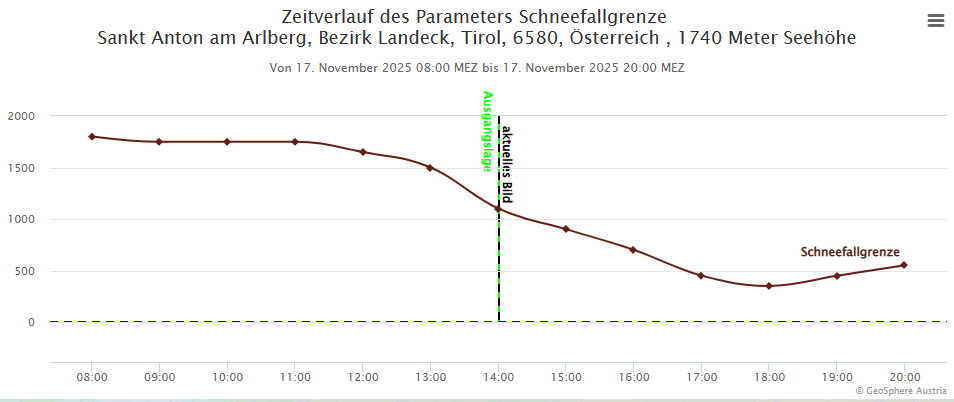
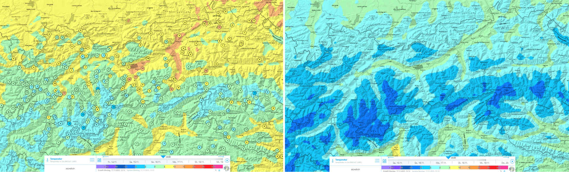
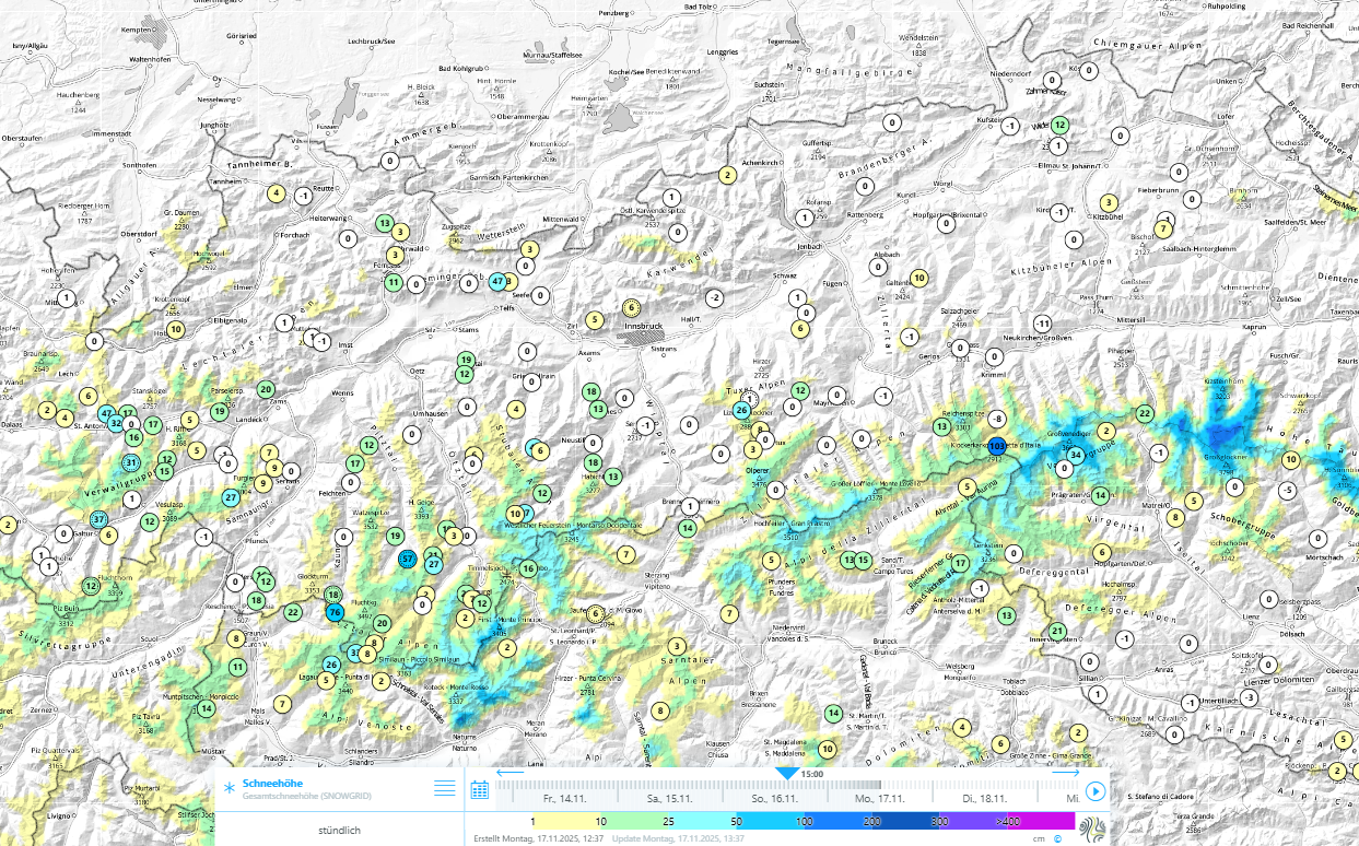
The current precipitation is bringing 15 and 25cm of fresh fallen snow to widespread regions of Tirol’s mountains. At the same time, cold air masses from the far north in Europe are being detoured: the snowfall level will descend on Monday 17.11 in some regions down to nearly 500m. That means, in higher valleys, the first snowfall of the season is about to arrive.

Seit Niederschlagsbeginn Sonntagnachmittag, 16.11. und bis zu dessen Ende in der Nacht auf Dienstag, 18.11. sind verbreitet 15 bis 25cm Neuschnee prognostiziert.
Since the precipitation started on Sunday afternoon, 16.11, and until it ends on Monday night, 15 to 25 cm of fresh snow is forecast widespread.
Prognostizierter Verlauf der Schneefallgrenze – exemplarisch für den Gitterpunkt St. Anton am Arlberg: Am Montagnachmittag, 17.11. sinkt die Schneefallgrenze von rund 1800m auf unter 500m ab (©GeoSphere Austria).
Forecast course of the snowfall level – exemplary for this is the crossover St. Anton am Arlberg: on Monday afternoon, 17.11, the snowfall level will drop from 1800m down to below 500m. (©GeoSphere Austria).
Gegenüberstellung der Temperaturen vom Sonntag, 16.11., um 20:00 Uhr und jenen vom darauffolgenden Montag zur gleichen Uhrzeit.
Comparison of temperatures on Sunday, 16.11 and 8:00 pm and on the following Monday at the same time.
Der Wind bläst während des Niederschlags meist nur mäßig stark. In der Nacht auf Dienstag, 18.11. lebt entlang des Alpenhauptkammes sowie in Osttirol allerdings zeitweise starker Nordföhn auf.
Winds will be blowing mostly at moderate strength during the precipitation. However on Monday night along the Main Alpine Ridge and in East Tirol, strong northerly foehn winds are expected.
Schneefall im Bereich der Berliner Hütte in den Zillertaler Alpen (©foto-webcam.eu).
Snowfall near the Berliner Refuge in the Zillertal Alps (©foto-webcam.eu).

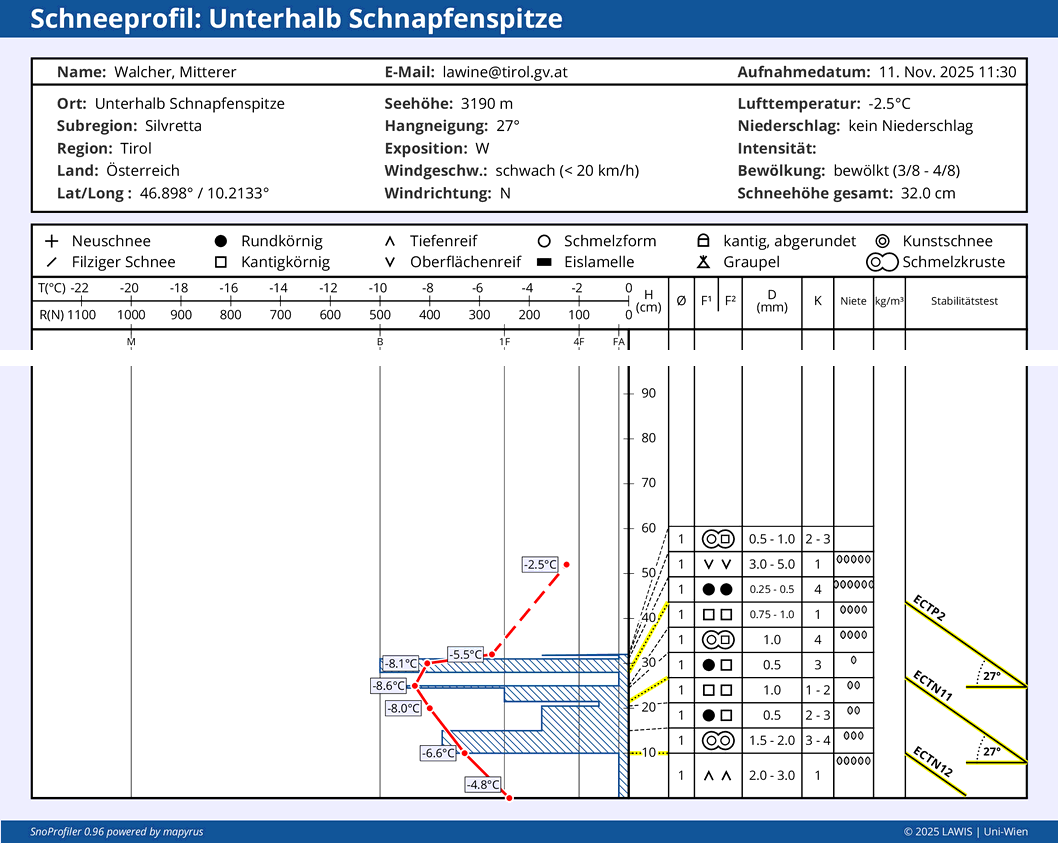
Snowpack: drifted masses prone to triggering in places

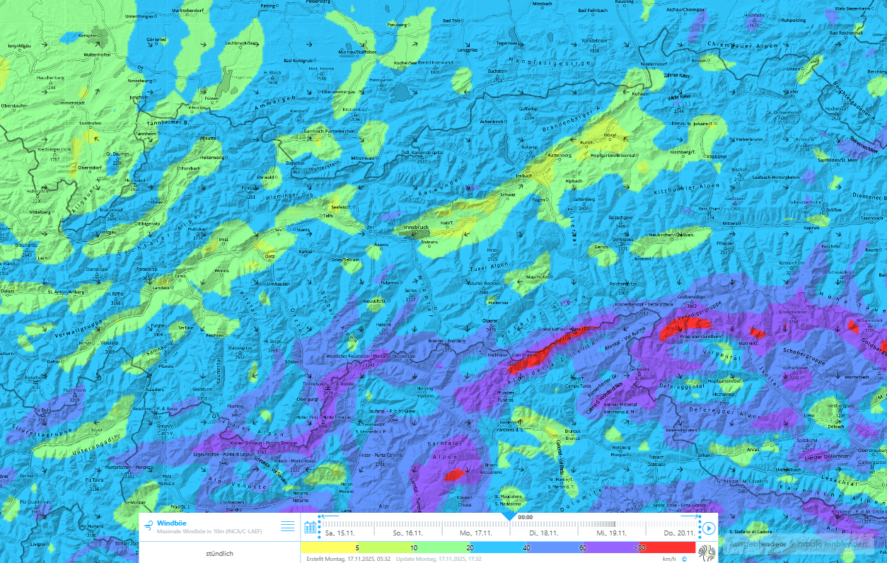
Due to moderate strength northerly winds, fresh snowdrift accumulations will be generated, esp. on slopes near ridgelines, in bowls and behind protruberances in the landscape.

Deposited snowdrift masses will be more frequent and also larger in size and distant from ridgelines along the Main Alpine Ridge, where winds will temporarily be stronger on Monday night. That is also where the greatest amounts of fresh fallen snow are anticipated. (see map above with forecast amounts of fresh snow)

These snowdrift accumulations should be avoided at high altitudes, where they will be deposited atop a weak old snowpack. Protected zones such as bowls and basins are unfavourable as of about 2200m and upwards (increasingly dangerous with ascending altitude) where potential snowdrifts blanket a cohesive, area-wide old snowpack. This applies particularly to shady slopes, with increasing altitude also to west-facing and east-facing slopes.

Modellierte Schneehöhe sowie Messwerte der automatischen Wetterstationen. Am unmittelbaren Hauptkamm und entlang der Grenze zu Vorarlberg hat sich am meisten Schnee von den Herbstschneefällen halten können.
Model of snow depths and measured values at the weather stations. Right on the Main Ridge and along the Vorarlberg border, most of the snow from the autumn bouts of snowfall has endured.
Blick in die nach Nordwesten orientierten Hänge der Deferegger Alpen oberhalb des Staller Sattels: hier lag vor den aktuellen Schneefällen kaum Schnee. Schwachschichten im Altschnee spielen in diesen Bereichen kein Thema (©Mark Kleinlercher, 15.11.2025).
View of the northwest-facing slopes of the Deferegger Alps above the Staller Sattel: prior to the current snowfall there was hardly any snow on the ground. Weak layers in the old snow do not play a role in these areas. (©Mark Kleinlercher, 15.11.2025).
Entlang des Alpenhauptkammes, aber auch im unmittelbaren Grenzgebiet zu Vorarlberg liegt gebietsweise bereits mehr Schnee: hier findet man besonders auf Gletschern, aber auch in geschützten Karen und Mulden eine zusammenhängende Schneedecke (©LWD Tirol, 11.11.2025).
Along the Main Alpine Ridge and also near the Vorarlberg border there is already more snow on the ground: in these areas there is a cohesive, area-wide snowpack, as well as in protected zones in west/north/east aspects (©LWD Tirol, 11.11.2025).
Der Schnee, welcher v.a. in der zweiten Oktoberhälfte und Anfang November gefallen ist, hat sich bei Schönwetter aufbauend umgewandelt und zeigt Schwachschichten in Form von kantigen Kristallen, Becherkristallen, mitunter auch Oberflächenreif – oft eingelagert zwischen Schmelzkrusten. Wenn dieses schwache Fundament von einem Schneebrett überlagert wird, sind Auslösungen von Schneebrettlawinen möglich.
The snow that had previously fallen, esp. in late October and at the beginning of November, transformed during the period of fine weather and now reveals weak layers in the form of faceted crystals, goblet crystals, also surface hoar – frequently squeezed between melt-freeze crusts. Where this weak base gets covered by a slab, triggering slab avalanches are possible.
Der Neuschnee fällt abhängig von Höhe und Exposition auf eine geringmächtige Schneedecke oder aber auf aperen Boden. Samnaungruppe (© LWD Tirol, 11.11.2025).
The fresh snow will fall on a shallow snowpack or on bare ground independent of altitude and aspect. Samnaun Massif (© LWD Tirol, 11.11.2025).
Diese mittelgroße Schneebrettlawine am Windacher Ferner im Skigebiet Stubaier Gletscher wurde am ersten Schönwettertag (4.11.) nach den letzten Schneefällen von Wintersportlern fernausgelöst. Der Neuschnee bildete das Schneebrett auf dem kantig aufgebauten Altschneefundament (©Barbara Fink, 05.11.2025).
This medium-sized slab avalanche on the Windacher Glacier in the Stubai Glacier ski area was remotely triggered by winter sports enthusiasts on the first day of fine weather (4.11) following the last snowfall. The fresh snow formed the slab on top of the faceted old snow fundament. (©Barbara Fink, 05.11.2025).

Other developments

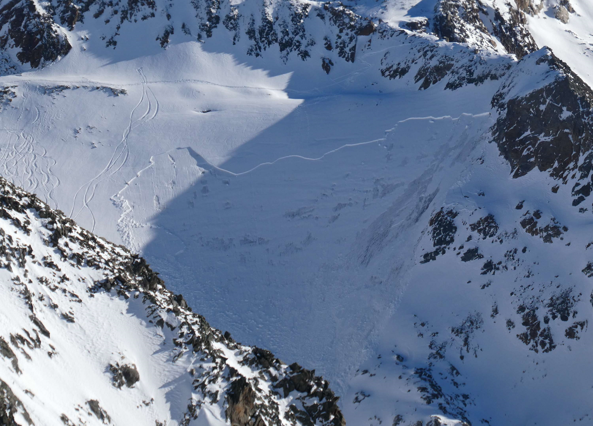
Due to the ongoing low temperatures it can be assumed that the snowdrift masses will harden only slowly. Caution and restraint are urged particularly near sudden drops in the terrain, e.g. bowls or fall-points in potential plummet paths of avalanches. Avalanche can reach medium size only in isolated cases in the areas with large amounts of snow on the ground, but even a small avalanche can lead to a perilous fall.

Ab Donnerstag, 20.11. herrscht neuerlich Tiefdruckeinfluss. Es trübt ein und beginnt leicht zu schneien. Über das nächste Wochenende hinweg sind vorerst jedoch keine erheblichen Neuschneemengen prognostiziert.
Starting on Thursday, 20.11, a low-pressure front will again prevail. It will cloud up the skies and light snowfall will set in. Through next weekend, no significant masses of fresh snowfall are anticipated.
Ein Blick in die Ötztaler Alpen vor dem Wetterumschwung: warme Luft und Staub aus der Sahara. Mit der Nordströmung sind die milden Temperaturen von Ende der vergangenen Woche vorerst Geschichte (©Günter Chwojan, 14.11.2025).
A view of the Ötztal Alps prior to the weather change: warm air masses and dust from the Sahara. Due to the northly air current, the mild temperatures of last week are, for the moment, over. (©Günter Chwojan, 14.11.2025).
Bild der Woche: Skitraining und Wintervorbereitung am Stubaier Gletscher (©LWD Tirol, 11.11.2025).
Photo of the week: ski training and winter preparations on the Stubai Glacier (©LWD Tirol, 11.11.2025).
Mit der Flugpolizei konnten wir uns in der vergangenen Woche einen Überblick über die Schneeverteilung und den Schneedeckenaufbau entlang des westlichen Alpenhauptkamms verschaffen. Gute Bedingungen im freien Gelände waren kaum anzutreffen. Im Verhältnis am besten zeigten sich die Skibedingungen von der Schneegrenze aufwärts, wo im unteren Teil der Schneedecke eine tragfähige Kruste Bodenkontakt verhinderte. Das Bild stammt aus den Lechtaler Alpen, an der Grenze zu Vorarlberg (©LWD Tirol, 11.11.2025)
Last week, with the help of the Airbourne Police we were able to gain an overview of snow distribution and snowpack layering along the western sector of the Main Alpine Ridge. Good skiing conditions in open terrain were not to be found. The relatively best conditions were found above the snowfall level, where faceted snow lay deposited atop a compact snow fundament. The photo is from the Lechtal Alps on the Vorarlberg border. (©LWD Tirol, 11.11.2025).

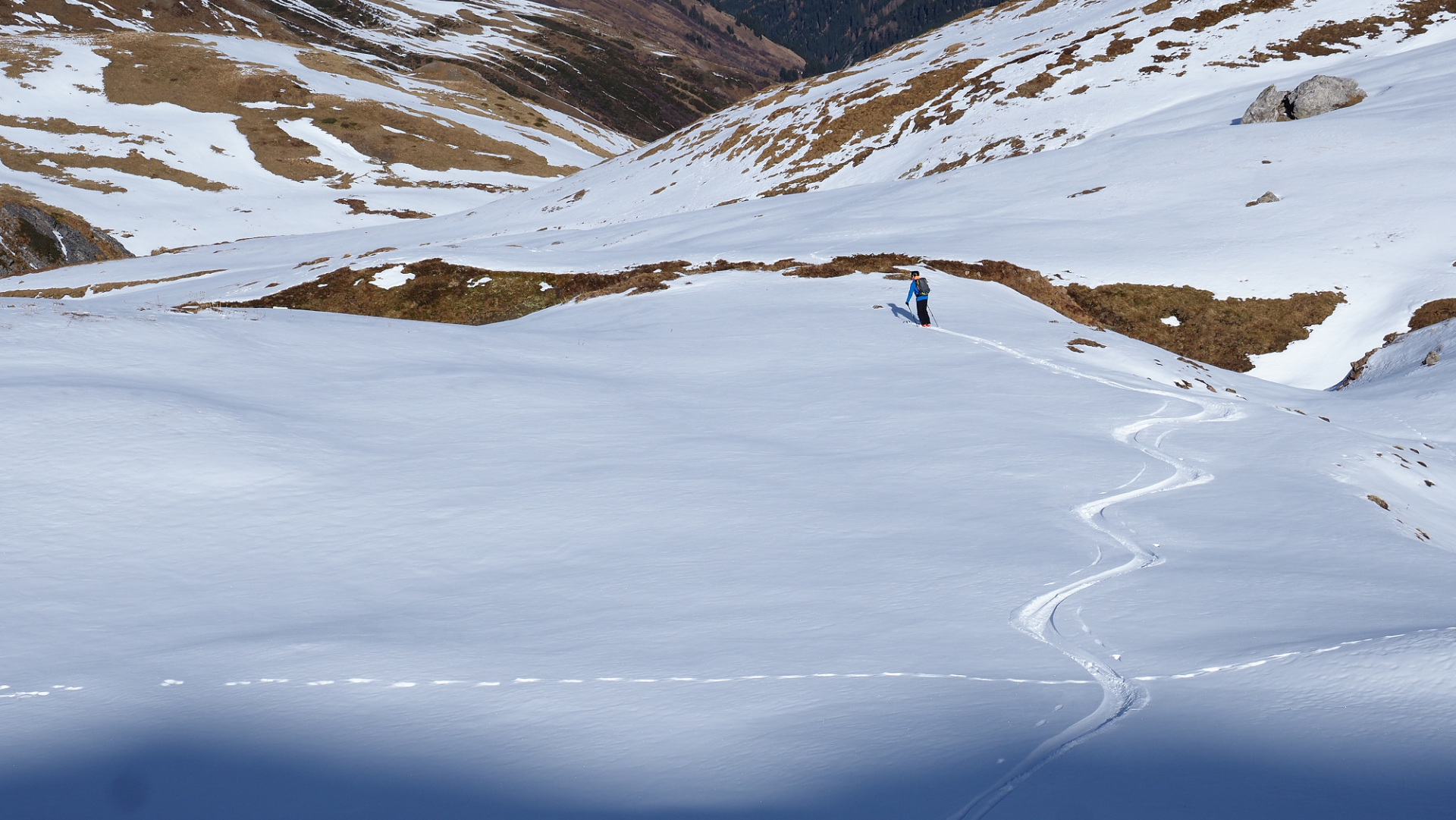
We look forward to hearing reports from open terrain

As always at this juncture of the season, not much information is available regarding open terrain. You can help us fill this hiatus by giving us feedback, which improves our knowledge of the snow and avalanche situation.

That means, if you have your skis strapped on or are en route in open terrain either on foot or snowshoes, we look forward to your photos and reports via SNOBS.LIVE about the snow situation, any alarm or danger signals or simply observations about the snow quality. Thank you!