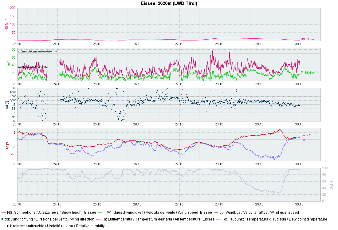
As was forecast, it snowed as much as 50cm in the western regions, locally even more, on Monday, 27.10. For a brief spell, you even had to watch out for slab, glide-snow and loose-snow avalanches. The higher temperatures which followed in its wake provided a swift decrease in avalanche danger and rapid melting of the snowpack, on sun-exposed sites in particular.
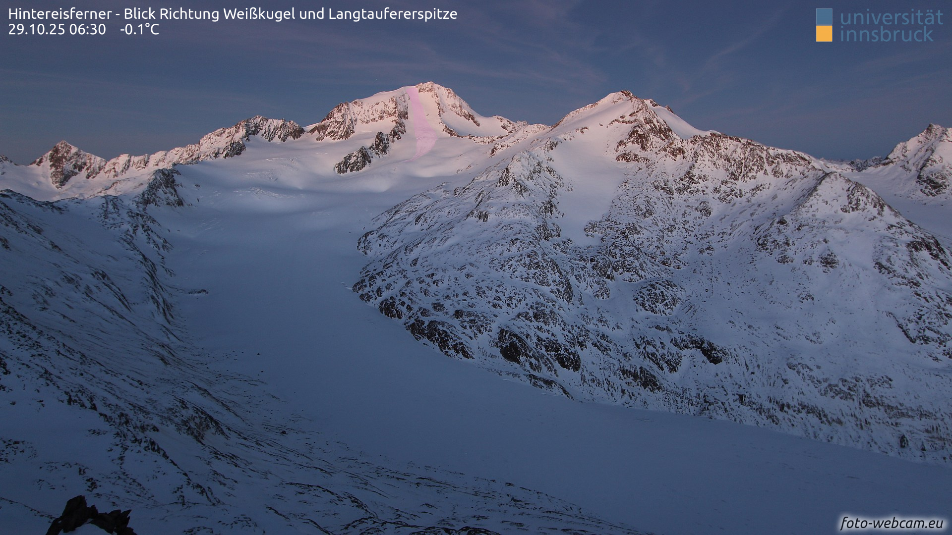
Isolated avalanche prone locations for slab avalanches are currently to be found on very steep, glaciated slopes in high alpine regions.
Weather, snow, avalanches
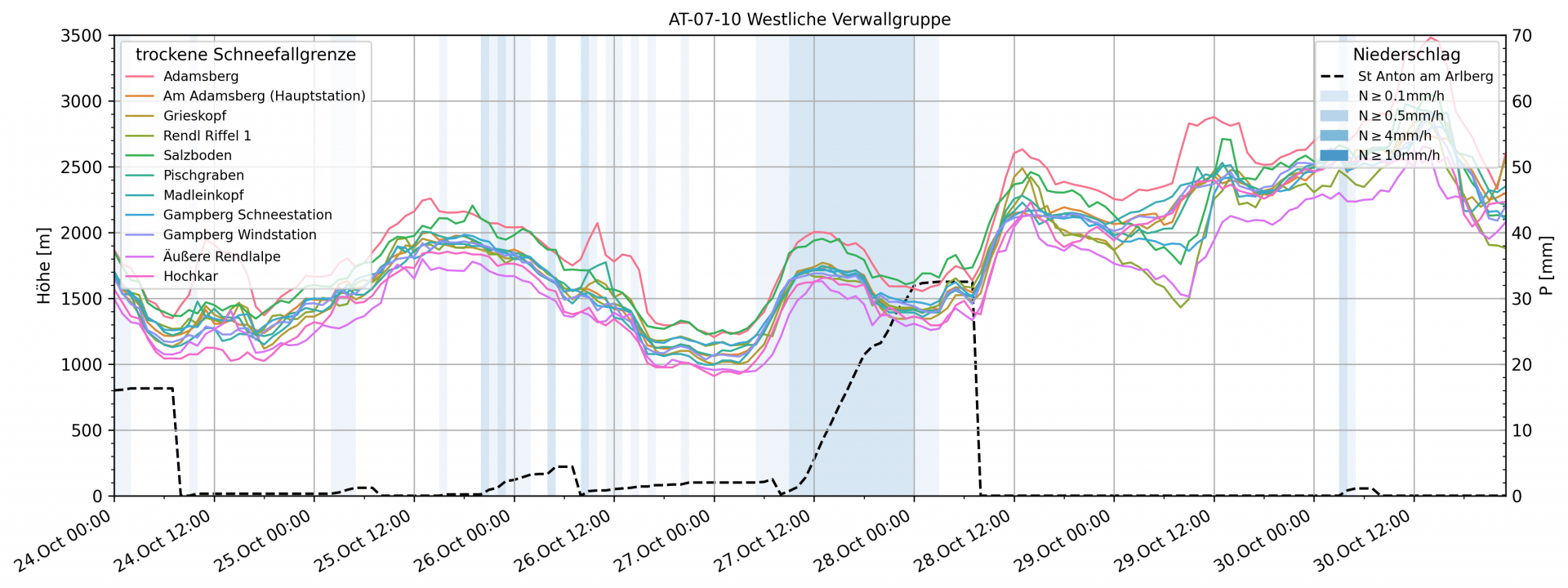
The weather
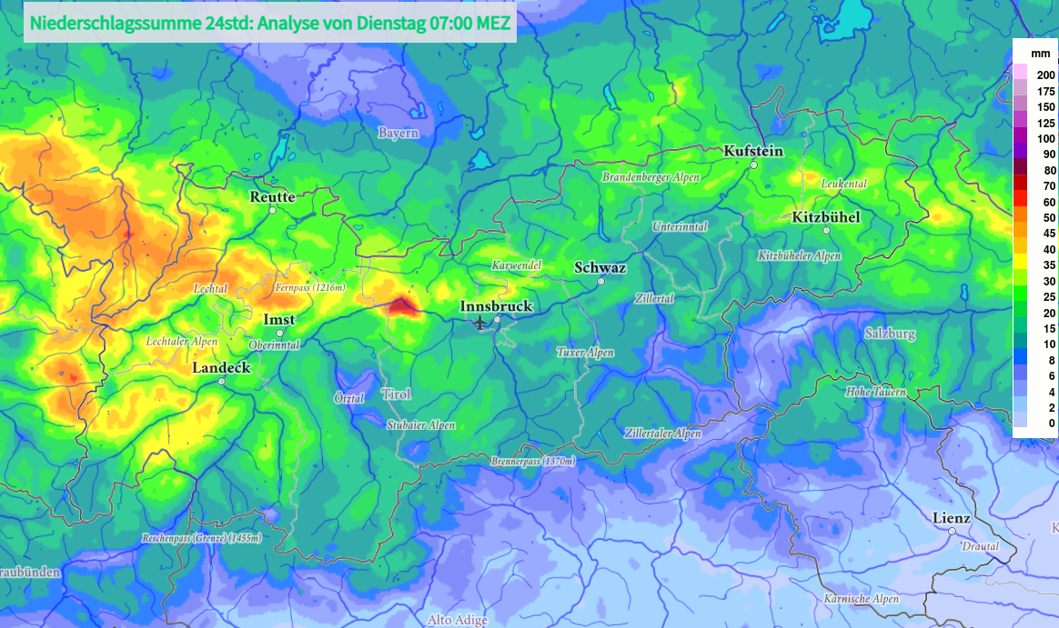
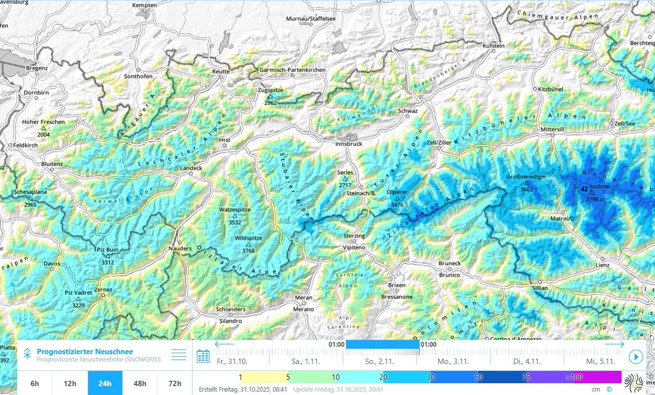
An analysis of the precipitation depicts the distribution of overall precipitated amounts on 27.10.2025. The focal point lay in the far west, followed by the northern and eastern regions of North Tirol,.
The snowpack
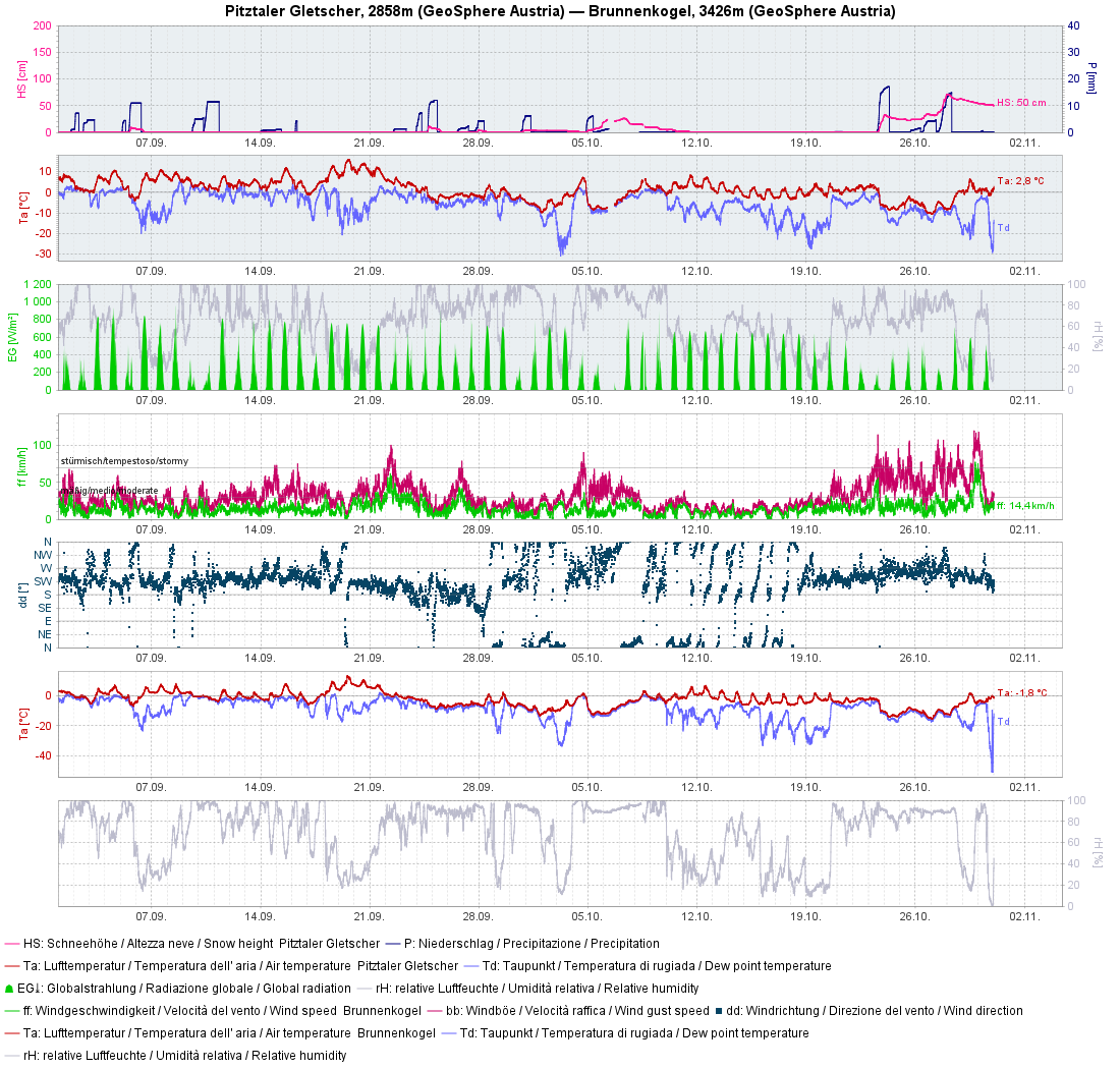
Taking into consideration avalanche releases in the glaciated regions at high altitude, what most interests us is a lengthy view in the rear-view mirror of what happened weather-wise. There have been bouts of fresh snowfall since September after which some snow remained on the ground in certain regions, or spots, at least in shady, high alpine, glaciated terrain.
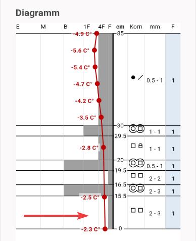
The upshot from the cocktail of snowfall plus dry, warm periods was, as can be seen in the image of the snow profile on the Stubai Glacier depicted below, a “crust sandwich” consisting of faceted snow crystals and melt-freeze crusts at its base.
The fresh snow was transported by the strong-to-storm strength winds. At heightened altitudes, wide-ranging transported snow masses were deposited.
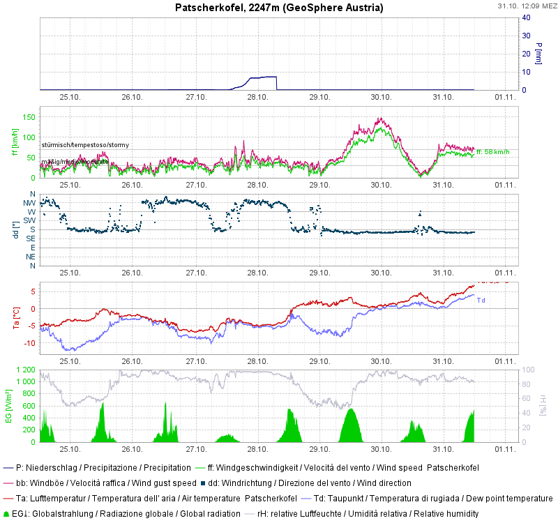
In the meantime, measurable amounts of the fresh snow have melted, including in the regions where snowfall was heavy…
Some rainfall on 30.10 up to about 2500m led to a moistening of the snowpack surface, even on shady slopes.
The avalanches
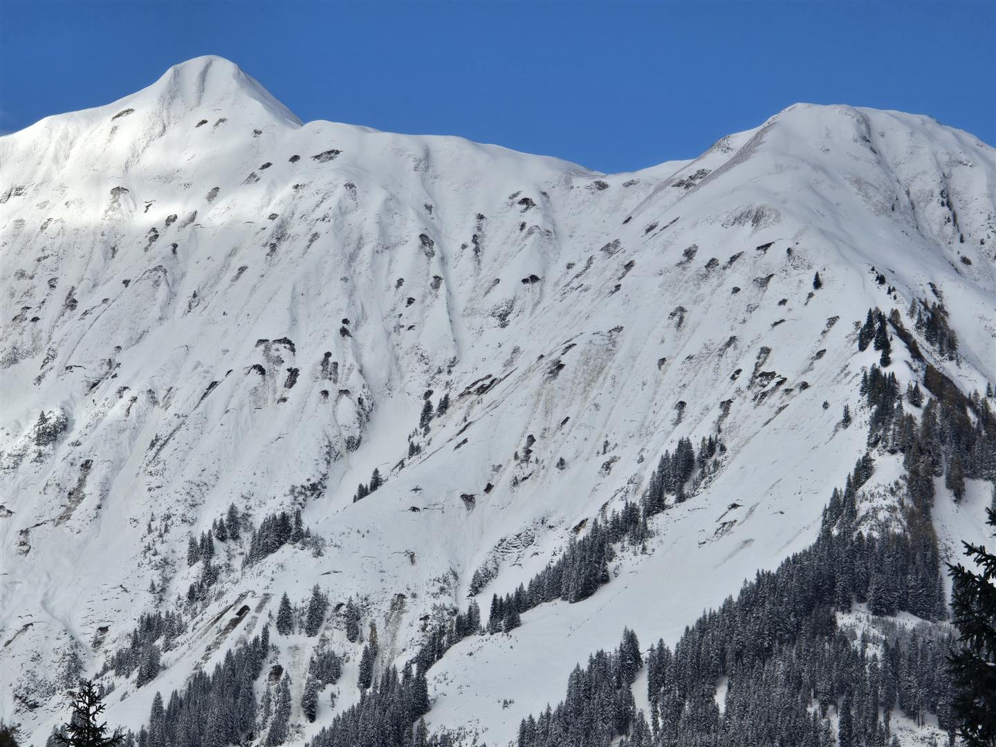
As mentioned, avalanche activity was observed just as anticipated: most of the releases unleashed in the form of small glide-snow avalanches across steep grass-covered slopes.
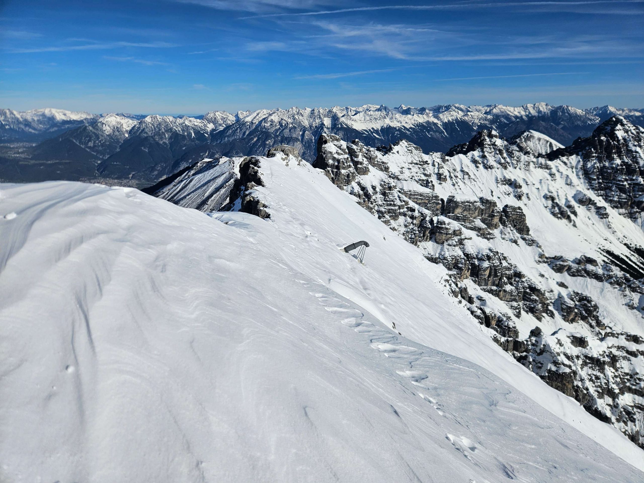
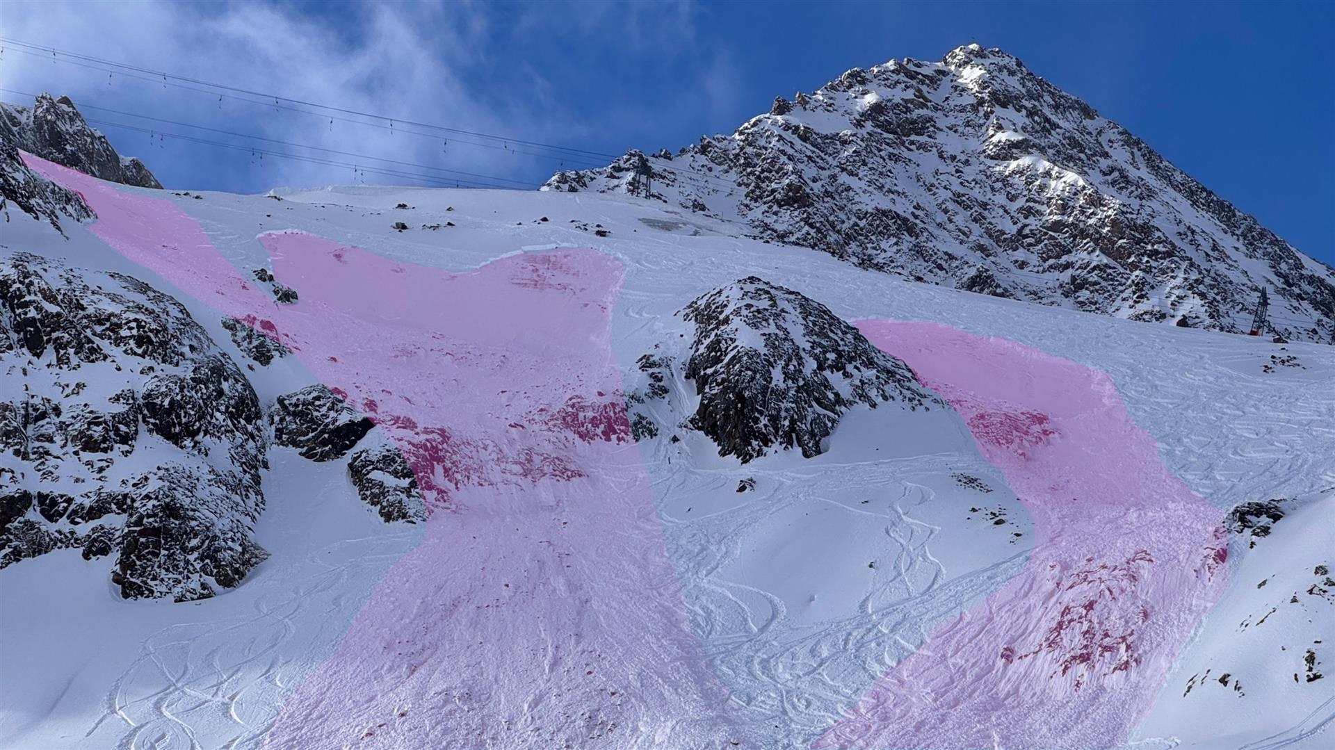
On the Stubai Glacier, several winter sports enthusiasts triggered medium-magnitude slab avalanches in the near-ground level weak layers atop the glacier ice on Tuesday, 28.10.2025. According to our information, no injuries were suffered.
Outlook
Above-average temperatures for this juncture of the season, accompanied by strong-velocity southerly foehn wind. Thus, we are ushered into the weekend.
On Sunday, 02.11, according to Geosphere Austria (GSA), the “foehn wind will collapse due to a cold front from the west. In the morning in Ausserfern, rainfall will set in, subsequently the rain will expand its scope into the Lower Inn Valley and East Tirol. The rainfall will often be heavy, and strong-velocity gust-laden westerly winds will be blowing. Large-scale amounts of precipitation are possible, particularly in the regions near the Main Alpine Ridge and in East Tirol. The snowfall level is expected to descend to 1500 metres by Sunday evening. Prior to the cold front, it will be mild (10 to 15 degrees), thereafter temperatures will drop measurably.” Following this little scenario there will be lots of sunshine and temperatures will again rise as the coming week gets underway.
During and following the snowfall: watch out for slab avalanches for a brief spell!
A situation similar to the one on 27.10 is being generated in the regions where snowfall is heaviest. At heightened altitudes there will be strong-velocity, gusty westerly winds which generate freshly formed snowdrift masses. Thus: Avoid fresh snowdrifts in very steep terrain at high altitudes and in high alpine regions. At high altitudes, the proneness to triggering of these drifts will rapidly decrease following the end of the precipitation.
A special degree of caution is called for in high alpine regions, to be specific, in glaciated, very steep terrain. In those places, the near-ground weak layers consisting of faceted crystals referred to above could well be triggerable by winter sports enthusiasts, and thereby unleash slab avalanches.