Intensive snowfall and winds will cause avalanche danger to rise significantly in Tirol starting on Monday 27.10. Particularly in the regions with most snowfall, naturally triggered dry-snow small-to-medium sized avalanches can be expected.
Higher temperatures and solar radiation will lead to heightened activity of moist loose-snow avalanches in steep rocky terrain. As the snow settles, also small-to-medium sized glide-snow avalanches will be possible on steep grass-covered slopes. Alpine projects over the next few days can expect wintery conditions.
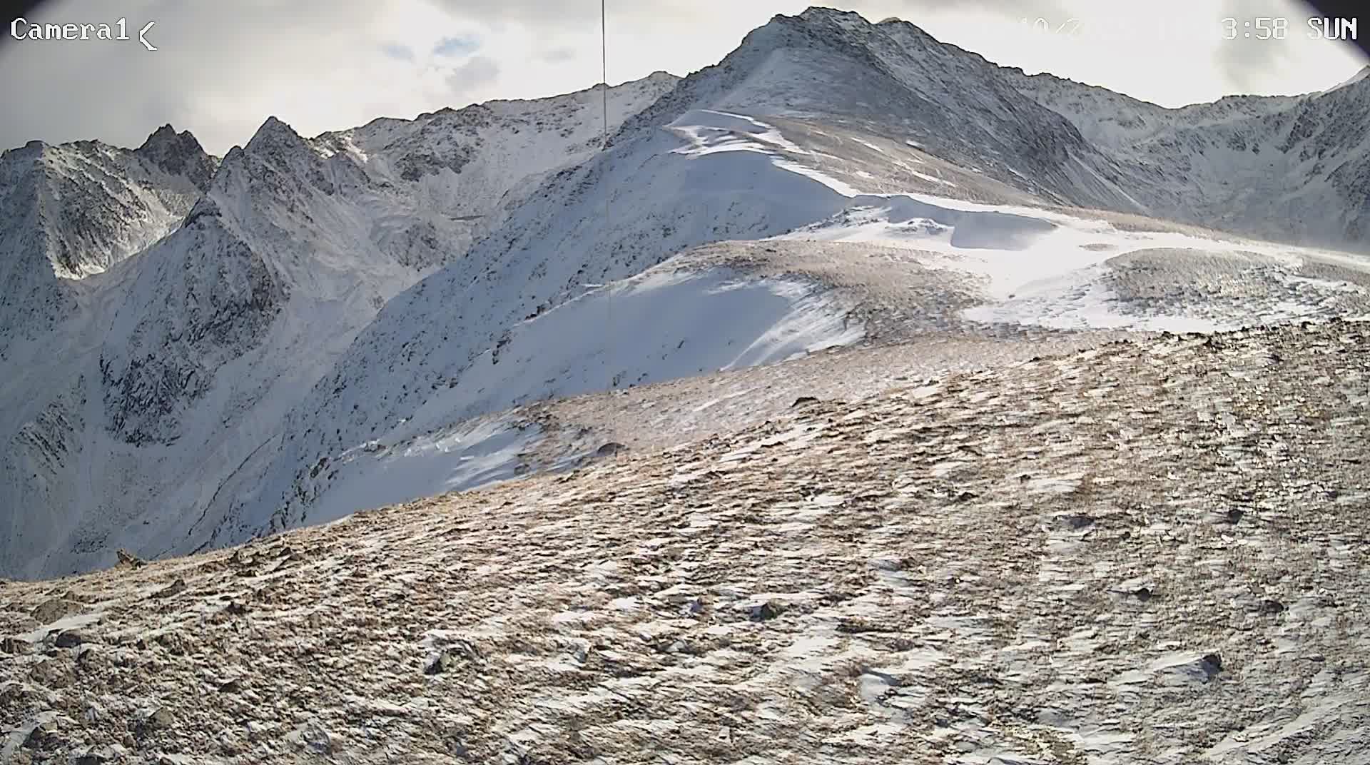
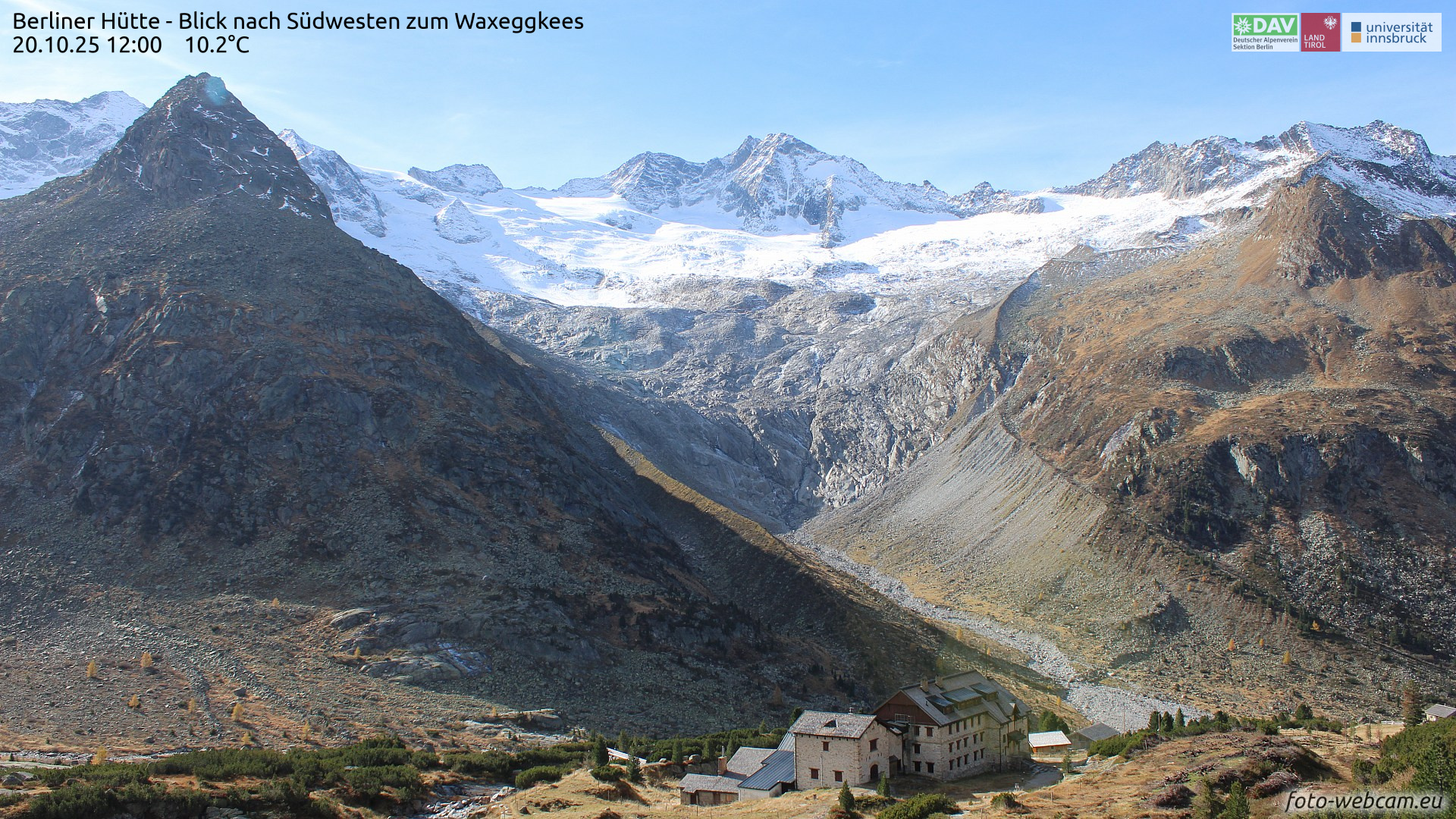
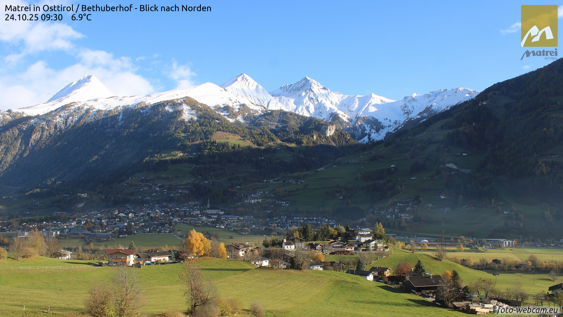
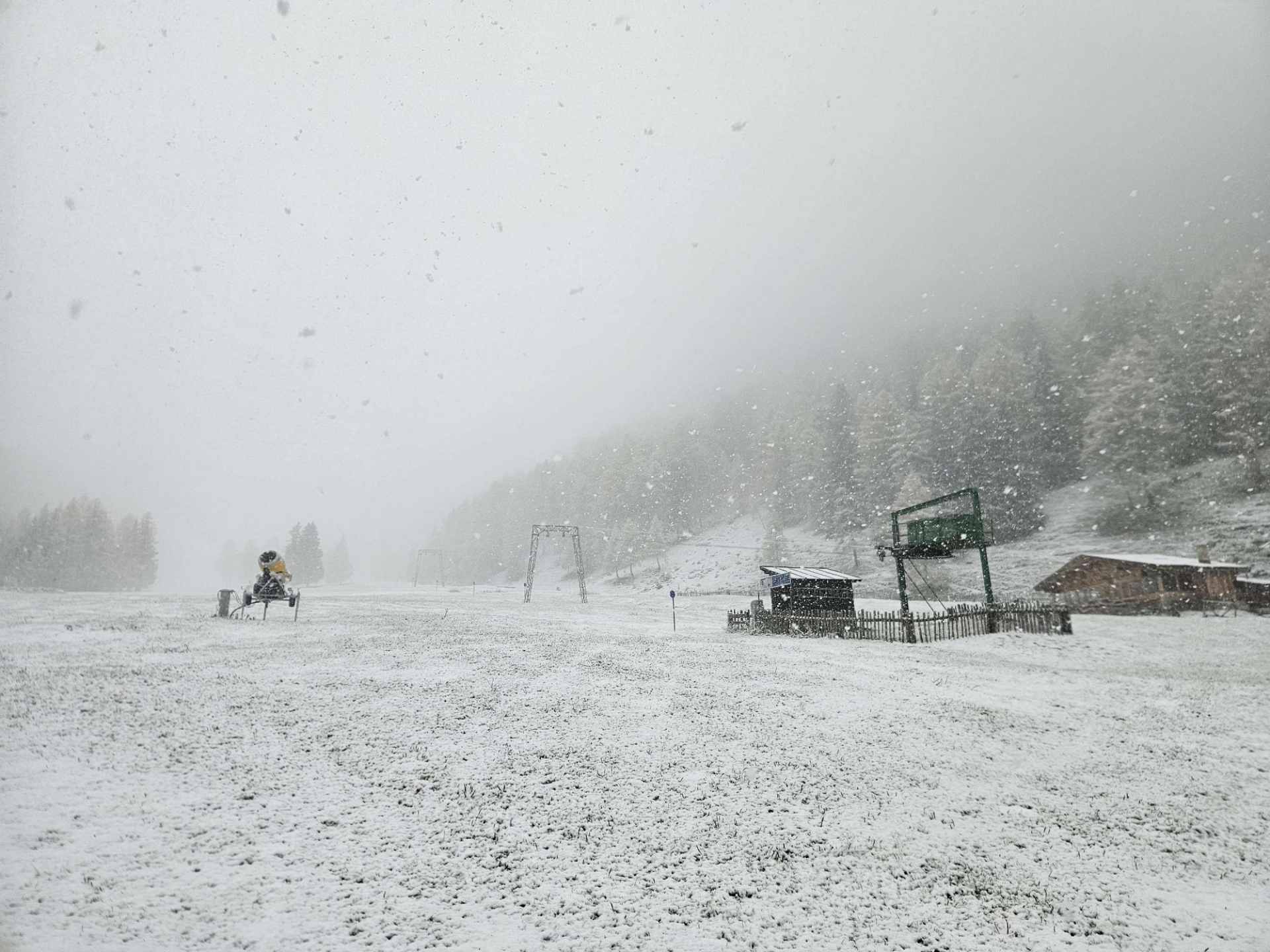
First onset of winter this season
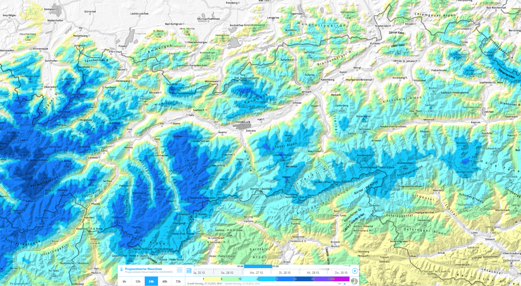
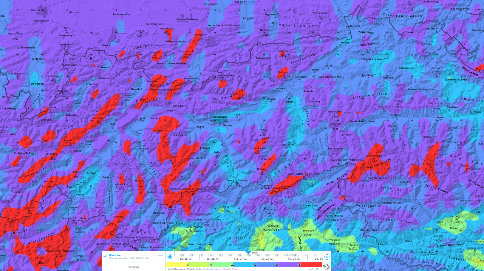
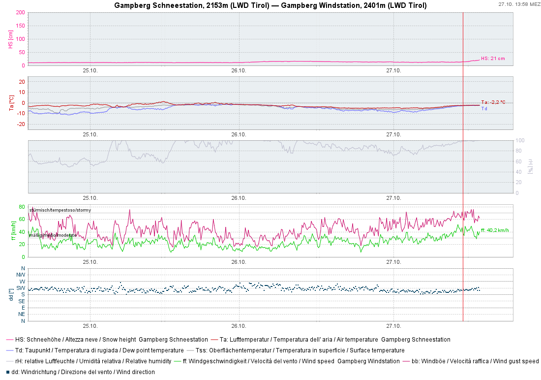
A powerful northwestern barrier cloud front has brought about heavy precipitation since morning on Monday, 27.10, in particular west of Innsbruck. The snowfall level lies between 1300 and 1500m – thus, in the mountains all the precipitation is falling as snow.
Particularly in the furthermost western regions between the Allgau Alps in the north and the Silvretta in the south, 40 to 50 cm of fresh snow will fall widespread, locally even more. Towards the east and south, the amounts of fresh snow will be successively less. At the same time, strong to storm-strength winds will be blowing from the west.
For a brief time, heightened avalanche danger – caution urged especially in regions with heavy snowfall
Dry-snow slab avalanches
Intensive snowfall and heavy winds are unleashing naturally-triggered dry-snow slab avalanche activity particularly as the precipitation unleashes today, Monday, 27.10. These avalanches are occurring especially on very steep leeward slopes, also steep slopes distant from ridgelines, for example, at the foot of rock walls.
In those places, individual winter sports enthusiasts can still trigger the fresh snowdrift accumulations as avalanches, even on Tuesday in some places. In the regions where snowfall is heaviest, avalanches can grow to medium size/magnitude. As a result of the settling process due to sunshine and higher temperatures in the days which follow, such avalanche prone locations will recede in number and will, starting in mid-week, be located only in isolated cases on shady slopes at high altitudes.
Loose-snow and glide-snow avalanches
As a result of the significant rise in temperatures and solar radiation, the likelihood of moist loose-snow avalanches triggering will increase for a brief spell on Tuesday in particular. As a consequence of the settling, increasingly frequent glide-snow avalanches will also be possible on steep grass-covered slopes. Both types of avalanches can grow to medium size/magnitude in the regions where snowfall has been heavy. Special caution is also urged in the vicinity of snow cracks, as well as in the runout zones of loose-snow avalanches.
Sharpen your focus on wintery dangers
For any and all undertakings in high alpine regions, it is time to sharpen your focus on the ever-present dangers of winter and to be adequately prepared when you are en route on wintery trails. As soon as there is snow covering steep slopes, there is a danger of avalanches. And for that reason, this is the rule of thumb: keep a sonar avalanche-search device fastened to your body, keep a shovel and a sonar beamer in your backpack.
As a further precaution, take the cornices into consideration: over the last few days, these have grown significantly in some regions as a result of fresh snowfall and wind. Caution is urged of a possible danger of falling.
On the glaciers, an acute, heightened awareness of the dangers of falling into a crevice needs to be awakened: avalanche crevices which previously were bare of snow are now covered with fresh snowfall and snowdrifts and are, therefore, no longer recognizable.