Wintertime conditions in the mountains – potential avalanche danger for a brief spell

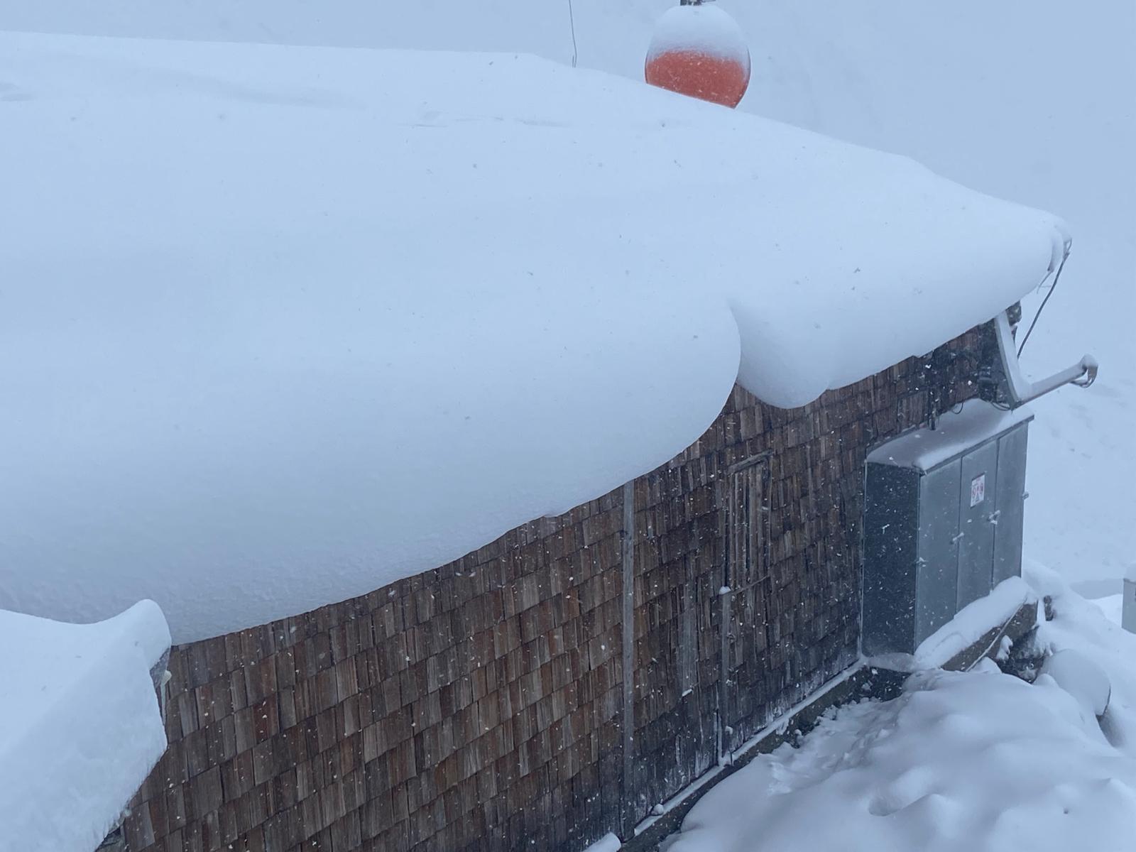
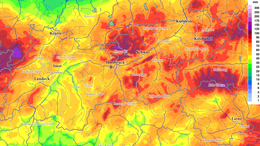
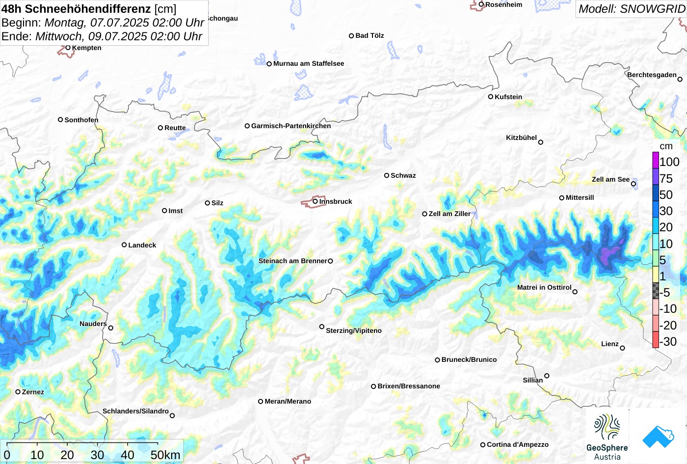
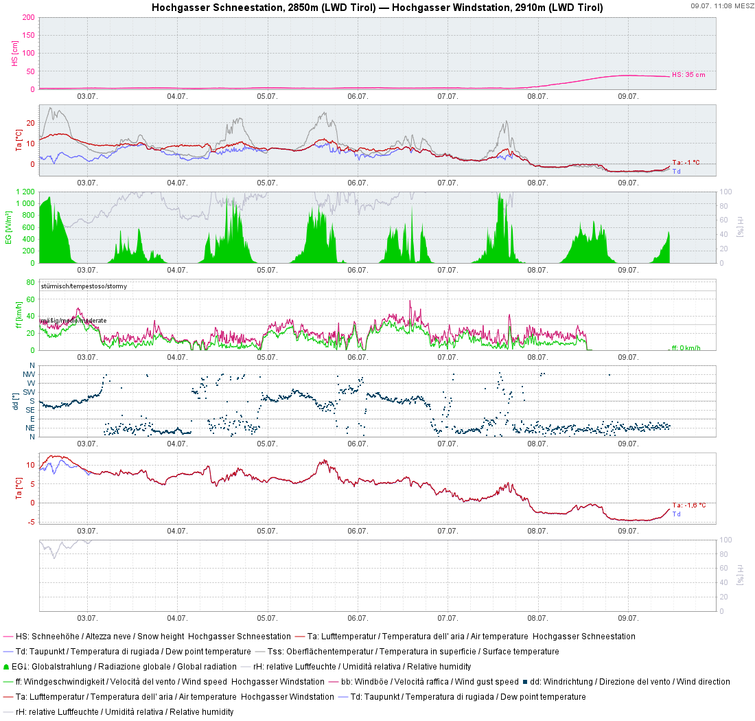
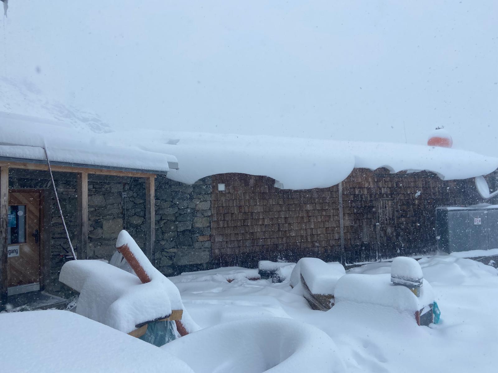
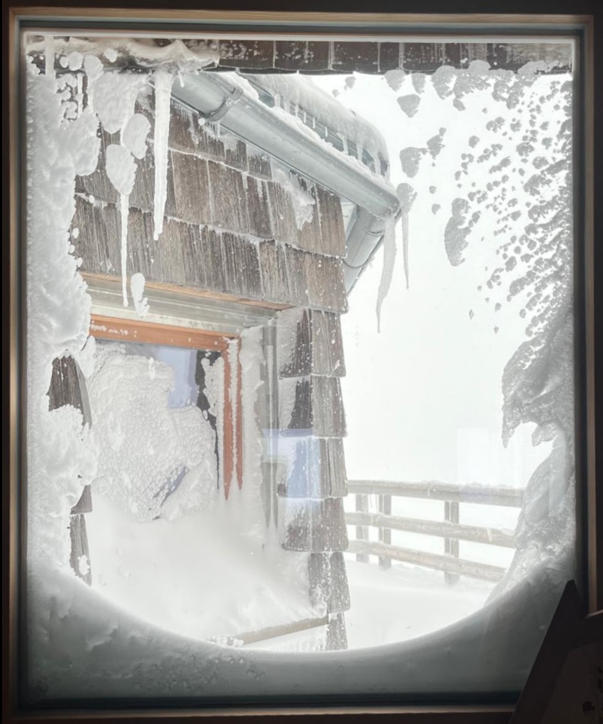
There has been significant snowfall in recent days particularly in the Zillertal Alps and Hohe Tauern: 30-80cm of fresh fallen snow has been registered at about 2800m since Monday evening, 07.07, most of which fell in the Venediger Massif. Strong velocity northerly winds transported the fresh snow far-reachingly. Freshly generated snowdrift accumulations can be prone to triggering in very steep gullies and bowls for a short time. In case of solar radiation and as temperatures rise, small wet loose-snow avalanches can be expected on extremely steep slopes.

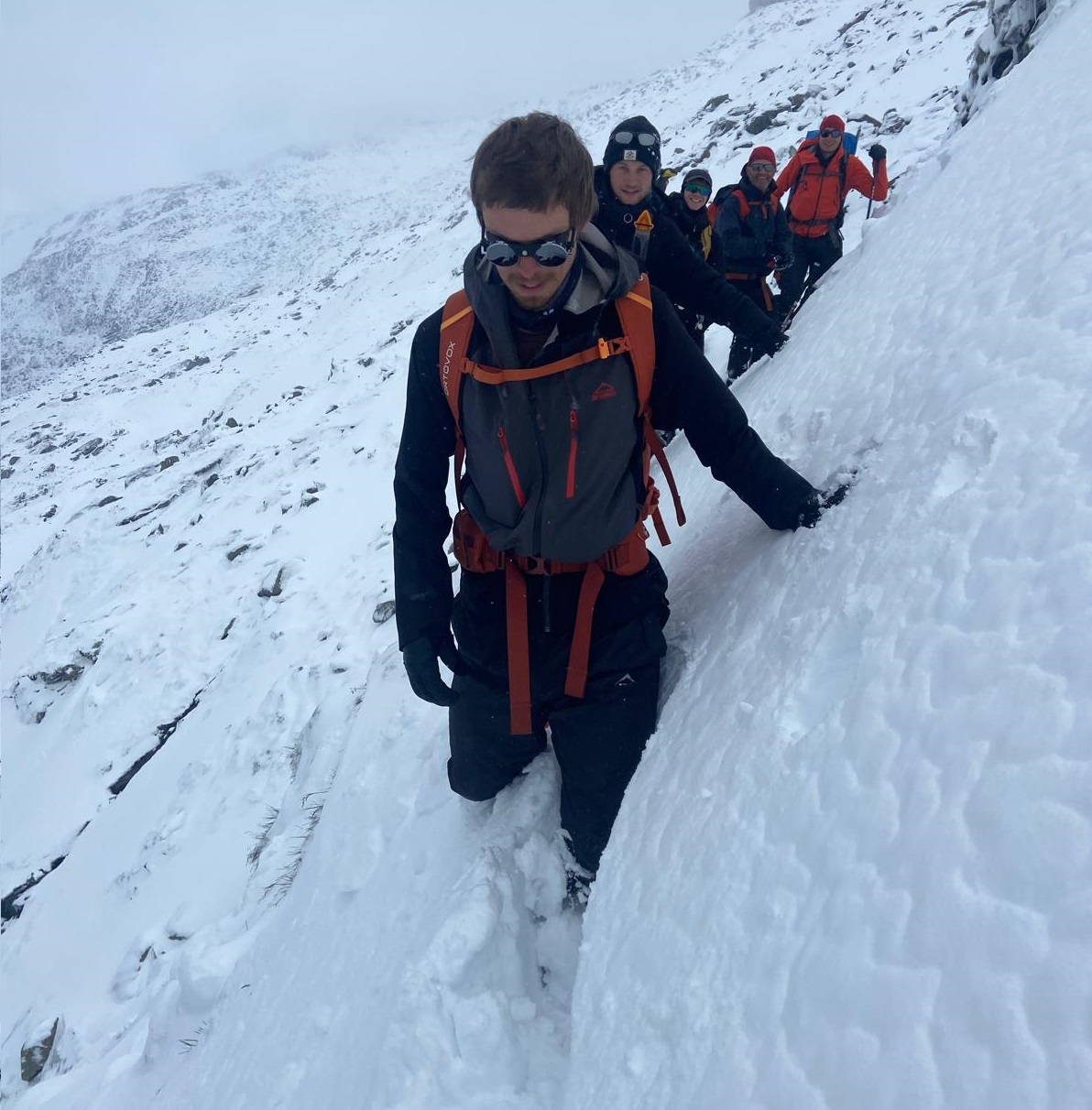
Caution is the byword in the next few days, including for dangers of possible falls in glaciar crevices.

Low pressure front brought lots of precipitation, dropping temperatures

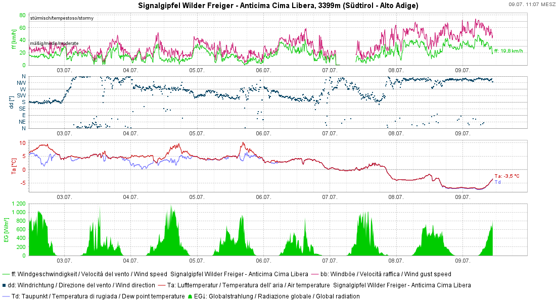
Cool, moist air masses from the north have led to heavy precipitation and lower temperatures since Monday, 07.07. Especially on Monday night, the snowfall level in places descended nearly to the treeline. At great heights, strong northerly winds, even reaching storm strength in gusts, were blowing. Most of the fresh snow fell in the eastern part of the Main Alpine Ridge, from the Zillertal Alps as far as the Glockner Massif.

72h- Niederschlagssumme seit Sonntag, 06.07. In den östlichen Landesteilen war am meisten Niederschlag zu verzeichnen (©GeoSphere Austria).
72-hr overall amounts of precipitation since Sunday, 6 July. Most of it was registered in the eastern parts of the land. (©GeoSphere Austria).
Modellierte Neuschneesumme der vergangenen 48- Stunden in Zentimeter. Am Zillertaler Hauptkamm sowie in den Hohen Tauern hat es am meisten geschneit.
Model of fresh fallen snow in centimetres over the last 48 hours, most of it in the Zillertal sector of the Main Alpine Ridge and Hohe Tauern.
Die grüne bzw. magenta- farbigen Linien in der oberen Grafik zeigen den Mittelwind bzw. die Böen an der Wetterstation am Wilden Freiger (Stubaier Alpen). Besonders hochalpin wehte der Nordwind stark bis stürmisch. Die Temperaturen fielen mit der Kaltfront deutlich.
Green and magenta-colored lines in the upper graph depict middle winds and gusts at the automated weather station on Wilder Freiger in the Stubai Alps. Particularly in high alpine regions, northerly winds were blowing at strong to storm-strength. Temperatures dropped significantly because of a cold front.
An der automatischen Wetterstation am Hochgasser in der Venedigergruppe sieht man den Anstieg der Schneehöhe ab den Nachtstunden auf Dienstag, 08.07.
At the automated weather station on Hochgasser in the Venediger Massif, the rising snow depths are visible starting on Monday night, 7 July. The wind meter has iced up, so cannot deliver current measurements.

Effects on avalanche danger

Particularly in the mountains in the eastern sector of the Main Alpine Ridge at high altitudes, caution towards freshly formed small snowdrift accumulations is called for. These drifts will be prone to triggering only for a short time after they have been generated. Avalanche prone locations tend to increase with ascending altitude. Special caution urged in terrain where falls are possible.

As a result of direct and diffuse solar radiation, as well as gradually rising temperatures, increasingly frequent naturally triggered moist loose-snow slides can be expected in extremely steep terrain (>40 degrees).

Massive snowdrifts near the Neue Prager Hütte (©Franz Holzer, 09.07.2025).
Winterliche Bedingungen auf der Neuen Prager Hütte. Seit der Aufnahme sind neuerlich rund 20cm Schnee hinzugekommen (©Peter Fuetsch, 08.07.2025).
Wintery conditions at the Neue Prager Hütte. Since this photo was taken, another 20cm has fallen. (©Peter Fuetsch, 08.07.2025).
Auf Hüttenzu- und Abstiegen ist aktuell mit winterlichen Bedingungen zu rechnen. Jedenfalls sollte man sich vor Aufbruch mit den HüttenwirtInnen in Verbindung setzen, um die Situation vor Ort abzuklären. Venedigergruppe. (©Franz Holzer, 09.07.2025).
On ascents and descents to mountain refuges, wintery conditions can currently be expected. Under all circumstances, contact the refuge manager prior to departure to find out the conditions reigning at the hut. Venediger Massif (©Franz Holzer, 09.07.2025).
Auf der Adlersruhe in der Glocknergruppe hat es mit rund 30cm etwas weniger geschneit, als im Bereich des Venedigers (©Anton Riepler, 09.07.2025).
At the Adlersruhe in the Glockner Massif there was about 30cm less snowfall than near the Venediger Massif. (©Anton Riepler, 09.07.2025).

The weather will remain variable over the next few days, particularly on the Main Alpine Ridge and in North Tirol. Large amounts of precipitation are no longer to be expected, and temperatures will rise again. The danger of dry-snow avalanches will quickly recede. Individual wet loose-snow slides are possible in extremely steep terrain.

Caution: covered glacier crevices

A source of danger never to be underestimated: the snow-blanketed or drifted crevices on glaciers. Just a few days ago, observers reported conditions like in August, mostly the result of last winter’s shallow snow depths. In regions where recent snowfall was heavy, open glacier crevices have now been covered at least partially, making them difficult to recognize.