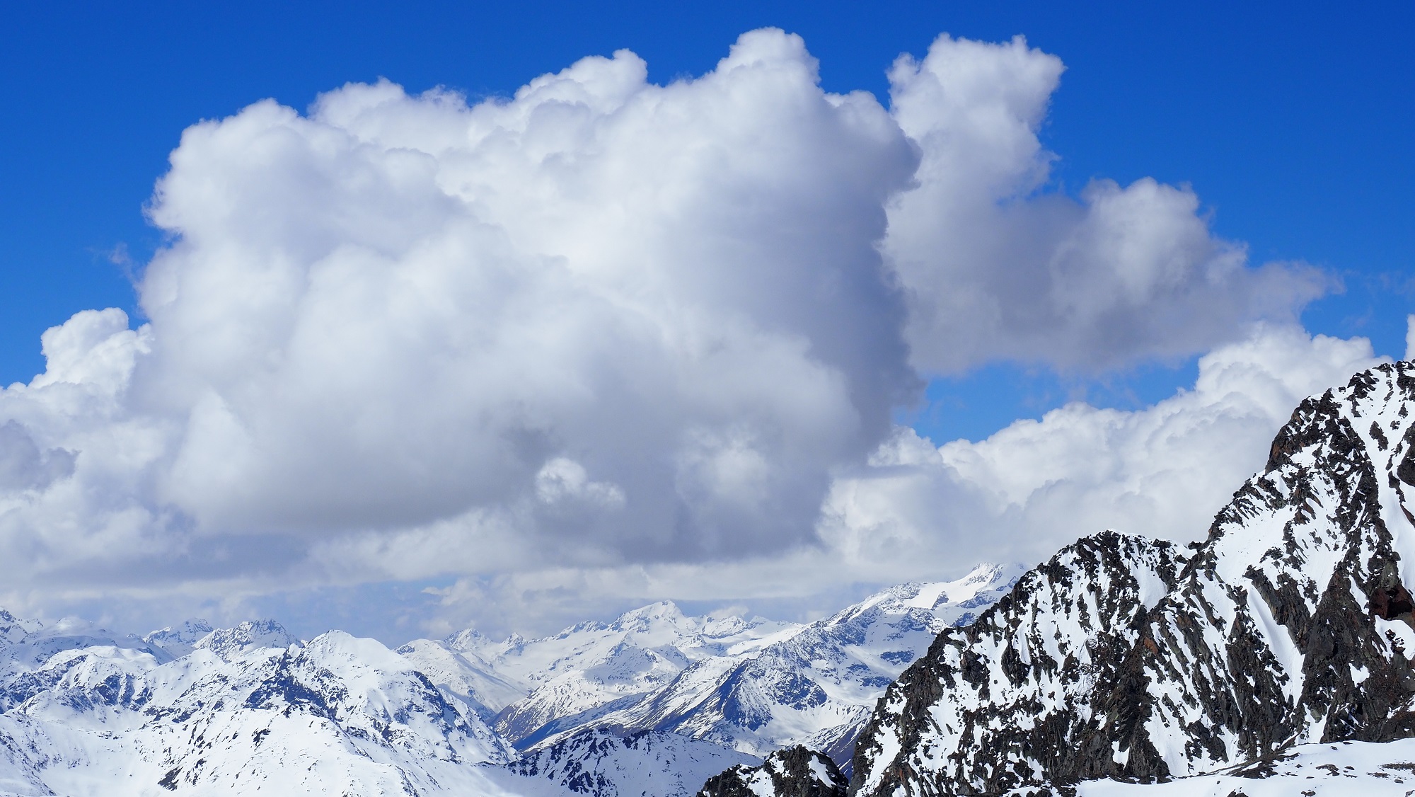
The main danger of avalanches still stems from the wet-snow problem, quite in step with the season. Due to outgoing longwave radiation and consolidation of the snowpack during nocturnal hours followed by higher daytime temperatures and solar radiation, avalanches are subject to a daytime danger cycle. Over the next few days, air will become gradually more moist, less stable, which will make the snowpack even wetter esp. above 2600m on shady slopes. On Sunday night, a cold front will reach us, temperatures will drop and a bit of fresh snow is expected.
Not much snow on the ground apart from Main Alpine Ridge – daytime cycle of avalanche danger
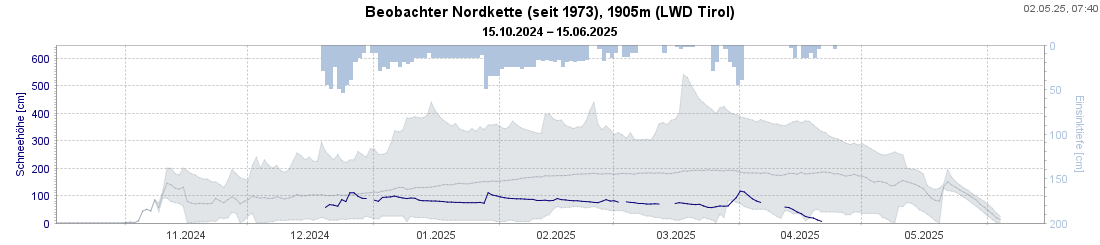
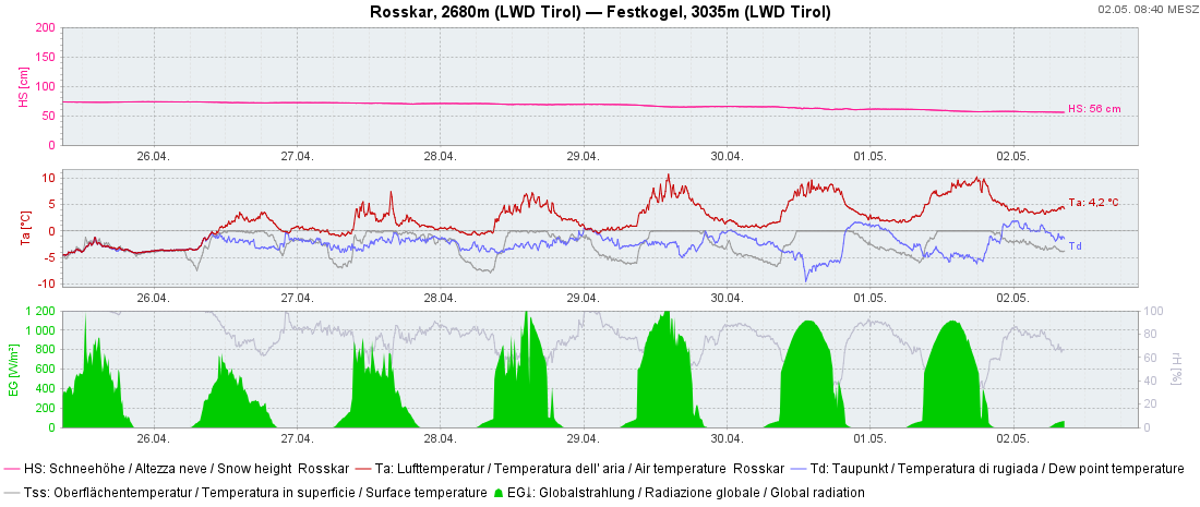
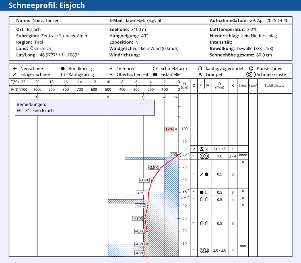
At the end of a winter season which has been generally low in snowfall, it’s no wonder that the snowpack has receded well up to the highest altitudes. The last few mild and sunny days reduced the snowpack a further notch. Sunny slopes are often bare of snow up to nearly 2600m, with regional variations. On shady slopes, a cohesive area-wide snowpack is not evident until above 2200m.
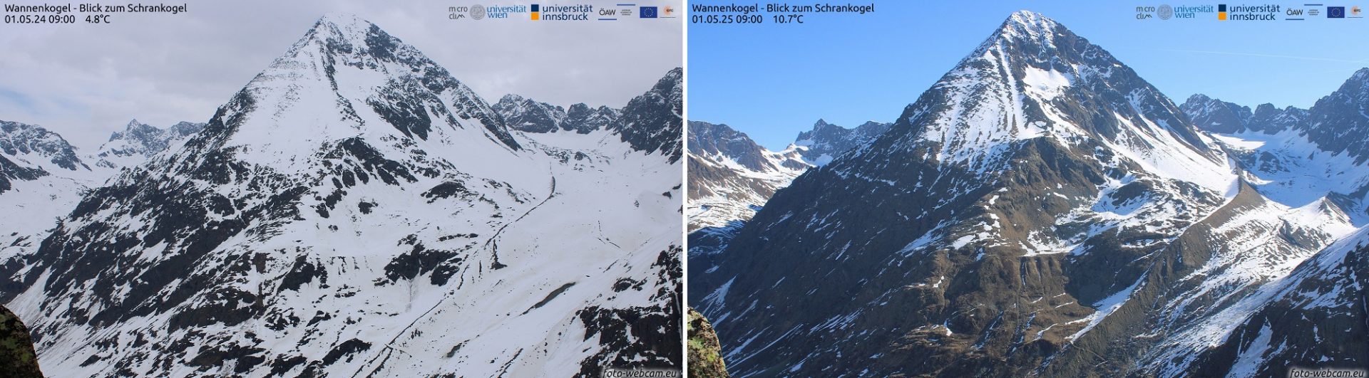
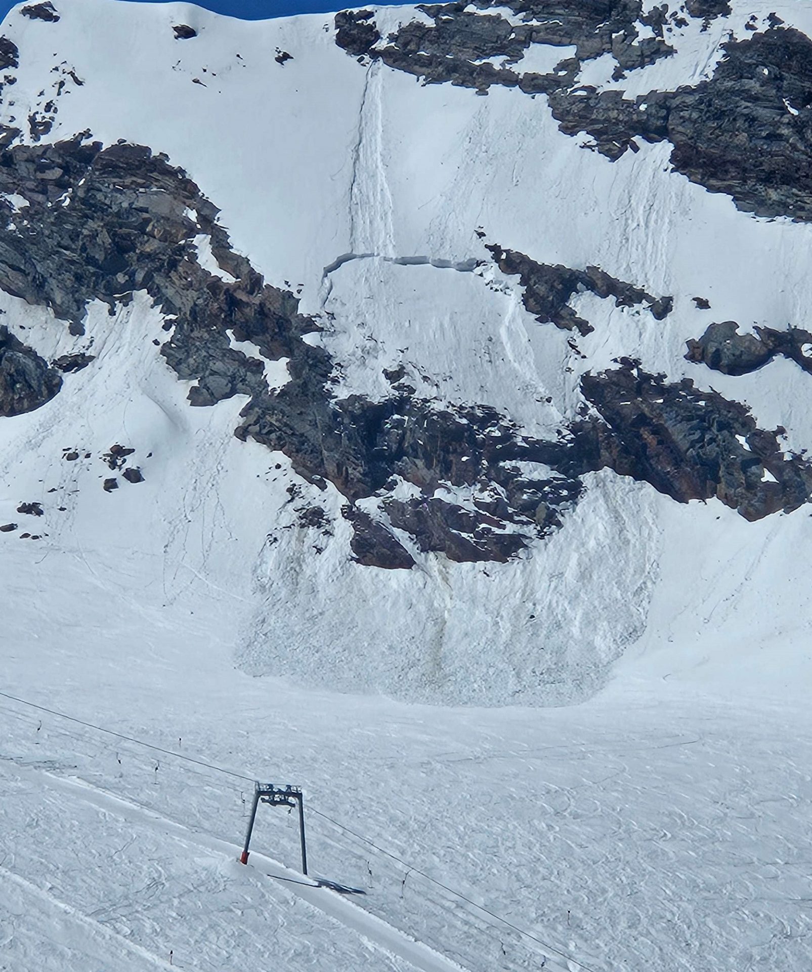
At higher altitudes the snowpack has been subject to a typical springtime cycle over the last few days: during nights of clear skies with good outgoing radiation the snowpack forms a melt-freeze crust which is capable of bearing loads (at least, above 2400m). Higher daytime temperatures and solar radiation then soften the crust during the course of the day (to what degree depending on aspect) and makes the snowpack wetter. The upshot: a corresponding daily cycle of wet-snow avalanche danger.
Weekend: increasingly unstable, rising wet-snow avalanche danger
Friday night (03-04 May) will be particularly cloudy, repeating the pattern of recent days. On Saturday, denser cloud cover will move in, a few showers are possible. In addition, some dust from the Sahara Desert will mix into the weather-batter, making conditions slightly gloomier.
On Sunday, 04 May, nighttime outgoing longwave radiation will be reduced. Moist/instable air masses will be warmer, the snowpack will become wetter still. This is interesting with regard to shady slopes above 2600-2800m where the snowpack is not yet zero-degree isotherm. Especially the precipitation resulting from strong convective cloud build-up, which will fall as rain up to nearly 3000m, could lead to the snowpack becoming thoroughly wet for the first time at this altitude. The likelihood of wet slab avalanches and loose-snow avalanches triggering will thereby increase. Moreover, avalanches can sweep away thoroughly wet layers of the snowpack along their plummet paths and, in isolated cases, grow to large size.
Next week: cool, instable weather, snowfall at great heights
On Sunday evening, 04 May, a cold front is predicted to reach us, bringing much cooler temperatures. Snowfall level will drop gradually to below the timberline. It will remain variable and cool until the end of the week. In the mountains a bit of snowfall is anticipated. Amounts of fresh snow will vary enormously due to the character of convective cloud build-up and varying snowfall levels.
Regarding avalanche danger this means that due to lower temperatures, danger of wet-snow avalanches will decrease. But wherever there is more snowfall, freshly generated snowdrift accumulations will require increased attentiveness particularly at high altitudes near ridgelines. In addition, small loose-snow avalanches are likely on extremely steep slopes, in case of extended bright intervals following the snowfall. The situation in springtime often changes radically over very short time intervals. For that reason, avalanche dangers have to be assessed thoroughly on the spot by those who are there.
At the end of our daily Avalanche Bulletins for winter season 2024/2025 we would like to thank all those who sent us valuable reports from outyling terrain via SNOBS during the course of the season.
A very special debt of thanks is due to the highly engaged observers who ardently took snow profiles, observed the avalanche situation and regularly sent us informative reports during the entire season. They remain the foundation of our ongoing work. Thank you very much!!
Current relevant information about snow condtions and the avalanche situation will be published in our blog from now until the start of the next winter season, particularly in case of significant changes in the situation.