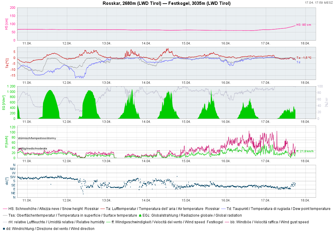
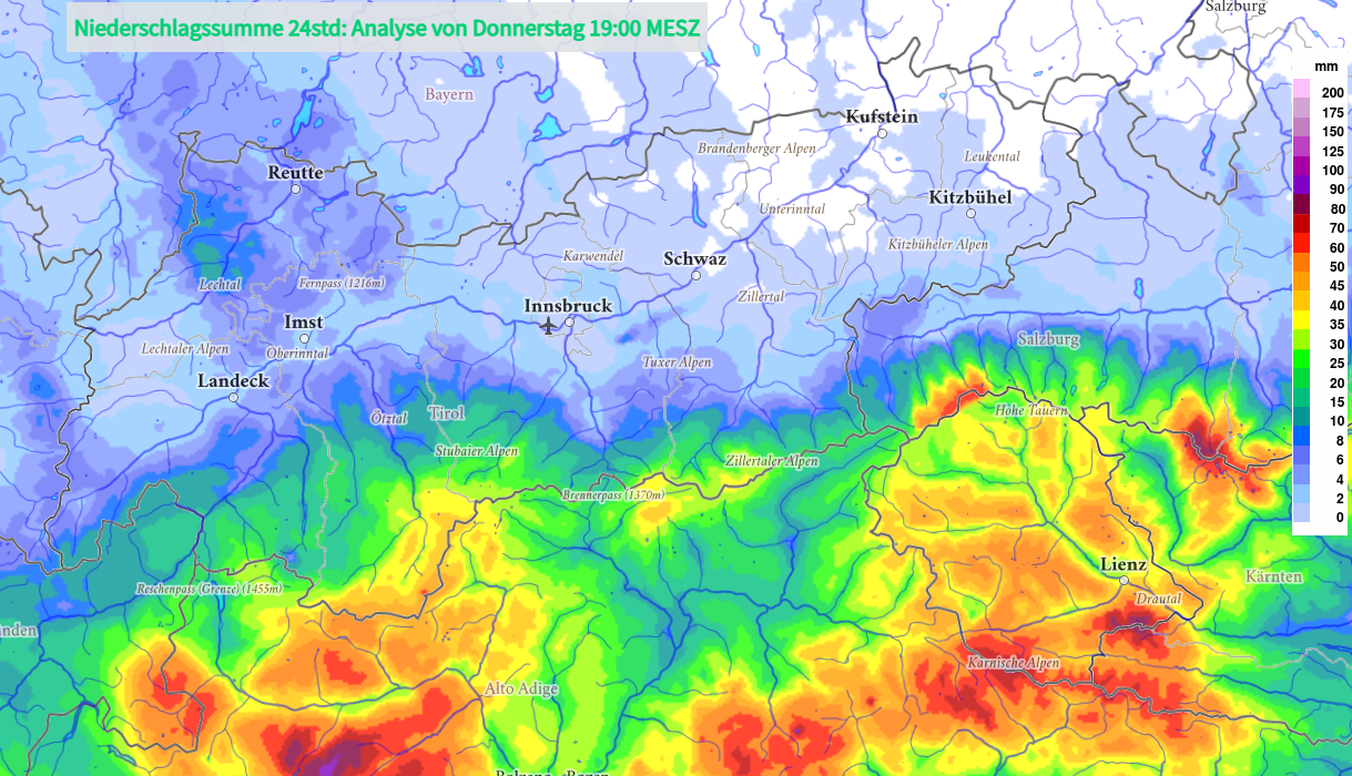
Since Wednesday evening 16.04, 40-80mm of precipitation was registered on the Main Alpine Ridge and in East Tirol. Snowfall level initially sank only slowly from 2800m, but large amounts of snow fell at high altitudes. Amid often stormy winds, widespread snowdrift accumulations were generated which at least will be easy to trigger on Friday. In addition, numerous moist loose-snow avalanches up to medium size can be expected in extremely steep terrain in regions with extended bright intervals. On the weekend conditions will remain variable, esp. in the south, and temperatures will rise. The clearer the nighttime skies, the greater the daytime danger cycle of wet-snow avalanches.
Multi-faceted avalanche situation following heavy precipitation
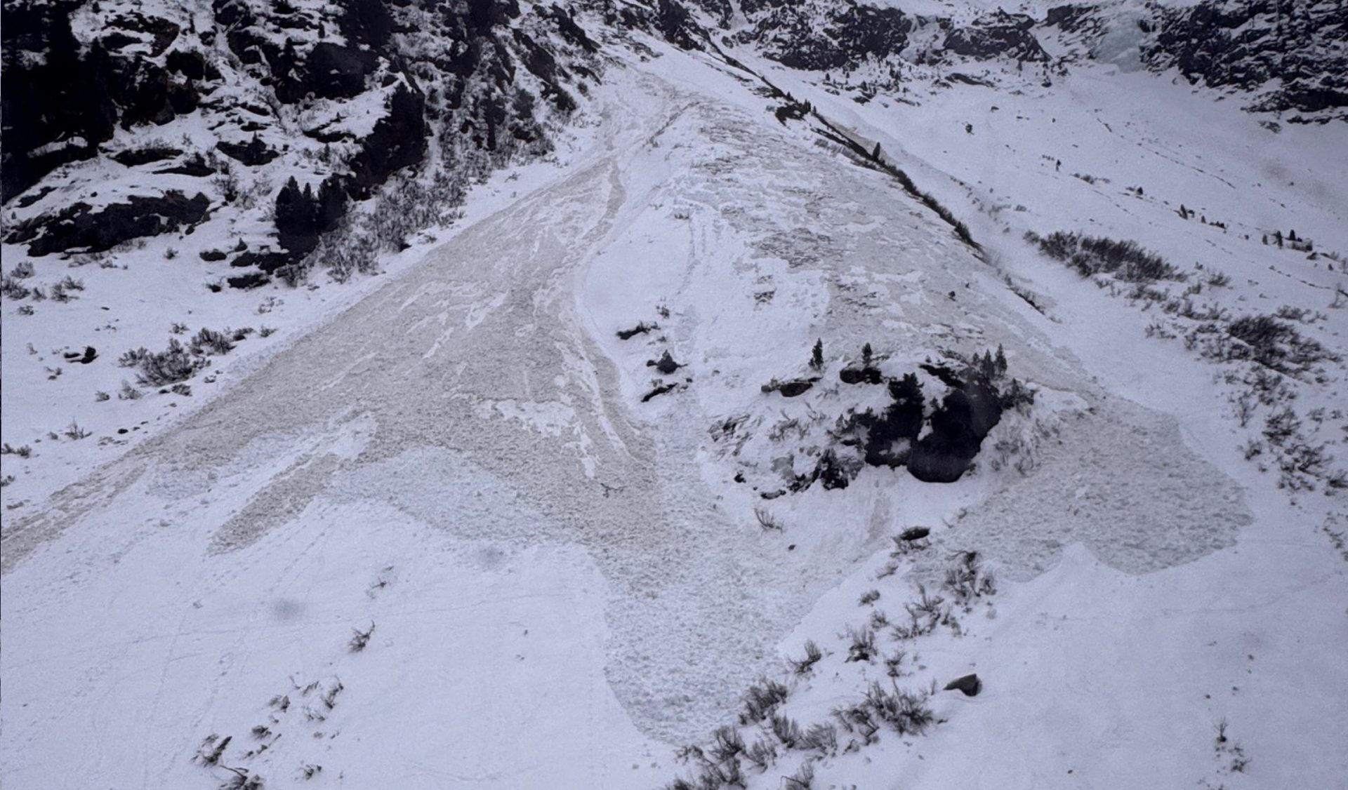
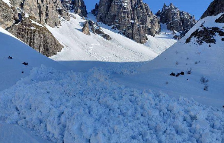
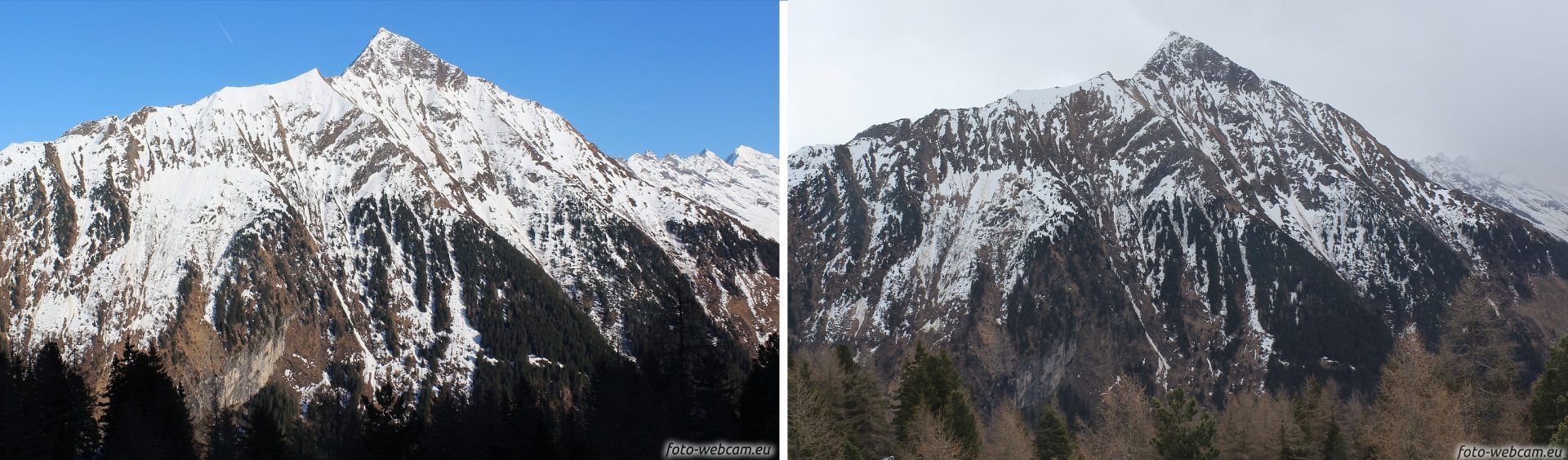
A powerful low pressure front over Genoa has supplied heavy precipitation to East Tirol and the Main Alpine Ridge since Wednesday evening, 16.04. The moist/warm air masses brought rainfall to over 2800m in places, thereby triggering numerous wet slab and loose-snow avalanches, increasingly frequently also on steep shady slopes. The snowfall level didn’t descend to 2000m until Thursday afternoon, so most of the precipitation fell as rain.
Wet-snow problem below 2600m
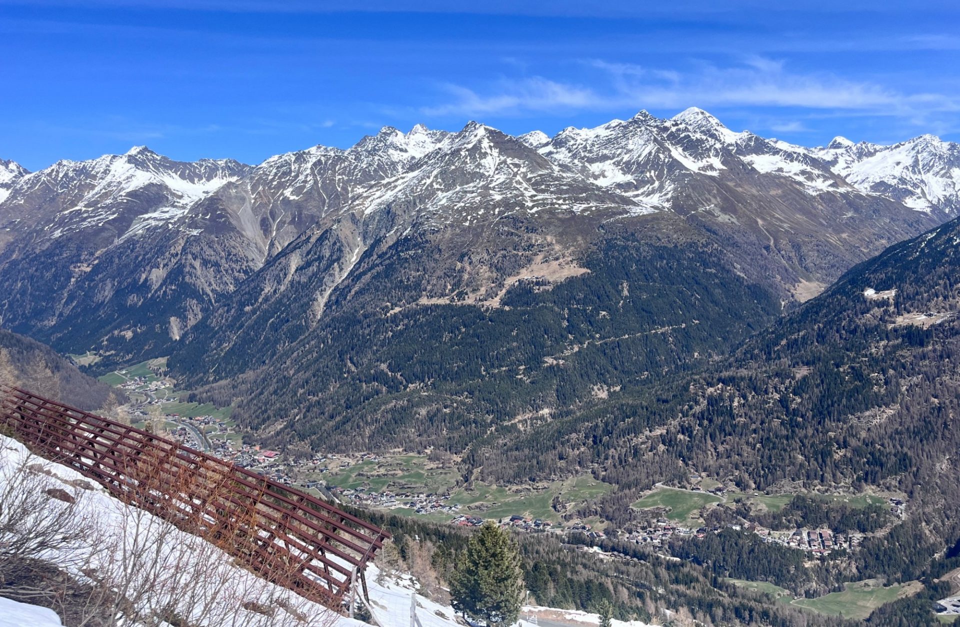
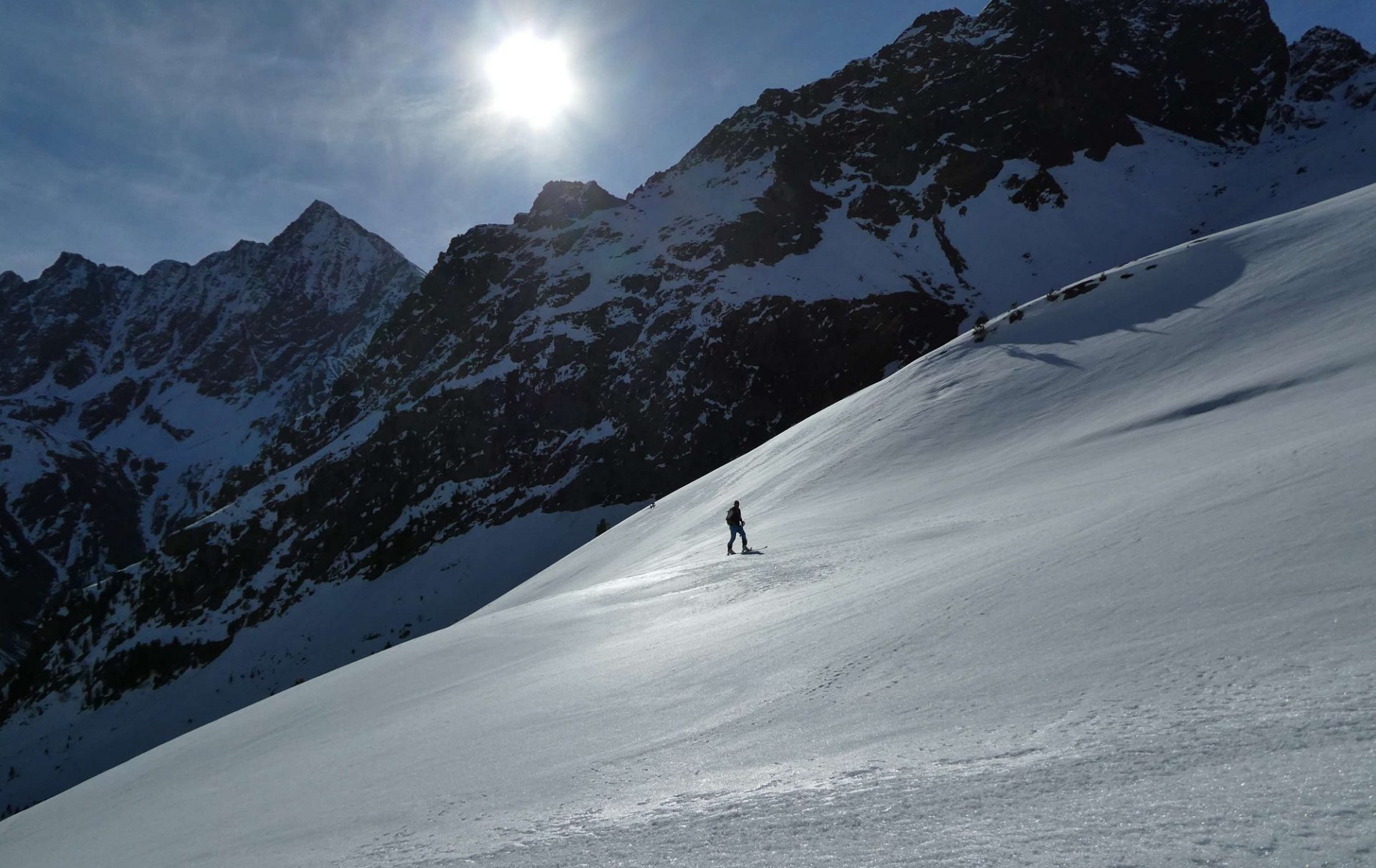
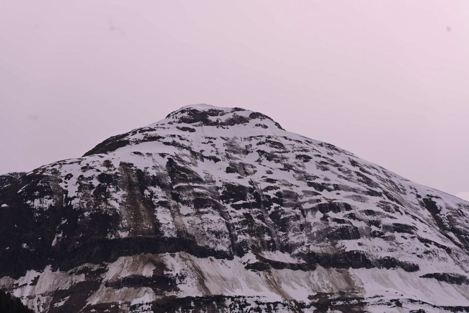
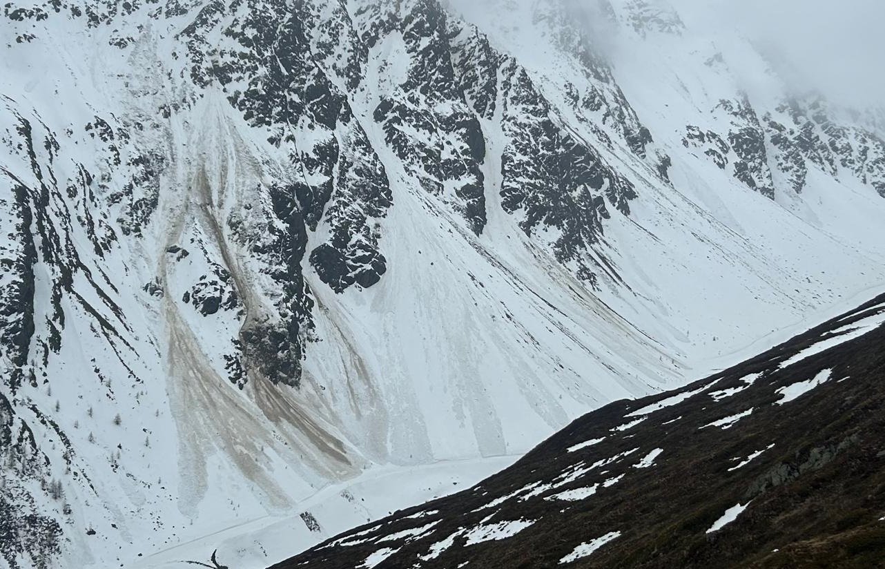
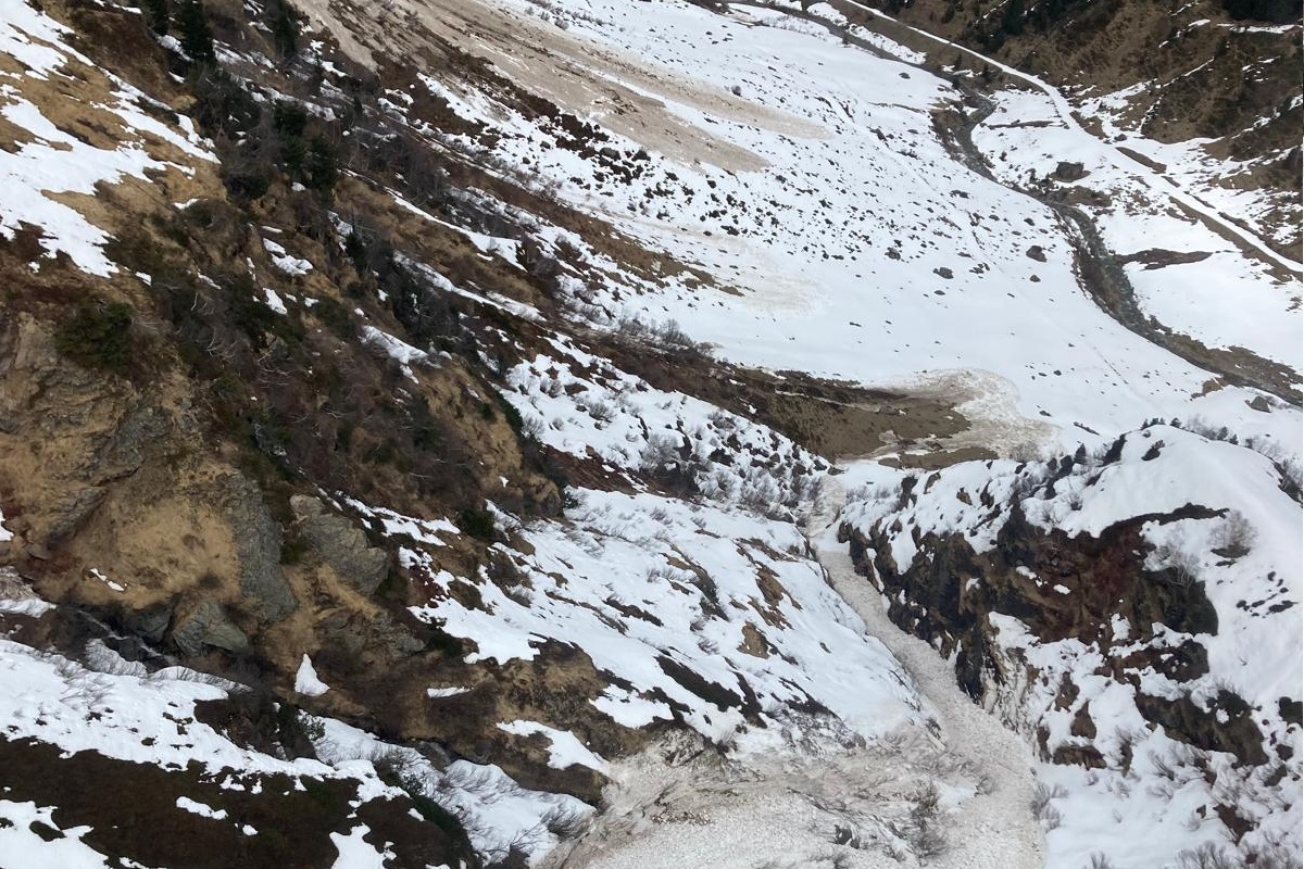
As temperatures dropped and intensive precipitation ended on Thursday night, the likelihood of wet-snow avalanches triggering receded. However, the snowpack remained wet and weak. Persons can still trigger the thoroughly wet snow as loose-snow avalanches, esp. on very steep slopes. Avalanches in their plummet path can sweep along masses of snow and grow to large size in isolated cases. Avalanche prone locations occur more frequently on shady slopes, since steep sunny slopes have much less snow on the ground.
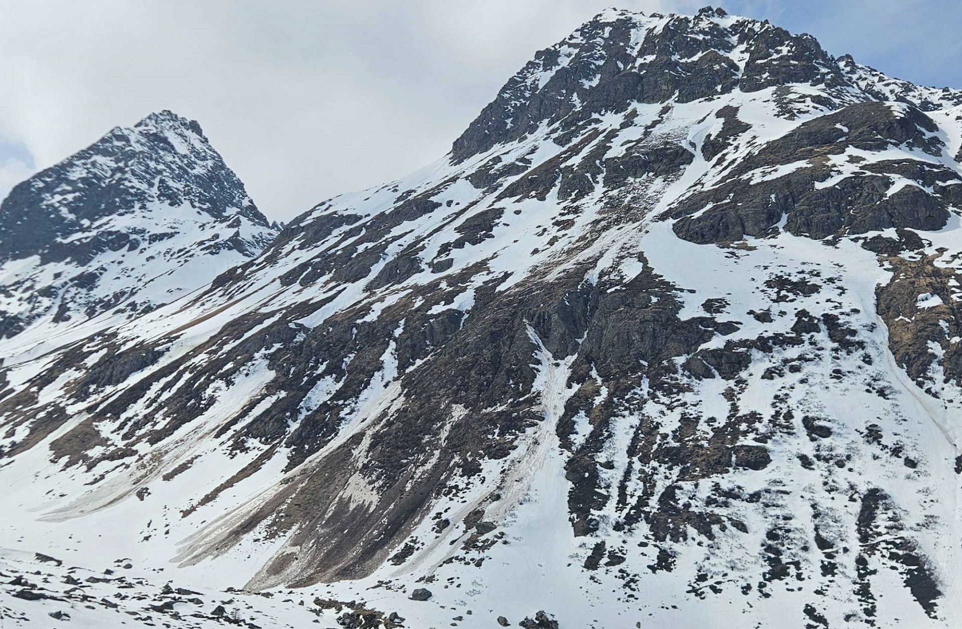
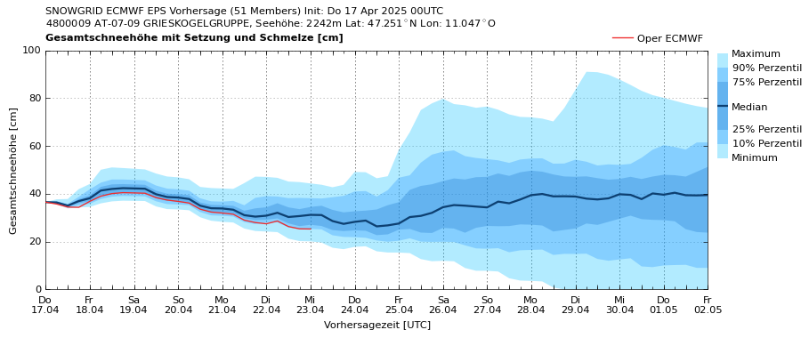
Regionally lots of fresh snow and drifts at great heights
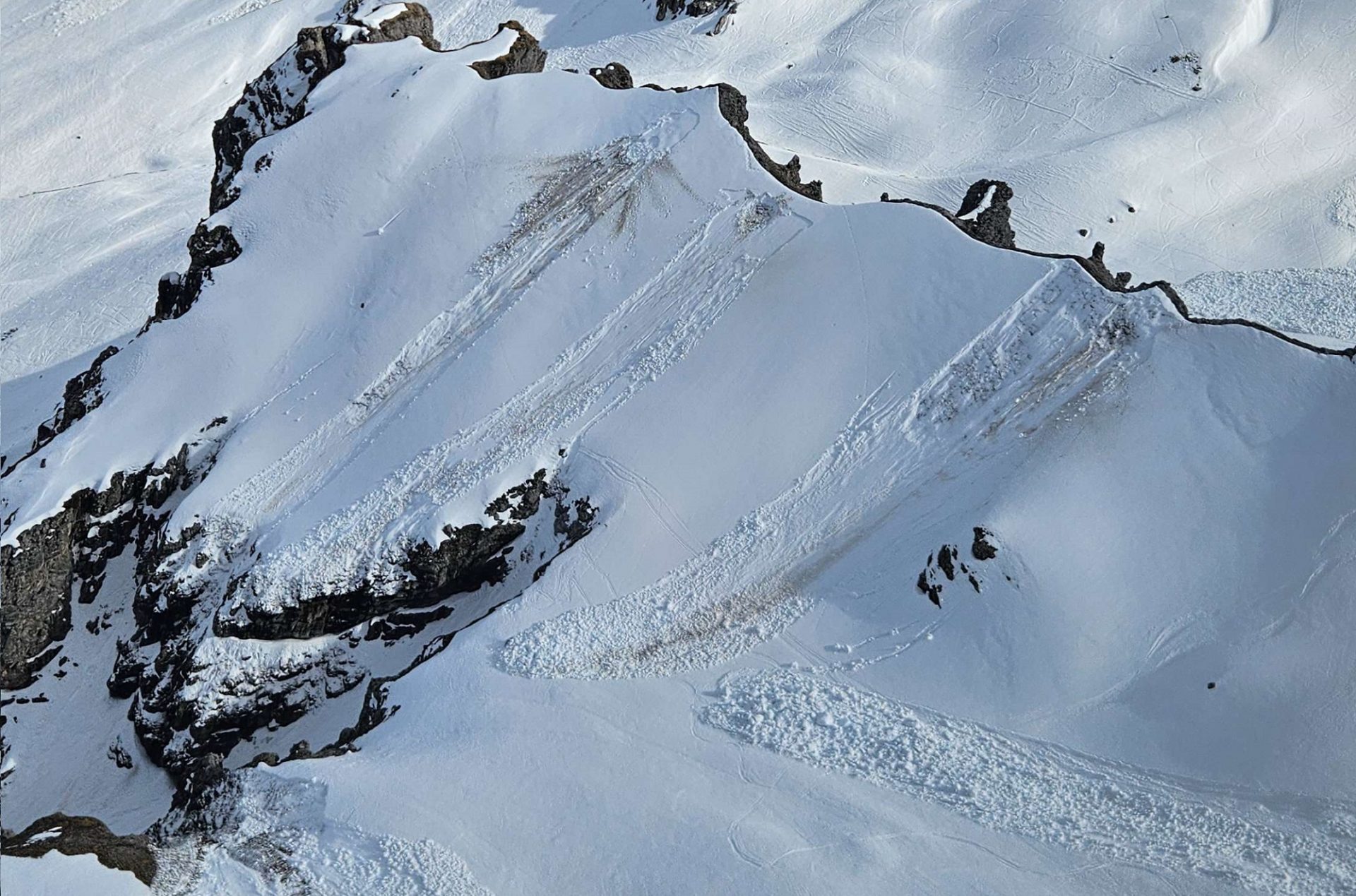
Above 2600-2800m it can be assumed that in the course of the heavy precipitation lots of fresh snow fell. This is particularly the case for the mountains along the Main Alpine Ridge, especially Hohe Tauern and Gurgler Massif in the Ötztal Alps. Southerly winds were often blowing at strong-to-storm strength during the precipitation, thus, far-reaching snowdrifts accumulated freshly which in places can be triggered by persons following the precipitation, particularly where snowfall was heaviest. Snowdrift accumulations are especially plentiful on shady slopes, in gullies and bowls, and in general behind protruberances in the terrain.
In case of extended bright intervals on Friday, 18.04, and Saturday, 19.04, numerous moist loose-snow avalanches are expected to trigger naturally on extremely steep slopes. These releases can also sweep along masses of unbonded snow and, particularly in long plummet paths, grow to dangerously large size.
Variable conditions will continue after Easter
Also after the holidays have passed, weather conditions will remain variable, temperatures will stay mild. Thus, the snowmelt will continue and the wet-snow problem will remain dominant. Nocturnal cloud cover will determine whether a melt-freeze crust will form on the surface and whether it will be capable of bearing loads the next morning. Friday night (18.04) appears promising, particularly in the northern regions. However, with warm temperatures and solar radiation, the danger of wet-snow avalanches will be subject to a slight daytime danger cycle on Saturday, 19.04.
The freshly generated snowdrift accumulations will settle and consolidate rapidly in the current springtime conditions.
Review: high activity of wet-snow avalanches due to rainfall, warmth
Last week was marked by warm, moist southern barrier cloud weather. Rain, moist air masses, diffuse radiation made the snowpack increasingly wet and, as a consequence, high activity of wet-snow avalanches resulted. Particularly on W/N/E-facing slopes (above 2200m depending on aspect) the snow was thoroughly wet for the first time. Thereby, especially numerous wet slab and loose-snow avalanches released. Also the gliding snow activity on steep grass-covered slopes increased noticeably due to water seepage. Snow depths receded markedly. Currently, shady slopes up to 2600m and sunny slopes up to 3000m are zero-degree isotherm.