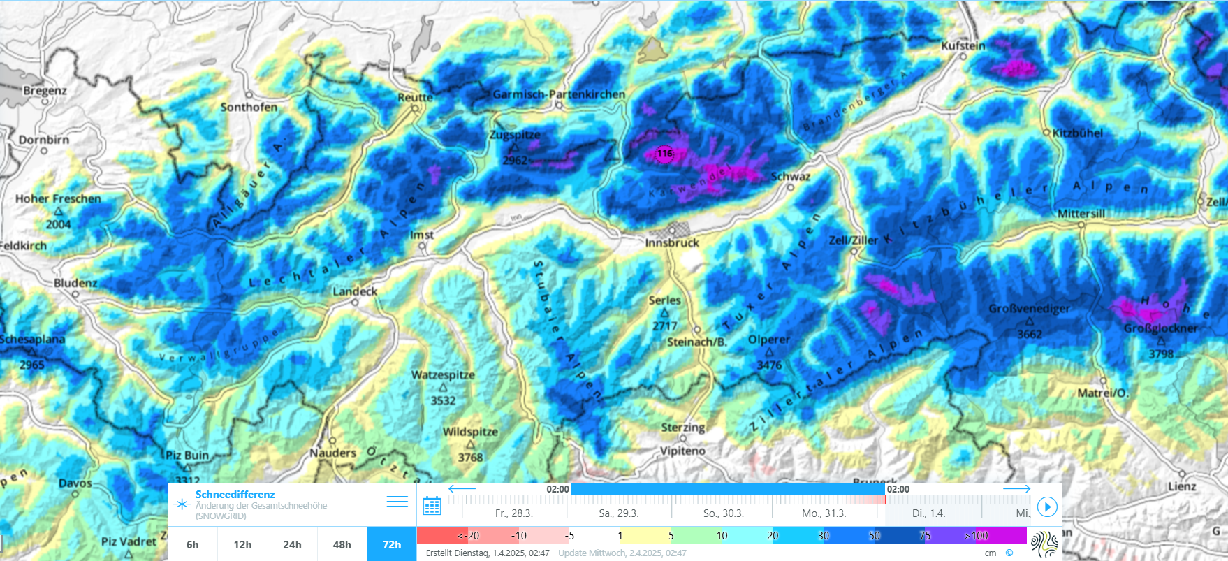
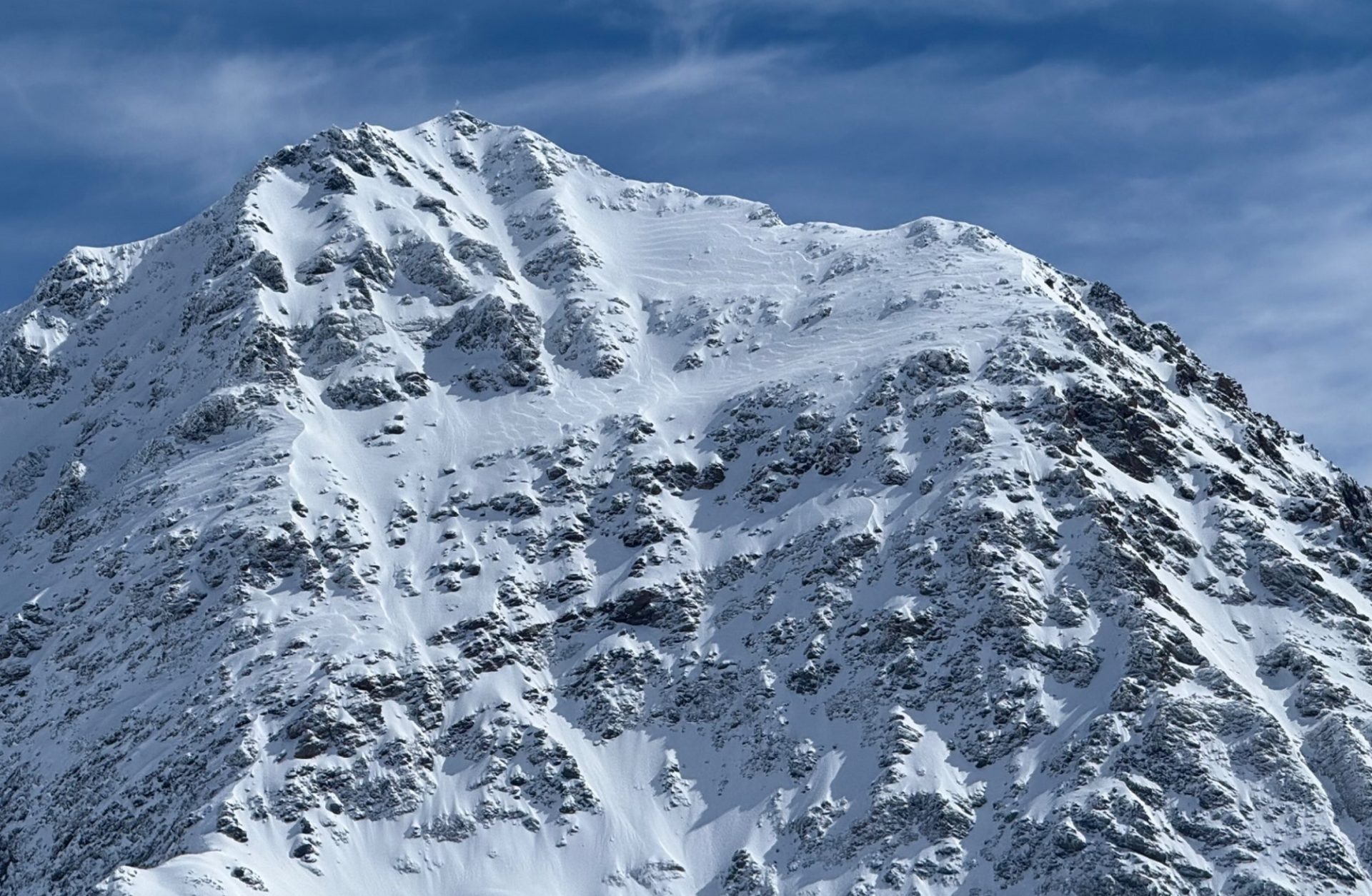
Over the last few days there has been heavy snowfall in our northern and eastern regions. Precipitation was often accompanied by storm-strength winds. High-pressure front conditions are will bring serene and sunny weather starting on Wednesday, but the avalanche situation will improve only slowly. One sole person can easily trigger slab avalanches in some places, including large-sized releases. Such danger zones are difficult to recognize, particularly where snowfall has been heavy. In addition, numerous loose-snow avalanches can be expected in extremely steep terrain due to solar radiation. And gliding snow activity is increasing again. Thus, the situation demands a savvy route selection and great restraint.
Heavy snowfall and storm-strength NW winds
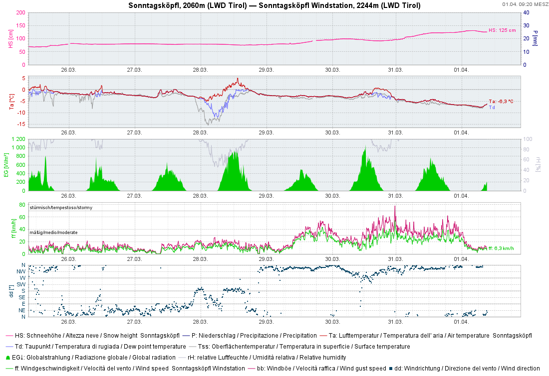
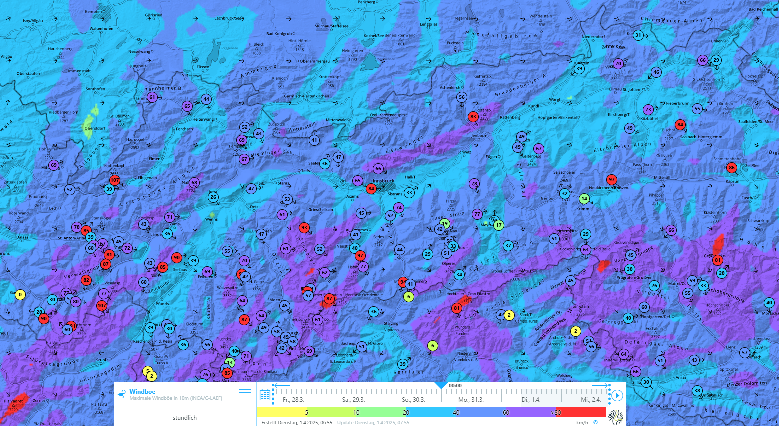
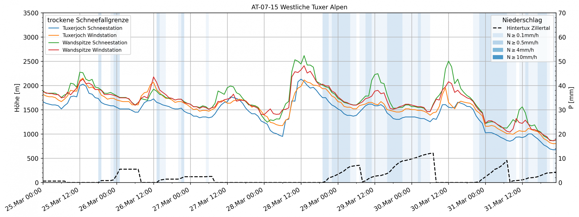
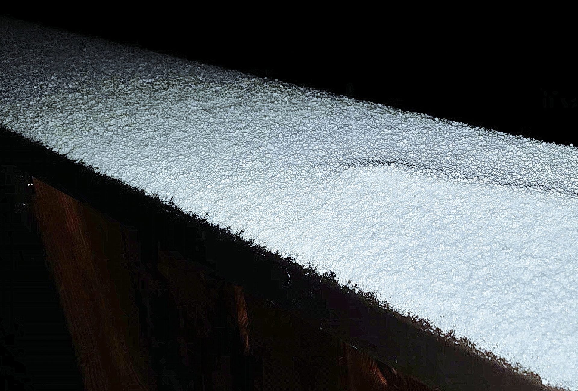
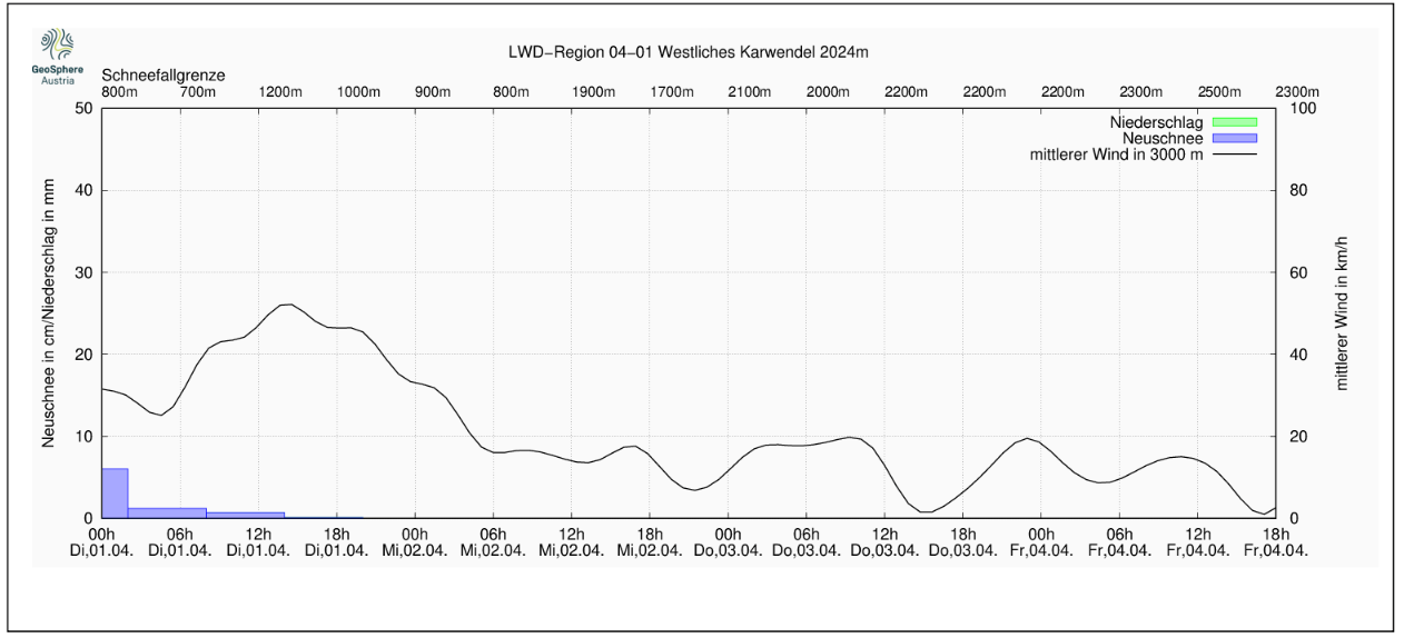
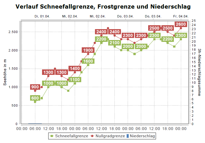
Since Friday, 28.03, moist air masses have been swept into Tirol by a N/NW airstream. Particularly in the northern and eastern regions it brought heavy snowfall in its wake. Precipitation was intermittently accompanied by strong to stormy northerly winds. The snowfall level fluctuated around 2000m to begin with, then descended swiftly to low and intermediate altitudes.
The large amounts of fresh fallen snow were deposited atop a shallow and often unfavorable old snowpack, esp. south of the Inn. During the extended high-pressure front conditions during the course of the winter it became expansively metamorphosed, particularly on shady slopes above 2200m. Especially in little-tracked terrain there are weak layers in the form of faceted crystals which are often embedded between crusts. The situation on E/W-facing slopes above 2600m is quite similar.
When a cold front moved in on Friday evening, 28.03 and the snowfall level rapidly descended, a layer of small faceted crystals may well have appeared on the snowpack surface as a consequence of Danger Pattern 4, cold on warm. This occurred particularly on W/N/E-facing slopes at 2200-2400m.
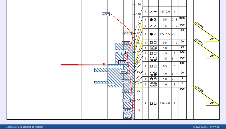
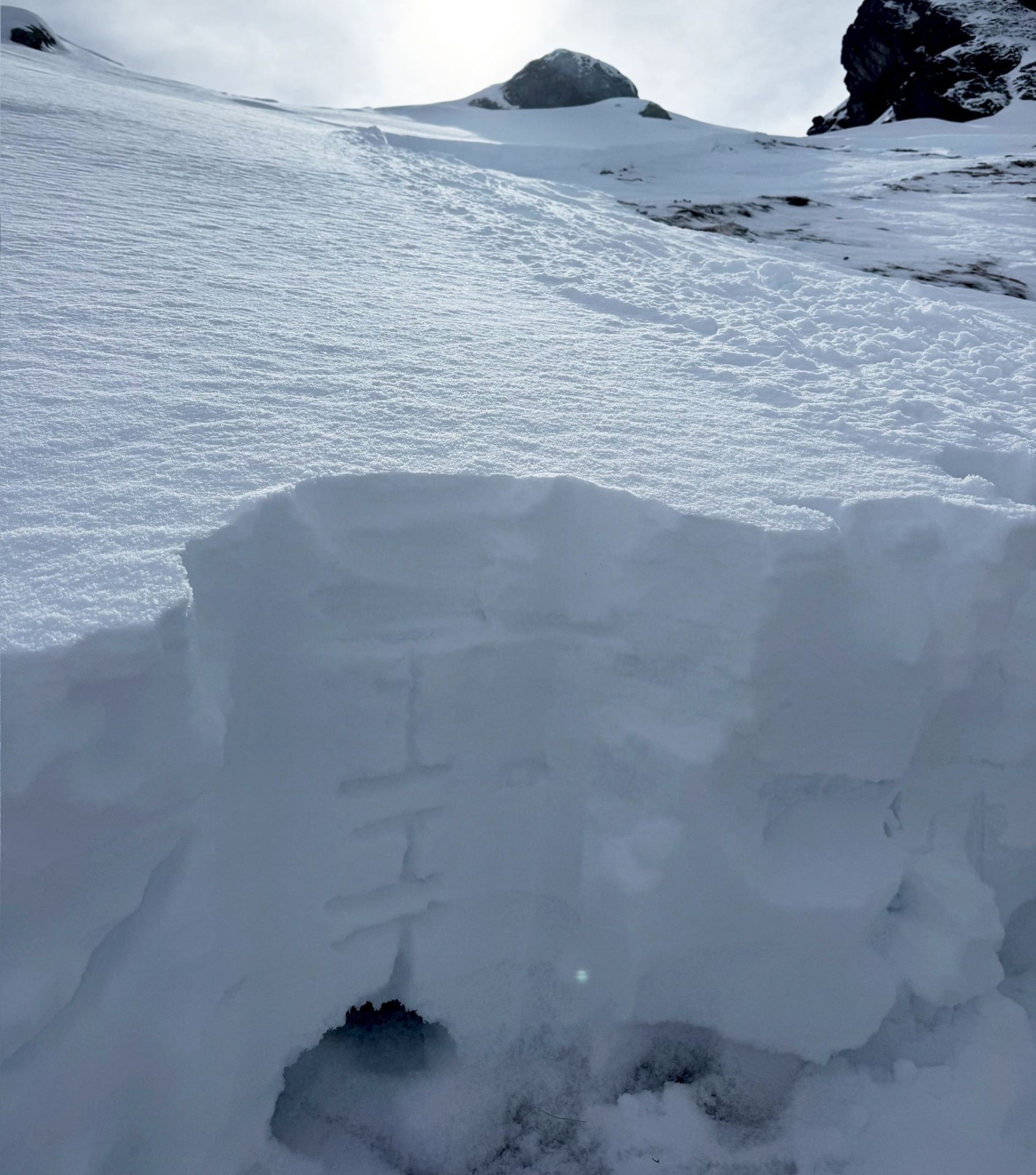
In this Profile from the Hohe Warte in the Tux Alps a fracture in the stability test was initiated by a faceted weak layer and the fracture subsequently propagated. This weak layer formed because of Danger Pattern 4, cold on warm, between the moistened, warmed snowpack surface and the cold fresh snow which was deposited on top of it.
Not persistent, short-lived weak layers
Not persistent weak layers inside the fresh snow and fresh snowdrifts might be soft layers in the form of graupel or else fresh fallen snow which fell without much wind impact for brief spells. These layers will consolidate quickly over the next few days due to solar radiation and rising temperatures, and then no longer be prone to triggering.
Restraint is imperative on the first fine-weather day
Tomorrow, Wednesday 02.04, will be the first day of beautiful weather following a quite robust period of heavy snowfall. The mountains will entice all comers through the deep snow, particularly to wind-protected shady slopes where there will be good powder. But the avalanche situation requires a high degree of caution on this first fine day. As is often the case in springtime, several avalanche problems and types of avalanches are prominent.
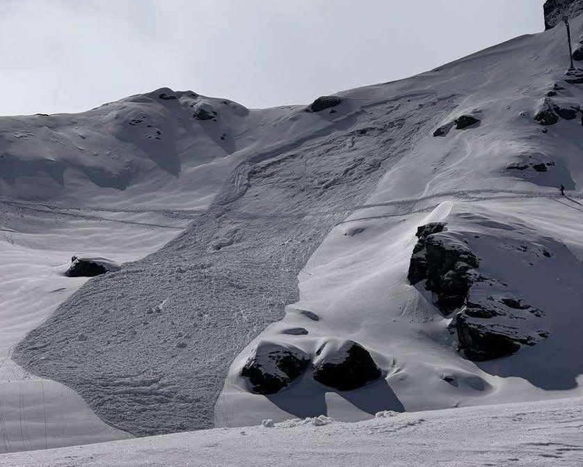
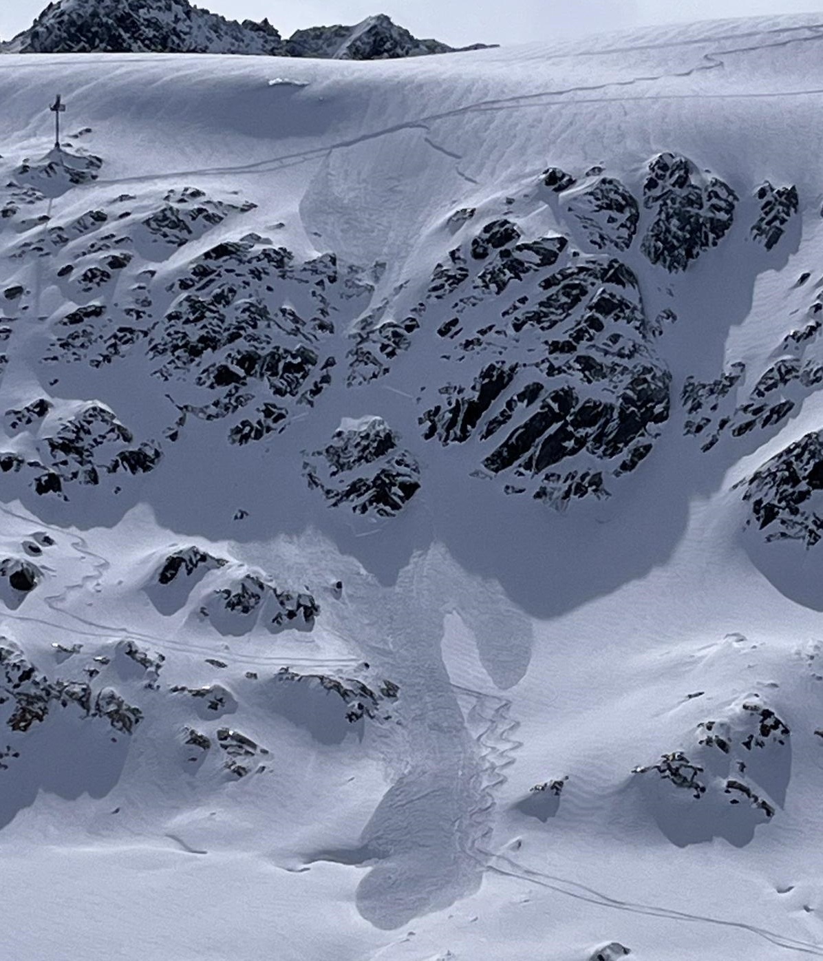
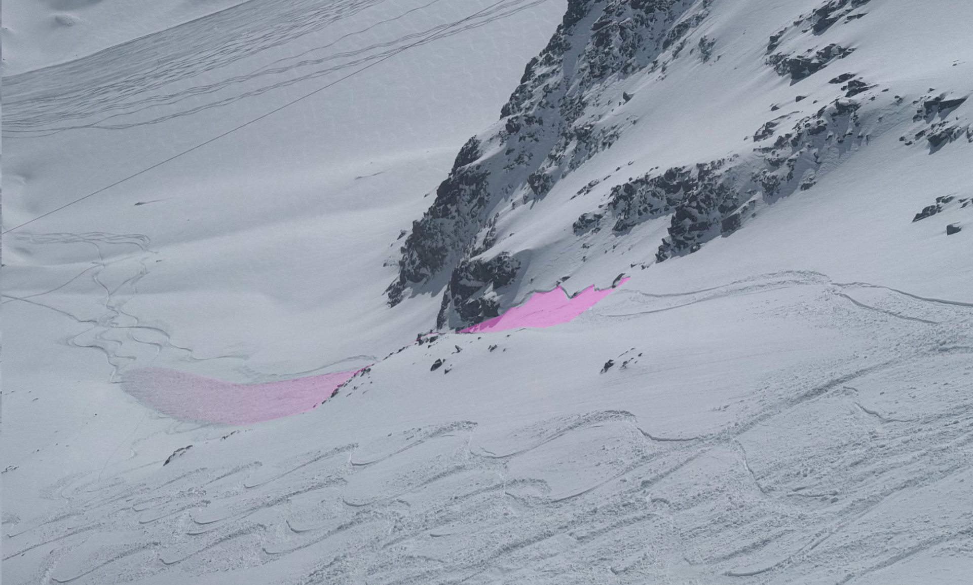
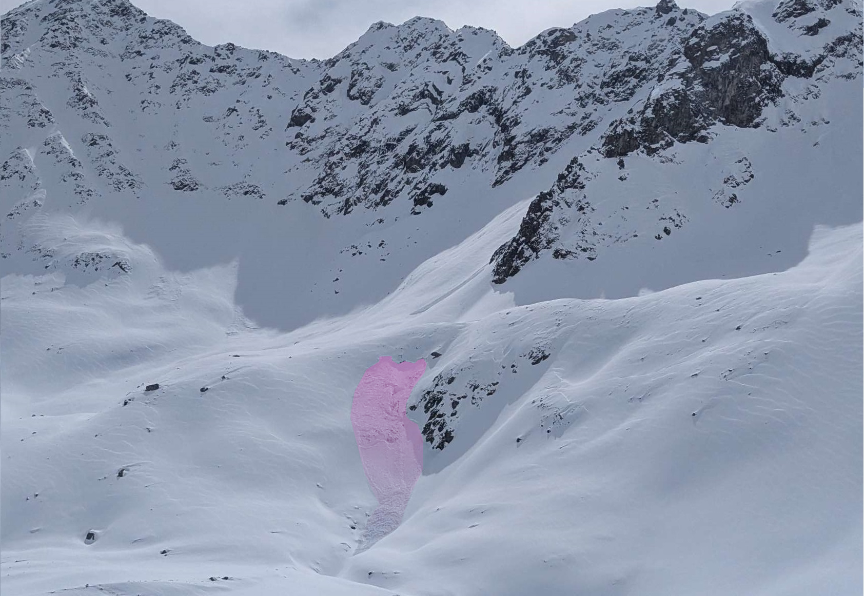
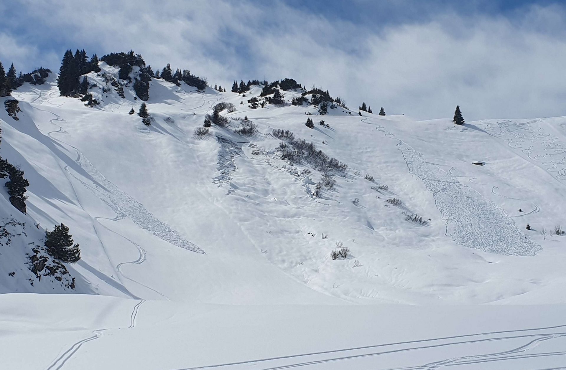
In particular above 2200m and especially on shady slopes (on sunny slopes above 2600m), slab avalanches can be triggered with ease by one single winter sports enthusiast, then grow to medium size, in isolated cases even to large size. Avalanche prone locations are often covered and hard to spot, what’s more, the weak layers referred to above are frequently prone to triggering. Our advice: analyse the overall situation with all five senses, move forward slowly before tackling terrain where consequences could be serious.
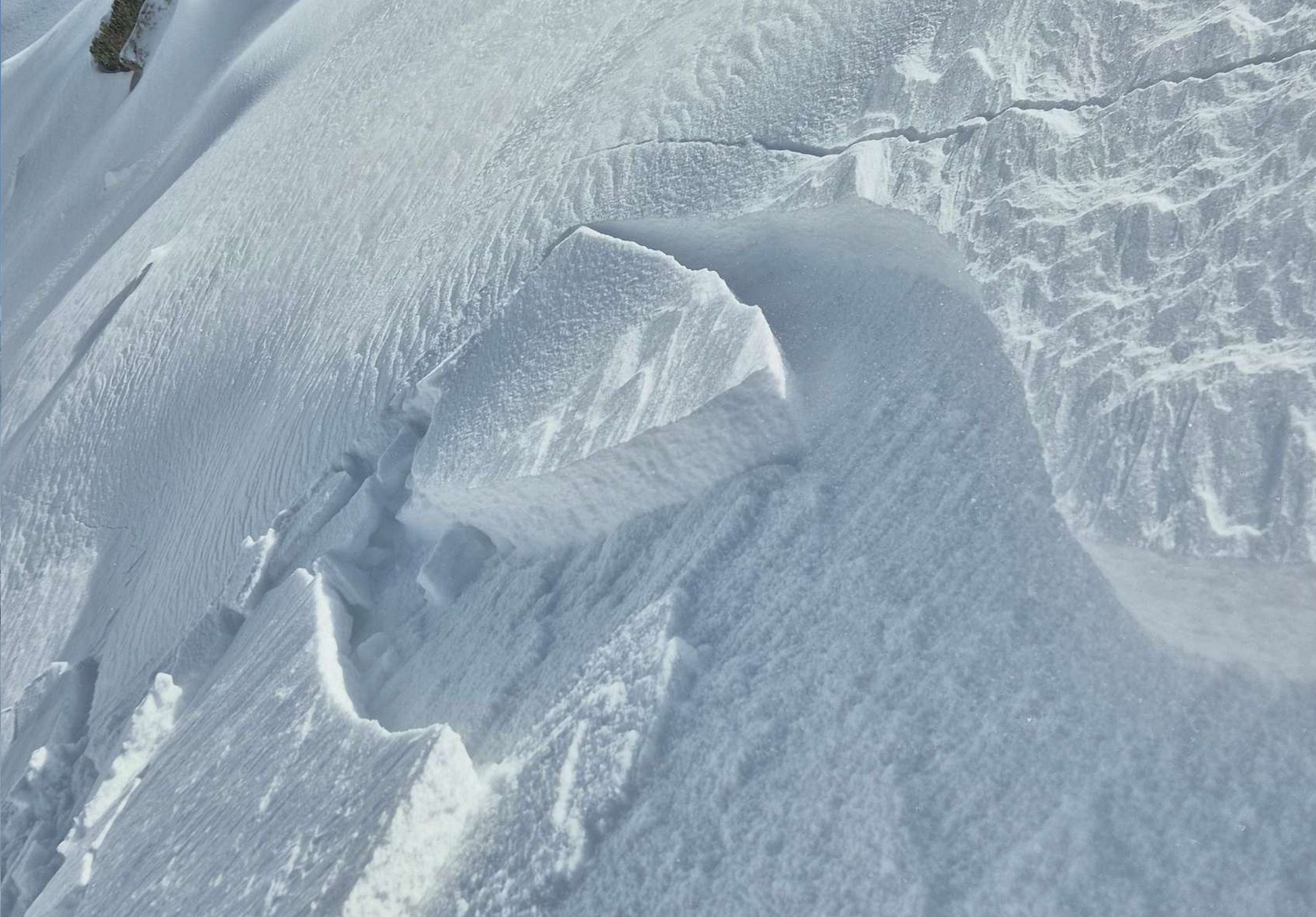
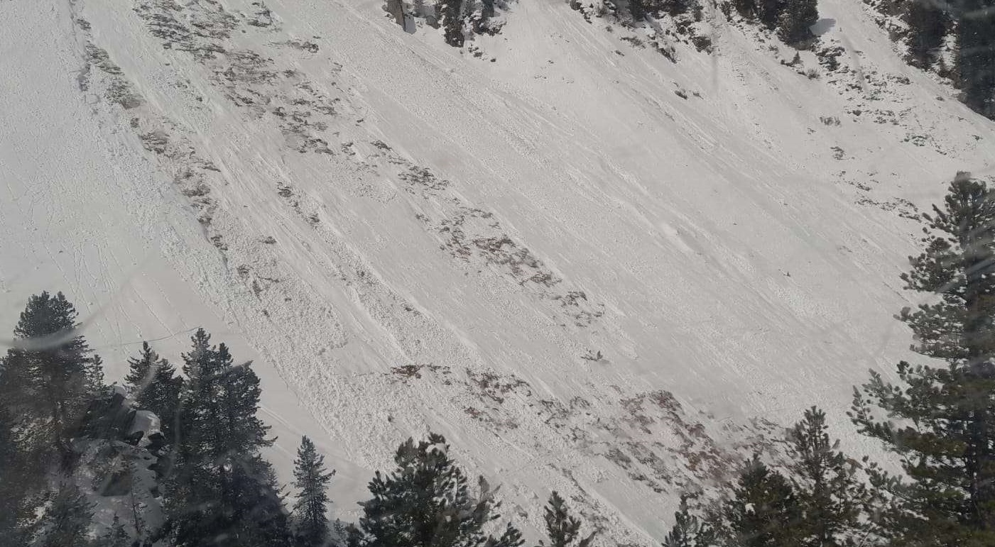
Particularly in the regions were snowfall was heaviest, the danger of naturally triggered avalnches in extremely steep terrain is a serious additional danger. Such avalanche releases can in isolated cases fracture down to more deeply embedded layers of the already wet snowpack, sweep those layers along and thereby grow to dangerously large size.
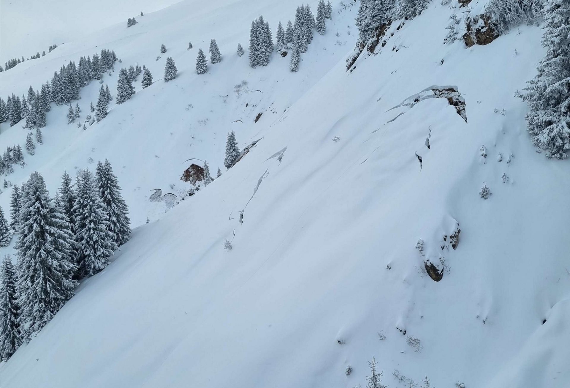
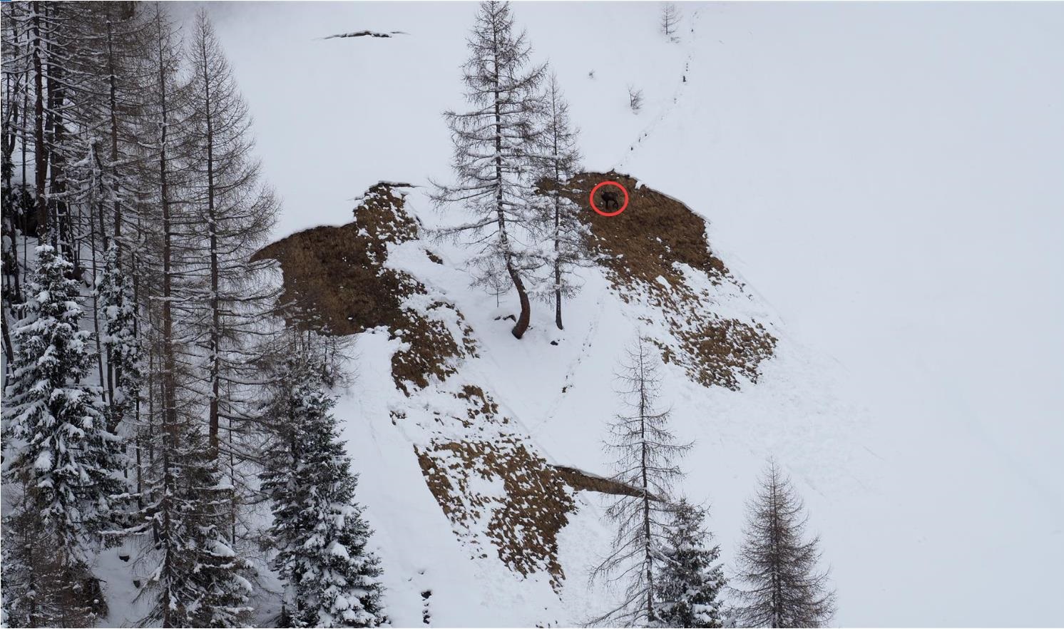
In those regions where snowfall has been heaviest it can be assumed that as the snow settles over the coming few days, gliding snow activity will increase. Particularly where the snow fell on bare ground, numerous small-to-medium sized glide-snow avalanches can be expected. Be sure to avoid all zones below glide cracks.