Lawinenunfall Schalfkogel

Avalanche incident analysis: Schalfkogel, Gurgler Ferner (24.03.2025)

On Monday, 24.03.2025, two persons died in an avalanche below the Schalfkogel in the Gurgler Massif. The release was a small slab that initially swept along three persons over rocky terrain and then buried two of them in a crevice at the edge of the Gurgler glacier. Cause: persistent weak layer.

How it happened

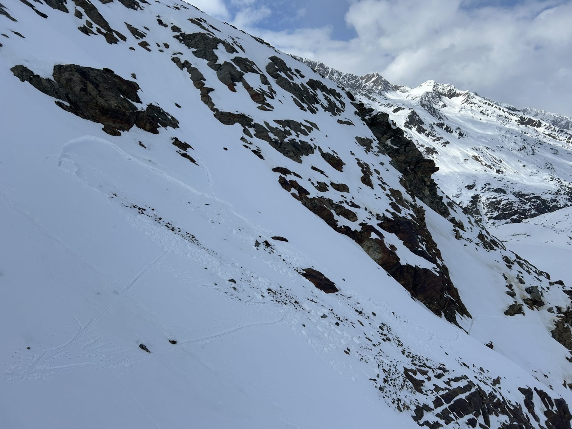
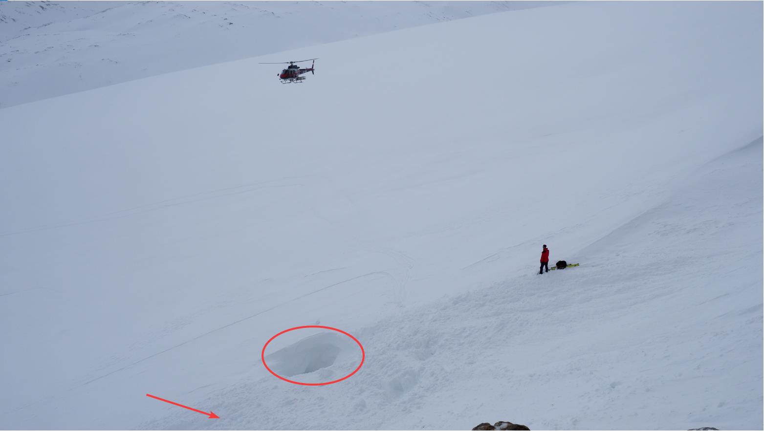
A group of six persons set out from the Langtalereckhütte in the Gurgler Massif to the Martin-Busch-Hütte via the Schalfkogel. As the group ascended (maintaining proper distances from each other) just above the Gurgler Ferner, a small slab avalanche triggered at about 2840m. It caught three persons in the group, plummeting snow masses swept them over rocky terrain. One of the persons escaped with only slight injuries to the orographic left of a crevice at the edge of the glacier. Two persons were swept into a crevice of the Gurgler Ferner and totally buried. These two did not survive, in spite of immediate rescue efforts by their comrades.

Überblicksfoto der Unfalllawine unterhalb des Schalfkogels (© Alpinpolizei, 24.03.2025)
Overview: scene of avalanche incident below the Schalfkogel (© Alpinpolizei, 24.03.2025)

Snowpack analysis

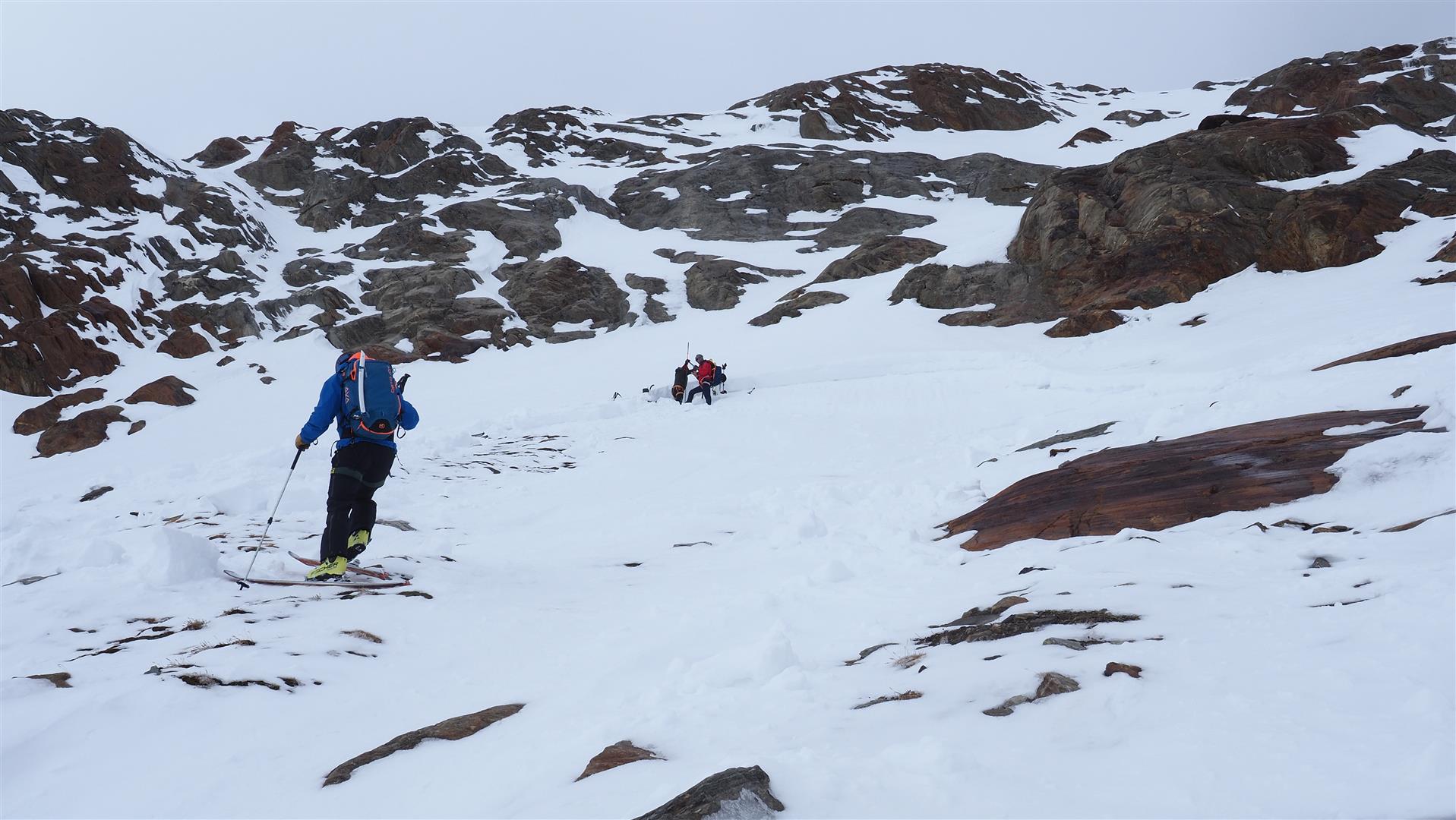
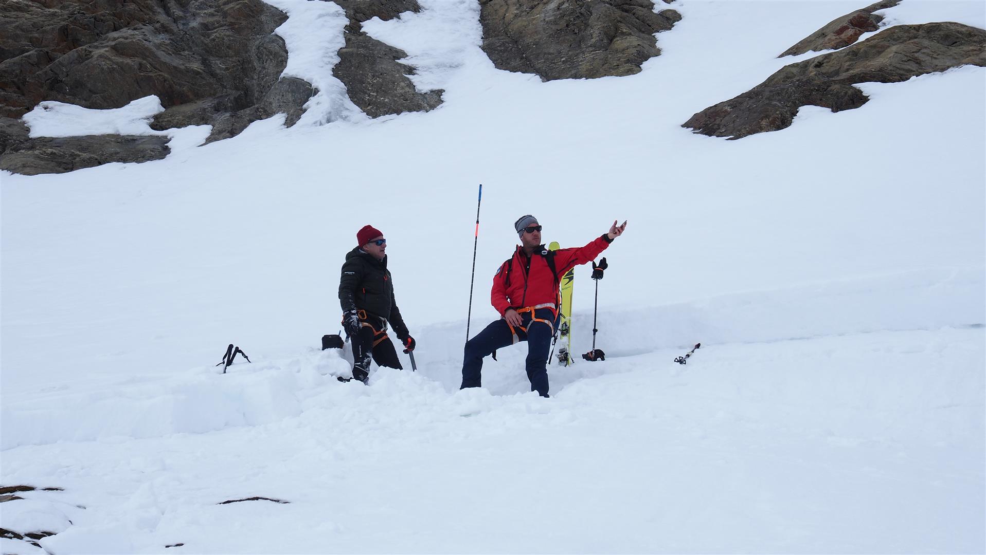
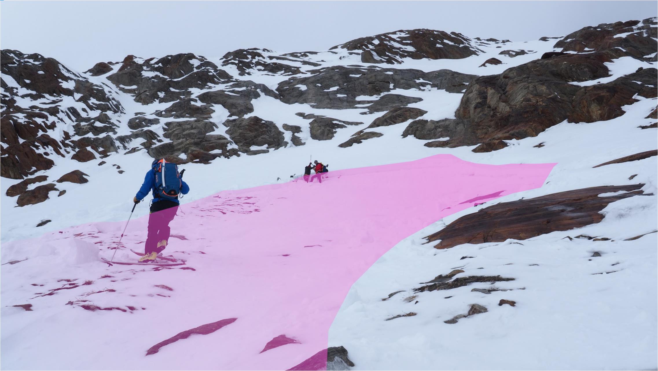
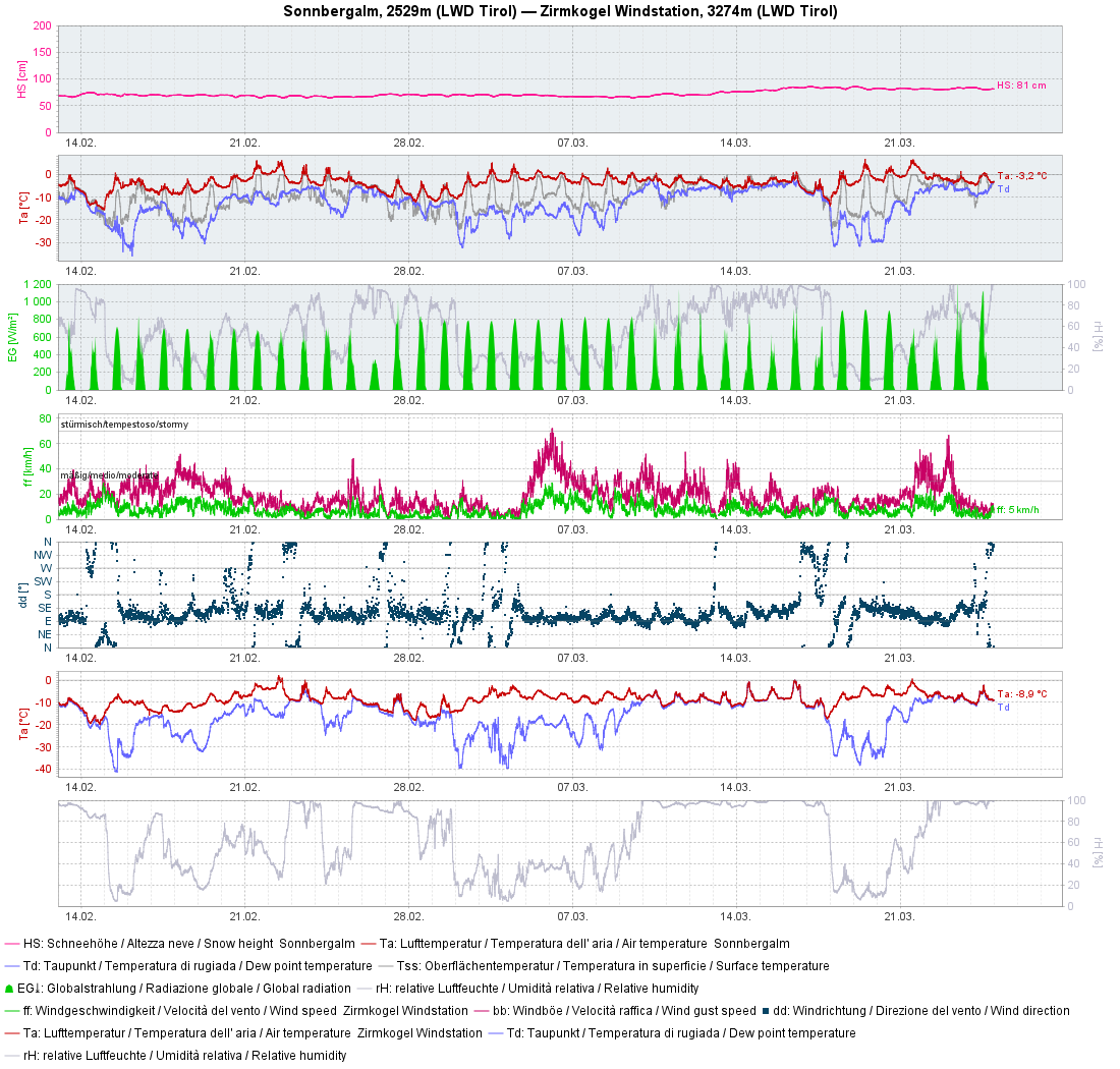
We were flown to the scene of the incident today, 25.03.2025, together with the Alpine Police in order to investigate the background of the avalanche. Our snowpack analysis revealed that a persistent weak layer was the cause of the incident. The snowpack surface that formed on 10.03.2025 served as a slab. Significant weak layers were evident beneath two thin layers of loose, faceted crystals which in turn were covered by thin melt-freeze crusts. These two sequences of faceted crystals plus thin melt-freeze crusts were the result of two minor snowfall events (13-14.02 and 26.02) as well as the subsequent long, dry periods of fine weather.

Wetterstation Sölden: Am 13.02. und 26.02. gab es geringfügigen Niederschlag. Jeweils folgend dominierte stabiles Hochdruckwetter. So bildeten sich durch Strahlungseinfluss und Wärme an den jeweiligen (neuen) Schneeoberflächen dünne Schmelzkrusten, darunter während Strahlungsnächten die kantigen Kristallen. Ab dem 10.03., insbesondere ab dem 14.03. bildete sich dann das Brett oberhalb der Schwachschichten.
Weather station Sölden: the uppermost graph shows the precipitation starting on 13.02.2025. After 14.02 and after 26.02 followed a period of stable high-pressure weather conditions. Due to solar radiation and daytime warmth, melt-freeze crusts formed on each of the newly formed snowpack surfaces on very steep sunny slopes, beneath which faceted crystals formed on nights of outgoing longwave radiation (particularly on east and west-facing slopes). Starting on 10.03, and especially from 14.03, a slab formed atop the weak layers through renewed precipitation.
Die kaum ersichtlichen Neuschneezuwächse ab dem 13.02. samt weiteren Wetterparametern an der Station Sonnbergalm im Nahbereich von Obergurgl.
Barely visible fresh snowfall starting on 13.02 with other weather parameters at Sonnbergalm station near Obergurgl.

We took snow profiles at several different places and also conducted stability tests. The crucial element for possible triggerings and/or complete fracture propagation was a well-formed slab, not evident everywhere.

Snow profile at the avalanche fracture point. A near-surface hardened layer (slab) is visible, beneath which a succession of thin crusts and faceted crystals is depicted. The arrow points to the weak layer which was relevant to the avalanche.
Orographisch links der Lawinenbahn unterhalb des Felsabbruchs wurde dieses Profil erstellt. Dort konnte aufgrund des zu gering ausgeprägten Bretts nur ein unvollständiger Bruch initiiert werden.
This snow profile was taken orographically left of the plummet path beneath the rocks. There, due to the only slightly formed slab, only an incomplete fracture was able to be initiated.

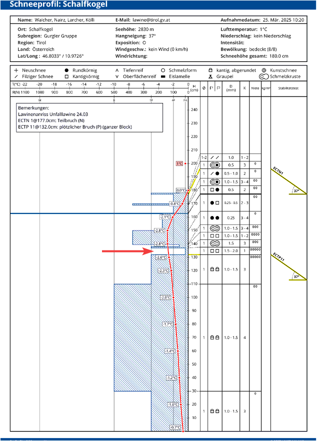
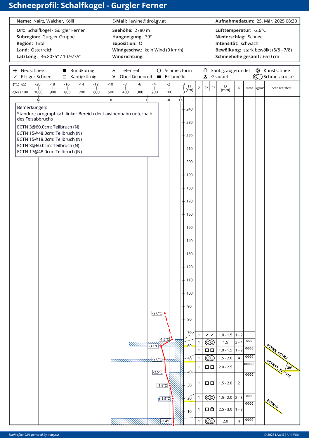
Another profile of the scene as well as snow profiles can be found – here.
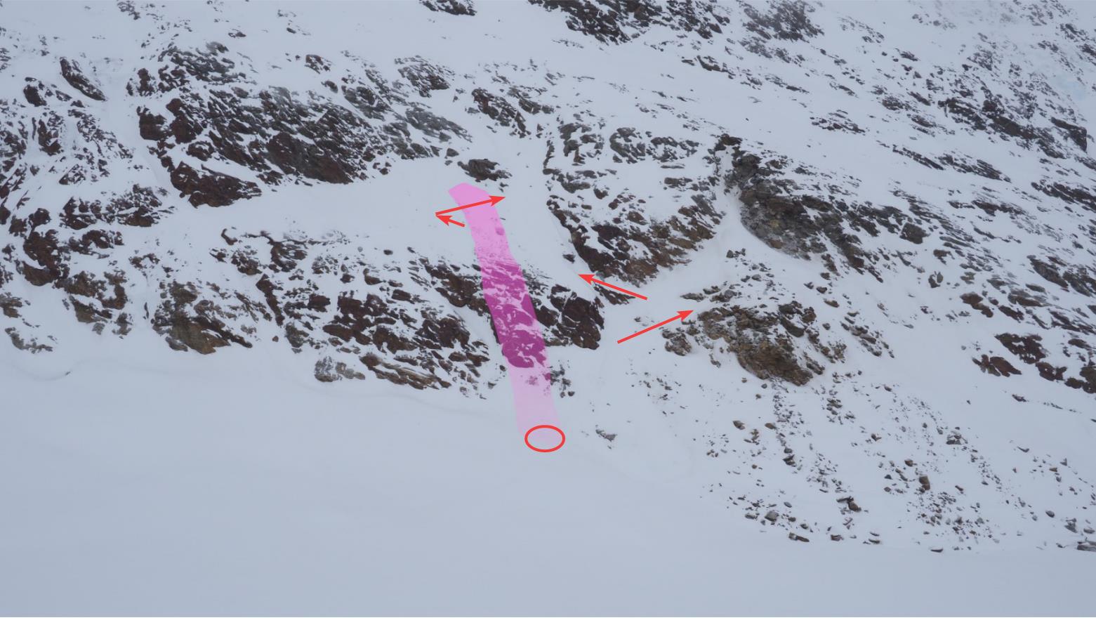
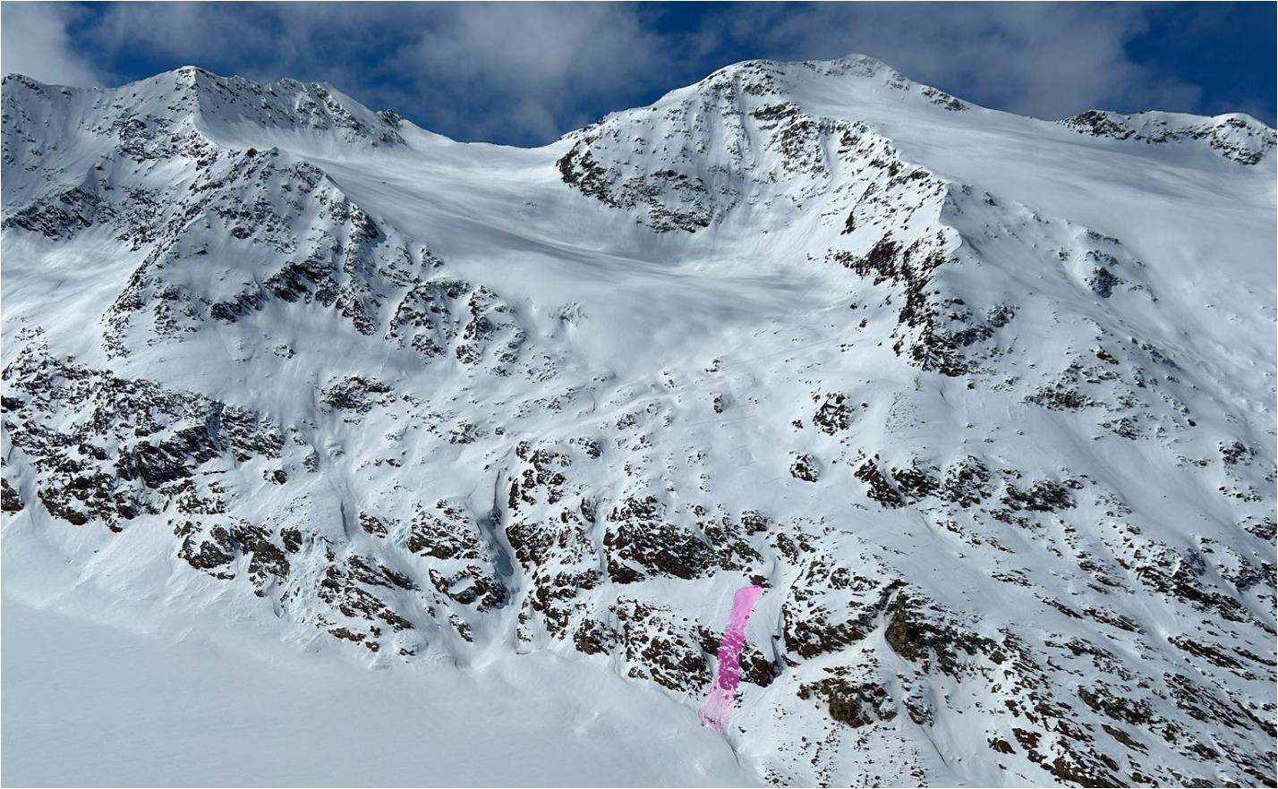
The fatal avalanche

The fatal avalanche was a small slab release. Maximum width was 16 metres, length was 125 metres. The fracture occurred at 2840m, was between 30cm and 60cm high, average fracture depth was 45cm. The slope gradient at the upper ascent track was 35° and faced east. In the avalanche plummet path was a shelf of rocks, and also a 6-metre deep crevice in the avalanche path into which two persons were swept and buried.

Unfalllawine mit Aufstiegsspur (Pfeile) und Verschüttungsstelle (Ellipse). Die Personen befanden sich mit Abständen im Bereich des obersten von links nach rechts verlaufenden Pfeiles. (© LWD Tirol, 25.03.2025)
Fatal avalanche with ascent track (arrows) and spot of burial (ellipse). The persons ascended, with distances kept, near the uppermost arrow from left to right. (© LWD Tirol, 25.03.2025)
Anrissbereich der Lawine samt Aufstiegsspur. Im Vordergrund (vor der Lawine) erkennt man zwei Spuren, die nach unten "bretteln" und somit den Standort zweier, nicht erfasster Personen. Die dritte, nicht erfasste Person befand sich bereits hinter dem Lawinenanriss. (© Alpinpolizei, 24.03.2025)
Fracture zone of the avalanche with ascent track. In foreground (ahead of avalanche) two tracks are visible which move downwards, showing the location of two persons not caught by the plummeting snow masses. The third person not caught in the release was behind the fracture. (© Alpinpolizei, 24.03.2025)
Sturzbahn samt Blick zum Lawinenanriss (© LWD Tirol, 25.03.2025)
Plummet path with view of the avalanche fracture (© LWD Tirol, 25.03.2025)
Am Lawinenanriss (© LWD Tirol, 25.03.2025)
At the avalanche fracture point (© LWD Tirol, 25.03.2025)
Lawinenkegel mit Verschüttungsstellen: Ellipse zeigt die Randspalte und die Verschüttungsstellen der zwei Lawinenopfer. Pfeil zeigt die Verschüttungsstelle der leicht verletzten Person. (© LWD Tirol, 25.03.2025)
Avalanche overview with points of burial: ellipse shows crevice and burial points of two avalanche victims. Arrow shows burial point of slightly injured person. (© LWD Tirol, 25.03.2025)