Treacherous persistent weak layer – On weekend southerly air-current full of moisture

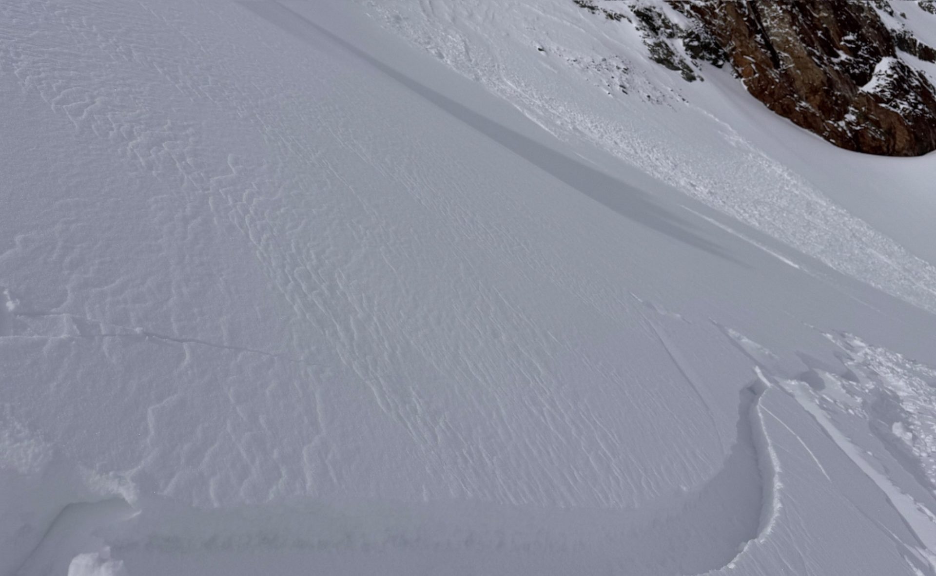
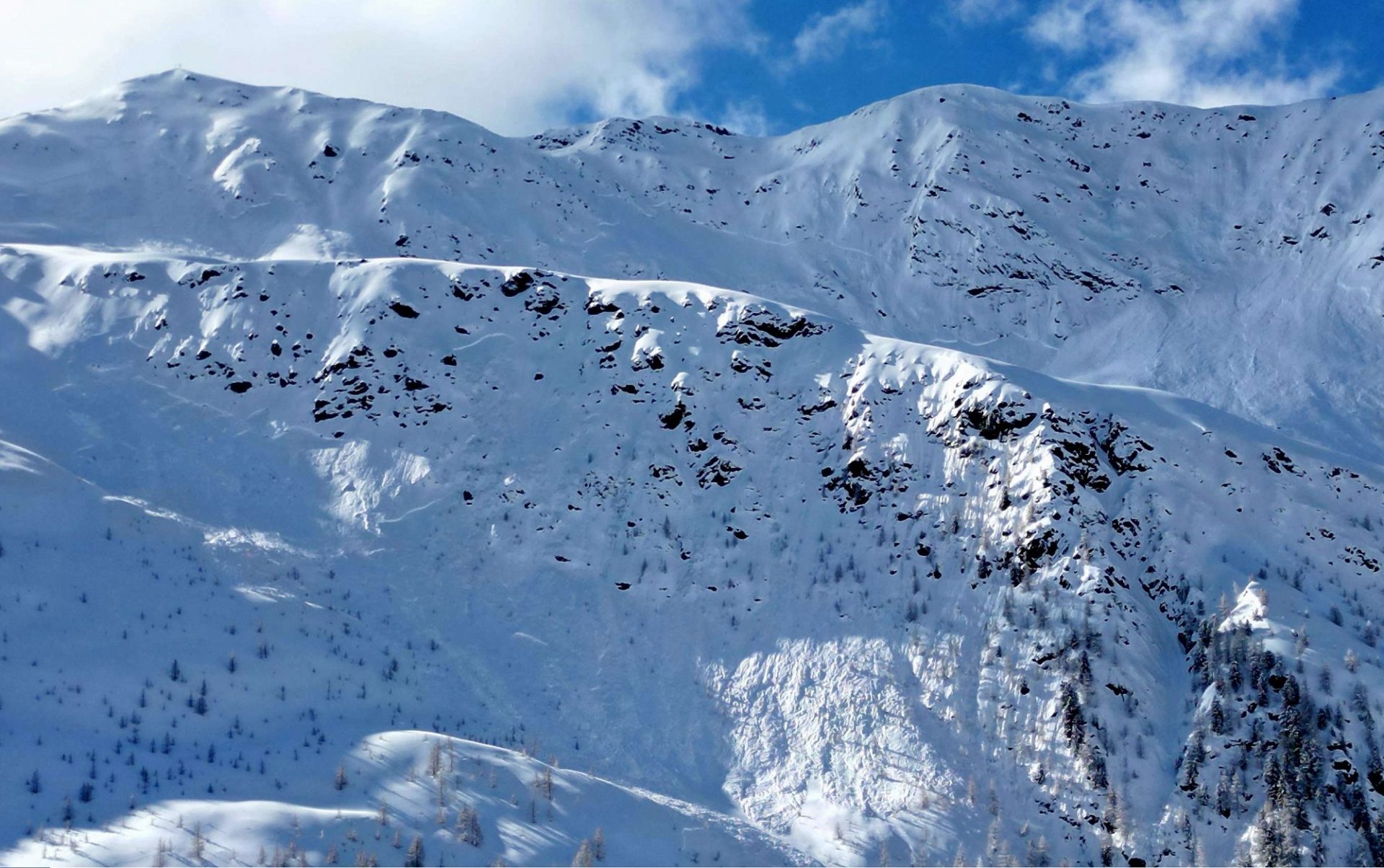
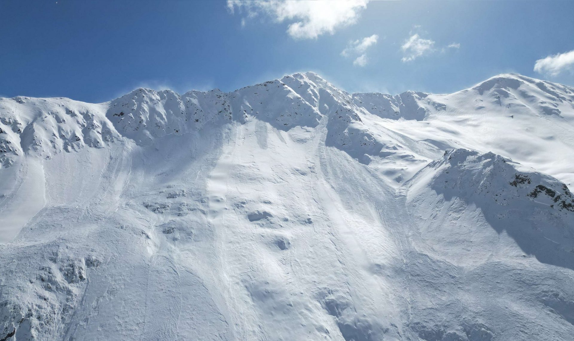
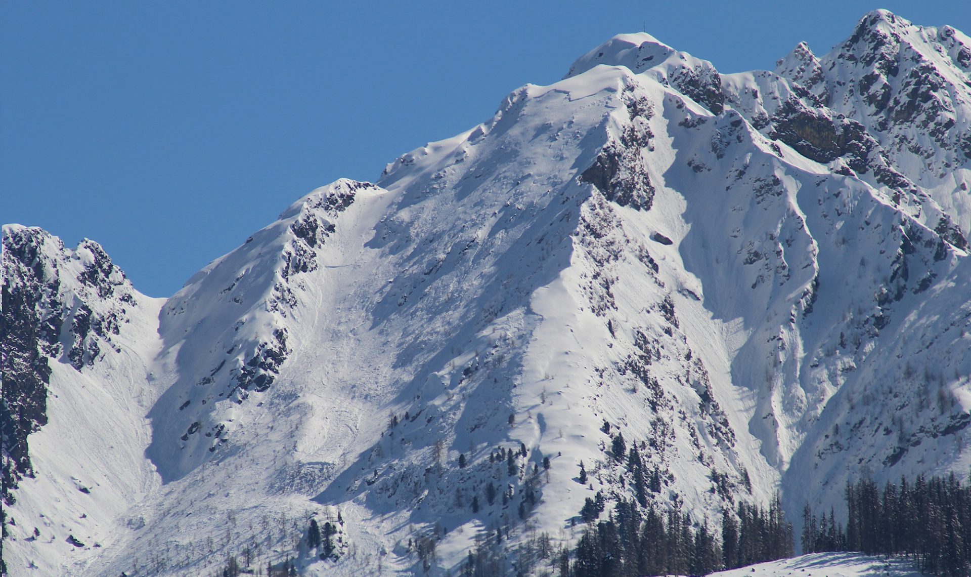
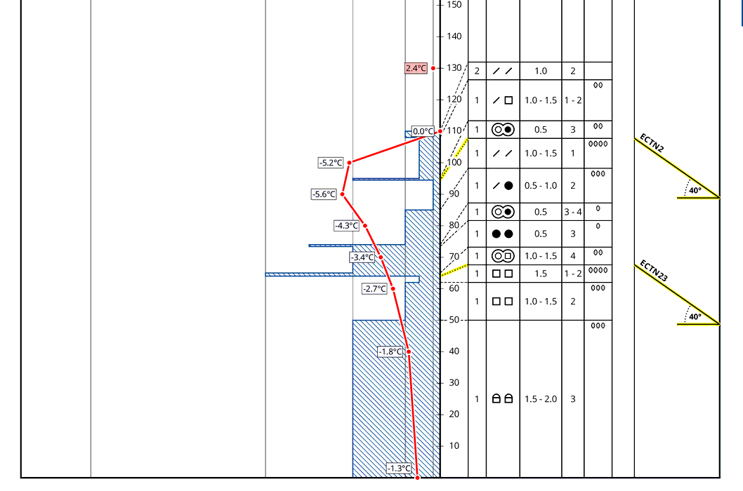
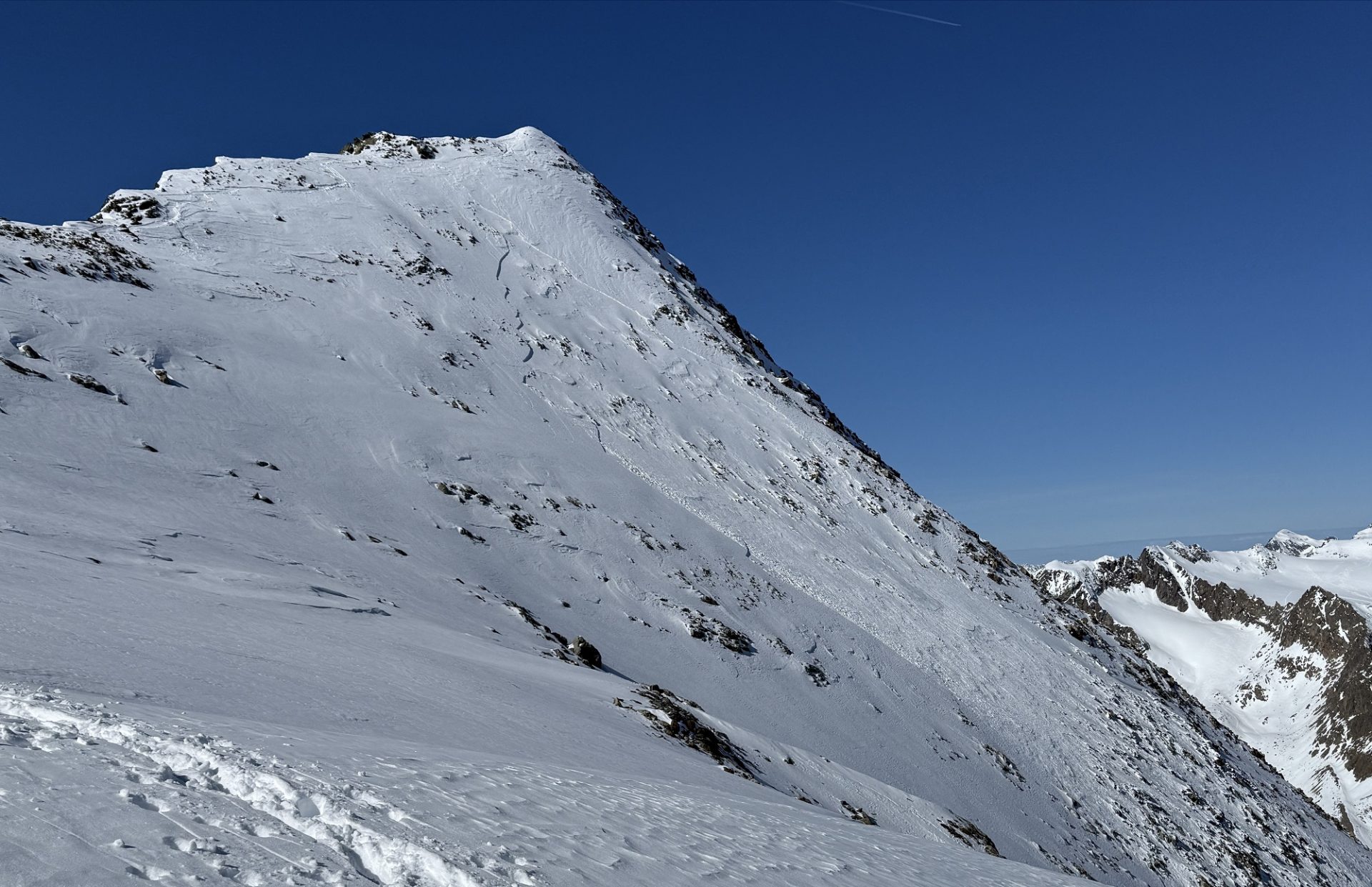
Particularly on the Main Alpine Ridge towards the south, weak old snowpack layers are still prone to triggering. Slab avalanches of medium size can be triggered by one sole person in places. Danger zones are difficult to recognize, they occur esp. in little-tracked, shady steep terrain. Defensive route selection is crucial.

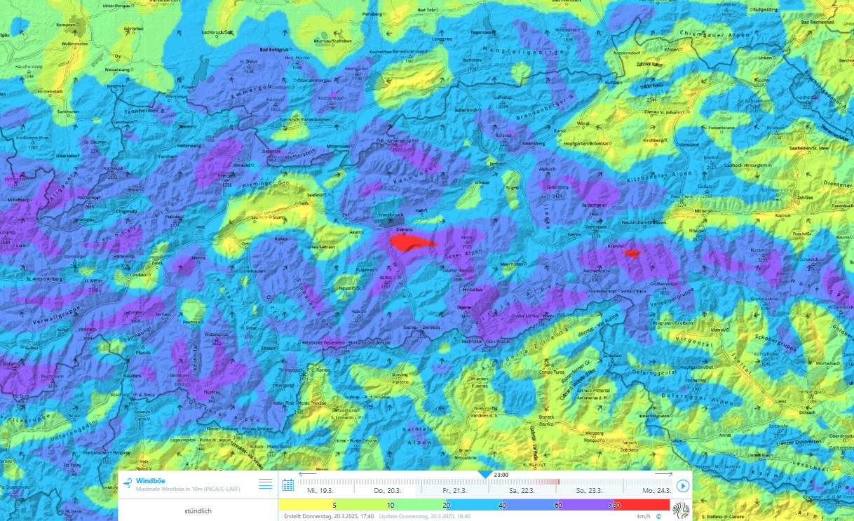
A weak southern barrier cloud front is forecast to start Friday evening, with intensifying southerly foehn wind. On Sunday, minor precipitation expected. Especially in high-alpine regions, fresh snowdrift accumulations will be generated by the winds, moist/warm air will make the snowpack wetter up to the timberline.

Small likelihood – big consequences

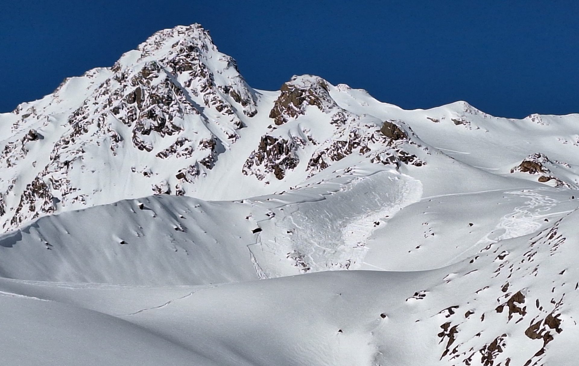
The current situation with regard to the persistent weak layer in the mountains along the Main Alpine Ridge and in particular in East Tirol is most easily summed up with the words “small likelihood – big consequences.” Danger zones for avalanche releases occur seldom, but when a release is provoked, slab avalanches can grow to dangerously large size.

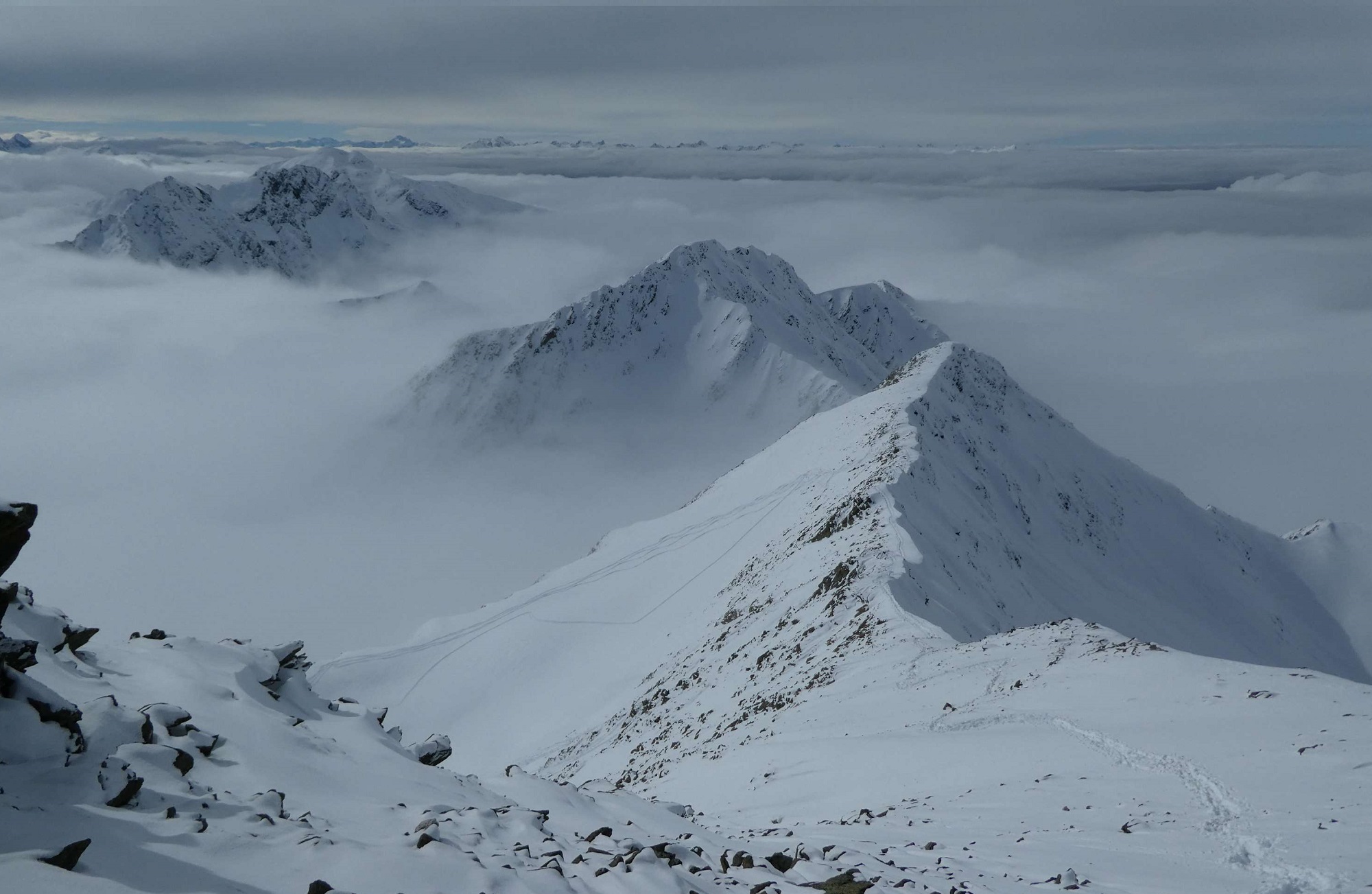
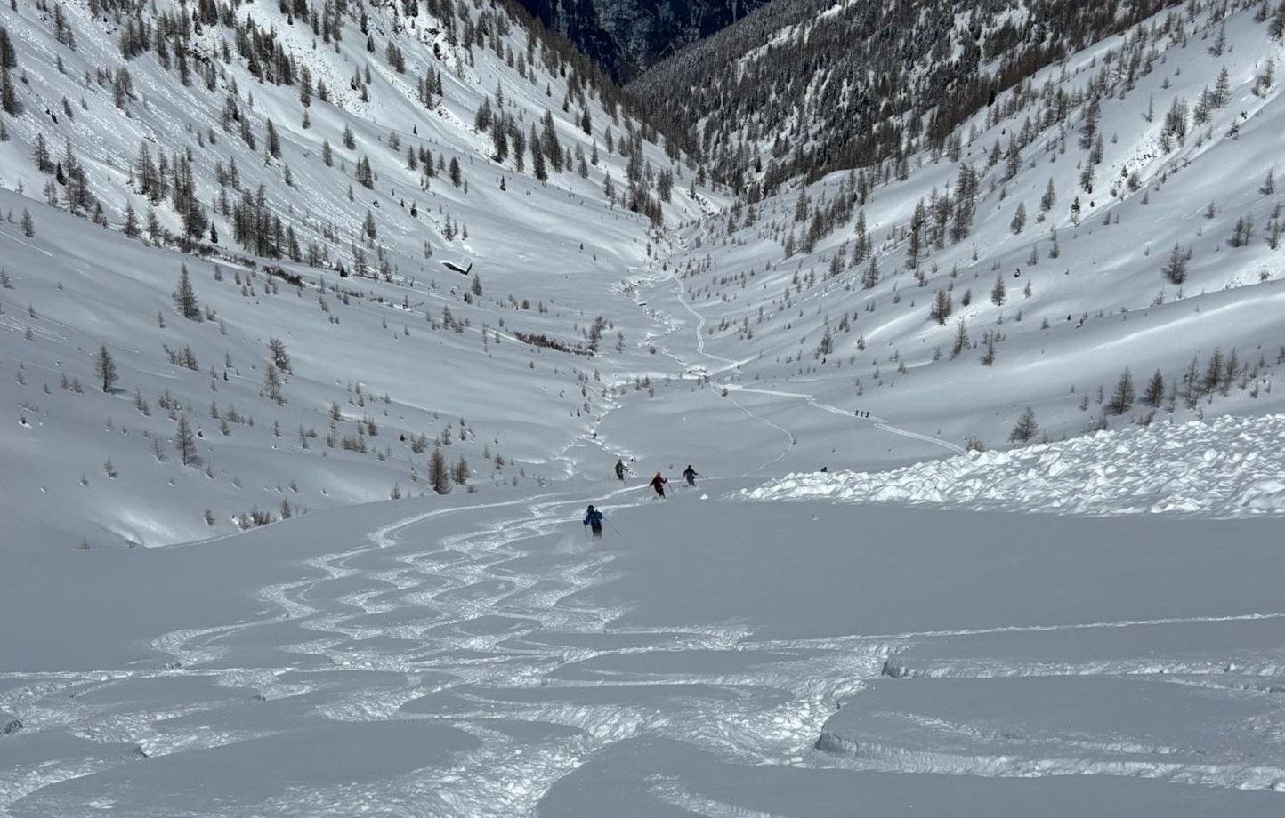
Avalanche prone locations occur especially on steep shady slopes above 2200m. Even for practiced backcountry tourers, these danger zones are difficult to recognize or detect, since the weak layer is often well settled and feels “good” when tracked upon (deeper down it gets harder). Even the well known danger indicators such as settling noises occur seldom. Observations show that a great deal of steep backcountry terrain has been tracked and skied over without any releases occurring. Nevertheless, isolated reports are reaching us of avalanches being triggered by persons, sometimes even remotely triggered.

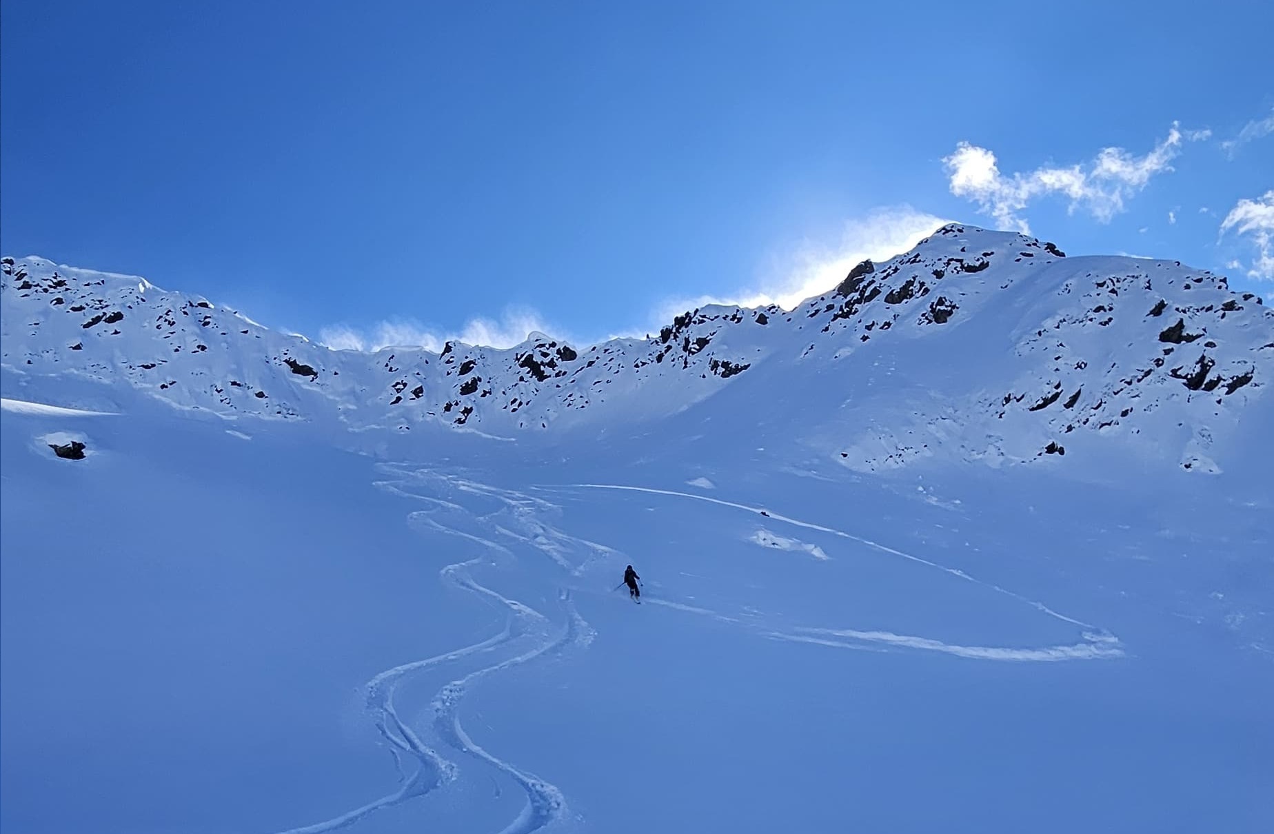
How to tackle the current persistent weak layer problem is quite simple, yet sobering: ONLY through a suitable, defensive route selection can the risks be reduced. Particularly large, shady steep slopes and terrain which conceal landscape traps should for the moment be avoided.

Einzelne Personen können stellenweise noch Schneebrettlawinen im Altschnee auslösen. Mit überlegter Geländewahl können die Konsequenzen eines Abgangs und folglich auch das Risiko deutlich reduziert werden. Im Bild die Auslösung einer kleinen Schneebrettlawine am vergangenen Montag in den östl. Deferegger Alpen (©Daniel Kleinlercher, 17.03.2025).
Even one sole person can trigger a slab avalanche in the old snow in some places. A well-considered route selection can reduce the chances of triggering a release and thereby reduce the risks. In photo, a small slab avalanche triggered last Monday in the eastern Deferegger Alps. (©Daniel Kleinlercher, 17.03.2025).

Bad weather on the weekend – Heightened avalanche danger in the north           

As of Friday midday a perturbance will bring high-altitude cloud cover and strengthening southerly foehn wind to North Tirol. On Friday night, winds will intensify and generate fresh snowdrift accumulations at high altitudes which will often be prone to triggering, especially on steep shady slopes in high-alpine zones.

Ab Freitagabend, 21.03. legt der Südföhn ordentlich an Stärke zu. An Schattenhängen in der Höhe bilden sich dadurch frische Triebschneeansammlungen.
Starting on Friday evening, 21.03, southerly foehn winds will increase in strength. On shady slopes at high altitudes, fresh snowdrifts will accumulate.
Frische Triebschneeansammlungen, welche sich mit dem Südföhn bilden, werden in der Höhe kurzzeitig leicht auszulösen sein (©Günter Chwojan, 14.03.2025).
Fresh snowdrift accumulations generated by the southerly foehn wind will be easy to trigger for a brief spell. (©Günter Chwojan, 14.03.2025).

The cloud cover on Friday night will have another effect: the snowpack will have reduced outgoing longwave radiation during the nocturnal hours and so cannot form a melt-freeze crust on the softened snowpack surfaces on sunny slopes. Saturday in North Tirol will be pleasant and mild. Thus, the snowpack will continue to moisten, even shady slopes will become moist up to the timberline. While East Tirol will get some precipitation (snowfall level above 2000m) on Saturday, the weather on Sunday will be wet, in fact “laundry-room weather conditions” with a mixture of sunshine, moist air masses and some precipitation (snowfall level 2000m) are forecast. Amounts of precipitation will be minor.

Schneevorhersage bis Montag, 24.03. 07:00 Uhr. Es sind nur unergiebige Neuschneemengen prognostiziert (©Bergfex).
Snow forecast until Monday, 24.03, 07:00. Only minor amounts of fresh snow foreseen. (©Bergfex).
Der Blick auf akkumulierte Neuschneesumme der kommenden 14 Tage verrät, dass es auch in der kommenden Woche eher wechselhaft weitergeht (©GeoSphere Austria).
View of accumulated fresh fallen snow over the next 14 days shows highly variable conditions will continue. (©GeoSphere Austria).

Heightened avalanche activity last weekend

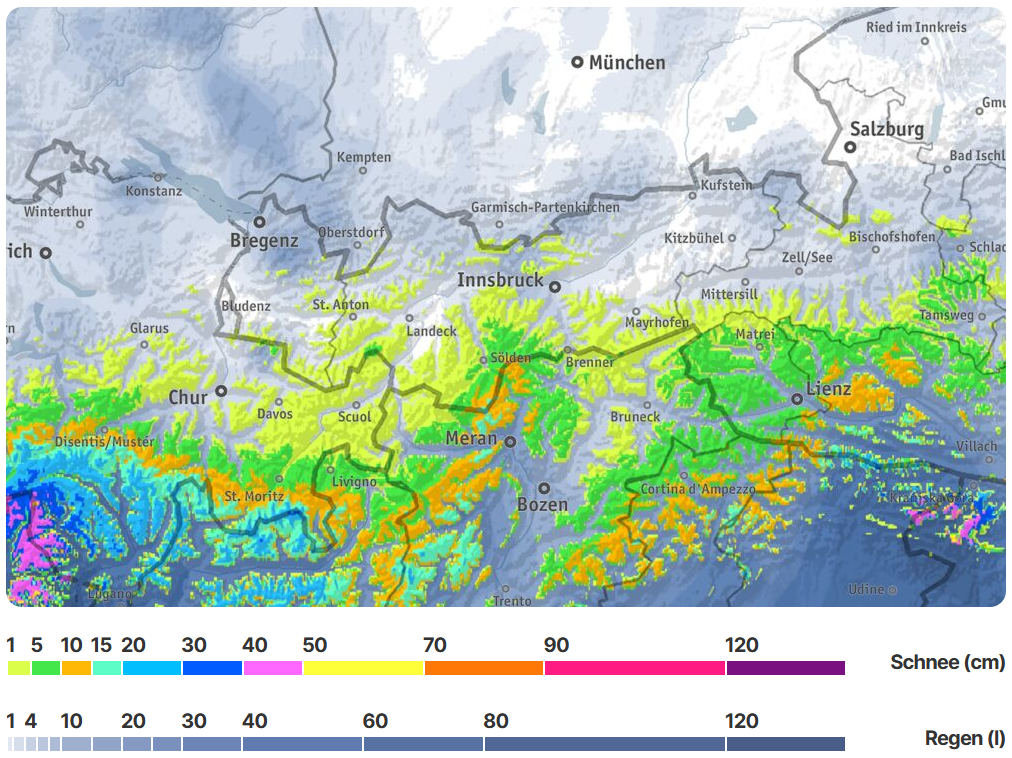
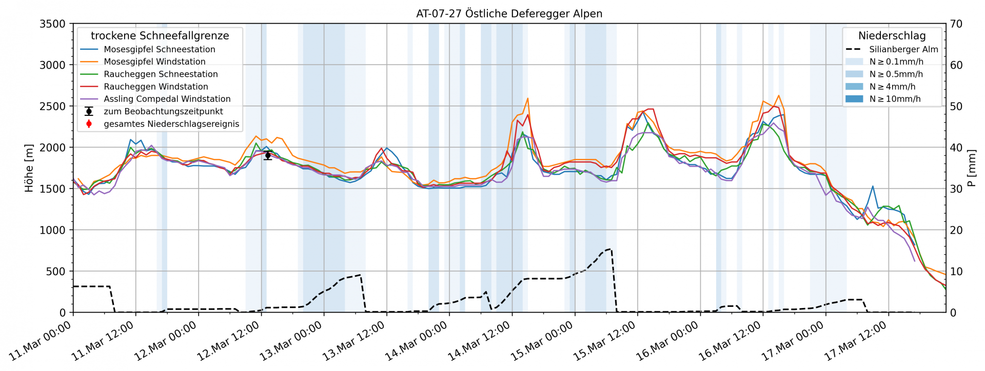
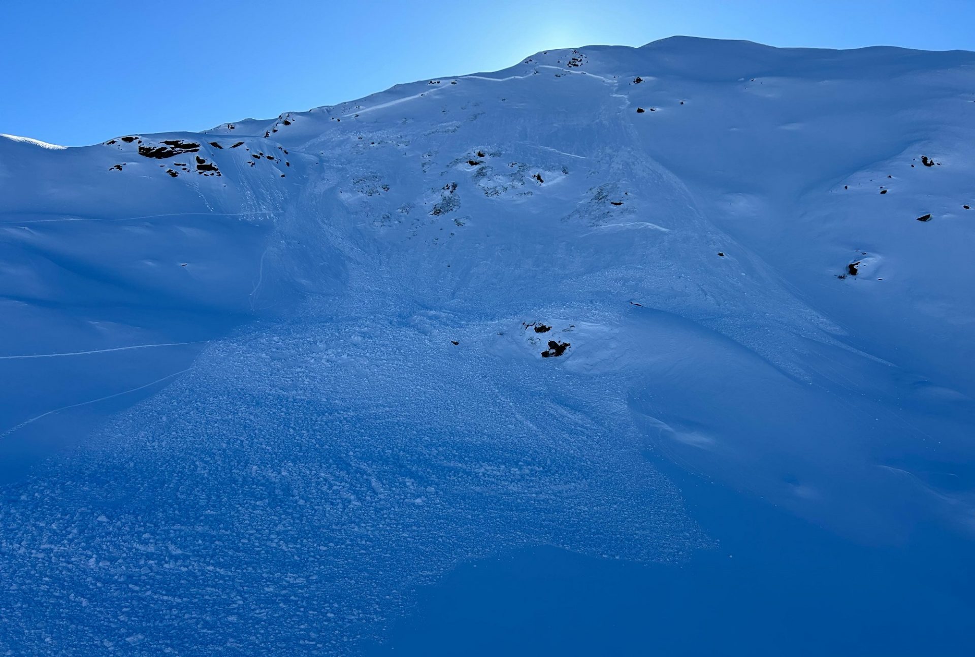
Starting on Wednesday, 12.03, until Sunday, 16.03, a weather front over Italy brought frequently heavy precipitation, especially south of the Main Alpine Ridge. Winds were generally light-to-moderate. The snowfall level diverged far from the forecast levels.

Akkumulierte Niederschlagssumme zwischen Mittwoch, 12.03. und Montag, 17.03. in Millimeter. Zwischen Ötztaler Hauptkamm und den Hohen Tauern sowie südlich davon fielen verbreitet 40 bis 70mm Niederschlag (©GeoSphere Austria).
Accumulated precipitation from Wednesday to Monday (12-17 March) in millimetres. Between the Main Ötztal Ridge and Hohe Tauern, and also south thereof, there was 40-70mm of precipitation registered widespread. (©GeoSphere Austria).
In der Stationsgrafik aus dem Defereggental erkennt man die geringen Windgeschwindigkeiten über den gesamten Niederschlagszeitraum. Zudem interessant ist der Vergleich der Lufttemperaturen zwischen der Schneemessstation auf 2115m (zweite Grafik von oben) sowie der Windmessstation auf 2630m (zweite Grafik von unten): Die Lufttemperatur erreicht während des Niederschlags an beiden Stationen mehrmals die 0°- Grad.
In the graphs from Defereggental, low windspeeds are evident for the entire period of precipitation. In addition, when comparing air temperatures between the measurement station at 2115m (2nd graph from top) and wind measurement station at 2630m (2nd graph from below): the air temperature often reached 0° degrees at both stations during the precipitation.
Die aus Stationsdaten errechnete trockene Schneefallgrenze zeigt für die Östlichen Deferegger Alpen zeitweise Regeneintrag bis gegen 2500m an. Dies deckt sich mit Rückmeldungen unserer Beobachter und liegt rund 800 Höhenmeter oberhalb der prognostizierten Nullgradgrenze.
The snowfall level for dry-snow calculated from the measurement data shows rainfall up to 2500m in the eastern Deferegger Alps. This corresponds to the reports from our observers. The zero-degree level lies 800m above the forecast level.

The warmth in the snowpack generated the formation of a slab which was deposited atop weak, faceted, expansively metamorphosed layers on shady slopes. This resulted in frequently high activity of naturally triggered slab avalanches, even reaching Magnitude 3. The culmination of avalanche activity in East Tirol occurred, according to observers, during the nighttime hours on Saturday and on Sunday (15-16 March). Upon review, this was the highest frequency of naturally triggered avalanches this winter.

Der Schneefall wurde meist nur von wenig Wind begleitet. Im Bild lockerer Pulverschnee auf der Terrasse der Stüdlhütte am Großglockner (©Matteo Bachmann, 14.03.2025).
The snowfall was accompanied by only little wind. In photo, loose powder on the terrace of the Stüdlhütte on the Grossglockner (©Matteo Bachmann, 14.03.2025).
Kleine Schneebrettlawinen am Bösring am Karnischen Kamm zeugen von einer hohen Störanfälligkeit der Schneedecke (©Roland Noichl, 14.03.2025).
Smalll slab avalanches on Bösring on the Carnic Ridge show high trigger sensitivity of the snowpack. (©Roland Noichl, 14.03.2025).
Am Sonntagnachmittag, 16.03. kam es im Skigebiet Kals am Großglockner zu einer spontanen Schneebrettlawine, welche die Piste erreichte und zu einer großangelegten Suchaktion führte. Es kam niemand zu Schaden (©Peter Fuetsch, 16.03.2025).
On Sunday afternoon, 16.03, an avalanche triggered naturally in the Kals ski area on the Grossglockner, even reaching the piste and leading to large-scale search operations. No one was injured. (©Peter Fuetsch, 16.03.2025).
Erst nach Ende der Niederschläge und mit dem Auftrocknen der Luft zeigte sich der Umfang der Lawinenaktivität während der Phasen markanter Erwärmung. Zahlreiche spontane Schneebrettlawinen waren besonders an sehr steilen Schattenhängen zwischen rund 2200 und 2500m auszumachen. Östl. Deferegger Alpen (©Mark Kleinlercher, 17.03.2025).
Not until the precipitation was over and the air masses dried out was the extent of avalanche activity during the warm period revealed. Numerous naturally triggered slab avalanches were evident, particularly on very steep shady slopes at 2200-2500m. Eastern Deferegger Alps (©Mark Kleinlercher, 17.03.2025).
Auch diese Bilder stammen vom hinteren Defereggental. Am Kamm erkennt man Schneefahnen aufgrund des Nordföhns, welcher am 17.03. in Osttirol wehte (©Mark Kleinlercher, 17.03.2025).
These photos are also from the rear Defereggen valley. Visible on the ridge: snow plumes generated by northerly foehn winds on 17.03. (©Mark Kleinlercher, 17.03.2025).
In den Karnischen Alpen zeigte sich ein sehr ähnliches Bild mit großflächigen spontanen Lawinenabgängen in einem sehr ähnlichen Höhen- und Expositionsbereich (©Hansjörg Schneider, 18.03.2025).
In the Carnic Alps, a similar picture with large-scale naturally triggered avalanche releases in much the same aspects and altitudes. (©Hansjörg Schneider, 18.03.2025).
Im flachen schattseitigen Gelände und Abseits der Lawinenablagerungen konnte in den Folgetagen sehr guter Pulverschnee angetroffen werden. Östl. Deferegger Alpen (©Michael Amraser, 17.03.2025)
In flat, shady terrain and distant from the avalanche deposits, good powder snow could be enjoyed in the following days. Eastern Deferegger Alps (©Michael Amraser, 17.03.2025)

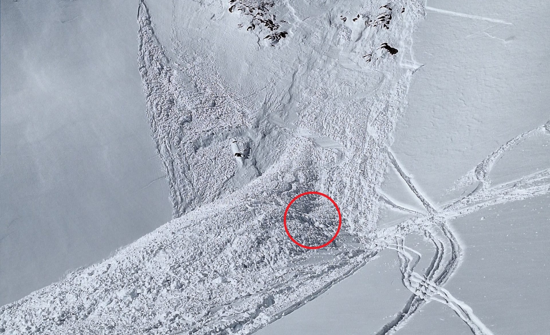
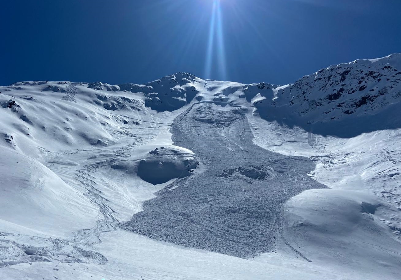
Avalanches triggered by persons in the last few days.

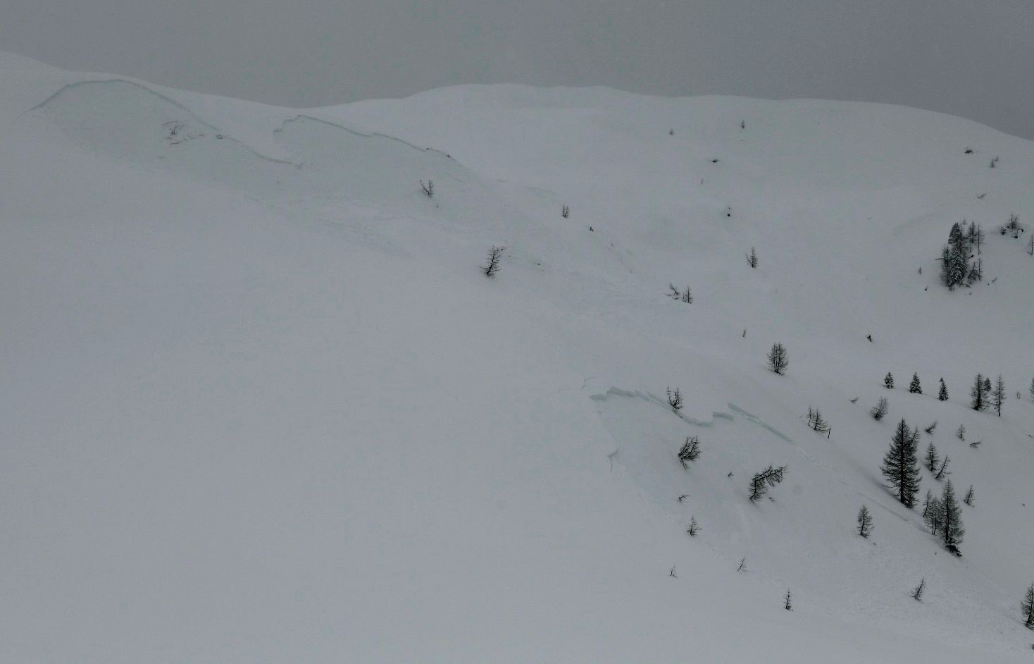
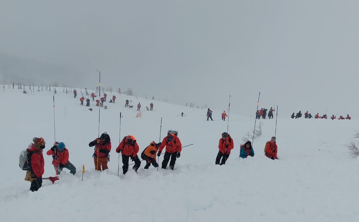
During this last week there were several slab avalanches involving persons. Most occurred in East Tirol and were connected to the persistent weak layer referred to above.

  • 14.03.2025 Ternegg, eastern Deferegger Alps; N, 2300m
  • 15.03.2025 Blankenstein, eastern Deferegger Alps; N, 2300m
  • 16.03.2025 Hauslabkogel, Gurgler Massif; NE, 3070m
  • 19.03.2025 Tscharrknollen Carnic Alps; NE, 2400m
  • 20.03.2025 Hinterbergkofel, eastern Deferegger Alps; N, 2500m
  • 20.03.2025 eastern Seespitze, Sellrain – Alpeiner Berge, NE, 3350m
Am Sonntag, 16.03. wurde diese mittelgroße Schneebrettlawine am Hauslabkogel in der Gurgler Gruppe personenausgelöst. Eine Person wurde im Staubereich der Lawine rund 1,5m ganzverschüttet… (©Alois Mariacher, 18.03.2025)
On Sunday, 16.03, this medium-sized slab avalanche was triggered by a person on the Hauslabkogel in the Gurgler Massif. One person was totally buried (150cm deep) where the avalanche snow masses accumulated… (©Alois Mariacher, 18.03.2025)
…im roten Kreis ist die Verschüttungsstelle erkennbar. Aufgrund sehr effizienter Kameradenrettung konnte die Person rechtzeitig geborgen werden. Die verletzte Person wurde – auch mit Unterstützung weiterer Alpinisten – mithilfe einer Ackja zur Martin-Busch-Hütte abtransportiert (©Alois Mariacher, 18.03.2025).
…the burial spot is visible in the red circle. Due to highly efficient rescue efforts by others, the person was unburied in time. The injured person was, with additional assistance from other mountaineers, transported to the Martin-Busch Refuge with an Ackja. (©Alois Mariacher, 18.03.2025).
Am Mittwoch, 19.03. ereignete sich am Tscharrknollen in den Karnischen Alpen an einem Nordosthang auf 2400m ein Lawinenereignis mit 3 beteiligten Personen. Diese stiegen mit Entlastungsabständen den 35-40 Grad steilen Hang auf und lösten im obersten Bereich eine mittelgroße Schneebrettlawine aus, welche alle drei Personen mitriss. Eine Person konnte den Lawinenairbag aktivieren und blieb an der Schneeoberfläche. Die beiden weiteren Personen wurden teilverschüttet. Alle Personen blieben unverletzt (©Alpinpolizei, 19.03.2025).
On Wednesday, 19.03, an avalanche incident occurred on the Tscharrknollen in the Carnic Alps on a NE slope at 2400m in which 3 persons were involved. They ascended the 35-40 degree steep gradient with sufficient distances between them, triggering a medium-sized slab avalanche in the uppermost part, and were all swept along with the plummeting snow masses. One person was able to activate the avalanche airbag, so remained on the surface. The other two were partially buried in snow masses. All 3 escaped without injuries. (©Alpinpolizei, 19.03.2025).
Das Schneeprofil in der Nähe des Lawinenanrisses, welches am Tag nach dem Unfall aufgenommen wurde, zeigt in einer Höhe von rund 65cm eine Schwachschicht aus kantigen Kristallen, welche Unfallkausal gewesen sein dürfte. Oberhalb der kantigen Kristalle befindet sich eine dünne Kruste, welche von Neuschnee vergangener Woche überlagert ist. Diese Kombination einer persistenten, kantigen Schwachschicht an der Altschneeoberfläche sowie das darüber befindliche Brett des gesetzten Neuschnees ist repräsentativ für das derzeitige Altschneeproblem. Mitunter konnte ein Durchreißen von Schneebrettlawinen in noch tiefere Schichten im Altschnee beobachtet werden.
The snow profile from near the avalanche incident (taken one day after the avalanche) shows at 65cm deep a weak layer of faceted crystals which probably was the cause of the release. Above the faceted crystals is a thin crust blanketed by the fresh fallen snow of last week. This combination of a persistent weak layer on the old snowpack surface and the slab on top of it is representative of the current problem. Moreover, slab avalanches were often seen to fracture down to more deeply embedded layers in the old snow.
Am 20.03. im Bereich des Hinterbergkofels am Staller Sattel an einem Nordhang auf 2500m fernausgelöste Schneebrettlawine. Auch hier war das Altschneeproblem ursächlich. Beim Lawinenabgang wurde niemand erfasst (©Franz Holzer, 20.03.2025).
On 20.03, a remotely triggered slab avalanche near the Hinterbergkofel on the Staller Sattel on a north-facing slope at 2500m. Also here, the persistent weak layer was the cause. No one was caught in the avalanche. (©Franz Holzer, 20.03.2025).
Geringmächtige Schneebrettlawine an der östlichen Seespitze in den Stubaier Alpen. Die Lawine wurde ebenfalls durch Wintersportler fernausgelöst. Hier lagerte Triebschnee im kammnahen extremen Steilgelände auf einer Schicht aus kantigen Kristallen. Solche Gefahrenstellen dürften mit aufkommenden Südföhn am Wochenende etwas häufiger anzutreffen sein (©Niklas Ohnmacht, 20.03.2025).
Small slab avalanche on eastern Seespitze in the Stubai Alps. The release was remotely triggered by winter sports enthusiasts. Above, snowdrifts deposited in extremely steep terrain near the ridgeline atop a layer of faceted crystals. Such danger zones will occur more frequently over the weekend due to the southerly foehn wind. (©Niklas Ohnmacht, 20.03.2025).