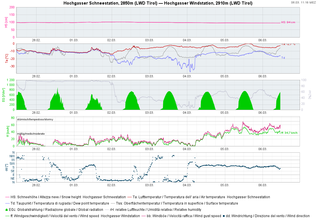
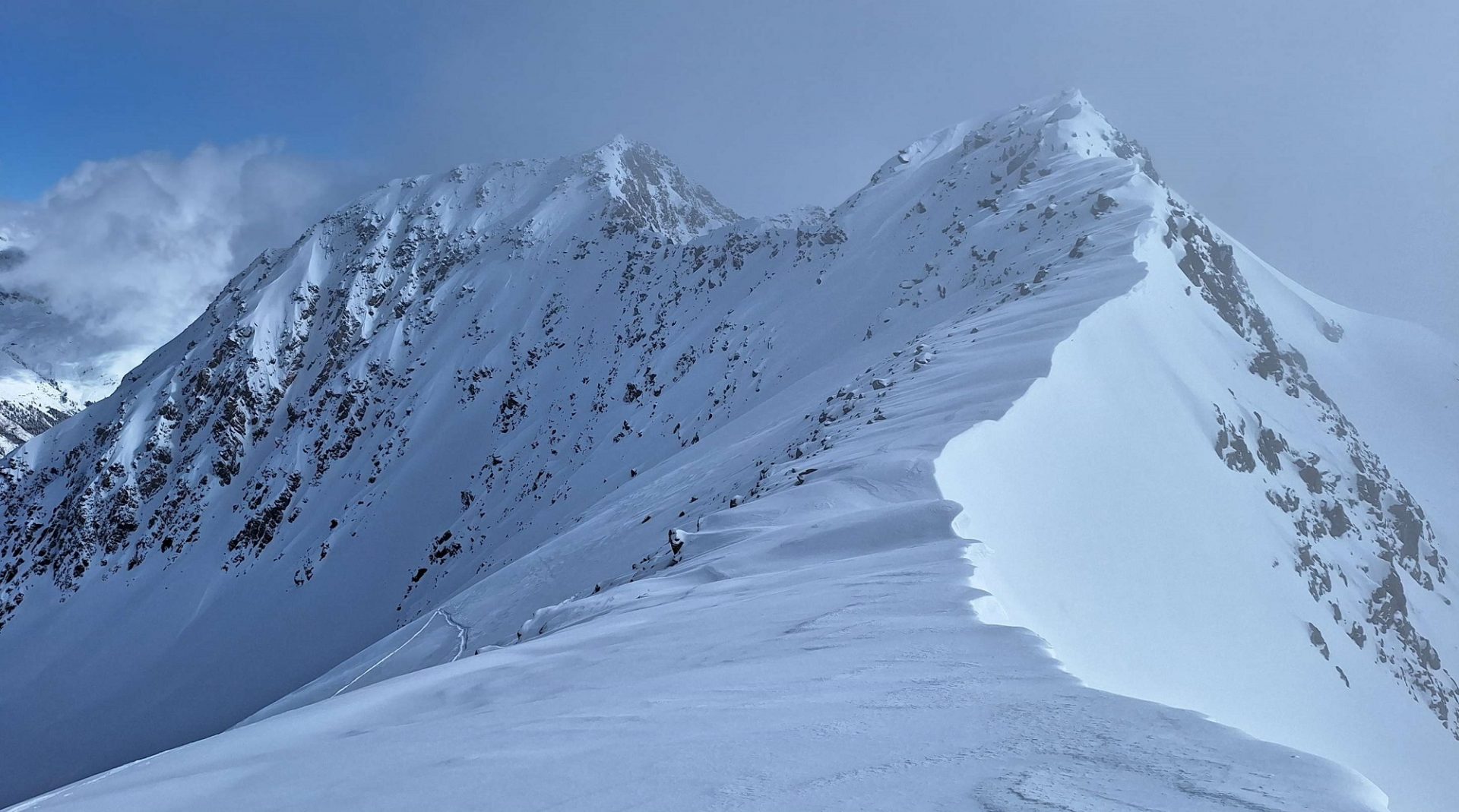
Isolated fresh snowdrifts prone to triggering lie along the Main Alpine Ridge and in the foehn-exposed regions of North Tirol. Danger zones occur esp. on very steep shady slopes, easily recognized. During the course of the day slightly increasing likelihood of wet glide-snow and loose-snow avalanches on extremely steep sunny slopes due to wet snowpack. Heading into the weekend, however, the avalanche situation is generally favorable. Next week will be more variable, even if major precipitation is not in sight.
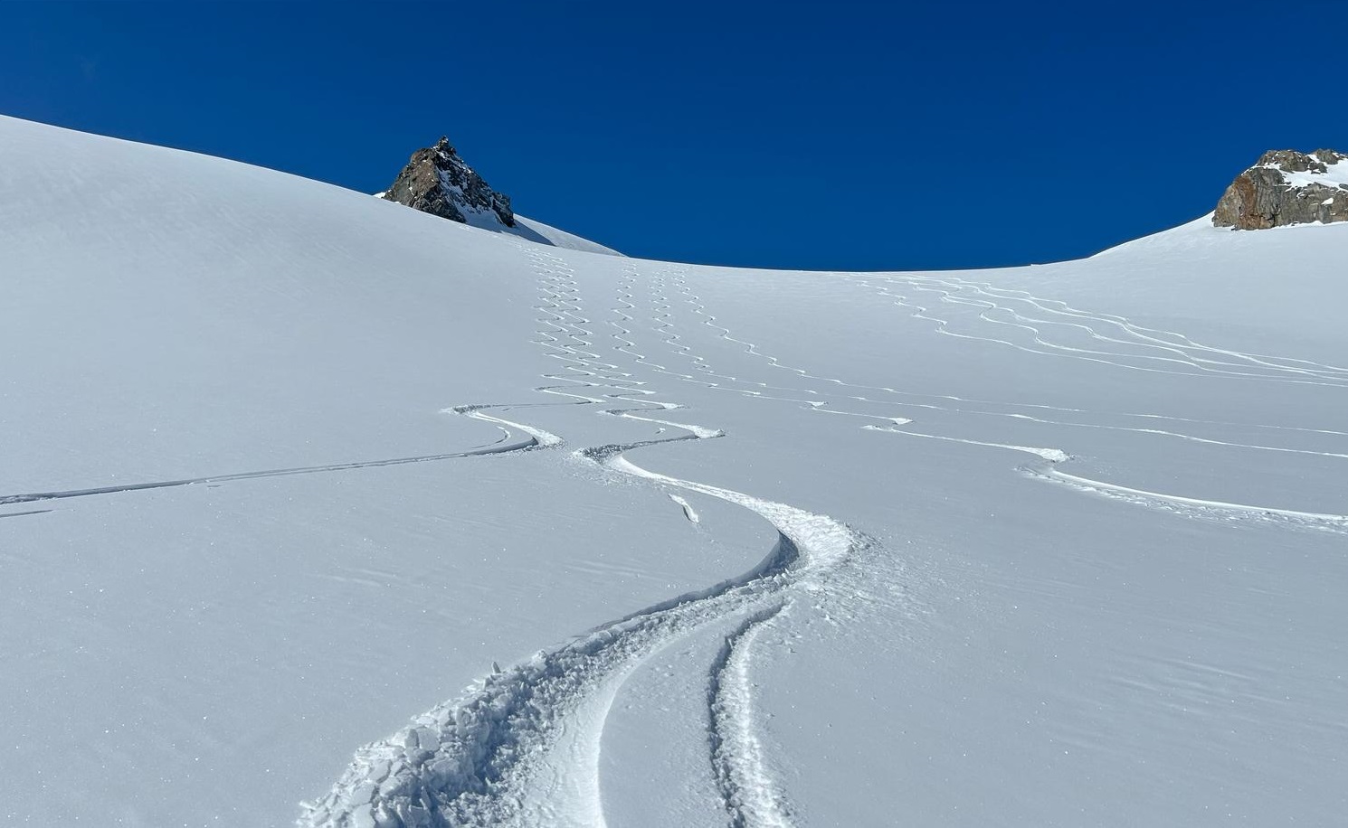
Isolated avalanche prone locations in extremely steep terrain
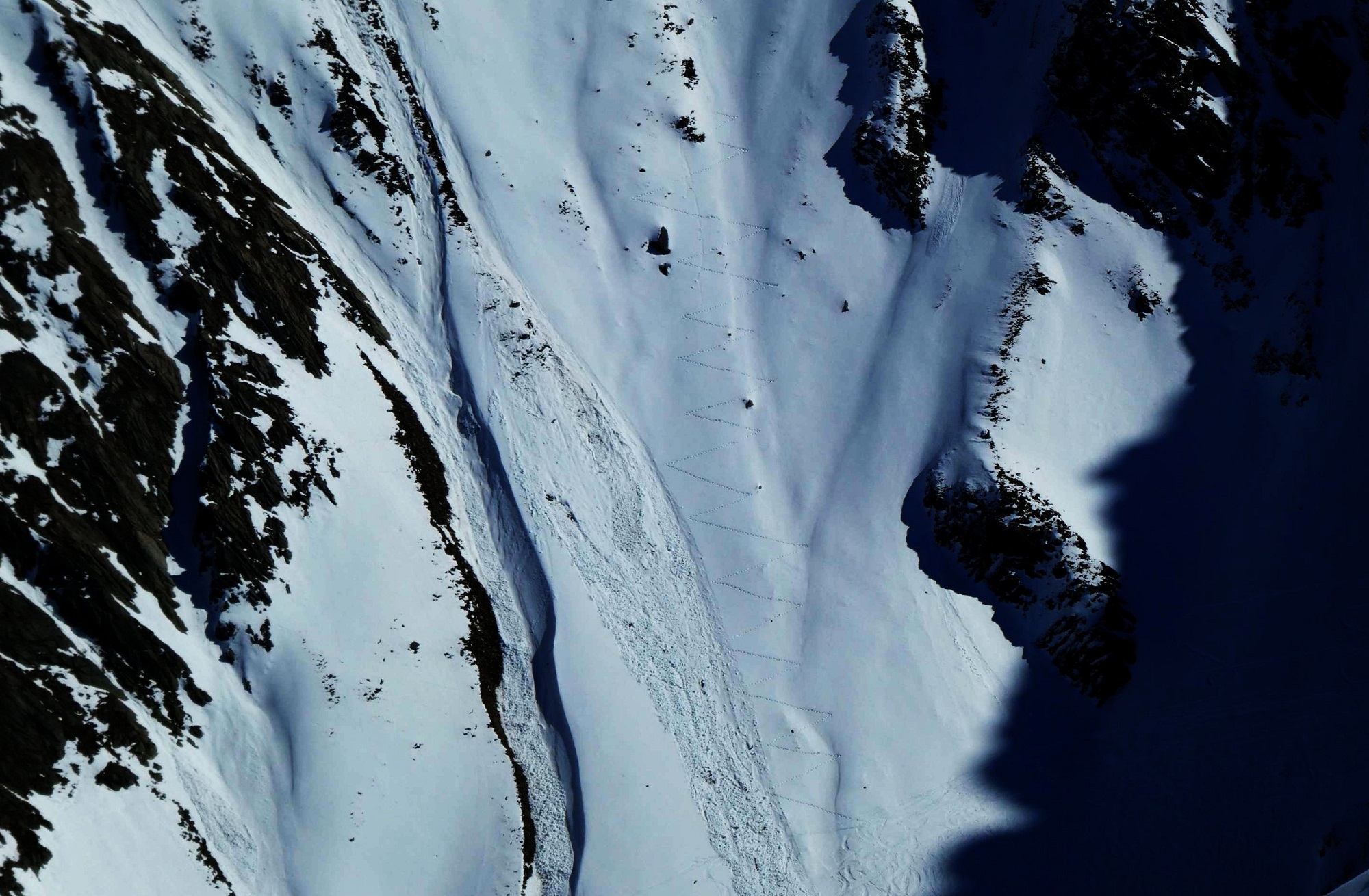
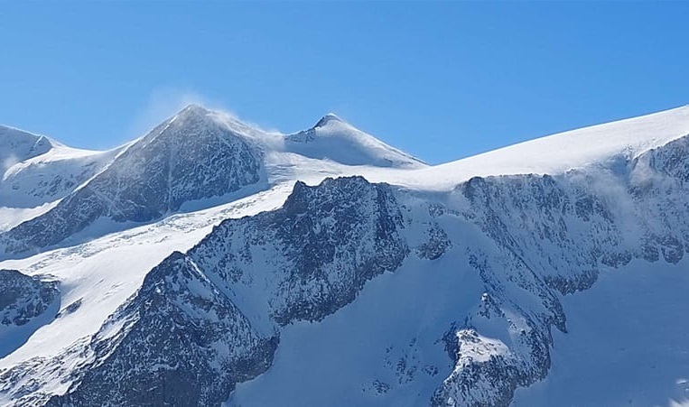
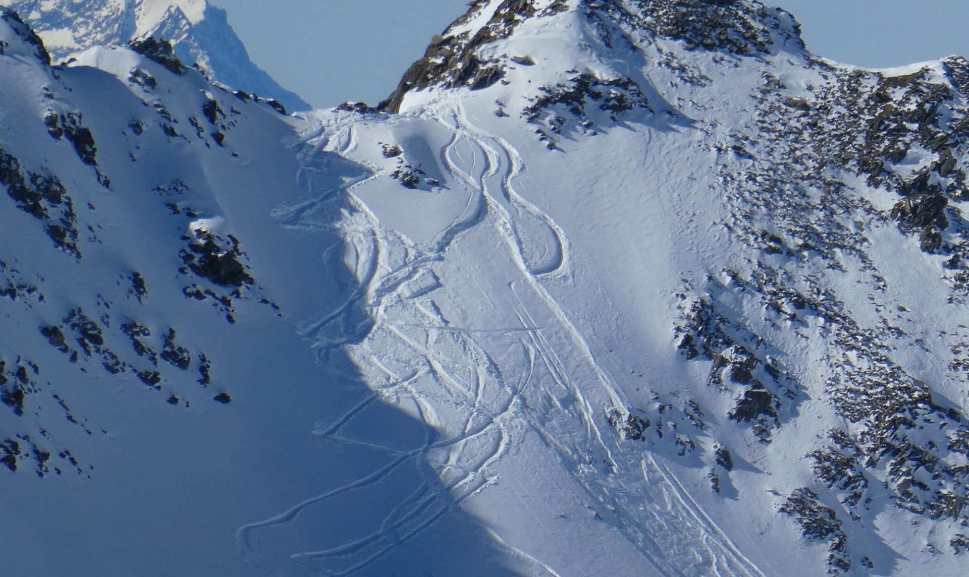
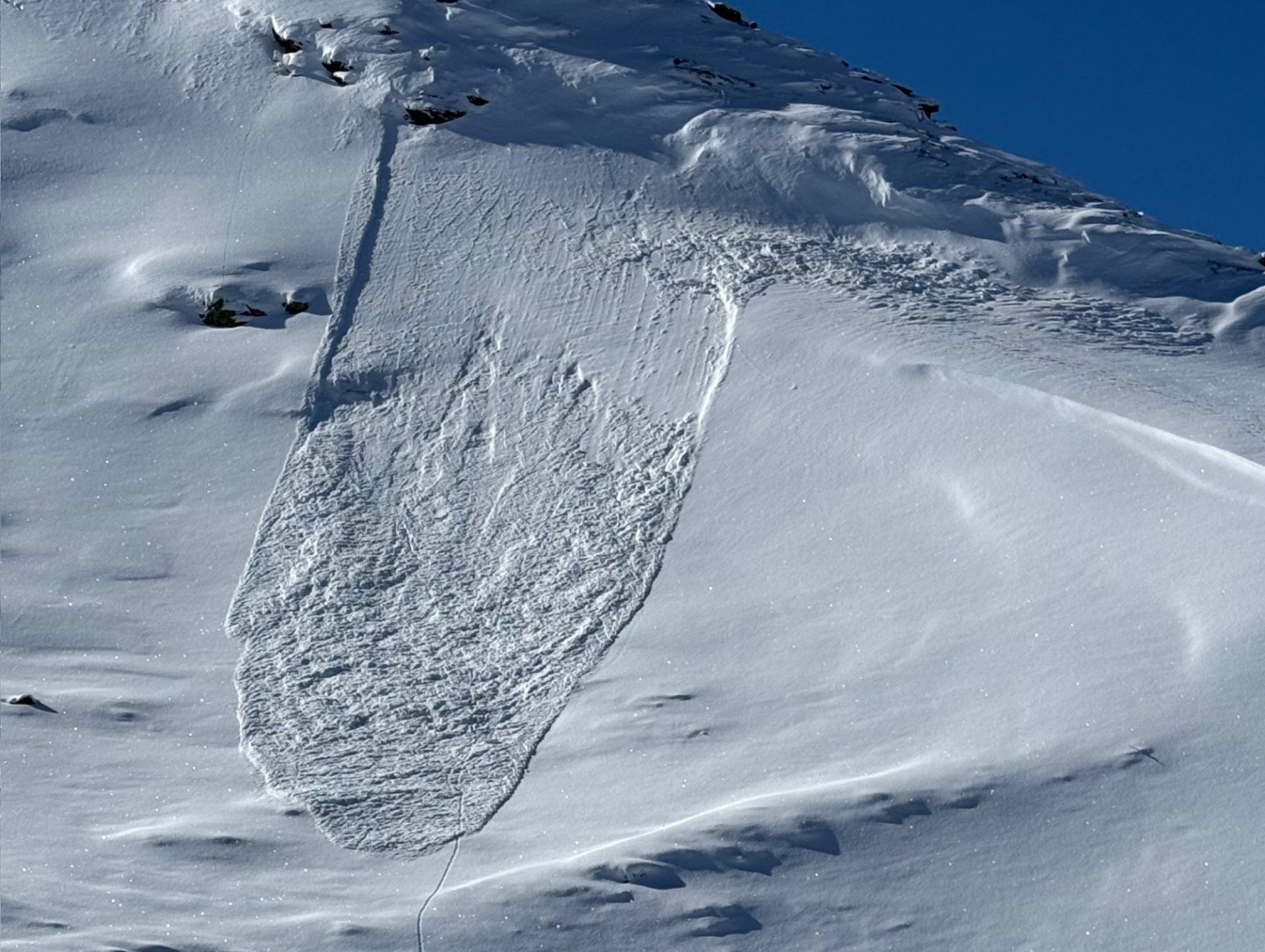
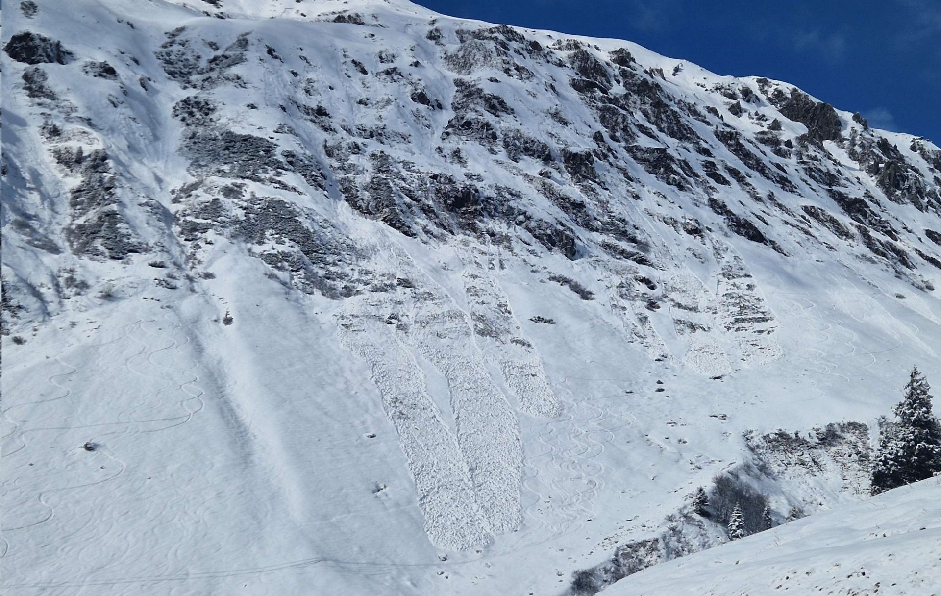
Regarding avalanche danger, two minor dangers threaten. On the one hand, strong-velocity southerly foehn winds along the Main Alpine Ridge and in the foehn-exposed regions of North Tirol have generated fresh snowdrift accumulations over the last few days. They were deposited on shady slopes atop a loose, expansively metamorphosed (faceted) snowpack surface and can be triggered by one sole person. The drifted masses are generally small-sized, larger on the eastern Main Alpine Ridge, and easy to recognize. Special caution urged in very steep terrain, behind protruberances in the terrain, in gullies and bowls.
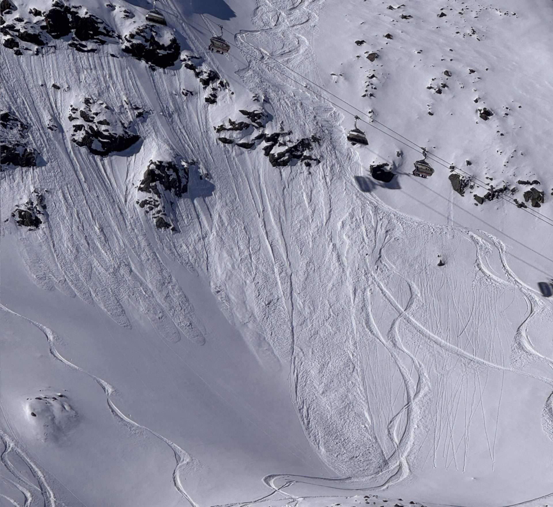
In addition, during the course of the day due to an extremely wet snowpack on sunny slopes, likelihood of mostly small-sized wet loose-snow avalanches will increase. Due to low air moisture this will strike particularly the south facing slopes (SE/S/SW) where the snowpack is already isotherm, and where lots of naturally triggered loose-snow activity was observed 2 weeks ago. The steep slopes are already becoming bare of snow, so danger zones occur seldom and partly dependent on the daytime cycle.
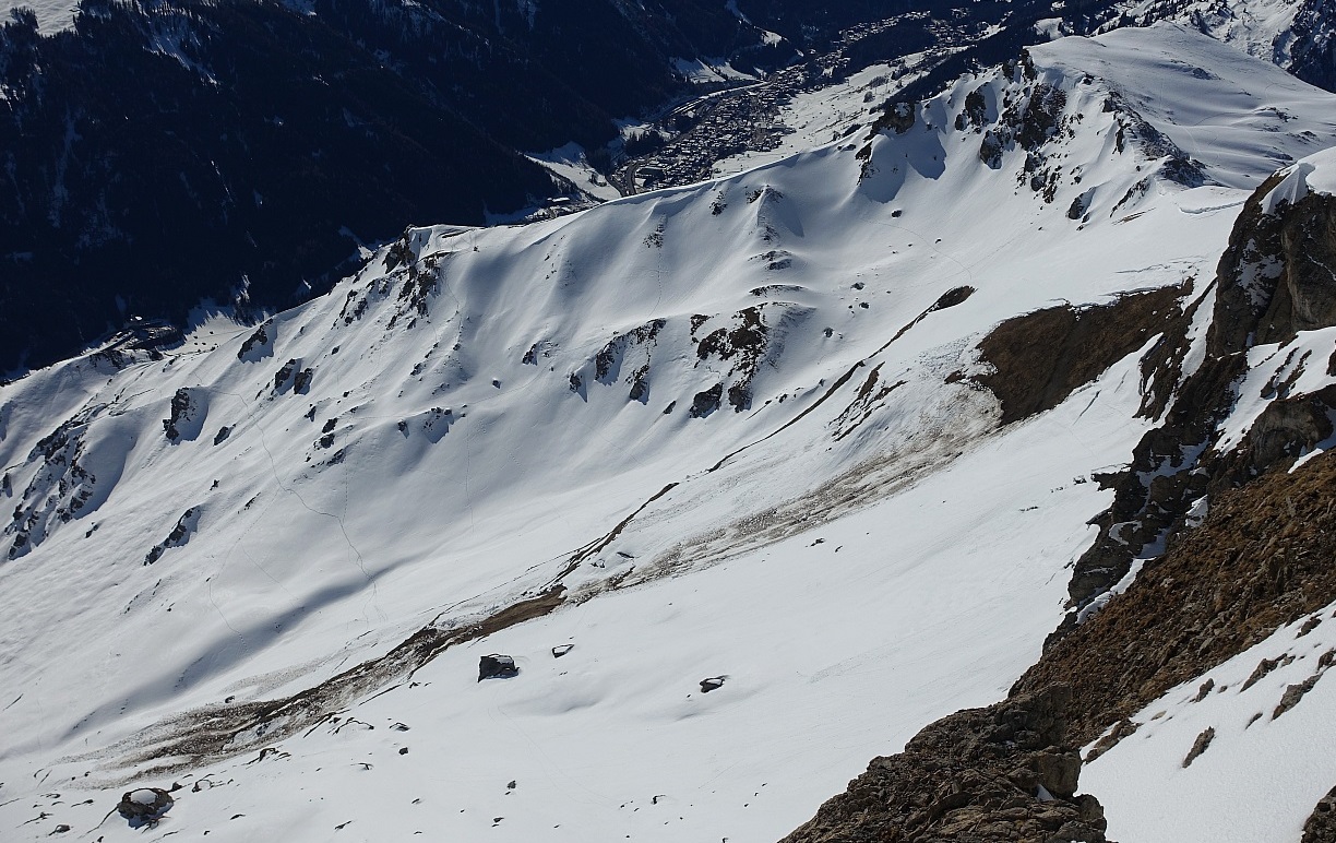
As a result of snowmelt, water seepage into the snowpack is intensifying gliding snow activity on steep slopes on smooth ground. This tendency is reinforced on sunny slopes. Danger zones can be spotted by glide cracks – they should be circumvented wherever possible, or a least quickly passed.
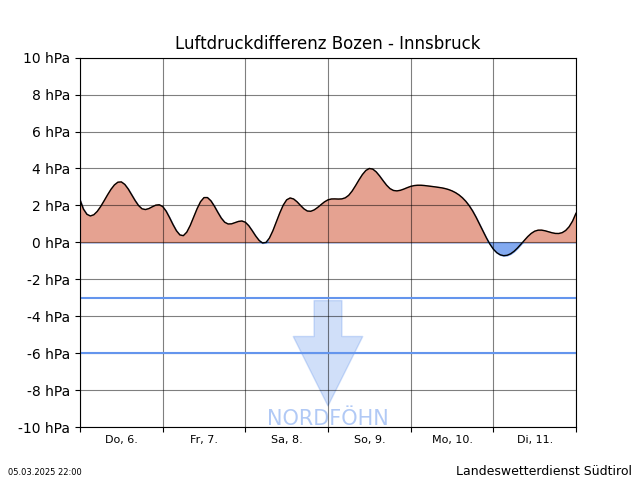
On Sunday, dense cloud cover will move in over the daytime hours, bringing variable conditions as the new week begins. Forecast details are still fuzzy, but major precipitation is not anticipated. At least until mid-week it will also remain quite mild.
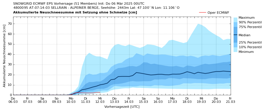
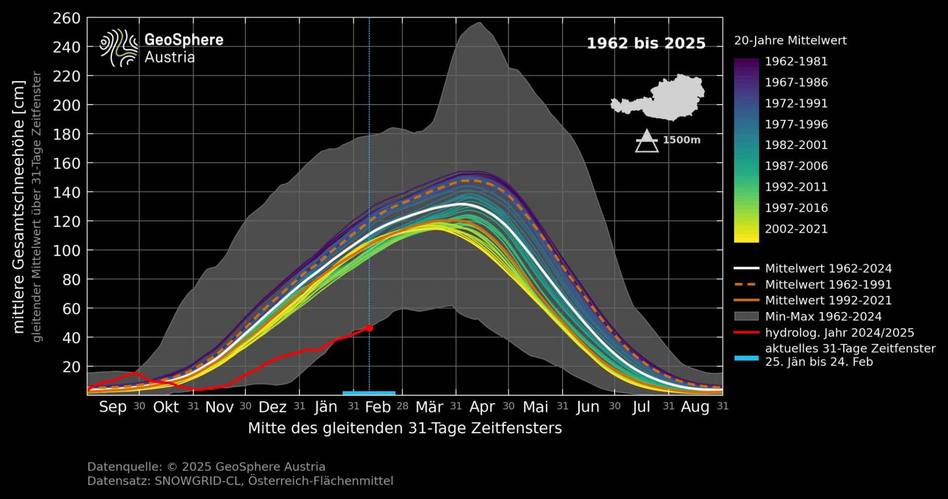
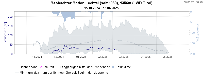
The month of February in Tirol, according to GeoSphere Austria , registered 74% less precipitation than long-term averages. Counterbalancing that was 20% more sunshine. No wonder avalanche danger has been low-to-moderate for more than a month throughout Tirol.
Incidentally, at the end of the meteorological winter, the Winter Report of GeoSphere Austria was published. Winter 2024-25 numbers among the driest winters throughout Austria since the beginning of measurement recording in 1858 (Tirol = -28% below mid-level).