Favorable avalanche situation widespread

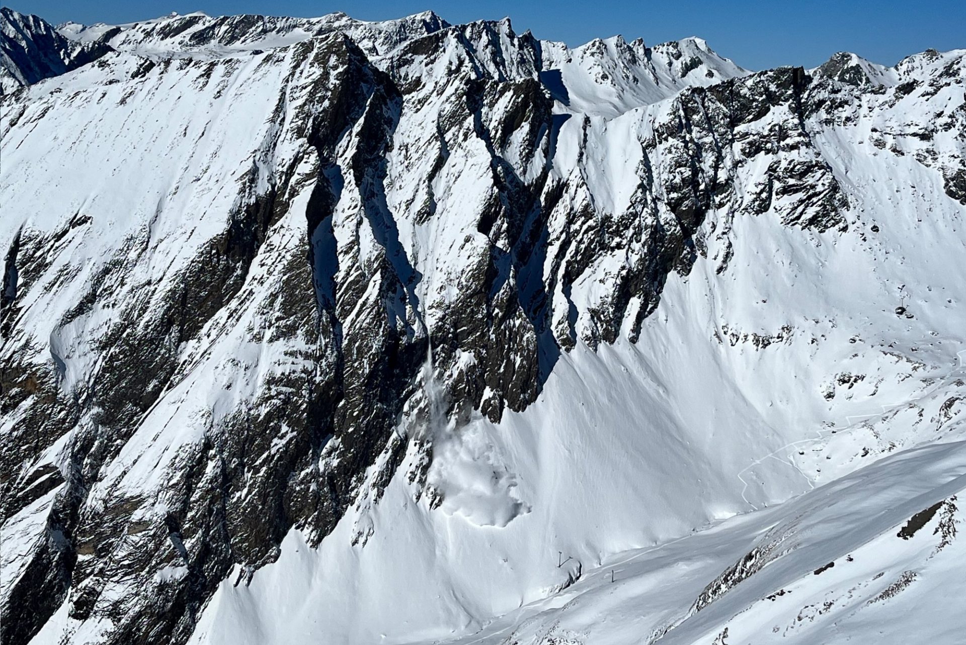
For dry slab avalanches only isolated danger zones, esp. on extremely steep shady slopes above 2400m. Due to mild temperatures and solar radiation, likelihood of wet loose-snow slides and glide-snow avalanches to increase somewhat. In general, favorable conditions prevail. Risks of injury from hidden rocks outweigh those of avalanche danger.

Few avalanche prone locations in extremely steep terrain

Impressively stable high-pressure front conditions have caused the small amounts of fresh snow from last week to metamorphose expansively and thus, become increasingly unbonded. Fractures in weak layers can’t propagate, since the requisite slab is lacking. Slab avalanches are thus becoming less and less likely.

Die Wetterentwicklung der vergangenen Woche mit trockener Luft und entsprechend klaren Nächten und teils wolkenlosen Tagen hat zu verstärkter aufbauender Umwandlung der Schneeoberfläche geführt.
Weather developments last week with dry air masses and clear nighttime skies, often cloudless days, have reinforced expansive metamorphosis of the snowpack surface.
Dieses Schneeprofil an einem 30°- steilen Nordhang auf 2600m zeigt eine recht markante Schwachschicht aus kantigen Kristallen etwa 30cm unterhalb der Schneeoberfläche. Im Stabilitätstest können sich Brüche jedoch nicht mehr fortpflanzen, da der darüber befindliche Schnee zu bindungsarm ist.
This snow profile on a 30°-gradient north-facing slope at 2600m shows a striking weak layer of faceted crystals about 30cm beneath the surface. In the stability test, fractures couldn’t propagate, since the snow on top of it was insufficiently bonded.

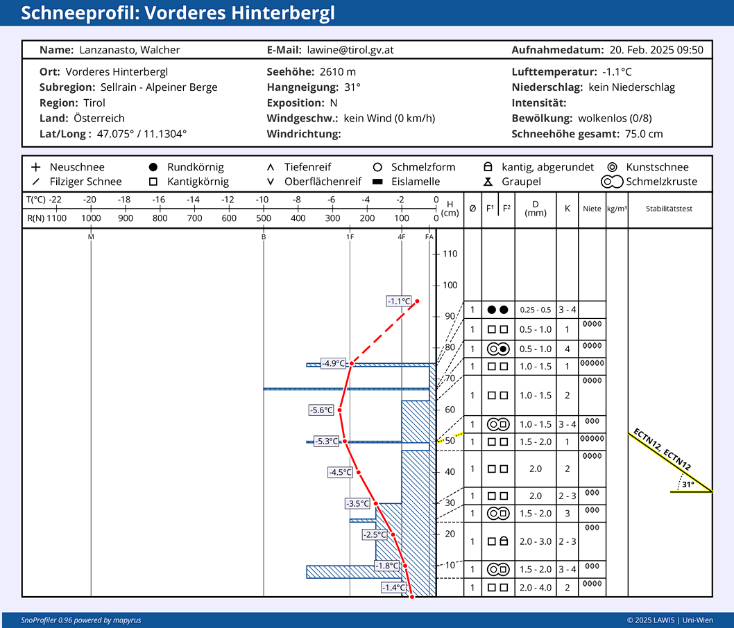
[ Digression: The process of expansive metamorphosis is pronounced during periods of high-pressure fronts because the surface expels its warmth in the form of long-wave outgoing radiation, leading to massive cooling. Whereas when skies are overcast, clouds reflect the long-wave radiation back to earth, restoring surface temperatures, bringing them in line with air temperature. Due to intense cooling of the surface, a stark temperature gradient in the uppermost 10-20cm of the snowpack is generated, leading to intensified expansive metamorphosis and the formation of faceted crystals. ]

Danger zones for dry slab avalanches have become more seldom over the last few days because of this development:

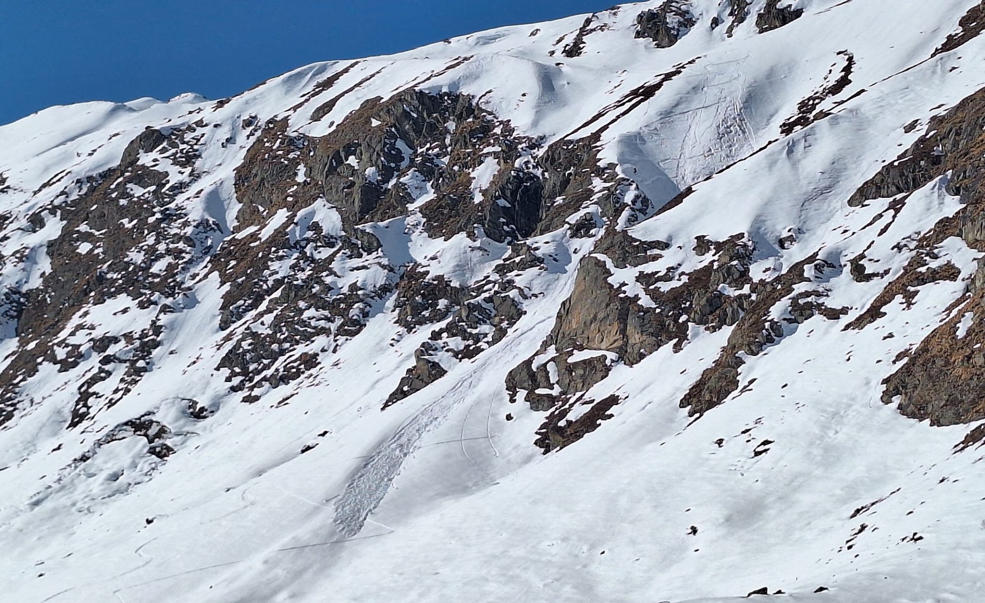
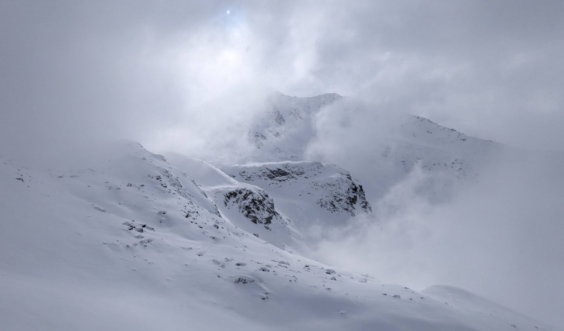
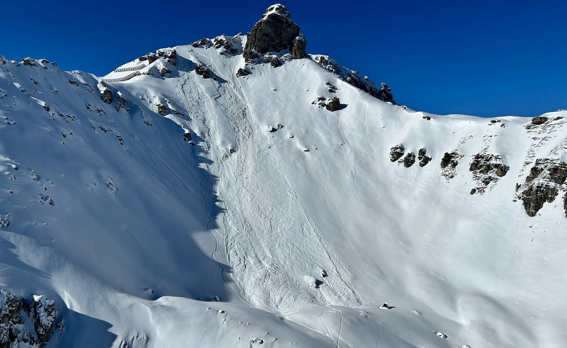
Isolated avalanche prone locations are to be found particularly in extremely steep terrain (>40°) mostly near ridgelines where highly visible, often hardened snowdrift masses can still be triggered as small avalanches. Here is where risks of taking a fall forced by traps in the terrain (e.g. only barely covered rocks) demand high caution.

In Kammlagen sind kleine Triebschneepakete vereinzelt noch störanfällig (©Daniel Kleinlercher, 20.02.2025).
In ridgeline terrain, small snowdrift accumulations are still prone to triggering in isolated cases. (©Daniel Kleinlercher, 20.02.2025).

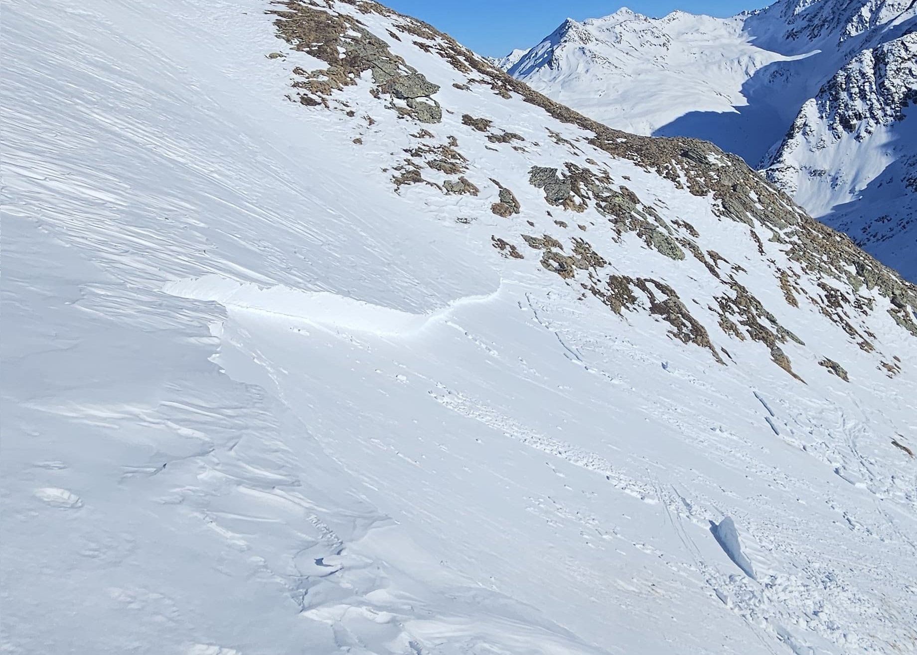
As far as the persistent weak layer problem goes, we haven’t received any reports of further releases since last weekend’s triggerings by persons. Danger zones are probably rare. The highest risks: in ridgeline terrain on extremely steep and little skied-on west/north/east facing slopes above 2400m.

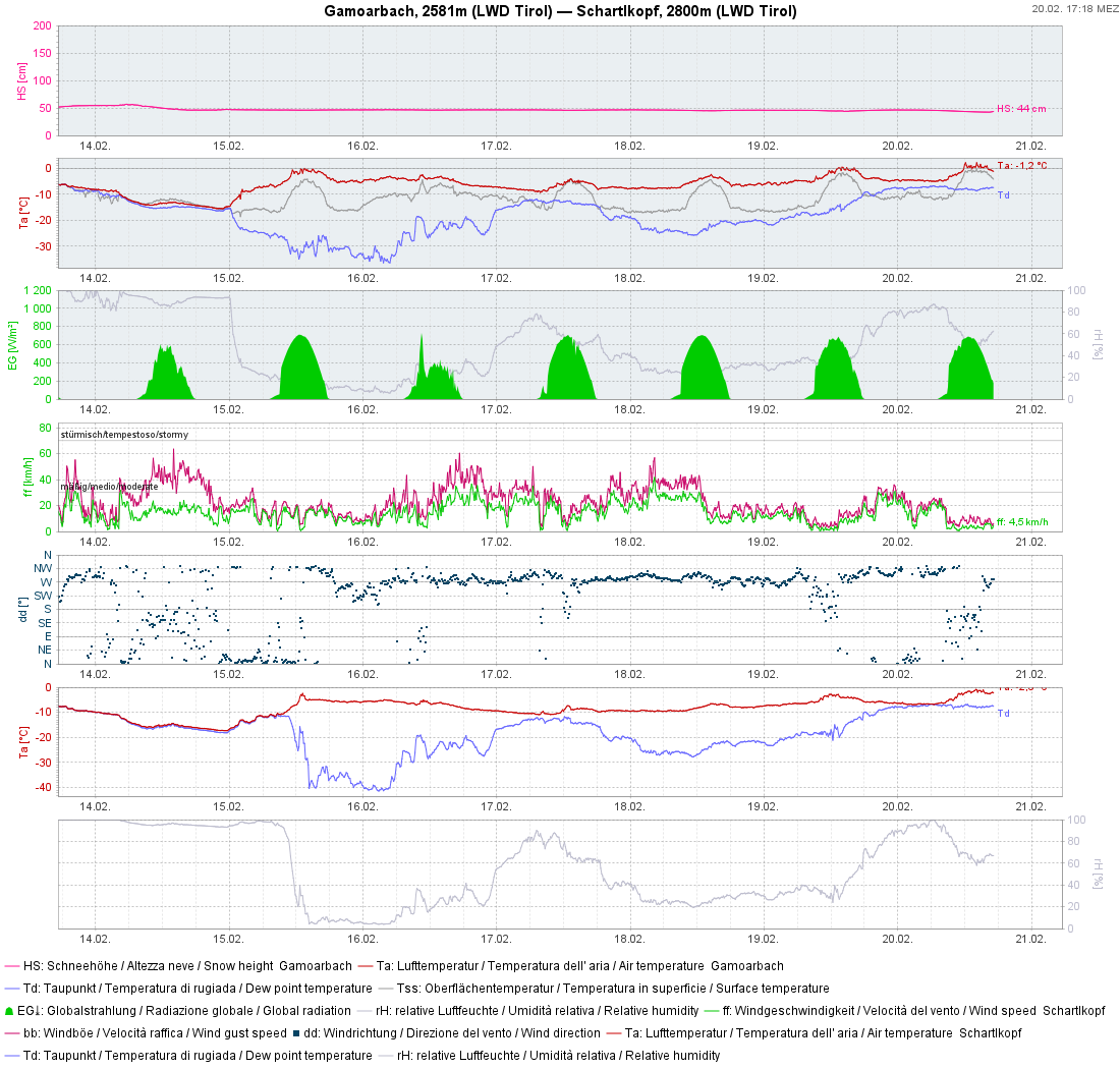
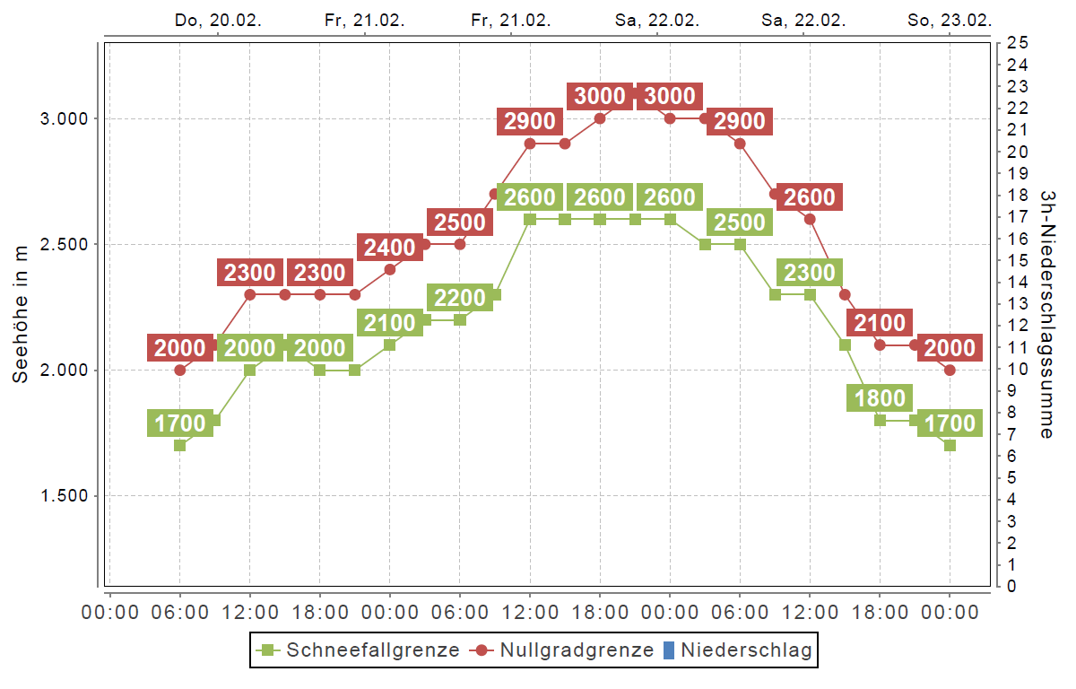
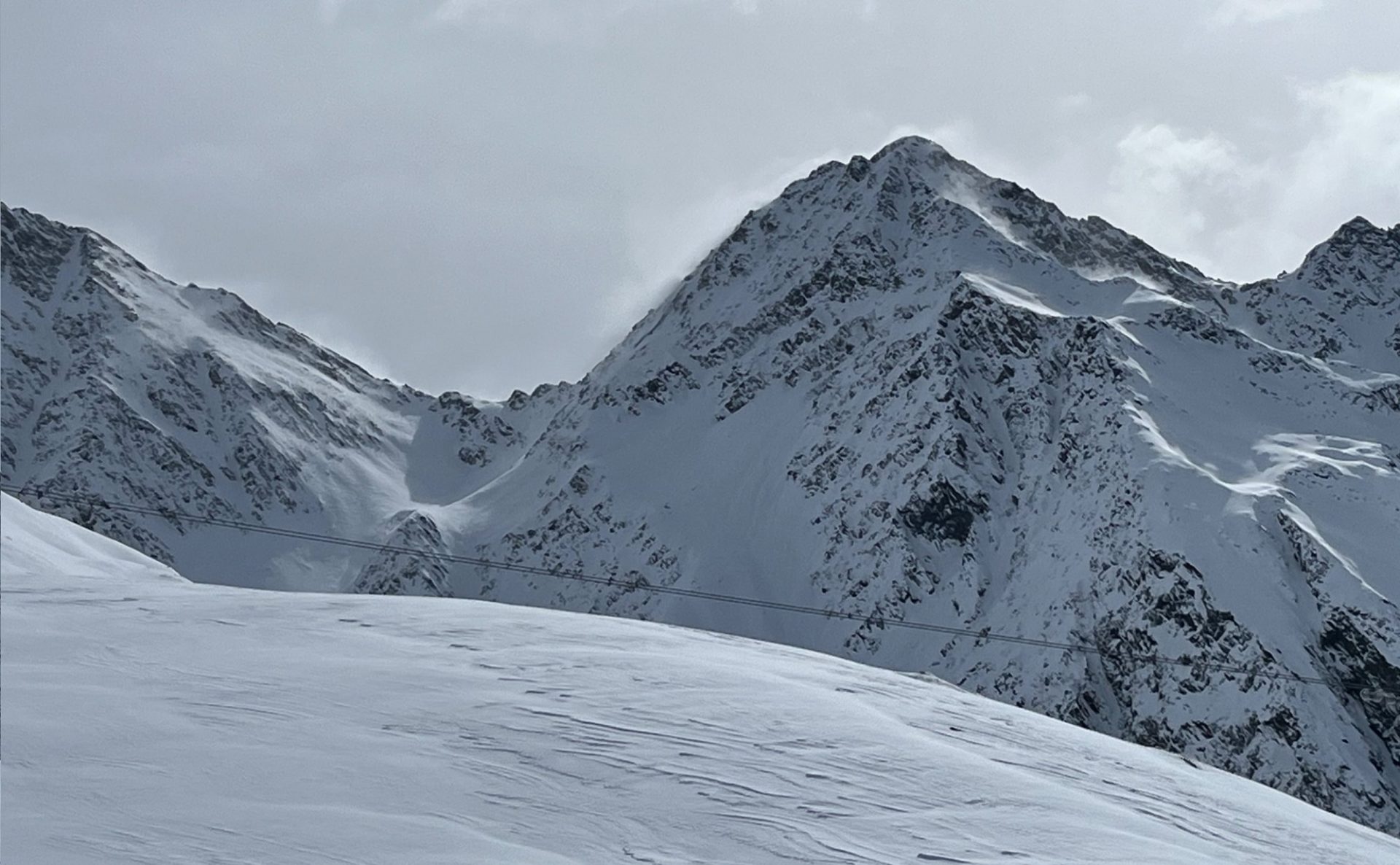
Due to mild temperatures (zero-degree level will rise temporarily to nearly 3000m tomorrow, 21.02) and solar radiation, the snowpack on south-facing slopes will soften and lose its firmness. Thereby, the likelihood of small wet loose-snow avalanches will increase somewhat on extremely steep south-facing slopes. Due to water seepage into the snowpack, gliding snow activity will also increase on steep grass-covered slopes, particularly in northwestern regions of Tirol. Zones below glide cracks should be avoided.

Die Nullgradgrenze klettert in den nächsten Tagen vorübergehend auf rund 3000m. In den darauffolgenden Tagen nehmen die Temperaturen sukzessive wieder ab und erreichen Mitte nächster Woche wieder ein der Jahreszeit entsprechendes Niveau (©Oberlandwetter).
The zero-degree level will rise temporarily to about 3000m over the next few days. In the days following, temperatures will gradually drop, by mid-week reach appropriate temperatures for this juncture of the season. (©Oberlandwetter).
Mit milden Temperaturen und Sonneneinstrahlung nimmt die Auslösewahrscheinlichkeit von nassen Lockerschneelawinen vorübergehend etwas zu. Die Mitreiß- und Absturzgefahr sollte beachtet werden (©LWD Tirol, 20.02.2025).
Due to mild temperatures and solar radiation, likelihood of wet loose-snow avalanches will increase somewhat for a brief spell. The dangers of being swept along and forced to take a fall require adequate consideration. (©LWD Tirol, 20.02.2025).

Review: short period of heightened trigger-sensitivity last weekend

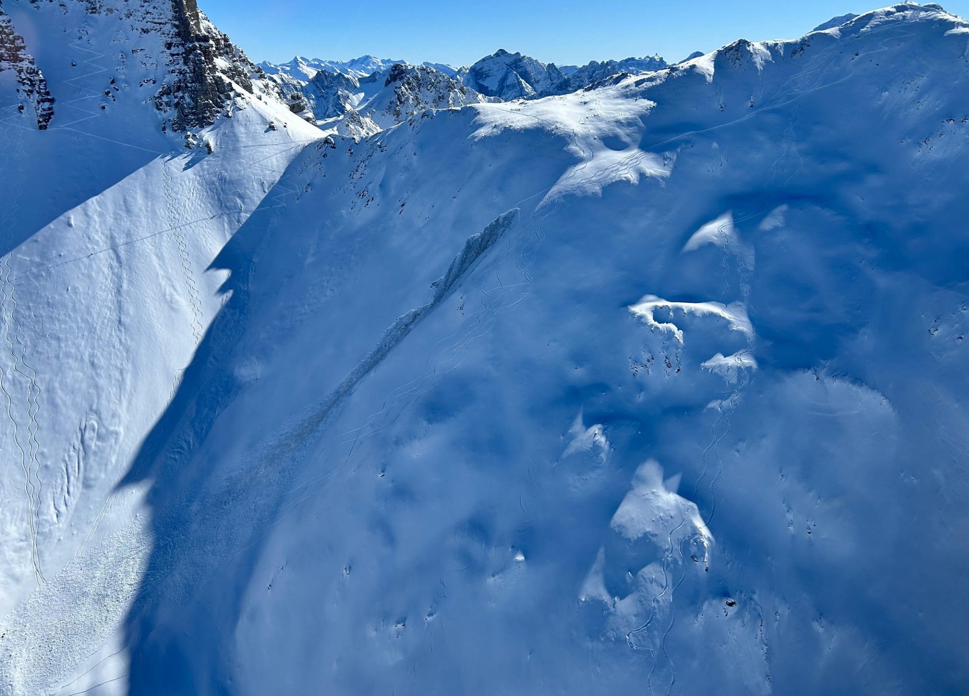
The fresh snow at the end of last week fell without much wind impact north of the Main Alpine Ridge, so snow quality on the sunny days which followed was quite good. Lots of winter sports enthusiasts were to be seen in backcountry, enjoying the fine conditions. The fresh snow distant from ridgeline and pass areas was loosely-packed and unbonded, so many very steep descents could be enjoyed.

72h Neuschneesumme inkl. Setzung von 12. bis 14.02. In den Stubaier Alpen schneite es mit 20 bis 30cm vergleichsweise am meisten.
72-hr amounts of fresh snow including settling on 12-14.02. Most fell in the Stubai Alps: 20-30cm.
Der Neuschnee vom 12.-14.02. fiel nördlich des Alpenhauptkamms oft mit wenig Wind. Vom lockeren Schnee bedeckte Steine und Untergrund stellten in der Abfahrt eine nicht zu unterschätzende Gefahr dar (©LWD Tirol, 14.02.2025).
Fresh snow on 12-14.02 fell with little wind north of the Main Alpine Ridge. Rocks only barely covered by the snow presented a danger not to be underestimated during descents. (©LWD Tirol, 14.02.2025).

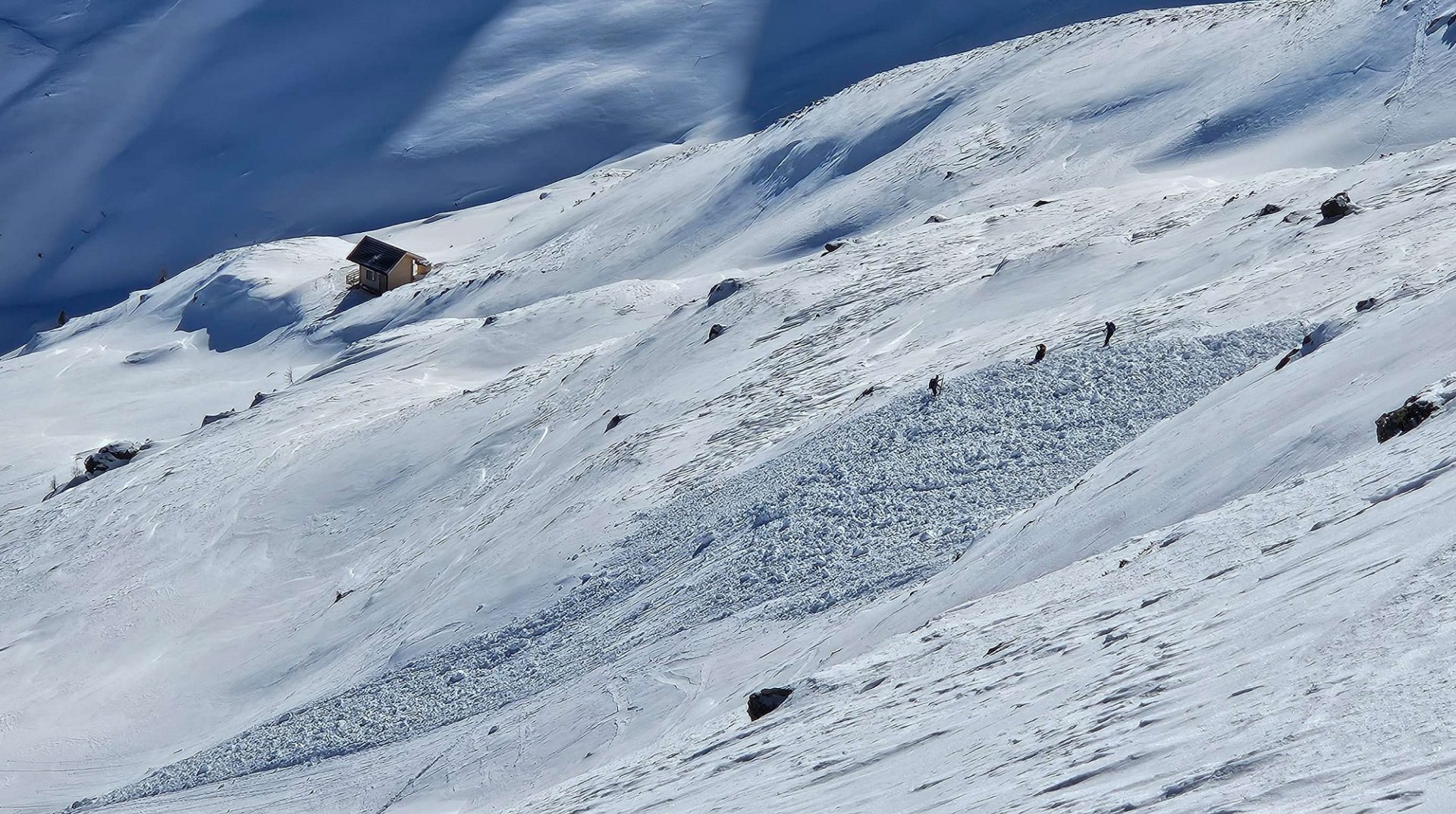
Outside of some small ridgeline snowdrift accumulations that released on Saturday, 15.02, also two medium-sized slab avalanches were triggered by persons in the ground-level old snow in the Stubai Alps. In this case, the burden of the fresh fallen snow was clearly enough to form an adequate slab for a short time. Those involved in the avalanches escaped without injuries.

Vor allem in Kamm- und Passlagen, vereinzelt auch hinter windexponierteren Geländekanten waren meist kleine Triebschneeansammlungen kurzfristig störanfällig. Als Schwachschicht diente lockerer Neuschnee (©Marvin Kärle, 16.02.2025).
Particularly in ridgeline and pass areas, in isolated cases also behind protruberances in the terrain, mostly small-sized snowdrift accumulations were prone to triggering for a short time. The weak layer: loose fresh snow. (©Marvin Kärle, 16.02.2025).
Am Samstag, 15.02. von Personen ausgelöste mittelgroße Schneebrettlawine an einem Nordhang auf 2500m unterhalb vom Gamskogel in den Kalkkögeln. Eine Person wurde mitgerissen, kam aber auf der Schneeoberfläche zu liegen und blieb unverletzt (©Alpinpolizei, 15.02.2025)...
On Saturday, 15.02, a medium-sized slab avalanche was triggered by persons on a north-facing slope at 2500m below the Gamskogel in the Kalkkögeln. One person was swept along but came to a stop on the surface and was not injured. (©Alpinpolizei, 15.02.2025)…
…Die Schneebrettlawine wurde im schwachen Altschneefundament ausgelöst (©Jonas Huser, 15.02.2025).
…the slab avalanche was triggered in the weak layers of the old snowpack base. (©Jonas Huser, 15.02.2025).
Ein weiterer Lawinenabgang aufgrund des bodennahen Altschneeproblems ereignete sich am selben Tag (15.02.) am wenig entfernten Hohen Burgstall an einem Osthang auf rund 2550m. Keiner der beteiligten Personen wurde von der Lawine erfasst (©Alpinpolizei, 15.02.2025).
Another avalanche from a persistent weak layer at ground level was triggered on the same day (15.02) on the nearby Hohe Burgstall on an east-facing slope at about 2550m. No one in the group was caught in the avalanche.(©Alpinpolizei, 15.02.2025).

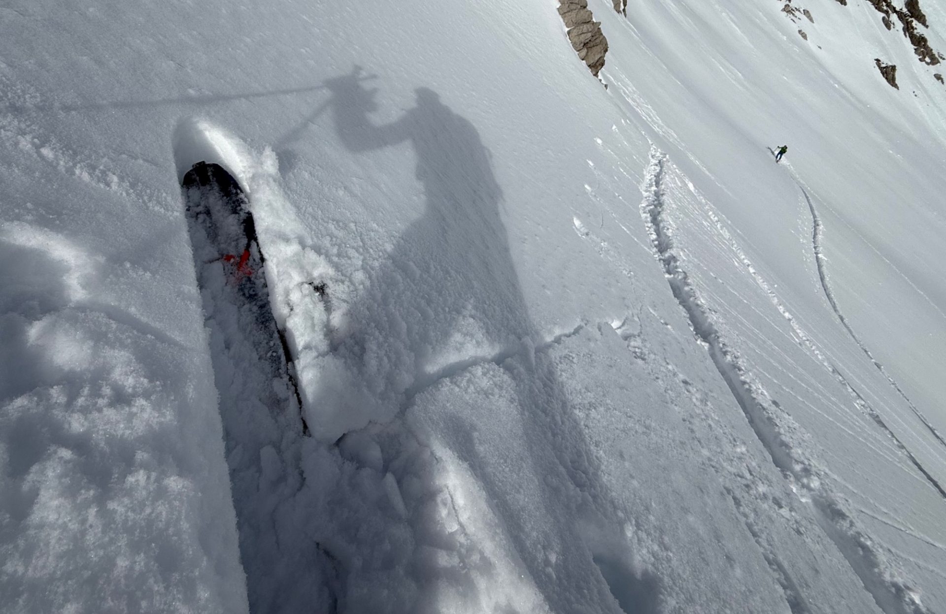
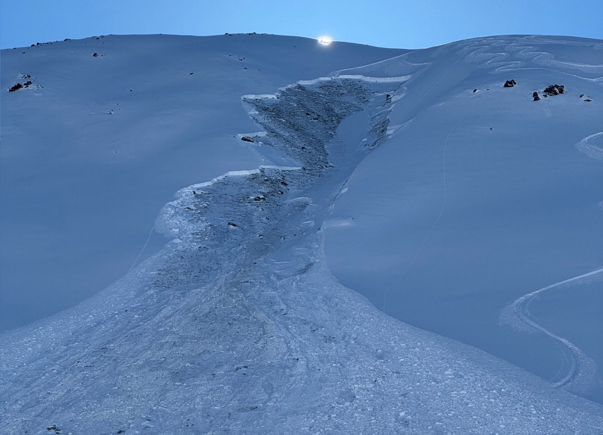
In East Tirol the snowfall was accompanied by often strong-velocity winds. Snowdrift accumulations were generated and deposited on top of the generally shallow, often weak snowpack. Also here on Saturday, a medium-sized slab avalanche was triggered by persons.

Während und nach dem Niederschlag blies der Wind v.a. in Osttirol teils stark und verfrachtete den lockeren Neuschnee. In den Deferegger Alpen wurden ebenso rund 30cm Neuschnee verzeichnet (©Anton Riepler, 14.01.2025).
During and after the precipitation, particularly in East Tirol, often strong-velocity winds transported the loose fresh snow. In the Deferegger Alps approximately 30cm of fresh snow was registered. (©Anton Riepler, 14.01.2025).
An der Reiterkarspitze in den Karnischen Alpen konnte der frische Triebschnee auf der schwachen Altschneedecke an einem Osthang auf rund 2400m von Personen als mittelgroße Schneebrettlawine ausgelöst werden. Bei dem Ereignis kam ebenfalls niemand zu Schaden (©Gerhard Figl, 15.02.2025).
On the Reiterkarspitze in the Carnic Alps, persons triggered freshly generated snowdrift accumulations atop the weak old snowpack surface, releasing a medium-sized slab avalanche on an east-facing slope at about 2400m. No one was injured in the avalanche.
Spontane trockene Lockerschneelawine aufgrund der Sonneneinstrahlung in der Glocknergruppe (©Anton Riepler, 15.02.2025).
Naturally triggered, dry loose-snow avalanche due to solar radiation in the Glockner Massif (©Anton Riepler, 15.02.2025).

Increasing perturbances starting middle of next week

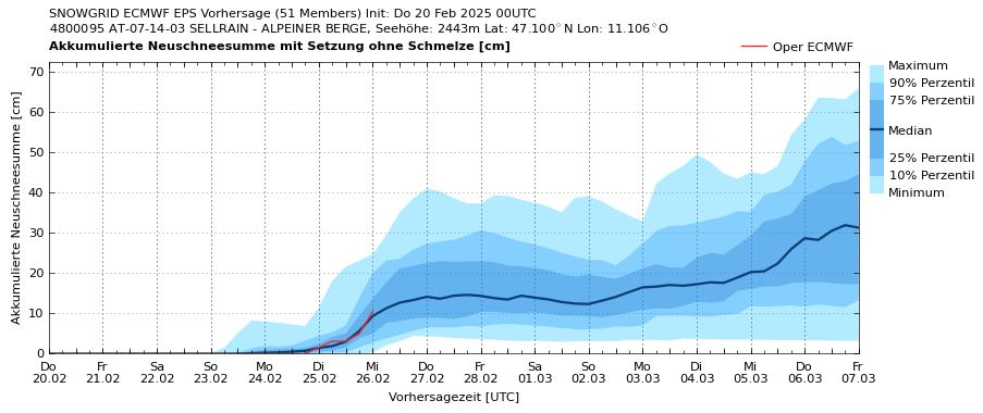
Next week we expect a mixture of sunshine and clouds, dry weather until Tuesday when some precipitation is anticipated. Thus, the danger of dry-snow avalanches will increase somewhat.

Ab Dienstag nächster Woche könnte auf den Bergen wieder etwas Neuschnee hinzukommen. Die Schneefallgrenze soll sich aus heutiger Sicht um die 1000m bewegen (©GeoSphere Austria).
Starting on Tuesday next week, there might be some fresh snowfall in the mountains. Snowfall level, seen from today’s perspective, will be at 1000m. (©GeoSphere Austria).