On 28.01.2025 a southern foehn air current and subsequent cold front brought often considerable masses of precipitation regionally. The combination of much fresh snow at high altitudes, strong-to-stormy winds and a weak snowpack led during the course of that day to the significant increase in avalanche releases we forecast; to excellent artificial triggerings; to many avalanches triggered by winter sports enthusiasts, glide cracks and settling noises, but also remote triggerings confirmed just how prone to triggering the snowpack really was.
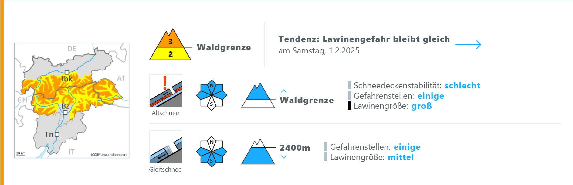
The danger is receding only slowly. Particularly in open steep terrain above the timberline where there are few tracks, restraint will be important during the next few days. Details of the primary endangered regions, altitudes and aspects can be found in the current edition of the Avalanchereport.
A period full of incidents
Prerequisites
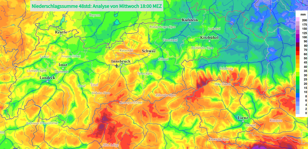
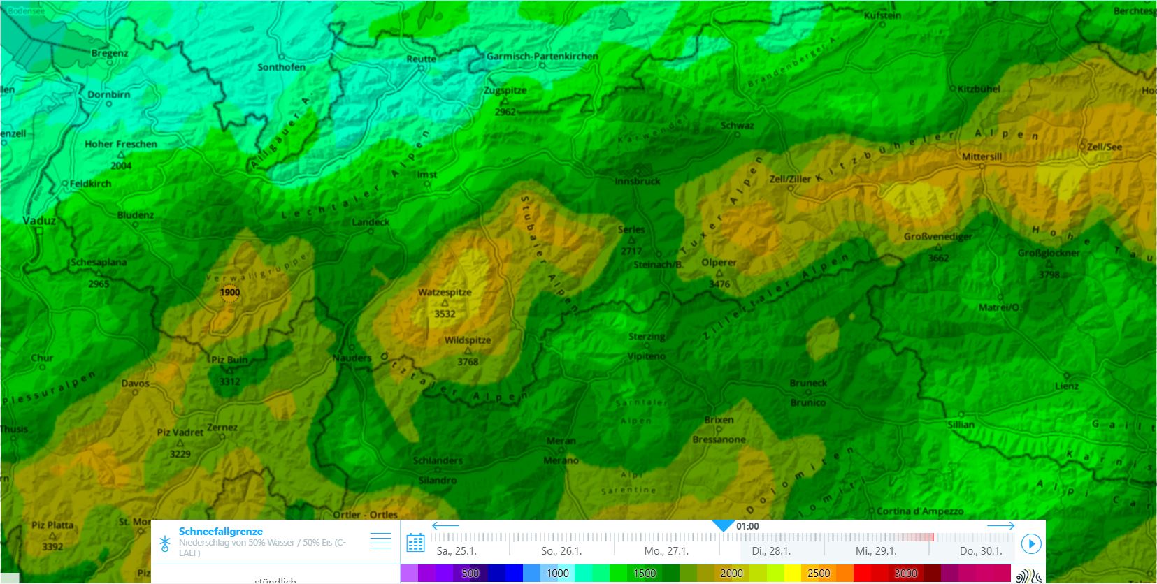
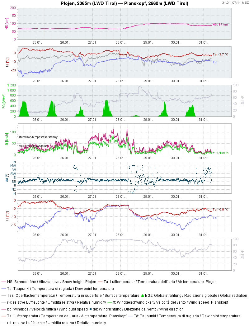
On 28.01 there was frequent rainfall in the morning hours between 1500 and 2200m (latter in SE regions) amid strong-to-stormy SW winds. During the day the snowfall level dropped generally to 1000m, sometimes descending lower down, depending on precipitation intensity. All in all in western regions, in the regions along the Main Alpine Ridge and in East Tirol, there was about 30-50cm registered, locally up to 70cm. Snowfall, wind and initially higher temperatures generated a marked slab. Together with the often wide-area weak layered snowpack (at least above the treeline on W/N/E facing slopes) the prerequisites were created for an extremely trigger-sensitive snowpack. During the course of the day the burden atop the snowpack exceeded its firmness, resulting in naturally triggered avalanches.
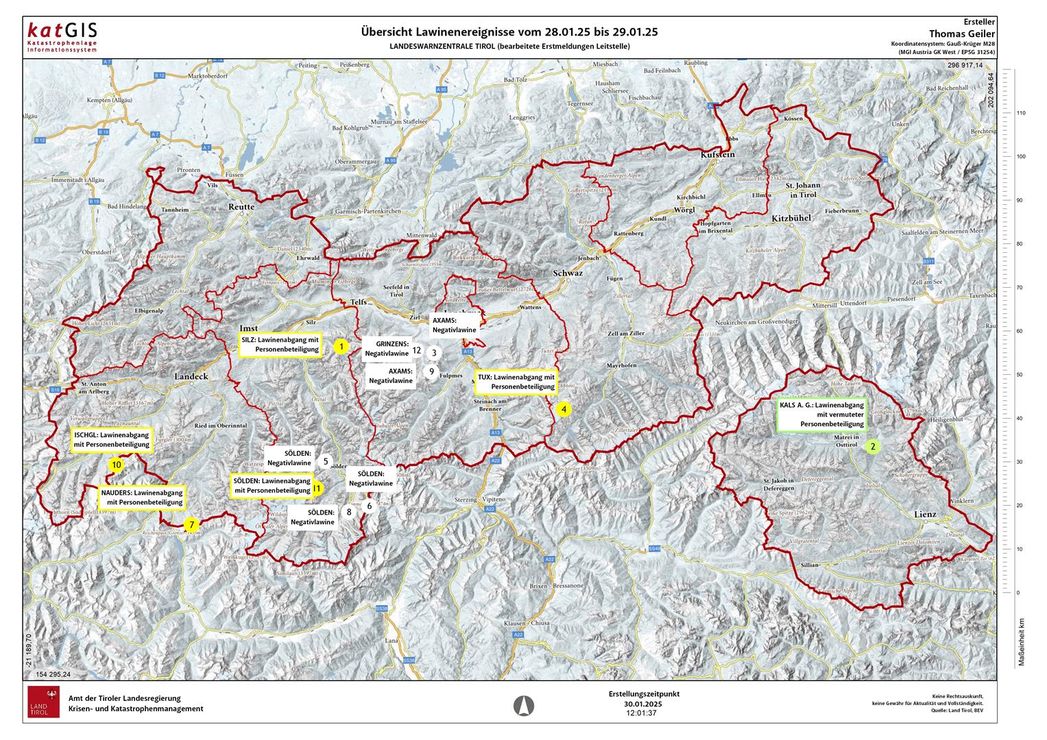
Particularly endangered regions and zones
On the current danger map from 31.01.2025 the regions we have designated as particularly endangered are visible. We currently assume that the forest rims and above have a very trigger-sensitive snowpack, increasingly on W/N/E facing slopes. This is confirmed by reports of avalanches which have released. Above 2800m, also the south-facing slopes could have this condition.
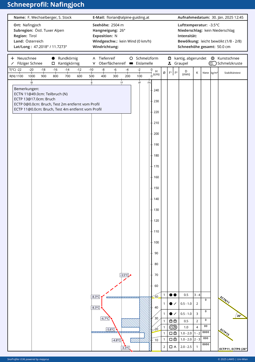
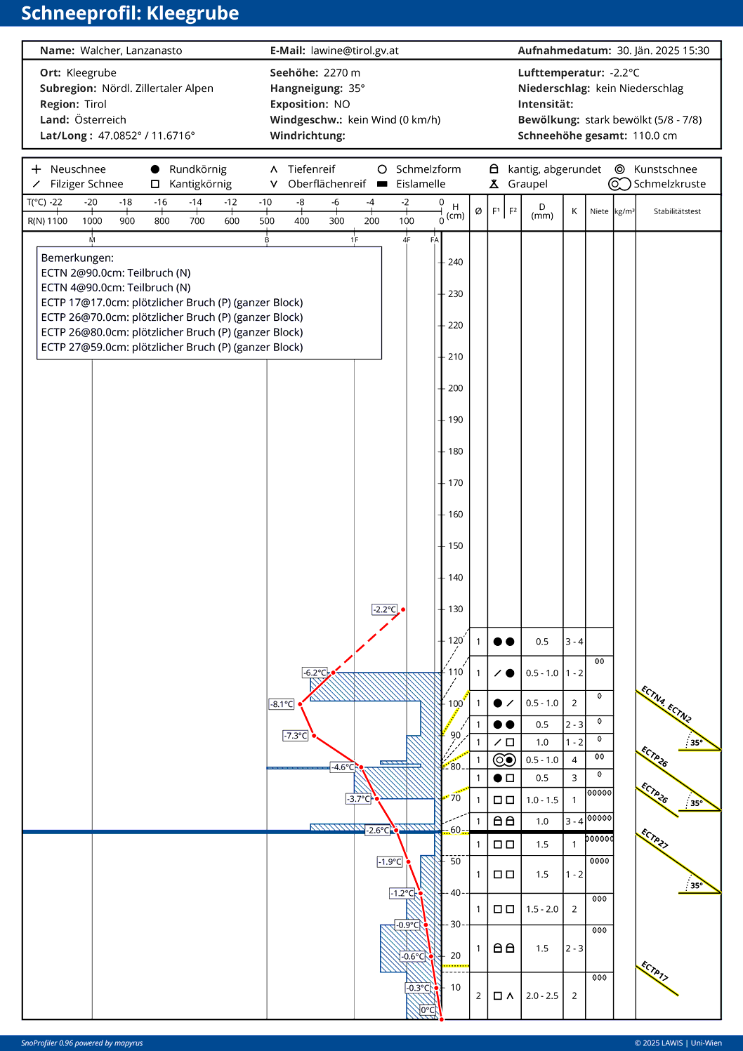
We assume that avalanche danger will recede only very slowly. This is currently confimed by numerous reports of alarm signals in open terrain, and also reports of snowpack analysis. Quite often, fractures can easily be generated and these propagate. Experience shows that the heightened proneness to triggering will persist for at least a week following the intensive period of precipitation.
Review of last few days
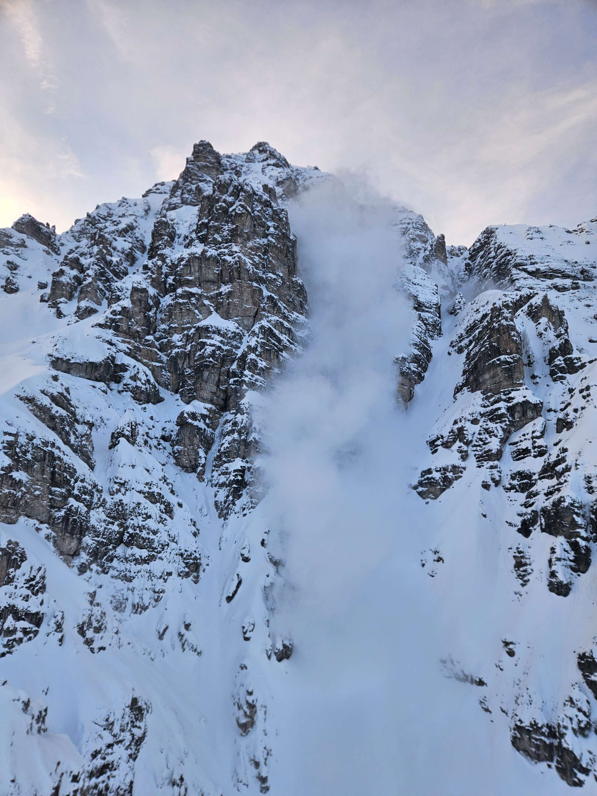
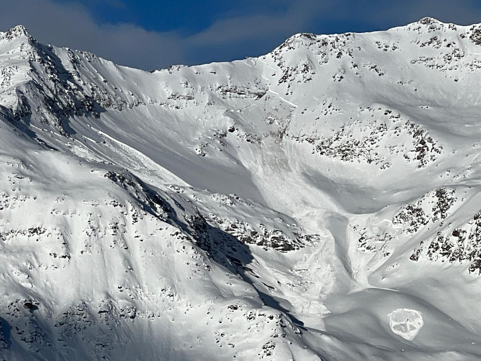
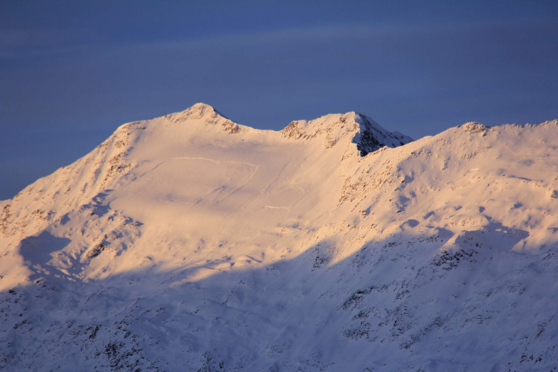
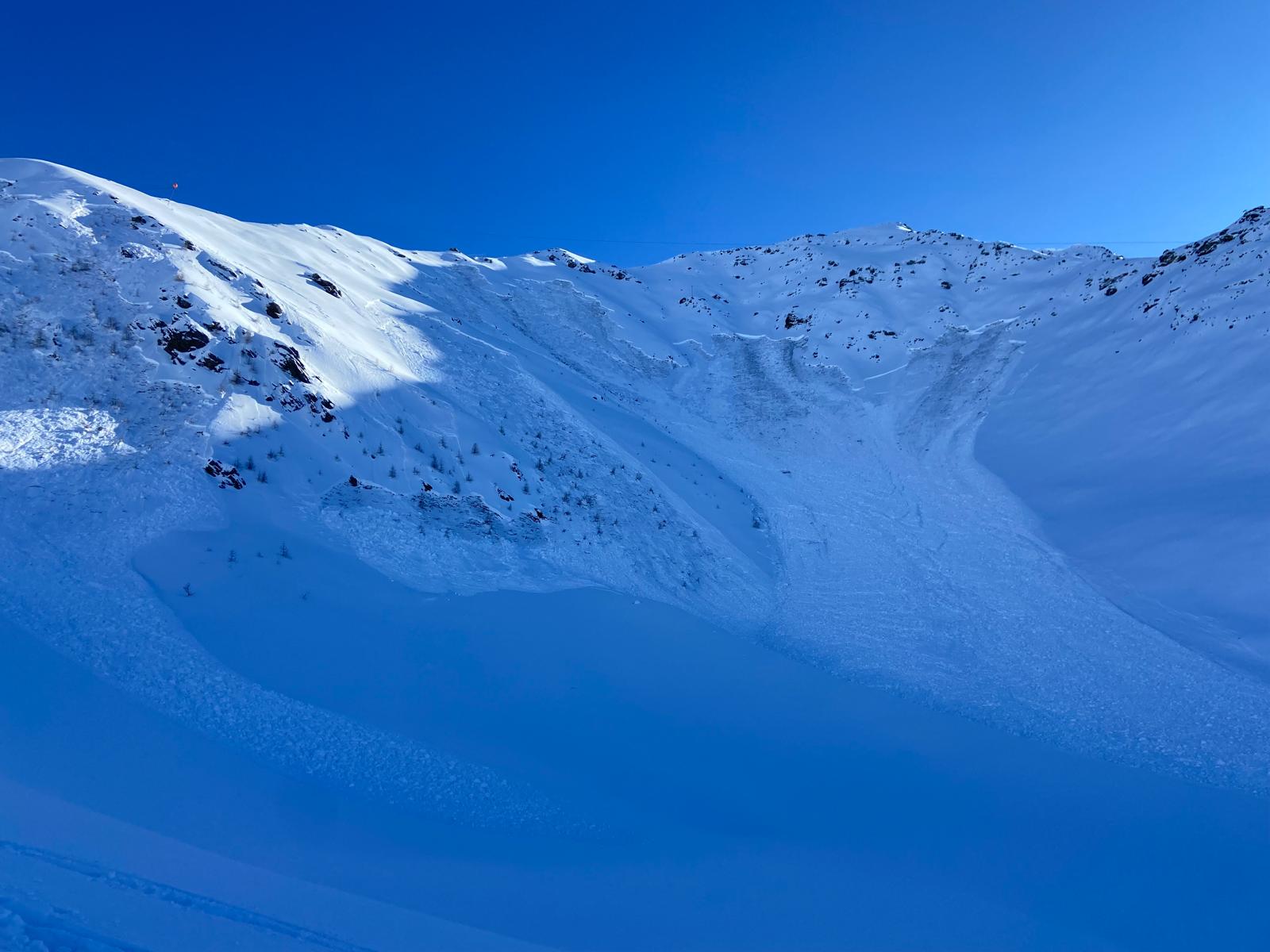
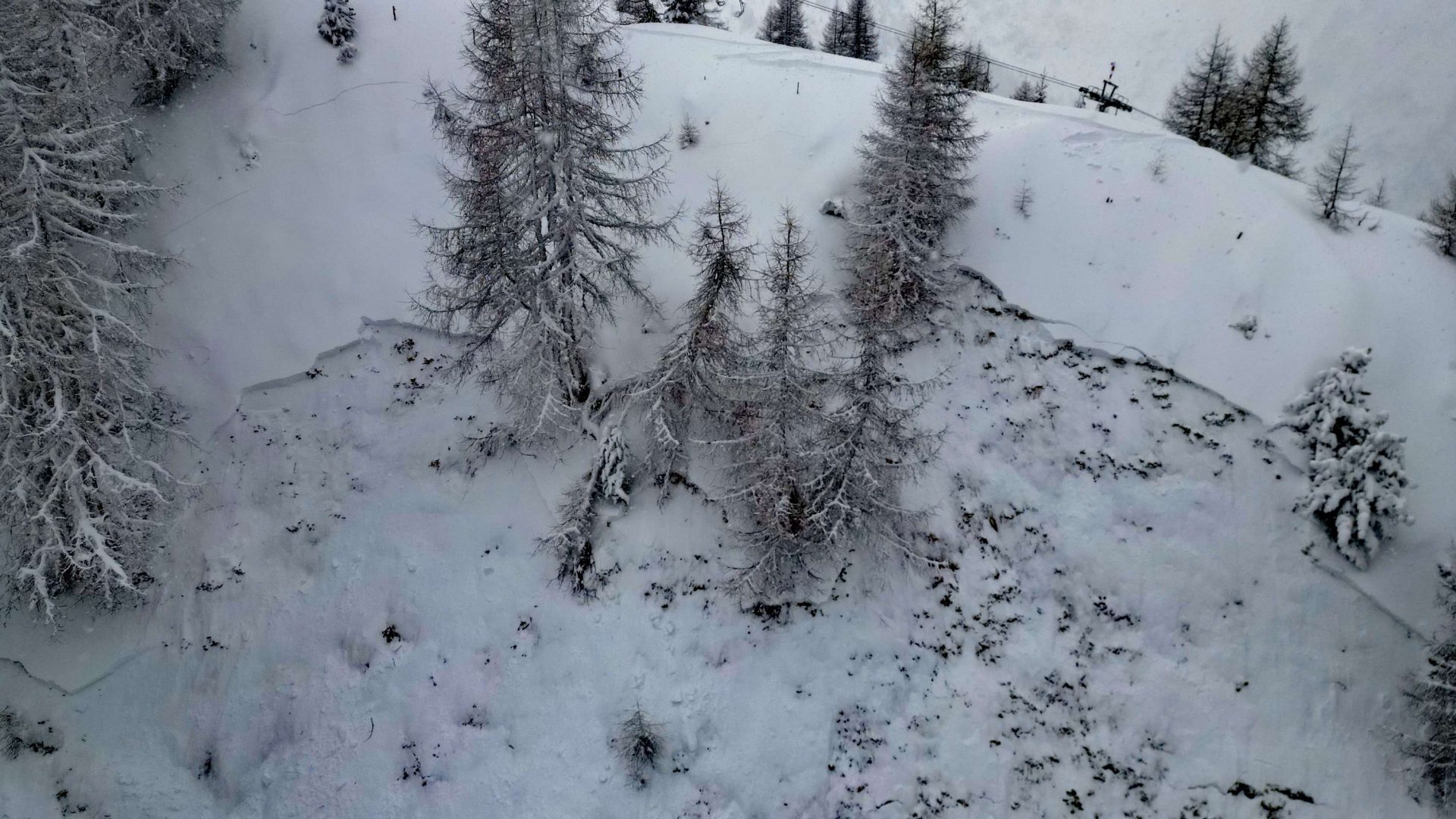
Naturally triggered avalanches
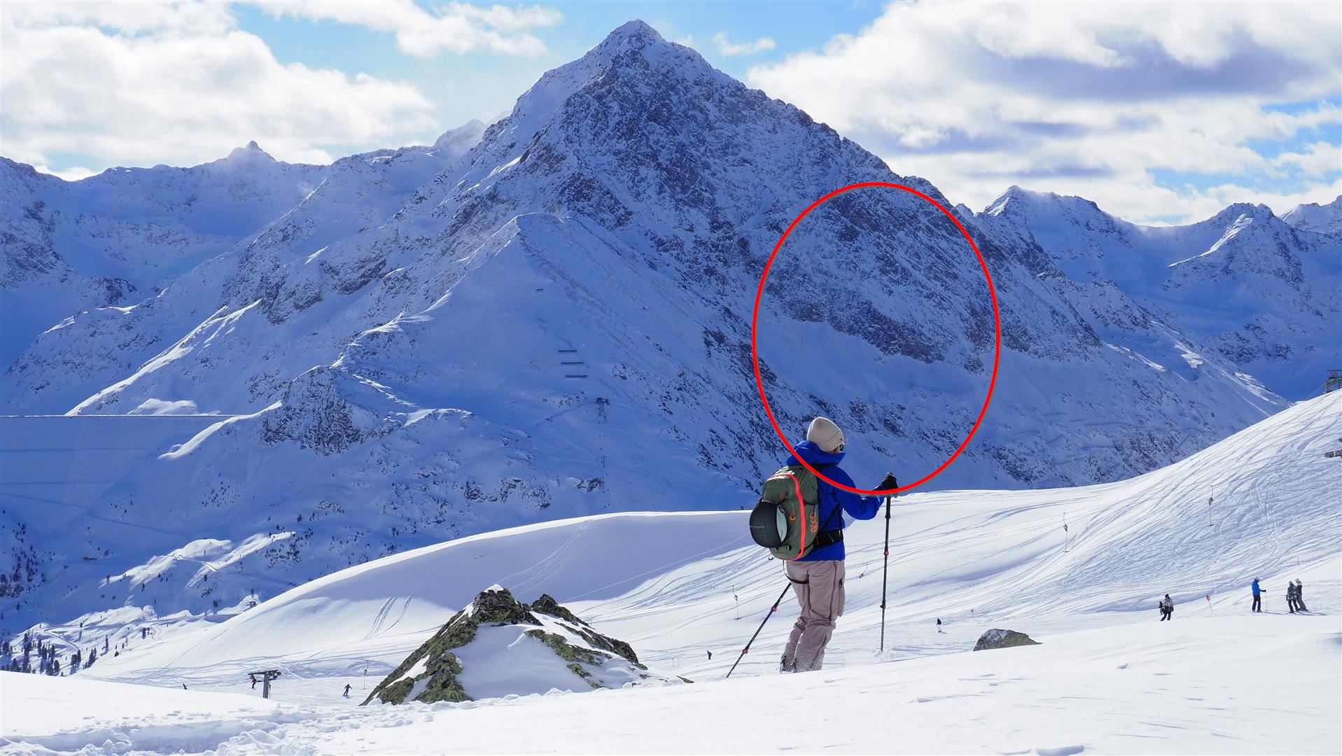
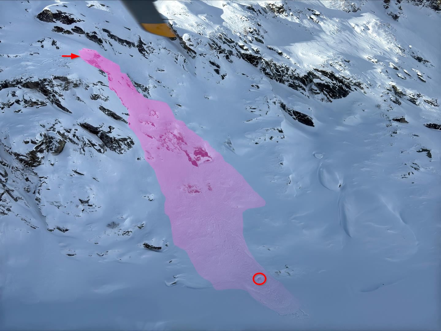
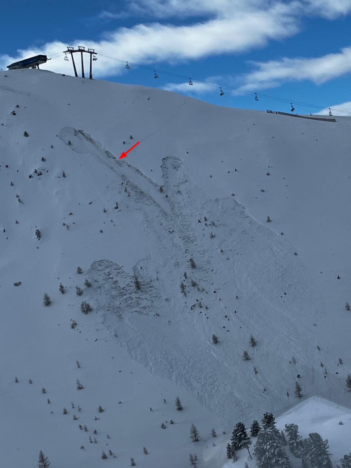
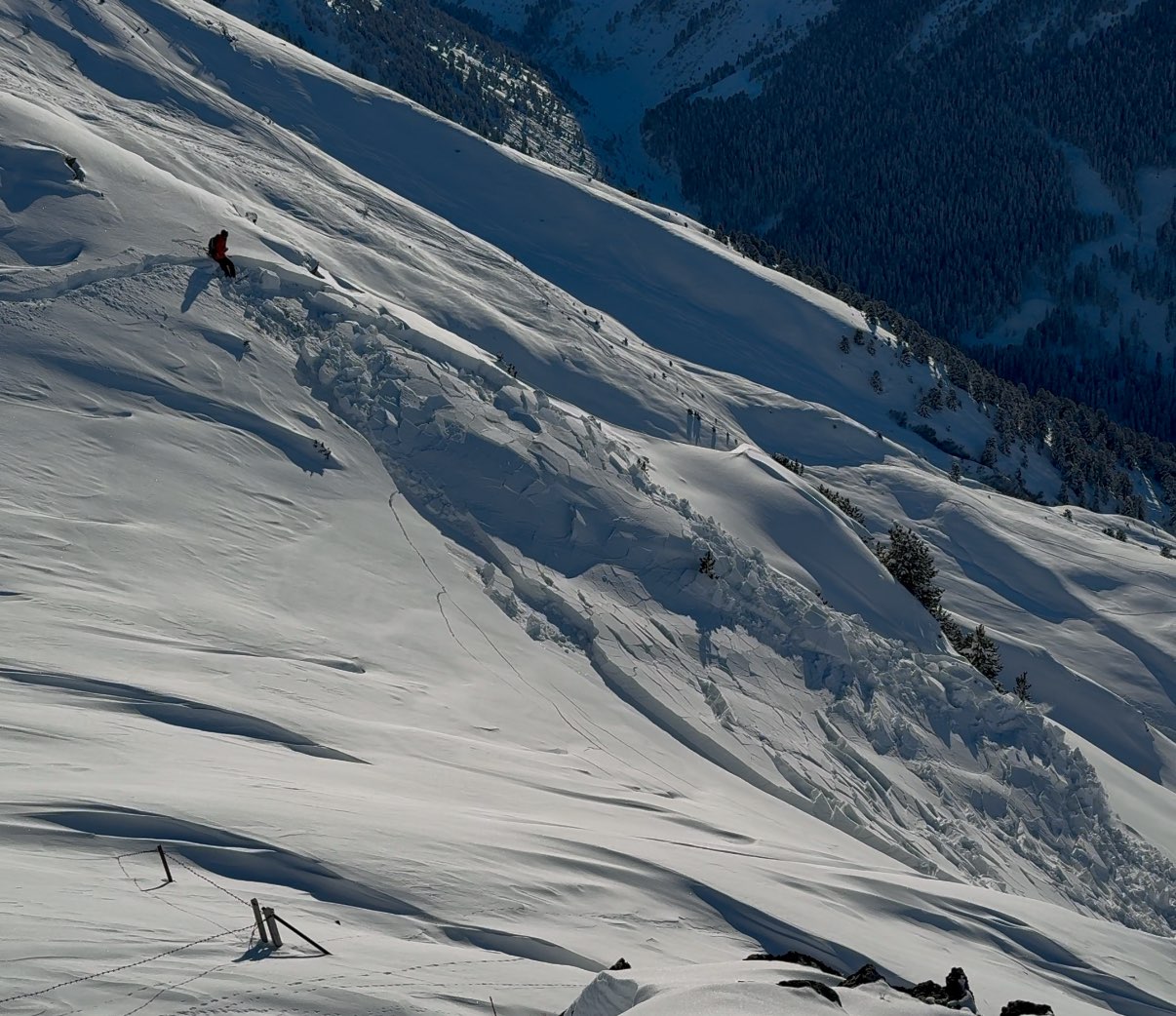
On 28.01 avalanche danger reached its high point in the late morning hours until late afternoon. At the time, numerous medium-sized, often large-sized slab avalanches triggered, as reports show. Here a small selection.
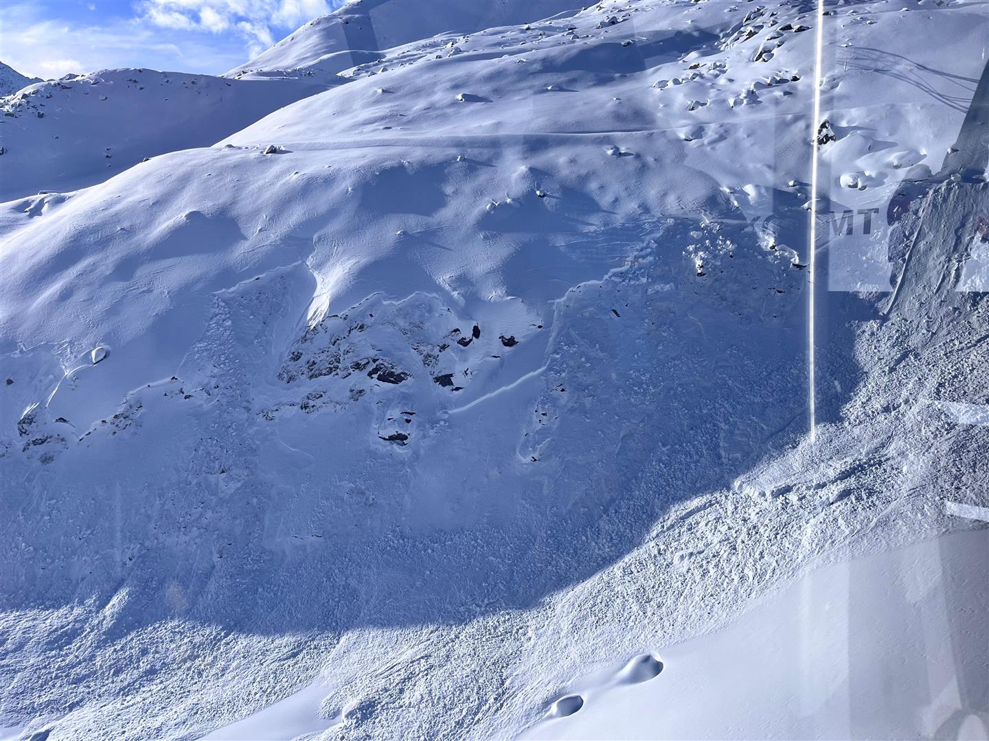
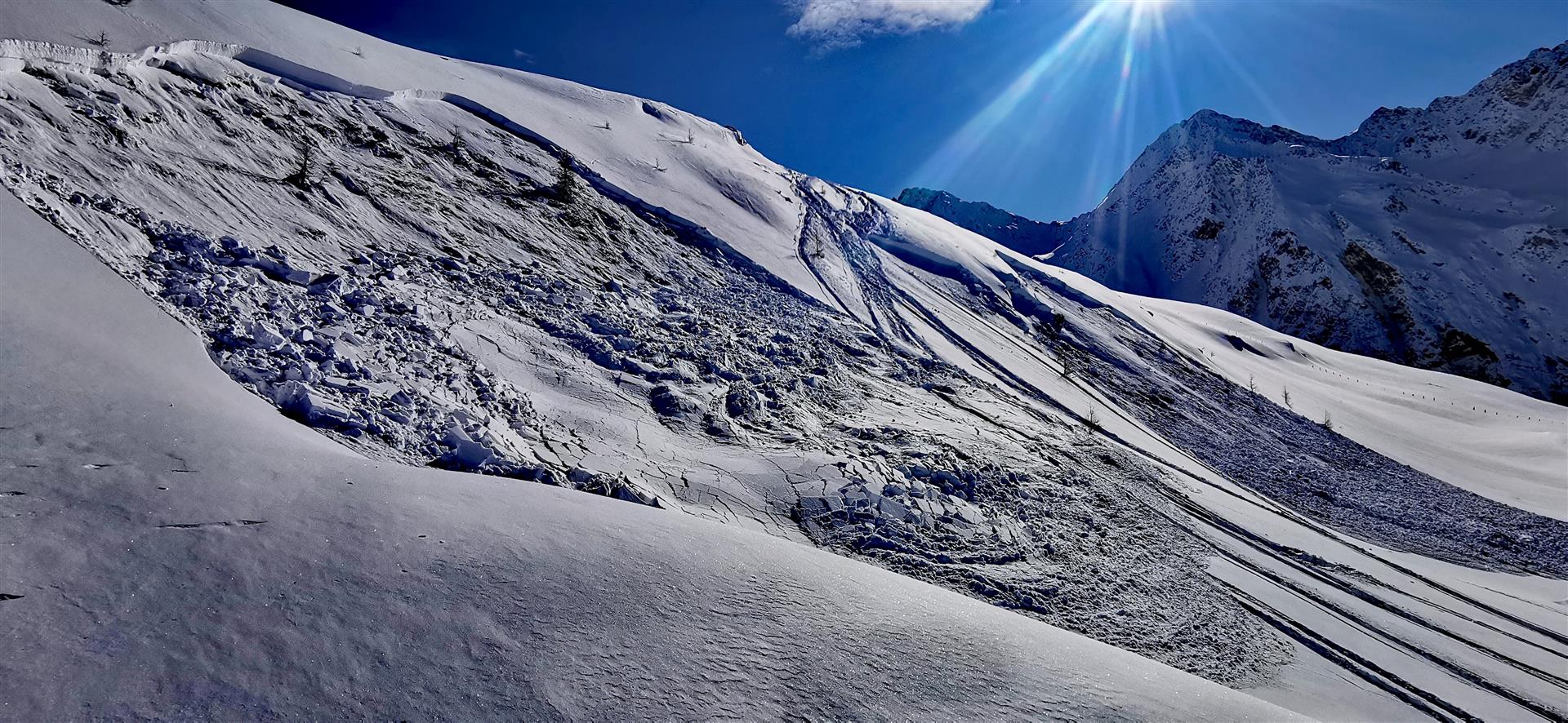
Artificial triggerings
Frequently with great success and also area-wide reach were the slab avalanches which were artificially triggered on 28 and 29 January. The artificial triggerings in the Arlberg region tended to be less successful.
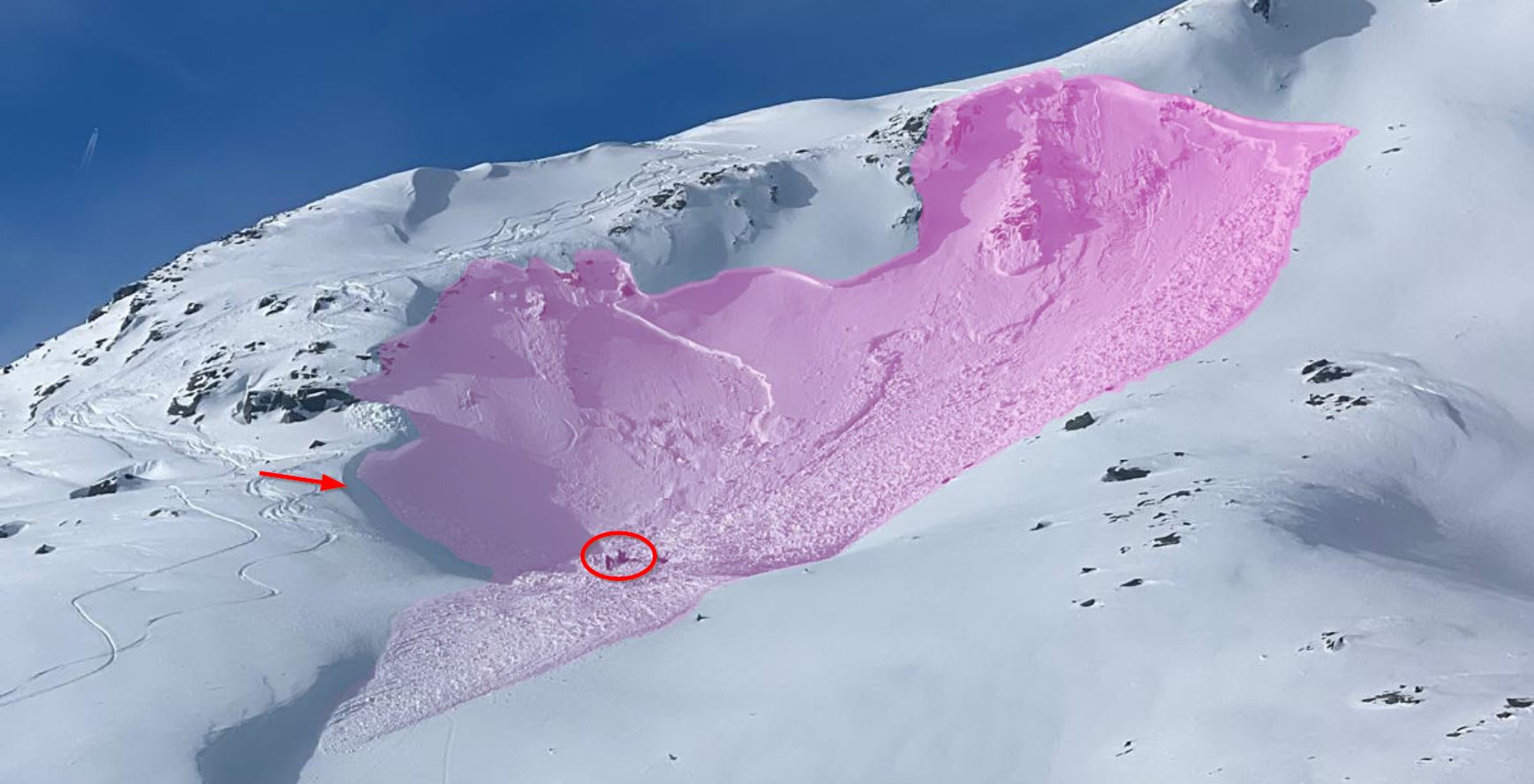
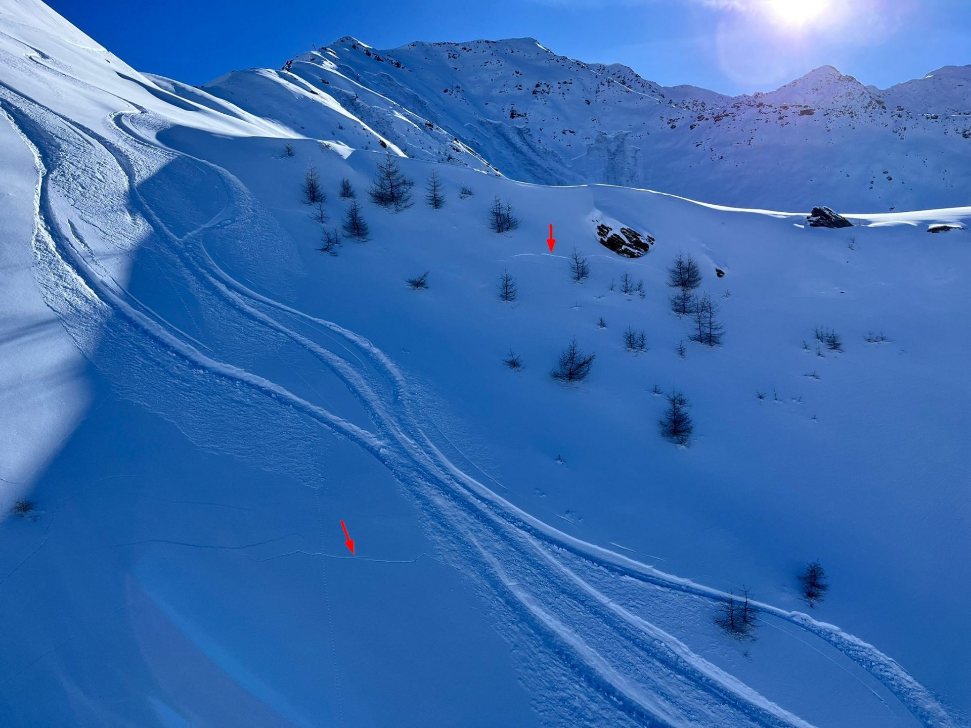
Remotely-triggered avalanches
Reports of remote triggerings continue to reach us. These are avalanches which are triggered through additional loading outside the area of fracture.
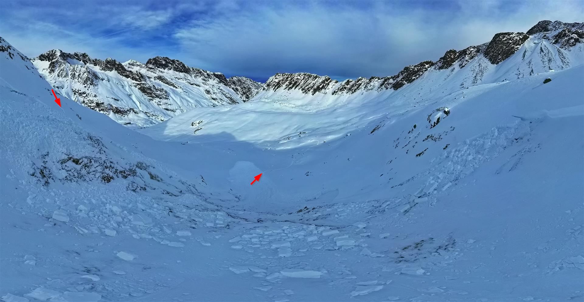
Avalanches triggered by persons or involving persons
Over the last few days, frequent reports of avalanches involving persons reached us. For details, see here:
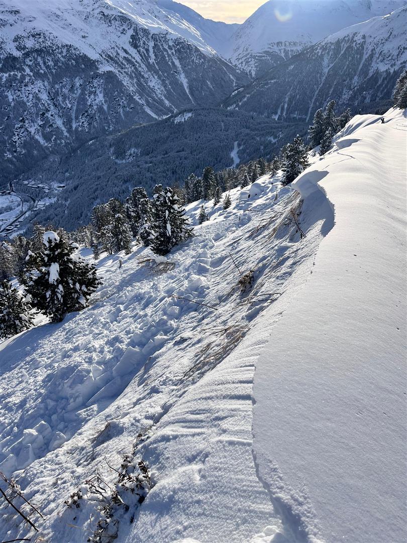
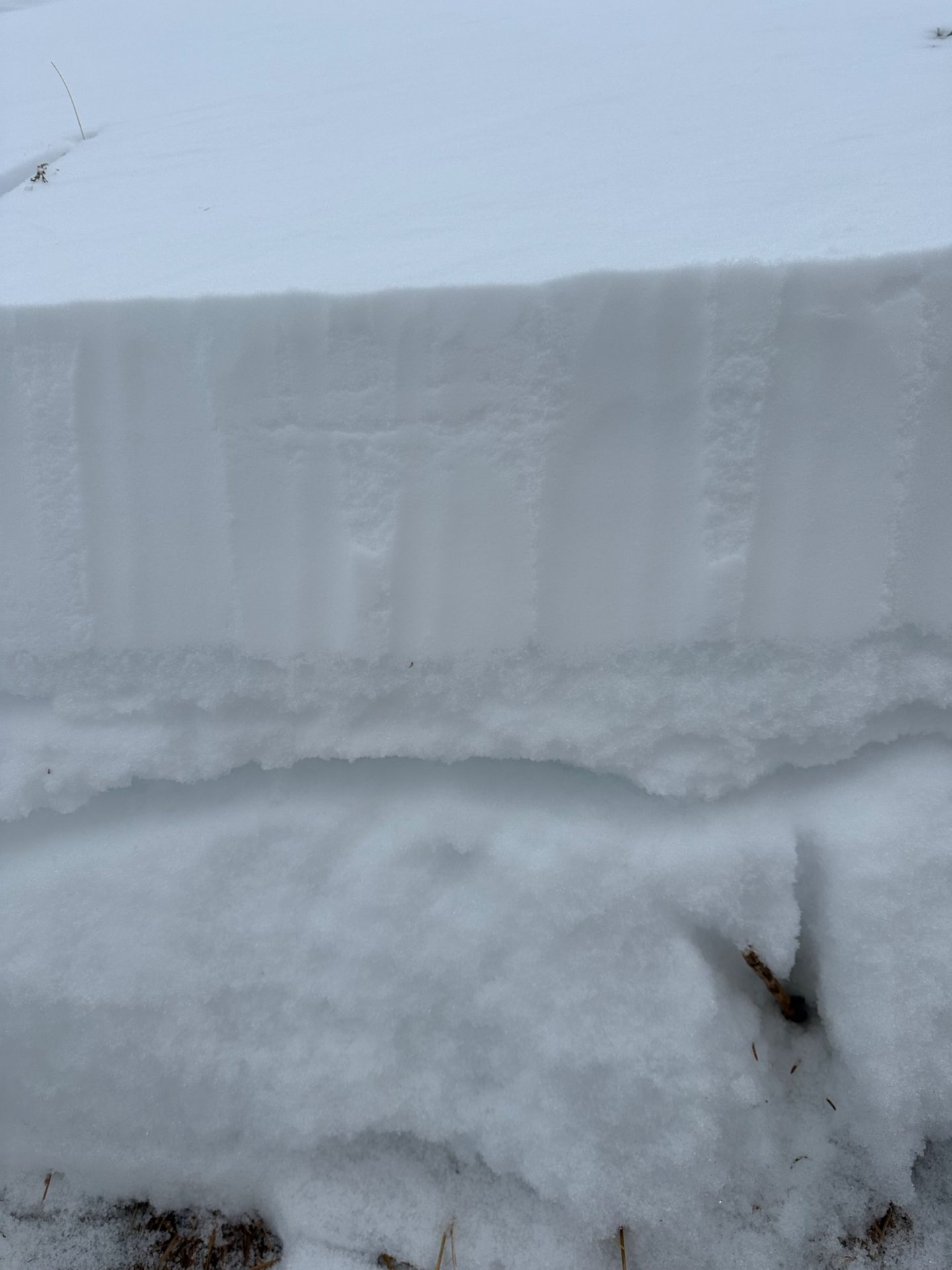
Glide cracks
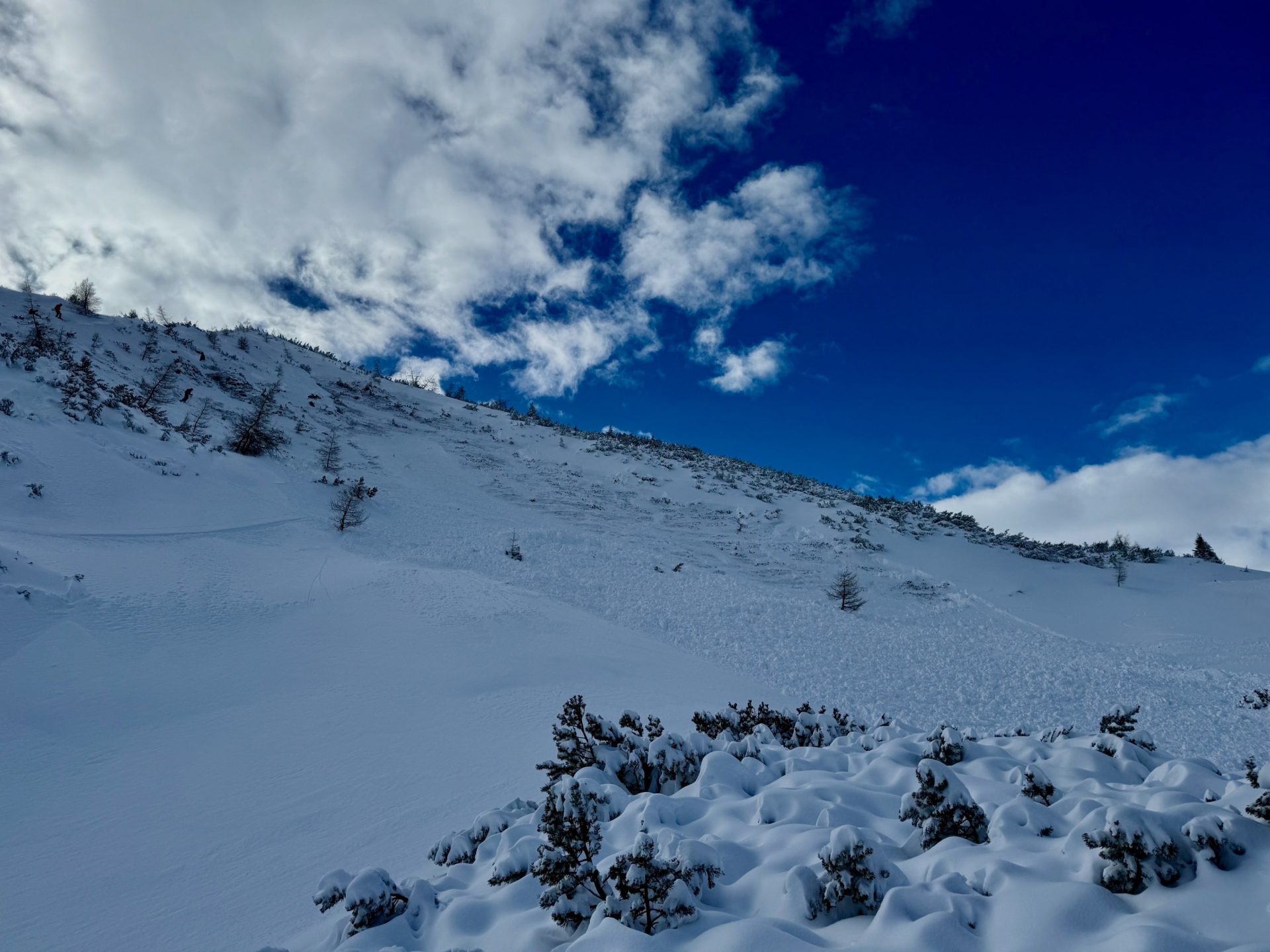
As mentioned, we are currently receiving reports of glide crack formation and settling noises, but also of remote triggerings. These are alarm signals of a snowpack which is extremely prone to triggering.
Where is it best?
We assume that in the zones which had the most snow in northern and northwestern regions, the persistent weak layer is quite a bit more difficult to disturb than in the regions further to the south. Also from there we have received few significant reports during and after the snowfall of 28.01 about heightened trigger sensitivity of the snowpack. Caution is necessary most of all in transitions from shallow to deep snow in very steep terrain, particularly on shady slopes.