Lots of fresh snow and wind are leading to a significant rise in avalanche danger. Fresh snow and snowdrifts will be deposited atop a weak, faceted expansively metamorphosed snowpack at and above the timberline, esp. on W/N/E facing slopes. During the snowfall, naturally triggered avalanches are likely, large-sized ones in isolated cases. The snowpack will remain prone to triggering even after the precipitation ends, avalanches can be easily triggered.
Fresh snow and drifts atop persistent weak layers
Southwesterly air current bringing heavy amounts of fresh snow
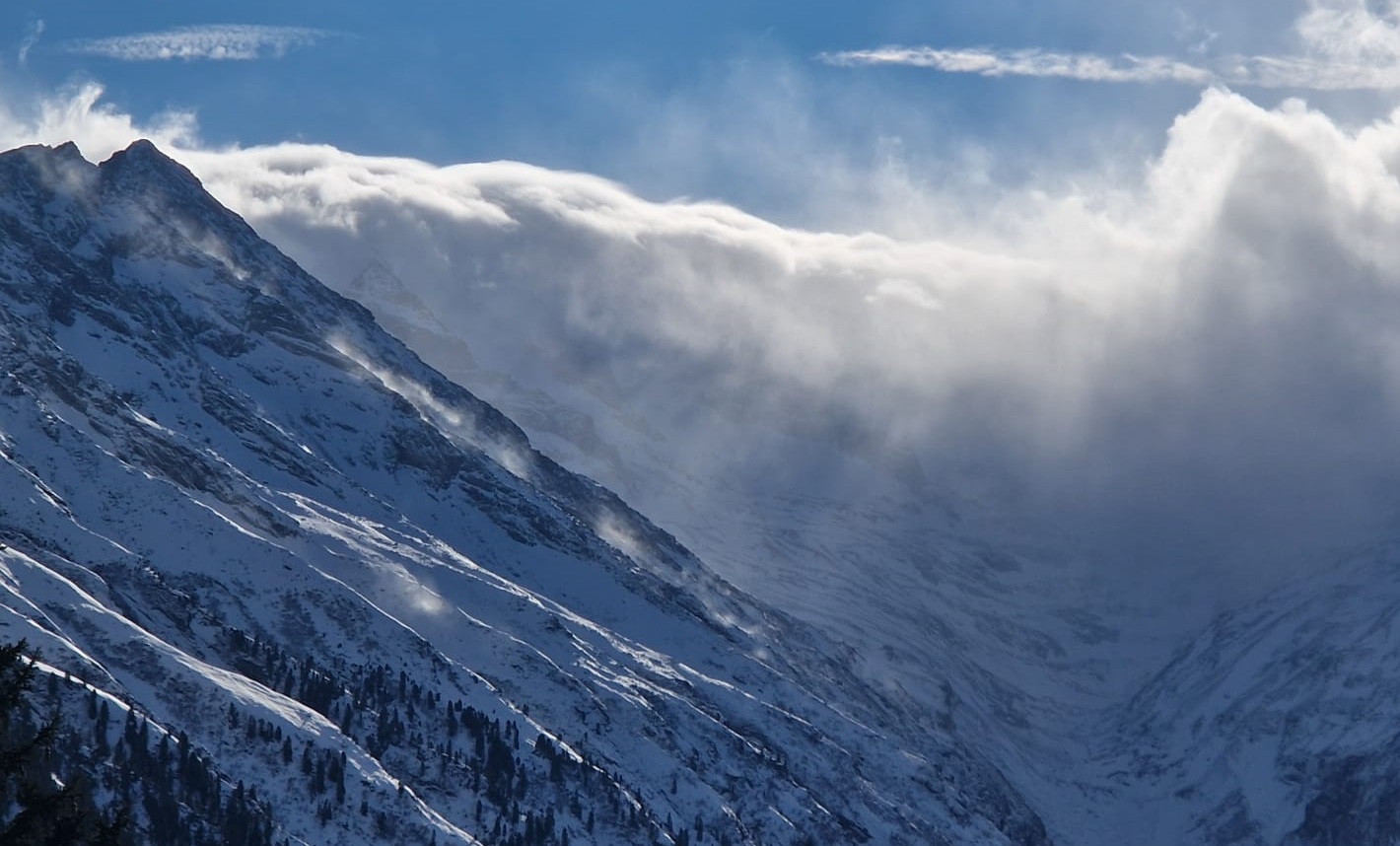
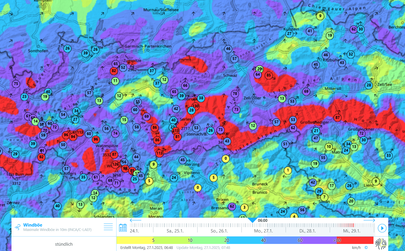
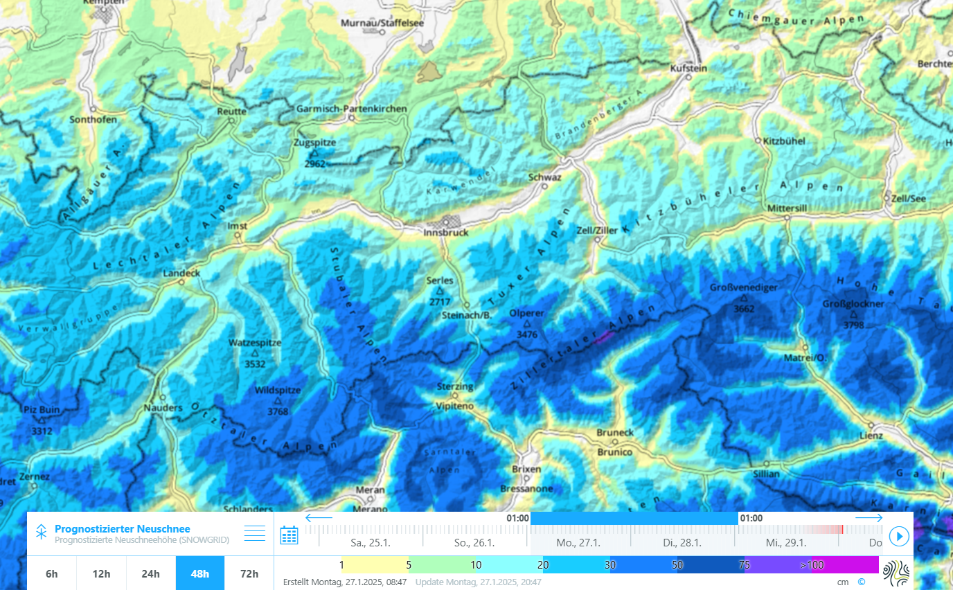
Storm-strength southerly foehn winds in North Tirol announced the arrival of a striking southwesterly front. By Tuesday evening it will bring 30-50cm of fresh snow, locally up to 70cm in the major areas of precipitation. Winds will be blowing at strong to storm strength from the southwest into Tuesday morning, thereafter slacken off. The snowfall level will lie at 1500-1700m, then descend down to low lying areas during the course of the precipitation.
Weak snowpack layering
On W/N/E facing slopes the fresh snow and snowdrifts will be deposited on top of a weak old snowpack. Particularly near the forest rims at about 1800-2200m, the snowpack surface is faceted and quite evenly distributed. There are also thin crusts near the surface regionally up to 2400m which have generated faceted crystals. Particularly at these altitudes and in these aspects there are surface-wide weak layers which will now be blanketed by a slab: the wind-impacted fresh fallen snow.
Further up, the snowpack surface is frequently wind-impacted and, thus, highly variable. Large-scale weak layers occur particularly in wind-protected shady bowls and at the foot of rock walls. The distribution of weak layers in very steep high-alpine, south-facing and glaciated terrain is currently unsure. Observations from 10 January along the Main Alpine Ridge on the South Tirolean side confirm at least one near-ground level surface-wide weak layer.
Significant increase, then gradual decrease of avalanche danger
Naturally triggered avalanches during precipitation
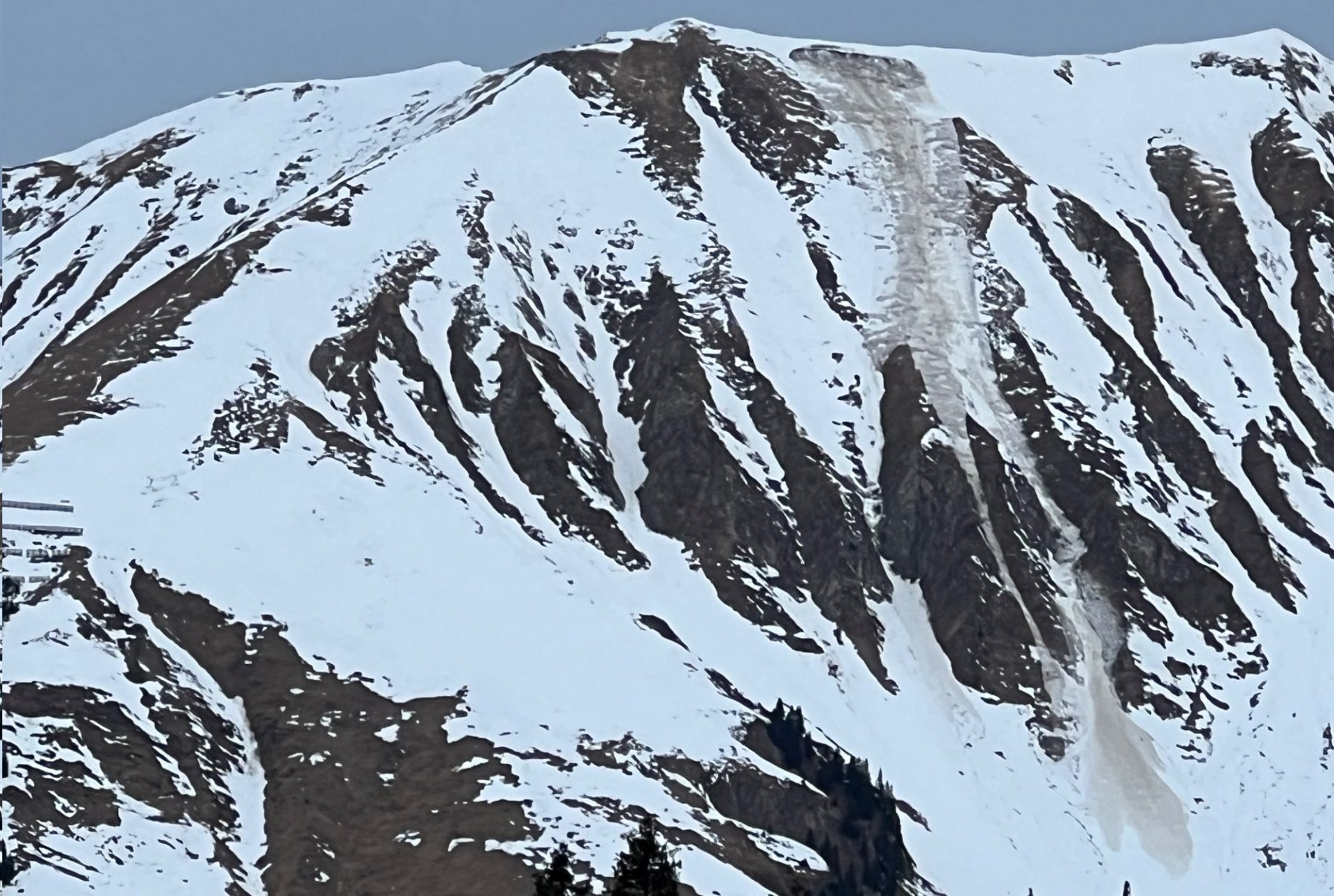
During the round of precipitation, in particular during the hours before temperatures drop and winds slacken off, naturally triggered slab avalanches can be expected. This will especially be the case in the zones cited above due to weak snowpack stability, and particularly where fresh snowdrift accumulations are deposited, namely, the wind-protected, north and south-facing very steep bowls and areas at the foot of rock walls.
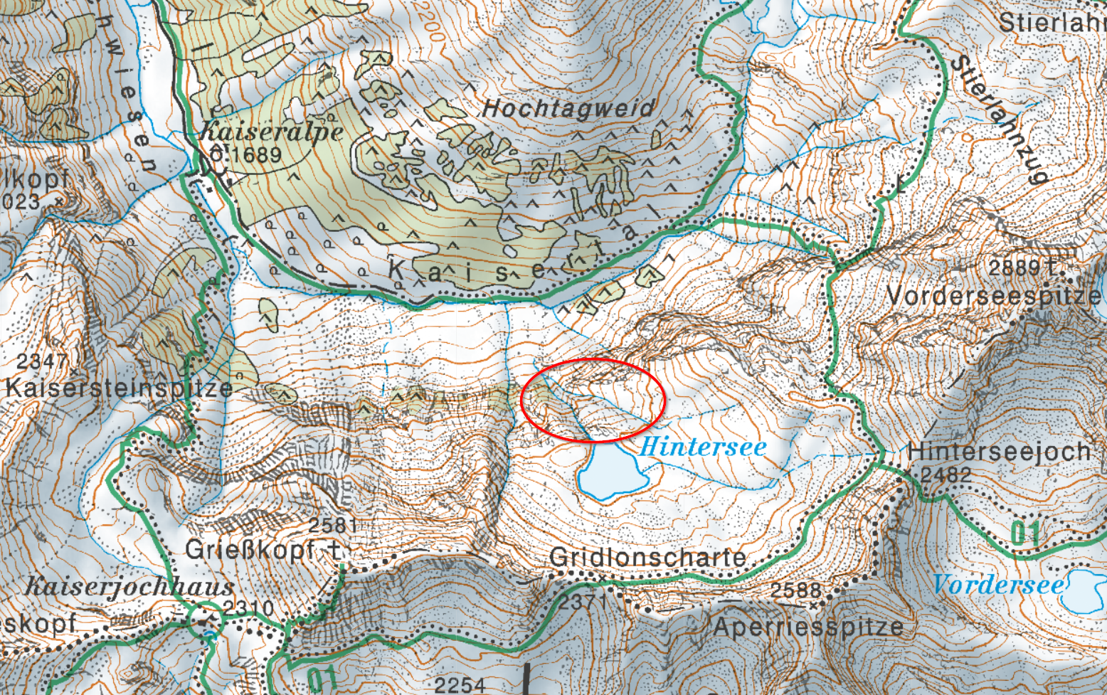
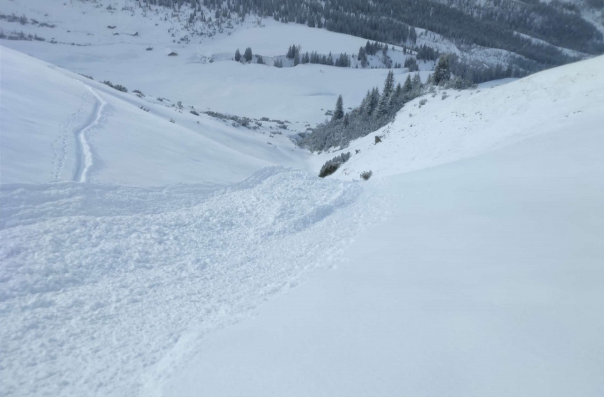
Avalanches and observations which reached us yesterday, Sunday, 26.01 and today, Monday, 27.01, bear witness to the unfavorable development of the situation. On the Aperriesspitze in Kaisertal, Lechtal Alps, there was an avalanche incident today on a NW-facing slope at 2100m in which a person was buried in snow masses, later lifted out and flown to the hospital in Zams with uncertain injuries.
That presents a highly unfavorable avalanche situation for all backcountry tours on Tuesday, 28.01, in which avalanches can be triggered in a wide range of different locations. The major peril is to be expected where most of the precipitation falls. The precise distribution is still subject to uncertainty.
High proneness to triggering following the end of the snowfall: CAUTION.
As mentioned above, this problem is a persistent weak layer, one which is characterized by trigger-sensitive layers which have endured for a longer period. Thus, over the coming days we will have a period of heavy snowfall which is much influenced by winds and have a relatively high trigger-sensitivity of the snowpack, particularly at the altitudes and in the aspects cited above. Caution in general is also urged on steep ridgeline slopes and behind protruberances in the landscape. The situation is less critical in areas which have been heavily skied on all winter long.
Glide cracks, settling noises, isolated remote triggerings possible
Today, 27.01, reports have reached us about glide cracks and settling noises. Over the next few days we assume that such clear and present danger signs will become more frequent. In isolated cases, remote triggerings can also be expected, more frequently on west and north-facing slopes in the major areas of precipitation starting at the timberline up to 2400m.
Avalanche prone locations are often blanketed, making assessment more difficult
What makes the situation even more difficult is that towards the end of the period of precipitation, winds will significantly ease off and temperatures drop. Thus, there will often be powder snow on the snowpack surface. As of that point, there will be no visible signs of immediate danger, outside the obvious ones (glide cracks, settling noises, fresh avalanches) apparent to the observer. For that reason it is all the more important, particularly in the above-cited regions where the snowpack is weak, to be extremely defensive and restrained or, better yet, to consequentially avoid these zones over the next few days.
Loose-snow and glide-snow avalanches
Following this round of snowfall, in addition, loose-snow avalanches will release in extremely steep terrain, particularly when it is sunny. Also glide-snow avalanches will occur more often due to the recent warm days and due to the new burden of fresh fallen snow on the snowpack.