Heavily wind-impacted, variable snowpack surface – and small drifts prone to triggering

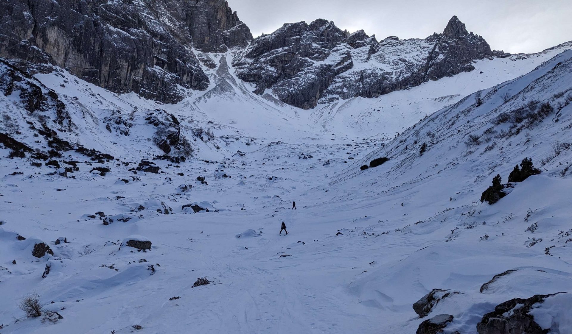
Avalanche danger in Tirol’s mountains currently falls between two danger levels, low and moderate. The major risk stems from small drifted masses on very steep north and east-facing ridgeline slopes. Simultaneously, snow depths throughout the land are below average for this juncture of the season. In many places lurks the danger of rocks and ground contact, glacier crevices are barely covered. Middle of next week, a SW front could bring fresh snow.

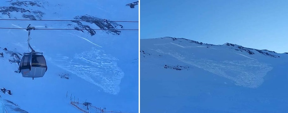
Small, often trigger-sensitive drifts at high altitudes

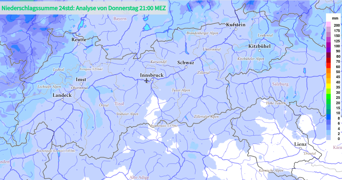
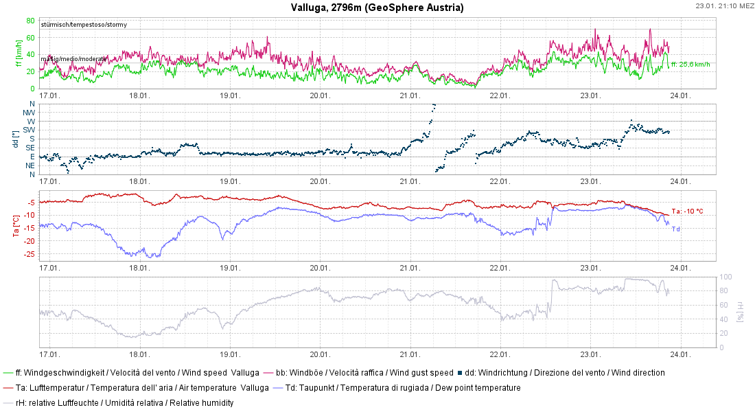
The cold front that passed over the land today, 23.01, brought (as forecast) only a negligible amount of precipitation, in western regions beginning as rain extending up to 2000m.

Die Kaltfront am Donnerstag, 23.01. bescherte nur sehr geringe Niederschlagsmengen (©GeoSphere Austria).
The cold front on Thursday, 23.01, brought paltry amounts of precipitation. (©GeoSphere Austria).
Ein Hauch von Neuschnee am Medrig (2568m) in der Samnaungruppe (©Martin Santeler, 23.01.2025).
A touch of fresh snow on Medrig (2568m) in the Samnaun Massif (©Martin Santeler, 23.01.2025).

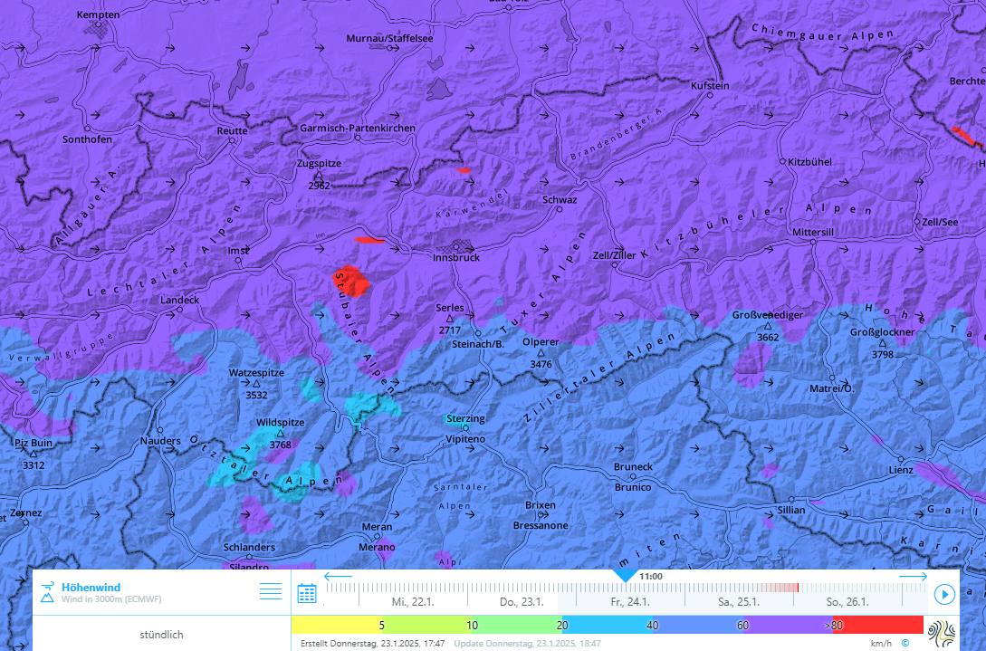
The southerly foehn collapsed when the cold front moved in. The often strong-velocity wind continues, however, although the wind direction has shifted more to westerly.

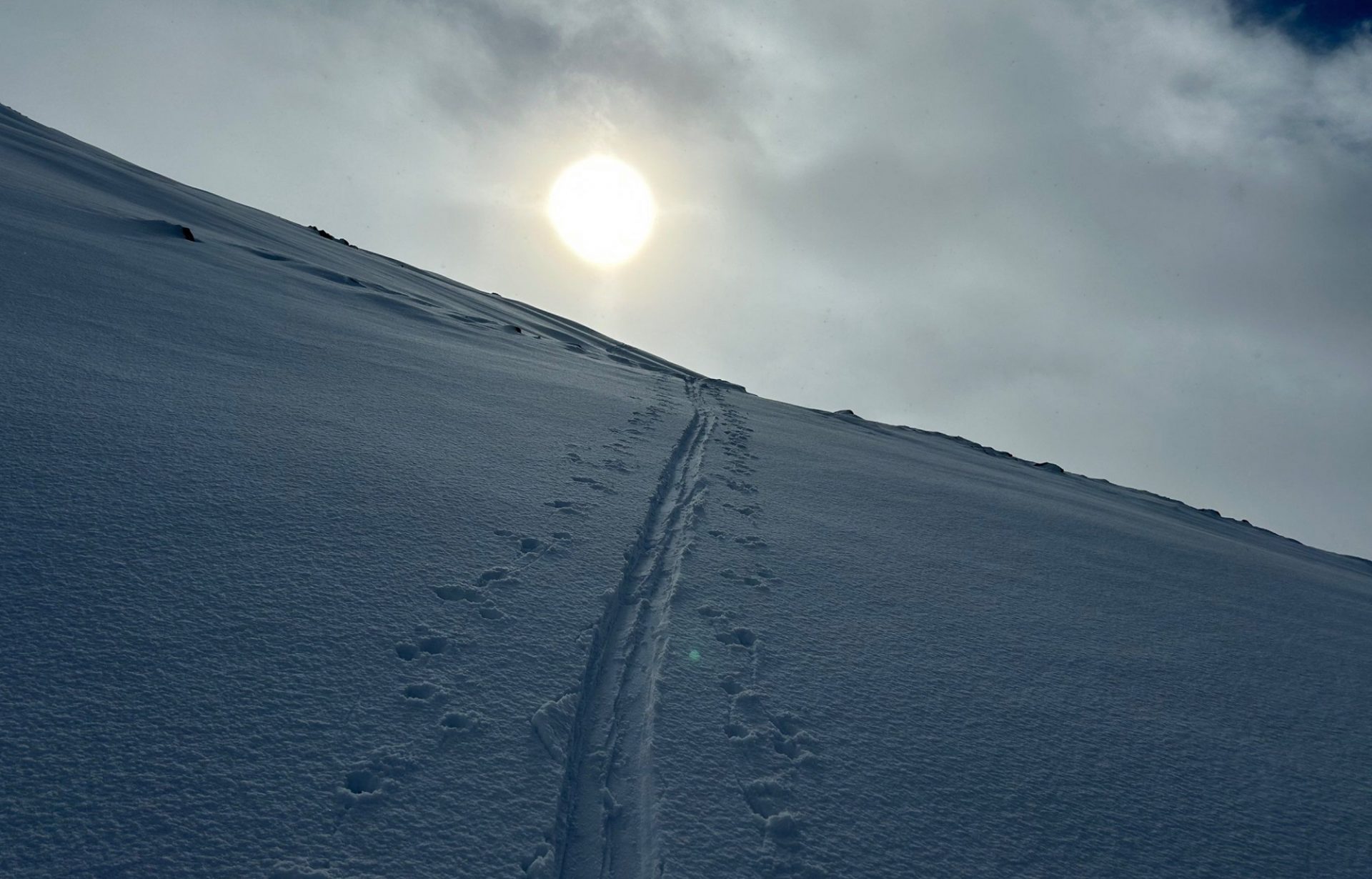
The shift in wind direction led to regionally loose surface snow (which had been left unaffected by the southerly foehn) being transported. Fresh snowdrift accumulations were thereby generated which may be prone to triggering on very steep north and east-facing slopes, at least on Friday, 24.01. This will be the case where the drifts get deposited atop a loose, expansively metamorphosed snowpack surface or possibly on top of fresh snow on wind-protected zones. With the currently highly diverse snowpack surface, there are not many spots like that. Due to the minor amounts of transportable snow, the fresh drifts will remain small. Moreover, they will be quite easy to recognize and thus can be circumvented, particularly in terrain where taking a fall is possible.

Starker Westwind am Gipfel der Valluga in den Lechtaler Alpen. Mit der Kaltfront sind die Temperaturen etwas zurückgegangen.
Strong-velocity westerly winds at the Valluga summit in the Lechtal Alps. With the cold front, temperatures dropped somewhat.
Auch am Freitag bläst in der Höhe stark bis stürmischer Westwind.
Also on Friday, a strong-to-stormy westerly wind was blowing at high altitude.

Springlike weather followed by southern barrier clouds

Starting on Friday, 24.01, air temperatures will rise measurably during the course of the day. On Saturday the zero-degree level will ascend to nearly 3000m. The small snowdrift accumulations will rapidly consolidate and soon be hardly triggerable.

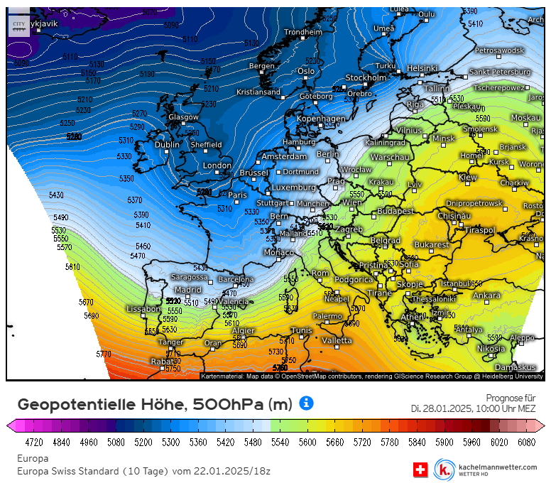
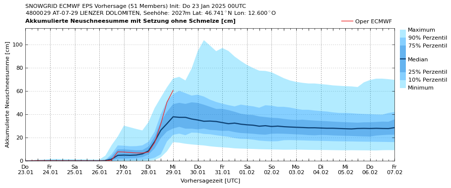
On Sunday, temperatures will then recede significantly and a moist southern barrier cloud front will establish itself. Thereby, another strong-to-stormy foehn wind phase will be ushered into North Tirol through Monday. Thereafter, until Wednesday, 29.01, heavy snowfall is possible.

In a few days an update of the situation will be published with more precise calculations about approaching weather developments. One thing is certain: the weather is going to get more interesting, both in terms of snowfall and of avalanche dangers.

Die Alpen geraten zu Beginn der kommenden Woche unter eine kräftige Anströmung von feuchter Luft aus Südwest (©Kachelmannwetter).
The Alps will be hit by a powerful current of moist air masses from the southwest at the beginning of next week (©Kachelmannwetter).
Prognostizierte, akkumulierte Neuschneesumme für die Lienzer Dolomiten. Die Unsicherheiten sind noch sehr groß (blau hinterlegte Bereiche) – jedenfalls aber lebt die Hoffnung auf ein Wiedererwachen des Winters (©GeoSphere Austria).
Forecast accumulated amounts of fresh snow for the Lienz Dolomites. The uncertainties still loom large (zones shaded blue) but there is hope that the winter might reawaken (©GeoSphere Austria).

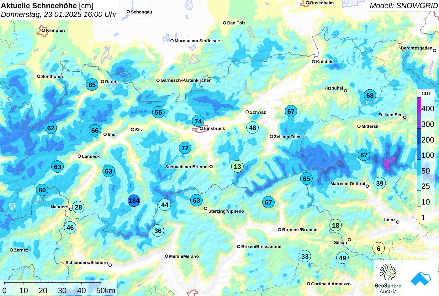
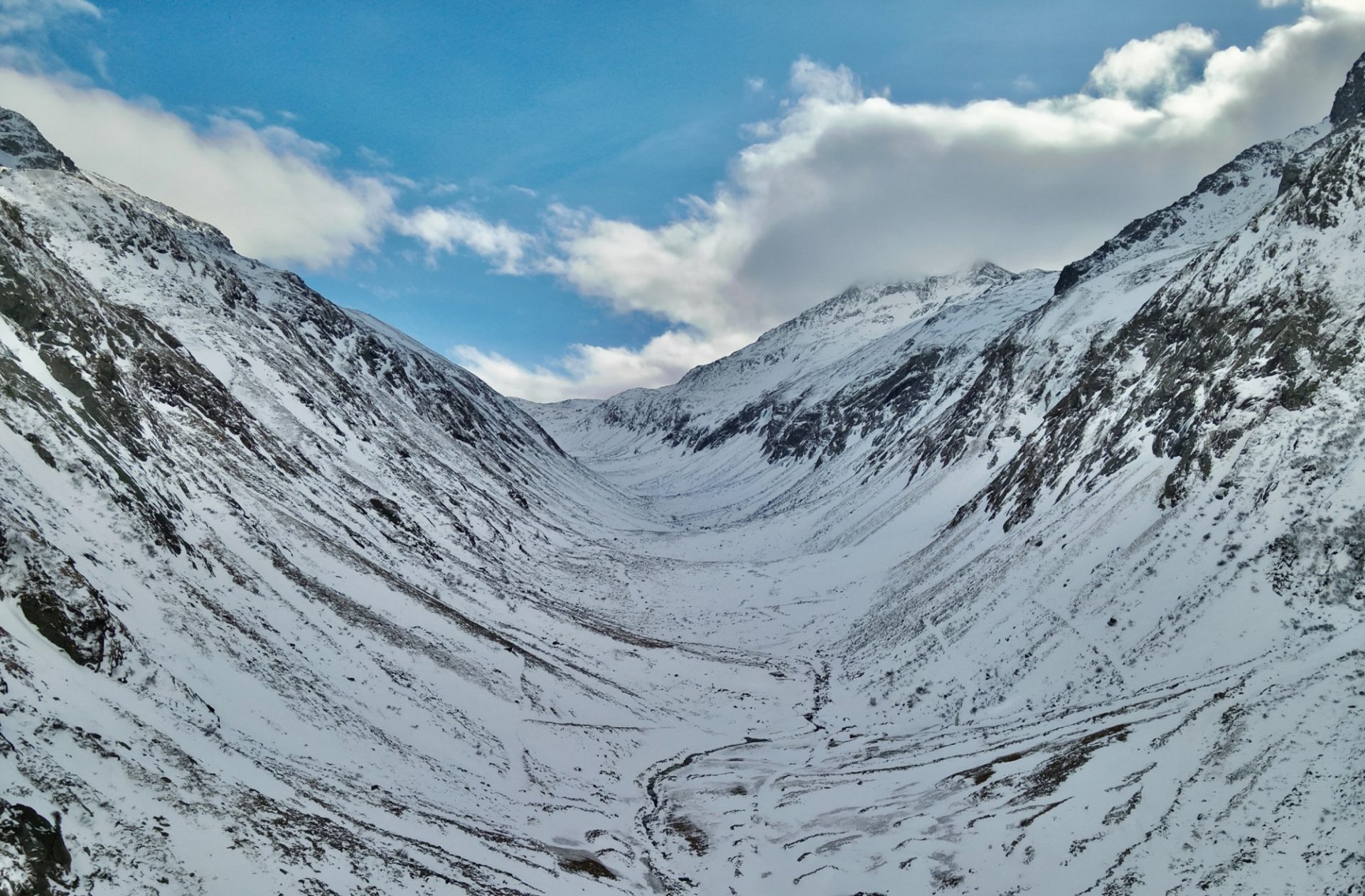
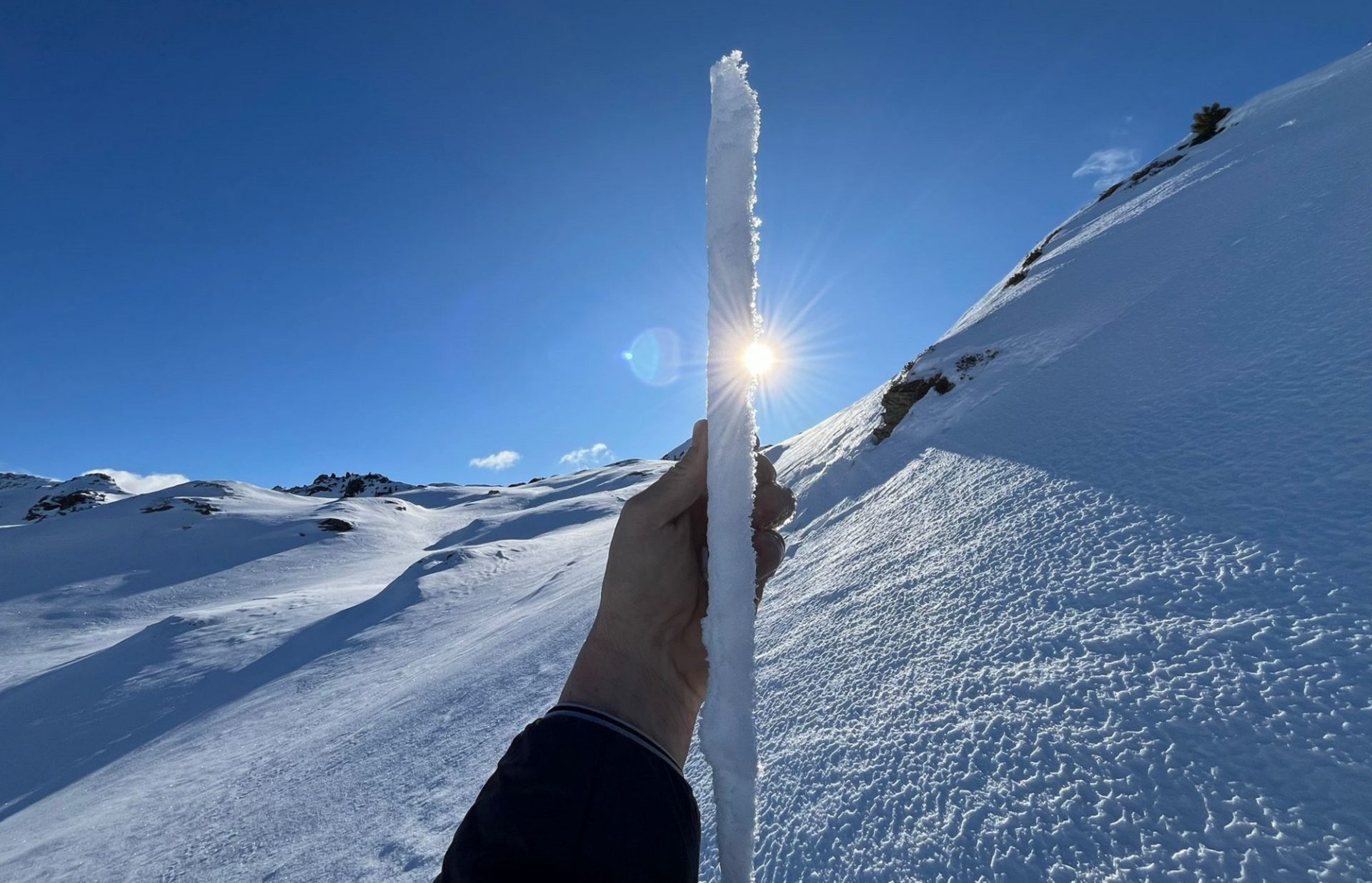
Not much snow, poor snow quality

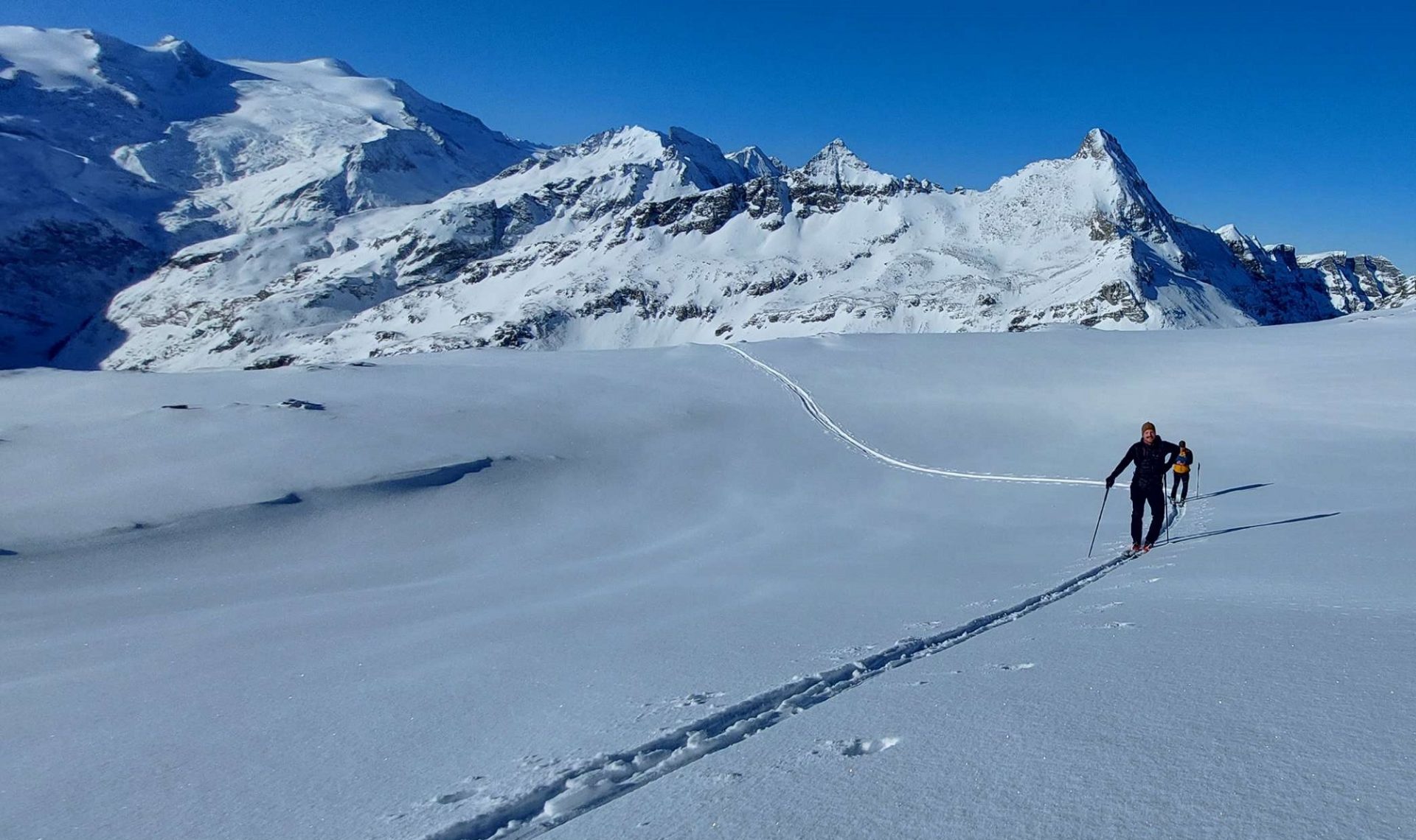
More than anything else it was the frequently strong-velocity wind which deteriorated snow quality over the last week. The snowpack surface is highly diverse, often pretty poor for skiing. Powder snow in the form of expansively metamorphosed, faceted crystals or surface hoar is most likely to be found on wind-protected shady slopes below 2000m. Steep south-facing slopes at all altitudes have become moist through solar radiation and mild temperatures. In isolated cases, acceptable firn snow has been reported.

Mit dem Neuschnee vom 15.01. konnten in der Venedigergruppe am vergangenen Freitag, 17.01. recht gute Verhältnisse angetroffen werden. In der Zwischenzeit hat der Wind den lockeren Schnee wieder vertragen. Rechts im Hintergrund der Tauernkogel, links der Großvenediger (©Peter Fuetsch, 17.01.2025).
With the fresh snow on 15.01 the Venediger Massif offered quite good conditions last Friday, 17.01. In the interim, winds have transported the loosely-packed snow. In background right, Tauernkogel, left the Grossvenediger (©Peter Fuetsch, 17.01.2025).
Mit Einsetzen des Südföhns am Samstag, 18.01. bildeten sich kleine, frische Triebschneeansammlungen. Diese wurden auf der kantig aufgebauten Schneeoberfläche abgelagert und waren kurzzeitig sehr störanfällig. Diese kleine Schneebrettlawine löste sich an einem Nordosthang auf rund 2600m am Stubaier Gletscher spontan (©Franz Josef Tanzer, 18.01.2025).
When the southerly foehn wind set in (Saturday, 18.01) small, fresh snowdrifts accumulated. They were deposited atop the expansively metamorphosed snowpack surface and for a short time were prone to triggering. This small slab avalanche triggered naturally on a NE-facing slope at 2600m on the Stubai Glacier (©Franz Josef Tanzer, 18.01.2025).
Stark windbeeinflusstes Landschaftsbild im Sandestal im oberen Gschnitztal (©LWD Tirol, 19.01.2025).
Heavily wind-impacted landscape in Sandestal in the upper Gschnitztal (©LWD Tirol, 19.01.2025).
Auch wenig Schnee in der Hundskehle in den Zillertaler Alpen. Skitouren sind hier derzeit wohl kaum möglich (©Thomas Eder, 20.01.2025).
Not much snow also in the Hundskehle in the Zillertal Alps. Backcountry tours are hardly possible there currently (©Thomas Eder, 20.01.2025).
In windgeschützeren schattigen Lagen, besonders im Bereich der Waldgrenze und darunter blieb der Schnee (auch mit Inversionswetterlage) oft konserviert. Er baute sich aufbauend um, teilweise bildete sich Oberflächenreif an der Schneeoberfläche. Kasern, Schmirn (©Jef Verstraeten, 21.01.2025).
In shady, wind-protected zones, particularly near the timberline and lower down, the loosely-packed snow was often preserved, even during the inversion weather period. It then metamorphosed expansively, frequently formed surface hoar. Kasern, Schmirn (©Jef Verstraeten, 21.01.2025).
Auch das Nurpenstal in den Tuxer Alpen war vom Südföhn etwas abgeschattet und bot noch recht gute Skibedingungen (©Florian Wechselberger, 21.01.2025).
Also the Nurpenstal in the Tux Alps was much affected by the southerly foehn wind, and offered quite rewarding conditions (©Florian Wechselberger, 21.01.2025).
An Schattenhängen ist die Schneedecke oft weitestgehend kantig aufgebaut. An der Schneeoberfläche wurde in den Tuxer Alpen, aber auch im Karwendel bis 2200m, z.T. bis 2400m die Ausbildung einer oberflächlichen Schmelzkruste beobachtet.
On shady slopes the snowpack is expansively metamorphosed far and wide. On the snowpack surface a superficial melt-freeze crust extending to 2200-2400m was reported in the Tux Alps and Karwendel by our observers…
Die Kruste dürfte sich durch die Ablagerung von unterkühlten Tröpfchen aus Nebel (evtl. unter Einfluss von Wind) geformt haben (©Stefan Wierer, 21.01.2025).
…the crust was probably generated by the “precipitation” of under-cooled droplets from the fog, possibly with wind impact (©Stefan Wierer, 21.01.2025).

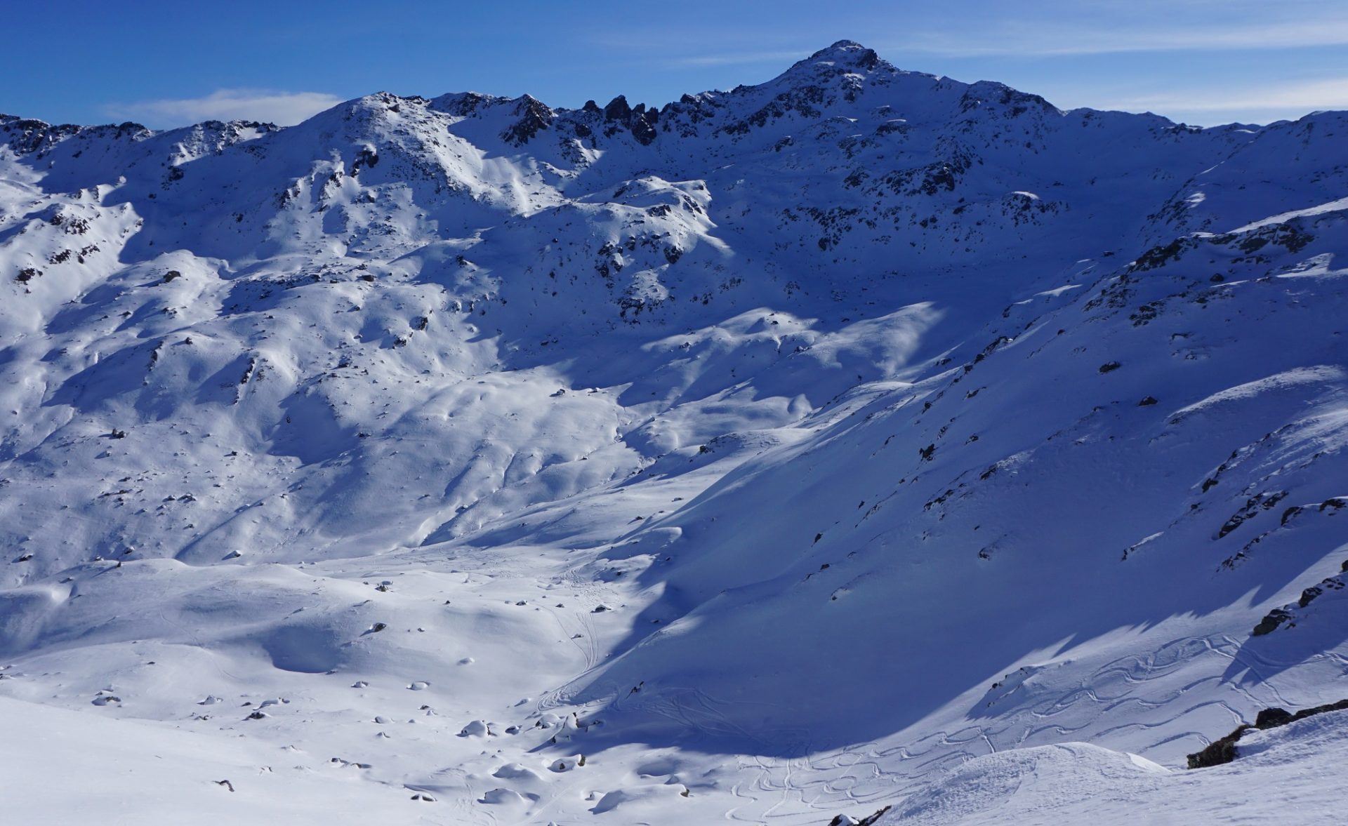
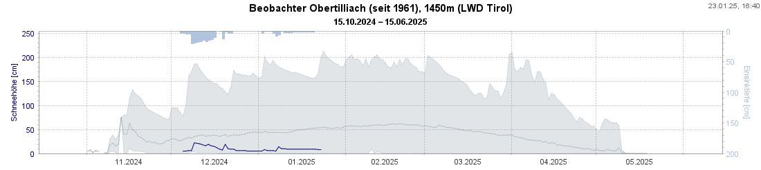
Besides the snow quality, the amounts of snow also leave much to be desired. Derived from the relative snow depths that the Swiss Avalanche Warning Service calculated along our common border near the Silvretta and Samnaun Massifs, we currently lie at approximately 60%, compared to long-term averages (1991-2020). In East Tirol, probably less than that.

Aktuelle Gesamtschneehöhe in Tirol.
Current overall snow depths in Tirol.
Die blaue Linie markiert die Entwicklung der Schneehöhe in der laufenden Saison bei unserem Beobachter in Obertilliach, Osttirol. Die graue Linie zeichnet die mittlere Schneehöhe am jeweiligen Tag seit Messbeginn 1961.
The blue line marks snow depth developments during the current season at our observation station in Obertilliach, East Tirol. The gray line depicts the mid-snow depth on the relevant day since measurements began in 1961. The current snow depth just about touches the absolute minimum.