Amidst constant stable weather conditions, the avalanche situation changes only minimally. That is a good time to cast a glance at the changes in the Avalanche Bulletin which will take effect during the current 2024/25 season.
What is easily the biggest, although least visible change since last winter is the change in the Avalanche Bulletin’s period of validity and simultaneous coordination of danger levels with our neighboring countries. This answers the often-expressed wish of all our readers/users: updates of the Avalanche Bulletins can now be clearly grasped. In addition, there are new weather maps which form the basis of danger assessments and backcountry touring planning.
New period of validity: 5:00 pm to 5:00 pm
In collaboration with all the Avalanche Warning Services of Austria and with the Avalanche Warning Service of Bavaria an agreement about unified time of publication (5:00 pm) and unified period of validity (5:00 pm to 5:00 pm of the following day) has been reached. This occurred in harmony with the already valid system of the Swiss, whereby consistency and easily understood correspondence should be the norm extending to far-reaching parts of the Alps. This creates more clarity and improved safety for backcountry planning for all users/readers. At the same time, a convergence of the working routines within the Avalanche Warning Services is aimed at, which makes agreement between the various forecasters far easier.
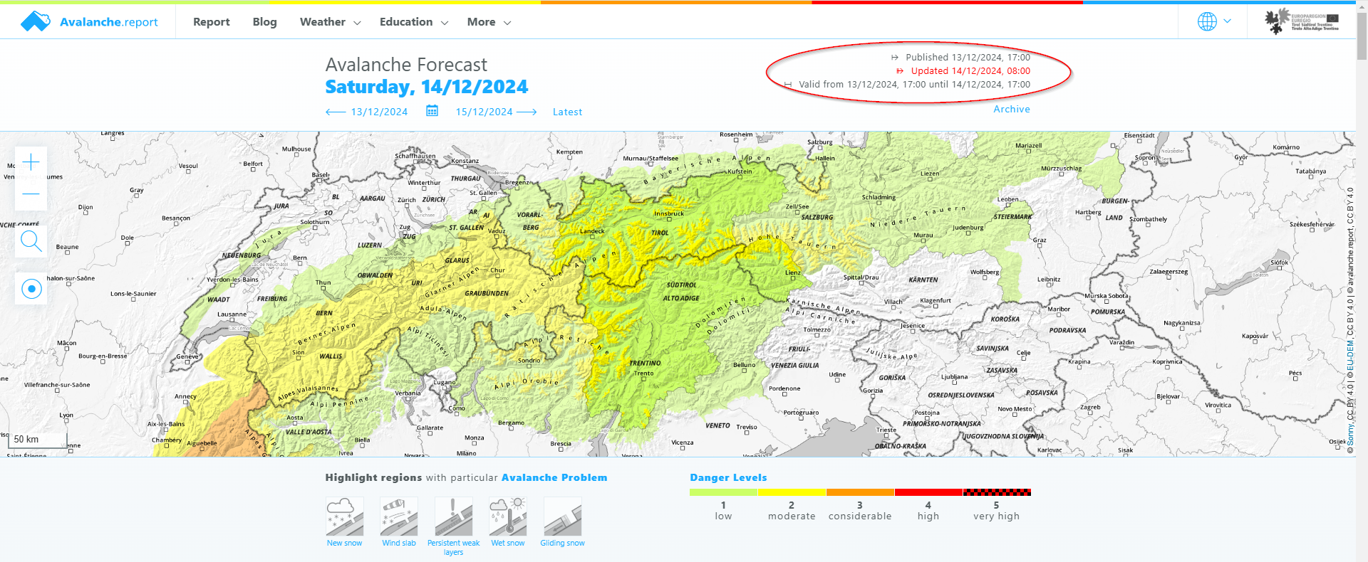
In the European Region of Tirol/South Tirol/Trentino, the period of validity of the Avalanche Bulletin changes as of the adjustments cited above. The bulletin was published at 5:00 pm in the past (time of publication), but was valid for 24 hours of the following day, i.e. midnight until 11:59 pm. Starting this season, the bulletin published is always the currently valid one and remains valid from the moment of publication until 5:00 pm the following day. The time of planned updates, when they are published, remains unchanged: 8:00 am.
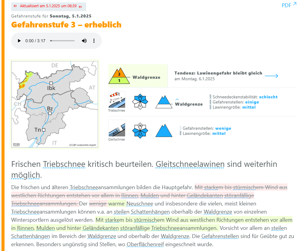
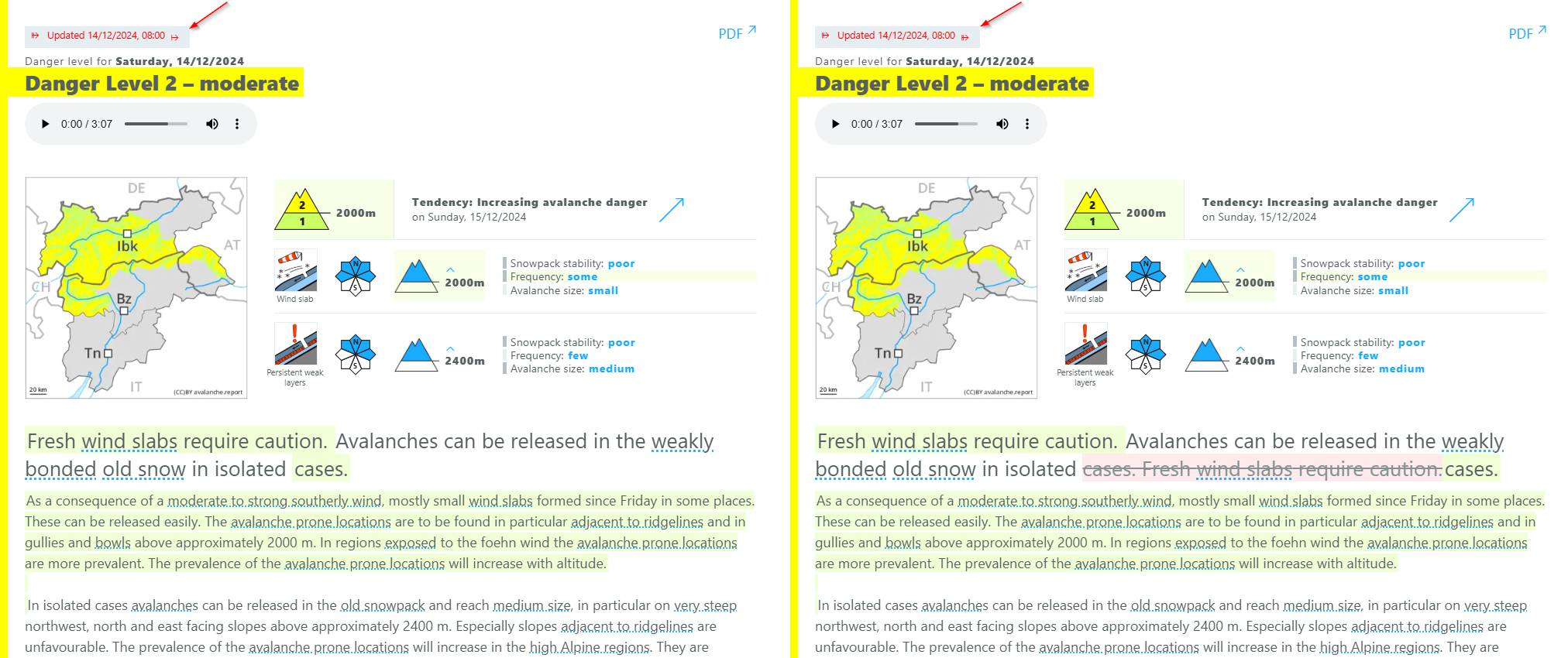
Clearly understandable updates
With immediate effect, all changes which are enacted in the course of an updated report will be made specially & specifically visible. This enables users to recognize an updated situation, then form their own picture of the new dangers and permit the new information to flow into that picture more easily.
At a glance, users can now see in an instant:
- in what regions changes have occurred
- what specific parameters have been changed
- what passages in the texts have been changed or adjusted
The new function permits newly added blocks of text/information to be marked. But it also makes visible texts which have been deleted in the update. Thus, ALL changes are made visible, compared to the Avalanche Bulletin which was published at 5:00 pm.
New weather maps, changed models
The Avalanche Bulletin has expanded its offerings through new maps and detailed weather parameters, with a special focus on improved information regarding winds. In addition, also the maps themselves have changed, they are based on newer models for their creation. Beneath the maps, the desired time and span-of-time can be selected. Outside of that, depending on the map chosen, also the calculated value of the chosed parameter can be depicted by clicking on the map.
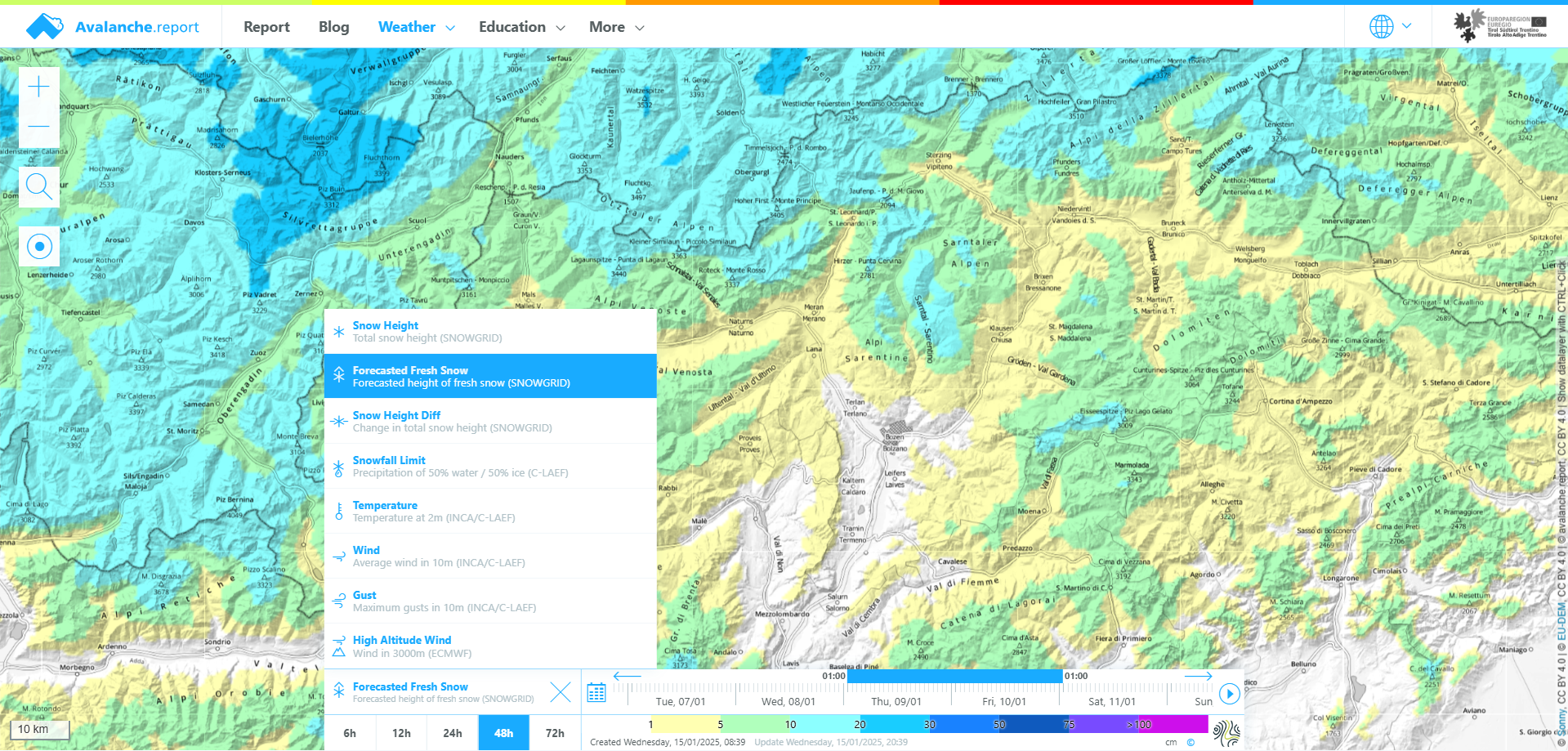
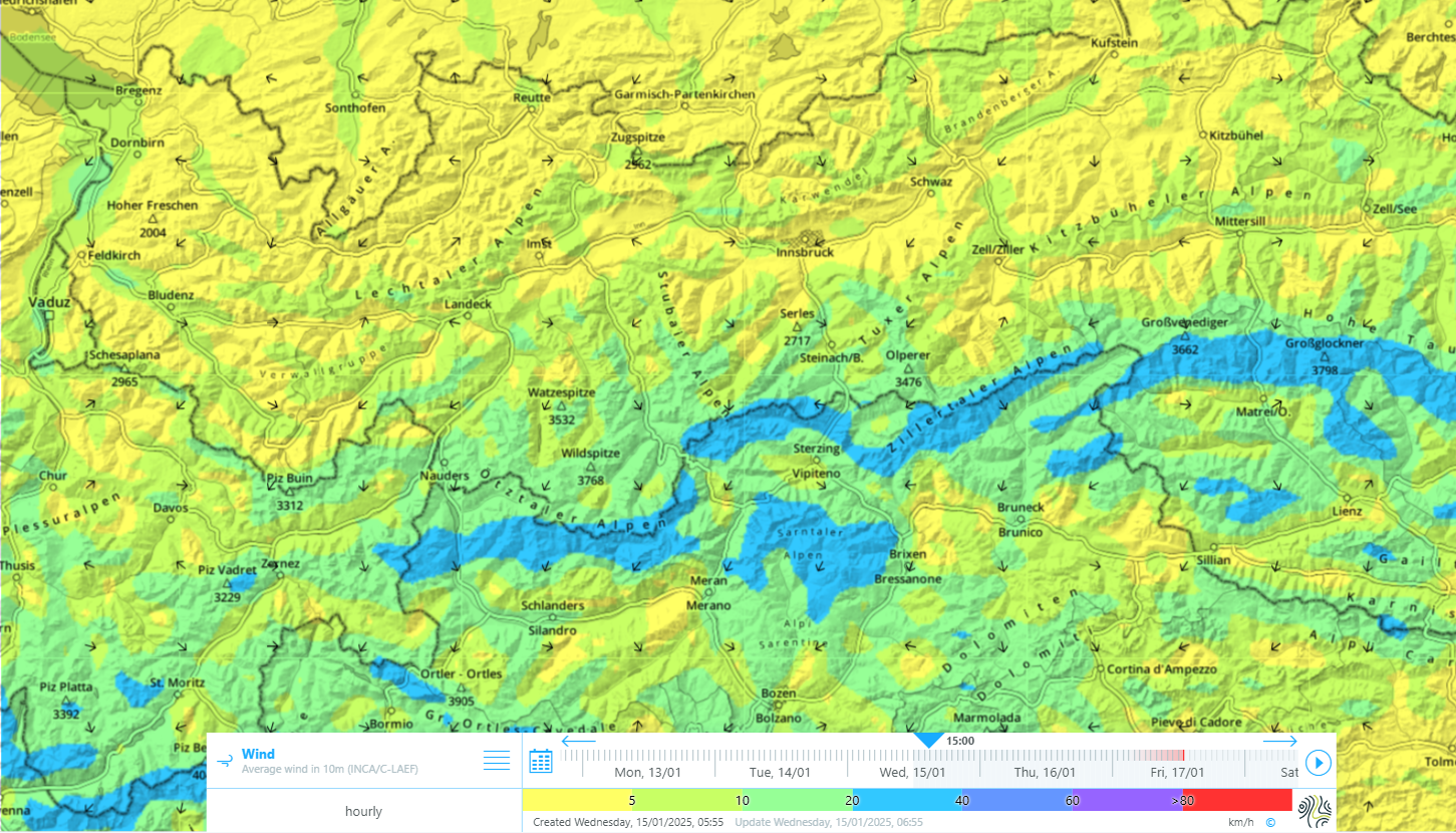
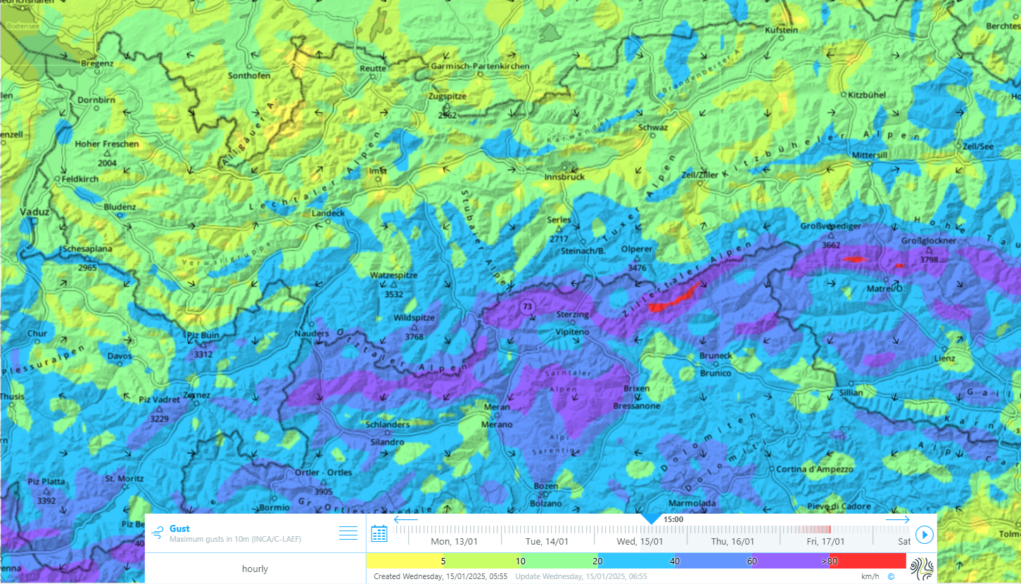
New maps for ground wind
For a few days now, two new forecast maps, one for mid-winds (windspeeds over 10 minutes of measurement) and wind gusts (highest windspeeds for 3 seconds) have been depicted at ground level. Thus, apart from the 3000m winds at high altitude, two new wind measurement products are now available. This is especially interesting in case of foehn wind, where high-altitude air currents and wind directions are often vastly different from ground-level air currents.
Weather models
All snow maps are generated by the snowpack model known as SNOWGRID* of GeoSphere Austria. For the forecast (prognosticated amount of fresh fallen snow) the ensemble system known as C-LAEF** is used as the basis of SNOWGRID. In the maps of snow depths and differences in snow depths, the analytical system INCA*** serves as the basis for SNOWGRID.
The high-altitude winds, i.e. the prognosticated mid-wind at 3000m altitude, is based on the ECMWF- Model****. The depiction of the mid-wind in the past was based on the most current forecast from the ECMW-model.
Also the snowfall level, which is based on the regional ensemble system C-LAEF, is provided as analysis. In this case, the last forecast was depicted.
In all other wind maps and temperature maps, the forecast C-LAEF provides the basis. In analysis, on the other hand, INCA is the basis.
* The Snowgrid snowpack model serves as area-wide analysis and forecast of snow depths, snow water equivalent and mid-temperature of the snow in Austria.
**The Ensemble Systzem C-LAEF (Convection-permitting Limited-Area Ensemble Forecasting) is a meteorological forecasting system which was developed specially for the extended Alpine region. It is based on a 2.5-kilometre grid and supplies forecasts for 60 hours. It is calculated twice daily and utilizes 17 different models in order to assess uncertainties in the forecast.
*** The INCA Analysis System (integrated nowcasting through comprehensive analysis) is an Austrian weather model which was developed specially for weather analysis and forecasts in the Nowcasting zone. It encompasses special regional and small-area topographical idiosyncracies and effects which often occur in the Alps.
**** The ECMWF-Model (European Centre for Medium-Range Weather Forecasts) is a global weather forecasting instrument which is operated by an independent international research institute. It is considered one of the most reliable weather models in the world and is used frequently for weather forecasting.