All signs currently point to the snowpack remaining prone to triggering over the holidays.
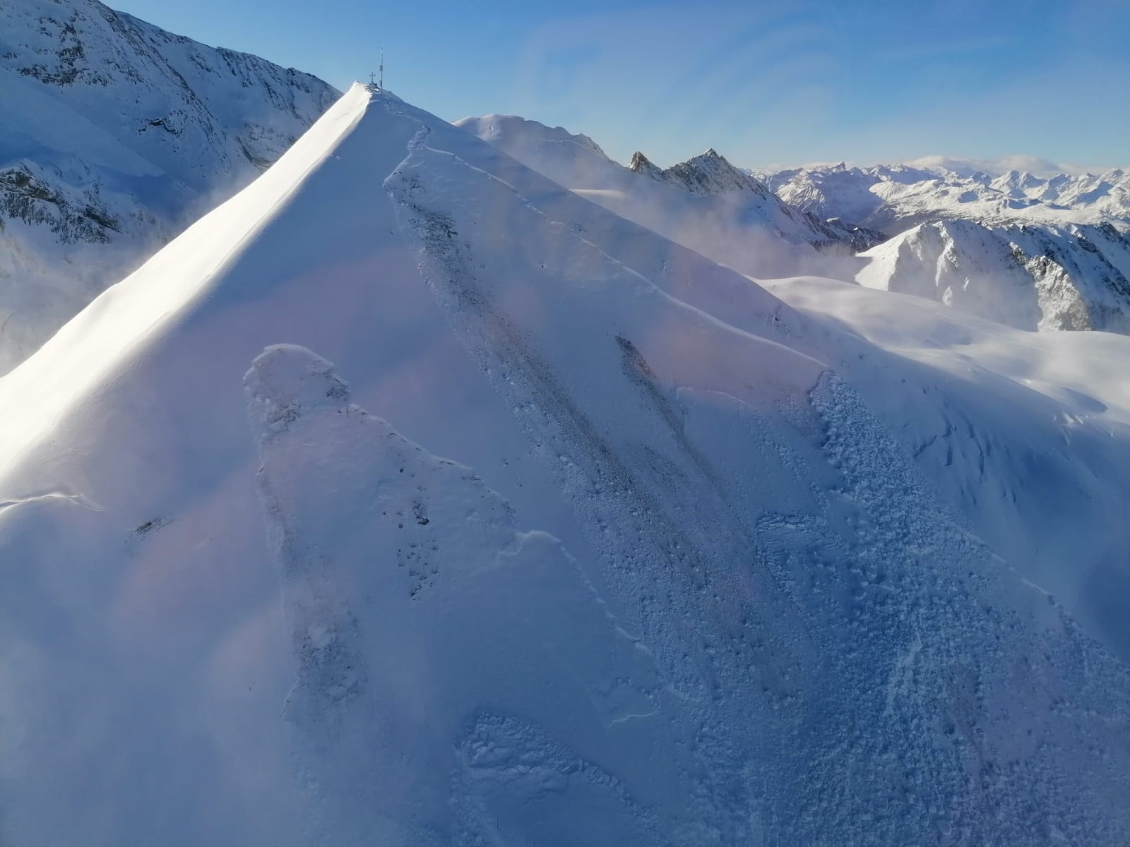
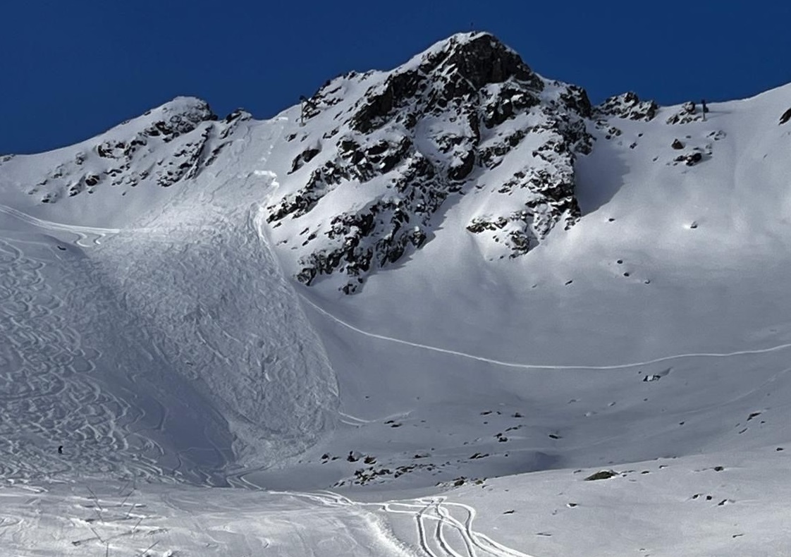
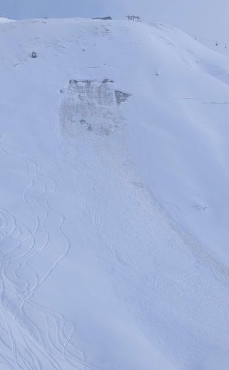
In areas with the most snowfall, avalanches can be triggered especially in the masses of fresh snow and drifts. In inneralpine regions, fresh, often widespread drifts lie deposited atop marked persistent weak layers in the old snowpack. Avalanches can easily be triggered by one single winter sports enthusiast and grow to large size. Settling noises can indicate imminent danger and remote triggerings are possible. Danger zones are unrecognizable. The situation calls for immense restraint.
High-pressure weather conditions meet trigger-sensitive snowpack
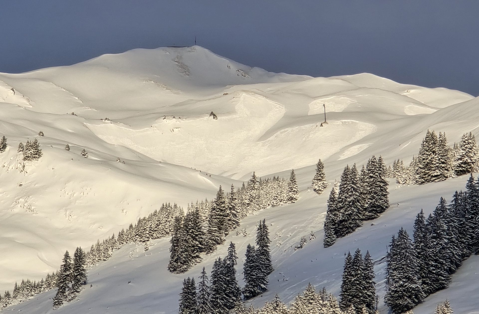
Starting on Wednesday, high-pressure weather conditions from the west will take the reins: holiday leisure, a fresh blanketing of snowfall in the mountains and brilliant blue skies. On top of that in far-reaching parts of Tirol, for the first time there is enough snow on the ground for backcountry tours. That is a tempting combination which will entice lots of people into the mountains.
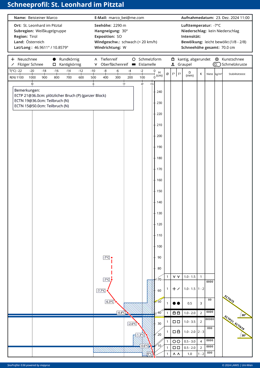
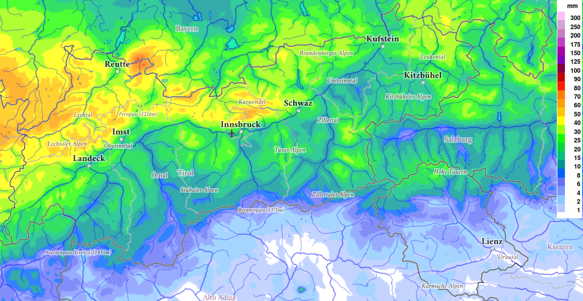
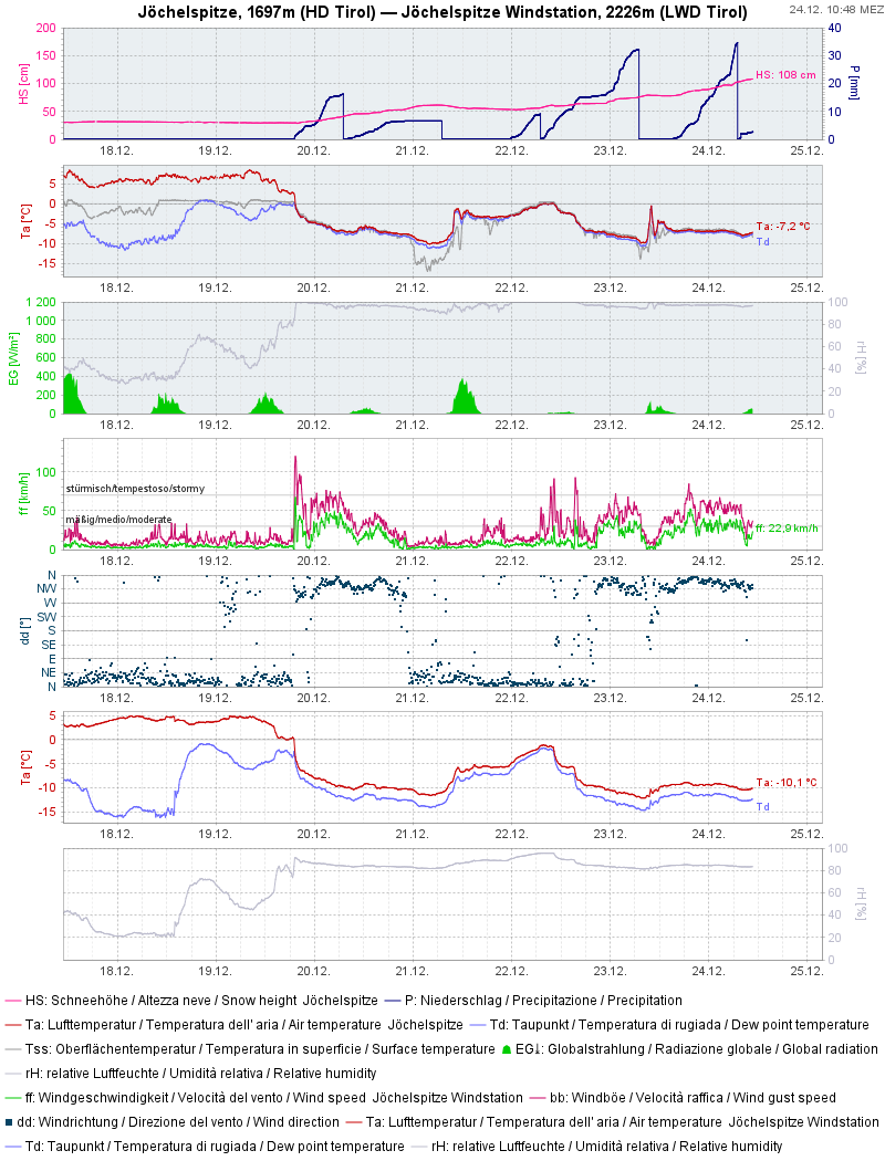
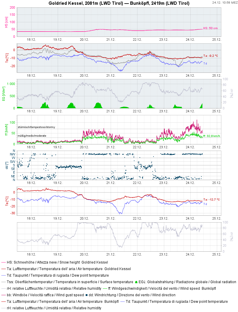
However, there is a party crasher: the snowpack. This is characterized by a truly hesitant launch into winter with little precipitation. True, thhere were repeated bouts of snowfall but generally paltry amounts. There was also rainfall up to high altitudes, particularly on 16 December in the eastern regions of North Tirol. During these dry periods it was often cold and beautiful, so the snowpack metamorphosed expansively in all aspects, but particularly on shady slopes. On sunny slopes, thin melt-freeze crusts formed above potential weak layers. We also got surface hoar which was blanketed in snowfall in some regions, particularly near the upper borderline of the fog. All in all, the old snowpack already has highly complex layering for this point in the season. What is most important, persistent weak layers prevail.
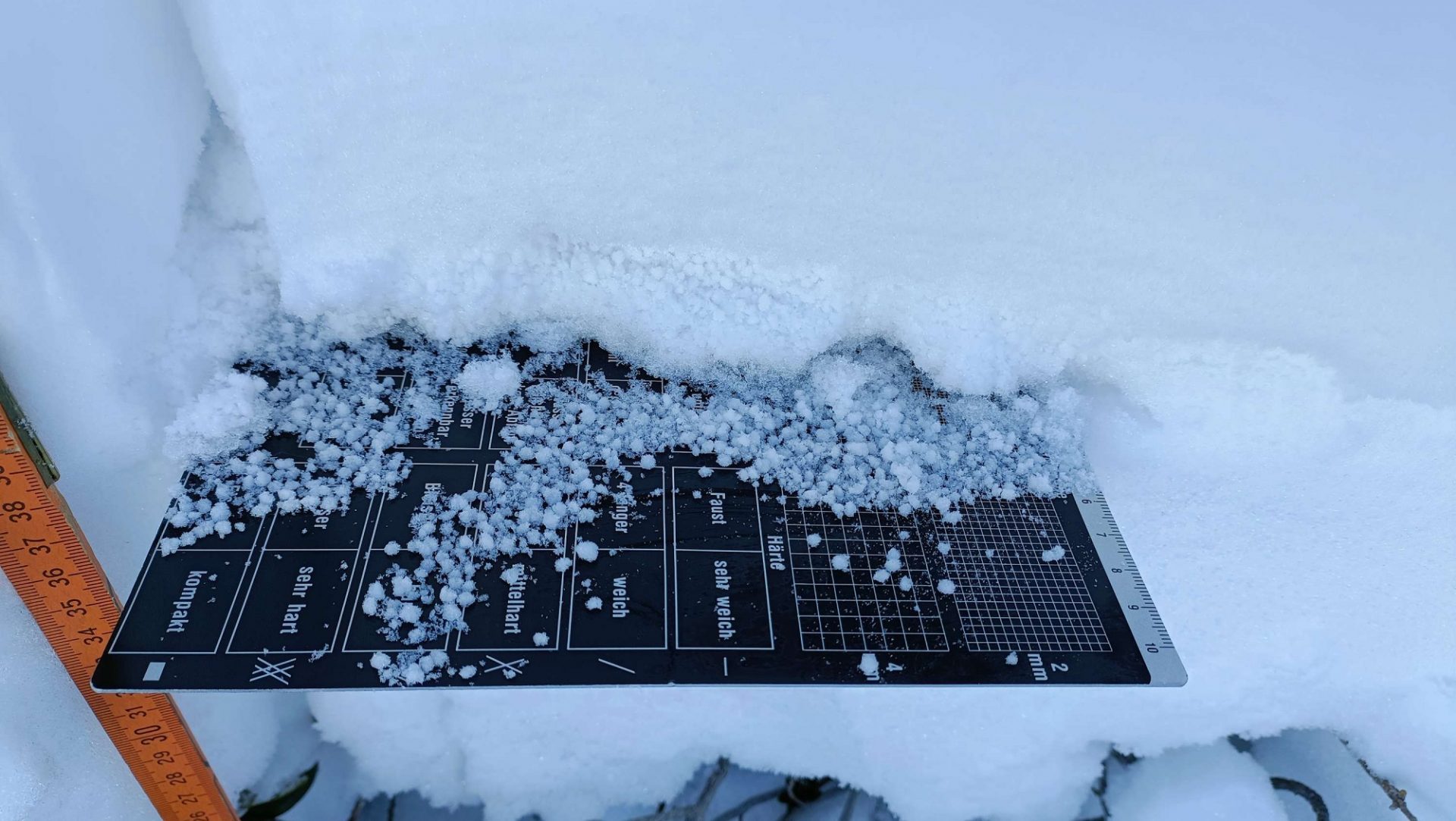
The persistent weak layer in detail
We know it well: persistent, trigger-sensitive weak layers (faceted crystals, surface hoar, depth hoar) in the snowpack are the essential components of a persistent weak layer problem. Currently we assume that these occur on shady slopes starting at about 2000m, more frequent above 2200m, on sunny slopes starting at 2200m, more. frequent above 2400m. In the N/NW barrier cloud regions, i.e. from Verwall Massif over the Lechtal and Allgau Alps all the way to the Karwendel, observations have shown that the snowpack, due to heavy precipitation in mid-November, tends to be more consolidiated now. In inneralpine regions, i.e. further south towards the Main Alpine Ridge and in the Hohe Tauern, the snowpack layering is significantly weaker.
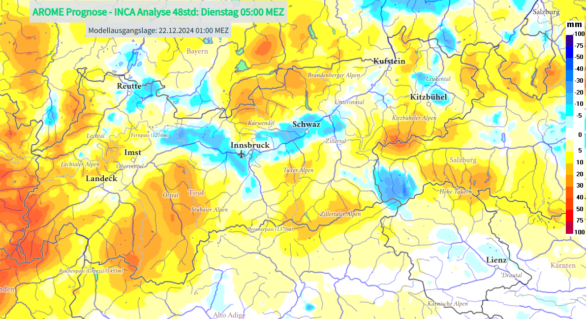
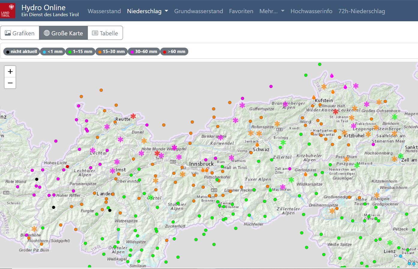
The second component is the slab which lies on top of it. This was still lacking in most places on Friday, 21.12. With the snowfall and strong winds of the last few days, the situation has changed. Most of the snowfall was in northern and western regions, i.e. where the old snowpack was tending to be better. We think that over the next few days the fresh snow and drifts will gradually settle, consolidate due to milder temperatures. Weak layers in the old snow may then be less triggerable. South of the Inn there has been less snowfall, nevertheless enough so that a marked slab could form atop the weak layers, particularly on wind-loaded slopes. As the snowpack settles and temperatures rise, the slab characteristics will improve another notch.
Avalanche Dangers and Risks
The tense avalanche situation will be with us further over the Christmas holidays. Near ridgelines, easterly winds will generate fresh snowdrift accumulations. But what is most critical is the persistent weak layer. This situation demands restraint and cool calculation over the coming days. At very least on the first few days of beautiful weather we strongly advise being highly conservative while in backcountry until the overall picture of danger zones becomes clearer. Complex avalanche terrain with traps to be avoided and huge steep slopes harbor high risks.
In addition, solar radiation and numerous small-to-medium naturally triggered loosely-packed snow avalanches can be expected on extremely steep sunny slopes. And also glide-snow avalanches will become a big theme on steep grass-covered slopes. Areas below glide cracks should be circumvented.
In East Tirol there is unfortunately too little snow on the ground at present. Backcountry skiing tours are possible only to a very limited degree.
The entire team at the Avalanche Warning Service of the State of Tirol wishes one and all happy holidays with families and friends.
We will publish an update on the avalanche situation on Thursday, 26.12.