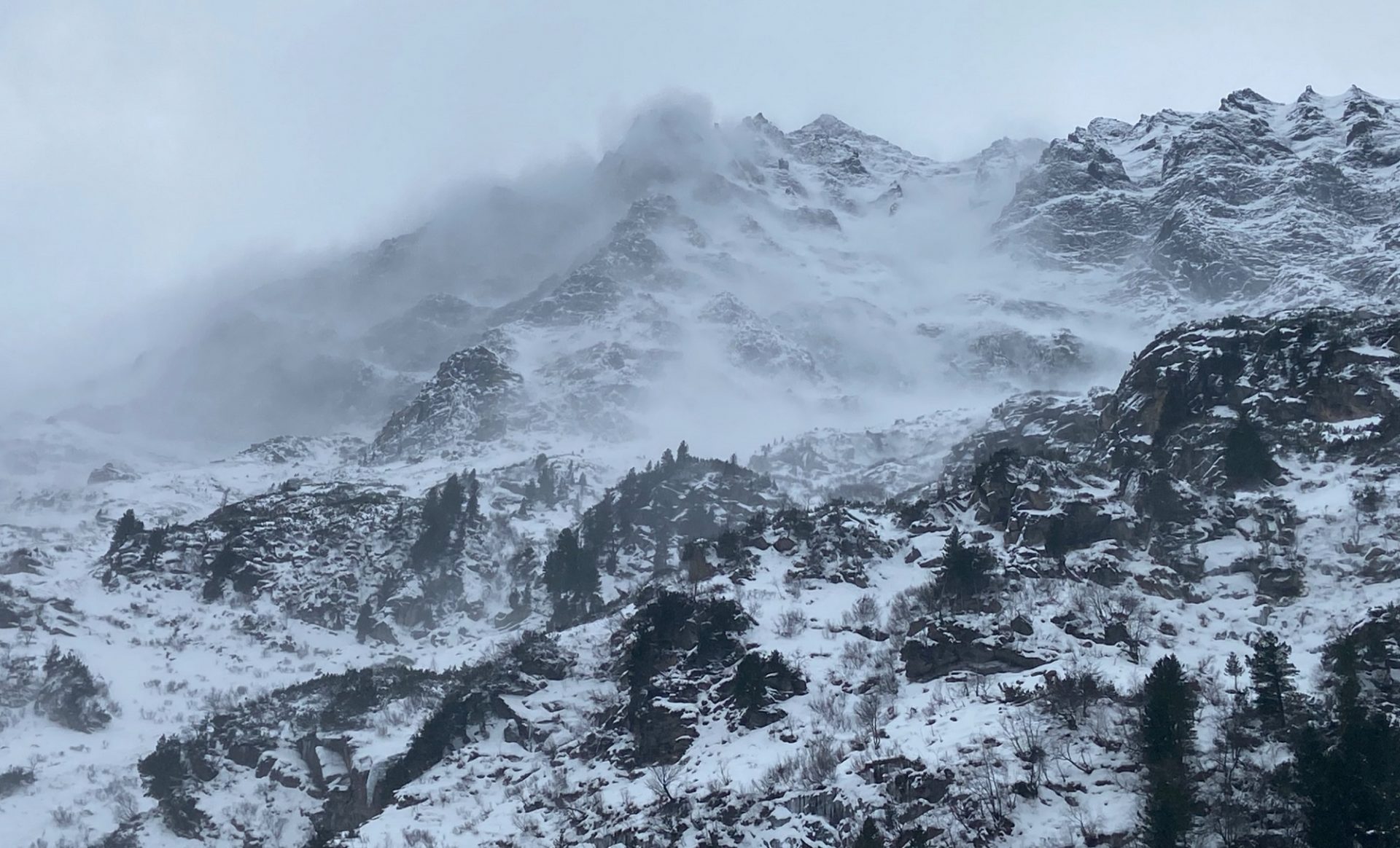
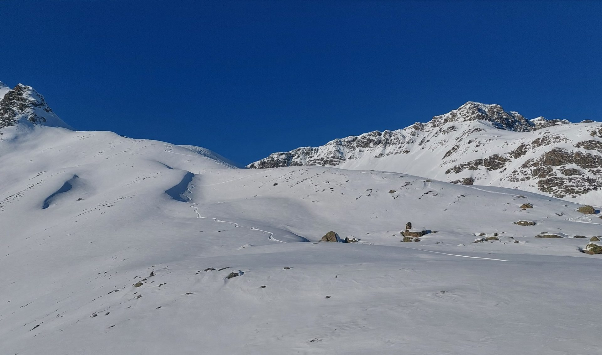
There is currently not much snow in the mountains of Tirol. But there are weak, faceted layers inside the shallow snowpack regionally. In places where they are covered by a consolidated slab, they can be triggered by a person. Such avalanche prone locations are located mostly on very steep north and east-facing ridgeline slopes above 2400m. Over the weekend the situation won’t change much, no significant snowfall is expected. But fresh snowdrift accumulations will be generated which are prone to triggering, particularly in ridgeline terrain.
Current situation
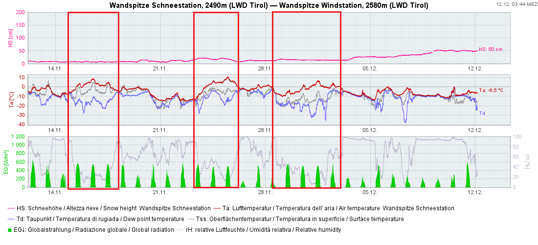
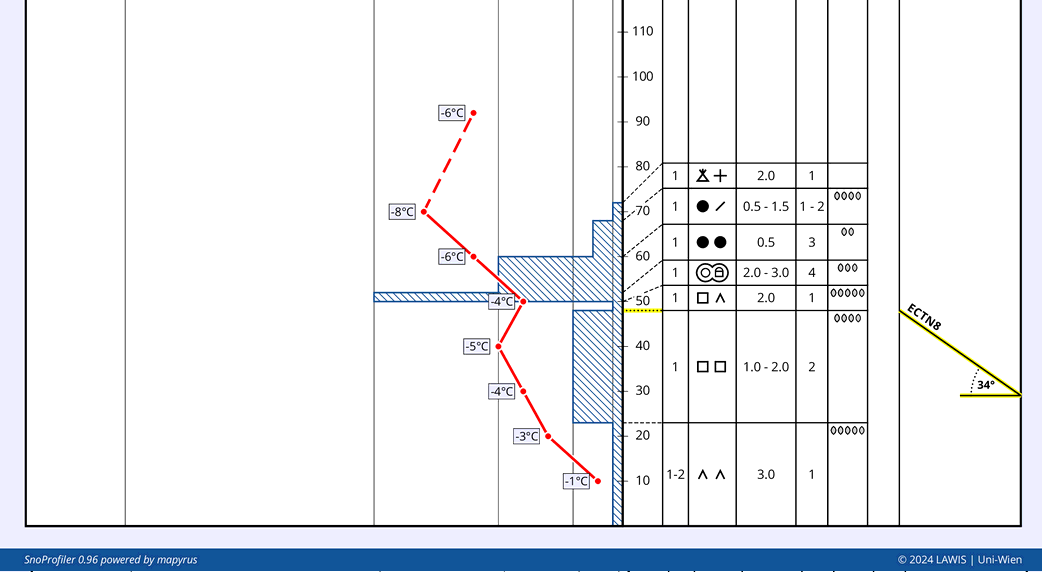
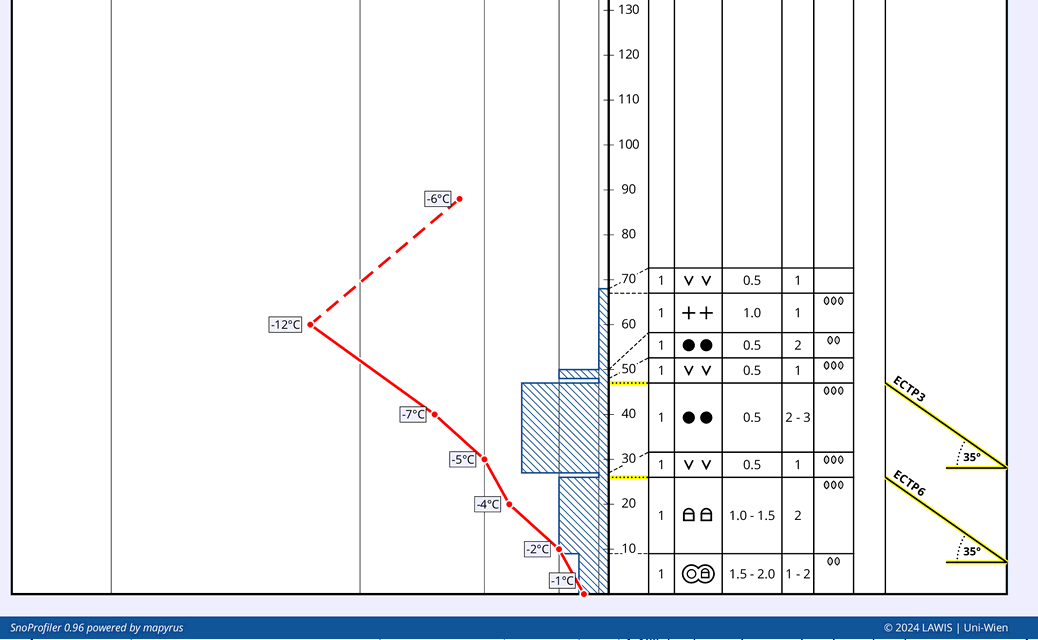
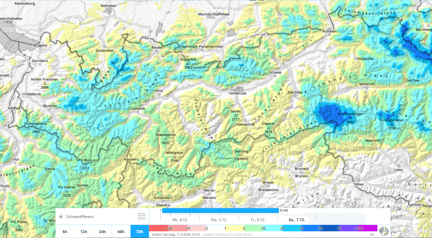
Avalanche danger in Tirol’s mountains is currently caused by a small but striking persistent weak layer. Since as a result of below average snow depths we have little information from outlying terrain, the problem is difficult to map out regionally. It appears that the most troublesome regions are those south of the Inn, from the Ötztal to the Tux and Zillertal Alps.
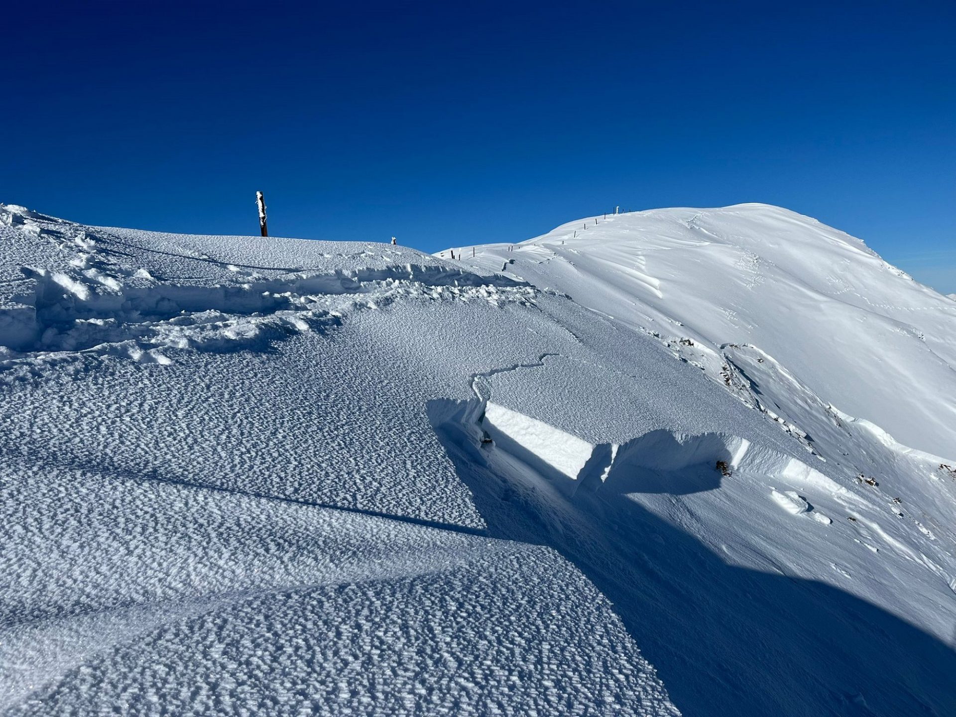
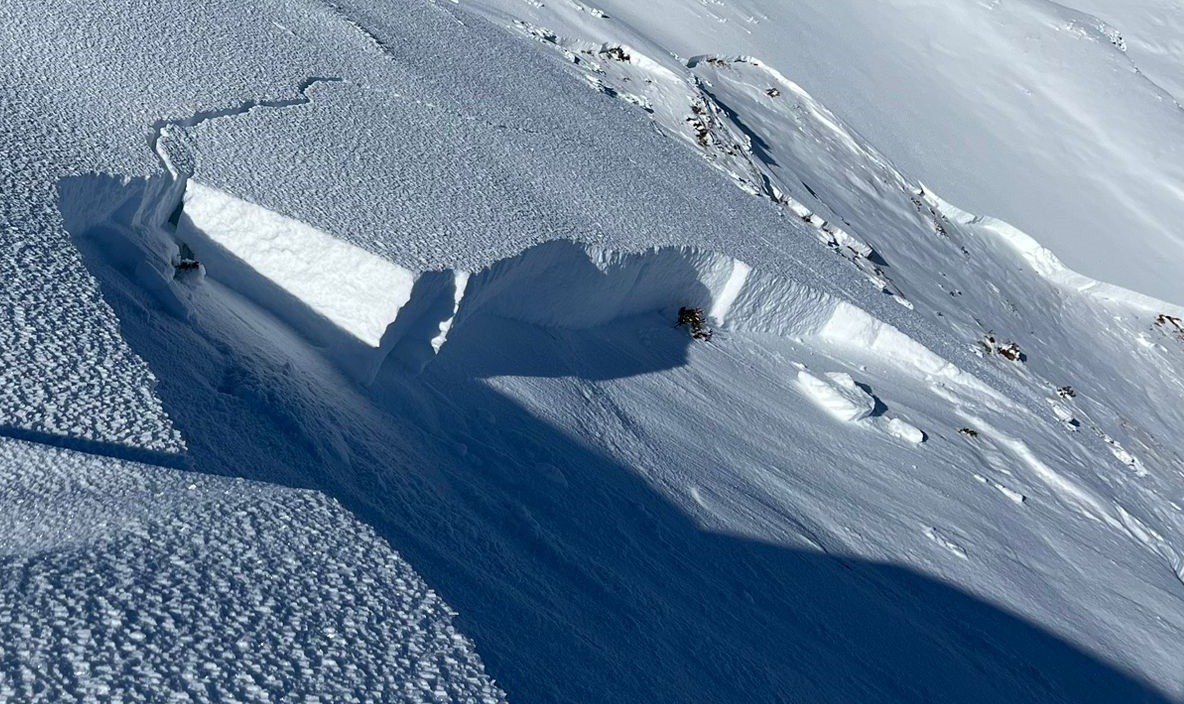
Actual danger zones are easier to delineate regionally: these occur especially near ridgelines on very steep slopes (>35 degrees) on northwest-to-north-to east facing slopes above 2400m. In those aspects, snowdrift accumulations were generated by precipitation and southwesterly winds last weekend. Above 2400m, in addition, there is sufficient snow beneath the older snowdrifts in many regions to cover the raw concavities and convexities in the terrain, thus making area-wide weak layers possible.
The low temperatures and clear nighttime skies of recent days have also made the snowpack surface metamorphose expansively since last weekend, and thereby forfeit its consolidation. Thus, the snowdrifts can no longer propagate fractures as well; that in turn makes slab formation less likely. Danger zones, therefore, are currently isolated. Due to shallow blanketing of the weak layers, avalanches will reach medium size at most.
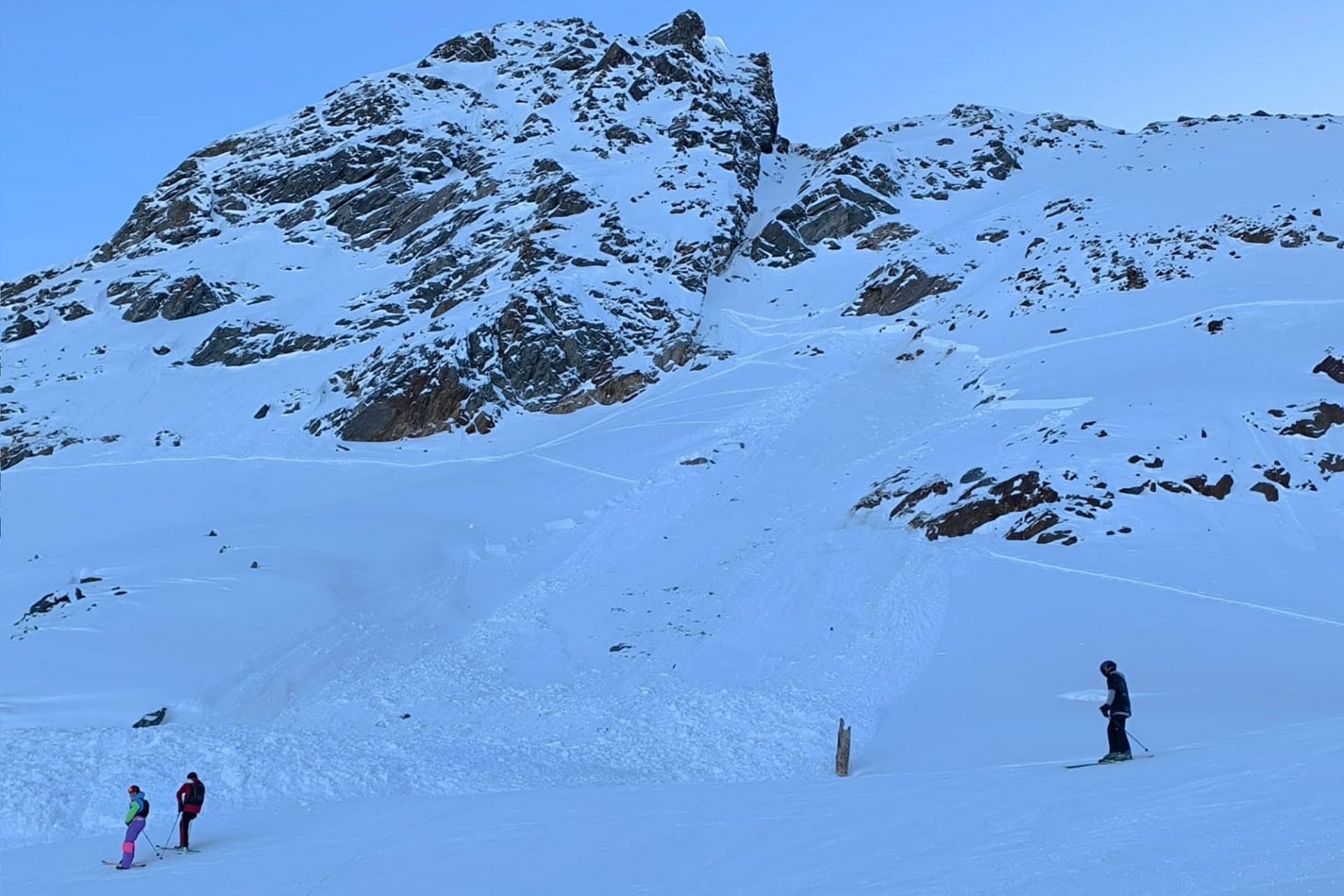
Apart from the dangers of avalanches, unwelcome contact with the ground is also a serious threat, and not just for your freshly prepared skis. The modest amounts of snow are best enjoyed on smooth grass-covered slopes.
Fresh snowdrifts to be generated by intensifying winds on the weekend
On the wings of a NW air current, moist air masses will be delivered to the Alps over the weekend. Hardly any snowfall is anticipated, but intermittently strong winds will transport the small amounts of fresh, generally loosely-packed, cold old snow. It will be deposited on shady leeward slopes atop a faceted snowpack surface, frequently on surface hoar. Thus, small but often extremely trigger-sensitive snowdrift masses will accumulate in ridgeline zones and behind wind-exposed protruberances in the landscape. Particularly in terrain where you can take a fall, high caution is required.
Over the next few weeks, temperatures will rise significantly. The zero-degree level will ascend to about 3000m by the end of next week. A weather change will be possible next weekend, with lower temperatures and precipitation.
Short review
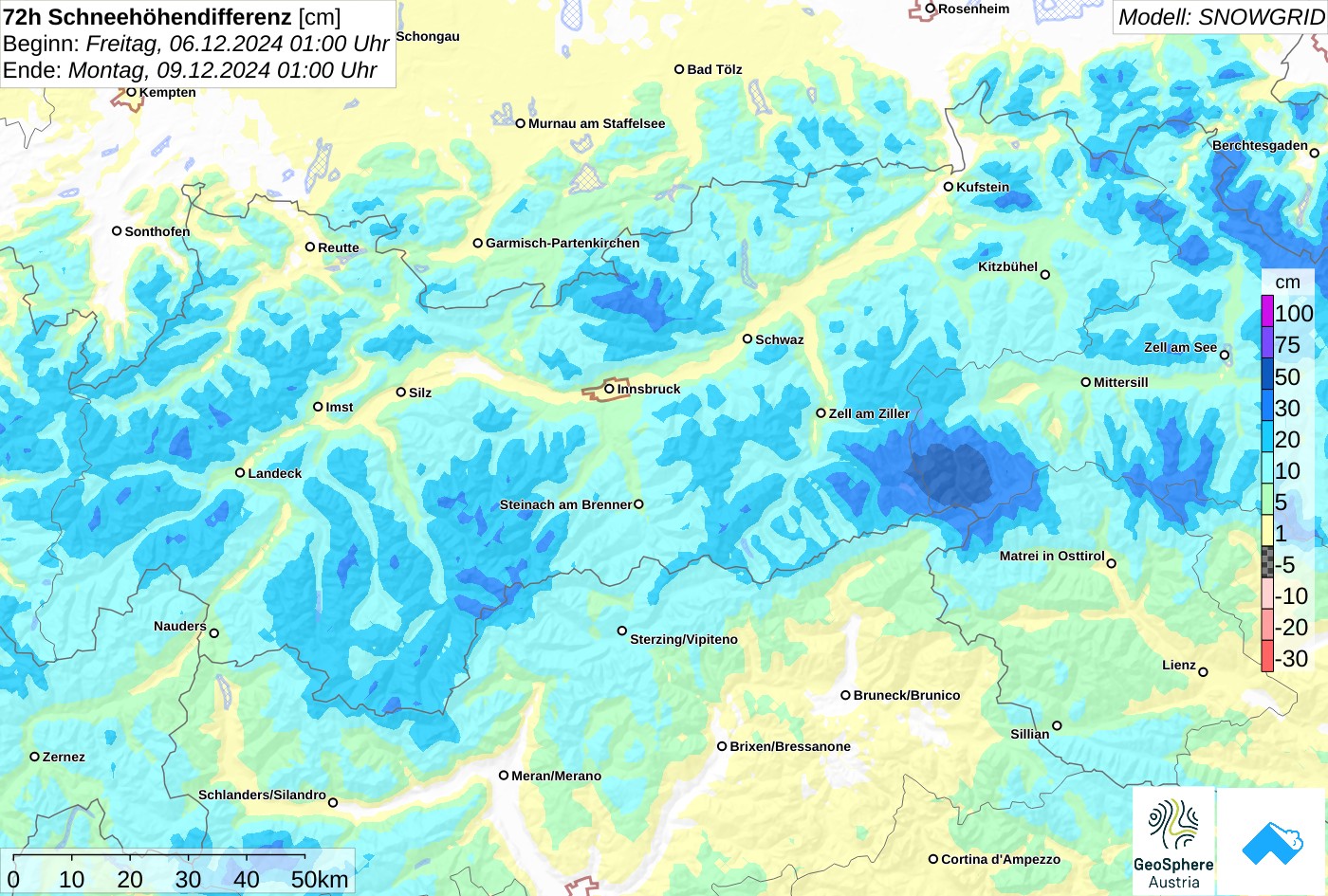
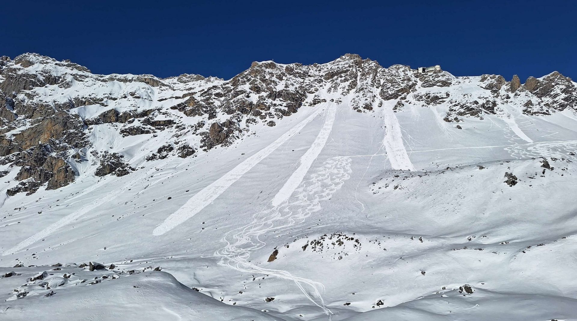
Due to the snowfall last weekend, initially accompanied by strong-velocity SW winds, snowdrifts accumulated particularly near ridgelines, blanketing a shallow and weak snowpack. Drifted masses were then triggerable by persons as a result. Reports of slab avalanches involving persons reached us more frequently starting on Tuesday, 10 December when weather conditions improved and there were more people backcountry. Most of the incidents were reported from the Tux and Zillertal Alps.
In addition, on Stubai Glacier a person skiing into extremely steep terrain was caught by an avalanche and swept along after being forced to take a fall.