Kalkkögel (© Barbara Fink, 29.11.2024)

Rising avalanche danger due to fresh snow and wind – Start of daily Avalanche Bulletins

A warm front and on its heels a cold front are bringing precipitation to the mountains. Despite an irregular snow cover, avalanche danger in outlying terrain should not be underestimated. Tomorrow, 7 December 2024, we are launching the daily publication of Avalanche Bulletins.

Turbulent weather & uncertain snowfall forecast for Sunday, 08.12.2024

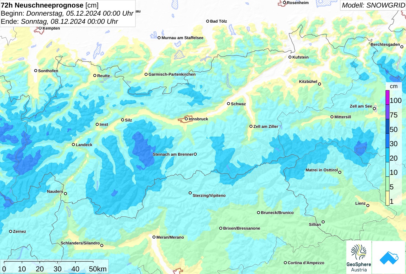
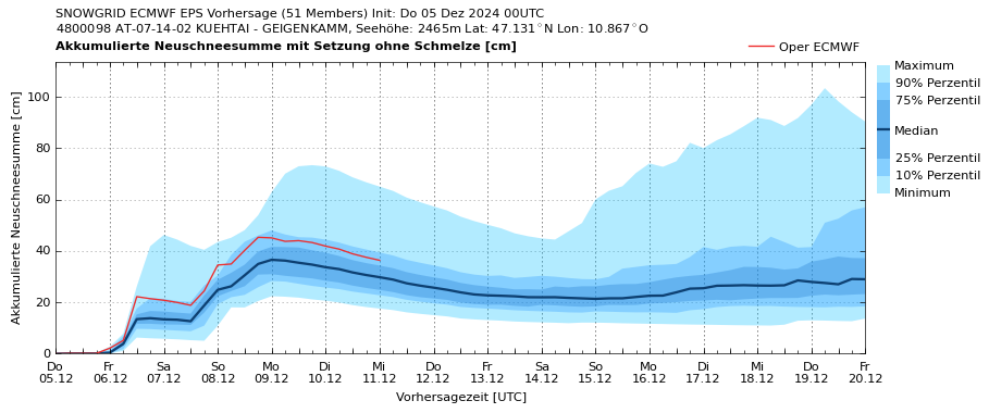
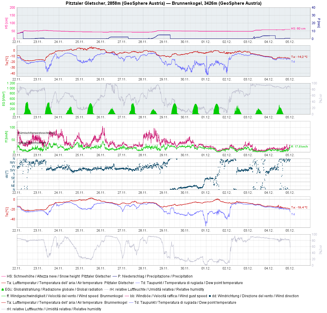
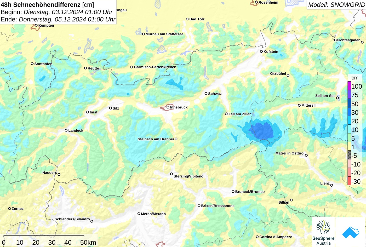
Tomorrow, Friday, 06.12.2024, a warm front will whisk rapidly through Tirol. Initially it may rain up to 2000m in the northern regions before the snowfall level descends. In the heights, 5-15 cm of fresh snow is anticipated. In the mountains it will be stormy from place to place. Winds will be mostly westerly. Saturday, 07.12.2024 will be dry to begin with. Brisk winds will shift to southwesterly. During the course of the day a cold front will bring snowfall. The forecasts of expected amounts of fresh snow are still uncertain due to the complexity of the weather situation: still hard to estimate, according to GeoSphere Austria.

72 Neuschneeprognose bis 08.12.2024 00:00 Uhr.
72-hr snowfall forecast until 08.12.2024 00:00 o’clock.
Neuschneeprognose für die Region Kühtai-Geigenkamm auf einer Seehöhe von 2465m. Man erkennt die zwei Niederschlagsstaffeln, jene von Sonntag wird die intensivere sein.
Forecast of fresh snow for the region Kühtai-Geigenkamm at 2465m. Visible are two bouts of precipitation, the one on Sunday will be more intensive.

Effect on avalanche danger

To start with: snowdrift problem

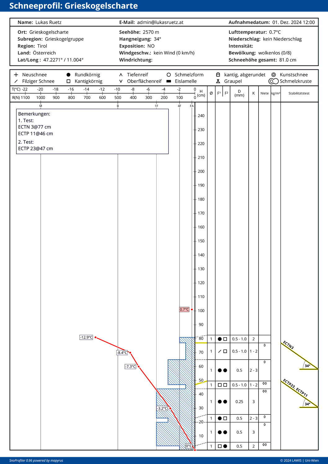
One thing is clear: avalanche danger will rise successively over the next few days. Tomorrow, 06.12.2024, fresh snowdrifts will accumulate at high altitudes and these masses will play a major part in the development. Not just because of the strong-to-stormy winds, but also due to rising temperatures, this will be well-bonded snowdrifts or “slab snow.” A complete slab formation requires a weak layer in order to trigger the slab in steep terrain. Possible, already well formed weak layers are currently found in some snow profiles, e.g. as expansively metamorphosed layers of faceted crystals, both on the surface and more deeply embedded in the snowpack.

Die kantige Schicht auf etwa 45cm kann für die nächstfolgenden Schneefälle bedeutsam sein. Schneeprofil in einem NO-Hang auf 2570m in der Grieskogelgruppe
The faceted layer at about 45cm could play a major role in the coming snowfall. Snow profile from a NE-facing slope at 2570m in the Grieskogel massif.
Ein aktuell ebenso typisches Schneeprofil. Ein oberflächennaher Harschdeckel umgeben von aufbauend umgewandelten Kristallen. Die Kruste stammte wohl auch vom Regeneinfluss vom 28.11.2024. Kleiner Seekopf am Allgäuer Hauptkamm.
Snow profile wreathed by a near-surface melt-freeze crust of expansively metamorphosed, faceted crystals. The crust stems from rainfall on 28.11.2024. Kleiner Seekopf on the Main Allgau Ridge.
Typisch für mittlere und hohe Lagen: Eine geringmächtige, großteils aufbauend umgewandelte Schneedecke. Zillertaler Alpen (© Christian Eder)
Typical at intermediate and high altitudes: a shallow, largely metamorphosed snowpack. Zillertal Alps (© Christian Eder)

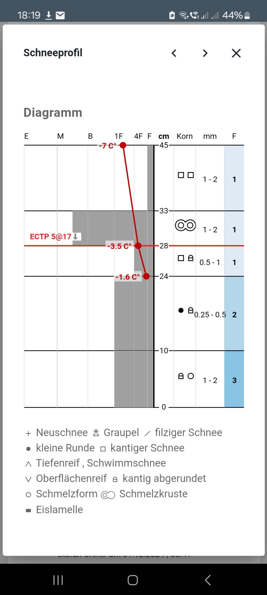
At the same time, surface hoar was also observed in some regions last week, especially in eastern regions of North Tirol on north-facing slopes at 1500-2300m altitude. This surface hoar will probably persist only from place to place in wind-protected shady zones above the rainfall level, due to the warm front approaching on 06.12.

Ein Krustensandwich samt Oberflächenreif in einem Nordhang auf 1666m. Dieser Oberflächenreif wird sich nicht halten können.
A crust sandwich with surface hoar on a north-facing slope at 1665m. The surface hoar won’t persist.
Oberflächenreif in den Tuxer Alpen (© Stefan Wierer, 01.12.2024)
Surface hoar in the Tux Alps (© Stefan Wierer, 01.12.2024)

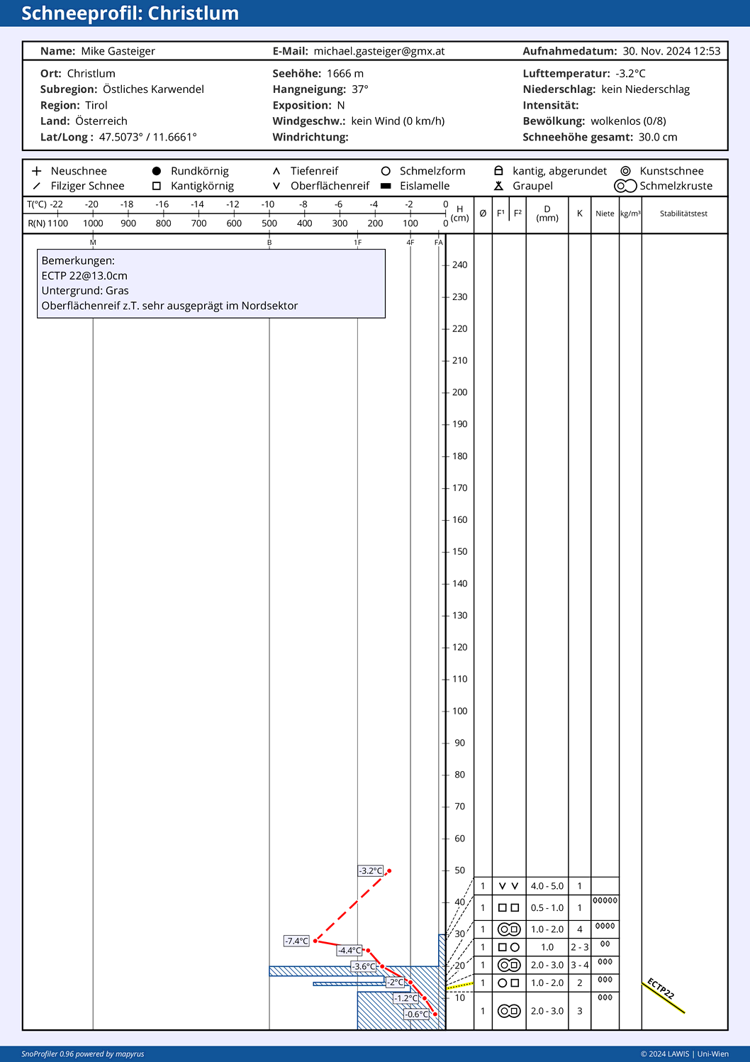
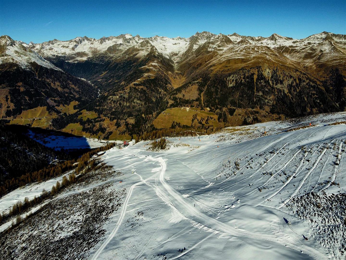
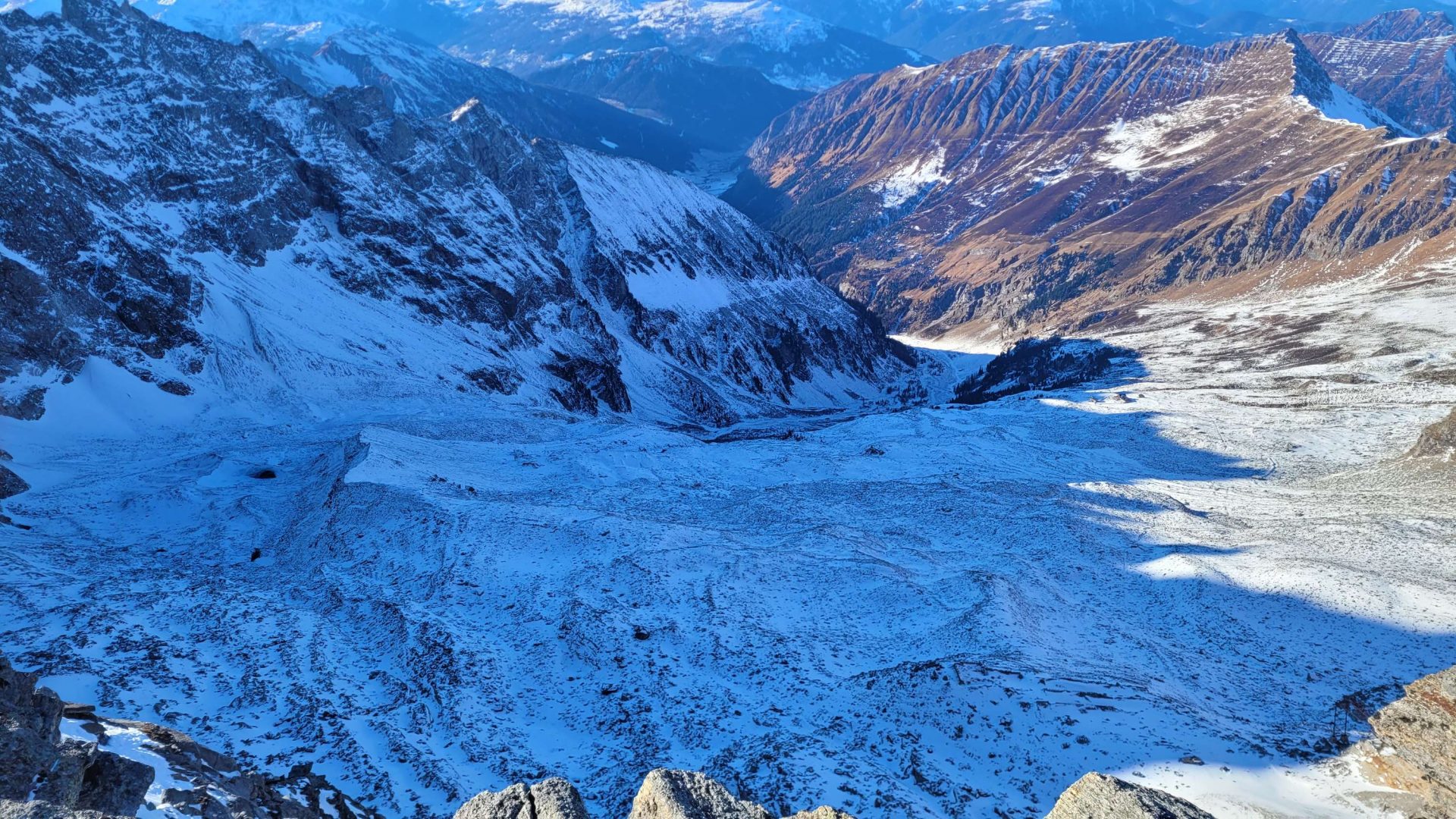
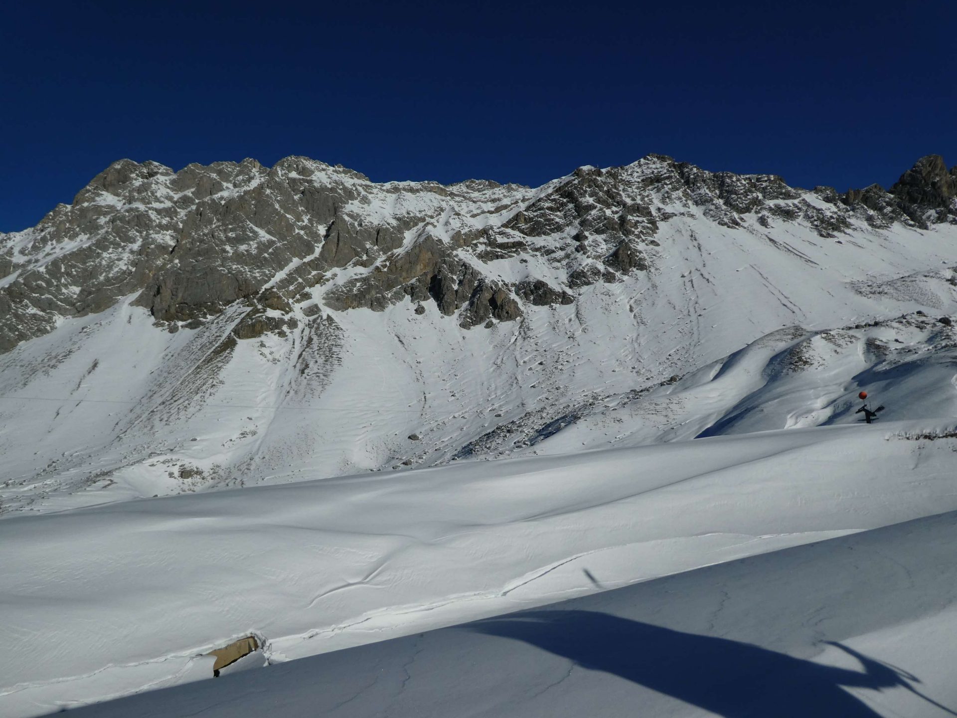
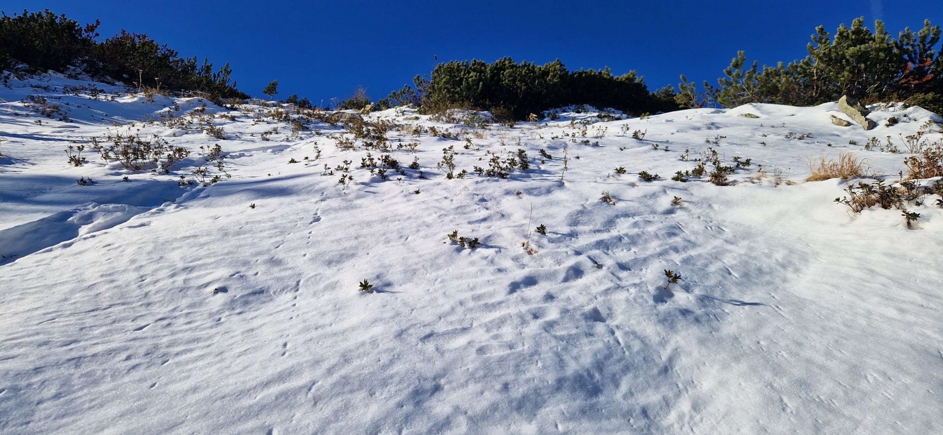
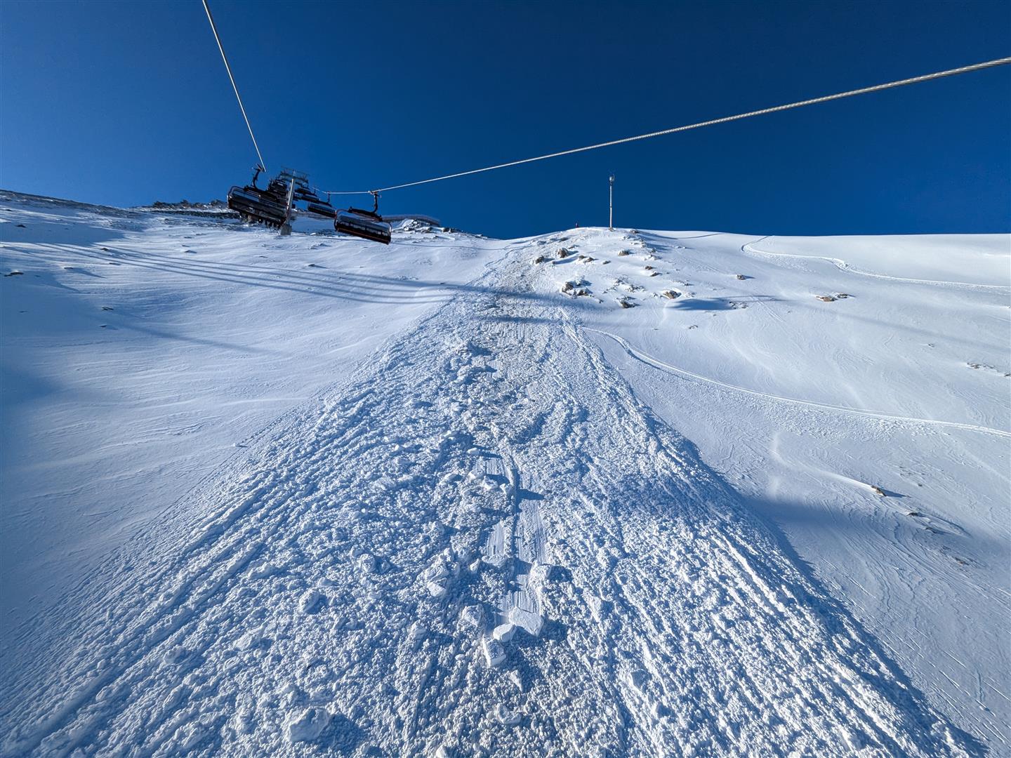
In high alpine terrain the snowpack is highly irregular: a mostly solid base from the autumnal snowfall with several soft layers near the surface. On shady slopes the snowpack tends to be softer and more faceted.

Bei diesem Profil in der Weißkugelgruppe auf 2880m konnte keine Störung der Schneedecke erreicht werden. An der Schneeoberfläche findet sich jedoch lockerer Schnee - in windabgewandten Steilhängen eine mögliche Schwachschicht.
In this profile from the Weisskugel massif at 2880m. the snowpack was not shakeable. On the surface, however, there is loosely-packed snow, which in leeward terrain would be a potential weak layer.

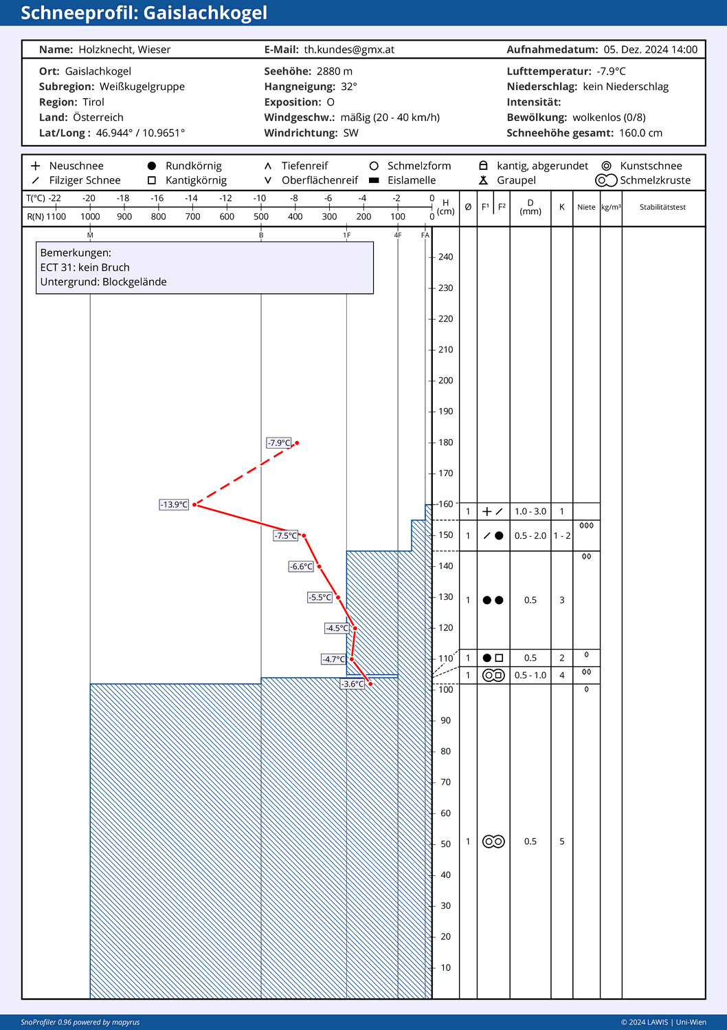
Currently the snow depths are below average for this juncture of the season. There is a cohesive, area-wide snowpack only at very high altitudes. Nonetheless, the snowpack is highly prone to triggering in some places. Most endangered are steep NW-N-E facing slopes. The danger zones tend to increase with ascending altitude.

Starting on Sunday in areas of major precipitation: gliding snow problem

Below 2400m, we expect increasingly frequent glide-snow slides and glide-snow avalanches on steep grass-covered slopes starting on Sunday. In zones where there was initially more rainfall, the glide-snow avalanche activity will be greater.

A look back…

Wetterentwicklung seit dem letzten Blogeintrag: Wenig Niederschlag
Weather development since the last blog: very little precipitation
48h-Schneehöhendifferenz: Die vergangenen Niederschläge brachten meist um 10cm Neuschnee
48-hr snow depth differences: recent precipitation brought generally 10cm of fresh snow.

Already some avalanches, despite lack of snow

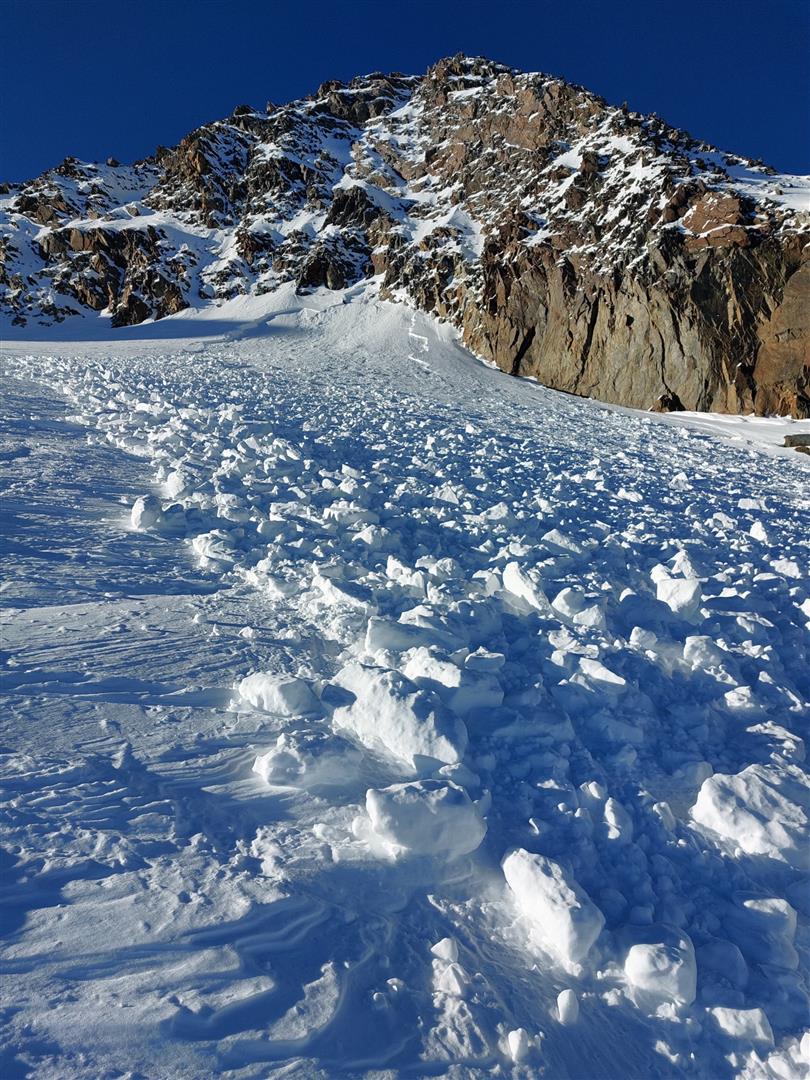
We have already received reports of avalanche triggerings. What was striking: not only the shallowness of fractures due to lack of snow, but the high proneness to triggering of the snowpack.

Kleines Schneebrett in der Axamer Lizum. (© Manuela Oberauer, 01.12.2024)
Small slab in Axamer Lizum. (© Manuela Oberauer, 01.12.2024)
Schneebrett auf der Stubaier Wildspitze (© Günter Chwojan, 30.11.2024)
Slab on Stubai Wildspitze (© Günter Chwojan, 30.11.2024)
Lawinenauslösung am Palinkopf in der Samnaungruppe (© Markus Kienbacher)
Avalanche triggered on Palinkopf in the Samnaun massif (© Markus Kienbacher)

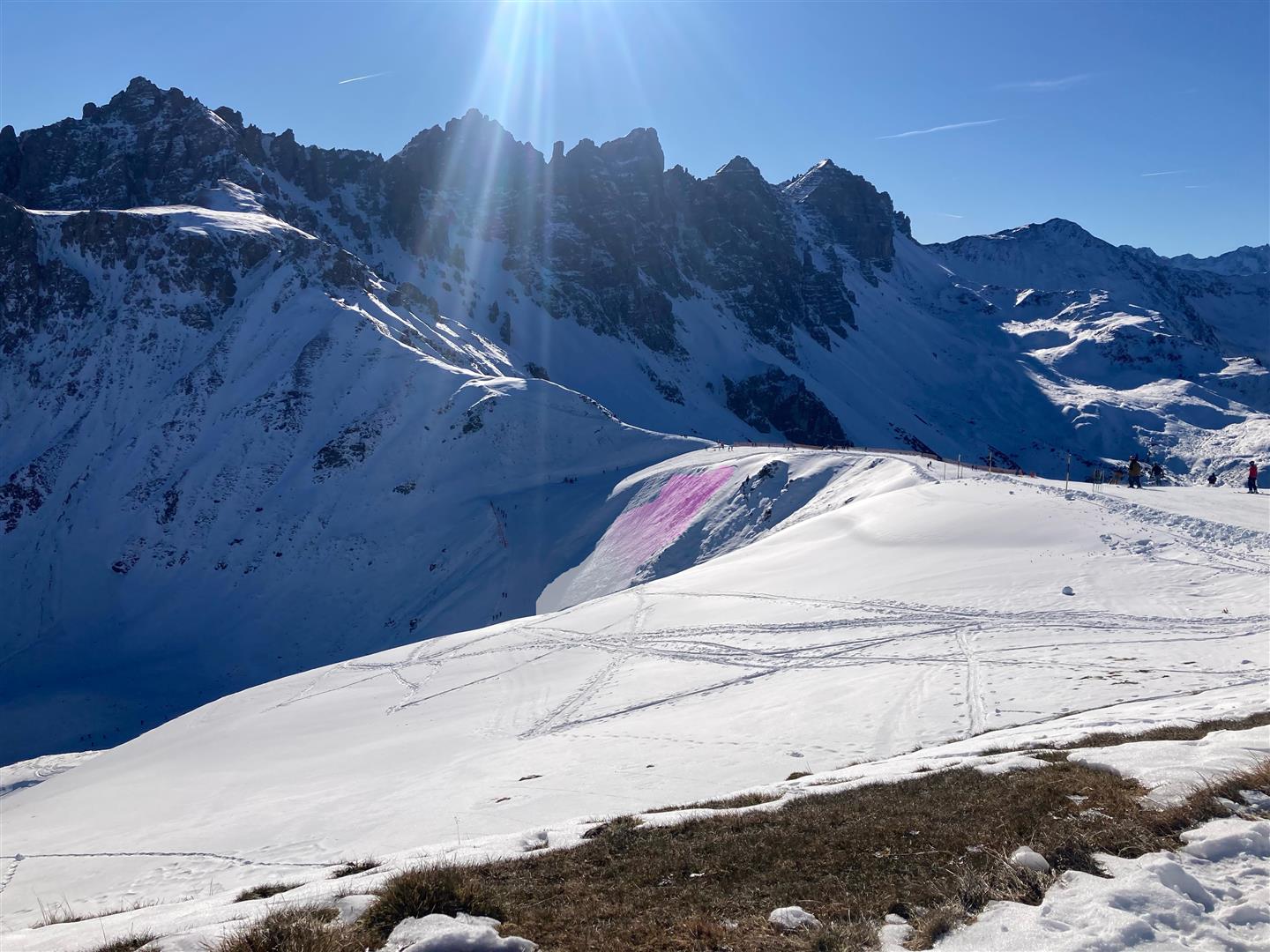
In backcountry, still not enough snow for winter sports

Schneeverteilung in den Villgrater Bergen vom 01.12.2024 (© Toni Riepler)
Snow distribution in the Villgrater mountains from 01.12.2024 (© Toni Riepler)
Unterwegs im Valsertal. (© Felix Erlacher, 01.12.2024)
En route in the Valsertal. (© Felix Erlacher, 01.12.2024)
Die für Wintersport vergleichsweise besten Bedingungen waren im Arlberggebiet zu finden (© Barbara Fink, 30.11.2024)
For winter sports, the best conditions were to be found in the Arlberg region. (© Barbara Fink, 30.11.2024)