Wetterbesserung nach den Schneefällen bis zum 22.11.2024 (© fotowebcam.eu, 22.11.2024)

Sudden winter outbreak esp. in western regions. Beware drifts/gliding snow.

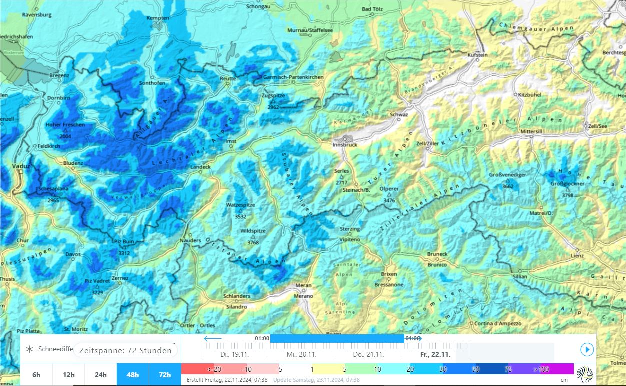
After a “golden autumn” the weather turned changeable on 12.11. A striking cold front, and then a storm-low “Renate” struck esp. western regions starting on 20.11.2024, bringing 30-50cm of fresh snow, locally more. Strong-velocity high altitude winds transported lots in the heights. Beware fresh snowdrifts in steep terrain. In coming days in the regions with snowfall: more glide-snow slides and avalanches on steep grass-covered slopes can be expected.

Snow in the peaks, often stormy and cold. Trigger-sensitive snowdrifts at high altitudes.

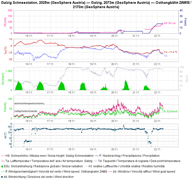
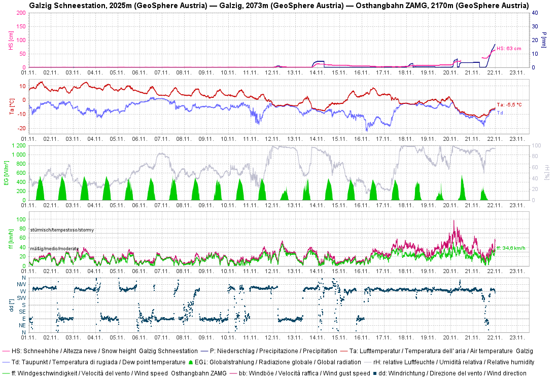
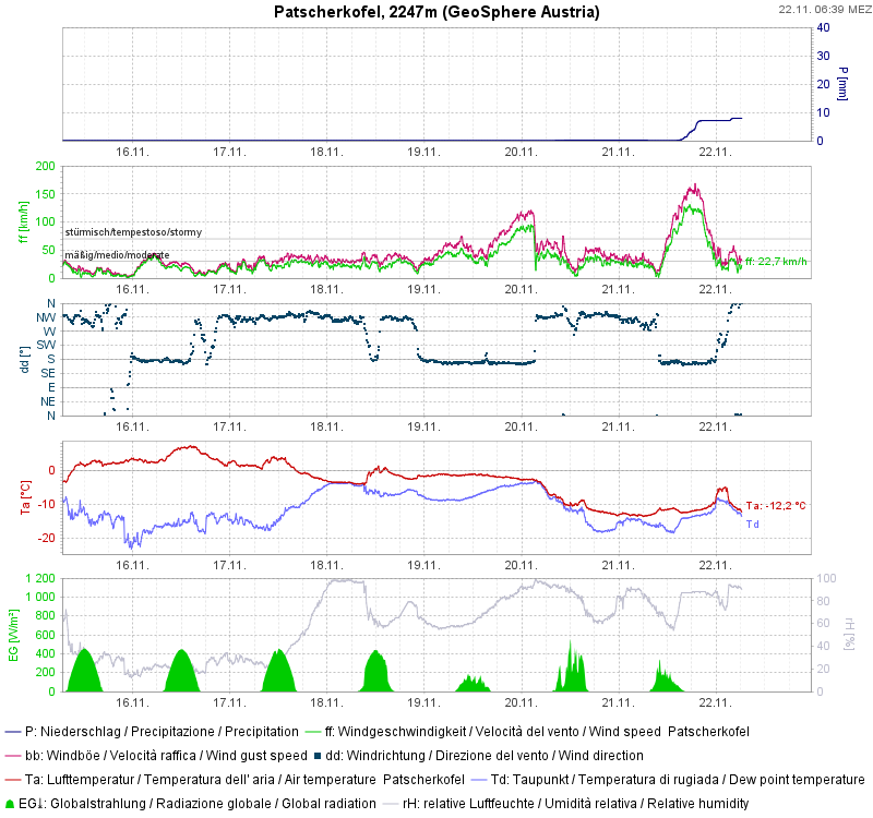
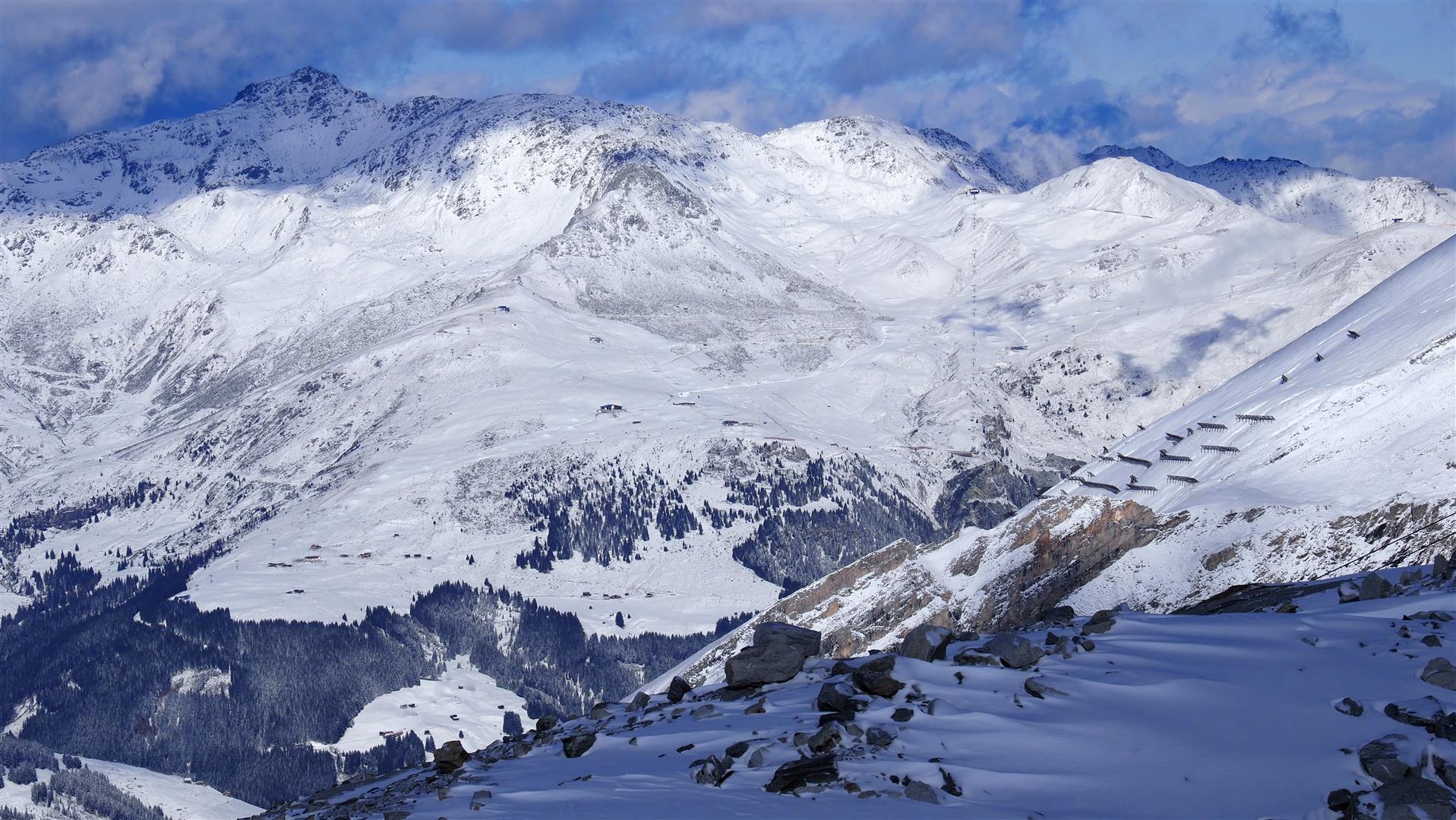
When weather conditions began to change on 12 November following an unusually long phase of beautiful autumnal weather, there were repeated bouts of minor snowfall in the mountains to start with, but only when on 19-20.11 a cold front moved in including the subsequent storm-low named “Renate” was there more fresh snowfall, most of which fell in the western and northwestern regions of North Tirol and in northernment East Tirol. Often 30-50cm was registered, more from place to place. The snowfall was accompanied by highly variable winds from diverse directions, thus generating far-reaching and also trigger-sensitive snowdrift accumulations at high altitudes.
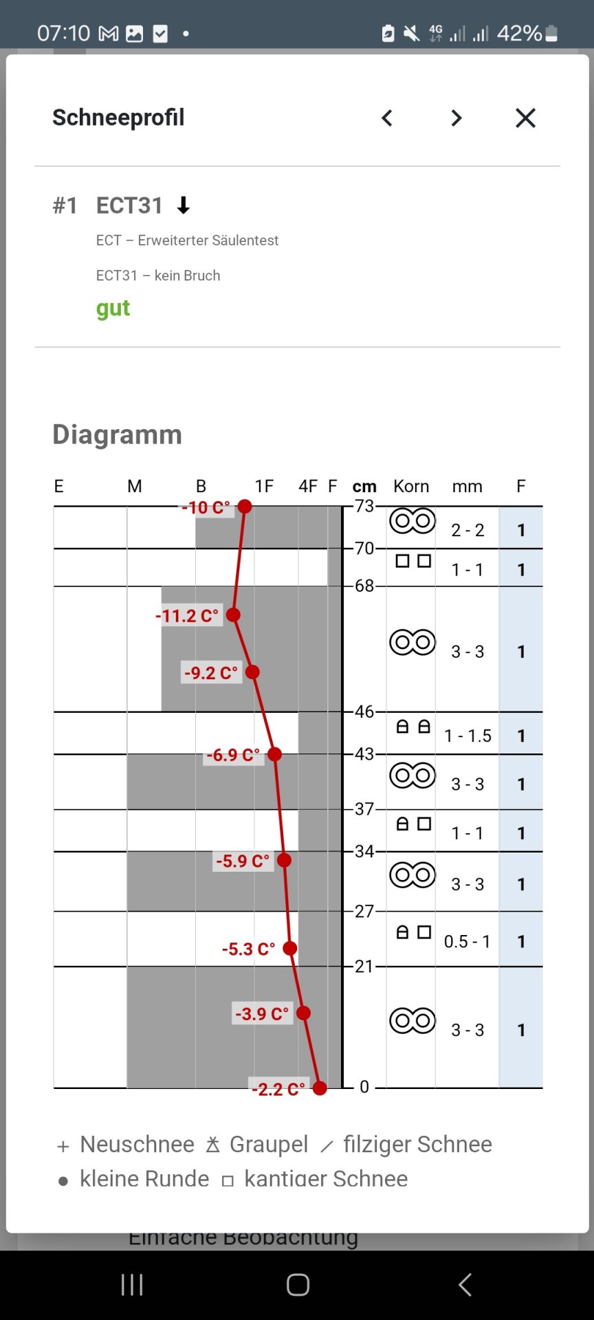
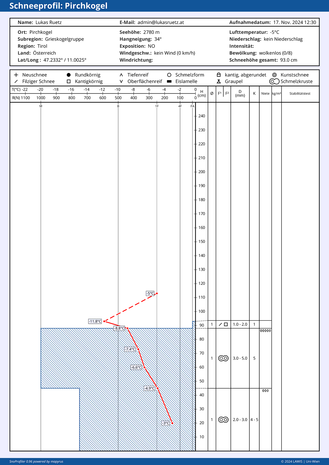
48h Neuschneemenge
48-hr amounts of fresh snowfall
Winterlich wurde es u.a. am Galzig am Arlberg. Die Grafik zeigt sehr gut den aktuell turbulenten Wettercharakter.
It turned wintery on Galzig on the Arlberg. The graph shows beautifully the current turbulent character of the weather.
Neuerlich ein Blick auf die Wetterstation Galzig, diesmal ein längerer Zeitausschnitt, an dem man gut den "goldenen" Herbst erkennen kann.
Another glance at the Galzig weather station, this time over a longer period, where the “golden autumn” is easily visible.
Weniger Niederschlag am Patscherkofel in den Westlichen Tuxer Alpen. Markant ist v.a. der wechselhafte Wind der vergangenen Woche.
Less precipitation on the Patscherkofel in the western Tux Alps. Last week’s variable wind is striking.

The snowpack

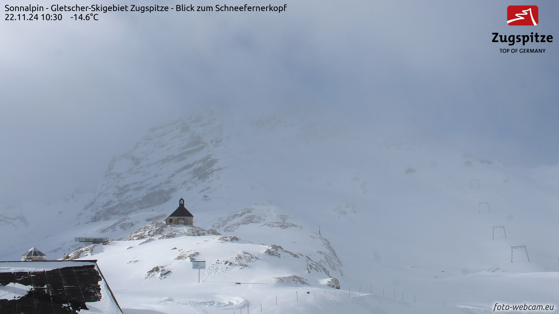
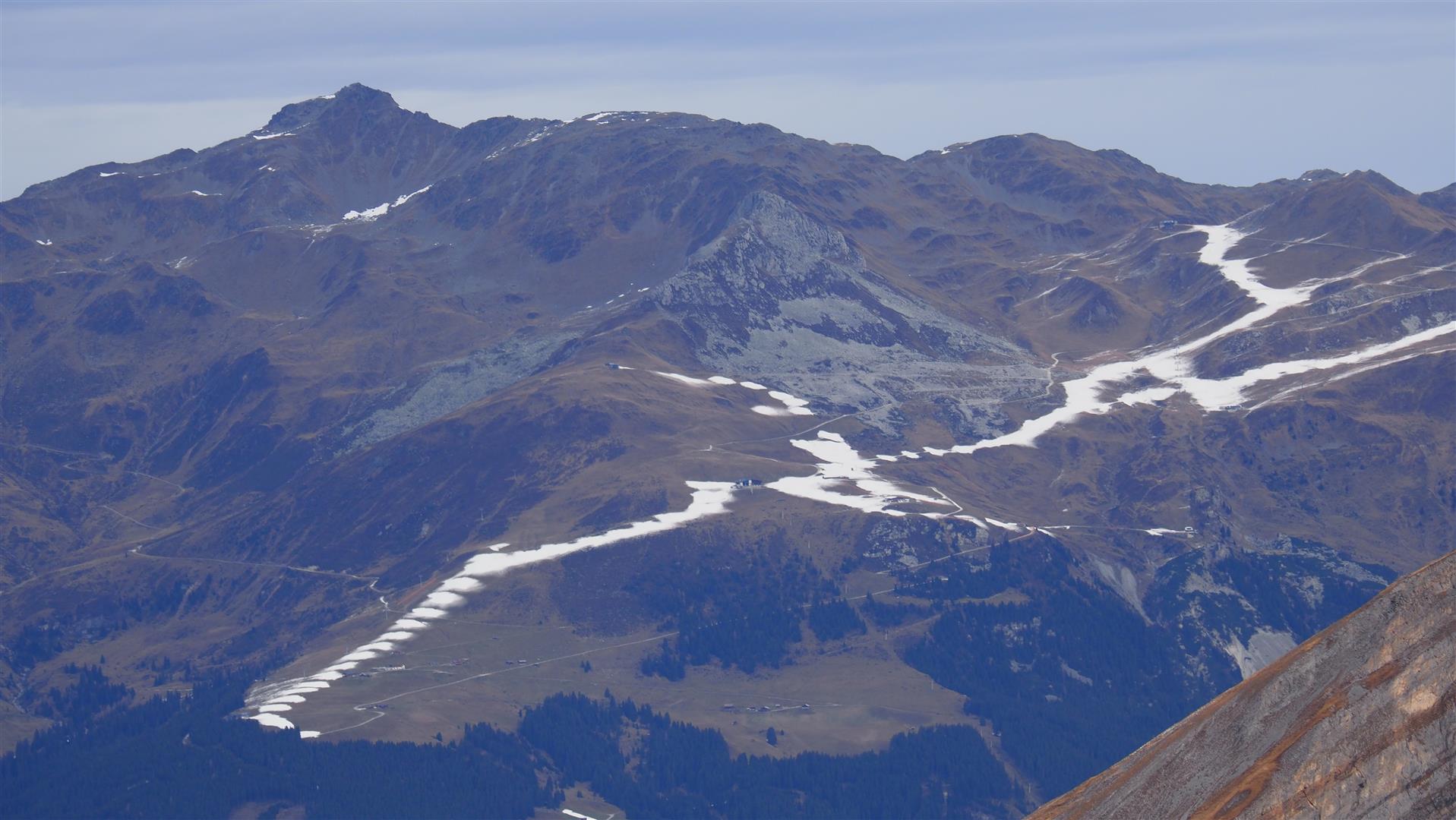
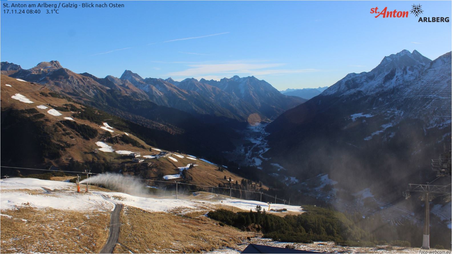
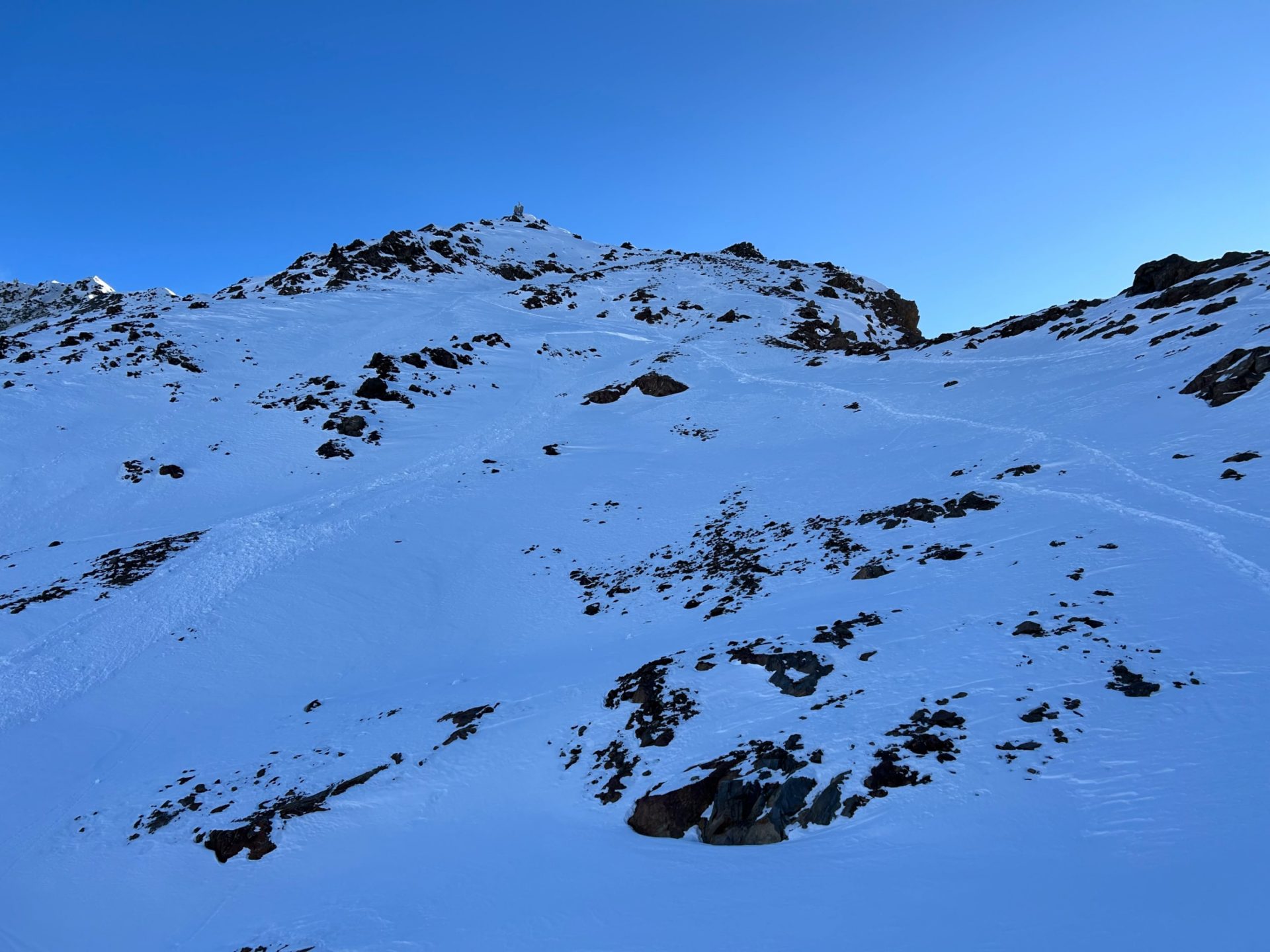
Autumnal snowfall, including heavy snow in mid-September (see blog) – melted away except in the heights. A cohesive, area-wide snowpack was found in shady terrain above 2700-2800m and in high-alpine glaciated terrain in all aspects.

Der Schnee von Mitte September ist bis in hohe Lagen wieder abgeschmolzen. Restschnee nur in Form von Lawinenablagerungen von Mitte September. Karwendel. (© LWD Tirol, 17.10.2024)
The snow from mid-September has melted except in high-altitude zones. Above, residual snow in the form of avalanche deposits from mid-September. Karwendel. (© LWD Tirol, 17.10.2024)
Blick vom Kaunertaler Gletscher Richtung Norden. Restschnee vom September und Oktober nur noch in großer Höhe. (© Martin Santeler, 11.11.2024)
View from Kaunertal Glacier towards north. Residual snow from September and October persists only at great heights. (© Martin Santeler, 11.11.2024)
Erst die Schneefälle von Mitte November zuckerten die Berge wieder an. Blick vom Tiefenbachferner Richtung Nordosten. (© Barbara Fink, 16.11.2024)
Not until the mid-November snowfall did the mountains get sugar-coated again. View from Tiefenbachferner glacier towards northeast. (© Barbara Fink, 16.11.2024)
Bis kürzlich prägten Kunstschneebänder das Landschaftsbild in Skigebieten. Blick vom Hintertuxer Gletscher in Richtung Nordosten. (© LWD TIrol, 19.11.2024)
Until recently, ribbons of artificial snow dotted the landscape in ski areas. View from Hintertux glacier towards northeast. (© LWD TIrol, 19.11.2024)
Vergleichsbild zu oberem Bild nach den Schneefällen vom 19.11. auf den 20.11.2024. Dieser Schnee wird rasch wieder abschmelzen. (© LWD Tirol, 20.11.2024)
A comparison to the photo above following snowfall on 19-20.11. This snow will melt rapidly. (© LWD Tirol, 20.11.2024)
Beschneiung am Arlberg vor den letzten Schneefällen. Inzwischen ist es hier vergleichsweise am winterlichsten (© fotowebcam.eu, 17.11.2024)
Snow cannons at work on the Arlberg prior to the last snowfall. This is now the most wintery area of all. (© fotowebcam.eu, 17.11.2024)

Snowpack layering

This is a simple matter in those regions where until now there was no snow, or very little. The danger of fresh snowdrift masses getting triggered comes only from the recent, still loosely-packed fresh fallen snow. In isolated cases snow which is expansively metamorphosed to a slight extent since 12.11 is a potential weak layer for small-to-medium sized slab avalanches.

Wherever the September/October snow persisted, on the other hand, particularly in high-alpine terrain, the old snowpack is more complex. In most cases it consists of a sequence of hardened melt-freeze crusts and softer, generally faceted layers. The latter are a potential weak layer for slab avalanches in some places.

Schneeprofil am Kaunertaler Gletscher in der Glockturmgruppe auf 3045m, NW, 34°. Abfolge von härteren und weicheren Schichten. Profil vom 11.11.2024. Eine bedeutsame Schwachschicht dürfte v.a. die kantige Schicht unter der oberflächigen Schmelzkruste sein. (© Martin Santeler)
Snow profile on Kaunertal Glacier in the Glockturm Massif at 3045m, NW, 34°. A sequence of hardened and softer layers. Profile from 11.11.2024. A significant weak faceted layer probably lies beneath the surface melt-freeze crust. (© Martin Santeler)
Kleines, spontanes Schneebrett am Kaunertaler Gletscher in der Glockturmgruppe (© Martin Santeler, 17.11.2024)
Small, naturally triggered slab at photo-center on the Kaunertal Glacier in the Glockturm Massif at 3050m on a north-facing slope. The slab triggered following the snowfall on 14.11, showcasing the high proneness to triggering of the near-surface faceted layer. (© Martin Santeler, 17.11.2024)
"Krustensandwich" am Schaufelferner in den Zentralen Stubaier Alpen auf 3300m in der NW-Flanke. Frische Triebschneepakete können hier länger problematisch bleiben. (© Günter Chwojan, 19.11.2024)
A “crust sandwich” on the Schaufelferner in the central Stubai Alps at 3300m on the NW flank. Freshly generated snowdrifts might be a more persistent problem here. (© Günter Chwojan, 19.11.2024)
Am Pirchkogel in der Grießkogelgruppe auf 2780m, NO, 34° findet man eine kompakte Basis mit einer dünnen, lockeren Schneeauflage. Bei einer zusammenhängenden Schneedecke im Steilgelände handelt es sich bei dieser lockeren Schneeauflage aus filzigen und kantigen Kristallen um eine mögliche Schwachschicht für Schneebrettlawinen. (© Lukas Ruetz, 17.11.2024)
On the Pirchkogel in the Griesskogel Massif at 2780m, NE, 34°, there is a compact snow base with a thin, loose layer on top of it. The snowpack is cohesive and area-wide. In steep terrain this loose layer consists of decomposed and faceted crystals surrounding a potential weak layer for slab avlanches. (© Lukas Ruetz, 17.11.2024)

What’s on the horizon?

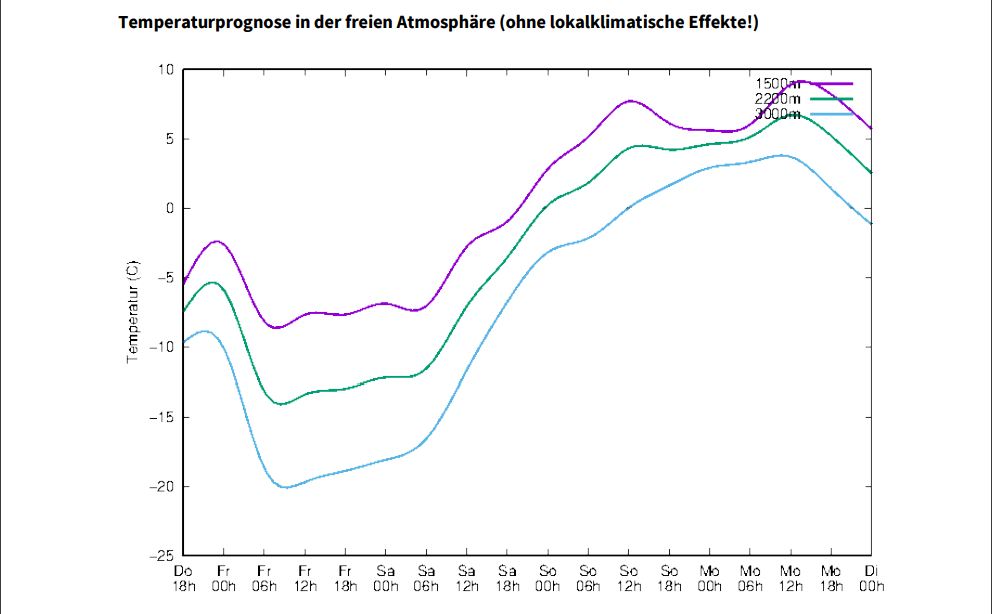
Today’s forecasts of Geosphere Austria predict windy and cold weather with some precipitation, esp. in NW regions. Starting tomorrow, dry weather with beginning foehn influence will set in, with markedly rising temperatures.

Temperaturprognose für die kommenden Tage. Es wird deutlich wärmer als zuletzt (© GSA)

What does that imply for avalanche danger?

As temperatures rise, a short-term danger of glide-snow slides and avalanches will increase in the areas where snowfall has been heavy. Freshly generated snowdrift accumulations will need special attentiveness starting on Sunday wherever this fresh snow fell on an already cohesive area-wide snowpack. (Caution urged in gullies and bowls where there is residual snow.) This is because the weak layer which matters for slab avalanches may be composed of the loosely-packed fresh snow and and the expansively metamorphosed old snow crystals. In the former case, the loose fresh snow (now covered by drifts) will quickly metamorphose to decomposed and round-grain snow crystals. And then there will be no more weak layer there.

Caution at great heights: even small-sized snowdrift accumulations in very steep terrain can be quite prone to triggering. Currently the danger of injury/being swept along tends to outweigh that of being buried in snow masses.

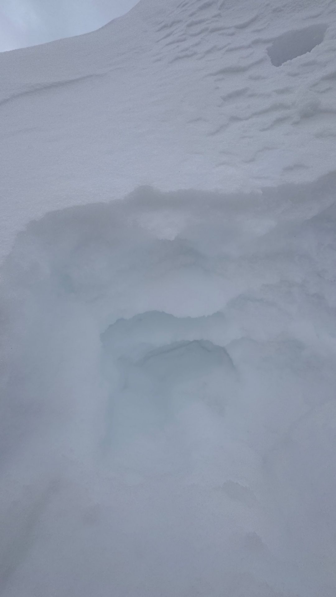
One general note of caution: there is frequently not enough snow to ski on. Sometimes appearances are deceptive. What seems to be a cohesive snowpack harbors hidden stones – sharks – just beneath the snow surface. These can lead to ugly falls.

The next blog update will be published as soon as the avalanche situation changes noticeably.