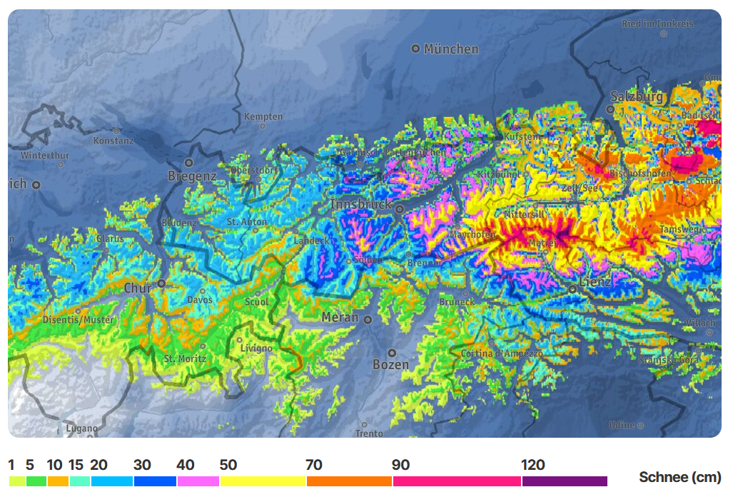
In the next few days cold and moist air masses will reach our region. Particularly in the eastern parts of Tirol, massive amounts of precipitation can be expected by Sunday morning. In the mountains, 50 to 100 cm of fresh snowfall is anticipated from place to place, falling on bare ground by and large. Once again, it is time to sharpen your senses for wintery dangers. Loosely-packed snow avalanches and glide-snow avalanches can be expected most of all in the regions where fresh snowfall is heaviest. Amid frequently storm-strength winds, snowdrift accumulations which are prone to triggering are expected to form on Friday above all else.
Sustained lower temperatures and large amounts of fresh snowfall in eastern regions of Tirol
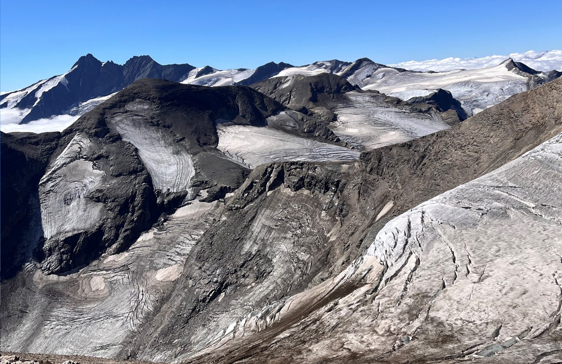
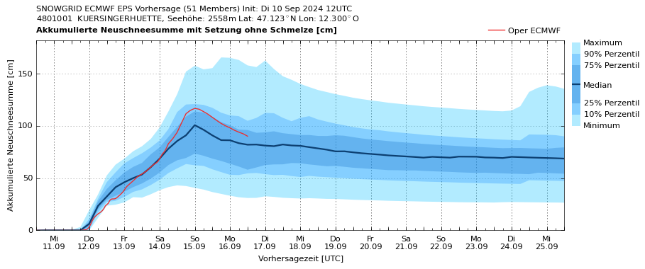
The warmest-ever measured August as well as an extremely warm launch into the month of September lie behind us. Since the weekend, temperatures have dropped measurably, in high alpine regions there has already been some snowfall arriving with the cold front of Monday, 9 September.

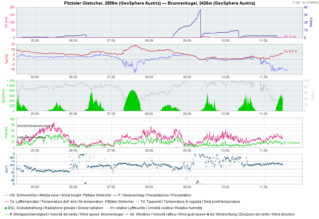
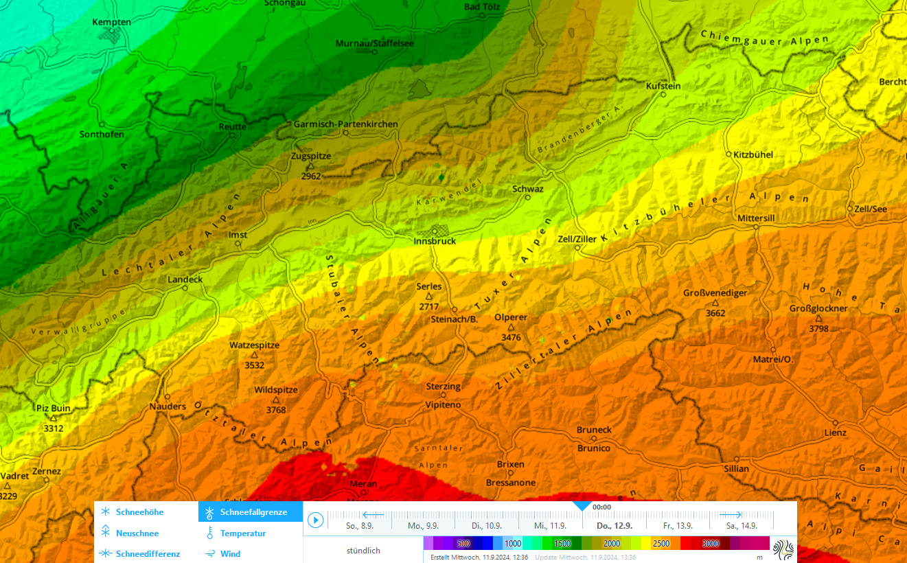
Since Monday, the weather has been capricious but at least occasionally pleasant, with temperatures corresponding to the season. A marked cold front is expected to reach us in the next few hours and will change the character of the weather noticably through Saturday, 14 September. In places, heavy precipitation can be expected. The snowfall level will drop down to intermediate altitudes, even to below 1000m on Friday for a brief spell in Tirol’s Lower Inn Valley.
The focal point of the precipitation will be in East Tirol and the Main Tauern Ridge through Thursday, 12 September. The snowfall level will drop to about 1500m.
On Friday, a northern barrier cloud front will move in, the focal point of the precipitation through Saturday 14 September will move to the north of the Main Alpine Ridge, particularly into the Tirolean Lowlands. In East Tirol, on the other hand, storm-strength northerly winds will set in. Apart from the Main Alpine Ridge, it will subsequently tend to remain dry.

Information about the unusual precipitation events, particularly in the eastern regions of Austria, can be found at the up-to-date Newsletter of GeoSphere Austria.
Avalanche danger will increase, due to fresh snowfall and often stormy winds
Glide-snow avalanches
If there is ample snow falling on warm, bare ground, we expect glide-snow avalanches: in the regions where snowfall is heaviest in the eastern parts of the land, steep, smooth grass-covered slopes will have numerous small-to-medium sized naturally triggered glide-snow avalanches. Caution is urged also on hikes in zones with steep hillsides.
Slab avalanches
As winds increase in intensity, reaching storm strength in southern regions, the fresh fallen snow will be transported starting on Friday, 13 September. Thereby, freshly formed snowdrift accumulations will be generated. These will be prone to triggering for a short spell. Also naturally triggered small-to-medium sized slab avalanches are possible.
Avalanche prone locations are to be found in particular at high altitudes, in very steep gullies and bowls, as well as near ridgelines, including in glaciated terrain. A potential weak layer: the loosely-packed powder snow. Most of the danger zones are to be found in the eastern sectors of the Main Alpine Ridge.
Loose-snow avalanches
In addition, generally small loose-snow avalanches can be expected in steep rocky terrain, especially if the sun appears on Sunday, at least temporarily.
Upshot
The weather over the coming days is unfavourable for undertakings in alpine terrain. Avalanches are a serious danger in the zones where fresh snowfall has been heavy and need to be taken into consideration in the planning of all mountain tours. If there is snowfall, there will be avalanches.