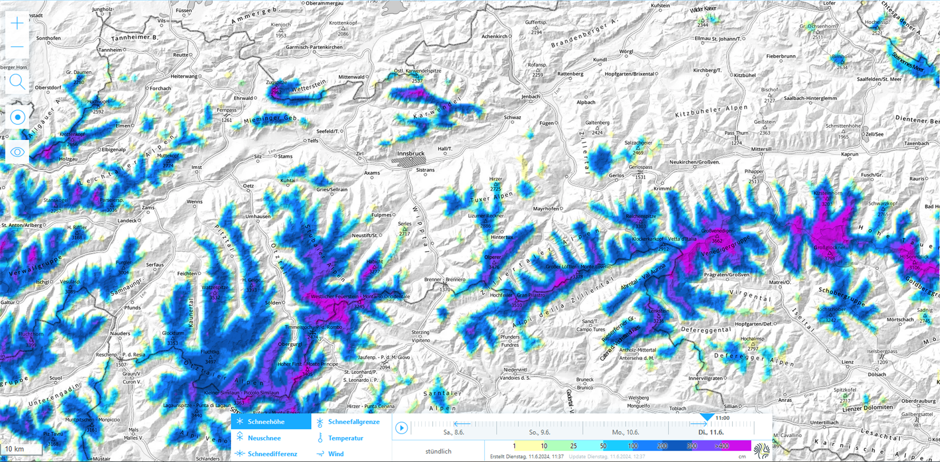
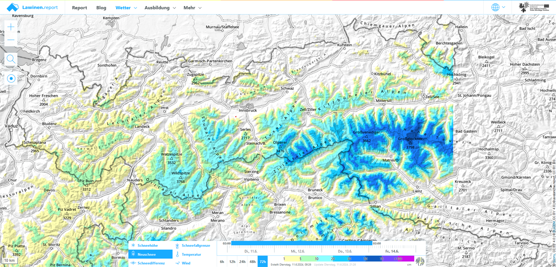
Once again we expect fresh snowfall in the mountains over the next few days. Focus: Zillertal Main Alpine Ridge and East Tirol, esp. in Hohe Tauern. Above 2500 m, 20-40cm of fresh snow is anticipated, locally as much as 50cm. For this juncture of the season there are above average snow depths in high alpine regions. For a short spell, avalanche activity above 2500m will increase.
Since the Avalanche Warning Service has little information available from outlying terrain, avalanche dangers need to be thoroughly analyzed on-site.
Fresh snow in the mountains, focus in Hohe Tauern
Due to the low-pressure weather system over the northern Atlantic, moist-cool air masses continue to flow into the alpine zones. As a consequence, we expect some cold and rainy days starting on Tuesday, 11.06, bringing fresh snowfall to the mountains. The focal point of precipitation will be in Tirol’s lowlands and in East Tirol. GeoSphere Weather Service forecasts for today, Tuesday 11.06, and tomorrow, 12.06, a snowfall level at 1900m in the north; it will lie at 2400m closer to the Main Alpine Ridge; in East Tirol the forecast is for 2500m.
Heightened avalanche danger for a short spell
The fresh fallen snow in the next few days will be deposited in all aspects atop a wet old snowpack surface up to high alpine altitudes. Due to the shower-like character of the precipitation, conditions for slab avalanches may occur from place to place. Strong winds near the zones of precipitation can lead to freshly generated snowdrift accumulations which will form a slab. Isolated danger zones will occur especially on very steep shady slopes and on very steep ridgeline slopes in high alpine zones. The avalanches will be mostly small-sized and triggerable only for a short time. Due to diffuse solar radiation the snowdrift accumulations will rapidly forfeit their firmness, esp. on Friday, 14.06. As a result, numerous naturally triggered loose-snow avalanches can be expected to unleash in steep rocky terrain in all aspects. Most will be small, depending on the amounts of fresh snow, some will reach medium size. In isolated cases they could trigger down to more deeply embedded layers of the snowpack.
Review
Since the last Blog, untiring observers have sent us valuable reports about the snow cover and avalanche activity which were quite respectable following the last measurable snowfall at the beginning of the month of June.
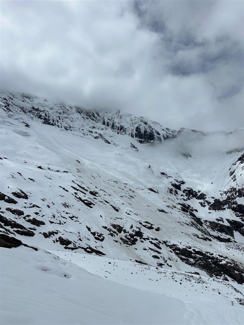
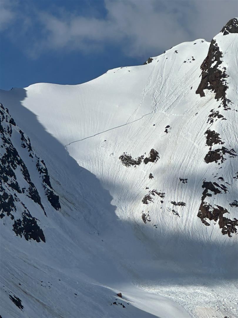
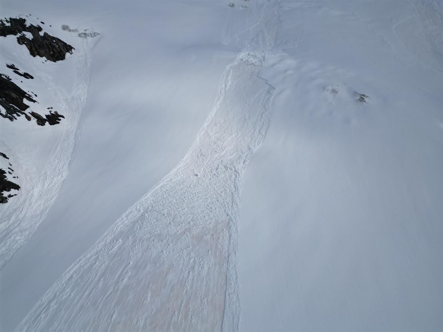
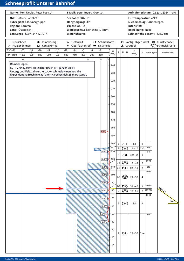
There is still above average snow on the ground in high alpine regions for this juncture of the season. Wherever there is snow, there are avalanches. For that reason, local conditions need to be carefully analyzed on site.